navigation system MERCEDES-BENZ CL-Class 2014 C217 Comand Manual
[x] Cancel search | Manufacturer: MERCEDES-BENZ, Model Year: 2014, Model line: CL-Class, Model: MERCEDES-BENZ CL-Class 2014 C217Pages: 274, PDF Size: 5.76 MB
Page 47 of 274
Activating/deactivating Bluetooth
®
X Press 000B.
The system menu appears.
X Select Settings by turning
003C0012003Dthe
COMAND controller and press 0037to
confirm.
X Select Activate Bluetooth and press
0037 to confirm.
This switches Bluetooth ®
on 0010 or off 0003. Setting the system language
This function allows you to determine the
language for the menu displays and the
navigation announcements .The selected
language affects the characters available for
entry.
The navigation announcements are not
available in all languages. If a language is not
available, the navigation announcements will
be in English.
When you set the system language, the
language of the Voice Control System will
change accordingly. If the selected language
is not supported by the Voice Control System,
English will be selected.
X Press the 000Bbutton.
X Select Settings by turning
003C0012003Dthe
COMAND controller and press 0037to
confirm.
X Select Language and press
0037to confirm.
The list of languages appears. The 000Fdot
indicates the current setting.
X Select the language by turning 003C0012003Dthe
COMAND controller and press 0037to
confirm.
COMAND loads the selected language and
sets it. Assigning
afavorites button
X To assign afavorites button: press the
000B button.
X Select Settings by turning
003C0012003Dthe
COMAND controller and press 0037to
confirm.
X Select Assign as Favorite and press
0037 to confirm.
The lis tofpredefined functions appears.
The dot 000Findicates the currently selected
function.
X Select the function by turning 003C0012003Dthe
COMAND controller and press 0037to
confirm.
The favorites button is assigned the
selected function.
X Example: to call up a favorite: press the
0019 favorites button.
This calls up the predefined function.
You can select the following predefined
functions in a menu:
R SplitView on/off : you can switch the
screen view for the front passenger on or
off.
R Display On/Off : you can switch the
display off or on.
R Full screen: 'Clock' :y
ou can call up
the full screen with the clock.
R 000CMenu :y
ou can call up the online and
Internet functions.
R Full screen: 'Map' :y
ou can call up the
full screen with the map.
R Spoken Driving Tip :y
ou can call up the
current driving recommendation.
R Display Traffic Messages :y
ou can call
up traffic reports.
R Navigate Home : you can start route
guidance to your home address if you have
already entered and saved the address
(Y page 69).
R Detour Menu :y
ou can call up the Detour
menu and then block a section of the route
and recalculate the route (Y page 92). Assigning
afavorites button
45Systemsettings
Page 49 of 274
Importing/exporting data
X
Insert the SD memory car d(Ypage 197).
or
X Connect aUSB device (e.g. aUSB memory
stick) ( Ypage 197).
X Press 000B.
The system menu appears.
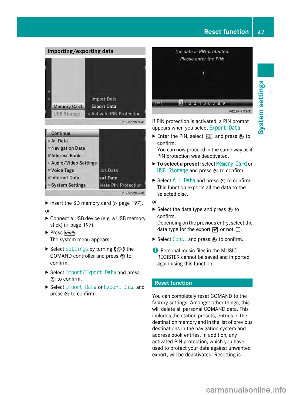
X Select Settings by turning
003C0012003Dthe
COMAND controlle rand press 0037to
confirm.
X Select Import/Export Data and press
0037 to confirm.
X Select Import Data or
Export Data and
press 0037to confirm. If PIN protection is activated, a PIN prompt
appears when you select
Export Data .
X Enter the PIN, select 0004and press0037to
confirm.
You can now proceed in the same way as if
PIN protection was deactivated.
X To select apreset: selectMemory Card or
USB Storage and press
0037to confirm.
X Select All Data and press
0037to confirm.
This functio nexports all the data to the
selected disc.
or
X Select the data type and press 0037to
confirm.
Depending on the previous entry, select the
data type for the export 0010or not 0003.
X Select Cont. and press
0037to confirm.
i Personal musi cfiles in the MUSIC
REGISTER cannot be saved and imported
again using this function. Reset function
You can completely reset COMAND to the
factory settings. Amongst other things, this
will delete all personal COMAND data. This
includes the station presets ,entries in the
destination memory and in the list of previous
destinations in the navigation system and
address book entries. In addition, any
activated PIN protection, which you have
used to protect your data against unwanted
export, will be deactivated .Resetting is Reset function
47System settings
Page 62 of 274
Your COMAND equipment
These operating instructions describe all the
standard and optional equipmen tfor your
COMAND system, as available at the time of
going to print. Country-specific differences
are possible. Please note that your COMAND
system may not be equipped with all the
features described. Introduction
Important safety notes
G
WARNING
If you operate information systems and
communication equipment integrated in the
vehicle while driving, you will be distracted
from traffic conditions. You could also lose
control of the vehicle. There is a risk of an
accident.
Only operate the equipment when the traffic
situation permits. If you are not sure that this
is possible, park the vehicle paying attention
to traffic conditions and operate the
equipment when the vehicle is stationary.
You must observe the legal requirements for
the country in which you are currently driving
when operating COMAND.
COMAND calculates the route to the
destination without taking account of the
following, for example:
R traffic lights
R stop and give way signs
R merging lanes
R parking or stopping in a no parking/no
stopping zone
R other road and traffic rules and regulations
R narrow bridges
COMAND can give incorrect navigation
commands if the actual street/traffic
situation does not correspond with the digital
map's data. Digital maps do not cover all
areas nor all routes in an area. For example, a route may have been diverted or the
direction of a one-way street may have
changed.
For this reason, you must always observe
road and traffic rules and regulations during
your journey. Road and traffic rules and
regulations always have priority over the
system's driving recommendations.
Navigation announcements are intended to
direct you while driving without diverting your
attention from the road and driving.
Please always use this feature instead of
consulting the map display for directions.
Looking at the icons or map display can
distract you from traffic conditions and
driving, and increase the risk of an accident.
General notes
Operational readiness of the navigation
system The navigation system must determine the
position of the vehicle before first use or
whenever operational status is restored.
Therefore, you may have to drive for a while
before precise route guidance is possible.
GPS reception
Among other things, correct functioning of
the navigation system depends on GPS
reception .Incertain situations, GPS
reception may be impaired, there may be
interference or there may be no reception at
all, e.g. in tunnels or parking garages.
i Using roof carriers may impair the correct
functioning of a roof antenna (phone,
satellite radio, GPS).
Entry restriction On vehicles for certain countries, there is a
restriction on entering data.
The restriction is active from a vehicle speed
of above approximately 3 mph (5 km/h). As
soon as the speed falls below approximately 60
IntroductionNavigation
Page 64 of 274
Basic settings
Setting route type and route options
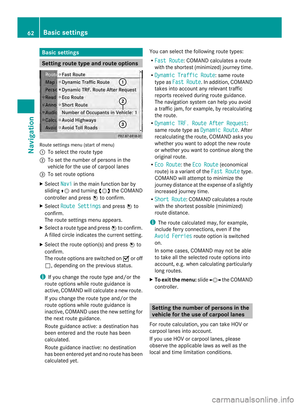
Route settings menu (start of menu)
0001
To select the route type
0002 To set the numbe rofpersons in the
vehicle for the use of carpool lanes
0014 To set route options
X Select Navi in the main function bar by
sliding 00360012and turning 003C0012003Dthe COMAND
controller and press 0037to confirm.
X Select Route Settings and press
0037to
confirm.
The route settings menu appears.
X Select a route type and press 0037to confirm.
Af illed circle indicates the current setting.
X Selec tthe route option(s) and press 0037to
confirm.
The route options are switched on 0010or off
0003, depending on the previous status.
i If you change the route type and/or the
route options while route guidance is
active, COMAND will calculate a new route.
If you change the route type and/or the
route options while route guidance is
inactive, COMAND uses the new setting for
the next route guidance.
Route guidance active: a destination has
been entered and the route has been
calculated.
Route guidance inactive: no destination
has been entered yet and no route has been
calculated yet. You can select the following route types:
R
Fast Route :C
OMAND calculates a route
with the shortest (minimized) journey time.
R Dynamic Traffic Route : same route
type as Fast Route .Ina
ddition, COMAND
takes into account any relevant traffic
reports received during route guidance.
The navigation system can help you avoid
a traffic jam, for example, by recalculating
the route.
R Dynamic TRF. Route After Request :
same route type as Dynamic Route . After
recalculating the route, COMAND asks you
whether you want to adopt the new route
or whether you want to continue along the
original route.
R Eco Route : the
Eco Route (economical
route) is a variant of the Fast Route type.
COMAND will attempt to minimize the
journey distance at the expense of a slightly
increased journey time.
R Short Route :C
OMAND calculates a route
with the shortest possible (minimized)
route distance.
i The route calculated may, for example,
include ferry connections, even if the
Avoid Ferries route option is switched
on.
In some cases, COMAND may not be able
to take all the selected route options into
account, e.g. when calculating particularly
long routes.
X To exit the menu: slide003400120035 the COMAND
controller. Setting the number of persons in the
vehicle for the use of carpool lanes
For route calculation, you can take HOV or
carpool lanes into account.
If you use HOV or carpool lanes, please
observe the applicable laws as well as the
local and time limitation conditions. 62
Basic settingsNavigation
Page 65 of 274
Carpool lanes may only be used under certain
conditions. Normally you can use these lanes
when two or more occupants are traveling in
the vehicle .However, there are lanes that can
only be used when three or four occupants
(e.g. in New York) travel in the vehicle. In
California, lone drivers can use a carpool lane
if their vehicle's emission level or fuel
consumption is below a fixed threshold.
Carpool lanes may be reserved for specific
times (e.g. during the peak period).
Carpool lanes are identified by HOV symbols
on special road signs and by markings on the
road. The road signs may also include the
designation CARPOOL .T
he lanes are arranged
as a separate lane next to the others or are
built as a physically separate lane.
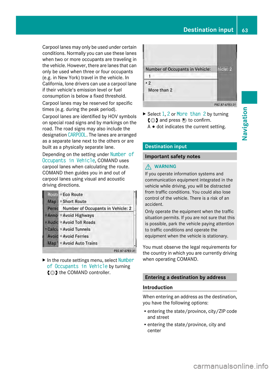
Depending on the setting under Number ofOccupants in Vehicle , COMAND uses
carpool lanes when calculating the route.
COMAND then guides you in and out of
carpool lanes using visual and acoustic
driving directions. X
In the route settings menu, select Numberof Occupants in Vehicle by turning
003C0012003D the COMAND controller. X
Select 1 ,
2 or
More than 2 by turning
003C0012003D and press 0037to confirm.
A 000F dot indicates the current setting. Destination input
Important safety notes
G
WARNING
If you operate information systems and
communication equipment integrated in the
vehicle while driving, you will be distracted
from traffic conditions. You could also lose
control of the vehicle. There is a risk of an
accident.
Only operate the equipment when the traffic
situation permits. If you are not sure that this
is possible, park the vehicle paying attention
to traffic conditions and operate the
equipment when the vehicle is stationary.
You must observe the legal requirements for
the country in which you are currently driving
when operating COMAND. Entering
adestination by address
Introduction When entering an address as the destination,
you have the following options:
R
entering the state/province, city/ZIP code
and street
R entering the state/province, city and
center Destination input
63Navigation Z
Page 72 of 274
X
Select Yes and press
0037to confirm.
After selecting Yes , the
Saving Procedure/Successful message
appears. Selecting
adestination from the
destination memory (e.g. My address)
Introduction The destination memory always contains an
entry named "My Address". You may wish to
assign your home address to this entry, for
example (Y
page 69), and select it for route
guidance. This entry is always located at the
top of the list in the destination memory.
X To switch to navigation mode: press the
0012 button.
X To show the menu: press0037the COMAND
controller.
X Select Destination in the navigation
system menu bar by turning 003C0012003Dthe
COMAND controller and pressing 0037to
confirm.
X Select From Memory and press
0037to
confirm.
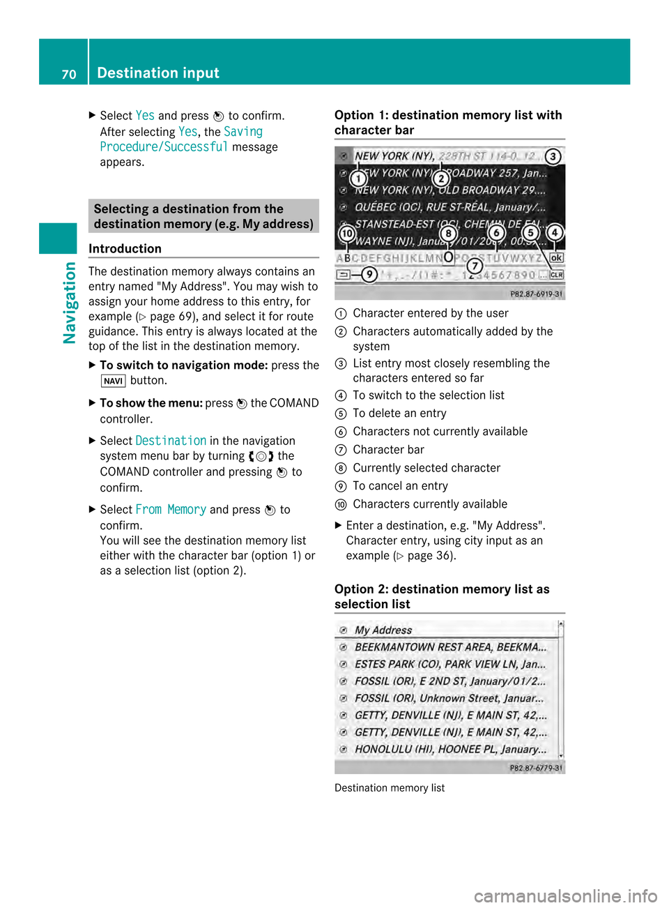
You will see the destination memory list
either with the character bar (option 1) or
as a selectio nlist (option 2). Opti
on 1: destination memory list with
character bar 0001
Characte rentered by the user
0002 Characters automatically added by the
system
0014 Listentry mos tclosely resembling the
characters entered so far
0013 To switch to the selection list
0011 To delete an entry
0012 Characters not currently available
0005 Character bar
0006 Currently selected character
0007 To cancel an entry
0008 Characters currently available
X Enter a destination, e.g. "My Address".
Character entry, using city input as an
example (Y page 36).
Option 2: destination memory list as
selection list Destination memory list70
Destination inputNavigation
Page 73 of 274
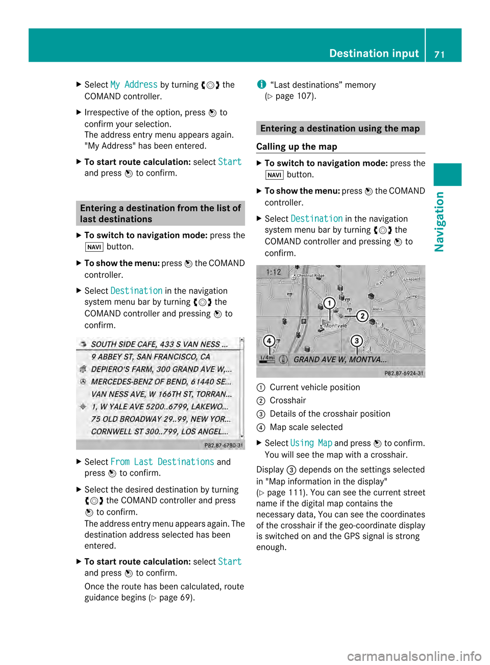
X
Select My Address by turning
003C0012003Dthe
COMAND controller.
X Irrespective of the option, press 0037to
confirm your selection.
The address entry menu appears again.
"My Address" has been entered.
X To start route calculation: selectStart and press
0037to confirm. Entering
adestination from the list of
last destinations
X To switch to navigation mode: press the
0012 button.
X To show the menu: press0037the COMAND
controller.
X Select Destination in the navigation
system menu bar by turning 003C0012003Dthe
COMAND controller and pressing 0037to
confirm. X
Select From Last Destinations and
press 0037to confirm.
X Select the desired destination by turning
003C0012003D the COMAND controller and press
0037 to confirm.
The address entry menu appears again .The
destination address selected has been
entered.
X To start route calculation: selectStart and press
0037to confirm.
Once the route has been calculated, route
guidance begins (Y page 69). i
“Last destinations” memory
(Y page 107). Entering
adestination usin gthe map
Calling up the map X
To switch to navigation mode: press the
0012 button.
X To show the menu: press0037the COMAND
controller.
X Select Destination in the navigation
system menu bar by turning 003C0012003Dthe
COMAND controlle rand pressing 0037to
confirm. 0001
Current vehicle position
0002 Crosshair
0014 Details of the crosshair position
0013 Map scale selected
X Select Using Map and press
0037to confirm.
You will see the map with acrosshair.
Display 0014depends on the settings selected
in "Map information in the display"
(Y page1 11). You can see the current street
name if the digital map contains the
necessary data, You can see the coordinates
of the crosshair if the geo-coordinate display
is switched on and the GPS signal is strong
enough. Destination input
71Navigation Z
Page 74 of 274
Moving the map and selecting the
destination
X
To scroll the map: slide003400120035, 003600120008or
00320012003B the COMAND controller.
X To set the map scale: as soon as you turn
003C0012003D the COMAND controller, the scale bar
appears.
X Turn 003C0012003D until the desired scale is set.
Turning clockwise zooms out from the map;
turning counter-clockwise zooms in. X
To selectad estination:press0037the
COMAND controller once or several times.
If COMAND is unable to assign a unique
address, you will see either the address
entry menu with the destination address or
a selectio nlist.
X Selec tadestination by turning 003C0012003Dthe
COMAND controller and press 0037to
confirm.
If the destination is within the limits of the
digital map, COMAND attempts to assign
the destination to the map.
If the destination can be assigned, you will
see the address entry menu with the
address of the destination. If not, you will
see the Destination From Map entry.
X To start route calculation: selectStart and press
0037to confirm. Entering
adestination usin ggeo-
coordinates
X To switch to navigation mode: press the
0012 button.
X To show the menu: press0037the COMAND
controller.
X Select Destination in the navigation
system menu bar by turning 003C0012003Dthe
COMAND controller and pressing 0037to
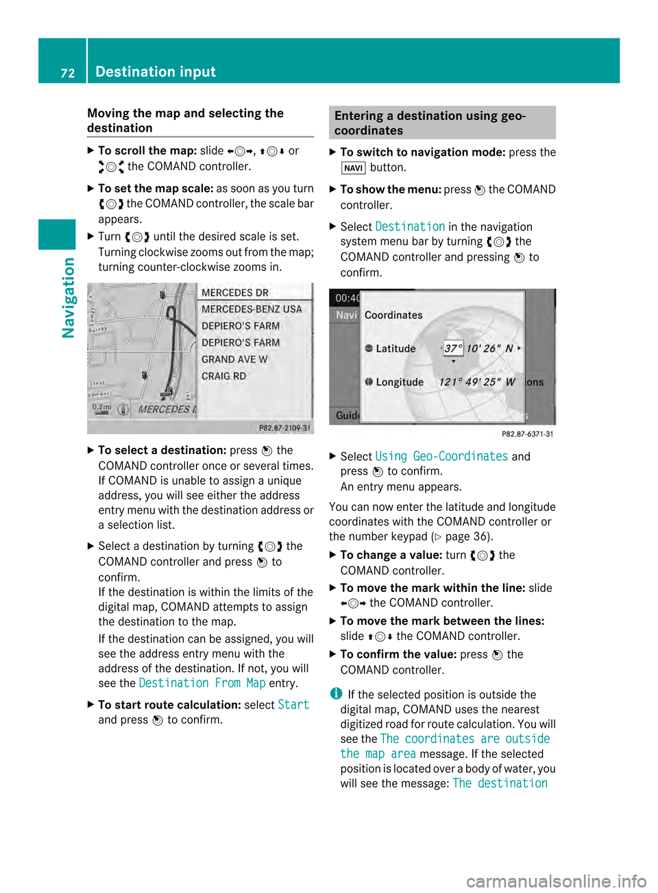
confirm. X
Select Using Geo-Coordinates and
press 0037to confirm.
An entry menu appears.
You can now enter the latitude and longitude
coordinates with the COMAND controller or
the number keypad ( Ypage 36).
X To change a value: turn003C0012003D the
COMAND controller.
X To move the mark within the line: slide
003400120035 the COMAND controller.
X To move the mark between the lines:
slide 003600120008 the COMAND controller.
X To confirm the value: press0037the
COMAND controller.
i If the selected position is outside the
digital map, COMAND uses th enearest
digitized road for route calculation .You will
see the The coordinates are outside
the map area message. If the selected
position is located over abody of water, you
will see the message: The destination72
Destination inputNavigation
Page 75 of 274
is in a body of water. Please
select another destination.
Entering
adestination using
Mercedes-Benz Apps
X To switch to navigation mode: press the
0012 button.
X To show the menu: press0037the COMAND
controller.
X Select Destination in the navigation
system menu bar by turning 003C0012003Dthe
COMAND controller and pressing 0037to
confirm.
X Select Mercedes-Benz Apps and press
0037 to confirm.
If an Internet connectio nis established, you
will see the message Do you want to accept the navigation data sent
via Mercedes-Benz Apps?
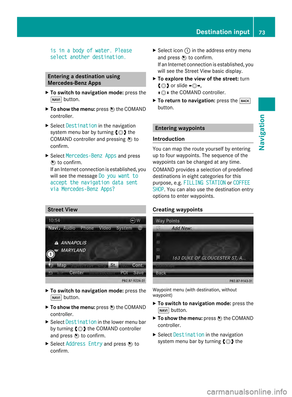
Street View
X
To switch to navigation mode: press the
0012 button.
X To show the menu: press0037the COMAND
controller.
X Select Destination in the lower menu bar
by turning 003C0012003Dthe COMAND controller
and press 0037to confirm.
X Select Address Entry and press
0037to
confirm. X
Select icon 0001in the address entry menu
and press 0037to confirm.
If an Internet connection is established, you
will see the Street View basic display.
X To explore the view of the street: turn
003C0012003D or slide 003400120035,
003600120008 the COMAND controller.
X To return to navigation: press the000A
button. Entering waypoints
Introduction You can map the route yourselfb
y entering
up to four waypoints. The sequence of the
waypoints can be changed at any time.
COMAND provides a selection of predefined
destinations in eigh tcategories for this
purpose, e.g. FILLING STATION or
COFFEE SHOP .Y
ou can also use the destination entry
options to enter waypoints.
Creating waypoints Waypoint menu (with destination, without
waypoint)
X
To switch to navigation mode: press the
0012 button.
X To show the menu: press0037the COMAND
controller.
X Select Destination in the navigation
system menu bar by turning 003C0012003Dthe Destination input
73Navigation Z
Page 79 of 274
Entering
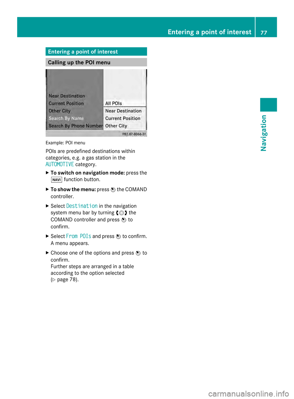
apoint of interest Calling up the POI menu
Example: POI menu
POIs are predefined destinations within
categories, e.g .agas station in the
AUTOMOTIVE category.
X To switch on navigation mode: press the
0012 function button.
X To show the menu: press0037the COMAND
controller.
X Select Destination in the navigation
system menu bar by turning 003C0012003Dthe
COMAND controller and press 0037to
confirm.
X Select From POIs and press
0037to confirm.
Am enu appears.
X Choose one of the options and press 0037to
confirm.
Further steps are arranged in a table
according to the option selected
(Y page 78). Entering
apoint of interest
77Navigation Z