remote start Acura MDX 2015 Navigation Manual
[x] Cancel search | Manufacturer: ACURA, Model Year: 2015, Model line: MDX, Model: Acura MDX 2015Pages: 341, PDF Size: 9.42 MB
Page 1 of 341

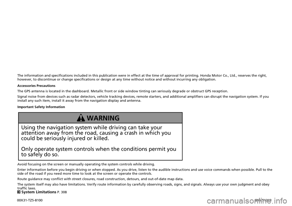
The information and specifications included in this publication were in effect at the time of approval for printing. Honda Motor Co., Ltd., reserves the right, however, to discontinue or change specifications or design at any time without notice and without incurring any obligation.
Accessories Precautions
The GPS antenna is located in the dashboard. Metallic front or side window tinting can seriously degrade or obstruct GPS reception.
Signal noise from devices such as radar detectors, vehicle tracking devices, remote starters, and additional amplifiers can disrupt the navigation system. If you install any such item, install it away from the navigation display and antenna.
Important Safety Information
Avoid focusing on the screen or manually operating the system controls while driving.
Enter information before you begin driving or when stopped. As you drive, listen to the audible instructions and use voice commands when possible. Pull to the side of the road if you need more time to look at the screen or operate the controls.
Route guidance may conflict with street closures, road construction, detours, and out-of-date map data.
The system itself may also have limitations. Verify route information by carefully observing roads, signs, and signals. Always use your own judgment and obey traffic laws. 2System Limitations P. 308
Using the navigation system while driving can take your
attention away from the road, causing a crash in which you
could be seriously injured or killed.
Only operate system controls when the conditions permit you
to safely do so.
WARNING
00X31-TZ5-8100 BNV51313
Page 2 of 341

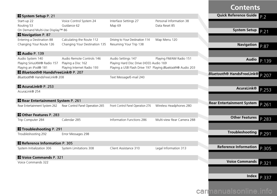
Contents
2System Setup P. 21
Start-up 22 Voice Control System 24 Interface Settings 27 Personal Information 38
Routing 53 Guidance 62 Map 69Data Reset 85
On Demand Multi-Use Display™ 86
2 Navigation P. 87
Entering a Destination 88 Calculating the Route 112Driving to Your Destination 114Map Menu 120
Changing Your Route 126 Changing Your Destination 135 Resuming Your Trip 138
2 Audio P. 139
Audio System 140 Audio Remote Controls 146 Audio Settings 147 Playing FM/AM Radio 151
Playing SiriusXM® Radio 157 Playing a Disc 162 Playing Hard Disc Drive (HDD) Audio 169
Playing an iPod® 181 Playing Internet Radio 193 Playing a USB Flash Drive 197 Playing Bluetooth® Audio 203
2Bluetooth® HandsFreeLink® P. 207
Bluetooth ® HandsFreeLink® 208 Text Message/E-mail 240
2AcuraLink® P. 253
AcuraLink® 254
2Rear Entertainment System P. 261
Rear Entertainment System 262 Rear Control Panel Operation 265Front Control Panel Operation 276Wireless Headphones 280
2Other Features P. 283
Trip Computer 284 Calendar 285 Information Functions 286 Multi-view Rear Camera 288
2Troubleshooting P. 291
Troubleshooting 292 Error Messages 298
2Reference Information P. 305
System Initialization 306 System Limitations 308 Client Assistance 310 Legal Information 313
2Voice Commands P. 321
Voice Commands 322
Quick Reference GuideP.2
System SetupP.21
NavigationP.87
AudioP.139
Bluetooth® HandsFreeLink®P.207
AcuraLink®P.253
Rear Entertainment SystemP.261
Other FeaturesP.283
TroubleshootingP.291
Reference InformationP.305
Voice CommandsP.321
IndexP.337
Page 23 of 341

22
System Setup
Start-up
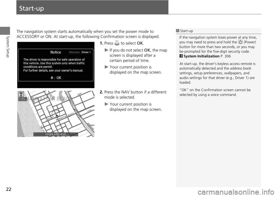
The navigation system starts automatically when you set the power mode to
ACCESSORY or ON. At start-up, the follow ing Confirmation screen is displayed.
1.Press u to select OK.
If you do not select OK, the map
screen is displayed after a
certain period of time.
Your current position is
displayed on the map screen.
2. Press the NAV button if a different
mode is selected.
Your current position is
displayed on the map screen.
1Start-up
If the navigation system loses power at any time,
you may need to press and hold the 9 (Power)
button for more than two seconds, or you may
be prompted for the five-digit security code.
2 System Initialization P. 306
At start-up, the driver’s keyless access remote is
automatically detected and the address book
settings, setup preferences, wa llpapers, and
audio settings for that driver (e.g., Driver 1) are
loaded.
“OK” on the Confirmati on screen cannot be
selected by using a voice command.
Page 309 of 341

308
Reference Information
System Limitations
GPS System
The signals received from the GPS satellites
are extremely weak (less than a millionth
of the strength of a local FM station) and
require an unobstructed view of the sky.
The GPS antenna is located in the
dashboard. The signal reception can easily
be interrupted or interfered with by the
following:
• Metallic window tint on the front or side
windows
• Cell phones, PDAs, or other electronic
devices docked in a cradle or lying loose
on the dashboard
• Remote starters or “hidden” vehicle
tracking systems mounted near the
navigation unit
• Audio electronic devices mounted near
the navigation unit
• Trees, tall buildings, freeway overpasses,
tunnels, or overhead electrical power
wires
The GPS is operated by the U.S.
Department of Defense. For security
reasons, there are certain inaccuracies built
into the GPS for wh ich the navigation
system must constantly compensate. This can cause occasional positioning errors of
up to several hundred feet.
Address Calculation
The destination icon shows only the
approximate location of a destination
address. This occurs if the number of
possible addresses is different from the
number of actual addresses on a block. For
example, the address 1425 on a 1400
block with 100 possible addresses
(because it is followed by the 1500 block)
will be shown a quarter of the way down
the block by the system. If there are only
25 actual addresses
on the block, the
actual location of address 1425 would be
at the end of the block.
Database
The digitized map database reflects
conditions as they existed at various points
in time before production. Accordingly,
your database may contain inaccurate or
incomplete data or information due to the
passage of time, road construction,
changing conditions, or other causes.
For example, some places/landmarks may
be missing when you search the database
because the name was misspelled, the
place was improperly categorized, or a
place/landmark is not yet in the database.
This is also true for police stations,
hospitals, and other public institutions. Do
not rely on the navigation system if you
need law enforcement or hospital services.
Always check with local information
sources.