light CADILLAC ESCALADE ESV 2011 Owners Manual
[x] Cancel search | Manufacturer: CADILLAC, Model Year: 2011, Model line: ESCALADE ESV, Model: CADILLAC ESCALADE ESV 2011Pages: 548, PDF Size: 8.45 MB
Page 277 of 548
Black plate (75,1)Cadillac Escalade/Escalade ESV Owner Manual - 2011
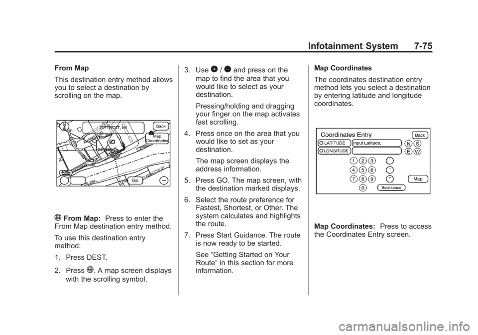
Infotainment System 7-75From Map
This destination entry method allows
you to select a destination by
scrolling on the map.
) From Map: Press to enter the
From Map destination entry method.
To use this destination entry
method:
1. Press DEST.
2. Press
) . A map screen displays
with the scrolling symbol. 3. Use
0 /
1 and press on the
map to find the area that you
would like to select as your
destination.
Pressing/holding and dragging
your finger on the map activates
fast scrolling.
4. Press once on the area that you
would like to set as your
destination.
The map screen displays the
address information.
5. Press GO. The map screen, with
the destination marked displays.
6. Select the route preference for
Fastest, Shortest, or Other. The
system calculates and highlights
the route.
7. Press Start Guidance. The route
is now ready to be started.
See “ Getting Started on Your
Route ” in this section for more
information. Map Coordinates
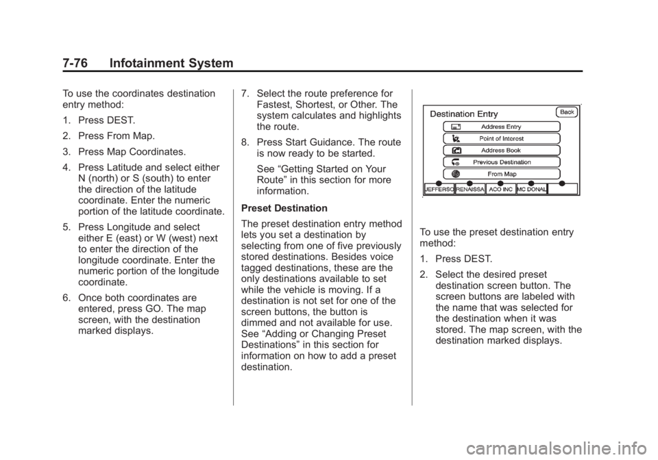
The coordinates destination entry
method lets you select a destination
by entering latitude and longitude
coordinates.
Map Coordinates: Press to access
the Coordinates Entry screen.
Page 278 of 548
Black plate (76,1)Cadillac Escalade/Escalade ESV Owner Manual - 2011
7-76 Infotainment System To use the coordinates destination
entry method:
1. Press DEST.
2. Press From Map.
3. Press Map Coordinates.
4. Press Latitude and select either
N (north) or S (south) to enter
the direction of the latitude
coordinate. Enter the numeric
portion of the latitude coordinate.
5. Press Longitude and select
either E (east) or W (west) next
to enter the direction of the
longitude coordinate. Enter the
numeric portion of the longitude
coordinate.
6. Once both coordinates are
entered, press GO. The map
screen, with the destination
marked displays. 7. Select the route preference for
Fastest, Shortest, or Other. The
system calculates and highlights
the route.
8. Press Start Guidance. The route
is now ready to be started.
See “ Getting Started on Your
Route ” in this section for more
information.
Preset Destination
The preset destination entry method
lets you set a destination by
selecting from one of five previously
stored destinations. Besides voice
tagged destinations, these are the
only destinations available to set
while the vehicle is moving. If a
destination is not set for one of the
screen buttons, the button is
dimmed and not available for use.
See “ Adding or Changing Preset
Destinations ” in this section for
information on how to add a preset
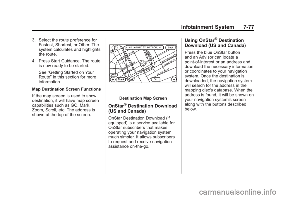
destination. To use the preset destination entry
method:
1. Press DEST.
2. Select the desired preset
destination screen button. The
screen buttons are labeled with
the name that was selected for
the destination when it was
stored. The map screen, with the
destination marked displays.
Page 279 of 548
Black plate (77,1)Cadillac Escalade/Escalade ESV Owner Manual - 2011
Infotainment System 7-773. Select the route preference for
Fastest, Shortest, or Other. The
system calculates and highlights
the route.
4. Press Start Guidance. The route
is now ready to be started.
See “ Getting Started on Your
Route ” in this section for more
information.
Map Destination Screen Functions
If the map screen is used to show
destination, it will have map screen
capabilities such as GO, Mark,
Zoom, Scroll, etc. The address is
shown at the top of the screen. Destination Map Screen
OnStar ®
Destination Download
(US and Canada) OnStar Destination Download (if
equipped) is a service available for
OnStar subscribers that makes
operating your navigation system
much simpler. It allows subscribers
to request and receive navigation
assistance on-the-go. Using OnStar ®
Destination
Download (US and Canada) Press the blue OnStar button
and an Advisor can locate a
point-of-interest or an address and
download the necessary information
or coordinates to your navigation
system. Once the destination is
downloaded, the navigation system
will search for the address in the
mapping disc's database. When the
address is found, it will be shown on
your navigation system's screen
along with the buttons described
below.
Page 283 of 548
Black plate (81,1)Cadillac Escalade/Escalade ESV Owner Manual - 2011
Infotainment System 7-81
r /
[ (Fast Forward Scroll):
Press to scroll to the next stopover
or to the final destination. The
u(fast forward skip) button changes
to a fast speed fast forward.
u (Fast Forward Skip): Press to
go to the next stopover or to the
final destination.
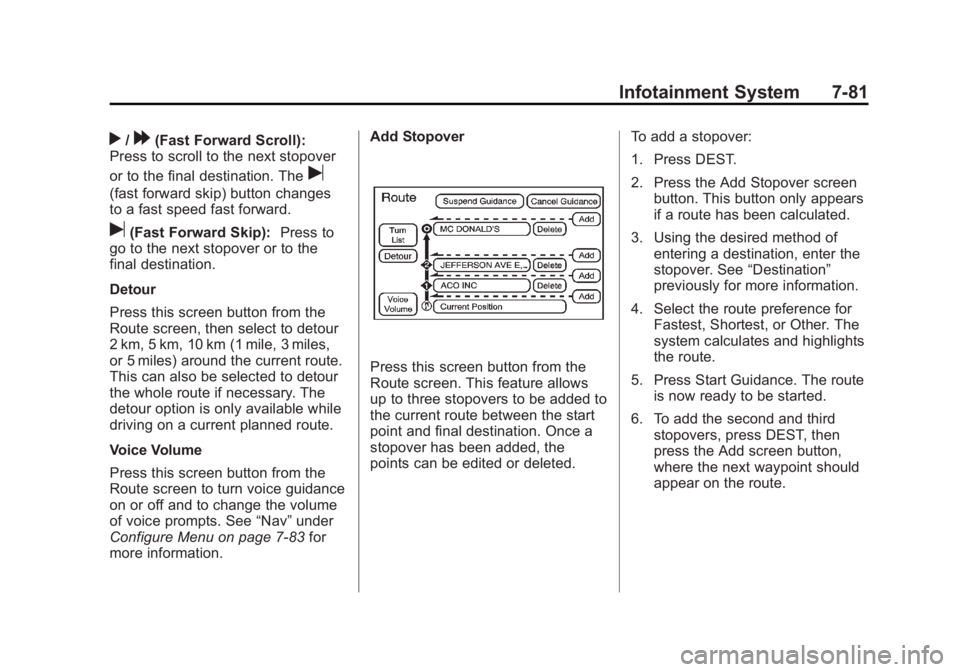
Detour
Press this screen button from the
Route screen, then select to detour
2 km, 5 km, 10 km (1 mile, 3 miles,
or 5 miles) around the current route.
This can also be selected to detour
the whole route if necessary. The
detour option is only available while
driving on a current planned route.
Voice Volume
Press this screen button from the
Route screen to turn voice guidance
on or off and to change the volume
of voice prompts. See “ Nav ” under
Configure Menu on page 7 ‑ 83 for
more information. Add Stopover
Press this screen button from the
Route screen. This feature allows
up to three stopovers to be added to
the current route between the start
point and final destination. Once a
stopover has been added, the
points can be edited or deleted. To add a stopover:
1. Press DEST.
2. Press the Add Stopover screen
button. This button only appears
if a route has been calculated.
3. Using the desired method of
entering a destination, enter the
stopover. See “ Destination ”
previously for more information.
4. Select the route preference for
Fastest, Shortest, or Other. The
system calculates and highlights
the route.
5. Press Start Guidance. The route
is now ready to be started.
6. To add the second and third
stopovers, press DEST, then
press the Add screen button,
where the next waypoint should
appear on the route.
Page 284 of 548
Black plate (82,1)Cadillac Escalade/Escalade ESV Owner Manual - 2011
7-82 Infotainment System 7. Select the route preference for
Fastest, Shortest, or Other. The
system calculates and highlights
the route.
8. Press Start Guidance. The route
is now ready to be started.
To delete a stopover from the
current route:
1. Press DEST.
2. Press Delete for the desired
stopover to delete.
3. The system displays a pop-up
confirmation message. Press
Yes to delete the stopover; press
No to cancel this operation.
4. Select the route preference for
Fastest, Shortest, or Other. The
system calculates and highlights
the route.
5. Press Start Guidance. The route
is now ready to be started.
Suspend Guidance
Press this screen button, from the
Route screen, to put the current
route on hold. Resume Guidance
Press this screen button, from the
Route screen, to resume guidance
on the current route.
Cancel Guidance
Press this screen button, from the
Route screen, to cancel the current
route.
Adding Destinations to the
Address Book There are two ways to add a
destination to the address book: .
To add the current vehicle
position to the address book,
press the Mark screen button
from the map screen. The
system automatically saves the
current vehicle information in the
address book. When scrolling on
the map the Mark screen button
automatically adds the current
scrolled position information in
the address book. .
Press the Add to Address Book
screen button when available
on POI information screens,
Destination Entry screens,
or POI screens. The system
automatically saves this
information in the address book.
See “ Nav ” under Configure Menu on
page 7 ‑ 83 for information on editing
address book entries.
Adding or Changing Preset
Destinations This feature allows additions
or changes one of five preset
destinations. When a destination
has been added as a preset
destination, it is available to select
from the Destination Entry screen.
See “ Preset Destination ” previously
for information on how to select a
preset destination as a final
destination.
Page 289 of 548
Black plate (87,1)Cadillac Escalade/Escalade ESV Owner Manual - 2011
Infotainment System 7-872. Press the Remove Map Data
screen button to remove the
map data. A screen showing,
“ The Map can now be safely
removed ” displays.
3. Press the confirmation screen
button to safely remove the
map data.
If the map data is not removed, the
map database will not be available
for that ignition cycle. Map database
functionality can be restored by
cycling the ignition. Off-Road Mode
To turn the Off-road mode on or off:
1. Press CONFIG.
2. Press the Nav screen button.
3. Press Off-Road mode. The
button will be highlighted when
the feature is on.
When the off-road mode is turned
on, the navigation system will show
the path being traveled by the
vehicle when not on a marked road.
This path will be a simulation since
the map database coverage will not
have these roads on the DVD. This
path will be stored in the navigation
system's memory, see “ Previous
Destination ” under Destination on
page 7 ‑ 69 for more information.
See Defensive Driving on page 9 ‑ 2
for more information about off-road
driving. Traffic Options
(US and Canada) Read the following Options
descriptions to understand how the
XM NavTraffic ™ operates.
XM NavTraffic
(USA and Canada) Vehicles with the navigation system
have an XM NavTraffic receiver. XM
NavTraffic is a subscription service
provided via XM Satellite Radio. XM
NavTraffic provides real-time traffic
information fully integrated to the
navigation system to display current
traffic conditions for a driver ’ s
chosen route. XM NavTraffic allows
drivers to make the most informed,
timesaving routing decisions.
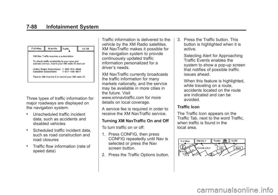
If the Traffic screen button is
pressed or if an attempt is made to
turn on the traffic display in the
Navigation Setup Menu without a
subscription, a Caution screen
displays indicating that XM traffic is
not activated.
Page 290 of 548
Black plate (88,1)Cadillac Escalade/Escalade ESV Owner Manual - 2011
7-88 Infotainment System
Three types of traffic information for
major roadways are displayed on
the navigation system: .
Unscheduled traffic incident
data, such as accidents and
disabled vehicles .
Scheduled traffic incident data,
such as road construction and
road closures .
Traffic flow information (rate of
speed data) Traffic information is delivered to the
vehicle by the XM Radio satellites.
XM NavTraffic makes it possible for
the navigation system to provide
continuously updated traffic
information personalized for a
driver ’ s needs.
XM NavTraffic currently broadcasts
the traffic information for many
markets nationally, and the service
may be available in more cities in
the future. Visit
www.xmnavtraffic.com for more
details on local coverage.
A service fee is required in order to
receive the XM NavTraffic service.
Turning XM NavTraffic On and Off
To turn traffic on or off:
1. Press CONFIG, then press
CONFIG repeatedly until Nav is
selected or press the Nav
screen button.
2. Press the Traffic Options button. 3. Press the Traffic button. This
button is highlighted when it is
active.
Selecting Alert for Approaching
Traffic Events enables the
system to show a pop-up screen
that notifies of possible traffic
issues ahead.
When this feature is highlighted,
while traveling on a route,
accidents located on the route
are indicated and can be
avoided.
Traffic Icon
The Traffic Icon appears on the
Traffic Tab, next to the word Traffic,
when traffic is found in the
local area.
Page 293 of 548
Black plate (91,1)Cadillac Escalade/Escalade ESV Owner Manual - 2011
Infotainment System 7-91
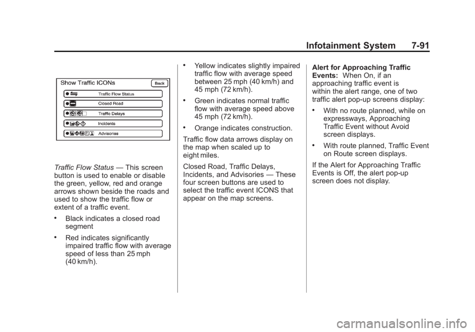
Traffic Flow Status — This screen
button is used to enable or disable
the green, yellow, red and orange
arrows shown beside the roads and
used to show the traffic flow or
extent of a traffic event. .
Black indicates a closed road
segment .
Red indicates significantly
impaired traffic flow with average
speed of less than 25 mph
(40 km/h). .
Yellow indicates slightly impaired
traffic flow with average speed
between 25 mph (40 km/h) and
45 mph (72 km/h). .
Green indicates normal traffic
flow with average speed above
45 mph (72 km/h). .
Orange indicates construction.
Traffic flow data arrows display on
the map when scaled up to
eight miles.
Closed Road, Traffic Delays,
Incidents, and Advisories — These
four screen buttons are used to
select the traffic event ICONS that
appear on the map screens. Alert for Approaching Traffic
Events: When On, if an
approaching traffic event is
within the alert range, one of two
traffic alert pop-up screens display: .
With no route planned, while on
expressways, Approaching
Traffic Event without Avoid
screen displays. .
With route planned, Traffic Event
on Route screen displays.
If the Alert for Approaching Traffic
Events is Off, the alert pop-up
screen does not display.
Page 297 of 548
Black plate (95,1)Cadillac Escalade/Escalade ESV Owner Manual - 2011
Infotainment System 7-95Display Off
Press this screen button to turn the
display off. Press any control button
to view the display.
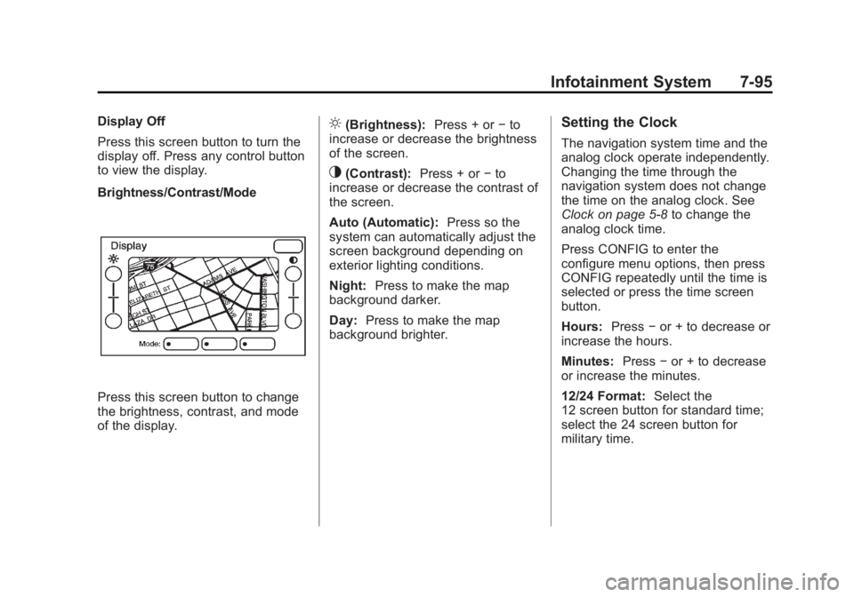
Brightness/Contrast/Mode
Press this screen button to change
the brightness, contrast, and mode
of the display. ] (Brightness): Press + or − to
increase or decrease the brightness
of the screen.
_ (Contrast): Press + or − to
increase or decrease the contrast of
the screen.
Auto (Automatic): Press so the
system can automatically adjust the
screen background depending on
exterior lighting conditions.
Night: Press to make the map
background darker.
Day: Press to make the map
background brighter. Setting the Clock The navigation system time and the
analog clock operate independently.
Changing the time through the
navigation system does not change
the time on the analog clock. See
Clock on page 5 ‑ 8 to change the
analog clock time.
Press CONFIG to enter the
configure menu options, then press
CONFIG repeatedly until the time is
selected or press the time screen
button.
Hours: Press − or + to decrease or
increase the hours.
Minutes: Press − or + to decrease
or increase the minutes.
12/24 Format: Select the
12 screen button for standard time;
select the 24 screen button for
military time.
Page 315 of 548

Black plate (3,1)Cadillac Escalade/Escalade ESV Owner Manual - 2011
Climate Controls 8-3Automatic Operation AUTO (Automatic): When
automatic operation is active the
system will control the inside
temperature, the air delivery,
and the fan speed.
Use the steps below to place the
entire system in automatic mode:
1. Press the AUTO button.
When AUTO is selected, the
display will change to show
the current temperature(s) and
AUTO come on the display. The
current delivery mode and fan
speed will also be displayed for
approximately 5 seconds.
When AUTO is selected,
the air conditioning operation
and air inlet will be automatically
controlled. The air conditioning compressor will run when the
outside temperature is over
about 4°C (40°F). The air inlet
will normally be set to outside
air. If it is hot outside, the air
inlet may automatically switch to
recirculate inside air to help
quickly cool down the vehicle.
The light on the button comes
on in recirculation.
2. Set the driver and passenger
temperature.
To find your comfort setting, start
with a 23°C (74°F) temperature
setting and allow about
20 minutes for the system to
regulate. Use the driver or
passenger temperature buttons
to adjust the temperature setting
as necessary. If a temperature
setting of 15°C (60°F) is chosen,
the system remains at the
maximum cooling setting. If a temperature setting of
32°C (90°F) is chosen, the
system remains at the maximum
heat setting. Choosing either
maximum setting will not cause
the vehicle to heat or cool any
faster.
Be careful not to cover the sensor
located on the top of the instrument
panel near the windshield. This
sensor regulates air temperature
based on sun load and also turns
on the headlamps.
To avoid blowing cold air in cold
weather, the system will delay
turning on the fan until warm air is
available. The length of delay
depends on the engine coolant
temperature. Pressing the fan
switch will override this delay and
change the fan to a selected speed.