lane HONDA CLARITY PLUG-IN 2020 Navigation Manual (in English)
[x] Cancel search | Manufacturer: HONDA, Model Year: 2020, Model line: CLARITY PLUG-IN, Model: HONDA CLARITY PLUG-IN 2020Pages: 147, PDF Size: 39.13 MB
Page 40 of 147
38
uuNavigationuAvoidances
System Setup
Avoidances
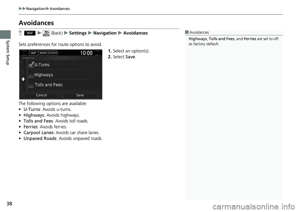
Hu (Back)uSettingsuNavigationuAvoidances
Sets preferences for route options to avoid.
1.Select an option(s).
2.Select Save.
The following options are available:
•U-Turns: Avoids u-turns.
•Highways: Avoids highways.
•Tolls and Fees: Avoids toll roads.
•Ferries: Avoids ferries.
•Carpool Lanes: Avoids car share lanes.
•Unpaved Roads: Avoids unpaved roads.1Avoidances
Highways, Tolls and Fees, and Ferries are set to off
as factory default.
Page 79 of 147
77Continued
Navigation
Driving to Your Destination
Viewing the Route
This section describes how to follow the route guidance to your destination.
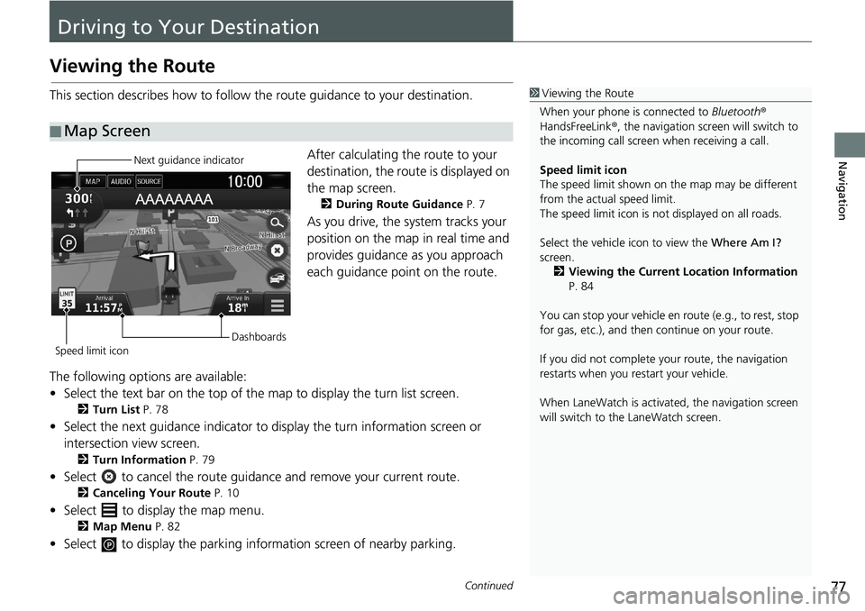
After calculating the route to your
destination, the route is displayed on
the map screen.
2During Route Guidance P. 7
As you drive, the system tracks your
position on the map in real time and
provides guidance as you approach
each guidance point on the route.
The following options are available:
• Select the text bar on the top of the map to display the turn list screen.
2Turn List P. 78
• Select the next guidance indicator to display the turn information screen or
intersection view screen.
2Turn Information P. 79
• Select to cancel the route guidance and remove your current route.
2Canceling Your Route P. 10
• Select to display the map menu.
2Map Menu P. 82
• Select to display the parking information screen of nearby parking.
■Map Screen
1Viewing the Route
When your phone is connected to Bluetooth®
HandsFreeLink®, the navigation screen will switch to
the incoming call screen when receiving a call.
Speed limit icon
The speed limit shown on the map may be different
from the actual speed limit.
The speed limit icon is not displayed on all roads.
Select the vehicle icon to view the Where Am I?
screen.
2Viewing the Current Location Information
P. 84
You can stop your vehicle en route (e.g., to rest, stop
for gas, etc.), and then continue on your route.
If you did not complete your route, the navigation
restarts when you restart your vehicle.
When LaneWatch is activated, the navigation screen
will switch to the LaneWatch screen.
Next guidance indicator
Speed limit iconDashboards
Page 81 of 147
Continued79
uuDriving to Your DestinationuViewing the Route
Navigation
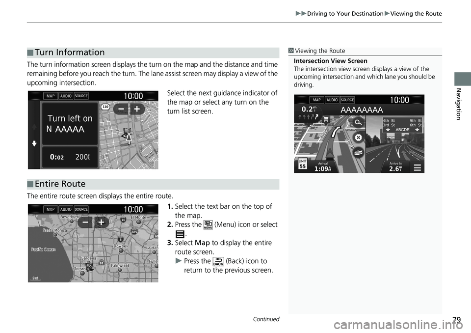
The turn information screen displays the turn on the map and the distance and time
remaining before you reach the turn. The lane assist screen may display a view of the
upcoming intersection.
Select the next guidance indicator of
the map or select any turn on the
turn list screen.
The entire route screen displays the entire route.
1.Select the text bar on the top of
the map.
2.Press the (Menu) icon or select
.
3.Select Map to display the entire
route screen.
uPress the (Back) icon to
return to the previous screen.
■Turn Information1Viewing the Route
Intersection View Screen
The intersection view screen displays a view of the
upcoming intersection and which lane you should be
driving.
■Entire Route
Page 127 of 147
125
Troubleshooting
Troubleshooting................................... 126
Map, Voice, Entering Destinations ........ 126
Traffic .................................................. 127
Guidance, Routing ............................... 128
Update, Coverage, Map Errors ............. 129
Display, Accessories.............................. 129
Miscellaneous Questions ...................... 130
Page 132 of 147
130
uuTroubleshootinguMiscellaneous Questions
Troubleshooting
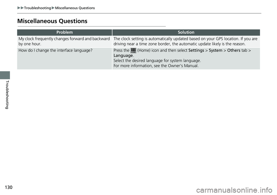
Miscellaneous Questions
ProblemSolution
My clock frequently changes forward and backward
by one hour.The clock setting is automatically updated based on your GPS location. If you are
driving near a time zone border, the automatic update likely is the reason.
How do I change the interface language?Press the (Home) icon and then select Settings > System > Others tab >
Language.
Select the desired language for system language.
For more information, see the Owner's Manual.
Page 135 of 147
133
uuSystem LimitationsuDatabase
Reference Information
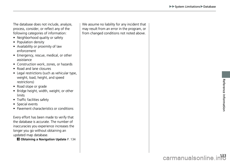
The database does not include, analyze,
process, consider, or reflect any of the
following categories of information:
• Neighborhood quality or safety
• Population density
• Availability or proximity of law
enforcement
• Emergency, rescue, medical, or other
assistance
• Construction work, zones, or hazards
• Road and lane closures
• Legal restrictions (such as vehicular type,
weight, load, height, and speed
restrictions)
• Road slope or grade
• Bridge height, width, weight, or other
limits
• Traffic facilities safety
• Special events
• Pavement characteristics or conditions
Every effort has been made to verify that
the database is accurate. The number of
inaccuracies you experience increases the
longer you go without obtaining an
updated map database.
2Obtaining a Navigation Update P. 134
We assume no liability for any incident that
may result from an error in the program, or
from changed conditions not noted above.