service HONDA INSIGHT 2021 Navigation Manual (in English)
[x] Cancel search | Manufacturer: HONDA, Model Year: 2021, Model line: INSIGHT, Model: HONDA INSIGHT 2021Pages: 127, PDF Size: 3.06 MB
Page 12 of 127
10
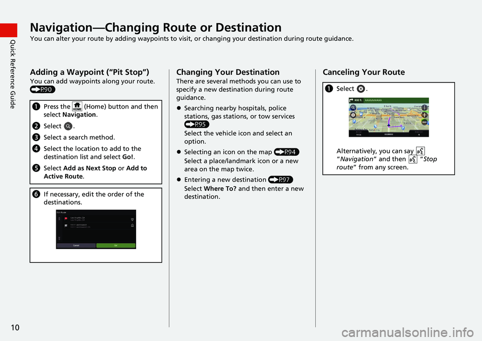
Quick Reference GuideNavigation—Changing Route or Destination
You can alter your route by adding waypoints to visit, or changing your destination during route guidance.
Adding a Waypoint (“Pit Stop”)
You can add waypoints along your route.
(P90)
aPress the (Home) button and then
select Navigation .
bSelect .
cSelect a search method.
dSelect the location to add to the
destination list and select Go!.
e Select Add as Next Stop or Add to
Active Route .
fIf necessary, edit the order of the
destinations.
Changing Your Destination
There are several methods you can use to
specify a new destina tion during route
guidance.
Searching nearby hospitals, police
stations, gas stations, or tow services
(P95)
Select the vehicle icon and select an
option.
Selecting an icon on the map (P94)
Select a place/landmark icon or a new
area on the map twice.
Entering a new destination (P97)
Select Where To? and then enter a new
destination.
Canceling Your Route
a Select .
Alternatively, you can say
“Navigation ” and then “ Stop
route ” from any screen.
Page 85 of 127
83
uuMap Operation uMap Tools
Continued
Navigation
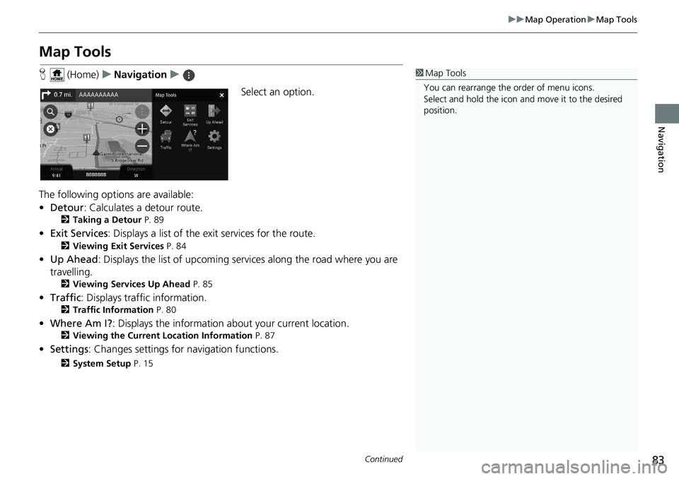
Map Tools
H (Home) uNavigation u
Select an option.
The following options are available:
• Detour : Calculates a detour route.
2Taking a Detour P. 89
•Exit Services : Displays a list of the ex it services for the route.
2Viewing Exit Services P. 84
•Up Ahead : Displays the list of upcoming serv ices along the road where you are
travelling.
2 Viewing Services Up Ahead P. 85
•Traffic : Displays traffi c information.
2Traffic Information P. 80
•Where Am I? : Displays the information about your current location.
2Viewing the Current Location Information P. 87
•Settings : Changes settings for navigation functions.
2System Setup P. 15
1Map Tools
You can rearrange the or der of menu icons.
Select and hold the icon and move it to the desired
position.
Page 86 of 127
uuMap Operation uMap Tools
84
Navigation
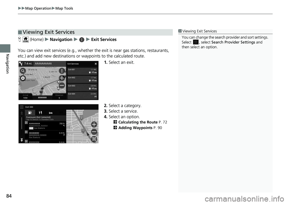
H (Home) uNavigation uuExit Services
You can view exit services (e.g., whether th e exit is near gas stations, restaurants,
etc.) and add new destinations or waypoints to the calculated route.
1.Select an exit.
2. Select a category.
3. Select a service.
4. Select an option.
2 Calculating the Route P. 72
2 Adding Waypoints P. 90
■Viewing Exit Services1
Viewing Exit Services
You can change the search pr ovider and sort settings.
Select , select Search Provider Settings and
then select an option.
Page 87 of 127
Continued85
uuMap Operation uMap Tools
Navigation
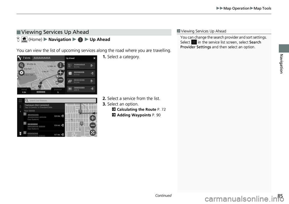
H (Home) uNavigation uuUp Ahead
You can view the list of upcoming servic es along the road where you are travelling.
1. Select a category.
2. Select a service from the list.
3. Select an option.
2 Calculating the Route P. 72
2 Adding Waypoints P. 90
■Viewing Services Up Ahead1
Viewing Services Up Ahead
You can change the search pr ovider and sort settings.
Select in the service list screen, select Search
Provider Settings and then select an option.
Page 88 of 127
uuMap Operation uMap Tools
86
Navigation
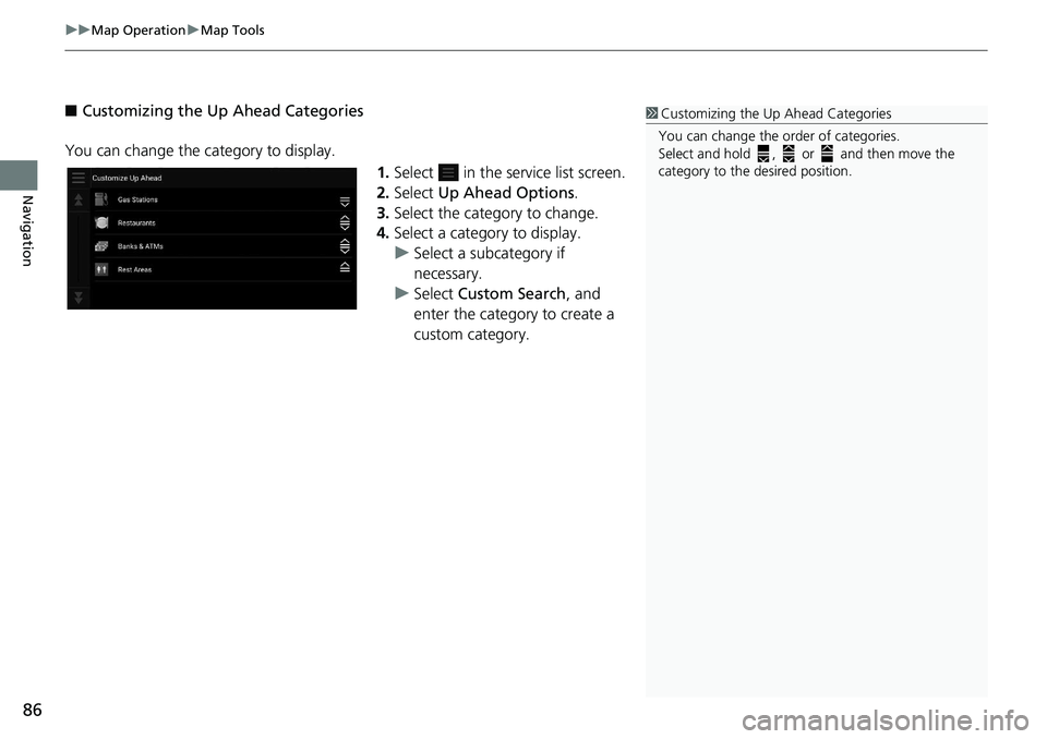
■ Customizing the Up Ahead Categories
You can change the category to display. 1.Select in the service list screen.
2. Select Up Ahead Options .
3. Select the category to change.
4. Select a category to display.
u Select a subcategory if
necessary.
u Select Custom Search, and
enter the category to create a
custom category.1 Customizing the Up Ahead Categories
You can change the order of categories.
Select and hold , or and then move the
category to the desired position.
Page 89 of 127
87
uuMap Operation uMap Tools
Navigation
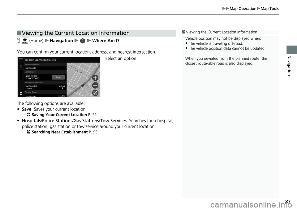
H (Home) uNavigation uuWhere Am I?
You can confirm your current location , address, and nearest intersection.
Select an option.
The following options are available:
• Save : Saves your current location.
2Saving Your Current Location P. 21
•Hospitals /Police Stations /Gas Stations/ Tow Services: Searches for a hospital,
police station, gas station or tow service around your current location.
2 Searching Near Establishment P. 95
■Viewing the Current Location Information1
Viewing the Current Location Information
Vehicle position may not be displayed when:
•The vehicle is traveling off-road.
•The vehicle position da ta cannot be updated.
When you deviated from the planned route, the
closest route-able road is also displayed.
Page 97 of 127
95
uuChanging Your Destination uSearching Near Establishment
Continued
Navigation
Searching Near Establishment
H (Home) uNavigation
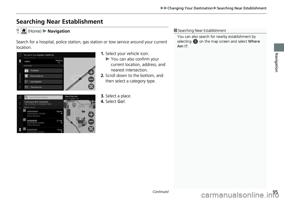
Search for a hospital, police station, gas station or tow service around your current
location.
1.Select your vehicle icon.
u You can also confirm your
current location, address, and
nearest intersection.
2. Scroll down to the bottom, and
then select a category type.
3. Select a place.
4. Select Go!.1 Searching Near Establishment
You can also search for nearby establishment by
selecting on the map screen and select Where
Am I? .
Page 103 of 127
101
uuTroubleshooting uTraffic
Troubleshooting
Traffic
ProblemSolution
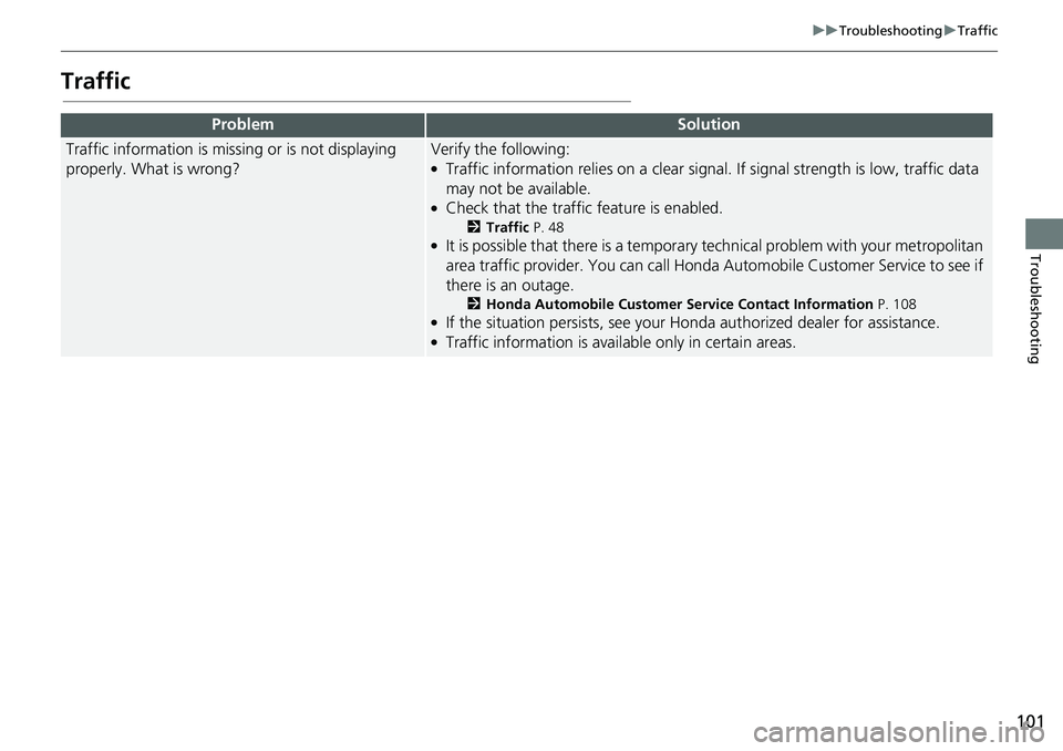
Traffic information is missing or is not displaying
properly. What is wrong?Verify the following:●Traffic information relies on a clear signal. If signal strength is low, traffic data
may not be available.
●Check that the traffic feature is enabled.
2 Traffic P. 48●It is possible that there is a temporar y technical problem with your metropolitan
area traffic provider. You can call Honda Au tomobile Customer Service to see if
there is an outage.
2 Honda Automobile Customer Service Contact Information P. 108●If the situation persists, see your Honda authorized dealer for assistance.●Traffic information is available only in certain areas.
Page 107 of 127
105
Reference Information
System Limitations................................106
GPS ......................................................106
Address Calculation ..............................106
Database ..............................................106
Customer Assistance .............................108
Resolving Problems ...............................108
Obtaining a Navigation Update .............108
Honda Automobile Customer Service Contact Information ............................108
Visiting Your Dealer ..............................109
Map Coverage ......................................109
Traffic Information ................................109 Legal Information
................................. 110
End User License Agreement ................ 110
Page 108 of 127
106
Reference Information
System Limitations
GPS
The signals received from GPS satellites are
extremely weak (less than a millionth of the
strength of a local FM station) and require
an unobstructed view of the sky. The GPS
antenna is located in the fin antenna. The
signal reception can easily be interrupted or
interfered with by the following:
• Audio electronic devices mounted near the navigation unit
• Trees, tall buildings, highway overpasses,
tunnels, or overhead electrical power
wires
GPS is operated by the U.S. Department of
Defense. For security reasons, there are
certain inaccuracies bui lt into GPS for which
the navigation system must constantly
compensate. This can cause occasional
positioning errors of up to several hundred
feet (meters).
Address Calculation
The destination icon shows only the
approximate location of a destination
address. This occurs if the number of
possible addresses is different from the
number of actual addr esses on a block. For
example, the address 1425 on a 1400 block
with 100 possible addresses (because it is
followed by the 1500 block) will be shown a
quarter of the way down the block by the
system. If there are only 25 actual addresses
on the block, the actual location of address
1425 would be at the end of the block.
Database
The digitized map database reflects
conditions as they existed at various points
in time before production. Accordingly,
your database may contain inaccurate or
incomplete data or information due to the
passage of time, road construction,
changing conditions, or other causes.
For example, some places/landmarks may
be missing when you search the database
because the name was misspelled, the place
was improperly categorized, or a place/
landmark is not yet in the database. This is
also true for police st ations, hospitals, and
other public institutions. Do not rely on the
navigation system if you need law
enforcement or hospital services. Always
check with local in formation sources.