cell phone HONDA RIDGELINE 2021 Navigation Manual (in English)
[x] Cancel search | Manufacturer: HONDA, Model Year: 2021, Model line: RIDGELINE, Model: HONDA RIDGELINE 2021Pages: 147, PDF Size: 8.2 MB
Page 128 of 147

126
uuTroubleshooting uGuidance, Routing
Troubleshooting
Guidance, Routing
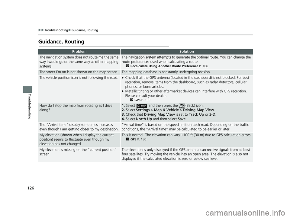
ProblemSolution
The navigation system does not route me the same
way I would go or the same way as other mapping
systems.The navigation system attempts to genera te the optimal route. You can change the
route preferences used when calculating a route.
2 Recalculate Using Another Route Preference P. 106
The street I’m on is not shown on the map screen.The mapping database is constantly undergoing revision.
The vehicle position icon is not following the road. ●Check that the GPS antenna (located in the dashboard) is not blocked. For best
reception, remove items from the dashboar d, such as radar detectors, cellular
phones, or loose articles.
●Metallic tinting or other aftermarket devices can interfere with GPS reception.
Please consult your dealer.
2 GPS P. 130
How do I stop the map from rotating as I drive
along?1.Select and then pres s the (Back) icon.
2. Select Settings > Map & Vehicle > Driving Map View .
3. Check that Driving Map View is set to Track Up or 3-D .
4. Select North Up and then select Save.
The “Arrival time” displa y sometimes increases
even though I am getting closer to my destination.“Arrival time” is based on the speed limit on each road. Depending on the traffic
conditions, the “Arrival time” may be calculated to be earlier or later.
My elevation (shown when I display the current
position) seems to fluc tuate even though my
elevation has not changed.This is normal. The elevation can vary ±100 ft (30 m) due to GPS calculation errors.
2 GPS P. 130
My elevation is missing on the “current position”
screen.The elevation is only displayed if the GP S antenna can receive signals from at least
four satellites. Try moving the vehicle into an open area. The elevation is also not
displayed if the calculated elevation is zero or below sea level.
21 RIDGELINE NAVI-31T6Z8400.book 126 ページ 2020年10月19日 月曜日 午後12時20分
Page 132 of 147

130
Reference Information
System Limitations
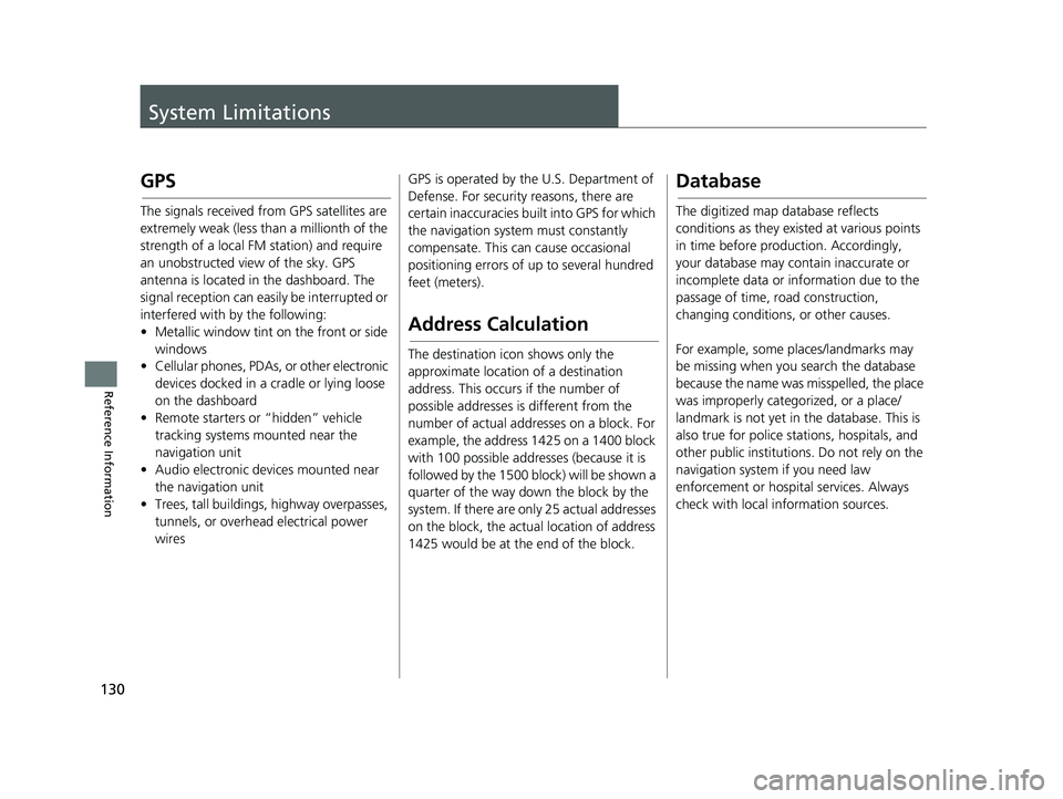
GPS
The signals received from GPS satellites are
extremely weak (less than a millionth of the
strength of a local FM station) and require
an unobstructed view of the sky. GPS
antenna is located in the dashboard. The
signal reception can easily be interrupted or
interfered with by the following:
• Metallic window tint on the front or side windows
• Cellular phones, PDAs, or other electronic
devices docked in a cradle or lying loose
on the dashboard
• Remote starters or “hidden” vehicle
tracking systems mounted near the
navigation unit
• Audio electronic devices mounted near
the navigation unit
• Trees, tall buildings, highway overpasses, tunnels, or overhead electrical power
wires GPS is operated by the U.S. Department of
Defense. For security
reasons, there are
certain inaccuracies bu ilt into GPS for which
the navigation system must constantly
compensate. This can cause occasional
positioning errors of up to several hundred
feet (meters).
Address Calculation
The destination icon shows only the
approximate location of a destination
address. This occurs if the number of
possible addresses is different from the
number of actual addr esses on a block. For
example, the address 1425 on a 1400 block
with 100 possible addresses (because it is
followed by the 1500 block) will be shown a
quarter of the way down the block by the
system. If there are only 25 actual addresses
on the block, the actual location of address
1425 would be at the end of the block.
Database
The digitized map database reflects
conditions as they existed at various points
in time before production. Accordingly,
your database may contain inaccurate or
incomplete data or information due to the
passage of time, road construction,
changing conditions, or other causes.
For example, some places/landmarks may
be missing when you search the database
because the name was misspelled, the place
was improperly categorized, or a place/
landmark is not yet in the database. This is
also true for police stat ions, hospitals, and
other public institutions. Do not rely on the
navigation system if you need law
enforcement or hospital services. Always
check with local information sources.
21 RIDGELINE NAVI-31T6Z8400.book 130 ページ 2020年10月19日 月曜日 午後12時20分
Page 137 of 147

135
uuLegal Information uUser Agreement
Continued
Reference Information
real time route guidance, fleet management
or similar applications; or (b) with, or in
communication with, including without
limitation, cellular phones, palmtop and
handheld computers, pa gers, and personal
digital assistants or PDAs.
Warning: This Data may contain inaccurate
or incomplete information due to the
passage of time, changing circumstances,
sources used and the na ture of collecting
comprehensive geographic Data, any of
which may lead to incorrect results.
No Warranty: This Data is provided to you
“as is”, and you agree to use it at your own
risk. HERE and its licensors (and their
licensors and suppliers) make no
guarantees, representations or warranties
of any kind, express or implied, arising by
law or otherwise, including but not limited
to, content, quality, accuracy,
completeness, effectiv eness, reliability,
fitness for a particular purpose, usefulness,
use or results to be obtained from this Data,
or that the Data or server will be
uninterrupted or error free. Disclaimer of Warranty:
HERE AND ITS
LICENSORS (INCLUDING THEIR LICENSORS
AND SUPPLIERS) DISCLAIM ANY
WARRANTIES, EXPRESS OR IMPLIED, OF
QUALITY, PERFORMANCE,
MERCHANTABILITY, FITNESS FOR A
PARTICULAR PURPOSE OR NON-
INFRINGEMENT. Some States, Territories
and Countries do not allow certain warranty
exclusions, so to that extent the above
exclusion may not apply to you.
Disclaimer of Liability: HERE AND ITS
LICENSORS (INCLUDING THEIR LICENSORS
AND SUPPLIERS) SHALL NOT BE LIABLE TO
YOU IN RESPECT OF ANY CLAIM, DEMAND
OR ACTION, IRRESPECTIVE OF THE NATURE
OF THE CAUSE OF THE CLAIM, DEMAND
OR ACTION ALLEGING ANY LOSS, INJURY
OR DAMAGES, DIRECT OR INDIRECT,
WHICH MAY RESULT FROM THE USE OR
POSSESSION OF THIS DATA; OR FOR ANY
LOSS OF PROFIT, REVENUE, CONTRACTS
OR SAVINGS, OR ANY OTHER DIRECT,
INDIRECT, INCIDENTAL, SPECIAL OR
CONSEQUENTIAL DAMAGES ARISING OUT
OF YOUR USE OF OR INABILITY TO USE THIS
DATA, ANY DEFECT IN THIS DATA, OR THE
BREACH OF THESE TERMS OR CONDITIONS, WHETHER IN AN ACTION IN
CONTRACT OR TORT OR BASED ON A
WARRANTY, EVEN IF HERE OR ITS
LICENSORS HAVE BEEN ADVISED OF THE
POSSIBILITY OF SUCH DAMAGES. Some
States, Territories and Countries do not
allow certain liability exclusions or damages
limitations, so to that
extent the above may
not apply to you.
Export Control: You agree not to export
from anywhere any part of the Data or any
direct product thereof except in compliance
with, and with all licenses and approvals
required under, applicable export laws,
rules and regulations, including but not
limited to the laws, rules and regulations
administered by the Office of Foreign Assets
Control of the U.S. Department of
Commerce and the Bure au of Industry and
Security of the U.S. Department of
Commerce. To the extent that any such
export laws, rules or regulations prohibit
HERE from complying with any of its
obligations hereunder to deliver or
distribute Data, such fa ilure shall be excused
and shall not constitute a breach of this
Agreement.
21 RIDGELINE NAVI-31T6Z8400.book 135 ページ 2020年10月19日 月曜日 午後12時20分