sat nav INFINITI Q50 2014 Infiniti Intouch
[x] Cancel search | Manufacturer: INFINITI, Model Year: 2014, Model line: Q50, Model: INFINITI Q50 2014Pages: 274, PDF Size: 1.43 MB
Page 127 of 274

8. Information and settings
8-4
SiriusXM TRAVEL LINK®
SiriusXM Travel Link information is a
subscription service offered by SiriusXM
Satellite Radio. It is necessary to subscribe
to use the SiriusXM Travel Link informa-
tion.
This service provides real-time information
regarding current weather, fuel prices,
sports scores, stock tickers and movie
times where available. The SiriusXM Travel
Link is broadcast to the vehicle by Sir-
iusXM Satellite Radio.
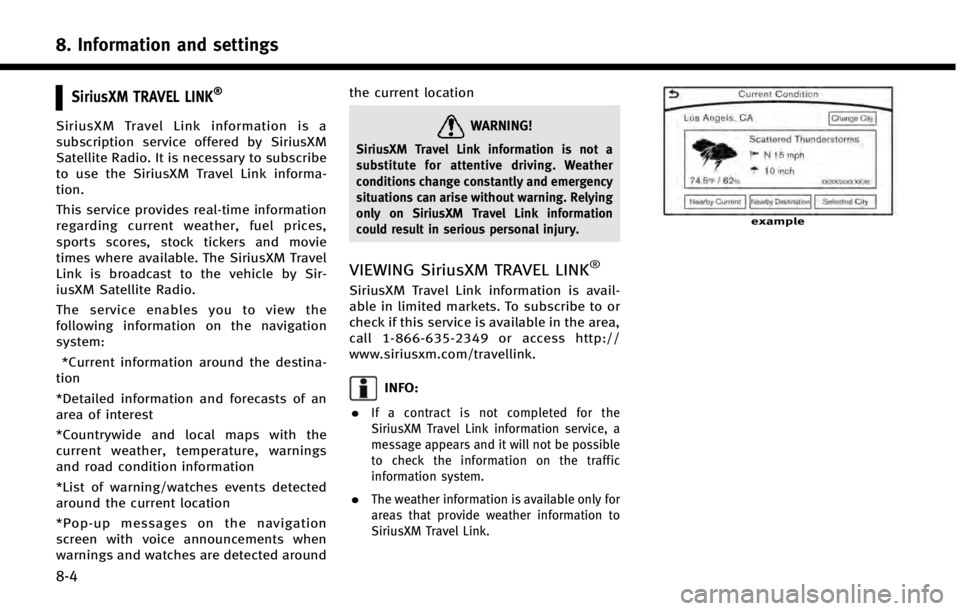
The service enables you to view the
following information on the navigation
system:*Current information around the destina-
tion
*Detailed information and forecasts of an
area of interest
*Countrywide and local maps with the
current weather, temperature, warnings
and road condition information
*List of warning/watches events detected
around the current location
*Pop-up messages on the navigation
screen with voice announcements when
warnings and watches are detected around the current locationWARNING!
SiriusXM Travel Link information is not a
substitute for attentive driving. Weather
conditions change constantly and emergency
situations can arise without warning. Relying
only on SiriusXM Travel Link information
could result in serious personal injury.
VIEWING SiriusXM TRAVEL LINK®
SiriusXM Travel Link information is avail-
able in limited markets. To subscribe to or
check if this service is available in the area,
call 1-866-635-2349 or access http://
www.siriusxm.com/travellink.
INFO:
.
If a contract is not completed for the
SiriusXM Travel Link information service, a
message appears and it will not be possible
to check the information on the traffic
information system.
.The weather information is available only for
areas that provide weather information to
SiriusXM Travel Link.
example
Page 133 of 274

8. Information and settings
8-10
vided.
. Due to infrastructure problems, or
transmission delay, there are times
when the information may differ from
the actual condition. Always observe
safe driving practices and follow all
traffic regulations.
. Due to the coverage and quality of
traffic information and road conditions,
it is not always possible for the system
to provide the shortest time route even
when traffic information is considered.
. Traffic information that is displayed
may differ from information from other
media (e.g., radio), as other media may
use different information sources.INFINITI CONNECTIONTM
SUBSCRIPTION TO INFINITI CON-
NECTION SERVICE
It is necessary to subscribe to Infiniti
Connection in order to use the Infiniti
Connection service. For the details about
the subscription, visit the INFINITI Owner’s
Portal Website or contact an INFINITI
retailer.
LEGAL DISCLAIMER
Avoid operating Infiniti ConnectionTMand
Infiniti Connection Plus services in such a
way that you are distracted while driving.
An Infiniti Connection Subscription Agree-
ment is required to use this service.
Beginning on the date of purchase of your
vehicle, for a limited period of time, this
service is complimentary. At the expiration
of the complimentary period, your credit
card (if on file) will be charged and your
service will automatically renew in accor-
dance with the terms of your Infiniti
Connection Subscription Agreement.
Services are dependent upon subscription
enrollment and the telematics device being
in operative condition, cellular connection
availability, navigation map data, and GPS satellite signal reception, which can limit
the ability to reach Infiniti Connection or to
receive support. The service requires a
compatible GSM/GPRS cellular network.
Should the cellular provider terminate or
restrict network service, services will not
be available. Under this circumstance, your
service may be suspended or terminated
without notice and without liability to
NISSAN, NISSAN’s third party service pro-
viders, the underlying wireless carrier or
any third party beneficiary. In the event
that a change of telecommunications sys-
tems or services becomes necessary, you
are solely responsible for replacing, as well
as the cost of replacing, any equipment in
the vehicle that is necessitated. Terms and
conditions of Infiniti Connection Subscrip-
tion Agreement apply.
INFINITI CONNECTION FEATURES
Infiniti Connection provides various types
of information and services by connecting
your vehicle to the Infiniti Connection Data
Center and Infiniti Connection Response
Center using the TCU (Telematics Control
Unit) installed in your vehicle.
Page 134 of 274

WARNING!
.Radio waves could adversely affect elec-
tric medical equipment. individuals who
use a pacemaker should contact the
device manufacturer regarding any pos-
sible effects before using the system.
. The TCU antenna is installed inside the
upper central part of the instrument
panel. An occupant should not get any
closer to the antenna than specified by
the pacemaker manufacturer. The radio
waves from the TCU antenna may ad-
versely affect the operation of the pace-
maker while using the Infiniti Connection
service.
CAUTION!
Please note that the Automatic Collision
Notification service and Emergency Call
function cannot be used in the following
conditions:
. The vehicle moves outside the Infiniti
Connection service area and connection
with the TCU (Telematics Control Unit) is
affected. .
The vehicle is in a location with poor
signal reception such as a tunnel, under-
ground parking, behind a building or in a
mountainous area.
. It may not be possible to make an
emergency call in all accidents or emer-
gencies, or if you are in a location
without reception.
INFO:
.
Infiniti Connection features are dependent
upon subscription enrollment and the tele-
matics device being in operative condition,
cellular connectivity, navigation map data
and GPS satellite signal reception. Terms
and conditions of the Infiniti Connection
Subscription Agreement apply.
.Enrollment is required in order to receive
Infiniti Connection services. The services
that can be received vary depending on
the plan in which you are enrolled.
.All services can be used free of charge for
the first year of ownership.
.After the first year, use of the service will no
longer be free of charge. The services that
can be received vary depending on the plan to which you subscribe.
.Laws in some jurisdictions may restrict the
use of
“Text-to-Speech.” Check local regula-
tions before using this feature.
Infiniti Connection services may be up-
dated. The latest detailed information is
available on the following websites or from
the support line.
Infiniti Connection website:
www.infiniticonnection.com (for U.S.)
https://canada.infiniticonnection.com
(for Canada)
Infiniti Connection support line:
1-800-334-7858 (for U.S.)
1-855-892-7418 (for Canada)
. Automatic Collision Notification:
The TCU (Telematics Control Unit) gen-
erates a signal automatically to the
Infiniti Connection Response Center in
the case of an accident severe enough
to trigger one of the vehicle’s air bags.
Upon the signal, a Response Specialist
receives the vehicle location and cus-
tomer information and notifies the
proper authorities in accordance with
established policies and procedures.
8. Information and settings
8-11
Page 177 of 274
![INFINITI Q50 2014 Infiniti Intouch 9. Navigation (if so equipped)
9-22
1. Push<MENU>and touch [Destination].
2. Touch [Nearby Places]. The category list is displayed.
3. Select [Emergency Facilities] for exam-ple.
4. Select preferred c INFINITI Q50 2014 Infiniti Intouch 9. Navigation (if so equipped)
9-22
1. Push<MENU>and touch [Destination].
2. Touch [Nearby Places]. The category list is displayed.
3. Select [Emergency Facilities] for exam-ple.
4. Select preferred c](/img/42/34966/w960_34966-176.png)
9. Navigation (if so equipped)
9-22
1. Push
Page 180 of 274

.Only the locations included in the database
in the map data can be searched for by
phone number. Residential phone numbers
cannot be used to search for a location.
1. Push
2. Touch [Phone Numbers]. The telephone number input screen is displayed.
3. Enter the telephone number including the area code. After finishing entry,
touch [OK].
INFO:
A list screen is displayed if there are two or
more search results. The upper screen
displaying the place name, address and
the location. Touch the preferred destination
from the list.
4. The selected destination is displayedon the upper display. Touch [Start] after
confirming the location of the displayed
destination.
SETTING FROM STORED ROUTES
It is possible to select a preferred route
from the stored routes.
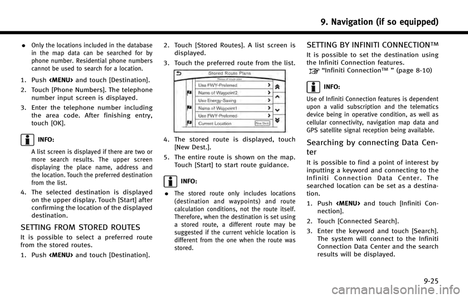
1. Push
displayed.
3. Touch the preferred route from the list.
4. The stored route is displayed, touch [New Dest.].
5. The entire route is shown on the map. Touch [Start] to start route guidance.
INFO:
.
The stored route only includes locations
(destination and waypoints) and route
calculation conditions, not the route itself.
Therefore, when the destination is set using
a stored route, a different route may be
suggested if the current vehicle location is
different from the one when the route was
stored.
SETTING BY INFINITI CONNECTIONTM
It is possible to set the destination using
the Infiniti Connection features.
“Infiniti ConnectionTM” (page 8-10)
INFO:
Use of Infiniti Connection features is dependent
upon a valid subscription and the telematics
device being in operative condition, as well as
cellular connectivity, navigation map data and
GPS satellite signal reception being available.
Searching by connecting Data Cen-
ter
It is possible to find a point of interest by
inputting a keyword and connecting to the
Infiniti Connection Data Center. The
searched location can be set as a destina-
tion.
1. Push
nection].
2. Touch [Connected Search].
3. Enter the keyword and touch [Search]. The system will connect to the Infiniti
Connection Data Center and the search
results will be displayed.
9. Navigation (if so equipped)
9-25
Page 198 of 274

INFO:
.
Only one of these route condition can be
utilized at a time.
.The recalculated route may not be the
shortest route because the system priori-
tizes roads that are easy to drive on for
safety reasons.
.If route conditions are set from [Search
Criteria], all sections in the route are subject
to the same route conditions even though
different route conditions have been set for
different sections in [Edit Route].
.If [Use Time Restricted Roads] is deacti-
vated, the system calculates a route without
any consideration of the regulations con-
cerning the time or day of the week.
Therefore, the suggested route may include
a road subject to traffic regulations con-
cerning the time or day of the week. When
driving along the route, always follow all
traffic regulations regardless of whether
[Use Time Restricted Roads] is set to be
considered or not.
.If the system cannot calculate any alter-
native routes, the previous route is dis-
played.
.If the vehicle greatly deviates from the
suggested route, the system calculates a
new route.
.Traffic jam information displayed on the
map screen is not statistical traffic informa-
tion.
.Even when [Use Real Time Traffic Info] is
turned on, if traffic information has not been
provided for the area, a detour may not
always be indicated in a location where a
traffic jam occurs.
.The system may not lead to a detour if traffic
closure or a traffic jam occurs far from the
present location.
.The system calculates to reduce the time
required for the entire route from the start to
the destination. If there are no appropriate
routes, the system may lead to a route
where a traffic jam occurs instead of leading
to a detour.
VIEWING TRAFFIC INFORMATION
SiriusXM Traffic information is a subscrip-
tion service offered by SiriusXM Satellite
Radio.
This service provides real-time information
regarding traffic flow, accidents, road
construction and other incidents, where
available.
SiriusXM Traffic combines information from
commercial and public traffic data provi-
ders including government departments of
transportation, police, emergency services,
road sensors, cameras and aircraft reports.
The traffic information is broadcast to the
vehicle by the SiriusXM satellites. Traffic
information available for the route the
driver selected is shown on the navigation
screen so traffic conditions between you
and the destination are known. Three types
of real-time traffic information for major
roadways are shown on the navigation
system: . Unscheduled traffic data for example,
accidents and disabled vehicles.
. Scheduled traffic data, for example
road construction and road closures.
9. Navigation (if so equipped)
9-43
Page 199 of 274

9. Navigation (if so equipped)
9-44
.Traffic flow information (rate of speed
data).
WARNING!
SiriusXM Traffic information is not a sub-
stitute for attentive driving. Traffic conditions
change constantly and emergency situations
can arise without warning. Relying only on
SiriusXM Traffic information may lead to a
collision and could result in serious personal
injury.
NOTE:
Flow information is provided only for roads
equipped with traffic sensors and is not
available in all markets covered by the service.
Flow data may not be available on portions of a
road that is under construction.
SiriusXM Traffic information is available in
limited markets. To subscribe or to check if
this service is available in the area:
call 1-866-635-2349 or see www.siriusxm.
com/siriusxmtraffic
INFO:
If a contract is not completed for SiriusXM Traffic
information service, a message appears, and it
will not be possible to check the information on
the traffic information system.
VIEWING AVAILABLE TRAFFIC INFORMA-
TION
NavTraffic information is a subscription
service offered by SiriusXM Satellite Radio.
This service provides real-time information
regarding traffic flow, accidents, road
construction and other incidents, where
available.
NavTraffic combines information from com-
mercial and public traffic data providers
including government departments of
transportation, police, emergency services,
road sensors, cameras and aircraft reports.
The traffic information is broadcast to the
vehicle by the SiriusXM satellites. Avail-
able traffic information on the route the
driver selected is shown on the navigation
screen so traffic conditions between you
and the destination are known. Three types
of real-time traffic information for major
roadways are shown on the navigation
system:
* Unscheduled traffic data for example,
accidents and disabled vehicles.
* Scheduled traffic data, for example road
construction and road closures.
* Traffic flow information (rate of speed
Page 214 of 274

GENERAL INFORMATION FOR NAVIGA-
TION SYSYTEM
CURRENT VEHICLE LOCATION
Display of current vehicle location
This navigation system combines the data
obtained from the vehicle (by gyro sensor)
and from GPS (Global Positioning System)
satellites to calculate the current location
of the vehicle. This position is then
displayed throughout route guidance to a
destination.
What is GPS (Global Positioning
System)?
GPS is a position detecting system that
uses satellites deployed by the U.S.
government. This navigation system re-
ceives radio signals from three or more
different satellites that orbit 13,049 miles
(21,000 km) above the earth in space, and
detect the position of the vehicle by
utilizing the principle of triangulation.
Positioning adjustment:
When the system judges that the vehicle
position is not accurate based on vehicle
speed and gyro sensor data calculations,the system will automatically adjust the
position of the vehicle icon using GPS
signals.
Receiving signals from GPS satellites:
The reception of GPS signals can be weak,
depending on the environment. Vehicles in
the following areas/environments may not
receive GPS signals.
*Inside tunnels or parking garages
*In areas with numerous tall buildings
*Under multi-layered highways
9. Navigation (if so equipped)
9-59
Page 238 of 274

1st Command2nd Command3rd Command Action
Navigation Repeat Instruction Speaks the current navigation guidance.
Voice Guidance OFF / Voice Guidance ON Turns the navigation guidance on and off.
Show
Remove
NOTE:
When searching for an address, the state cannot be specified by voice commands. Speak an address within the state or change the state setting prior to
starting the voice recognition session.
INFO:
When the current car position is in Puerto Rico and Guam, the system does not recognize the general navigation commands.
Audio Command
1st Command2nd Command3rd Command Action
Audio AM Turns to the AM band, selecting the station last played.
FM <87.9-107.9> Turns to the AM band, selecting the station of the preferred frequency.
FM Turns to the FM band, selecting the station last played.
SXM
SXM Turns to the SiriusXM Satellite Radio band, selecting the channel last played.
USB Play Artist
iPod
®Play Artist
USB Play Artist
iPod Play Artist
10. Voice recognition
10-11