service indicator INFINITI Q50 2021 Infiniti Intouch
[x] Cancel search | Manufacturer: INFINITI, Model Year: 2021, Model line: Q50, Model: INFINITI Q50 2021Pages: 268, PDF Size: 1.13 MB
Page 158 of 268

6. Navigation (if so equipped)
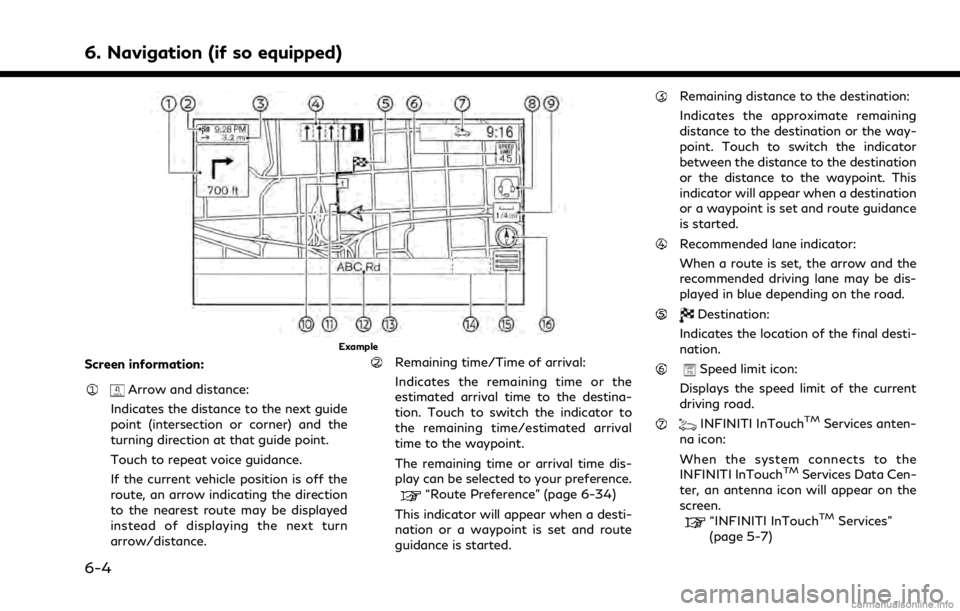
Example
Screen information:
Arrow and distance:
Indicates the distance to the next guide
point (intersection or corner) and the
turning direction at that guide point.
Touch to repeat voice guidance.
If the current vehicle position is off the
route, an arrow indicating the direction
to the nearest route may be displayed
instead of displaying the next turn
arrow/distance.
Remaining time/Time of arrival:
Indicates the remaining time or the
estimated arrival time to the destina-
tion. Touch to switch the indicator to
the remaining time/estimated arrival
time to the waypoint.
The remaining time or arrival time dis-
play can be selected to your preference.
“Route Preference” (page 6-34)
This indicator will appear when a desti-
nation or a waypoint is set and route
guidance is started.
Remaining distance to the destination:
Indicates the approximate remaining
distance to the destination or the way-
point. Touch to switch the indicator
between the distance to the destination
or the distance to the waypoint. This
indicator will appear when a destination
or a waypoint is set and route guidance
is started.
Recommended lane indicator:
When a route is set, the arrow and the
recommended driving lane may be dis-
played in blue depending on the road.
Destination:
Indicates the location of the final desti-
nation.
Speed limit icon:
Displays the speed limit of the current
driving road.
INFINITI InTouchTMServices anten-
na icon:
When the system connects to the
INFINITI InTouch
TMServices Data Cen-
ter, an antenna icon will appear on the
screen.
“INFINITI InTouchTMServices”
(page 5-7)
6-4
Page 159 of 268

(if so equipped):
Touch the icon to connect to the
INFINITI InTouch
TMServices Voice
Menu.
“Connecting to Interactive Voice
Menu” (page 5-12)
Scale indicator:
Indicates the scale of the map.
Touch the icon to display the scale bar.
The map scale can be adjusted using the
scale bar.
“Changing scale of map” (page 6-7)
Waypoint:
Displays the location of the waypoint
that the vehicle will stop by before
heading to the final destination.
Suggested route:
Appears in bold blue during route gui-
dance.
Street name:
Displays the name of the street that the
vehicle is currently driving on.
Vehicle icon:
Indicates the current vehicle location
and the direction of travel.
Traffic indicator:
Indicates the reception condition of the
traffic information.
Touch to display the traffic information
screen.
“Viewing traffic events from list”
(page 6-43)
[PREMIUM TRAFFIC]:
Displayed when [Use Premium Traffic]
is turned on and the traffic information
is available.
“Traffic information setting”
(page 6-44)
[SiriusXM TRAFFIC]:
Displayed when [Use Premium Traffic]
is turned off and the traffic information
is available.
“Traffic information setting”
(page 6-44)
A SiriusXM Traffic
TMsubscription is
necessary to receive SiriusXM® infor-
mation services.
[]:
Touch the icon to display the shortcut
menu.
“Shortcut menu” (page 2-13)
[]:
Indicates the directional setting of the
map.
Touch to change the map view and the
map orientation.
“Changing map view and map
orientation” (page 6-8)
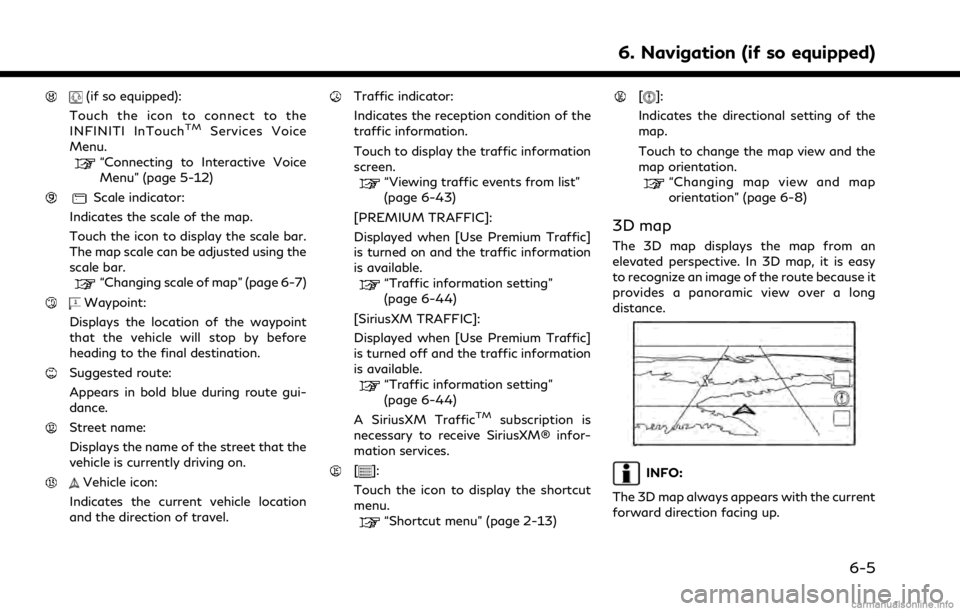
3D map
The 3D map displays the map from an
elevated perspective. In 3D map, it is easy
to recognize an image of the route because it
provides a panoramic view over a long
distance.
INFO:
The 3D map always appears with the current
forward direction facing up.
6. Navigation (if so equipped)
6-5