display LINCOLN BLACKWOOD 2002 Navigation Manual
[x] Cancel search | Manufacturer: LINCOLN, Model Year: 2002, Model line: BLACKWOOD, Model: LINCOLN BLACKWOOD 2002Pages: 48, PDF Size: 0.89 MB
Page 39 of 48

GLOSSARY
Map CD
Compact Disc with CD-i format. CD which contains data only readable by
a special CD player. Digitized road maps, city maps and a database of
facilities of special interest (for example parking, hotels, restaurants, gas
stations etc.) are stored on a map CD.
GPS
Global positioning system: A system for determination of the exact
position by receiving data from several earth orbiting satellites. To
calculate a precise position at least four satellites have to be receivable
simultaneously. The GPS receiver calculates the vehicle position with the
received GPS signals. The satellite icon is displayed in green color as
long as sufficient GPS data is received.
Gyroscope
One of the sensors used for calculation of the current vehicle position.
The gyro is located in the navigation computer. It measures changes in
the vehicle's direction.
Navigation computer
The core component of the navigation system. The navigation computer
compares the data on the map CD with the signals coming from the
sensors and from the GPS receiver and calculates the current vehicle
position. Also route planning and guidance functions are handled by the
navigation computer.
SDVC
Speed dependent volume control: For compensation of engine, wind and
rolling noise of the vehicle the voice volume is increased dependent on
the vehicle speed. The increase of the voice volume is controlled by the
navigation system. You can adjust the volume increments by selecting
different SDVC curves.
Glossary
39
Page 40 of 48

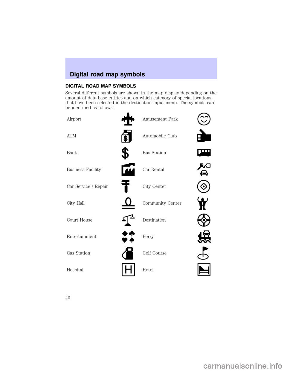
DIGITAL ROAD MAP SYMBOLS
Several different symbols are shown in the map display depending on the
amount of data base entries and on which category of special locations
that have been selected in the destination input menu. The symbols can
be identified as follows:
Airport
Amusement Park
AT MAutomobile Club
BankBus Station
Business FacilityCar Rental
Car Service / RepairCity Center
City HallCommunity Center
Court HouseDestination
EntertainmentFerry
Gas StationGolf Course
HospitalHotel
Digital road map symbols
40
Page 42 of 48

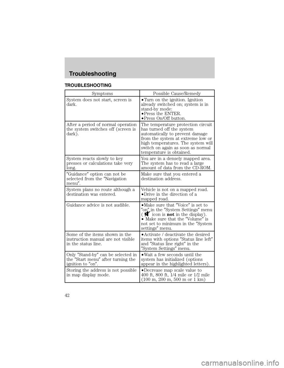
TROUBLESHOOTING
Symptoms Possible Cause/Remedy
System does not start, screen is
dark.²Turn on the ignition. Ignition
already switched on; system is in
stand-by mode:
²Press the ENTER.
²Press On/Off button.
After a period of normal operation
the system switches off (screen is
dark).The temperature protection circuit
has turned off the system
automatically to prevent damage
from the system at extreme low or
high temperatures. The system will
switch on again as soon as normal
temperature is obtained.
System reacts slowly to key
presses or calculations take very
long.You are in a densely mapped area.
The system has to read a large
amount of data from the CD-ROM.
9Guidance9option can not be
selected from the9Navigation
menu9.Make sure that you entered a
destination address.
System plans no route although a
destination was entered.Vehicle is not on a mapped road.
²Drive in the direction of a
mapped road.
Guidance advice is not audible.²Make sure that9Voice9is set to
9on9in the9System Settings9menu
(
icon isnotin the display).
²Make sure that the9Volume9is
not set to minimum in the9System
settings9menu.
Some of the items shown in the
instruction manual are not visible
in the status line.²Activate / deactivate the desired
items with options9Status line left9
and9Status line right9in the
9System Settings9menu.
Only9Stand-by9can be selected in
the9Start menu9after turning the
ignition to9on9.²Wait a few seconds until the
system has initialized (options
appear in the highlighted letters).
Storing the address is not possible
in map display mode.²Decrease map scale value to
400 ft, 800 ft, 1/4 mile or 1/2 mile
(100 m, 200 m, 500 m or 1 km)
Troubleshooting
42
Page 43 of 48

Symptoms Possible Cause/Remedy
Color of the satellite icon on the
GPS logo is constantly red.²Drive outdoors, if you are in a
garage or a tunnel.
Display shows9NO CD9or
9WRONG CD9.²Make sure that an appropriate
CD is inserted correctly in the CD
player.
Current time in the status line is
wrong.²Adjust the time zone in the
9System Settings9menu, option
9Date / Clock9.
Not possible to store address in
the address book.Address book is full.
²Delete one or more entries no
longer used.
Entered relocation intersection is
not accepted during vehicle
position input.Not all intersections entered by
the9keyboard9are suitable for
relocation.
²Select an intersection displayed
in the list.
Guidance is not precise. An inaccuracy of 30 m (100 ft) is
within the limit.
Displayed vehicle position by the
navigation system does not
correspond with actual vehicle
position.Bad GPS reception for a longer
period of time.
²If necessary, wait a few minutes.
The system automatically corrects
the position as soon as sufficient
GPS reception is resumed.
Guidance advice does not
correspond with actual traffic
situation.It is possible that the vehicle
position calculated by the system
is currently wrong. The roads may
be changed and do not correspond
with the information stored on the
map CD.
Troubleshooting
43