ECO mode MERCEDES-BENZ C-Class SEDAN 2017 W205 Comand Manual
[x] Cancel search | Manufacturer: MERCEDES-BENZ, Model Year: 2017, Model line: C-Class SEDAN, Model: MERCEDES-BENZ C-Class SEDAN 2017 W205Pages: 178, PDF Size: 9.47 MB
Page 57 of 178
Basic settings
Selecting the route type
X
To switch to navigation mode: press the
00BE button.
X To show the menu: slide6the controller.
X To select Options
Options: turn and press the con-
troller.
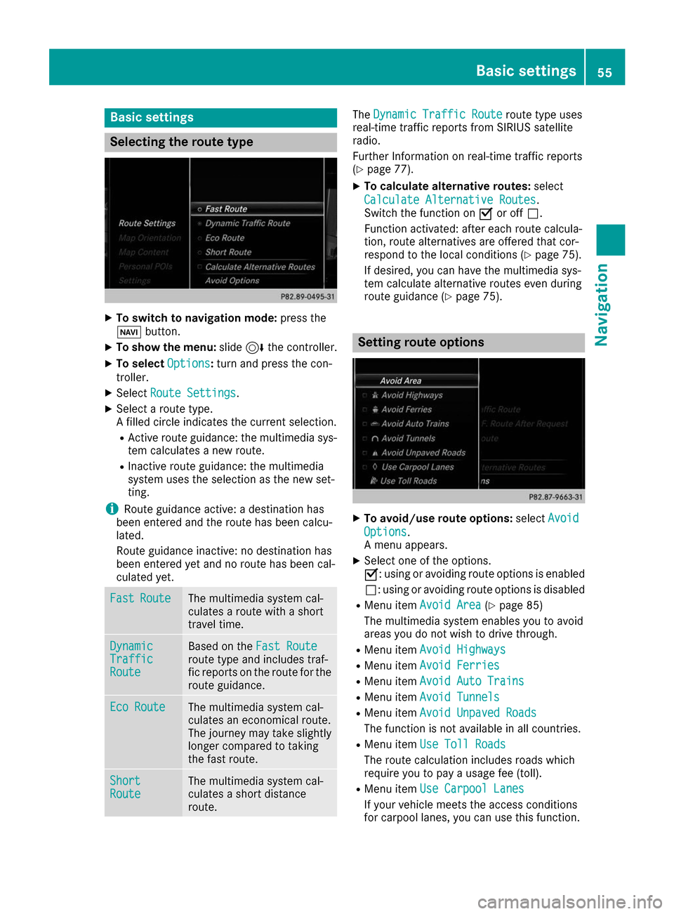
X Select Route Settings
Route Settings.
X Select a route type.
A filled circle indicates the current selection.
R Active route guidance: the multimedia sys-
tem calculates a new route.
R Inactive route guidance: the multimedia
system uses the selection as the new set-
ting.
i Route guidance active: a destination has
been entered and the route has been calcu-
lated.
Route guidance inactive: no destination has
been entered yet and no route has been cal-
culated yet. Fast Fast
Route
Route The multimedia system cal-
culates a route with a short
travel time.
Dynamic Dynamic
Traffic Traffic
Route Route Based on the
Fast Route
Fast Route
route type and includes traf-
fic reports on the route for the
route guidance. Eco Route Eco Route The multimedia system cal-
culates an economical route.
The journey may take slightly
longer compared to taking
the fast route. Short Short
Route Route The multimedia system cal-
culates a short distance
route. The
Dynamic Traffic Route Dynamic Traffic Route route type uses
real-time traffic reports from SIRIUS satellite
radio.
Further Information on real-time traffic reports
(Y page 77).
X To calculate alternative routes: select
Calculate Alternative Routes Calculate Alternative Routes .
Switch the function on 0073or off 0053.
Function activated: after each route calcula-
tion, route alternatives are offered that cor-
respond to the local conditions (Y page 75).
If desired, you can have the multimedia sys-
tem calculate alternative routes even during
route guidance (Y page 75). Setting route options
X
To avoid/use route options: selectAvoid Avoid
Options
Options.
A menu appears.
X Select one of the options.
0073: using or avoiding route options is enabled
0053: using or avoiding route options is disabled
R Menu item Avoid Area Avoid Area (Ypage 85)
The multimedia system enables you to avoid
areas you do not wish to drive through.
R Menu item Avoid Highways Avoid Highways
R Menu item Avoid Ferries
Avoid Ferries
R Menu item Avoid Auto Trains
Avoid Auto Trains
R Menu item Avoid Tunnels
Avoid Tunnels
R Menu item Avoid Unpaved Roads
Avoid Unpaved Roads
The function is not available in all countries.
R Menu item Use Toll Roads
Use Toll Roads
The route calculation includes roads which
require you to pay a usage fee (toll).
R Menu item Use Carpool Lanes Use Carpool Lanes
If your vehicle meets the access conditions
for carpool lanes, you can use this function. Basic settings
55Navigation Z
Page 69 of 178
X
To select Destination
Destination: turn and press the
controller.
X Select From Mercedes-Benz Apps
From Mercedes-Benz Apps.
The list of Mercedes-Benz Apps appears. Using geo-coordinates
X To switch to navigation mode: press the
00BE button.
X To show the menu: slide6the controller.
X To select Destination
Destination: turn and press the
controller.
X Select Using Geo-Coordinates
Using Geo-Coordinates .
Geo-coordinates (longitude and latitude) are
entered in degrees, minutes and seconds.
X To enter geo-coordinates: turn the control-
ler.
The value for degree, minute or second
changes.
X To move the selection within the line: slide
1 the controller.
X To move the selection between lines: slide
4 the controller.
X To confirm the value: press the controller.
X To store geo-coordinates: selectSave
Save by
turning and pressing the controller.
The destination with the geo-coordinates can
be saved as:
R a home address in the address book
R a navigable address book contact
For further information on the address
book, see (Y page 104)
R a personal destination on the SD card
(Y page 81)
X To start route calculation: selectStart
Start
Route Route Guidance
Guidance by turning and pressing the
controller. Personal POIs and routes
General notes
The use of personal POIs for displaying traffic
surveillance equipment is not permitted in every country. Please observe the country-specific
regulations and always drive at a suitable speed.
Personal POIs are filed in categories:
R Not Classified
Not Classified Standard entry for personal POIs
R Mercedes-Benz Apps Mercedes-Benz Apps
Personal POIs (destinations, routes) that you
have imported via the online functions.
R Categories which you have created yourself,
e.g. on your PC
Personal routes are not categorized. Settings for personal POIs
Displaying on the map Requirements: an SD card with personal POIs is
inserted (Y page 145).
The SD card has the FAT data system format
(e.g. FAT32).
All personal POIs of the selected category are
displayed on the map with a corresponding sym-
bol.
If the "Alert when approaching" function is acti- vated (Y page 68), the symbols are displayed
up to a map scale of 2 mi.
X To switch to navigation mode: press the
00BE button.
X To show the menu: slide6the controller.
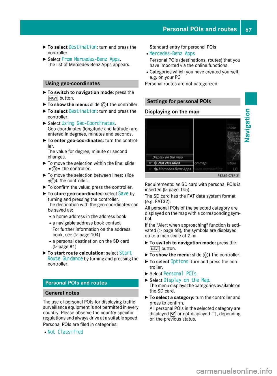
X To select Options Options: turn and press the con-
troller.
X Select Personal POIs
Personal POIs.
X Select Display on the Map
Display on the Map .
The menu displays the categories available on
the SD card.
X To select a category: turn the controller and
press to confirm.
All personal POIs in the selected category are displayed 0073or not displayed 0053, depending
on the previous status. Personal POIs and routes
67Navigation Z
Page 72 of 178
X
Select personal POI or personal route
(Y page 69).
X To explore a personal POI or personal
route:
turn and press the controller to select
Map Map.
The map with the crosshair appears and
shows the destination.
X Scroll the map (Y page 54).
X Set the map scale (Y page 82).
X To switch to the menu: press the 0038button.
X To call the personal POI: turn and press the
controller to select Call
Call .
If a mobile phone is connected to the multi-
media system and the telephone number is
available, the call is connected (Y page 98).
X To save a personal POI: turn and press the
controller to select Save
Save .
X Continue saving (Y page 80).
X To edit the name and symbol: turn and
press the controller to select Edit
Edit .
X Select Change Name
Change Name orEdit Icon Edit Icon .
X Character entry (Y page 30).
X Select a symbol.
X To delete a personal POI or route: turn and
press the controller to select Delete
Delete.
A prompt will appear.
X Select Yes
Yes orNo
No.
If you select Yes
Yes, the personal destination or
personal route is deleted.
X To select the outward and return routes:
select
Swap
Swap by turning and pressing the con-
troller.
The starting and destination positions of your personal route, and thus the direction for
route guidance, are switched round. One-way
streets or restricted intersections are taken
into consideration. Therefore, the outward
and return routes may differ from each other.
X To start route guidance: turn and press the
controller to select Start Start.Recording the route
General notes Routes are recorded using the SD card.
Requirements: the SD card has the FAT data
system format (e.g. FAT32). When recording the route, bear in mind the fol-
lowing:
R If the SD card is inserted, it must not be
removed during recording.
R If route recording is started manually, it must
be finished manually before the multimedia
system is switched off (e .g. when the engine
is switched off).
R The multimedia system minimizes the num-
ber of route points recorded. Therefore when
the recorded route is subsequently com-
menced, it may differ from the route that was originally recorded.
Starting/finishing route recording X
Insert the SD memory card (Y page 145).
X To switch to navigation mode: press the
00BE button.
X To show the menu: slide6the controller.
X To select Destination
Destination: turn and press the
controller.
X Select From Memory Card From Memory Card .
X Select Start Route Recording
Start Route Recording.
The route is recorded and REC appears at the bottom edge of the screen.
X To stop recording, select End Route
End Route
Recording
Recording from the menu.
The route is stored under Personal Routes
Personal Routes.
Displaying/editing the recorded route X
Insert the SD memory card (Y page 145).
X To switch to navigation mode: press the
00BE button.
X To show the menu: slide6the controller.
X To select Destination
Destination: turn and press the
controller.
X Select From Memory Card
From Memory Card .
X Select Personal Routes
Personal Routes.
Previously recorded routes are displayed.
X To select a route, turn and press the control-
ler.
The map appears with a menu. The recorded
route is shown on the map in blue.
X To calculate a route: selectStart
Start.
X To change the name and symbol: select
Edit Edit.
X Select Change Name
Change Name orEdit Icon
Edit Icon . 70
Personal POIs and routesNavigation
Page 73 of 178
X
Character entry (Y page 30).
X Select a symbol. Route guidance
General notes
The multimedia system calculates the route to
the destination without taking the following into
account, for example:
R traffic lights
R stop and yield signs
R parking or stopping restrictions
R road narrowing
R temporary traffic rules and regulations
The navigation system can give differing driving
recommendations if the actual street/traffic sit- uation does not correspond with the digital
map's data. For example, if the road layout or
the direction of a one-way street has been
changed.
For this reason, you must always observe road
and traffic rules and regulations during your
journey. Road and traffic rules and regulations
always have priority over system driving recom- mendations.
Route guidance begins once a route has been
calculated (Y page 59).
The multimedia system guides you to your des-
tination by means of navigation announcements in the form of audible navigation announce-
ments and route guidance displays.
The route guidance displays can be seen if nav-
igation mode is switched on.
If you do not follow the navigation announce-
ments or if you leave the calculated route, the
multimedia system automatically calculates a
new route to the destination.
If the digital map contains the corresponding
information, the following applies:
R During route guidance, the multimedia sys-
tem tries to avoid roads with restricted
access. These include, for example, roads
which are closed to through-traffic.
R Roads that have time restrictions (e.g. closed
on Sundays and public holidays) are consid-
ered for route guidance on days when they are open. For this purpose, the relevant times
must be correctly stored in the database. Change of direction
Overview Changes of direction have three phases:
R Preparation phase
R Announcement phase
R Change-of-direction phase
Changes in direction are also shown in the mul-
tifunction display of the instrument cluster (see the vehicle Operator's Manual).
Preparation phase The multimedia system prepares you for the
upcoming driving maneuver, e.g. with the
announcement "Prepare to turn right". You see
the full-screen map.
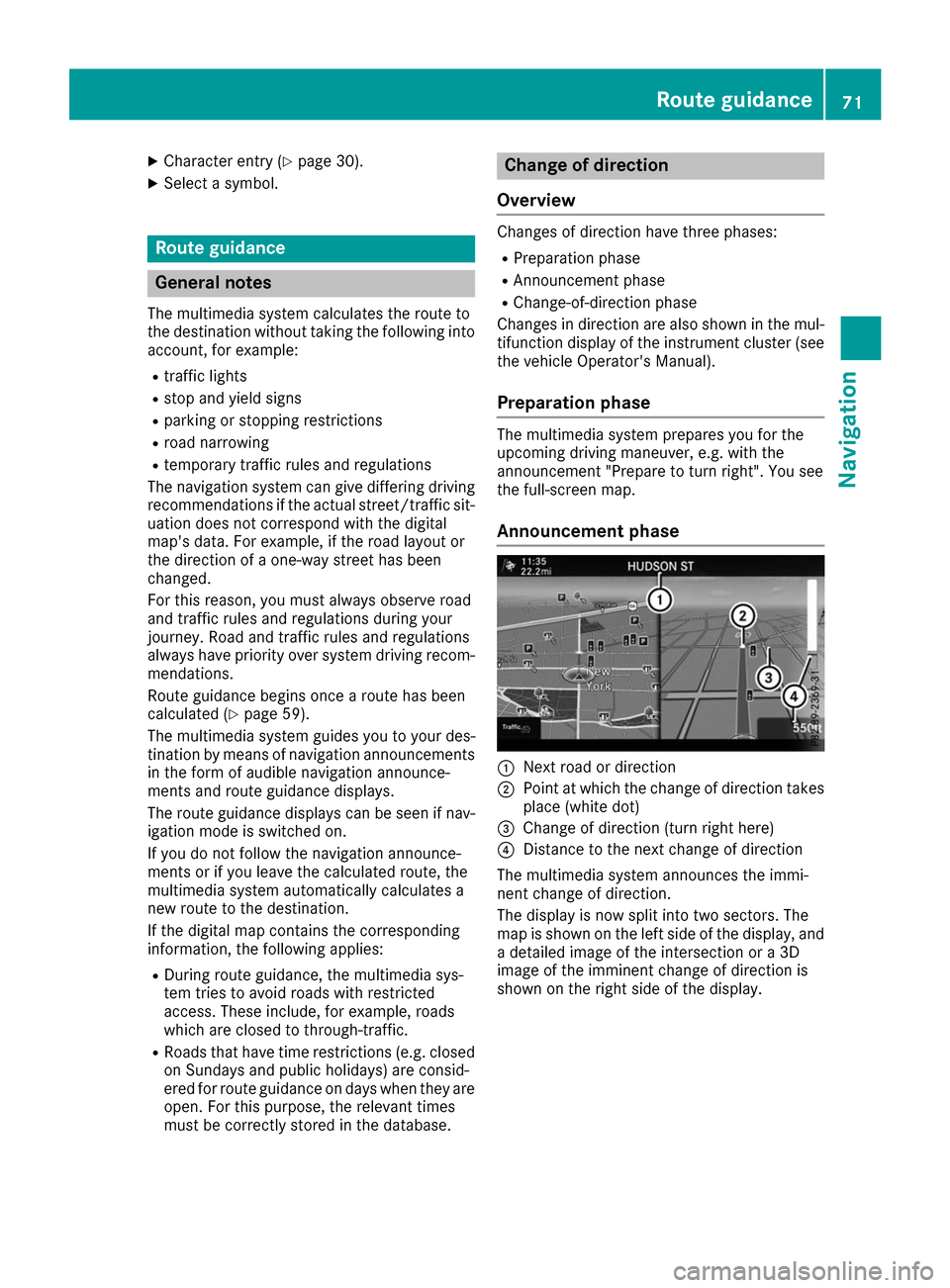
Announcement phase 0043
Next road or direction
0044 Point at which the change of direction takes
place (white dot)
0087 Change of direction (turn right here)
0085 Distance to the next change of direction
The multimedia system announces the immi-
nent change of direction.
The display is now split into two sectors. The
map is shown on the left side of the display, and a detailed image of the intersection or a 3D
image of the imminent change of direction is
shown on the right side of the display. Route guidance
71Navigation Z
Page 74 of 178
Change-of-direction phase
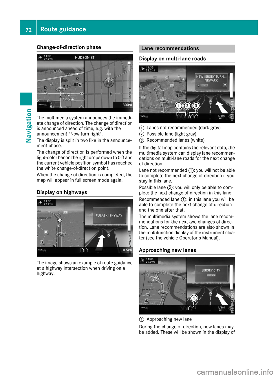
The multimedia system announces the immedi-
ate change of direction. The change of direction is announced ahead of time, e.g. with the
announcement "Now turn right".
The display is split in two like in the announce-
ment phase.
The change of direction is performed when the
light-color bar on the right drops down to 0 ft and
the current vehicle position symbol has reached
the white change-of-direction point.
When the change of direction is completed, the map will appear in full screen mode again.
Display on highways The image shows an example of route guidance
at a highway intersection when driving on a
highway. Lane recommendations
Display on multi-lane roads 0043
Lanes not recommended (dark gray)
0044 Possible lane (light gray)
0087 Recommended lanes (white)
If the digital map contains the relevant data, the
multimedia system can display lane recommen-
dations on multi-lane roads for the next change
of direction.
Lane not recommended 0043: you will not be able
to complete the next change of direction if you
stay in this lane.
Possible lane 0044: you will only be able to com-
plete the next change of direction in this lane.
Recommended lane 0087: in this lane you will be
able to complete the next change of direction
and the one after that.
The multimedia system shows the lane recom-
mendations for the next two changes of direc-
tion. Lane recommendations are also shown in
the multifunction display of the instrument clus- ter (see the vehicle Operator's Manual).
Approaching new lanes 0043
Approaching new lane
During the change of direction, new lanes may
be added. These will be shown in the display of 72
Route guidanceNavigation
Page 75 of 178
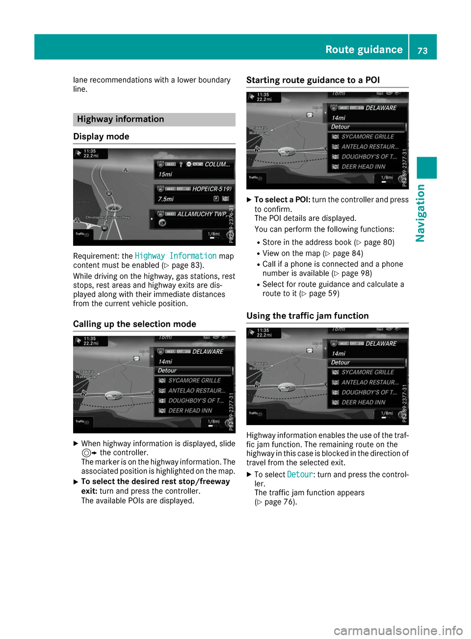
lane recommendations with a lower boundary
line. Highway information
Display mode Requirement: the
Highway Information
Highway Information map
content must be enabled (Y page 83).
While driving on the highway, gas stations, rest
stops, rest areas and highway exits are dis-
played along with their immediate distances
from the current vehicle position.
Calling up the selection mode X
When highway information is displayed, slide
9 the controller.
The marker is on the highway information. The
associated position is highlighted on the map.
X To select the desired rest stop/freeway
exit:
turn and press the controller.
The available POIs are displayed. Starting route guidance to a POI X
To select a POI: turn the controller and press
to confirm.
The POI details are displayed.
You can perform the following functions:
R Store in the address book (Y page 80)
R View on the map (Y page 84)
R Call if a phone is connected and a phone
number is available (Y page 98)
R Select for route guidance and calculate a
route to it (Y page 59)
Using the traffic jam function Highway information enables the use of the traf-
fic jam function. The remaining route on the
highway in this case is blocked in the direction of
travel from the selected exit.
X To select Detour Detour: turn and press the control-
ler.
The traffic jam function appears
(Y page 76). Route guidance
73Navigation Z
Page 76 of 178
Destination reached
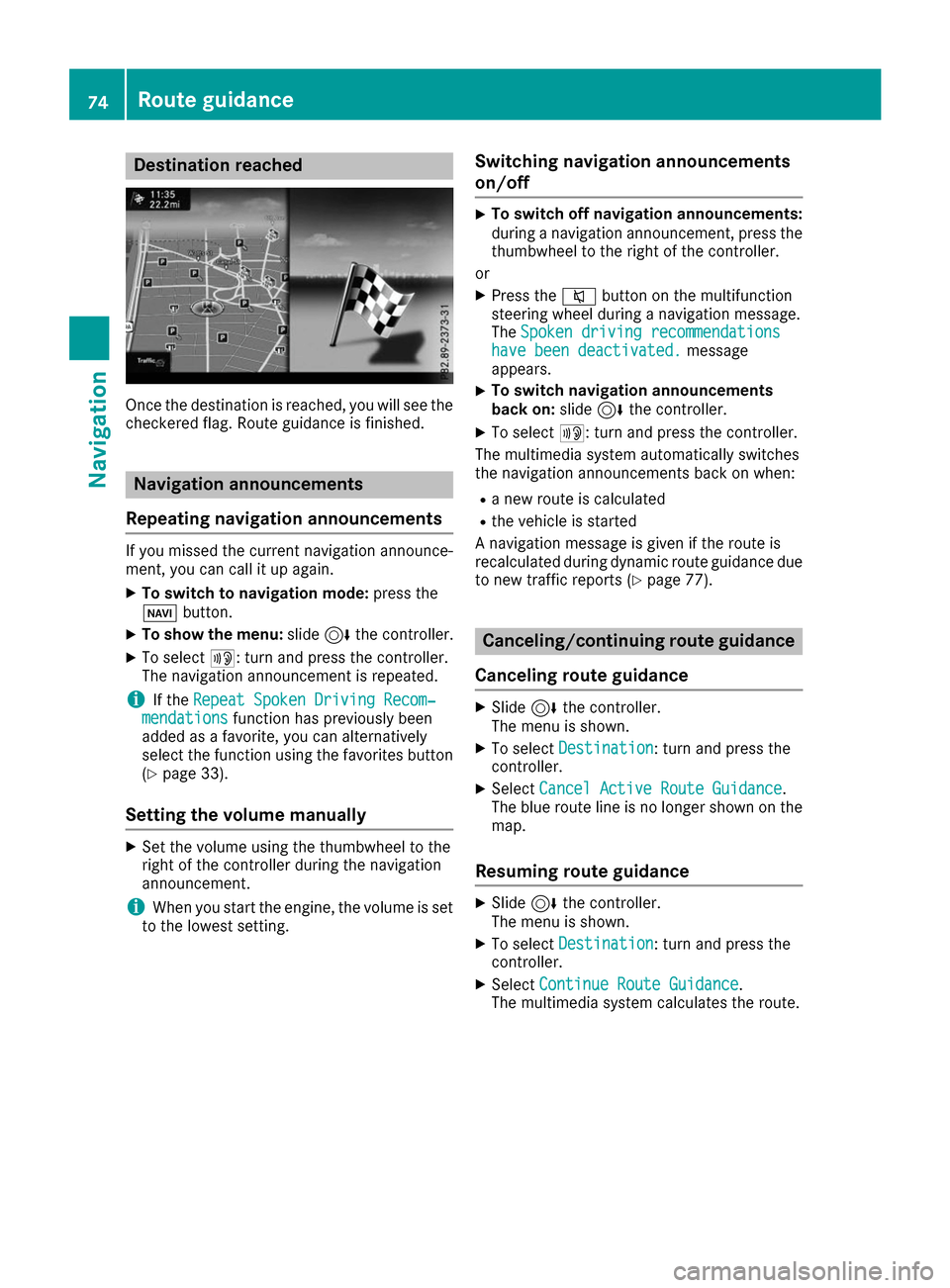
Once the destination is reached, you will see the
checkered flag. Route guidance is finished. Navigation announcements
Repeating navigation announcements If you missed the current navigation announce-
ment, you can call it up again.
X To switch to navigation mode: press the
00BE button.
X To show the menu: slide6the controller.
X To select 006A: turn and press the controller.
The navigation announcement is repeated.
i If the
Repeat Spoken Driving Recom‐
Repeat Spoken Driving Recom‐
mendations
mendations function has previously been
added as a favorite, you can alternatively
select the function using the favorites button
(Y page 33).
Setting the volume manually X
Set the volume using the thumbwheel to the
right of the controller during the navigation
announcement.
i When you start the engine, the volume is set
to the lowest setting. Switching navigation announcements
on/off X
To switch off navigation announcements:
during a navigation announcement, press the thumbwheel to the right of the controller.
or
X Press the 0063button on the multifunction
steering wheel during a navigation message.
The Spoken driving recommendations
Spoken driving recommendations
have been deactivated. have been deactivated. message
appears.
X To switch navigation announcements
back on:
slide6the controller.
X To select 006A: turn and press the controller.
The multimedia system automatically switches
the navigation announcements back on when:
R a new route is calculated
R the vehicle is started
A navigation message is given if the route is
recalculated during dynamic route guidance due
to new traffic reports (Y page 77). Canceling/continuing route guidance
Canceling route guidance X
Slide 6the controller.
The menu is shown.
X To select Destination Destination: turn and press the
controller.
X Select Cancel Active Route Guidance
Cancel Active Route Guidance.
The blue route line is no longer shown on the map.
Resuming route guidance X
Slide 6the controller.
The menu is shown.
X To select Destination
Destination: turn and press the
controller.
X Select Continue Route Guidance
Continue Route Guidance.
The multimedia system calculates the route. 74
Route guidanceNavigation
Page 77 of 178
Route information
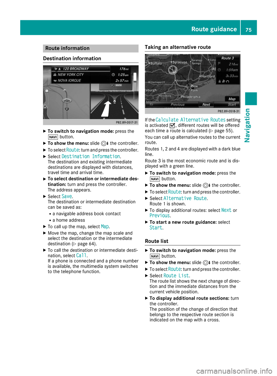
Destination information X
To switch to navigation mode: press the
00BE button.
X To show the menu: slide6the controller.
X To select Route
Route: turn and press the controller.
X Select Destination Information
Destination Information.
The destination and existing intermediate
destinations are displayed with distances,
travel time and arrival time.
X To select destination or intermediate des-
tination: turn and press the controller.
The address appears.
X Select Save
Save .
The destination or intermediate destination
can be saved as:
R a navigable address book contact
R a home address
X To call up the map, select Map
Map.
X Move the map, change the map scale and
select the destination or the intermediate
destination (Y page 64).
X To call the destination or intermediate desti-
nation, select Call
Call .
If a phone is connected and a phone number
is available, the multimedia system switches
to the telephone function. Taking an alternative route If the
Calculate Calculate Alternative
Alternative Routes
Routessetting
is activated 0073, different routes will be offered
each time a route is calculated (Y page 55).
You can call up alternative routes to the current
route.
Routes 1, 2 and 4 are displayed with a dark blue line.
Route 3 is the most economic route and is dis-
played with a green line.
X To switch to navigation mode: press the
00BE button.
X To show the menu: slide6the controller.
X To select Route
Route: turn and press the controller.
X Select Alternative Route Alternative Route.
Route 1 is shown.
X To display additional routes: select Next
Nextor
Previous
Previous .
X To start a new route guidance: select
Start
Start.
Route list X
To switch to navigation mode: press the
00BE button.
X To show the menu: slide6the controller.
X To select Route
Route: turn and press the controller.
X Select Route List
Route List .
The route list shows the next change of direc-
tion and the immediate distances from the
current vehicle position.
X To display additional route sections: turn
the controller.
The position of the change of direction that
belongs to the respective route section is
indicated on the map with a cross. Route guidance
75Navigation Z
Page 88 of 178
X
To switch an area to avoid on/off: select an
area by turning and pressing the controller.
The area will be avoided 0073or not 0053.
X To display/change an area: mark an area by
turning the controller.
X Slide 9the controller.
X To select Display/Change
Display/Change: press the con-
troller.
The map with the crosshair appears.
The area currently blocked is displayed as a
red square.
X To move the area to a new location: slide
1, 4,2the controller.
X To change the size of the area: press the con-
troller.
X Turn the controller.
X To accept changes: press the controller.
A message appears stating that the area has
been set.
Deleting one/all areas X
To switch to navigation mode: press the
00BE button.
X To show the menu: slide6the controller.
X To select Options
Options: turn and press the con-
troller.
X Select Route Settings
Route Settings.
X Select Avoid Options Avoid Options.
X Select Avoid Area
Avoid Area.
A list appears.
X To delete an area: mark an area by turning
the controller.
X Slide 9the controller.
X Select Delete
Delete orDelete All
Delete All .
A prompt appears asking whether you wish to
delete the area.
X Select Yes
Yes orNo
No.
After selecting Yes
Yes, the area is deleted.
X To delete all areas: when the list appears,
slide 9 the controller.
X Select Delete All
Delete All .
A prompt appears asking whether you wish to
delete all areas.
X Select Yes
Yes orNo
No.
After selecting Yes
Yes, all areas are deleted. SIRIUS XM service
Displaying SIRIUS XM service informa-
tion You can display the SIRIUS XM service informa-
tion.
X To switch to navigation mode: press the
00BE button.
X To show the menu: slide6the controller.
X To select Traffic Traffic: turn and press the con-
troller.
X Select SIRIUS Service
SIRIUS Service.
The provider's phone number (SIRIUS XM)
and the serial number of your service module
are displayed.
i Alternatively you can call up this function
using the touchpad (Y page 24).
Registering for the SIRIUS XM traffic
report service X
Call the provider telephone number shown on
the multimedia system display.
i You can also have the satellite service acti-
vated online. To do so, visit the SIRIUS XM
Radio website at http://www.sirius.com
(USA).
X The connection is established: follow the
service employee's instructions.
The activation process may take up to ten
minutes.
i If registration is not included when purchas-
ing the system, your credit card details will be
required to activate your account. Updating the digital map
Introduction The digital maps generated by the map software
become outdated in the same way as conven-
tional road maps. Optimal route guidance can
only be provided by the navigation system in
conjunction with the most up-to-date map soft- ware.
Information about new versions of the digital
map can be obtained from an authorized
Mercedes-Benz Center. You can have the digital
map updated there using a data medium, or you can update it yourself. 86
Map functionsNavigation
Page 93 of 178
Your multimedia system equipment
These operating instructions describe all the
standard and optional equipment of your multi-
media system, as available at the time of going
to press. Country-specific differences are pos-
sible. Bear in mind that your vehicle may not
feature all functions described here. This also
applies to safety-relevant systems and func-
tions.
Read the information on qualified specialist
workshops in the vehicle Operator's Manual. Important safety notes
G
WARNING
If you operate mobile communication equip-
ment while driving, you will be distracted from traffic conditions. You could also lose controlof the vehicle. There is a risk of an accident.
Only operate this equipment when the vehicleis stationary.
If you make a call on your mobile phone while
driving, always use hands-free mode. Only use
the mobile phone when road, weather and traffic conditions permit. Some jurisdictions prohibit
the driver from using a mobile phone while driv-
ing a vehicle.
Bear in mind that at a speed of 30 mph (approx-
imately 50 km/h), the vehicle covers a distance
of 44 feet (approximately 14 m) per second.
Excessive levels of electromagnetic radiation
may cause damage to your health and the health
of others.
There is scientific discussion surrounding the
possible health risks posed by electromagnetic
fields. You can reduce this risk by using an exte- rior antenna.
Therefore, connect your mobile communica-
tions equipment to the vehicle's exterior
antenna wherever possible. General notes
Telephony
A Bluetooth ®
interface is available for teleph-
ony. If your mobile phone supports the Bluetooth
®
profile PBAP ( PhoneBookAccess Profile), the
contacts are automatically displayed in the mul-
timedia system.
You can use the message function if your mobile
phone supports the MAP Bluetooth ®
profile
( Message Access Profile).
With a suitable mobile phone, you can use the
hands-free system and receive vCards via the
Bluetooth ®
interface.
You can obtain more information about suitable
mobile phones on the Internet at
http://www.mercedes-benz.com/connect .
Or call the Mercedes-Benz Service Center at
1-800-FOR-MERCedes(1-800-367-6372 )for
the USA or at 1-800-387-0100 for Canada. HD Voice
®
The multimedia system supports telephone
calls in HD Voice ®
. The voice quality can be
improved with this procedure.
Requirements for HD Voice ®
:
R Your mobile phone and mobile phone network
provider support HD Voice ®
.
R The mobile phone and mobile phone network
provider of the person you are calling support
HD Voice ®
.
Depending on the quality of the connection, the
voice quality may fluctuate. Call disconnection while the vehicle is
in motion
A call may be disconnected if: R there is insufficient network coverage in cer-
tain areas
R you move from one transmitter/receiver area
(cell) into another and no channels are free
R you use a SIM card that is not compatible with
the network available Operating options
You can operate the telephone by:
R using the controller by turning, pressing, slid-
ing 1 or4
R using the touchpad (Y page 24) General notes
91Telephone Z