air MERCEDES-BENZ E-Class SEDAN 2011 W212 Comand Manual
[x] Cancel search | Manufacturer: MERCEDES-BENZ, Model Year: 2011, Model line: E-Class SEDAN, Model: MERCEDES-BENZ E-Class SEDAN 2011 W212Pages: 234, PDF Size: 8.64 MB
Page 88 of 234

cVd
theCOMAND controller andpress
W toconfirm.
Displaying andediting therecorded
route X
Insert theSDmemory card(Ypage 157).
X Select List in
the Routes menubyturning
cVd theCOMAND controller andpress
W toconfirm.
Previousl yrecorded routesaredispla yed. X
Select aroute andpress Wtoconfirm.
The map appea rswith amenu. The
recorded routeisshown inthe map witha
blue dotted line. Tur
ning offfrom theroute onthe map
X Select Demo by
turning cVdtheCOMAND
cont roller andpress Wtoconfirm.
The map withthecrosshair appears.
X Proceed asdescribed inthe "Rou te
demonstration" section(Ypage 84). Start
ingroute calculation
X Select Start in
the menu byturning cVd
the COMAND controller andpress Wto
confirm.
COMAND attemptstoalig nthe recorded
route withthedigital map.
Editing theroute
You canchange theroute name andtheicon.
X Select Edit in
the menu byturning cVd
the COMAND controller andpress Wto
confirm . X
To change theroute name: select
Rename and
press Wtoconfirm .
i The name cannot bechanged whilethe
vehicle isin motion.
X To change theicon: select Change Icon and
press Wtoconfirm .
X Ad escript ionforboth entries canbefound
in the "Personal POIs"sectionunder
"Managing categoriesforperson alPOIs"
(Y page 73).
Changing directionforrout ecalculation
You cansetthe icon forthe route tothe
start ingpoint ortothe destin ation, thereby
changin gthe direct ionforroute calculation .
i Durin groute calculation ,one- way streets
or turn restrictions, forexample, aretaken
int oa ccoun t.Therefor e,the outward and
return routes maydiffer fromeach other. 86
Rout
eguida nceNavigation
Page 93 of 234

Icon Descr
iption Tr
affic rep ortsint he ma pd ispla y List
of
tr af fic
rep orts Tr
affic
rep orts Gree
n
lin ew ith
arr ows Un
impe ded
tr aff icflo w No
delays
On lyappear sonthe side ofther oad
(dir ection oftravel) onwhic htraffic
flo wi su nim peded (Not
availab le) (Not
availab le) Red
line
wit h
arr ows Warn
ing
mes sage In
cid ento nr oad
Ap pear sonthe side ofther oad
affect ed(direction oftravel) (Not
availa ble) (Not
availa ble) Displaying
real-timetraffic repor ts
X To switch onnavigation mode:pressthe
Ø functionbutton .
X To show themenu: pressWthe COMAND
cont roller.
X Select Traffic by
turnin gcVd the
COMAND controller andpress Wto
conf irm.
If the dialog fieldshows theNoTraffic Messages message,
thismeans that:
R no traffic reports havebeen received yet.
R no traffic reports areavaila ble.
X To cancel thesearch: selectCancel and
press Wtoconf irm.
X To close thereport window: selectOK and
press Wtoconf irm.
If traffic reports exist,alist isshown.
The cont entofthe listvaries depending on
whether routeguidance isactive ornot .
List when routeguidance isnot active The
listshows allthe roads, areasorregions
for which reports areavaila ble. At
raffic report mayrefer toan area ora
region, e.g.ifvisibility isimpaired duetofog.
X To read atraffic report :select aroad,
area orregion byturnin gcVd the
COMAND controller andpress Wto
conf irm.
List when routeguidance isactive The
first listshows theroads, areasand
regions thatliealong theroute andforwhich
traffic reports areavaila ble. Tr
affic repor ts
91Navigation Z
Page 100 of 234

Storing
thevehicle position inthe list
of previous destinations
X To switch onnavigation mode:pressthe
Ø functionbutton.
X To show themenu: pressWthe COMAND
cont roller.
X Select Position in
the navigation system
menu barbyturnin gcVd theCOMAND
cont roller andpress Wtoconf irm.
X Select Save vehicle position and
press
W toconf irm.
COMAND storesthecurrent vehicle
position asad estination inthe listof
previous destinations . Storing
thecrosshair positioninthe
list ofprevious destinations
Ac rossha irapp ears onthe map ifyou have
moved themap manua lly.Y ou can store the
crosshair positionasad estinat ioninthe list
of previous destinations.
X To show themenu: pressWthe COMAND
cont roller.
X Select Position in
the navigation system
menu barbyturnin gcVd theCOMAND
cont roller andpress Wtoconf irm.
X Select Savecrosshair position and
press Wtoconf irm. Dele
ting oneofthe previous
destinat ions
X To switch onnavigation mode:pressthe
Ø functionbutton .
X To show themenu: pressWthe COMAND
cont roller.
X Select Destination in
the navigation
system menubarbyturnin gcVd the
COMAND controller andpressing Wto
conf irm. X
Select Fromlast destinations and
press Wtoconf irm.
The listoflast destination sappears.
X Select thedesired destinationandpress
W tocon firm.
The destin ationaddress appears.
X Select Delete and
press Wtocon firm.
Ap rompt appears asking whethe rthe entr y
should bedeleted.
X Select Yes or
No and
press Wtoconfirm .
If you select Yes ,t
he entr yisd eleted.
If you select No ,t
he process willbeaborted. Map
operation andsettings Note
Company logosdisplayedonthe map are
trademarks ofthe respective companies and
used solely forthe purpose ofindicating the
location ofthese companies. Theuseofsuch
logos onthe map does notindicate approval
of, support ofor advertising bythese
companies forthe navigation systemitself. Setting
themap scale
X To hide themenu: slideZVtheCOMAND
cont roller and,when theFull Screen menu
itemisshown, pressW.
X To call upthe scale bar:assoon asyou
turn cVd theCOMAND controller, scale
bar =appea rs.
X Turn cVd untilthedesired scaleisset. 98
Map
operat ionand settingsNavigation
Page 101 of 234

:
Set map scaleas an umb erwith uni t
; Currentl ysetmap scaleas ind icated by
the need leon the scaleba r
= Mapscale
Unit ofmea sureme nt: inthe COMAND
di spl aydepe nds onthe selecti onmad efor the
instr umentclu ster (seethe veh icle
Ope rator'sManua l). Mov
ingt he map
Sho wing the crossh air X
To hide themen u:slide ZV theCOMAND
control lera nd, when the FullScreen menu
itemi sshown, pressW.
X To scroll themap: slideXVY, ZVÆor
aVb theCOMAND controller.
Ac rossha irapp ears onthe map. Ifyou slide
it aga in,the map moves inthe
correspo ndingdirection under the
crossha ir. Map
withcrossha ir
: Current vehicl eposition
; Cross hair
= Detail softhe crossha irposi tion
? Map scale selected Displ
ay= may bethe name ofas treet, for
exampl e,provid edthe digitalmap contains
the necessary data.Alter natively, itmay show
the geo- coor dinat eposit ion ofthe crosshair
if the Geo- coordinates display
isswitc hed
on (Ypage 102).
Hid ing thec rossh airand center ingthe
ma ponthe vehicle position or
destina tion X
Press the% backbutton twice.
The cross hairdisappears andthemap is
set tothe vehicle position .
or
X Set themap tothe vehicle position ;see the
explanat ionbelow. Centering
themap onthe vehicle or
destina tionposition
Centering themap onthe vehicle
position X
To show themenu: pressWthe COMAND
con troller.
X Select Positio n in
the navigation system
menu barbysliding VÆandturningcVd
the COMAND controller andpress Wto
con firm.
X Select Vehicle PositionMap and
press
W tocon firm or,ifthe cross hairisshown,
press the% backbutton .
This hides thecross hair.
Centering onthe destina tion This
function requires thataroute toa
destin ationhasbeen calculated. Ifthe route
includes waypoints andanintermediate stop,
the map canalso beset tothese position s.
X To show themenu: pressWthe COMAND
con troller.
X Select Positio n in
the navigation system
menu barbysliding VÆandturningcVd Map
opera tionandsettings
99Navigation Z
Page 102 of 234
the
COMAND controllera nd pre ssW to
confi rm.
X Sel ect Destination Position Map and
pre ssW toconfi rm.
The cros shairpo sitio niss etto the relevant
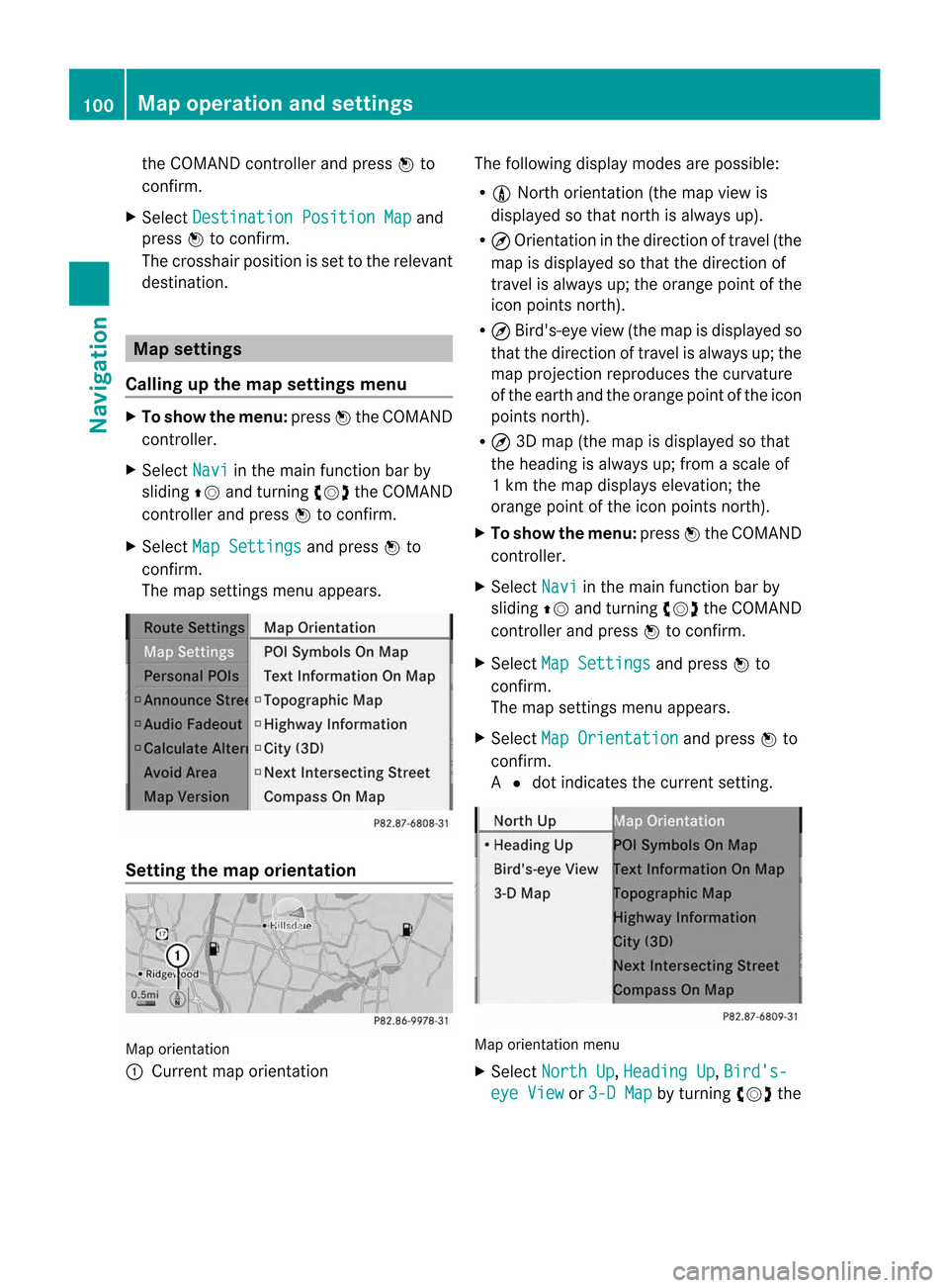
destination. Map
settings
Callin gupthe map settings menu X
To show themenu: pressWthe COMAND
cont roller.
X Select Navi in
the main function barby
sliding ZVandturning cVdtheCOMAND
cont roller andpress Wtoconfirm.
X Select MapSettings and
press Wto
confirm.
The map settings menuappears. Setting
themap orientation Map
orientation
: Current maporientation The
followi ngdispla ymodes arepossible :
R 0 North orientation (themap view is
displa yedsothat north isalwa ysup).
R ¤ Orientation inthe direction oftravel (the
map isdispla yedsothat thedirection of
travel isalwa ysup; the orange pointofthe
icon points north).
R ¤ Bird's-eye view(themap isdispla yedso
that thedirection oftravel isalwa ysup; the
map project ionreproduces thecurvature
of the earth andtheorange pointofthe icon
points north).
R ¤ 3D map (themap isdispla yedsothat
the heading isalwa ysup; from ascale of
1k mt hemap displa yselevation; the
orange pointofthe icon points north).
X To show themenu: pressWthe COMAND
cont roller.
X Select Navi in
the main functionbar by
sliding ZVandturning cVdtheCOMAND
cont roller andpress Wtoconfirm .
X Select MapSettings and
press Wto
confirm .
The map settin gsmenu appears.
X Select MapOrientation and
press Wto
confirm .
A # dot indicates thecurrent setting. Map
orientation menu
X Select North Up ,
Heading Up ,
Bird's- eye
View or
3-D Map by
turning cVdthe 100
Map
operat ionand settingsNavigation
Page 104 of 234
Map
information inthe display During
routeguidance, youcan have map
informati onshow natthe bottom edgeofthe
displa y.
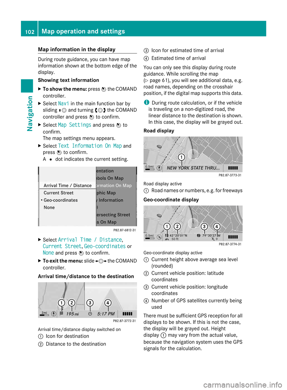
Showing textinformat ion
X To show themenu: pressWthe COMAND
cont roller.
X Select Navi in
the main functionbar by
sliding ZVandturning cVdtheCOMAND
cont roller andpress Wtoconfirm .
X Select MapSettings and
press Wto
confirm .
The map settin gsmenu appears.
X Select TextInformation OnMap and
press Wtoconfirm .
A # dot indicates thecurrent setting. X
Select Arrival Time/Distance ,
Current Street ,
Geo-coordinates or
None and
press Wtoconfirm .
X To exit themenu: slideXVY theCOMAND
cont roller.
Arrival time/distance tothe destination Arrival
time/distanc edisplay switched on
: Icon fordestination
; Distanc etot he destination =
Icon forestimated timeofarrival
? Estimated timeofarrival
You canonly seethis displa yduring route
guida nce.While scrolling themap
(Y page 61),youwillsee additional data,e.g.
road names, depending onthe crosshair
position, ifthe digital mapsupports thisdata.
i During routecalculation, orifthe vehicle
is traveling onanon- digitized road,the
linear distance tothe destination isshown.
In this case, thedispla ywillbe grayed out.
Road display Road
display active
: Road names ornumbers, e.g.forfreeways
Geo-coo rdinatedisplay Geo-coordinate
displayactive
: Current heightaboveaverage sealevel
(rounded)
; Current vehicleposition: latitude
coordinates
= Current vehicleposition: longitude
coordinates
? Number ofGPS satellites currentlybeing
used
There mustbesufficient GPSreception forall
displa ystobe shown. Ifthis isnot thecase,
the displa ywillbe grayed out.Height
displa y: may varyfrom theactual value,
because thenavigation systemusestheGPS
signals forthe calculation. 102
Map
operat ionand settingsNavigation
Page 105 of 234
While
scrolling themap (Ypage 61),youwill
see thegeo-c oordinat esofthe cross hair
position .Height display :and number of
satellites used?are not displayed.
"None" menuoption Display
switchedoff
: Current maporient ation
i Durin gthe "Move map"function youcan
see additional information depending on
the position ofthe cross hair,such asaroad
name, ifthe digital mapsupports thisdata.
Switching thetopogr aphical map on/
off The
topogr aphical mapuses differen tcolors
to depict elevation. Thecolor keygenerally
reflect sthe topography's dominant
vegetation orthe ground's perceived color
when seenfromtheair,forexample:
R green (grass) forlowland
R yellow ,brown (woodland) forhills
R gray (stone) andwhite (snow) for
mountains.
X To show themenu: pressWthe COMAND
cont roller.
X Select Navi in
the main functionbar by
sliding ZVandturnin gcVd theCOMAND
cont roller andpress Wtoconf irm.
X Select MapSettings and
press Wto
conf irm.
The map settings menu appears.
X Select Topographic Map and
press Wto
conf irm.
Dependin gonthe previous state,switch
the option onO oroff ª. Freeway
information When
driving onfreeways, youcan have the
nearest gasstation s,rest areas, etc.,asw ell
as your current distance fromthem, shown
on the right- hand sideofthe display .
X To switch onnavigation mode:pressthe
Ø functionbutton .
X To show themenu: pressWthe COMAND
cont roller.
X Select Navi in
the main functionbar by
sliding ZVandturnin gcVd theCOMAND
cont roller andpress Wtoconf irm.
X Select MapSettings and
press Wto
conf irm.
The map settings menu appears.
X Select Highway Information and
press
W toconf irm.
Dependin gonthe previous state,switch
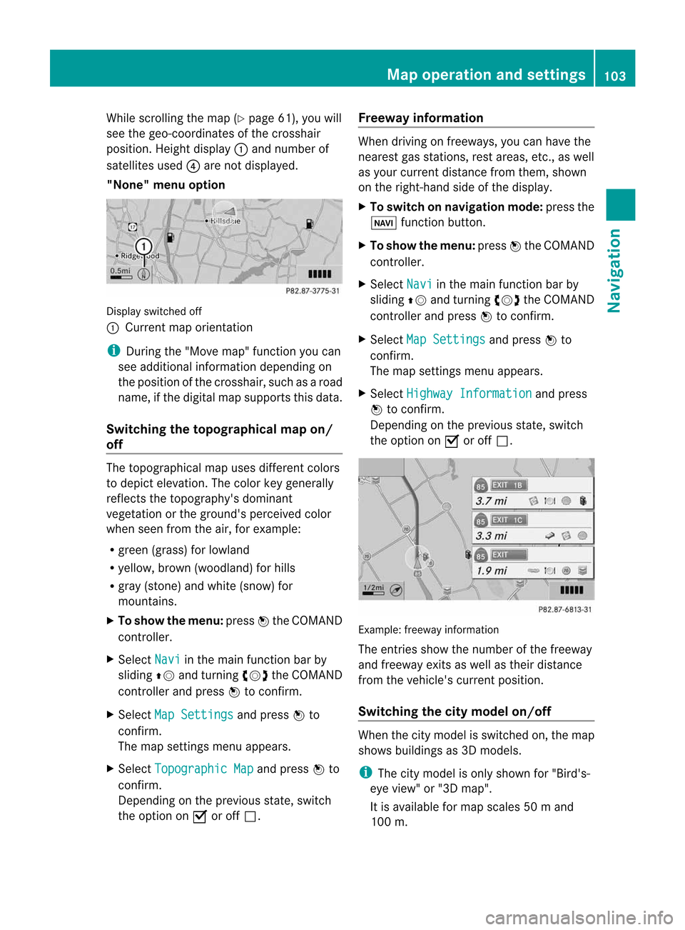
the option onO oroff ª. Example:
freewayinformation
The entriesshow thenumber ofthe freeway
and freeway exitsaswell astheir distance
from thevehicle's currentposition.
Switching thecity model on/off When
thecity model isswitched on,the map
shows buildingsas3D models.
i The citymodel isonly shown for"Bird's-
eye view" or"3D map".
It is availa bleformap scales 50ma nd
100 m. Map
operatio nand settin gs
103Navi gation Z
Page 108 of 234

Opt
ion 1:the menu appears X
Select Using Map ,
From Memory or
From Persona
lPOIs and
press Wtocon firm.
If you select Using Map ,t
he map withthe
cross hairappears.
Aft erchoosin gbetween FromMemory or
From Persona lPOIs ,e
ither the
destin ationmemory (Ypage 94)orthe list
of categor iesforpersonal pointsofint erest
appears (Ypage 75).
X Choose thedestin ationorpersonal pointof
int erest andpress Wtocon firm.
X Ifthe destin ationaddress isdisplayed,
select Continu e and
press Wtocon firm.
The map appears.
The cross hairmarks thecenterofthe area
that isto be avoided.
X To move themap :slide XVY, ZVÆor
aVb theCOMAND controller.
X To set the map scale: assoon asyou turn
cVd theCOMAND controller, thescale bar
appears. Turningclock wise zooms outfrom
the map; turningcount er-clockwise zooms
in.
X Turn cVd untilthedesired scaleisset.
X To app lyab lock: press Wthe COMAND
con troller.
Ar ed square appears onthe map. X
To adj ust the size ofthe squa re:turn
cVd theCOMAND controller.
The square isenlarged orreduced.
X To confirm thesettings: pressW.
The listappears. Thepreviously selected
area tobe avoided hasbeen added and
activ ated.
X Follow theinst ruct ions listed under "Option
2: the listappears".
Opt ion 2:the listappears "Avoid
area"list(example)
i Available listplaces arenamed Area
areshown ingray.
X Select Avoid NewArea by
turn ingcVd
the COMAND controller andpress Wto
con firm.
Am enu appears. 106
Addit
ional settingsNavigation
Page 109 of 234
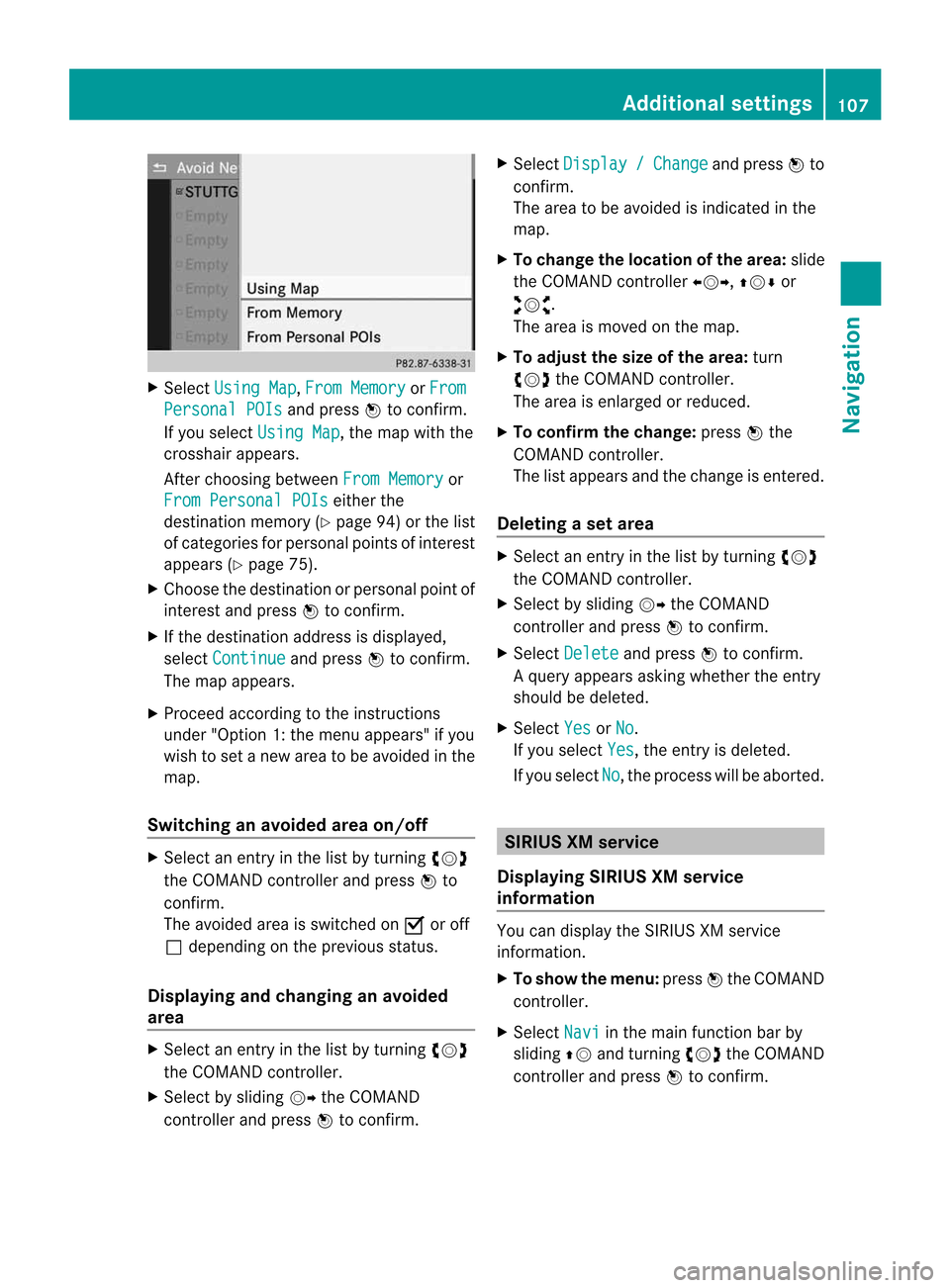
X
Sel ect Using Map ,
Fro mMemory or
Fro m Per
son alPOI s and
pressW toconfi rm.
If yo us elect UsingMap ,t
he map with the
cros shairap pe ars .
After choosingbetwe enFro mMemory or
Fro mPerson alPOI s ei
ther the
de stina tionmemo ry(Y page 94) orthe list
of cate goriesf or persona lpoints ofinter est
ap pe ars (Ypage 75).
X Ch oos ethe destina tionorpersona lpoint of
inter estand pressW toconfi rm.
X Ifthe destina tionaddre ssisdispl ayed ,
sel ect Continue and
pressW toconfi rm.
The map appe ars .
X Pro cee dacco rding tothe instr uctions
und er"Opti on 1:the menu appe ars "ify ou
wi sh toset anew areatob eavoided inthe
map .
Sw itchin gana voide darea on/o ff X
Sel ect anentr yint he list by turning cVd
the COMAND controllera nd pre ssW to
confi rm.
The avoide da reai ss witch edon O oroff
ª depe ndi ng on the previous sta tus .
Di spl aying and chang inga na voide d
area X
Sel ect anentry inthe list by turning cVd
the COMAND controller.
X Sel ect byslid ing VY theCOMAND
contro ller and pressW toconfi rm. X
Sel ect Dis play / Cha
nge and
pressW to
confi rm.
The area tobe avoide disind ica ted inthe
ma p.
X To chang ethe locati onofthe area :sl id e
the COMAND controller XVY ,ZVÆ or
aVb .
The area ismov edon the map.
X To adjust thesize ofthe area :tur n
cVd theCOMAND controller.
The area isenl arge do rred uce d.
X To confi rm the chang e:pre ssW the
CO MAND controller.
The list ap pe arsa nd the change isente red.
De letin gas etarea X
Sele ctan ent ryinthel ist byturnin gcVd
th eC OMA NDcontroller .
X Sele ctby slidin gVY theC OMA ND
con troller andpres sW tocon firm.
X Sele ctDel ete and
pres sW tocon firm.
Aq uery appear sasking whet herthee ntry
sho uld bedelet ed.
X Se lec tYes or
No .
If you selectYes ,t
he entryi sd elet ed.
If you sele ctNo ,t
he pro ces swillbe abor ted. SIR
IUS XMservice
Disp laying SIRIUS XMservice
info rmation You
candisplaytheS IRIUS XMservice
inf orm ation.
X To show them enu:pre ssW theC OMA ND
co ntrol ler.
X Se lec tNav i in
them ainfunction bar by
slidi ngZV andturnin gcVd theC OMA ND
co ntrol ler and pressW toconfirm . Add
itiona lsettings
107Navigatio n Z
Page 119 of 234
mobil
ephone (Ypag e119). IfCOMAND
does notfind yourmobile phone, external
authorization (Ypage 118)maybe
necessary.
i Ifyou callupthe telephone listagain, the
unauthorized devicesareremoved fromthe
list. Inthis case, startanew search to
update theBluetooth ®
telephone list.
Authoriz ing(registering) amobile
ph one Opt
ion1:usin gthe passkey (access code)
X In theB luet ooth®
te lepho neslist,selec tthe
not yetauthorized mobilephonebyturning
cVd theCOMAND controller.
X Select thelistsymbol tothe right ofthe
entr ybysliding VYtheCOMAND
cont roller andpress Wtoconfirm .
X Select Authorize and
press Wtoconfirm .
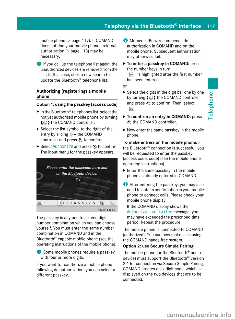
The input menu forthe passkey appears. The
passkey isany one tosixteen- digit
number combination whichyoucan choose
yourself. Youmust enter thesame number
combination inCOMAND andinthe
Bluetooth ®
-capable mobilephone(seethe
operating instructionsofthe mobile phone).
i Some mobile phones requireapasskey
with fourormore digits.
If you want toreauthorize amobile phone
following <0025002400460033002E0021001B0030001F002C002A00330021002C00300031
0052V youcan select a
different passkey. i
Mercedes-Ben zrecomm endsde-
authorization inCOMAND andonthe
mobile phone. Subsequent authorization
may other wisefail.
X To enter apassk eyinCOMAND: press
the number keysinturn .
¬ ishighlighted afterthefirst number
has been entered.
or
X Select thedigits inthe digit barone byone
by turn ingcVd theCOMAND controller
and press Wtocon firm. Then, select
¬.
X To confirm anentry inCOMAND: press
W the COMAND controller.
X Now enterthe same passkey inthe mobile
phone.
To mak eentries onthe mobile phone:if
the Bluetoot h®
con nection issuccess ful,you
will berequested toent erthe passkey
(access code,code) (seethemobile phone
operatin ginst ruct ions).
X En ter the same passkey inthe mobile
phone asalready entered inCOMAND .
i Afterent ering thepasskey, youmay also
need toent erac onfirmat ioninyour mobile
phone tocon nectcalls. Pleas echeck your
mob ilephon edispl ay.
If th eC OMA NDdispl aysho wsthe
Aut horizatio nf ailed mes
sage, you
may have excee ded thep res cribed time
peri od.Repeat thep roced ure.
The mob ilephon eisc onnec ted toCOMA ND
(auth orized). Youcannowm ake calls using
th eC OMA NDhands-free syst em.
Opt ion 2:use Secur eSimple Pairing
The mob ilephon e(or theB luetoot h®
audio
devi ce)must suppo rttheB luetooth®
ver sion
2. 1f or conn ection viaSecure SimplePairing.
COMAND createsasix-digit code,which is
display edon the two devices thataretobe
conn ected. Telephony
viathe Bluetooth ®
interfa ce117Telephone Z