navigation update MERCEDES-BENZ GLC-Class 2016 X253 Comand Manual
[x] Cancel search | Manufacturer: MERCEDES-BENZ, Model Year: 2016, Model line: GLC-Class, Model: MERCEDES-BENZ GLC-Class 2016 X253Pages: 222, PDF Size: 6.39 MB
Page 13 of 222
Switching object detection on/
off .................................................... 54
Switching on/off (COMAND) ........... 53
Receiving vCards ............................... 131
Redialing (telephone) ........................ 118
Reducing the volume
Switching announcements on/off
(COMAND) ....................................... 65
Reserve fuel level
Switching announcements on/off(COMAND) ....................................... 65
Resetting (factory settings) ............... 48
Road map
see Map (navigation)
Route (navigation)
Selecting an alternative route .......... 88
Setting route options (avoiding:
highways, toll roads, tunnels, fer-
ries) ................................................. 65
Setting the route type (short
route, fast route, dynamic route or
economic route) ............................... 64
Starting calculation .......................... 69
Route guidance
Canceling/continuing ...................... 88
Freeway information ........................ 86
General notes .................................. 84
Lane recommendations ................... 85
Off-road ........................................... 90
Traffic reports .................................. 91
S
Safety notesAudio CD/DVD and MP3 mode ..... 179
Using the telephone ....................... 110
Satellite radio
Displaying information ................... 175
Overview ........................................ 172
Registering .................................... 171
Switching to ................................... 172
SatRadio
Channel list updates ...................... 175
Memory functions .......................... 173
Music and sports alerts ................. 173
Notes ............................................. 170
Selecting a category ...................... 172
Selecting a channel ....................... 172 Tagging music tracks ..................... 174
SD memory card
Ejecting .......................................... 182
Inserting ........................................ 182
Inserting/removing ........................ 182
Searching for a gas station
When the fuel level is low ................ 78
Seat-belt adjustment function
Activating/deactivating
(COMAND) ....................................... 51
Selecting stations
Radio ............................................. 167
Sending DTMF tones ......................... 119
Setting access data
Online and Internet ........................ 148
Setting the language
COMAND ......................................... 45
Setting the night design ..................... 38
Setting the text reader speed ............ 41
Setting the volume
Telephone calls ................................ 30
Setting the waveband
Radio ............................................. 167
Settings
Sound settings ............................... 208
Short message
see Text messages (SMS)
SIRIUS weather display
5-day forecast ................................ 212
Daily forecast ................................. 212
Detail information .......................... 213
Information chart ........................... 212
Selecting a location for the
weather forecast ............................ 213
Switching on/off ........................... 212
Weather map ................................. 215
Sound
Switching on/off .............................. 30
Sound settings
Balance/fader ............................... 208
Calling up the sound menu ............ 208
Equalizer ........................................ 208
Sound system
see Burmester
®surround sound system
Speed dial
Deleting ......................................... 135
Setting up ...................................... 134
Index11
Page 96 of 222
Starting the text reader function man-
ually
XTo switch to navigation mode:press the
Ø button.
XTo show the menu: slide6the control-
ler.
XTo select Traffic: turn and press the con-
troller.
XSelect Read Out All Messages on
Route.
COMAND reads out the reports in
sequence.
If there are no reports for the route, the
Read
OutAllMessagesonRoutemenu
item is gray and cannot be selected.
XTo cancel the read-aloud function: select
Cancel Read-Aloud Function
.
COMAND reads out the current report and
then exits the read-aloud function.
Automatic read-aloud function
XTo switch to navigation mode: press the
Ø button.
XTo show the menu: slide6the control-
ler.
XTo select Traffic: turn and press the con-
troller.
XSelect Read Traffic Announcements
Automatically.
Depending on the previous state, switch
the option on Oor off ª.
Recalculating the route dynamically
TheDynamic Traffic Routeroute type
takes into account all of the traffic reports it
receives for the current route when calculat-
ing the route (
Ypage 64).
If you have selected Dynamic Traffic
Routeas the route type, COMAND guides you
to your destination along the updated route.
Storing destinations
General notes
If a route to a destination has been calculated,
COMAND saves the destination to the last
destinations memory. If the memory is full,
COMAND overwrites the oldest destination.
When you save the current vehicle position or a crosshair position, this position is stored in
the "Last destinations" memory.
You can save destinations permanently in the
address book and on an SD memory card. For instance, this is possible immediately after
entering an address.
Requirement: the SD memory card is format-
ted using the FAT file system (e.g. FAT32).
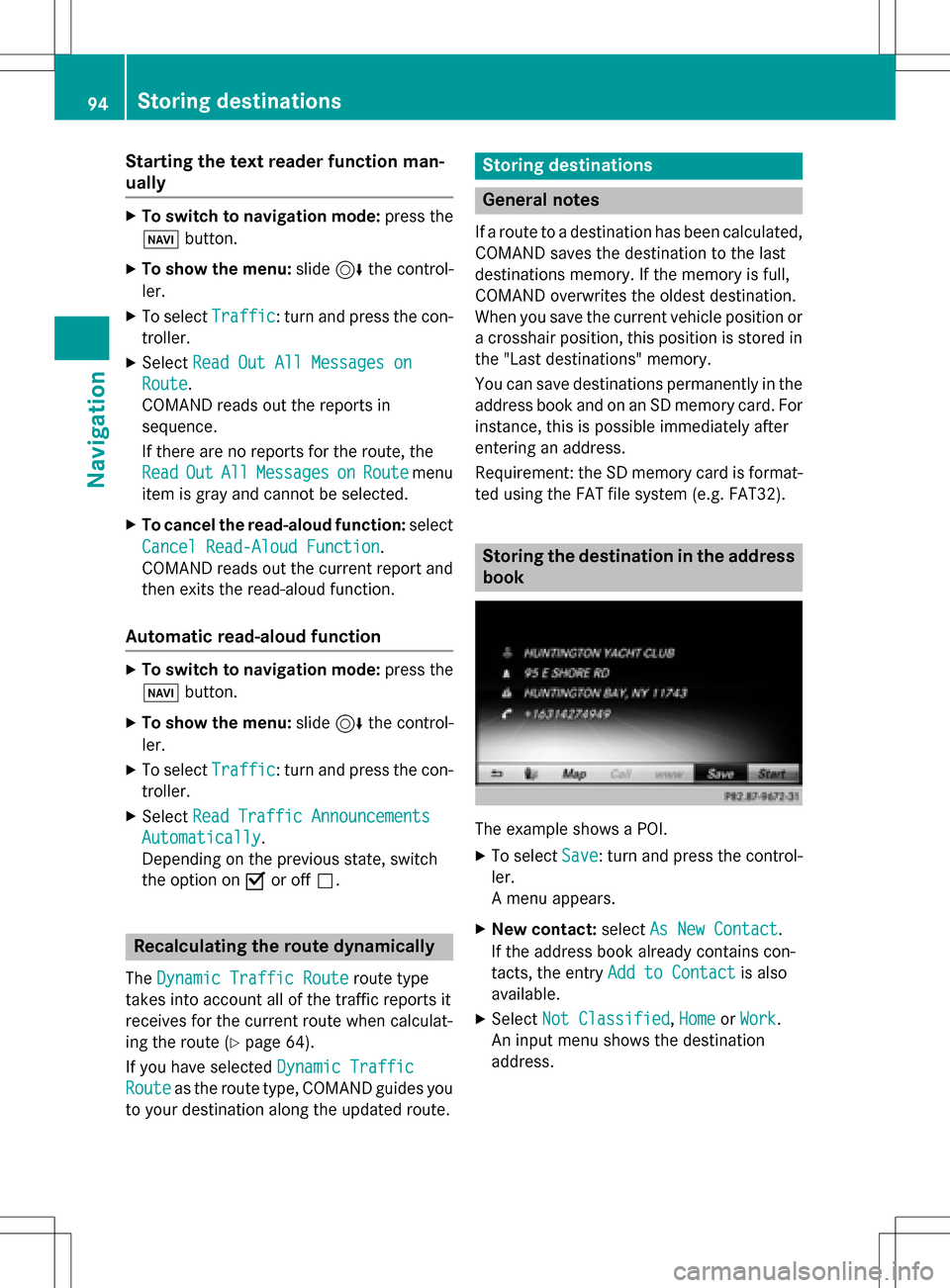
Storing the destination in the address
book
The example shows a POI.
XTo select Save: turn and press the control-
ler.
A menu appears.
XNew contact: selectAs New Contact.
If the address book already contains con-
tacts, the entry Add to Contact
is also
available.
XSelect Not Classified,Homeor Work.
An input menu shows the destination
address.
94Storing destinations
Navigation
Page 104 of 222
XSelectDelete All.
A prompt appears asking whether you wish
to delete all areas.
XSelect YesorNo.
After selecting Yes
, all areas are deleted.
SIRIUS XM service
Displaying SIRIUS XM service informa-
tion
You can display the SIRIUS XM service infor-
mation.
XTo switch to navigation mode: press the
Ø button.
XTo show the menu: slide6the control-
ler.
XTo select Traffic: turn and press the con-
troller.
XSelect SIRIUS Service.
The provider's phone number (SIRIUS XM)
and the serial number of your service mod-
ule are displayed.
iAlternatively you can call up this function
using the touchpad (
Ypage 25).
Registering for the SIRIUS XM traffic
report service
XCall the provider telephone number shown
on the COMAND display.
iYou can also have the satellite service
activated online. To do so, visit the SIRIUS
XM Radio website at
http://www.sirius.com (USA).
Once the connection has been established:
XFollow the service employee's instructions.
The activation process may take up to
10 minutes.
If registration is not included when purchas-
ing the system, your credit card details will be
required to activate your account.
Updating the digital map
Introduction
The digital maps generated by the map soft-
ware become outdated in the same way as
conventional road maps. Optimal route guid-
ance can only be provided by the navigation
system in conjunction with the most up-to-
date map software.
Information about new versions of the digital
map can be obtained from an authorized
Mercedes-Benz Center. You can have the dig-
ital map updated there using a data medium,
or you can update it yourself.
For North American countries, it is possible to
update the map data for COMAND free of
charge for a period of three years. Information
on the availability of this service for your vehi-
cle can be obtained from your authorized
Mercedes-Benz Center.
Entitlement to the free update
For the first three years after your vehicle is
registered, you are entitled to all available
updates to the map software for COMAND.
They are usually installed during a regular
vehicle service. After this period, you can pur-
chase further updates from your authorized
Mercedes-Benz Center.
The free updates relate to the vehicle and not
to an individual. If there is a change of own-
ership within the three years after first regis-
tration, the new owner is entitled to the map
software updates.
Updating at an authorized Mercedes-
Benz Center
If an update for your map software is availa-
ble, you will receive it free of charge at your
authorized Mercedes-Benz Center during
your vehicle's annual service. You can
arrange a separate appointment for this at
your authorized Mercedes-Benz Center on
request.
102Map functions
Navigation
Page 105 of 222
The update can only be performed:
Rat an authorized Mercedes-Benz Center
Rfor map data for North America
The map software is not provided on DVD.
Carrying out a manual update
After the free update of the map data has
expired or when buying map data, you can
update the data yourself.
The update process may take some time (up
to 45 minutes), depending on the size of the
digital map. The update will be completed
more quickly if the vehicle is stationary. If you
start the update with the engine switched off
and the starter battery has insufficient power,
COMAND may automatically switch off. This
protects the battery. In order to prevent this,
a suitable power supply to the vehicle must be
maintained.
Navigation functions
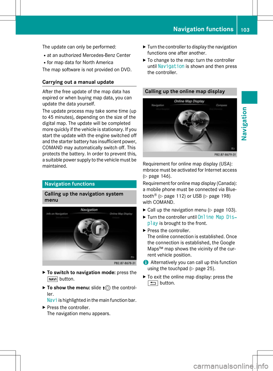
Calling up the navigation system
menu
XTo switch to navigation mode: press the
ß button.
XTo show the menu: slide5the control-
ler.
Navi
is highlighted in the main function bar.
XPress the controller.
The navigation menu appears.
XTurn the controller to display the navigation
functions one after another.
XTo change to the map: turn the controller
until Navigation
is shown and then press
the controller.
Calling up the online map display
Requirement for online map display (USA):
mbrace must be activated for Internet access
(
Ypage 146).
Requirement for online map display (Canada):
a mobile phone must be connected via Blue-
tooth
®(Ypage 112) or USB (Ypage 198)
with COMAND.
XCall up the navigation menu (Ypage 103).
XTurn the controller until OnlineMapDis‐
playis brought to the front.
XPress the controller.
The online connection is established. Once
the connection is established, the Google
Maps™ map shows the vicinity of the cur-
rent vehicle position.
iAlternatively you can call up this function
using the touchpad (
Ypage 25).
XTo exit the online map display: press the
% button.
Navigation functions103
Navigation
Z
Page 109 of 222
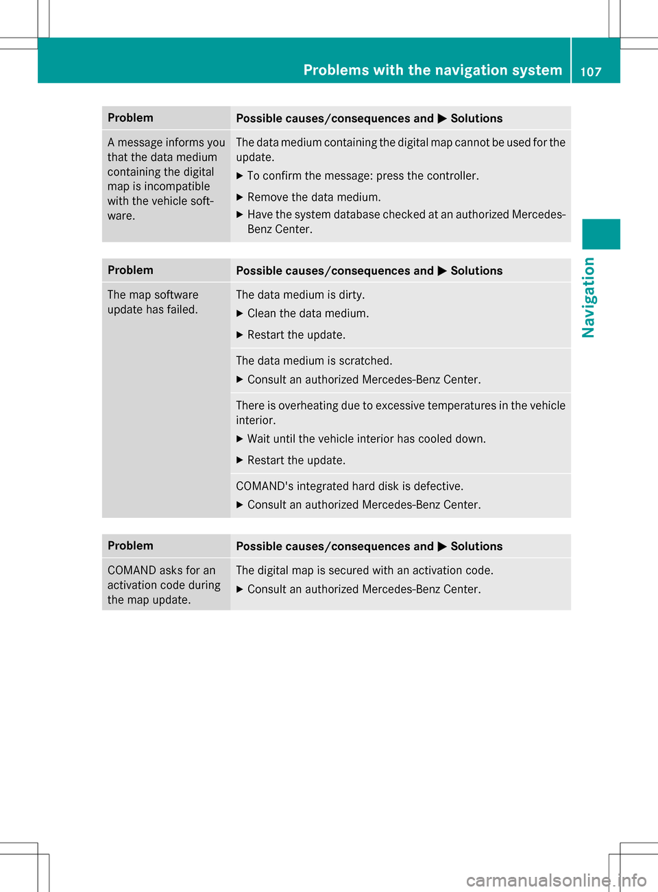
ProblemPossible causes/consequences andMSolutions
A message informs you
that the data medium
containing the digital
map is incompatible
with the vehicle soft-
ware.The data medium containing the digital map cannot be used for the
update.
XTo confirm the message: press the controller.
XRemove the data medium.
XHave the system database checked at an authorized Mercedes-
Benz Center.
ProblemPossible causes/consequences andMSolutions
The map software
update has failed.The data medium is dirty.
XClean the data medium.
XRestart the update.
The data medium is scratched.
XConsult an authorized Mercedes-Benz Center.
There is overheating due to excessive temperatures in the vehicle
interior.
XWait until the vehicle interior has cooled down.
XRestart the update.
COMAND's integrated hard disk is defective.
XConsult an authorized Mercedes-Benz Center.
ProblemPossible causes/consequences andMSolutions
COMAND asks for an
activation code during
the map update.The digital map is secured with an activation code.
XConsult an authorized Mercedes-Benz Center.
Problems with the navigation system107
Navigation
Z