navigation system MERCEDES-BENZ R-Class 2012 W251 Comand Manual
[x] Cancel search | Manufacturer: MERCEDES-BENZ, Model Year: 2012, Model line: R-Class, Model: MERCEDES-BENZ R-Class 2012 W251Pages: 210, PDF Size: 5.11 MB
Page 71 of 210
direct
ionsmay cause youtodivert your
atte ntion from driving andincrease yourrisk
of an acciden t.
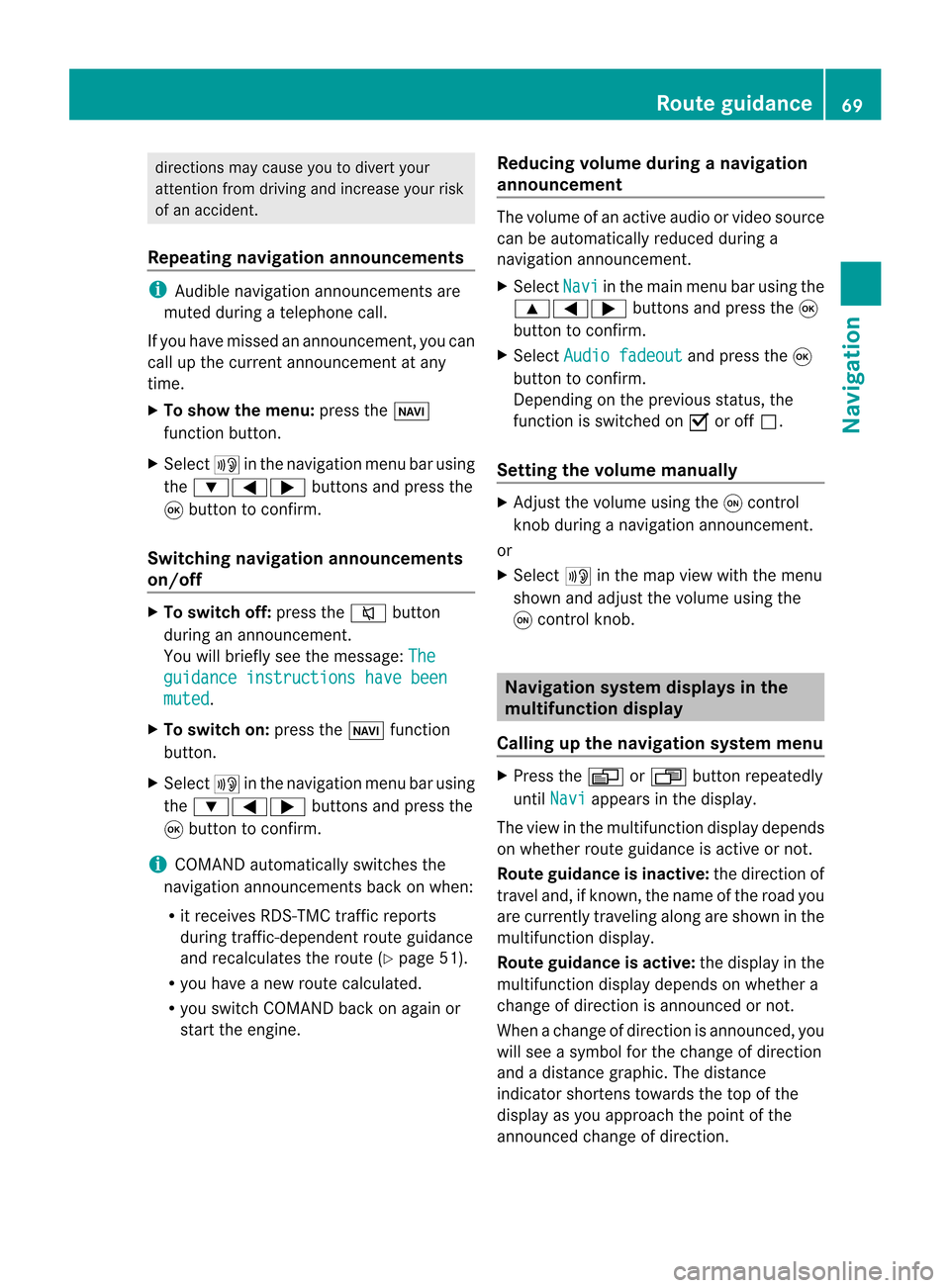
Repea tingnavigat ionannouncement s i
Audible navigationannoun cementsare
muted duringatelephon ecall.
If you have missed anannoun cement,you can
call upthe curren tannoun cementat any
time.
X To show themenu: presstheØ
func tion butto n.
X Select +inthe navigat ionmenu barusing
the :=; buttonsand press the
9 butto nto con firm.
Switching navigationannouncement s
on/off X
To switch off:press the8 button
during anannoun cement.
You willbriefly seethemessage: The guidan
ceinstru ctions havebeen muted .
X To switch on:press theØ function
butto n.
X Select +inthe navigat ionmenu barusing
the :=; buttonsand press the
9 butto nto con firm.
i COMAND automaticallyswitch esthe
navigat ionannoun cementsback onwhen:
R itreceiv esRDS- TMC trafficreport s
during traffic-dependen troute guidance
and recalculates theroute (Ypage 51).
R you have anew route calculated.
R you switch COMAND backonagain or
start theengine. Reducing
volumeduring anavig ation
anno uncemen t The
volu meofan active audio orvide osou rce
can beautomatica llyredu cedduring a
navig ationannou ncement.
X Sele ctNavi in
the mainmenu barusing the
9=; buttonsand press the9
button tocon firm.
X Select Audio fadeout and
press the9
button tocon firm.
Depen dingonthe previous status,the
func tion isswitch edon O oroff ª.
Sett ingthe volume manually X
Adj ust the volume usingtheqcon trol
kn ob during anavigation announcement.
or
X Select +inthe map view withthemenu
shown andadjust thevolume usingthe
q con trol knob. Nav
igation system displaysinthe
mult ifunction display
Calling upthe navigat ionsystem menu X
Press theV orU button repeatedly
until Navi appears
inthe display.
The view inthe multifunc tiondisplay depends
on whether routeguidance isactive ornot .
Rout eguida nceisinactive: thedirect ionof
travel and,ifkn own, thename ofthe road you
are curren tlytravelin galong areshown inthe
multifunc tiondisplay.
Rout eguida nceisactive: thedisplay inthe
multifunc tiondisplay depends onwhether a
change ofdirect ionisannoun cedornot .
When achange ofdirect ionisannoun ced,you
will see asymbol forthe change ofdirect ion
and adistanc egraphic. Thedistanc e
indicat orshort enstowards thetop ofthe
display asyou approach thepoint ofthe
announ cedchange ofdirect ion. Rout
eguida nce
69Navigation Z
Page 74 of 210
X
To sho wthe men u:pre ssthe 9button.
X Sel ect Route in
the navigati on menu bar
us ing the :=; buttons and
pre ssthe 9button toconfi rm.
X Sel ect Routebrowser and
pressthe 9
bu tton toconfi rm.
At the top ofthe displ ay,yo uwi llsee
info rma tiona bout thehighlighted route
sect ion,forexample thedistan cetobe driven
on the road androad designat ion.The
highlighted routesectionismark edinwhite
with ared border onthe map.
X To view thenext orprevious route
section: selectNext or
Previo us and
press the9butt ontocon firm.
i Ifthe first orlast route sectionis
highlighted, youcann otselect Previo us or
Next .
X To zoom inor out ofthe map:select N
or M and press the9butt ontocon firm.
X To close therout ebrowser: selectBack and
press the9butt ontocon firm. Off-
road andoff-m ap
Rout eguida ncetoan off-r oad
destina tion G
WARN
ING
The COMAND navigationsystem maydirect
you tooff- road routes thatyour vehicle may
not becapable oftrav ersing through without
damaging yourtires,wheels orvehicle. Itis
the driver' ssole respon sibility todeterm ine
the suitability ofthe route. Off-road routes
may beofvarying condition sand their
appropriaten essforuse may beaffect edby
various factorssuch astime ofday, time of
year andimmediate weathercondition sthat
cann otbe judged ortake ninto consi derati on
by the COMAND system . CO
MAND canguide yo uto destina tions
wh ich arewi thi nt he area covered bythe
digital map,butwhich arenot themselves
recorded onthe map.
These destinations areknown asoff-r oad
destinations, whichyoucan enter using the
map, forexample. Inthese cases, COMAND
guides youforaslong aspossible with
navigation announcemen tsand displa yson
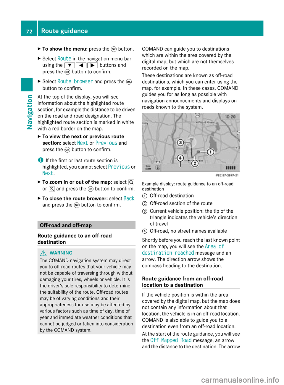
roads known tothe system. Example
display:route guidance toan off-r oad
destination
: Off- road destination
; Off- road section ofthe route
= Current vehicleposition: thetipofthe
triangle indicates thevehicle’s direction
of travel
? Off- road, nostreet names available
Short lybefore youreach thelast known point
on the map, youwillsee theArea of destination
reached message
andan
arrow. Thedirection arrowshows the
compass headingtothe destination .
Route guidance fromanoff-road
location toad esti nation If
th evehi cleposit ioniswith inthearea
cov ered bythedigit almap, butthemap does
no tcon tain anyinform ationabout that
locat ion,th evehi cleisin an off-road locat ion.
COMA NDisalso able toguide youtoa
dest inationeven from anoff-road locat ion.
At thest art oftherout eguidan ce,you willsee
th eOff Mapped Road mes
sage, anarro w
and thedist anceto thed estin ation. Thearrow 72
Rout
eguida nceNavigation
Page 75 of 210
shows
thecompass headingtothe actual
destination.
The route ishighlig htedblue, starting from
the last recognized streetthevehicle wason
before itleft themap.
As soon asthe vehicle isback onaroad
known tothe system, routeguidance
cont inues inthe usua lway .
Route guidance fromanoff-map
location toad esti nation If
th eveh icle posit ionisouts idethearea
cov ered bythedigit almap, then theveh icle
is in an off-map locat ion.COMAND isalso
able toguide youtoadestination evenfrom
an off-map location.
At the start ofthe route guidance,youwillsee
the Off Mapped Road message,
anarrow
and thedistance tothe destination. Thearrow
shows thecompass headingtothe road left
last.
The route ishighli ghted bluestarting atthe
nearest roadknown tothe system.
As soon asthe vehicle isback onaroad
known tothe system, routeguidance
cont inues inthe usua lway .
Off-road duringrouteguidance Due
toroadworks, forexample, theremaybe
differences betweenthedata onthe digital
map andtheactual course ofthe road.
In such cases, thesystem willtemporarily be
unable tolocate thevehicle position onthe
digital mapandthus considers thevehicle to
be inan off-road position.
In the displa y,you willsee theOff Mapped Road message,
anarrow andthedistance to
the destination. Thearrow shows the
compass headingtothe last road youwere
driving on.
As soon asthe system canassign thevehicle
position tothe map again,route guidance
cont inues inthe usua lway . Tra
ffic report s Condition
s
i The satellite radioreception described
below requires optionally available satellite
radio equipment aswell asasubscription
to SIRIUS XMSatellite RadioTraffic
Message Service.Furtherdetailson
satellite radioareavail able inthe "Satellite
radio" chapter (Ypage 121).
COMAND canreceive trafficreports via
satellite radioandincorporate theminthe
navigation system.Trafficreports andmap
icons canthen beshown inthe COMAND
displa y. Real-time
traffic report son the map
COMAND canshow certain trafficincidents
on the map. Theincidents areshown onthe
map atascale from1/16 mito20 mi.
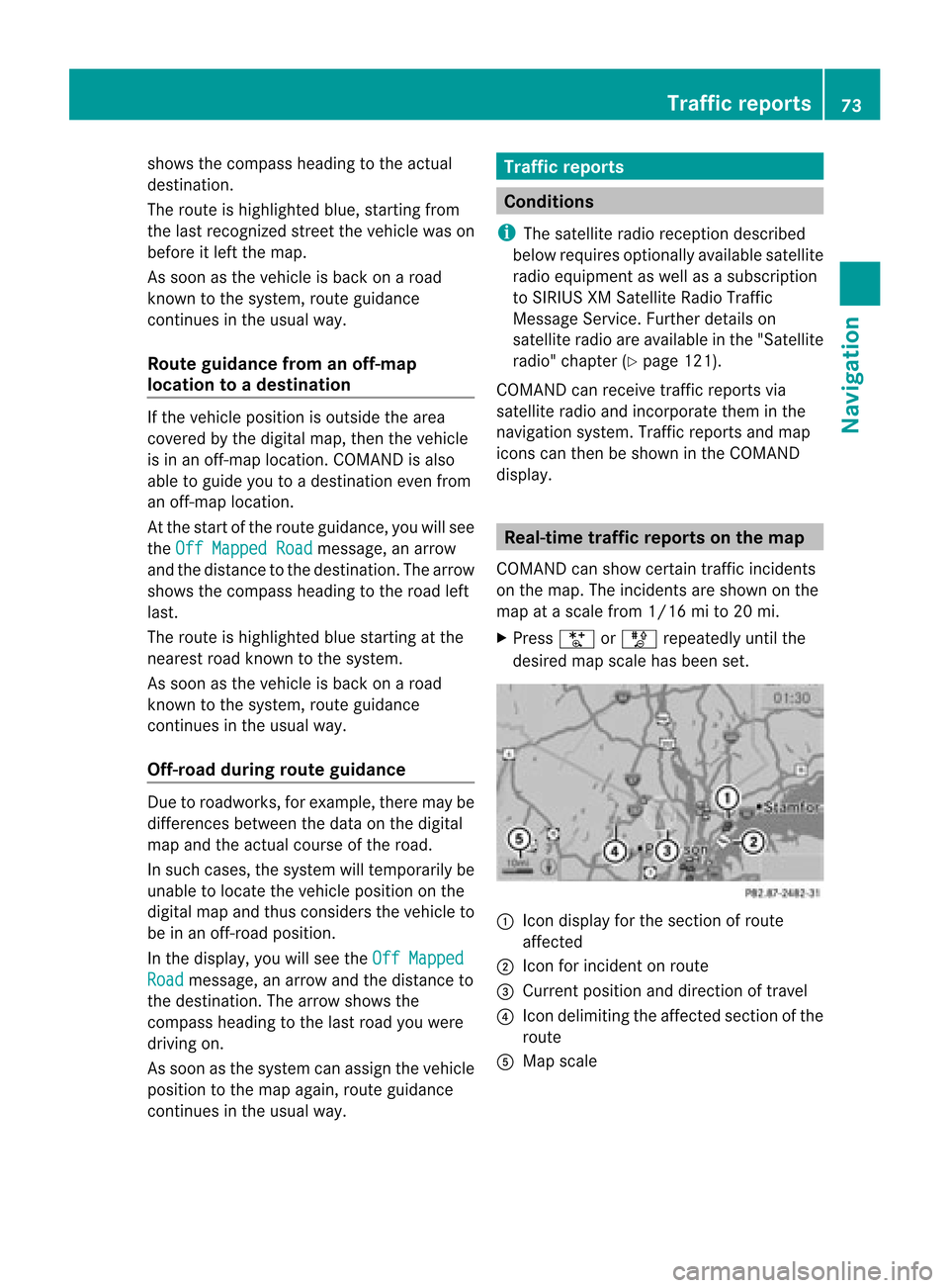
X Press UorT repeatedly untilthe
desired mapscale hasbeen set. 1
Icon displa yfor the section ofroute
affected
2 Icon forincident onroute
3 Current position anddirection oftravel
4 Icon delimi tingtheaffected sectionofthe
route
5 Map scale Tr
affic report s
73Navigat ion Z
Page 78 of 210
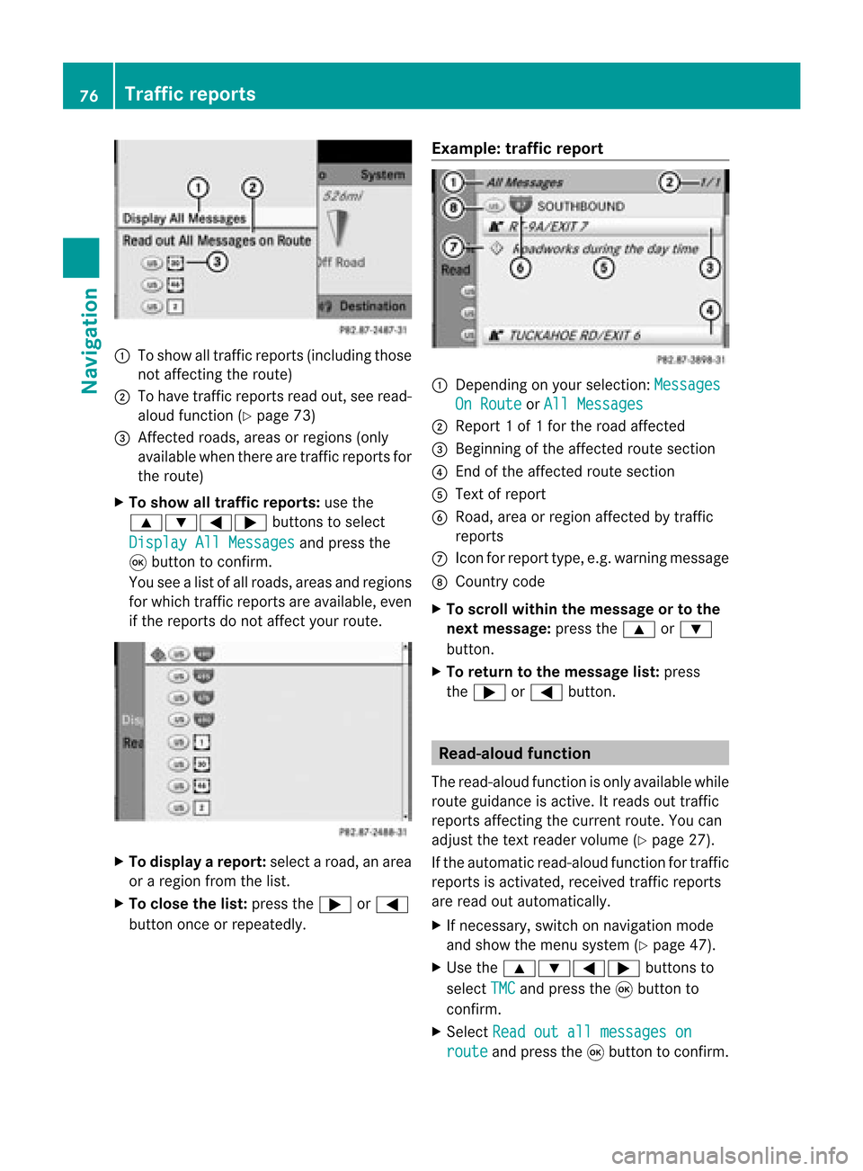
1
Toshow alltraff icreports (including those
not affect ingthe route)
2 Tohave trafficreports readout,seeread-
aloud function(Ypage 73)
3 Affected roads, areasorregions (only
availab lewhen therearetraff icreports for
the route)
X To show alltraffic repor ts:use the
9:=; buttonsto select
Display AllMessages and
press the
9 button toconf irm.
You seealist ofall roads, areasandregions
for which trafficreports areavailab le,even
if the reports donot affect yourroute. X
To display arepor t:select aroad, anarea
or aregion fromthelist.
X To close thelist: press the; or=
button onceorrepeatedly. Examp
le:traffic repor t 1
Dependin gon your selection :Messages On
Route or
All Messages 2
Report 1of 1for the road affect ed
3 Beginn ingofthe affect edroute section
4 Endof the affect edroute section
5 Text ofreport
6 Road, areaorregion affectedbytraff ic
reports
C Icon forreport type,e.g.warning message
D Country code
X To scroll within themessage ortothe
next message: pressthe9 or:
button .
X To retu rntothe message list:press
the ; or= button . Read-
aloud function
The read-aloud functionisonly availab lewhile
route guidance isactive. Itreads outtraff ic
reports affectingthe curren troute. Youcan
adjust thetext reader volume (Ypage 27).
If the automatic read-aloud functionfortraff ic
reports isactivat ed,received trafficreports
are read outautomatically.
X Ifnecess ary,switch onnavigation mode
and show themenu system (Ypage 47).
X Use the9:=; buttonsto
select TMC and
press the9button to
conf irm.
X Select Readoutallmessages on route and
press the9button toconf irm. 76
Tr
affic repor tsNavigation
Page 83 of 210
Route
guidanc eis acti ve X
To sho wthe men u:pre ssthe 9button.
X Sel ect Posi tion in
the navi gation menu
ba ru sing the:=; buttonsand
press the9button toconfirm.
X Select Destination PositionMap and
press the9button toconfirm.
You willsee themap withacrosshair atthe
destination.
X To show themenu: pressthe9button.
X Select Position in
the navigation menu
bar using the:=; buttonsand
press the9button toconfirm.
X Select SaveCrosshair Position and
press the9button toconfirm.
COMAND storesthecrosshair positionas
a destination inthe listofprevious
destinations. Del
eting oneofthe previous
destinations
X To switch onnavigation mode:pressthe
Ø function button.
X To show themenu: pressthe9button.
X Select Position in
the navigation menu
bar using the:=; buttonsand
press the9button toconfirm.
X Select FromLastDestinations and
press the9button toconfirm.
The listofprevious destinations appears.
X Select thedesired destination andpress
the 9button toconfirm.
The destination addressappears.
X Select Delete and
press the9button to
confirm.
Ap rompt appears, asking whethe rthe
entr yshould bedeleted. X
Select Yes or
No and
press the9button
to confirm .
If you select Yes ,
the entr yis deleted.
If you select No ,
the process willbe
canceled. Map
operation andsettings Notes
Company logosdisplayedonthe map are
trademarks ofthe respective companies and
used solely forthe purpose ofindicating the
location ofthese companies. Theuseofsuch
logos forthe map does notindicate approval,
support oradvertisement ofthe navigation
system bythe respective companies. Adjust
ingthe map scale
X To call upthe scale bar:press theU
or T button.
The map scale appea rsat the upper edge
of the screen.
X To zoom inthe map :press theU
button asoften asnecessary.
X To zoom outthemap :press theT
button asoften asnecessary. Map
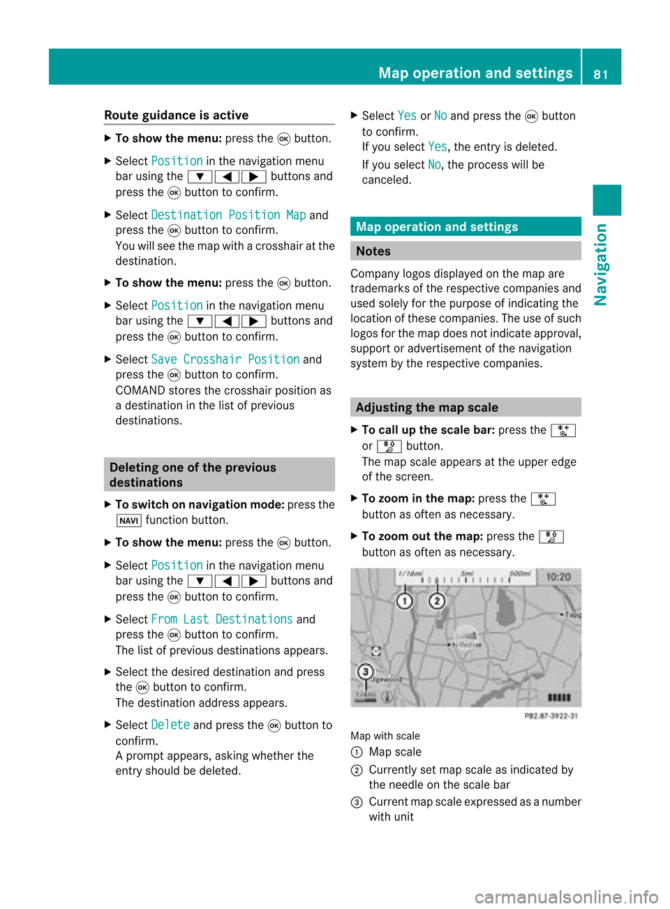
withscale
: Map scale
; Currently setmap scale asindicated by
the needle onthe scale bar
= Current mapscale expressed asanumber
with unit Map
operat ionand settings
81Navigation Z
Page 87 of 210
Geo-c
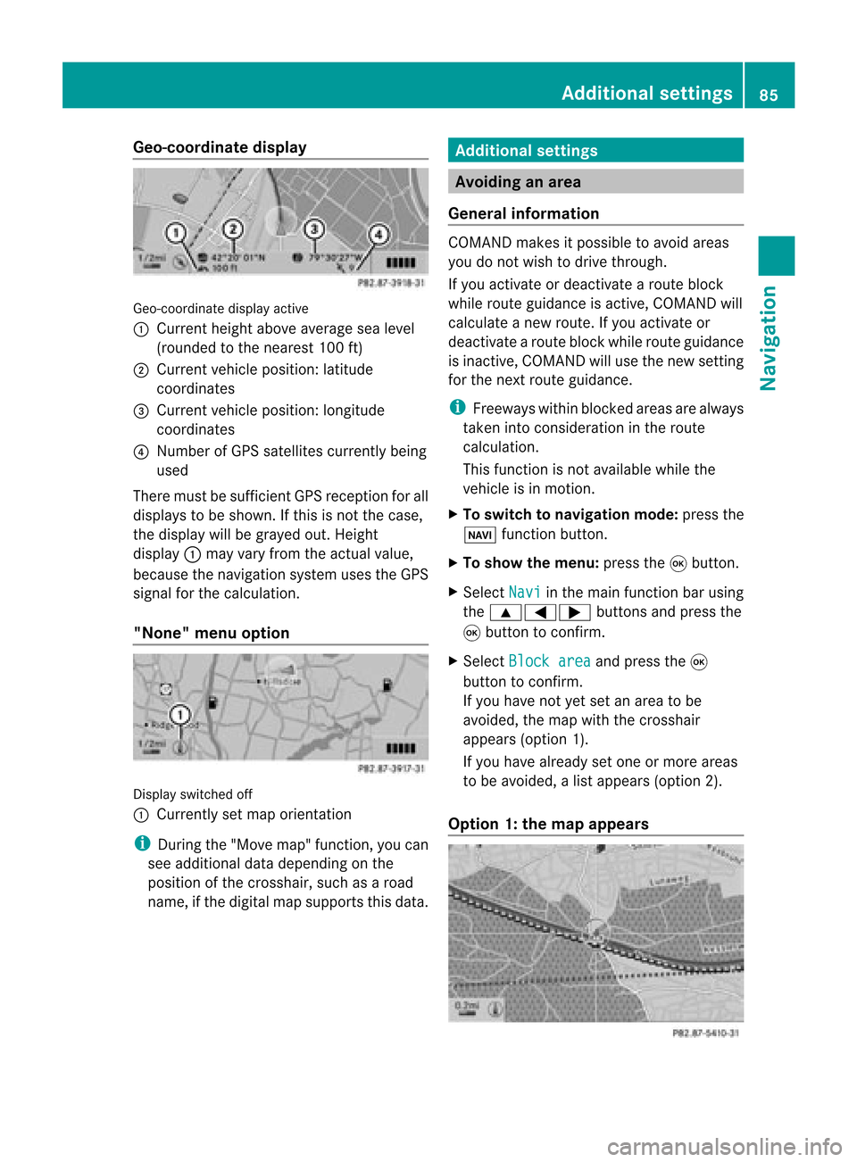
oordinate display Geo-coord
inatedisplayactive
: Current heightabo veavera gesea level
(rou nded tothe nearest 100ft)
; Current vehicle position: latitude
coordina tes
= Current vehicle position: longitu de
coordina tes
? Numbe rofG PS satellites currentlybeing
used
There mustbesufficient GPSrecept ionforall
displays tobe shown. Ifthis isnot thecase,
the display willbegrayed out.Height
display :may varyfrom theactual value,
because thenavigation systemusestheGPS
signal forthe calculation.
"None" menuoption Display
switched off
: Currently setmap orient ation
i During the"Move map"function,youcan
see additional datadepending onthe
position ofthe crosshair, suchasaroad
name, ifthe digital mapsupports thisdata. Additional
settings Avoiding
anarea
General information COMAND
makesitpossible toavoid areas
you donot wish todrive through.
If you activat eor deactivat earoute block
while route guidance isactive, COMAND will
calculate anew route. Ifyou activat eor
deactivat earoute block whileroute guidance
is inact ive,COMAND willuse thenew setting
for the next route guidance.
i Freeways withinblocked areasarealway s
taken intocons ideration inthe route
calculation.
This funct ionisnot availabl ewhile the
vehicle isin motion .
X To switch tonavigation mode:pressthe
Ø functionbutton .
X To show themenu: pressthe9button .
X Select Navi in
the main functionbar using
the 9=; buttonsand press the
9 button toconf irm.
X Select Block area and
press the9
button toconf irm.
If you have notyetsetanarea tobe
avoided, themap withthecrosshair
appears (option1).
If you have already setone ormore areas
to be avoided, alist appears (option2).
Option 1:the map appears Addit
ional settings
85Navigation Z
Page 91 of 210
X
Sel ect Positi on in
the navi gation menu
ba ru sing the:=; buttonsand
press the9button toconfirm.
X Select Compass and
press the9button to
confirm.
Depending onthe previous status,you
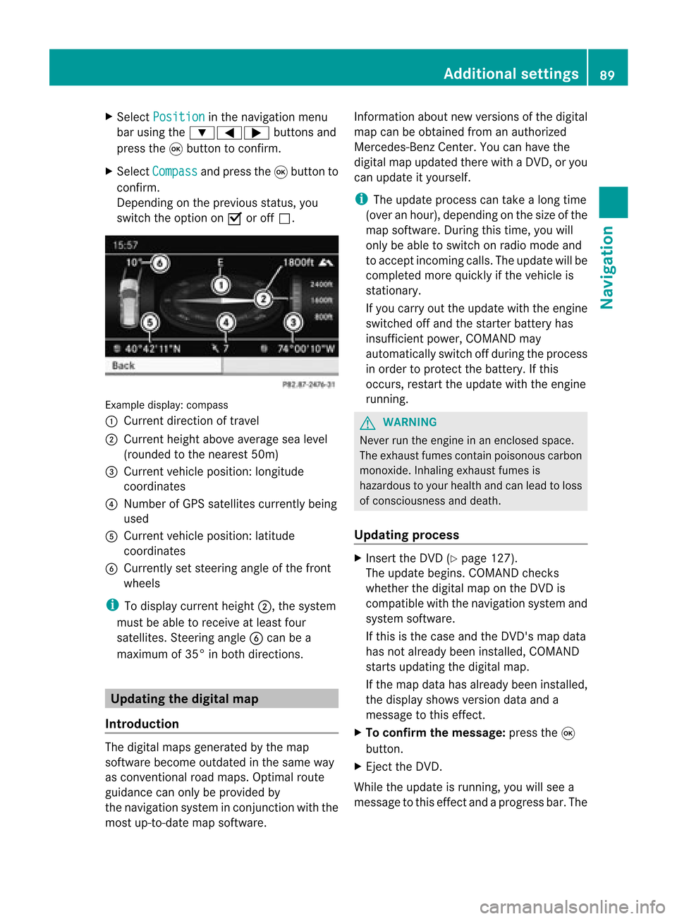
switch theoption onO oroff ª. Example
display:compass
: Current direction oftravel
; Current heightaboveaverage sealevel
(rounded tothe nearest 50m)
= Current vehicleposition: longitude
coordinates
? Number ofGPS satellites currentlybeing
used
A Current vehicleposition: latitude
coordinates
B Currently setsteering angleofthe front
wheels
i Todispla ycurrent height;,thesystem
must beable toreceive atleast four
satellites. SteeringangleBcan bea
maximum of35° inboth directions. Updat
ingthe digital map
Introduction The
digital mapsgenerated bythe map
software becomeoutdated inthe same way
as conven tionalroadmaps. Optimal route
guida ncecanonly beprovided by
the navigation systeminconj unction withthe
most up-to-date mapsoftware. Information
aboutnew version sof the digital
map canbeobtained fromanauthoriz ed
Mercedes- BenzCenter .You canhave the
digital mapupdated therewith aDVD ,or you
can update ityourself.
i The update process cantake along time
(over anhour), depending onthe size ofthe
map software. Duringthis time, youwill
only beable toswitch onradio mode and
to accept incomingcalls. Theupdate willbe
complet edmore quickly ifthe vehicle is
stat ionary.
If you carry outtheupdate withtheengin e
switch edoff and thestart erbatter yhas
insuffic ientpower, COMAND may
automatic allyswitch offduring theprocess
in order toprotec tthe batter y.Ifthis
occ urs, restartthe update withtheengin e
runn ing. G
WARN
ING
Never runtheengin ein an enclos edspace.
The exhaust fumescontain poisonous carbon
monox ide.Inhaling exhaustfumesis
hazardous toyour health andcanlead toloss
of con sciousnes sand death.
Upda tingprocess X
Inser tthe DVD (Ypage 127).
The update begins. COMAND checks
whether thedigital maponthe DVD is
compat iblewith thenavigation systemand
system software.
If this isthe case andtheDVD 'smap data
has notalready beeninstalled, COMAND
start supdating thedigital map.
If the map data hasalready beeninstalled,
the display showsversion dataanda
message tothis effec t.
X To confirm themessage: pressthe9
button .
X Eject the DVD .
While theupdate isrunn ing,youwillsee a
message tothis effec tand apro gressbar.The Addi
tional settin gs
89Navigation Z
Page 92 of 210
nav
igati on system isnot opera tional unti lthe
up date iscomp lete.
i Youcanno teje ctthe DVD during the
up date. Ifyo usw itch offCOMAND during
the update, the update isinte rrupte d.It
then continuesfrom where itwa s
inte rrupte dwh en the system isres tarte d.
CO MAND maypro mpt youto cha nge theDVD
du ring theupdate.
X Pre ssthe V load /eje ctbutton.
X Ta ke the DVD outof the slot.
X Inse rtthe requested DVD.
Once theupdate hasbe en succes sfully
comp leted ,yo uwi llsee ames sage tothis
eff ect.
X To confi rm the mes sage:pre ssthe 9
bu tton.
X Ta ke the DVD outof the slot.
The update iscomp lete.
If the updateisnot succes sfully comp leted ,
yo uwi llsee ames sage tha tthe map update
is not possible.
X To confirm themessage: pressthe9
button.
X Take theDVD outofthe slot. 90
Additional
settingsNavigation
Page 93 of 210

Problems
withthenavigation system Problem Possible
causes/co nsequences andM Solutions
COMAND
isunable to
cont inue route
guida nceafter the
journey hasbeen
interr upted. Route
guidanceiscanceled ifyou interr uptthejourney formore
than twohours.
"Interr upting thejourney" referstostopping thevehicle and
switching offCOMAND. "Continuing routeguidance"refers to
switching COMAND backonand driving on.
X Continue routeguidance(Ypage 68).
COMAND determines thevehicle's position.Depending onthe
driving situation, thismay take some time.
Route guidancemay berestric tedduring thedeterminat ionof
the vehicle's position.
When positioning iscomplete, routeguidanceisresumed with
navigation announcementsandroute guidancedisplay s. Problem Possible
causes/co nsequences andM Solutions
COMAND
isunable to
determine thevehicle's
position. COMAND
hastoredetermine theposition ofthe vehicle ifthe
vehicle hasbeen transport ed(e.g. byferry, bymotorail orafter
towing).
X Start thevehicle andpullaway .
COMAND determines thevehicle's position.Depending onthe
driving situation, thismay take some time.
Route guidancemay berestric tedduring thedeterminat ionof
the vehicle's position.
When positioning iscomplete, routeguidanceisresumed with
navigation announcementsandroute guidancedisplay s. Problems
withthenavigation system
91Navigation Z
Page 94 of 210
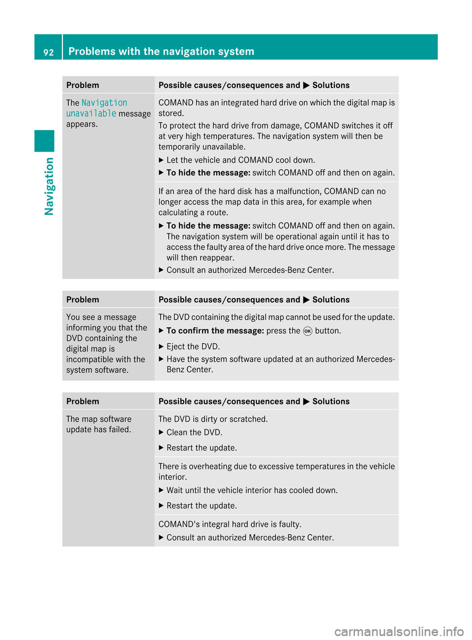
Problem Possible
causes/co nsequences andM Solutions
The
Navigation unavailable message
appea rs. COMAND
hasanintegrated harddrive onwhich thedigital mapis
stored.
To protect thehard drive fromdamage, COMAND switchesitoff
at very high temperatures. Thenavigation systemwillthen be
temporarily unavailable.
X Let the vehicle andCOMAND cooldown.
X To hide themessage: switchCOMAND offand then onagain. If
an area ofthe hard diskhasamalfunction ,COMAND canno
longer access themap data inthis area, forexample when
calculating aroute.
X To hide themessage: switchCOMAND offand then onagain.
The navigation systemwillbeoperational againuntilithas to
access thefaulty areaofthe hard drive oncemore. Themessage
will then reappear.
X Consult anauthorized Mercedes-B enzCenter. Problem Possible
causes/co nsequences andM Solutions
You
seeamessage
informin gyou that the
DVD containing the
digital mapis
incompatible withthe
system software. The
DVD containing thedigital mapcannot beused forthe update.
X To confirm themessage: pressthe9button.
X Ejec tthe DVD .
X Have thesystem software updatedatan authorized Mercedes-
Benz Center. Problem Possible
causes/co nsequences andM Solutions
The
map software
update hasfailed. The
DVD isdirty orscratc hed.
X Clea nthe DVD .
X Restart theupdate. There
isoverheating duetoexcessive temperatures inthe vehicle
interior.
X Wait untilthevehicle interior hascooled down.
X Restart theupdate. COMAND's
integralharddrive isfaulty.
X Consult anauthorized Mercedes-B enzCenter. 92
Problems
withthenavigation systemNavigation