fuel MERCEDES-BENZ SL-Class 2014 R131 Comand Manual
[x] Cancel search | Manufacturer: MERCEDES-BENZ, Model Year: 2014, Model line: SL-Class, Model: MERCEDES-BENZ SL-Class 2014 R131Pages: 274, PDF Size: 5.76 MB
Page 94 of 274

The volume of an active audio or video
source is automatically reduced during a
navigation announcement.
R Gas on Reserve Once you have reached reserve fuel
level, you will see a prompt asking
whether you wish to start the search for
a gas station (Y page 76).
X Select the function and press 0037to confirm.
Switch the function on 0010or off 0003.
Setting the volume manually X
Adjust the volume using the 0002control
knob during a navigation announcement.
or
X Select RPT in the map view with the menu
shown and adjust the volume using the
0002 control knob.
Announcing street names If the function is switched on, the name of the
street which you are turning into is
announced.
Announcements are not made in the chosen
language in all countries. They are made when
relevant street names for the selected
language are available in the database.
X
To switch to navigation mode: press the
0012 button.
X To show the menu: press0037the COMAND
controller.
X Select Navi in the main function bar by
sliding 00360012the COMAND controller and
press 0037to confirm.
X Select Announce Street Names and press
0037 to confirm.
The function is switched on 0010or off 0003,
depending on the previous status. Canceling route guidance
Canceling or continuing route guidance X
To switch to navigation mode: press the
0012 button.
X To show the menu: press0037the COMAND
controller.
X Select Destination in the navigation
system menu bar by turning 003C0012003Dthe
COMAND controller and press 0037to
confirm.
X To cancel route guidance: selectCancel Route Guidance and press
0037to confirm.
or
X To continue route guidance: select
Continue Route Guidance and press
0037
to confirm.
COMAND calculates the route.
Destination or area of destination
reached When you reach your destination, COMAND
displays a checkered flag and route guidance
is automatically ended.
If the destination is not in close proximity to
a digitized street, the
Area of destination reached message appears
when the destination is reached. Influencing route guidance
Avoiding asection of the route blocked
by a traffic jam This function blocks a sectio
nofthe route
ahead of you. You can set the length of the
blocked route section. If possible, COMAND
calculates a detour around the blocked
section of the route.
X To switch to navigation mode: press the
0012 button.
X To show the menu: press0037the COMAND
controller. 92
Route guidanceNavigation
Page 264 of 274

Your COMAND equipment
These operating instructions describe all the
standard and optional equipmen tfor your
COMAND system, as available at the time of
going to print. Country-specific differences
are possible. Please note that your COMAND
system may not be equipped with all the
features described. Introduction
i This function is currently not available for
Canada.
For the reception of weather forecasts via
satellite radio, you will need a SIRIUS XM
Satellite Weather subscription.
When the Call SIRIUS to activate system at 888-539-7474 message with the
SIRIUS device identification number appears,
you will first have to obtain access to the
weather service. Adescription of the
procedure can be found in the "Registering
satellite radio" section (Y page 189).
COMAND can receive weather forecasts via
satellite radio for the entire USA (including
Alaska and Hawaii). The received weather
data can be displayed as an information chart
(daily forecast, five-day forecast, detailed
information) or on the weather map.
The weather data received from a weather
station is stored in COMAND for one hour. It
can therefore be displayed again immediately
after restarting the engine (for example after
refueling).
The weather map can display the following
weather data with symbols:
R rain radar
R storm characteristics
R areas of high-pressure/low-pressure,
weather fronts
R course of tropical cyclones (hurricanes,
typhoons)
R wind direction and speeds i
The rain radar cannot be displayed for
Alaska, Hawaii and Puerto Rico.
i Hurricane: term used to describe the
tropical cyclones that primarily develop in
the Atlantic, North Pacific and South Pacific
oceans. The wind speeds are above
74 mph (118 km/h). Five categories are
used to classify the strength of a hurricane.
Typhoon: term used to describe a tropical
cyclone that develops in the northwestern
Pacific. The wind speeds are in the category
of a hurricane. Switching the SIRIUS weather display
on/off
Activating
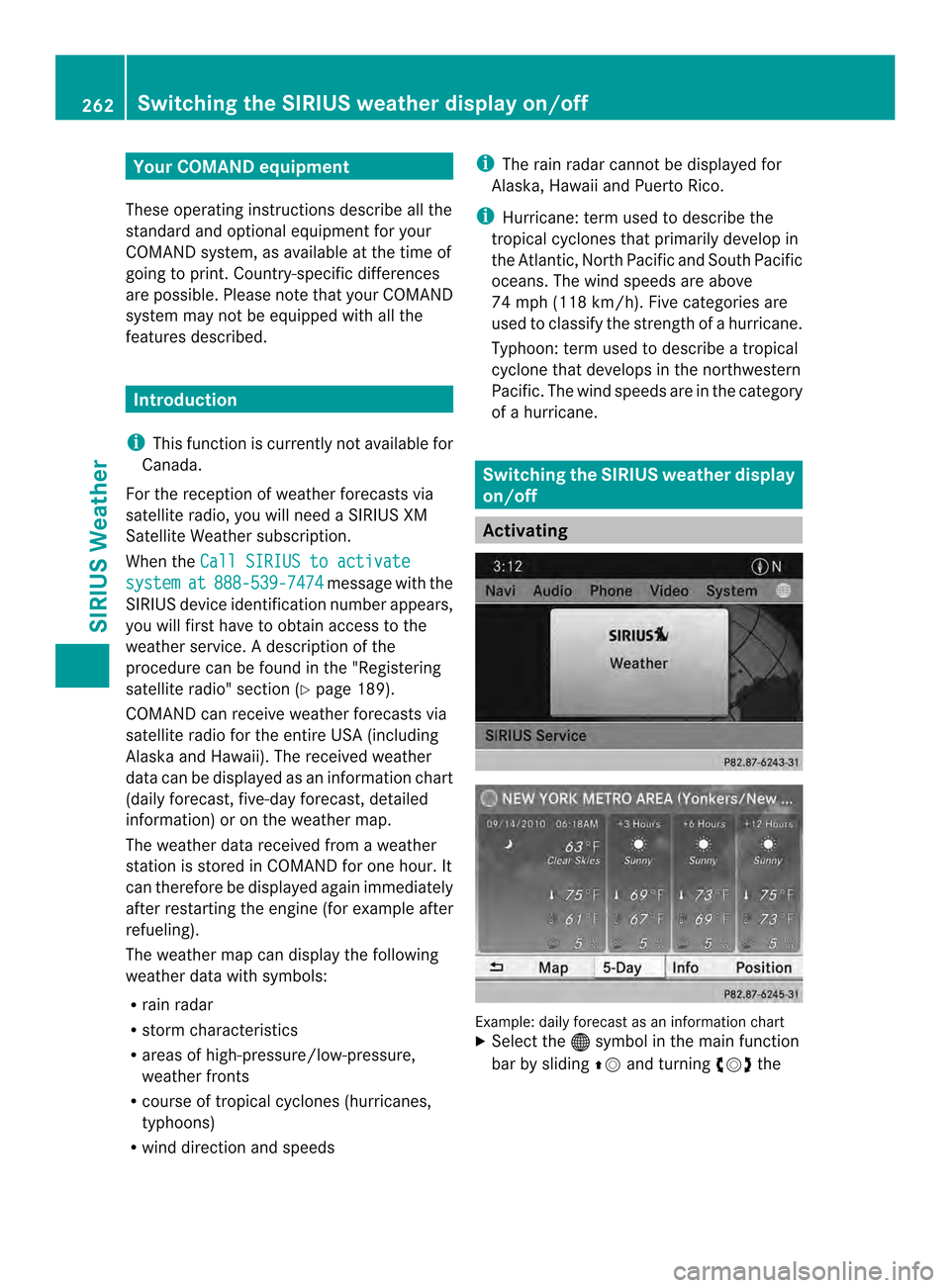
Example: daily forecast as an information chart
X
Select the 000Csymbol in the main function
bar by sliding 00360012and turning 003C0012003Dthe 262
Switching the SIRIUS weather displa
yon/offSIRIUS Weather