stop start NISSAN GT-R 2015 R35 Multi Function Display User Guide
[x] Cancel search | Manufacturer: NISSAN, Model Year: 2015, Model line: GT-R, Model: NISSAN GT-R 2015 R35Pages: 298, PDF Size: 11.39 MB
Page 257 of 298

10-22Multi function meter
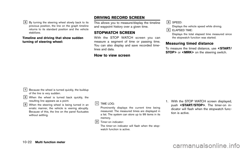
&3By turning the steering wheel slowly back to its
previous position, the line on the graph timeline
returns to its standard position and the vehicle
stabilizes.
Timeline and driving that show sudden
turning of steering wheel:
&1Because the wheel is turned quickly, the buildup
of the line is very sudden.
&2When the wheel is turned back quickly, the
resulting line appears as a point.
&3When the steering wheel is being turned in an
erratic manner, the vehicle is veering abruptly.
Because of this, the line on the panel fluctuates
without settling.
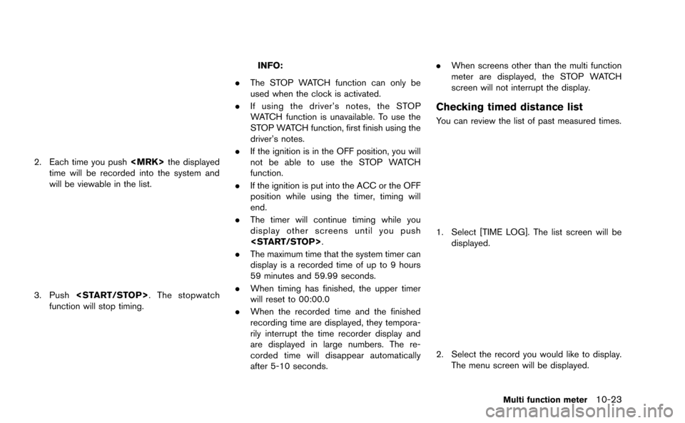
This allows you to measure/display the timeline
and waypoint history over a given time.
STOPWATCH SCREEN
With the STOP WATCH screen you can
measure a segment of time or passing time.
You can also display and save recorded time-
lines and data.
How to view screen
&1TIME LOG:
Prominently displays the current time being
measured. The measured times are displayed in
a list. The system can store up to 99 items in its
memory.
&2Timer-on indicator:
The timer-on indicator will flash when the stop-
watch function is active.
&3SPEED:
Displays the vehicle speed while driving.
&4ELAPSED TIME:
Displays the total elapsed time measured since
the stopwatch function was started.
Measuring timed distance
To measure the timed distance, use
1. With the STOP WATCH screen displayed,
push
dicator will flash when the stopwatch func-
tion is active.
DRIVING RECORD SCREEN
Page 258 of 298

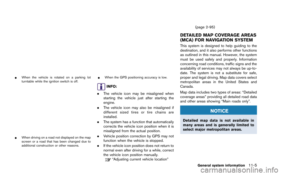
2. Each time you push
time will be recorded into the system and
will be viewable in the list.
3. Push
function will stop timing.
INFO:
. The STOP WATCH function can only be
used when the clock is activated.
. If using the driver’s notes, the STOP
WATCH function is unavailable. To use the
STOP WATCH function, first finish using the
driver’s notes.
. If the ignition is in the OFF position, you will
not be able to use the STOP WATCH
function.
. If the ignition is put into the ACC or the OFF
position while using the timer, timing will
end.
. The timer will continue timing while you
display other screens until you push
. The maximum time that the system timer can
display is a recorded time of up to 9 hours
59 minutes and 59.99 seconds.
. When timing has finished, the upper timer
will reset to 00:00.0
. When the recorded time and the finished
recording time are displayed, they tempora-
rily interrupt the time recorder display and
are displayed in large numbers. The re-
corded time will disappear automatically
after 5-10 seconds. .
When screens other than the multi function
meter are displayed, the STOP WATCH
screen will not interrupt the display.
Checking timed distance list
You can review the list of past measured times.
1. Select [TIME LOG]. The list screen will be
displayed.
2. Select the record you would like to display.
The menu screen will be displayed.
Multi function meter10-23
Page 266 of 298

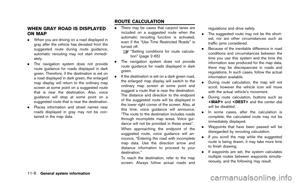
*When the vehicle is rotated on a parking lot
turntable while the ignition switch is off.
*When driving on a road not displayed on the map
screen or a road that has been changed due to
additional construction or other reasons.
*When the GPS positioning accuracy is low.
INFO:
. The vehicle icon may be misaligned when
starting the vehicle just after starting the
engine.
. The vehicle icon may also be misaligned if
different sized tires or tire chains are
installed.
. The system has a function that automatically
corrects the vehicle icon position when it is
misaligned from the actual position.
. Vehicle position correction by GPS may not
function when the vehicle is stopped.
. If the vehicle icon position does not return to
normal even after driving for a while, correct
the vehicle icon position manually.
“Adjusting current vehicle location” (page 2-95)
DETAILED MAP COVERAGE AREAS
(MCA) FOR NAVIGATION SYSTEM
This system is designed to help guiding to the
destination, and it also performs other functions
as outlined in this manual. However, the system
must be used safely and properly. Information
concerning road conditions, traffic signs and the
availability of services may not always be up-to-
date. The system is not a substitute for safe,
proper and legal driving. Map data covers select
metropolitan areas in the United States and
Canada.
Map data includes two types of areas: “Detailed
coverage areas” providing all detailed road data
and other areas showing “Main roads only”.
NOTICE
Detailed map data is not available in
many areas and is generally limited to
select major metropolitan areas.
General system information11-5
Page 267 of 298

11-6General system information
WHEN GRAY ROAD IS DISPLAYED
ON MAP
.When you are driving on a road displayed in
gray after the vehicle has deviated from the
suggested route during route guidance,
automatic rerouting may not start immedi-
ately.
. The navigation system does not provide
route guidance for roads displayed in dark
green. Therefore, if the destination is set on
a road displayed in dark green, the enlarged
map display will return to the ordinary map
screen at some point on a suggested route
that is near the destination. Also, voice
guidance will stop at some point on a
suggested route that is near the destination.
. Places information and street names near
roads displayed in gray may not be con-
tained in the map data.
.There may be cases that carpool lanes are
included on a suggested route when the
automatic rerouting function is activated,
even if the “Use Time Restricted Roads” is
turned off.
“Setting conditions for route calcula-
tion” (page 2-65)
. The navigation system does not provide
route guidance for roads displayed in dark
green.
. If the destination is set on a dark green road,
the enlarged map display will switch to the
ordinary map screen at some point and
suggest a route that is near the destination.
The distance and direction to the endpoint
of the suggested route will be displayed in
the lower right corner of the screen. Also, at
this time, voice guidance will announce,
“The route to the destination includes roads
through incomplete map areas. Voice gui-
dance will not be provided in these areas”.
When approaching the endpoint of the
suggested route, voice guidance will an-
nounce, “Entering the road with incomplete
map data. Use the direction arrow and
distance information to proceed to your
destination.”
To reach the destination, refer to the map
screen. Always follow actual roads and regulations and drive safely.
. The suggested route may not be the short-
est, nor are other circumstances such as
traffic jams considered.
. Because of the inevitable difference in road
conditions and circumstances between the
time you use this system and the time the
information was produced for the map data,
there may be discrepancies in roads and
regulations. In such cases, follow the actual
information available.
. During route calculation, the map will not
scroll, however the vehicle icon will move
with the actual vehicle’s movement.
. During route calculation, buttons such as
Page 296 of 298

Setting previous start point ...................................... 2-35
Setting the image viewer .......................................... 7-11
Settings screen.............................................................. 7-2
Speaker adaptation..................................................... 8-22
Speed limit indication on map................................. 2-92
Standard mode.............................................................. 8-2
Start-up screen.............................................................. 1-9
Status screen................................................................. 6-2
Steering screen ........................................................ 10-20
Steering switch.............................................................. 1-8
Stopwatch screen.................................................... 10-22
Storing a location/route............................................. 2-70
Storing avoid area....................................................... 2-75
Storing location ........................................................... 2-70
Storing route ................................................................ 2-73
Storing tracked route ................................................. 2-74
System feedback announcement modes.............. 8-22
T
Tire pressure information............................................. 6-4
To turn the system OFF............................................... 5-6
Touch panel operation ............................................... 1-13
Trademarks...................................................................... 0-5
Traffic information........................................................ 12-9
Traffic information on map ........................................ 6-10
Traffic information settings........................................ 6-11
Transferring information to/from address book.... 2-89
U
Unit settings ................................................................... 7-9
Unit settings (Tire Pressure) .................................... 7-10
USB device operation................................................ 3-17
Using Voice Recognition System................... 8-4, 8-17
V
Vehicle icon .................................................................. 12-4
Vehicle information display.......................................... 6-4
Ventilators........................................................................ 5-6
Viewing available traffic information ......................... 6-7
Viewing available weather information................... 6-12
Viewing GPS current location information ........... 6-22
Viewing information about current
vehicle location .............................................................. 6-3
Viewing navigation system version information.... 6-22
Voice command examples ............................... 8-9, 8-24
Voice commands........................................................... 4-3
Voice guidance ................................................... 2-4, 12-8
Voice recognition...................................................... 12-12
Volume adjustment........................................................ 7-6
W
What is GPS (Global Positioning System)?........ 11-2
When gray road is displayed on map ................... 11-6
X
XM NavTraffic®information......................................... 2-3
13-3