change time NISSAN MURANO 2015 3.G LC2 Kai Navigation Manual
[x] Cancel search | Manufacturer: NISSAN, Model Year: 2015, Model line: MURANO, Model: NISSAN MURANO 2015 3.GPages: 203, PDF Size: 1.12 MB
Page 59 of 203
![NISSAN MURANO 2015 3.G LC2 Kai Navigation Manual []Each time [] is touched,
the repeat mode changes.
“Changing play mode”
(page 3-29)
[
] Touch to return to the be-
ginning of the current track.
Touch again to select the
previous track. Touch an NISSAN MURANO 2015 3.G LC2 Kai Navigation Manual []Each time [] is touched,
the repeat mode changes.
“Changing play mode”
(page 3-29)
[
] Touch to return to the be-
ginning of the current track.
Touch again to select the
previous track. Touch an](/img/5/436/w960_436-58.png)
[]Each time [] is touched,
the repeat mode changes.
“Changing play mode”
(page 3-29)
[
] Touch to return to the be-
ginning of the current track.
Touch again to select the
previous track. Touch and
hold to rewind the current
track.
[
/] Touch to play and pause the track.
[
] Touch to select the next
track. Touch and hold to
fast-forward the track.
[
] Each time [] is touched,
the random mode changes.
“Changing play mode”
(page 3-29)
*8Track number and device name:
Indicates the track number and the selected
Bluetooth
�Šdevice name.
INFO:
Depending on the audio device that is connected
to the vehicle, track information may not be
displayed.
Bluetooth�Šaudio operation
The ability to pause, change tracks, fast forward,
rewind, randomize and repeat music may be
different between devices. Some or all of these
functions may not be supported on each device.
INFO:
Depending on the Bluetooth
�Šaudio device that
is connected, it may not be possible to perform
audio operations or a time lag may occur before
music is played back.
Activation and playing:
A Bluetooth
�Šaudio device can be selected by
selecting the source on the audio source menu
screen.
“Selecting audio source” (page 3-11)
To pause playing the Bluetooth�Šaudio, touch
[/]. Touch again to resume playing.
Skipping tracks:
Push <
>/<>, touch []/[] on the
Bluetooth�Šaudio screen, or tilt up/down <
>/<>
on the steering wheel briefly to
skip to the next or the previous track.
While a track is playing, turning
Skipping folders:
Turn
different folders. If no folders are found, tracks
will be skipped.
Fast-forwarding/rewinding:
To fast-forward or rewind the track, push and
hold <
>/<>, touch and hold []/[],
or tilt and hold <
>/<>on the steering
wheel.
Changing play mode:
Repeat mode
Touch [
] on the screen to change the repeat
mode as follows.
(off) ?[All] ?[1 Track]? (off)
Random mode
Touch [
] on the screen to change the random
mode as follows.
[All] �œ(off)
3. Audio system
3-29
Page 62 of 203
3. Audio system
AUDIO ADJUSTMENTS WHEN MAP,
AUDIO OR HOME MENU IS DIS-
PLAYED
When Map, Audio or HOME MENU screen is
displayed, some audio settings can be adjusted
with
selected setting item will change as follows.
[Bass] ?[Treble] ?[Balance] ?[Fade]
Rotate
the level of the selected setting item.
CD/USB MEMORY DEVICE
CARE AND CLEANING
CD
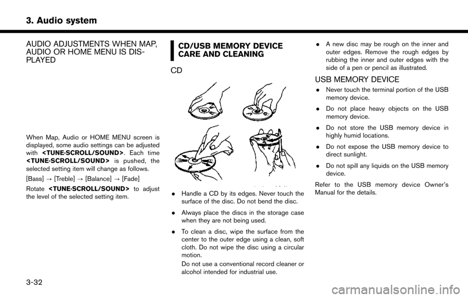
. Handle a CD by its edges. Never touch the
surface of the disc. Do not bend the disc.
. Always place the discs in the storage case
when they are not being used.
. To clean a disc, wipe the surface from the
center to the outer edge using a clean, soft
cloth. Do not wipe the disc using a circular
motion.
Do not use a conventional record cleaner or
alcohol intended for industrial use. .
A new disc may be rough on the inner and
outer edges. Remove the rough edges by
rubbing the inner and outer edges with the
side of a pen or pencil as illustrated.
USB MEMORY DEVICE
.Never touch the terminal portion of the USB
memory device.
. Do not place heavy objects on the USB
memory device.
. Do not store the USB memory device in
highly humid locations.
. Do not expose the USB memory device to
direct sunlight.
. Do not spill any liquids on the USB memory
device.
Refer to the USB memory device Owner’s
Manual for the details.
3-32
Page 81 of 203
SiriusXM TRAVEL LINK
SiriusXM Travel Link information is a subscription
service offered by SiriusXM Satellite Radio. It is
necessary to subscribe to use the SiriusXM
Travel Link information.
This service provides real-time information re-
garding current weather, fuel prices, sports
scores, stock tickers and movie times where
available. The SiriusXM Travel Link is broadcast
to the vehicle by SiriusXM Satellite Radio.
The service enables you to view the following
information on the navigation system:
*Current information around the destination
*Detailed information and forecasts of an area of
interest
*Countrywide and local maps with the current
weather, temperature, warnings and road condi-
tion information
*List of warning/watches events detected
around the current location
*Pop-up messages on the navigation screen with
voice announcements when warnings and
watches are detected around the current loca-
tion
WARNING
SiriusXM Travel Link information is not a
substitute for attentive driving. Weather
conditions change constantly and emer-
gency situations can arise without warn-
ing. Relying only on SiriusXM Travel Link
information could result in serious per-
sonal injury.
VIEWING SiriusXM TRAVEL LINK
SiriusXM Satellite Radio and SiriusXM Travel
Link subscriptions are sold separately or as a
package, and are continuous until you call
SiriusXM to cancel. See SiriusXM Customer
Agreement for complete terms at www.siriusxm.
com. SiriusXM Travel Link is available in select
markets.
For more information, call Listener Care at 1-
877-447-0011 or visit siriusxm.com/travellink.
INFO:
. If a contract is not completed for the
SiriusXM Travel Link information service, a
message appears and it will not be possible
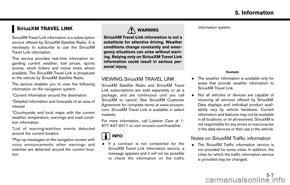
to check the information on the traffic information system.
Example
.
The weather information is available only for
areas that provide weather information to
SiriusXM Travel Link.
. Not all vehicles or devices are capable of
receiving all services offered by SiriusXM.
Data displays and individual product avail-
ability vary by vehicle hardware. Current
information and features may not be available
in all locations, or on all receivers. SiriusXM is
not responsible for any errors or inaccuracies
in the data services or their use in the vehicle.
Notes on SiriusXM Traffic information
.The SiriusXM Traffic information service is
not provided for some cities. In addition, the
cities for which the traffic information service
is provided may be changed.
5. Information
5-7
Page 89 of 203
the map orientation.“Changing map view and map orienta-
tion” (page 6-8)
*11Remaining distance to the destination:
Indicates the approximate remaining dis-
tance to the destination or waypoint. This
indicator will appear when a destination or
waypoint is set and route guidance is
started.
The arrow displayed here indicates the
direction of the destination. It can be
displayed only when the map scale is in
the range of 1/64 miles (25 m) - 1/8 miles
(200 m) .
*12Estimated time to the destination:
Indicates the estimated time to the destina-
tion or waypoint. This indicator will appear
when a destination or waypoint is set and
route guidance is started.
“Guidance settings” (page 6-39)
*13Traffic indicator:
Indicates the reception condition of the
traffic information transmitted from the
provider.
Green: Reception condition is good.
Gray: Reception condition is not good.
The indicator does not appear without aSiriusXM Traffic subscription.
*14Vehicle icon:
Indicates the current vehicle location and
the direction the vehicle is heading.
*15Suggested route:
Appears in bold blue during route guidance.
*16Stored location (yellow):
Displays the locations that are stored in the
Address Book. The icons can be changed
according to your preferences.
“Storing location” (page 6-46)
*17Street name:
Displays the name of the street that the
vehicle is currently driving on.
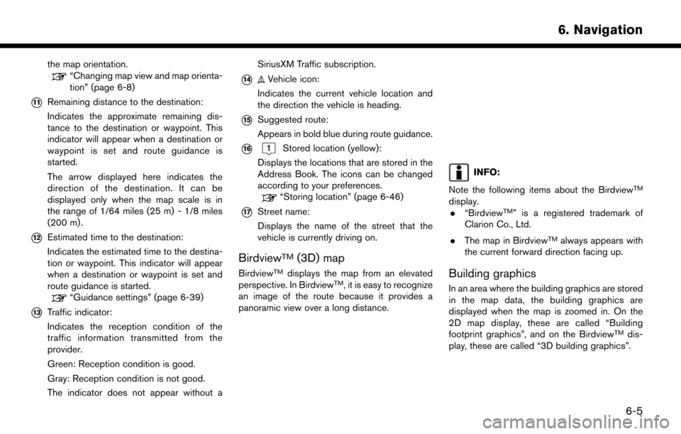
BirdviewTM(3D) map
BirdviewTMdisplays the map from an elevated
perspective. In BirdviewTM, it is easy to recognize
an image of the route because it provides a
panoramic view over a long distance.
INFO:
Note the following items about the Birdview
TM
display. . “BirdviewTM” is a registered trademark of
Clarion Co., Ltd.
. The map in Birdview
TMalways appears with
the current forward direction facing up.
Building graphics
In an area where the building graphics are stored
in the map data, the building graphics are
displayed when the map is zoomed in. On the
2D map display, these are called “Building
footprint graphics”, and on the Birdview
TMdis-
play, these are called “3D building graphics”.
6. Navigation
6-5
Page 92 of 203
![NISSAN MURANO 2015 3.G LC2 Kai Navigation Manual 6. Navigation
CHANGING MAP
Changing map view and map orienta-
tion
The map view and the map orientation can be
changed by touching []/[] on the map
screen.
The screen will change to North Up, Heading NISSAN MURANO 2015 3.G LC2 Kai Navigation Manual 6. Navigation
CHANGING MAP
Changing map view and map orienta-
tion
The map view and the map orientation can be
changed by touching []/[] on the map
screen.
The screen will change to North Up, Heading](/img/5/436/w960_436-91.png)
6. Navigation
CHANGING MAP
Changing map view and map orienta-
tion
The map view and the map orientation can be
changed by touching []/[] on the map
screen.
The screen will change to North Up, Heading Up
and Birdview
TMeach time []/[] is touched.
North Up
Heading Up
BirdviewTM
INFO:
. You can also change the map view from the
map view settings screen.
“Map view settings” (page 6-8)
. For Head Up map view, long range map
which displays wider area in the traveling
direction is available.
“Map view settings” (page 6-8)
Setting split screen
Two different maps can be displayed on a screen
with the split screen setting.
1. Touch [] on the map screen.
2. Touch [Map View].
3. Touch [Change View].
4. Select [Split: 2D Map] or [Split: Birdview Map].
INFO:
The settings on the left split map can be changed
from map view settings menu.
“Map view settings” (page 6-8)
MAP VIEW SETTINGS
The setup for the map view is performed from the
Settings menu on the touch screen display.
1. Touch [
] on the map screen.
2. Touch [Map View].
The following settings are available.
6-8
Page 121 of 203
![NISSAN MURANO 2015 3.G LC2 Kai Navigation Manual 6. Touch [Calculate] to apply the change.
RECALCULATING ROUTE
A route can be manually searched again after
changing the search conditions.
1. Touch [Navi] on the Launch Bar.
2. Touch [Recalculate]. A NISSAN MURANO 2015 3.G LC2 Kai Navigation Manual 6. Touch [Calculate] to apply the change.
RECALCULATING ROUTE
A route can be manually searched again after
changing the search conditions.
1. Touch [Navi] on the Launch Bar.
2. Touch [Recalculate]. A](/img/5/436/w960_436-120.png)
6. Touch [Calculate] to apply the change.
RECALCULATING ROUTE
A route can be manually searched again after
changing the search conditions.
1. Touch [Navi] on the Launch Bar.
2. Touch [Recalculate]. A message is displayedand the route is recalculated.
3. Touch [Start] or conduct other operations as necessary.
“Options before starting the route
guidance” (page 6-23)
INFO:
. When a waypoint has been set on the route,
the system will search for only one route,
even if route recalculation is performed.
. When the vehicle deviates from the sug-
gested route, the route from the current
location to the destination is automatically
searched again by the Auto Reroute func-
tion.
“Route Settings” (page 6-41)
SEARCHING FOR DETOUR ROUTE
USING TRAFFIC INFORMATION
When a serious traffic event occurs on the route,
or if the system finds a faster route, a detour alert
will display automatically. If the automatic alert is
not noticed, a detour can also be searched for
manually.
1. Touch [Navi] on the Launch Bar.
2. Touch [Traffic Detour].
3. When the detour search is successful,
detailed information about the detour route
and the comparison screen of the two routes
are displayed.
*1Original route (blue)
*2Detour route (purple)
*3The change of distance and estimated
travel time to destination when the
detour route is taken.
4. To accept the suggested detour route, touch [Yes].
INFO:
. Without a subscription to SiriusXM Traffic, it
will not be possible to receive traffic detour
information or apply settings for functions
related to traffic information. A message
appears when a related menu item is
selected.
“Notes on SiriusXM Traffic information”
(page 5-7)
. If no route is set, or [Use Real Time Traffic
Information] is turned off, this function cannot
be operated.
“Route Settings” (page 6-41)
. If a detour route is not selected and no
further action is performed, the detour route
will be automatically canceled.
. The detour suggestion can be retrieved even
after the message disappears by manually
selecting [Traffic Detour]. The system will
then search for the detour again and will
suggest a detour if one is available at that
6. Navigation
6-37
Page 122 of 203
![NISSAN MURANO 2015 3.G LC2 Kai Navigation Manual 6. Navigation
time.
Automatic detour guidance
When [Auto Reroute] and [Use Real Time Traffic
Information] are turned on in the detailed route
settings, a message will be displayed automati-
cally when NISSAN MURANO 2015 3.G LC2 Kai Navigation Manual 6. Navigation
time.
Automatic detour guidance
When [Auto Reroute] and [Use Real Time Traffic
Information] are turned on in the detailed route
settings, a message will be displayed automati-
cally when](/img/5/436/w960_436-121.png)
6. Navigation
time.
Automatic detour guidance
When [Auto Reroute] and [Use Real Time Traffic
Information] are turned on in the detailed route
settings, a message will be displayed automati-
cally when the system finds a detour.
“Route Settings” (page 6-41)
To accept the suggested detour route, touch
[Yes].
INFO:
. If no operation is performed for 1 minute after
the message is displayed, the message
disappears. The detour will not be accepted,
and the current suggested route will remain
unchanged.
. When [Traffic Announcements] is turned on
in the guidance settings, the system will announce voice guidance at the same time
the message appears on the screen.
“Guidance settings” (page 6-39)
SETTING DETOUR ROUTE
To detour from the suggested route, a route
detouring for a specified distance can be
calculated.
1. Touch [Navi] on the Launch Bar.
2. Touch [Detour].
3. Touch a detour distance select from 1/2 mile,
1 mile, 3 miles or 5 miles. After calculating
the detour, the system displays the detour
route on the map.
INFO:
. When the vehicle has deviated from the
suggested route, [Detour] cannot be se-
lected.
. If the system cannot calculate a detour with
the specified conditions the previous sug-
gested route is displayed.
. If the vehicle is traveling very fast, the detour
route may start from a location that the
vehicle has already passed.
ROUTE GUIDANCE SETTINGS
The route search conditions and route guidance
can be set.
6-38
Page 127 of 203
VIEWING TRAFFIC INFORMA-
TION
NavTraffic information is a subscription service
offered by SiriusXM Satellite Radio.
This service provides real-time information re-
garding traffic flow, accidents, road construction
and other incidents, where available.
NavTraffic combines information from commer-
cial and public traffic data providers including
government departments of transportation, po-
lice, emergency services, road sensors, cameras
and aircraft reports. The traffic information is
broadcast to the vehicle by the SiriusXM
satellites. Available traffic information on the
route the driver selected is shown on the
navigation screen so traffic conditions between
you and the destination are known. Three types
of real-time traffic information for major roadways
are shown on the navigation system:
* Unscheduled traffic data for example, accidents
and disabled vehicles.
* Scheduled traffic data, for example road
construction and road closures.
* Traffic flow information (rate of speed data) .
WARNING
NavTraffic information is not a substitute
for attentive driving. Traffic conditions
change constantly and emergency situa-
tions can arise without warning. Relying
only on NavTraffic information may lead
to a collision and could result in serious
personal injury.
NOTE:
. Flow information is provided only for
roads equipped with traffic sensors and
is not available in all markets covered
by the service. Flow data may not be
available on portions of a road that is
under construction.
. A SiriusXM Traffic subscription is ne-
cessary to view Traffic Info.
“SiriusXM Travel Link” (page 5-7)
VIEWING AVAILABLE TRAFFIC IN-
FORMATION
Viewing traffic events from list
1. Touch [Info] on the Launch Bar.
2. Touch [SXM Traffic]. A list of available types
of information are displayed.
Available
items Function
[Info on
Route] Displays a list of traffic information
found on the route from the current
vehicle location to the destination.
Available only when a route is set.
[Nearby
Traffic Info] Displays a list of available traffic
information around the current ve-
hicle location.
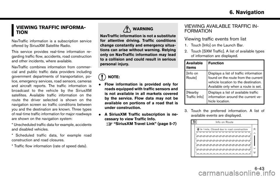
3. Touch the preferred information. A list of
available events are displayed.
6. Navigation
6-43
Page 129 of 203
*4Remaining distance and estimated time to
the destination calculated with considera-
tion of traffic information on route.
INFO:
Traffic icons are displayed in the scale level of
1/64 miles (25 m) - 5 miles (10 km) range. Some
traffic icons are displayed only on the map at
higher detail levels.
TRAFFIC INFORMATION SETTING
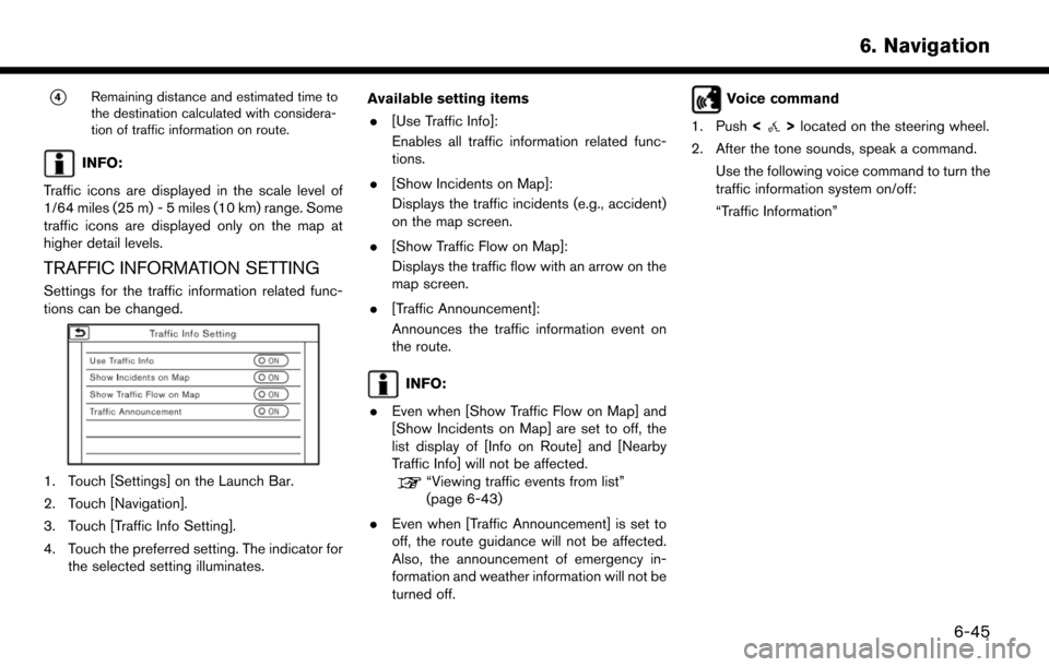
Settings for the traffic information related func-
tions can be changed.
1. Touch [Settings] on the Launch Bar.
2. Touch [Navigation].
3. Touch [Traffic Info Setting].
4. Touch the preferred setting. The indicator for the selected setting illuminates. Available setting items
. [Use Traffic Info]:
Enables all traffic information related func-
tions.
. [Show Incidents on Map]:
Displays the traffic incidents (e.g., accident)
on the map screen.
. [Show Traffic Flow on Map]:
Displays the traffic flow with an arrow on the
map screen.
. [Traffic Announcement]:
Announces the traffic information event on
the route.
INFO:
. Even when [Show Traffic Flow on Map] and
[Show Incidents on Map] are set to off, the
list display of [Info on Route] and [Nearby
Traffic Info] will not be affected.
“Viewing traffic events from list”
(page 6-43)
. Even when [Traffic Announcement] is set to
off, the route guidance will not be affected.
Also, the announcement of emergency in-
formation and weather information will not be
turned off.
Voice command
1. Push <
>located on the steering wheel.
2. After the tone sounds, speak a command. Use the following voice command to turn the
traffic information system on/off:
“Traffic Information”
6. Navigation
6-45
Page 146 of 203
6. Navigation
— If you calculate a route on a main road, thestarting point of the route may not exactly
match the current vehicle location.
— The endpoint of the route may not exactly match the destination.
— If you calculate a route on a main road, the system may display a route from another
main road. This may be because the
position of the vehicle icon is not accu-
rate. In this case, park the vehicle in a safe
location and reset the vehicle icon, or
continue driving to see if the position of
the vehicle icon is automatically adjusted
before recalculating the route.
— There are cases in which the system shows an indirect route to reach the
destination or waypoints, if you set them
from stored or facility information. In order
to correct this, you must be careful about
the traffic direction, especially when lanes
with different travel directions are shown
separately, such as interchanges and
service areas.
— This system makes no distinction be- tween limited traffic control and total
control (blockage) . It may show an
indirect route even if the road is usable. — Even if the ferry preference is set to OFF, a
route that uses a ferry line may be
suggested.
ROUTE GUIDANCE
INFO:
The system will only announce street names
when the system language is set to English.
Street names are not announced when the
system is set to French/Spanish.
Repeating voice guidance
This function is available throughout route
guidance, from the time after the route calcula-
tion is completed until the vehicle arrives at the
destination. Push and hold the