service NISSAN MURANO 2015 3.G LC2 Kai Navigation Manual
[x] Cancel search | Manufacturer: NISSAN, Model Year: 2015, Model line: MURANO, Model: NISSAN MURANO 2015 3.GPages: 203, PDF Size: 1.12 MB
Page 82 of 203
5. Information
.In some cases, infrastructure problems may
prevent the complete display of the traffic
information. This is not a malfunction.
. Due to infrastructure problems, or due to the
time when the traffic information service
broadcast is received, the displayed informa-
tion may differ from the actual traffic condi-
tions.
. Depending on the traffic information, a
detour route may be slower than the original
route.
. SiriusXM Satellite Radio and SiriusXM Traffic
subscriptions are sold separately or as a
package, and are continuous until you call
SiriusXM to cancel. See SiriusXM Customer
Agreement for complete terms at www.
siriusxm.com. SiriusXM Travel Link is avail-
able in select markets. For more information,
call Listener Care at 1-877-447-0011 or
visit siriusxm.com/traffic.
. SiriusXM Traffic is available in over 130
metropolitan markets. For the most current
list of markets covered, please refer to
www.siriusxm.com/siriusxmtraffic, or call Sir-
iusXM Listener Care at 1-877-447-0011.
. Due to road maintenance, infrastructure
problems (e.g. malfunction of road sensors, outage of central computer of infrastructure)
or natural disasters, there are times when
some or all traffic information may not be
available.
. Incident information is based on human
collection. Not all incidents that have hap-
pened are collected and provided.
. Due to infrastructure problems, or transmis-
sion delay, there are times when the informa-
tion may differ from the actual condition.
Always observe safe driving practices and
follow all traffic regulations.
. Due to the coverage and quality of traffic
information and road conditions, it is not
always possible for the system to provide the
shortest time route even when traffic in-
formation is considered.
. Traffic information that is displayed may differ
from information from other media (e.g.,
radio) , as other media may use different
information sources.CONTROL PANEL AND VEHICLE
INFORMATION DISPLAY INTER-
ACTION
Some of the information and operations available
on the control panel can also be viewed and
operated on the vehicle information display. The
vehicle information display operations can be
conducted with the switches on the steering
wheel.
AUDIO
Use <>/<>and selecton the vehicle
information display main menu.
The vehicle information display shows the status
for the audio source currently in use.
Some examples of what will be displayed:
. Source
. Artist
. Song
. Album
Pushing
available audio sources.
5-8
Page 87 of 203
SAFETY INFORMATION
The navigation system is primarily designed to
help you reach your destination. However, you,
the driver, must use the system safely and
properly. Information concerning road condi-
tions, traffic signs and the availability of services
may not always be up to date. The system is not a
substitute for safe, proper, and legal driving.
WARNING
.Do not rely on route guidance alone.
Always be sure that all driving man-
euvers are legal and safe in order to
avoid accidents.
MAP OPERATION
DISPLAYING CURRENT VEHICLE
LOCATION
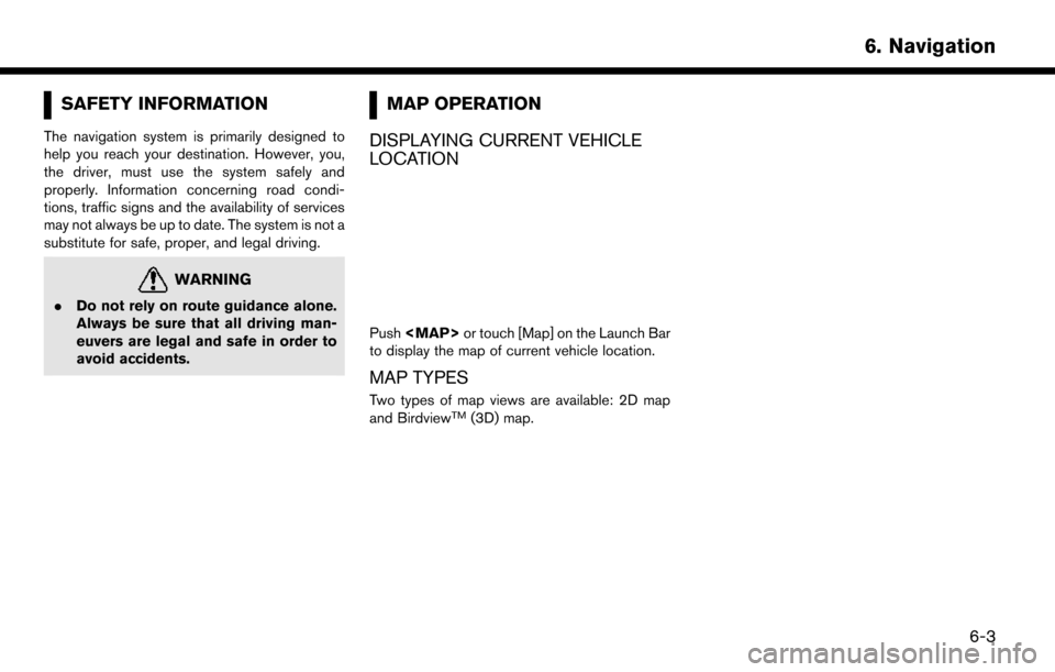
Push
Page 100 of 203
![NISSAN MURANO 2015 3.G LC2 Kai Navigation Manual 6. Navigation
3. Input the street address.
.Touch [State/Province] to enter the stateor province name.
.Touch [House #] to enter the housenumber. If the house number is not
available, touch [No House NISSAN MURANO 2015 3.G LC2 Kai Navigation Manual 6. Navigation
3. Input the street address.
.Touch [State/Province] to enter the stateor province name.
.Touch [House #] to enter the housenumber. If the house number is not
available, touch [No House](/img/5/436/w960_436-99.png)
6. Navigation
3. Input the street address.
.Touch [State/Province] to enter the stateor province name.
.Touch [House #] to enter the housenumber. If the house number is not
available, touch [No House #].
.Touch [Street] to enter the street name.
After finishing the entry, touch [List]. A list
of streets is displayed.
.Touch [City] to enter the city name. If thecity name is not available, touch [All
Cities].
4. When information about state, house num- ber, street, and city are entered, the destina-
tion is proposed on the touch screen display.
Touch [OK].
5. Touch [Start] to start route guidance.
Voice command
1. Push <
>located on the steering wheel.
2. After the tone sounds, speak a command.
Use the following voice command to search for a
destination by address:
“Street Address”*
*: This voice command operation is available only
when the language setting is in English.
FINDING NEARBY PLACE
A facility located near the current vehicle location
or another location that you move to by scrolling
the map can be set as the destination. This
allows you to set the destination to a facility
located near the current vehicle location or
another location that you move to by scrolling
the map.
1. Touch [Navi] on the Launch Bar.
2. Touch [Nearby Points of Interest]. The category list is displayed.
3. Select [Emergency Services] for example.
4. Select preferred category from the subcategory list.
5. Touch the preferred destination from the list.The position of the selected location is
displayed in the preview on the touch screen
display.
6-16
Page 127 of 203
VIEWING TRAFFIC INFORMA-
TION
NavTraffic information is a subscription service
offered by SiriusXM Satellite Radio.
This service provides real-time information re-
garding traffic flow, accidents, road construction
and other incidents, where available.
NavTraffic combines information from commer-
cial and public traffic data providers including
government departments of transportation, po-
lice, emergency services, road sensors, cameras
and aircraft reports. The traffic information is
broadcast to the vehicle by the SiriusXM
satellites. Available traffic information on the
route the driver selected is shown on the
navigation screen so traffic conditions between
you and the destination are known. Three types
of real-time traffic information for major roadways
are shown on the navigation system:
* Unscheduled traffic data for example, accidents
and disabled vehicles.
* Scheduled traffic data, for example road
construction and road closures.
* Traffic flow information (rate of speed data) .
WARNING
NavTraffic information is not a substitute
for attentive driving. Traffic conditions
change constantly and emergency situa-
tions can arise without warning. Relying
only on NavTraffic information may lead
to a collision and could result in serious
personal injury.
NOTE:
. Flow information is provided only for
roads equipped with traffic sensors and
is not available in all markets covered
by the service. Flow data may not be
available on portions of a road that is
under construction.
. A SiriusXM Traffic subscription is ne-
cessary to view Traffic Info.
“SiriusXM Travel Link” (page 5-7)
VIEWING AVAILABLE TRAFFIC IN-
FORMATION
Viewing traffic events from list
1. Touch [Info] on the Launch Bar.
2. Touch [SXM Traffic]. A list of available types
of information are displayed.
Available
items Function
[Info on
Route] Displays a list of traffic information
found on the route from the current
vehicle location to the destination.
Available only when a route is set.
[Nearby
Traffic Info] Displays a list of available traffic
information around the current ve-
hicle location.
3. Touch the preferred information. A list of
available events are displayed.
6. Navigation
6-43
Page 128 of 203
6. Navigation
4. Touch a preferred events from the list tocheck the detailed information and the map.
Displaying urgent traffic information
When an urgent event is found around the
current vehicle location, a message pops up
automatically on the touch screen display with a
voice announcement.
The message includes the icon, event type, event
information and the direct distance from the
current location to the event.
INFO:
. Urgent traffic information is displayed re-
gardless of whether [Use Traffic Info] func-
tion is on or off.
“Traffic information setting”
(page 6-45)
. When there are multiple urgent events, the
event with the shortest direct distance from
the current location is displayed.
. If the urgent event is on the recommended
route, and if a detour is found, the detour
route notification screen is displayed when
the vehicle approaches the detour point.
Traffic information on map
With a subscription to SiriusXM Traffic service,
traffic information is displayed on both 2D map
and Birdview
TMmap screen.“Notes on SiriusXM Traffic information”
(page 5-7)
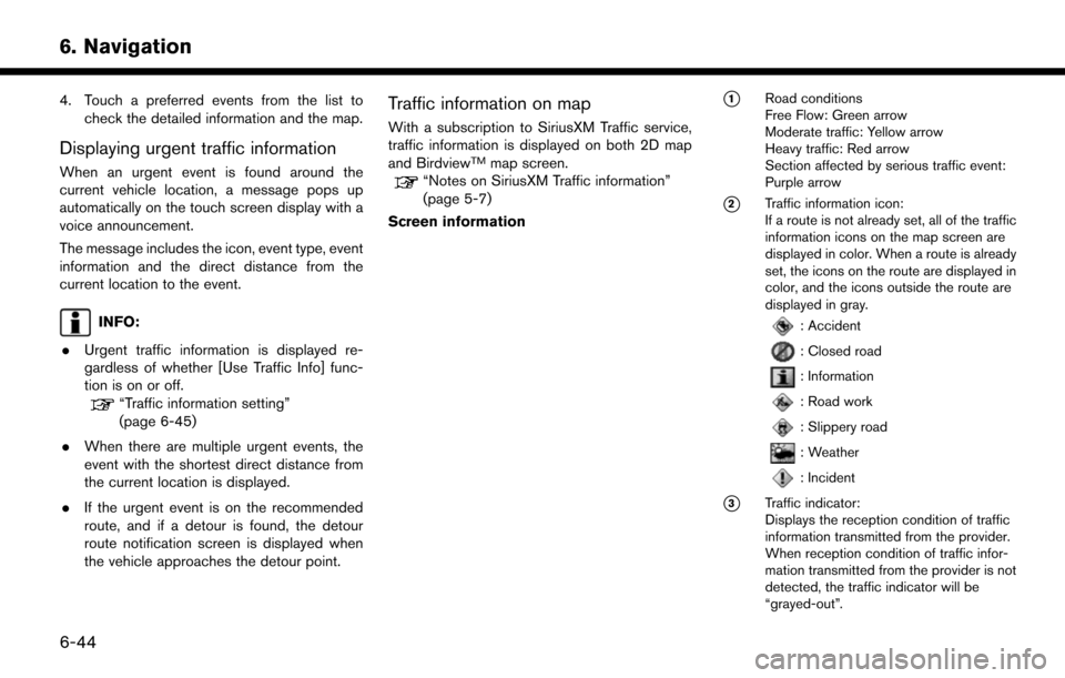
Screen information
*1Road conditions
Free Flow: Green arrow
Moderate traffic: Yellow arrow
Heavy traffic: Red arrow
Section affected by serious traffic event:
Purple arrow
*2Traffic information icon:
If a route is not already set, all of the traffic
information icons on the map screen are
displayed in color. When a route is already
set, the icons on the route are displayed in
color, and the icons outside the route are
displayed in gray.
: Accident
: Closed road
: Information
: Road work
: Slippery road
: Weather
: Incident
*3Traffic indicator:
Displays the reception condition of traffic
information transmitted from the provider.
When reception condition of traffic infor-
mation transmitted from the provider is not
detected, the traffic indicator will be
“grayed-out”.
6-44
Page 144 of 203
6. Navigation
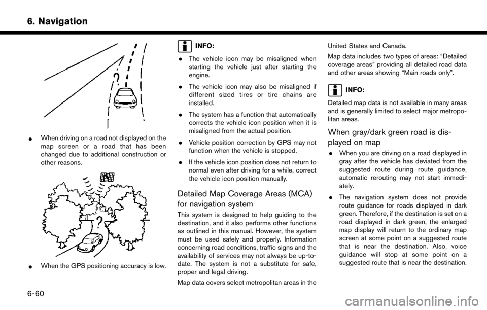
*When driving on a road not displayed on the
map screen or a road that has been
changed due to additional construction or
other reasons.
*When the GPS positioning accuracy is low.
INFO:
. The vehicle icon may be misaligned when
starting the vehicle just after starting the
engine.
. The vehicle icon may also be misaligned if
different sized tires or tire chains are
installed.
. The system has a function that automatically
corrects the vehicle icon position when it is
misaligned from the actual position.
. Vehicle position correction by GPS may not
function when the vehicle is stopped.
. If the vehicle icon position does not return to
normal even after driving for a while, correct
the vehicle icon position manually.
Detailed Map Coverage Areas (MCA)
for navigation system
This system is designed to help guiding to the
destination, and it also performs other functions
as outlined in this manual. However, the system
must be used safely and properly. Information
concerning road conditions, traffic signs and the
availability of services may not always be up-to-
date. The system is not a substitute for safe,
proper and legal driving.
Map data covers select metropolitan areas in the United States and Canada.
Map data includes two types of areas: “Detailed
coverage areas” providing all detailed road data
and other areas showing “Main roads only”.
INFO:
Detailed map data is not available in many areas
and is generally limited to select major metropo-
litan areas.
When gray/dark green road is dis-
played on map
. When you are driving on a road displayed in
gray after the vehicle has deviated from the
suggested route during route guidance,
automatic rerouting may not start immedi-
ately.
. The navigation system does not provide
route guidance for roads displayed in dark
green. Therefore, if the destination is set on a
road displayed in dark green, the enlarged
map display will return to the ordinary map
screen at some point on a suggested route
that is near the destination. Also, voice
guidance will stop at some point on a
suggested route that is near the destination.
6-60
Page 146 of 203
6. Navigation
— If you calculate a route on a main road, thestarting point of the route may not exactly
match the current vehicle location.
— The endpoint of the route may not exactly match the destination.
— If you calculate a route on a main road, the system may display a route from another
main road. This may be because the
position of the vehicle icon is not accu-
rate. In this case, park the vehicle in a safe
location and reset the vehicle icon, or
continue driving to see if the position of
the vehicle icon is automatically adjusted
before recalculating the route.
— There are cases in which the system shows an indirect route to reach the
destination or waypoints, if you set them
from stored or facility information. In order
to correct this, you must be careful about
the traffic direction, especially when lanes
with different travel directions are shown
separately, such as interchanges and
service areas.
— This system makes no distinction be- tween limited traffic control and total
control (blockage) . It may show an
indirect route even if the road is usable. — Even if the ferry preference is set to OFF, a
route that uses a ferry line may be
suggested.
ROUTE GUIDANCE
INFO:
The system will only announce street names
when the system language is set to English.
Street names are not announced when the
system is set to French/Spanish.
Repeating voice guidance
This function is available throughout route
guidance, from the time after the route calcula-
tion is completed until the vehicle arrives at the
destination. Push and hold the
Page 148 of 203
6. Navigation
How to order map data updates
Visit NissanNavigation.com or contact the
NISSAN NAVIGATION SYSTEM HELPDESK
to order updated map data (See the contact
information on the inside front cover of this
manual) .
About map data
1. This map data has been prepared byCLARION CO., LTD. (CLARION) , under
license from HERE. has added, processed
and digitized data based on the digital road
map data of HERE. Due to the production
timing of the map data, some new roads may
not be included in this map data or some of
the names or roads may be different from
those at the time you use this map data.
2. Traffic control and regulation data used in this map data may be different from those at
the time you use this map data due to the
data production timing. When driving your
vehicle, follow the actual traffic control signs
and notices on the roads.
3. Reproducing or copying this map software is strictly prohibited by law.
Published by Nissan North America, Inc.
*
C2012 HERE. All Rights Reserved.
*
CZENRIN CO., LTD.2013. All rights reserved. Certain business data provided by Infogroup
*
C
2012, All Rights Reserved.
WARNING
.This navigation system should not be
used as a substitute for your own
judgement. Any route suggestions
made by this navigation system may
never override any local traffic reg-
ulations, your own judgement, and/
or knowledge of safe driving prac-
tices. Disregard route suggestions by
the navigation system if such sugges-
tions would: cause you to perform an
hazardous or illegal maneuver, place
you in an hazardous situation, or
route you into an area you consider
unsafe.
. The advice provided by the naviga-
tion system is to be regarded only as
a suggestion. There may be situa-
tions where the navigation system
displays the vehicle’s location incor-
rectly, fails to suggest the shortest
course, and/or fails to direct you to
your desired destination. In such
situations, rely on your own driving
judgement, talking into account cur-
rent driving conditions. .
Do not use the navigation system to
route you to emergency services. The
database does not contain a com-
plete listing of locations of emer-
gency service providers such as
police, fire stations, hospitals and
clinics. Please use your judgement
and your ability to ask for directions
in these situations.
. As the driver you solely are respon-
sible for your driving safety.
— In order to avoid traffic accidents, do not operate the system while
driving.
— In order to avoid traffic accidents, operate the system only when the
vehicle is stopped at a safe place
and the parking brake is set.
— In order to avoid traffic accidents or traffic offence, remember that
actual road conditions and traffic
regulations take precedence over
the information contained on the
navigation system.
— Accordingly, the Software may contain inaccurate or incomplete
information due the passage of
time, changing circumstances, and
6-64
Page 149 of 203
due to the nature of the sources
used. Please observe the actual
traffic circumstances and regula-
tions at all times while driving.
— In a situation when actual road conditions and traffic regulations
differ from the information con-
tained on the navigation system,
then abide by traffic rules.
— The navigation system does not provide, or account for in any way,
information regarding traffic and
road laws; speed restrictions; road
conditions including road slope,
grade, and/or surface conditions;
obstruction information including
bridge and tunnel height and
width, and/or other prevailing driv-
ing and/or road conditions. Always
rely on your own driving judgment,
taking into account current driving
conditions.
— Minimize the amount of time spent viewing the screen while driving.
The marks of companies displayed by this
product to indicate business locations are
the marks of their respective owners. The use of such marks in this product does not imply
any sponsorship, approval, or endorsement
by such companies of this product.
End-user terms
The data (“Data”) is provided for your personal,
internal use only and not for resale. It is protected
by copyright, and is subject to the following
terms and conditions which are agreed to by you,
on the one hand, and CLARION CO., LTD.
(“CLARION”) and its licensors (including their
licensors and suppliers) on the other hand.
*
C2012 HERE. All rights reserved.
This data includes information taken with permis-
sion from Canadian authorities, including *
CHer
Majesty, *CQueen’s Printer for Ontario, *C
Canada Post, GeoBase�Š,*CDepartment of
Natural Resources Canada. All rights reserved.
HERE holds a non-exclusive license from the
United States Postal Service
�Što publish and sell
ZIP+4�Šinformation.
*
CUnited States Postal Service�Š2012. Prices
are not established, controlled or approved by
the United States Postal Service
�Š. The following
trademarks and registrations are owned by the
USPS: United States Postal Service, USPS, and
ZIP+4. Terms and conditions:
Personal Use Only.
You agree to use this Data
together with Nissan Automotive Products for
the solely personal, non-commercial purposes
for which you were licensed, and not for service
bureau, time-sharing or other similar purposes.
Accordingly, but subject to the restrictions set
forth in the following paragraphs, you agree not
to otherwise reproduce, copy, modify, decom-
pile, disassemble or reverse engineer any portion
of this Data, and may not transfer or distribute it
in any form, for any purpose, except to the extent
permitted by mandatory laws. Multi-disc sets
may only be transferred or sold as a complete set
as provided by CLARION and not as a subset
thereof.
Restrictions.Except where you have been
specifically licensed to do so by CLARION, and
without limiting the preceding paragraph, you
may not (a) use this Data with any products,
systems, or applications installed or otherwise
connected to or in communication with vehicles,
capable of vehicle navigation, positioning, dis-
patch, real time route guidance, fleet manage-
ment or similar applications; or (b) with or in
communication with any positioning devices or
any mobile or wireless-connected electronic or
computer devices, including without limitation
cellular phones, palmtop and handheld compu-
6. Navigation
6-65
Page 164 of 203
7. Voice recognition
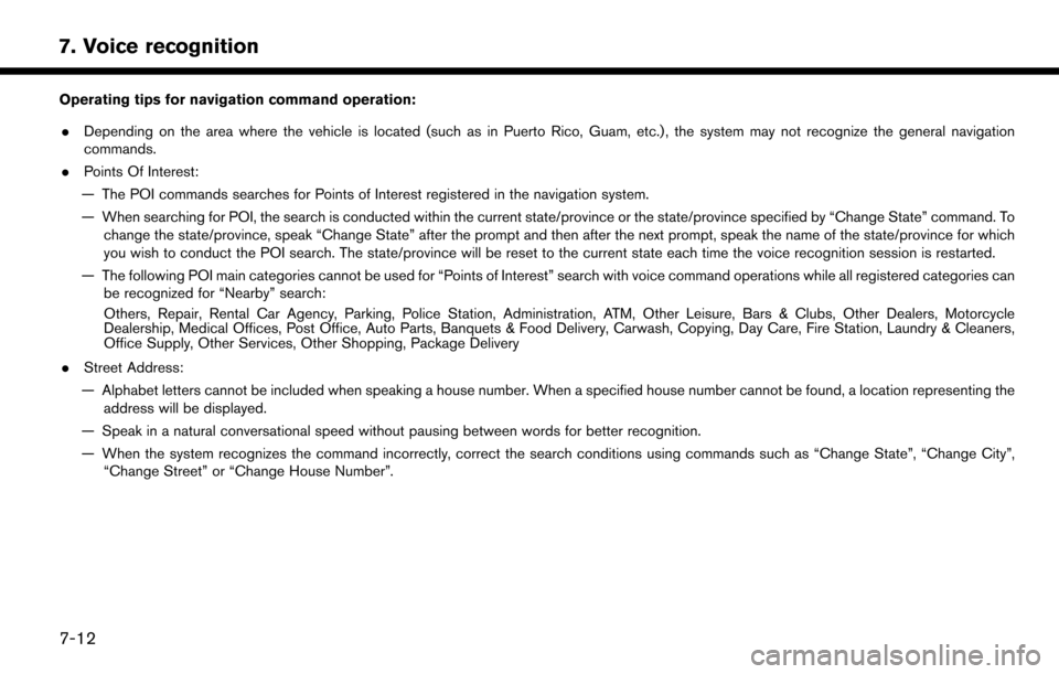
Operating tips for navigation command operation:. Depending on the area where the vehicle is located (such as in Puerto Rico, Guam, etc.) , the system may not recognize the general navigation
commands.
. Points Of Interest:
— The POI commands searches for Points of Interest registered in the navigation system.
— When searching for POI, the search is conducted within the current state/province or the state/province specified by “Change State” command. To change the state/province, speak “Change State” after the prompt and then after the next prompt, speak the name of the state/province for which
you wish to conduct the POI search. The state/province will be reset to the current state each time the voice recognition session is restarted.
— The following POI main categories cannot be used for “Points of Interest” search with voice command operations while all registered categories can be recognized for “Nearby” search:
Others, Repair, Rental Car Agency, Parking, Police Station, Administration, ATM, Other Leisure, Bars & Clubs, Other Dealers, Motorcycle
Dealership, Medical Offices, Post Office, Auto Parts, Banquets & Food Delivery, Carwash, Copying, Day Care, Fire Station, Laundry & Cleaners,
Office Supply, Other Services, Other Shopping, Package Delivery
. Street Address:
— Alphabet letters cannot be included when speaking a house number. When a specified house number cannot be found, a location representing the address will be displayed.
— Speak in a natural conversational speed without pausing between words for better recognition.
— When the system recognizes the command incorrectly, correct the search conditions using commands such as “Change State”, “Change City”, “Change Street” or “Change House Number”.
7-12