NISSAN QUEST 2006 V42 / 3.G Navigation Manual
QUEST 2006 V42 / 3.G
NISSAN
NISSAN
https://www.carmanualsonline.info/img/5/699/w960_699-0.png
NISSAN QUEST 2006 V42 / 3.G Navigation Manual
Trending: warning light, sensor, lights, buttons, parking brake, length, language
Page 51 of 272
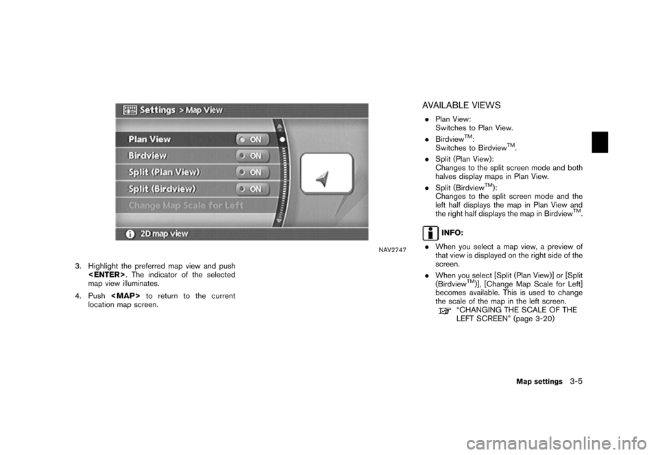
NAV2747
3. Highlight the preferred map view and push . The indicator of the selected
map view illuminates.
4. Push
Page 52 of 272
NAV2748
Split (Plan View)
NAV2749
Split (Birdview
TM)
NAV2750
INFO:
You can also set the map view using the
following procedure.
1) Push .
2) Highlight [Navigation] and push
.
3) Highlight [Map View] and push .
3-6
Map settings
Page 53 of 272
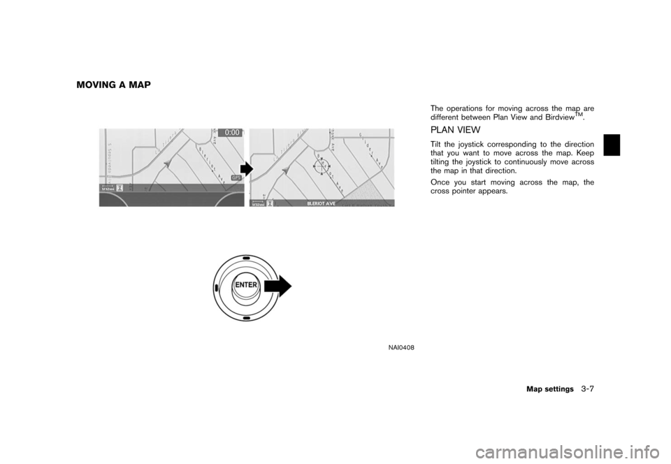
NAI0408
The operations for moving across the map are
different between Plan View and Birdview
TM.
PLAN VIEWTilt the joystick corresponding to the direction
that you want to move across the map. Keep
tilting the joystick to continuously move across
the map in that direction.
Once you start moving across the map, the
cross pointer appears.
MOVING A MAP
Map settings
3-7
Page 54 of 272
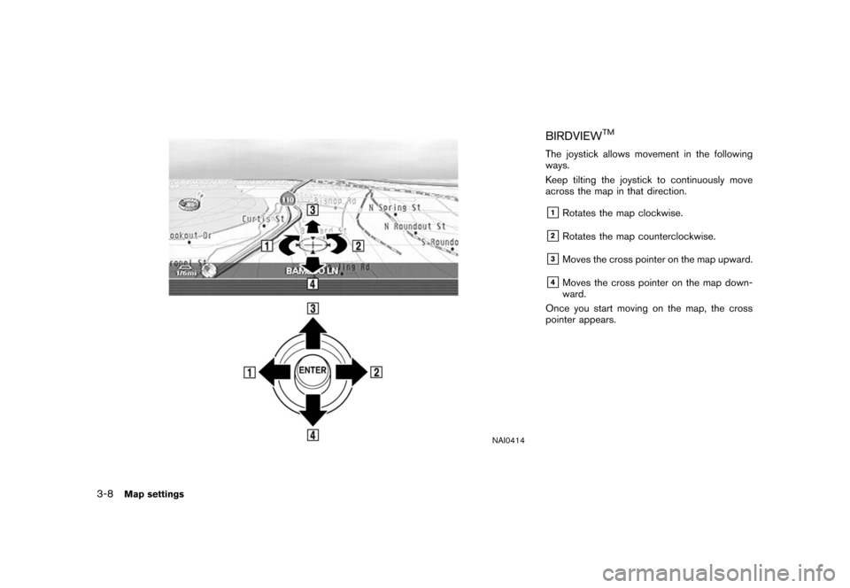
NAI0414
BIRDVIEW
TM
The joystick allows movement in the following
ways.
Keep tilting the joystick to continuously move
across the map in that direction.&1Rotates the map clockwise.
&2Rotates the map counterclockwise.
&3Moves the cross pointer on the map upward.
&4Moves the cross pointer on the map down-
ward.
Once you start moving on the map, the cross
pointer appears.
3-8
Map settings
Page 55 of 272
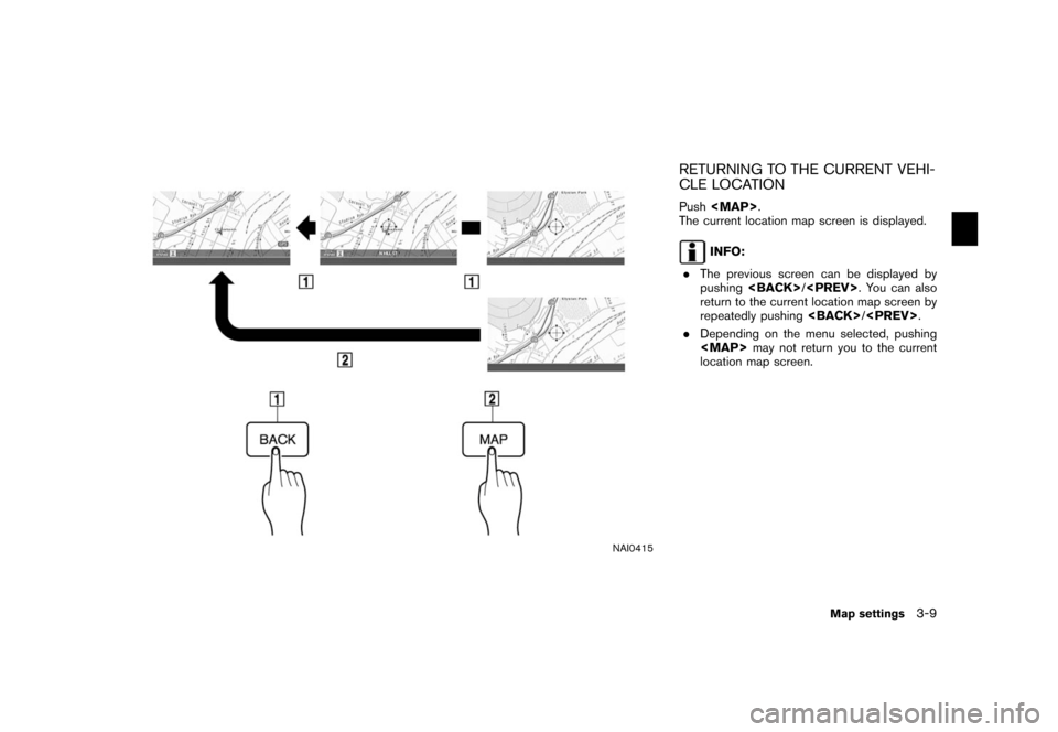
NAI0415
RETURNING TO THE CURRENT VEHI-
CLE LOCATIONPush
Page 56 of 272
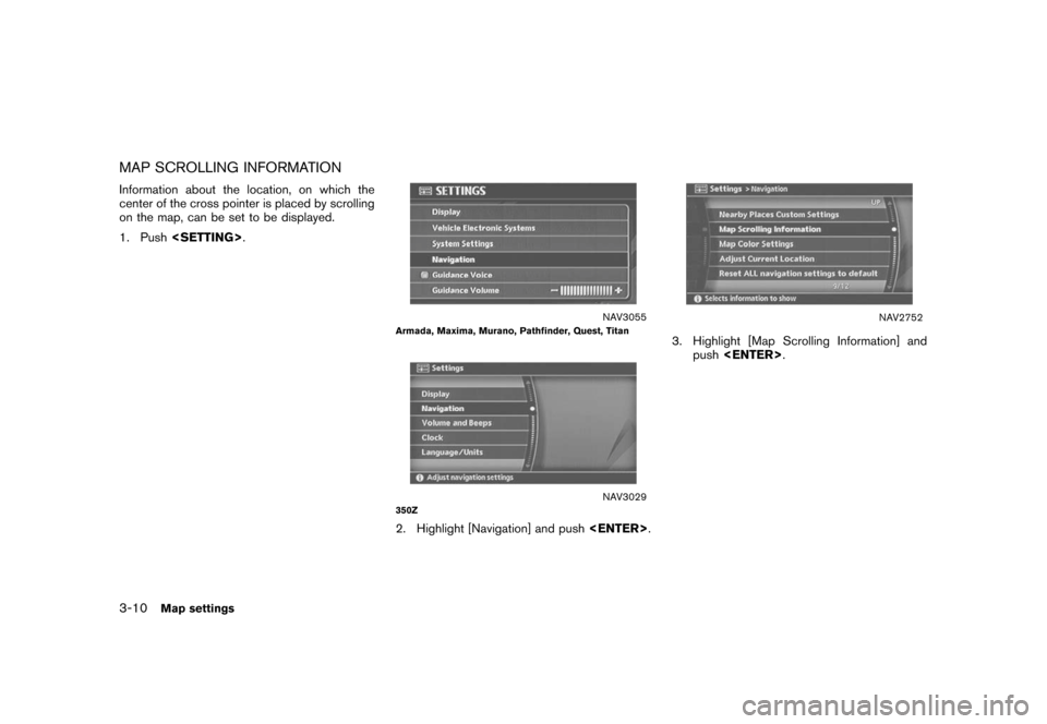
MAP SCROLLING INFORMATIONInformation about the location, on which the
center of the cross pointer is placed by scrolling
on the map, can be set to be displayed.
1. Push .
NAV3055
Armada, Maxima, Murano, Pathfinder, Quest, Titan
NAV3029
350Z2. Highlight [Navigation] and push
.
NAV2752
3. Highlight [Map Scrolling Information] and
push .
3-10
Map settings
Page 57 of 272
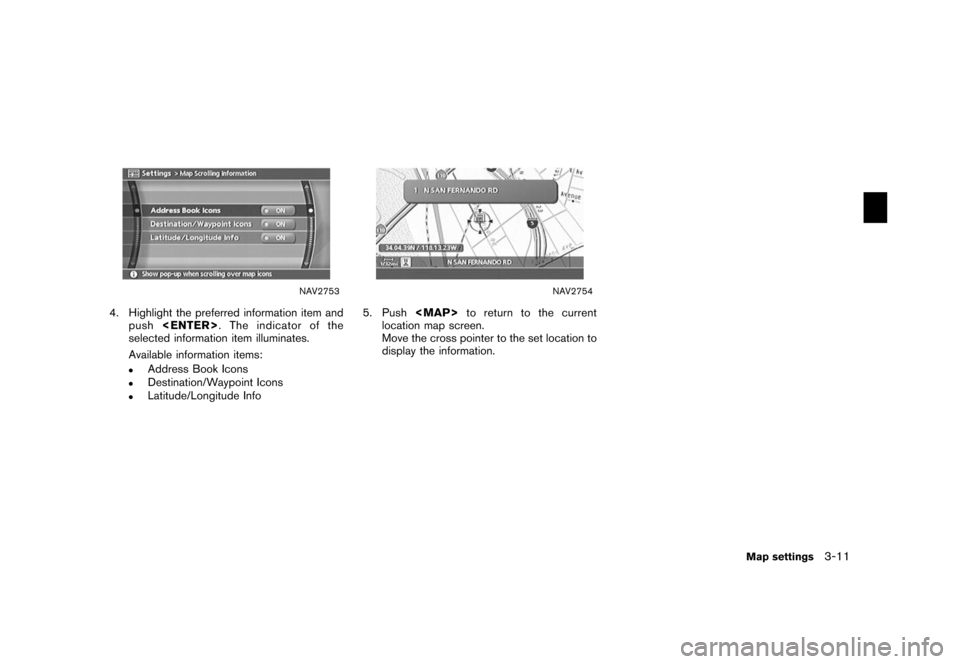
NAV2753
4. Highlight the preferred information item andpush . The indicator of the
selected information item illuminates.
Available information items:
.
Address Book Icons
.
Destination/Waypoint Icons
.
Latitude/Longitude Info
NAV2754
5. Push to return to the current
location map screen.
Move the cross pointer to the set location to
display the information.
Map settings
3-11
Page 58 of 272
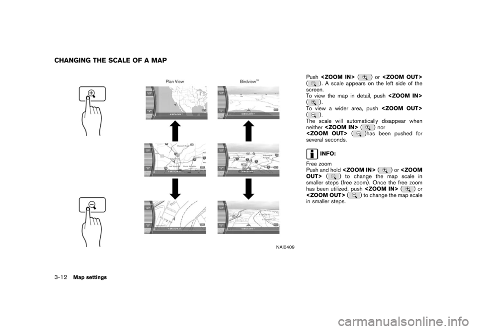
NAI0409
Push (
)or
(
) . A scale appears on the left side of the
screen.
To view the map in detail, push
().
To view a wider area, push
().
The scale will automatically disappear when
neither (
) nor
(
)has been pushed for
several seconds.
INFO:
Free zoom
Push and hold (
)or
OUT> (
) to change the map scale in
smaller steps (free zoom) . Once the free zoom
has been utilized, push (
)or
(
) to change the map scale
in smaller steps.
CHANGING THE SCALE OF A MAP3-12
Map settings
Page 59 of 272
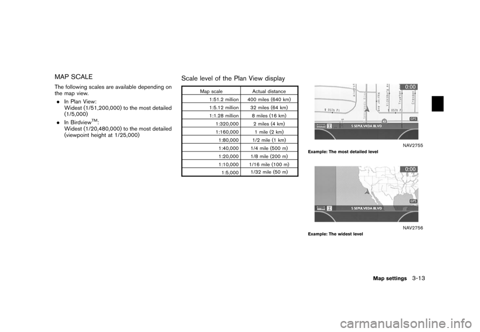
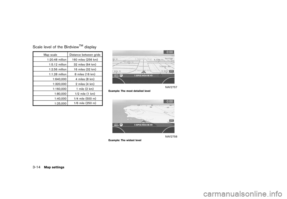
MAP SCALEThe following scales are available depending on
the map view.. In Plan View:
Widest (1/51,200,000) to the most detailed
(1/5,000)
. In Birdview
TM:
Widest (1/20,480,000) to the most detailed
(viewpoint height at 1/25,000)
Scale level of the Plan View display
Map scale Actual distance
1:51.2 million 400 miles (640 km)
1:5.12 million 32 miles (64 km)
1:1.28 million 8 miles (16 km) 1:320,000 2 miles (4 km)
1:160,000 1 mile (2 km)1:80,000 1/2 mile (1 km)
1:40,000 1/4 mile (500 m)
1:20,000 1/8 mile (200 m)
1:10,000 1/16 mile (100 m)
1:5,000 1/32 mile (50 m)
NAV2755
Example: The most detailed level
NAV2756
Example: The widest level
Map settings
3-13
Page 60 of 272
Scale level of the Birdview
TM
display
Map scale Distance between grids1:20.48 million 160 miles (256 km)1:5.12 million 32 miles (64 km)
1:2.56 million 16 miles (32 km)
1:1.28 million 8 miles (16 km) 1:640,000 4 miles (8 km)
1:320,000 2 miles (4 km)
1:160,000 1 mile (2 km)1:80,000 1/2 mile (1 km)
1:40,000 1/4 mile (500 m)
1:25,000 1/6 mile (250 m)
NAV2757
Example: The most detailed level
NAV2758
Example: The widest level
3-14
Map settings
Trending: instrument panel, ECU, service reset, light, sport mode, heater, change time
![NISSAN QUEST 2006 V42 / 3.G Navigation Manual
NAV2748
Split (Plan View)
NAV2749
Split (Birdview
TM)
NAV2750
INFO:
You can also set the map view using the
following procedure.
1) Push <SETTING> .
2) Highlight [Navigation] and push <ENTER>
.
3) Hi NISSAN QUEST 2006 V42 / 3.G Navigation Manual
NAV2748
Split (Plan View)
NAV2749
Split (Birdview
TM)
NAV2750
INFO:
You can also set the map view using the
following procedure.
1) Push <SETTING> .
2) Highlight [Navigation] and push <ENTER>
.
3) Hi](/img/5/699/w960_699-51.png)


