display Seat Leon 5D 2007 RADIO-NAVIGATION MFD2
[x] Cancel search | Manufacturer: SEAT, Model Year: 2007, Model line: Leon 5D, Model: Seat Leon 5D 2007Pages: 63, PDF Size: 2.89 MB
Page 33 of 63
Navigation
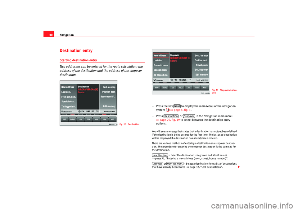
30Destination entryStarting destination entry
Two addresses can be entered for the route calculation; the
address of the destination and the address of the stopover
destination.
– Press the key to display the main Menu of the navigation
system ⇒page 4, fig. 1 .
– Press or in the Navigation main menu ⇒page 29, fig. 19 to select between the destination entry
options. You will see a message that states that a destination has not yet been defined
if the destination is being entered for the first time. The last used destination
will be displayed if a destination has already been entered.
There are various methods of entering a destination or a stopover destina-
tion. The procedure for entering the stopover destination is the same as for
the destination.
– Enter the destination using town and street names
⇒ page 31, “Entering a new address (town, street, house number)”.
or – Select a destination from a list of destinations
that have already been stored ⇒page 32, “Last destinations”.
Fig. 20 Destination
Fig. 21 Stopover destina-
tion
NAVI
A13Destination
Stopover
New direction.Last dest.
From dst. mem.
MFD2 ingles Seite 30 Montag, 15. Mai 2006 9:19 09
Page 35 of 63
Navigation
32
– Enter the letters or numbers by turning and pressing the menu knob.
– A list of names or numbers is seen on the lower part of the screen. Press to go to the list.
– Select a name from the list by turning and pushing the menu knob. You can scroll through several pages of the list using the
scroll markers , , and and confirm your selection by
pressing .
– Press to select a special destination close to the
destination address (town, street etc.) that you have already
entered. and mark characters and deleted characters.
will display language-specific characters as necessary.
The term “Town” is used regardless of how many people live there. Both a
village of 100 inhabitants and a city with 1 million are named as towns. A list
of names to choose from will appear for town names which are used more
than once. The system will automatically switch to street entry after town
entry and then to house number entry. The centre of the town will be offered
as a destination if the town is so small that none of the streets have been
digitally mapped.
The keys and will not be active if a town name has not
been entered.
Note
Enter an intersection and house number as described.
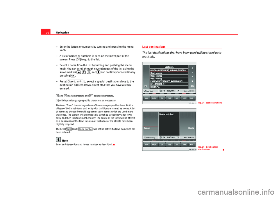
Last destinations
The last destinations that have been used will be stored auto-
matically.
OK
OK
Close to addr.
Street
House number
Fig. 24 Last destinationsFig. 25 Deleting last
destinations
MFD2 ingles Seite 32 Montag, 15. Mai 2006 9:19 09
Page 37 of 63
Navigation
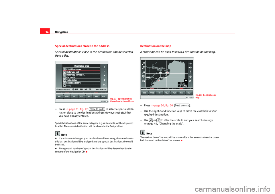
34Special destinations close to the address
Special destinations close to the destination can be selected
from a list.– Press ⇒page 31, fig. 22 to select a special desti-
nation close to the destination a ddress (town, street etc.) that
you have already entered.Special destinations of the same category, e.g. restaurants, will be displayed
in a list. The nearest destination will be shown in the first position.
Note
•
If you have not changed your destination address entry, the area close to
this last destination will be analysed and the special destinations there will
be listed.
•
The type and number of special destinations will be determined by the
content of the Navigation CD.
Destination on the map
A crosshair can be used to mark a destination on the map.–Press ⇒page 30, fig. 20 .
– Use the right-hand function keys to move the crosshair to your required destination.
– Use or to alter the scale to suit your search strategy ⇒page 45, “Changing the scale”.
NoteThe next section of the map will be shown after a few seconds when the cross-
hair is moved to the side of the screen.
Fig. 27 Special destina-
tions close to the address
Close to addr.
Fig. 28 Destination on
map
Dest. on map
MFD2 ingles Seite 34 Montag, 15. Mai 2006 9:19 09
Page 44 of 63
Navigation41
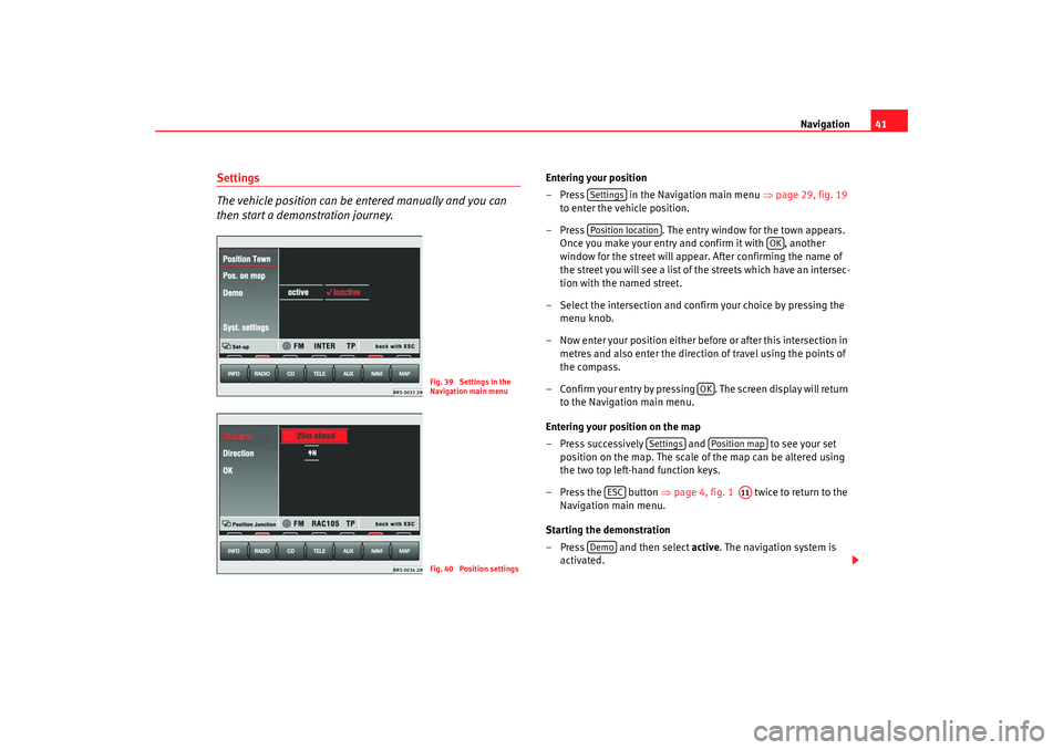
Settings
The vehicle position can be entered manually and you can
then start a demonstration journey.
Entering your position
– Press in the Navigation main menu ⇒page 29, fig. 19
to enter the vehicle position.
– Press . The entry window for the town appears.
Once you make your entry and confirm it with , another
window for the street will appear. After confirming the name of
the street you will see a list of the streets which have an intersec-
tion with the named street.
– Select the intersection and confirm your choice by pressing the menu knob.
– Now enter your position either before or after this intersection in metres and also enter the directio n of travel using the points of
the compass.
– Confirm your entry by pressing . The screen display will return to the Navigation main menu.
Entering your position on the map
– Press successively and to see your set
position on the map. The scale of the map can be altered using
the two top left-hand function keys.
– Press the button ⇒page 4, fig. 1 twice to return to the
Navigation main menu.
Starting the demonstration
– Press and then select active. The navigation system is
activated.
Fig. 39 Settings in the
Navigation main menuFig. 40 Position settings
SettingsPosition location
OK
OK
Settings
Position map
ESC
A11
Demo
MFD2 ingles Seite 41 Montag, 15. Mai 2006 9:19 09
Page 45 of 63
Navigation
42
– The MFD2 radio navigation system will now travel along the route virtually from start to finish if the route guidance function is
started. You can listen to announcements and look at displays.The navigation system will need some time for an exact definition of your
position if you have transported your vehicle using the train or a ferry. Your
position can be entered manually if the automatic definition is not
successful.
The manual position input can be used to calculate a route between any two
points regardless of where the vehicle is actually located.Manually excluding stretches of the journey
Stretches of the journey ahead and/or parts of the route list
can be blocked manually.
Menu for blocking and traffic jams
– Press the traffic jam button ⇒page 4, fig. 1 if you want to
block a stretch of the route ahead.
Entering traffic jam information
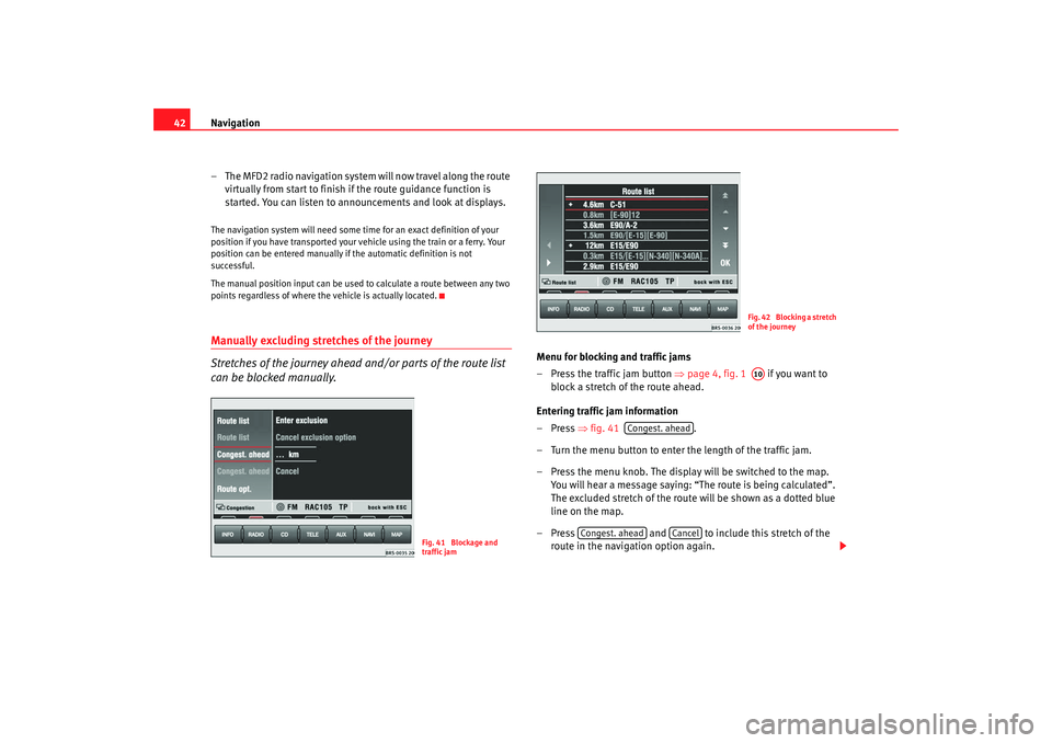
–Press ⇒fig. 41 .
– Turn the menu button to enter the length of the traffic jam.
– Press the menu knob. The display will be switched to the map. You will hear a message saying: “The route is being calculated”.
The excluded stretch of the route will be shown as a dotted blue
line on the map.
– Press and to include this stretch of the
route in the navigation option again.
Fig. 41 Blockage and
traffic jam
Fig. 42 Blocking a stretch
of the journeyA10
Congest. ahead
Congest. ahead
Cancel
MFD2 ingles Seite 42 Montag, 15. Mai 2006 9:19 09
Page 46 of 63
Navigation43
Blocking part of the route list
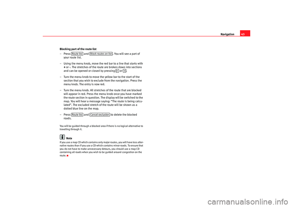
– Press and . You will see a part of
your route list.
– Using the menu knob, move the red bar to a line that starts with
+ or -. The stretches of the route are broken down into sections
and can be opened or closed by pressing or .
– Turn the menu knob to move the yellow bar to the start of the section that you wish to exclude from the navigation. Press the
menu knob. The entry is now red.
– Turn the menu knob. All stretches of the route that are blocked will appear in red. Press the menu knob once you have marked
the route section in question. The display will be switched to the
map. You will hear a message saying: “The route is being calcu-
lated”. The excluded stretch of the route will be shown as a
dotted blue line on the map.
– Press and to delete the blocked
roads.
You will be guided through a blocked area if there is no logical alternative to
travelling through it.
Note
If you use a map CD which contains only major routes, you will have less alter-
native routes than if you use a CD which contains minor roads. To ensure that
you do not have to make unnecessary detours, you should use a map CD
containing all roads when you wish to be guided around congestion on the
route.
Route list
Block routes on list
Route list
Cancel exclusion
MFD2 ingles Seite 43 Montag, 15. Mai 2006 9:19 09
Page 47 of 63
Navigation
44Map and symbol displaysInformation in the map and symbol displays
Information on the route will be shown in the map or symbol
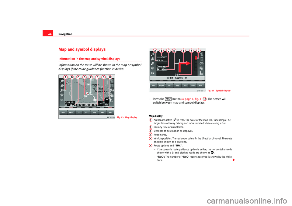
displays if the route guidance function is active.
– Press the button ⇒page 4, fig. 1 . The screen will
switch between map and symbol displays.Map display
Autozoom active (
in red). The scale of the map will, for example, be
larger for motorway driving and more detailed when making a turn.
Journey time or arrival time.
Distance to destination or stopover.
Road name.
Vehicle position. The red arrow points in the direction of travel. The route
ahead is shown as a blue line.
Route options and “ TMC”.
− If the dynamic route guidance option is active, the horizontal arrow is
shown with a D, and blocked roads are shown as
.
− “TMC ”: The number of “ TMC” reports received is shown by the white
dots.
Fig. 43 Map display
Fig. 44 Symbol display
MAP
A12
AAABACADAEAF
MFD2 ingles Seite 44 Montag, 15. Mai 2006 9:19 09
Page 48 of 63
Navigation45
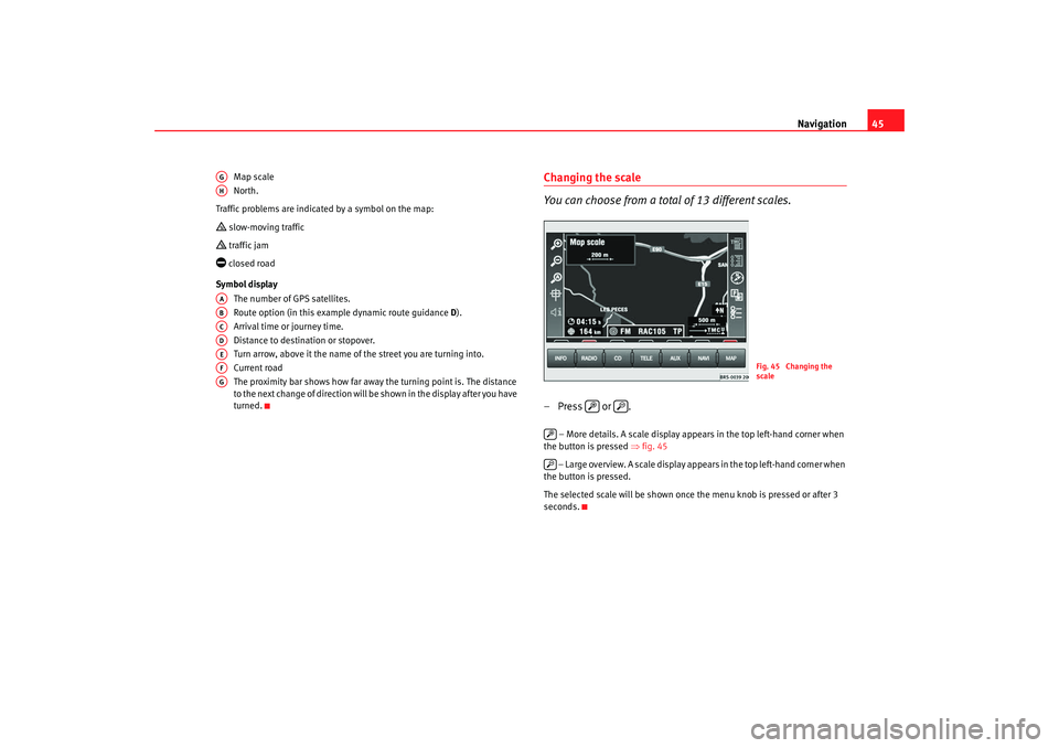
Map scale
North.
Traffic problems are indicated by a symbol on the map:
slow-moving traffic traffic jam closed road
Symbol display The number of GPS satellites.
Route option (in this example dynamic route guidance D).
Arrival time or journey time.
Distance to destination or stopover.
Turn arrow, above it the name of the street you are turning into.
Current road
The proximity bar shows how far away the turning point is. The distance
to the next change of direction will be shown in the display after you have
turned.
Changing the scale
You can choose from a total of 13 different scales.– Press or .
– More details. A scale display appears in the top left-hand corner when
the button is pressed ⇒fig. 45
– Large overview. A scale display appears in the top left-hand corner when
the button is pressed.
The selected scale will be shown once the menu knob is pressed or after 3
seconds.
AGAHAAABACADAEAFAG
Fig. 45 Changing the
scale
MFD2 ingles Seite 45 Montag, 15. Mai 2006 9:19 09
Page 49 of 63
Navigation
46Changing display options
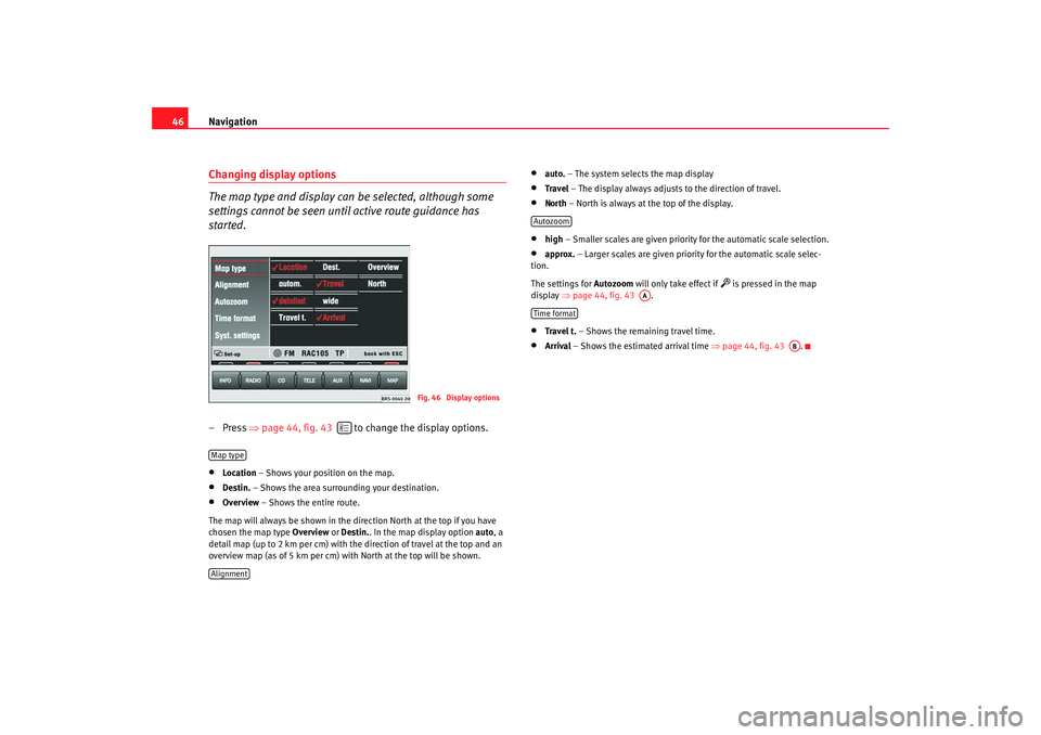
The map type and display can be selected, although some
settings cannot be seen until active route guidance has
started.– Press ⇒page 44, fig. 43 to change the display options.•
Location – Shows your position on the map.
•
Destin. – Shows the area surrounding your destination.
•
Overview – Shows the entire route.
The map will always be shown in the direction North at the top if you have
chosen the map type Overview or Destin. . In the map display option auto, a
detail map (up to 2 km per cm) with the direction of travel at the top and an
overview map (as of 5 km per cm) with North at the top will be shown.
•
auto. – The system selects the map display
•
Travel – The display always adjusts to the direction of travel.
• North – North is always at the top of the display.•
high – Smaller scales are given priority for the automatic scale selection.
•
approx. – Larger scales are given priority for the automatic scale selec-
tion.
The settings for Autozoom will only take effect if
is pressed in the map
display ⇒page 44, fig. 43 .
•
Travel t. – Shows the remaining travel time.
•
Arrival – Shows the estimated arrival time ⇒page 44, fig. 43 .
Fig. 46 Display options
Map typeAlignment
Autozoom
AA
Time format
AB
MFD2 ingles Seite 46 Montag, 15. Mai 2006 9:19 09
Page 50 of 63
Navigation47
Traffic reports display
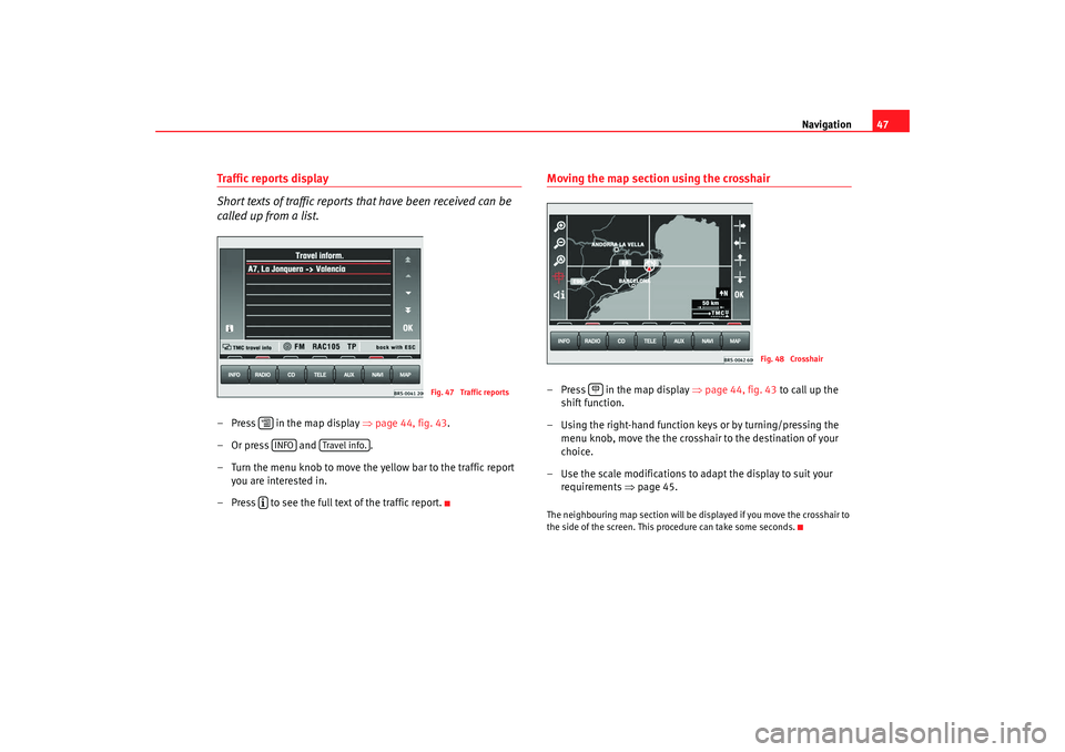
Short texts of traffic reports that have been received can be
called up from a list.–Press in the map display ⇒page 44, fig. 43 .
–Or press and .
– Turn the menu knob to move the yellow bar to the traffic report you are interested in.
– Press to see the full text of the traffic report.
Moving the map section using the crosshair– Press in the map display ⇒page 44, fig. 43 to call up the
shift function.
– Using the right-hand function keys or by turning/pressing the menu knob, move the the crosshair to the destination of your
choice.
– Use the scale modifications to adapt the display to suit your requirements ⇒page 45.The neighbouring map section will be displayed if you move the crosshair to
the side of the screen. This procedure can take some seconds.
Fig. 47 Traffic reports
INFO
Travel info.
Fig. 48 Crosshair
MFD2 ingles Seite 47 Montag, 15. Mai 2006 9:19 09