navigation system SKODA FABIA 2007 1.G / 6Y Sat Compass Navigation System Manual
[x] Cancel search | Manufacturer: SKODA, Model Year: 2007, Model line: FABIA, Model: SKODA FABIA 2007 1.G / 6YPages: 43, PDF Size: 2.92 MB
Page 14 of 43
General comments13
“TA”
Here you can set if your na vigation system should repl ay incoming traffic informa-
tion.
•“ ON ” - all incoming traffic information is replayed. If TA is switched on, only TP
stations can be set.
•“ OFF ” - Traffic information is not replayed.
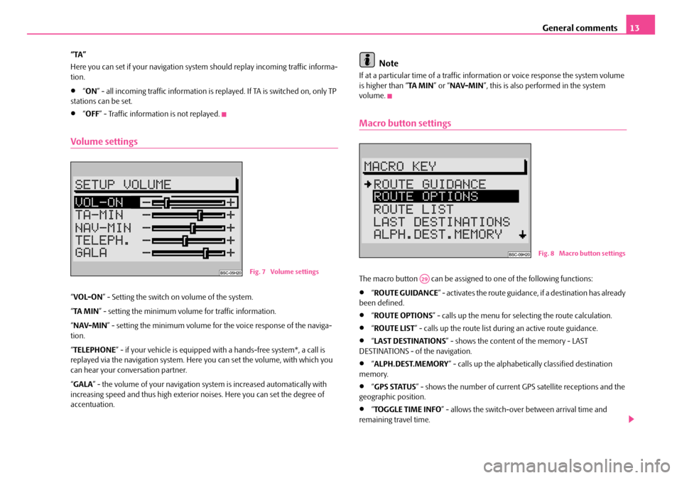
Volume settings
“VOL-ON ” - Setting the switch on volume of the system.
“ TA MI N ” - setting the minimum volume for traffic information.
“ NAV-MIN ” - setting the minimum volume for the voice response of the naviga-
tion.
“ TELEPHONE ” - if your vehicle is equipped with a hands-fr ee system*, a call is
replayed via the navigation system. Here you can set the volume, with which you
can hear your conv ersation partner.
“ GALA ” - the volume of your navigation sy stem is increased automatically with
increasing speed and thus high exterior noises. Here you can set the degree of
accentuation.
Note
If at a particular time of a traffic information or voice response the system volume
is higher than “ TA MIN” or “NAV-MIN ”, this is also performed in the system
volume.
Macro button settings
The macro button can be assigned to one of the following functions:
•“ ROUTE GUIDANCE ” - activates the route guidance, if a destination has already
been defined.
•“ ROUTE OPTIONS ” - calls up the menu for se lecting the route calculation.
•“ROUTE LIST ” - calls up the route list during an active route guidance.
•“LAST DESTINATIONS ” - shows the content of the memory - LAST
DESTINATIONS - of the navigation.
•“ ALPH.DEST.MEMORY ” - calls up the alphabetica lly classified destination
memory.
•“ GPS STATUS ” - shows the number of current GPS satellite receptions and the
geographic position.
•“ TOGGLE TIME INFO ” - allows the switch-over between arrival time and
remaining travel time.
Fig. 7 Volume settings
Fig. 8 Macro button settings
A29
s2ck.7.book Page 13 Friday, April 20, 2007 12:38 PM
Page 15 of 43
General comments
14
•“ SHOW LOCATION ” - the route guidance is performed under the information
of all directions, where the destination is located and if necessary the name of the
driven road.
Note
When calling up the menu the selection marking is on the menu point “ ROUTE
GUIDANCE ”. The current assignment of the macro button is marked with an
arrow.
Time settings
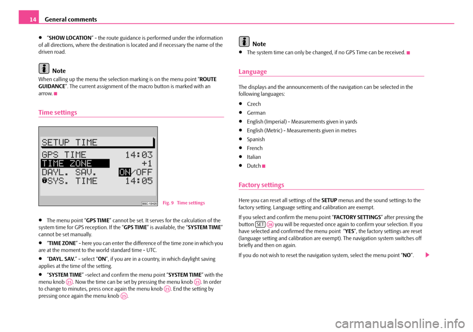
•The menu point “ GPS TIME” cannot be set. It serves for the calculation of the
system time for GPS reception. If the “ GPS TIME” is available, the “ SYSTEM TIME”
cannot be set manually.
•“ TIME ZONE ” - here you can enter the difference of the time zone in which you
are at the moment to the world standard time - UTC.
•“ DAYL. SAV. ” - select “ON”, if you are in a country, in which daylight saving
applies at the time of the setting.
•“ SYSTEM TIME ” -select and confirm the menu point “ SYSTEM TIME” with the
menu knob . Now the time can be set by pressing the menu knob . In order
to change to minutes, press once again the menu knob . End the setting by
pressing once again the menu knob .
Note
•The system time can only be changed, if no GPS Time can be received.
Language
The displays and the announcements of th e navigation can be selected in the
following languages:
•Czech
•German
•English (Imperial) - Measur ements given in yards
•English (Metric) - Measurements given in metres
•Spanish
•French
•Italian
•Dutch
Factory settings
Here you can reset all settings of the SETUP menus and the sound settings to the
factory setting. Language setting and calibration are exempt.
If you select and confirm the menu point “ FA C TO R Y S E T T I N G S” after pressing the
button you will be requested once ag ain to confirm your selection. If you
have selected and confirmed the menu point “YES ”, the factory settings are reset
(language setting and calibration are exempt). The navigation system switches off
briefly and then on again.
If you do not wish to reset the naviga tion system, select the menu point “NO”.Fig. 9 Time settings
A25A25A25A25
SETA28
s2ck.7.book Page 14 Friday, April 20, 2007 12:38 PM
Page 16 of 43
General comments15
Note
If the navigation CD is inserted there is the possibility beforehand to delete the
stored destinations. If you wish to delete the stored destinations, select the menu
point “ YES”, if not, select “ NO”.
Anti-theft protection
Anti-theft coding
The anti-theft coding of yo ur navigation system prevents an operation of the
system after a voltage interruption, e.g. during a vehicle repair or after theft.
After disconnecting the battery, after separa ting the navigation system from the on-
board voltage of the vehicle and after a de fective protection, the entry of the code
is required when operating.
In such cases “ SAFE” is shown in the display after switching on.
Caution
•This code number is affixed together wi th the unit number on the “Unit card”,
which is located behind the instructions.
•The “unit card” must be disconnected and stored outside the vehicle.
Note
The code is normally stored in the instrume nt cluster. Through this the navigation
system is automatically decoded (convenien ce coding). A manual entry of the code
is normally not necessary.
Code entry
The electronical lock is cancelled by entering the correct code. The order
of the following operating steps must be maintained: – Switch on the navigation system - after the start screen with the
display “ SAFE” the request for entry of the code number is displayed
after 2 seconds “ 1000” is shown on the display.
– Continue pressing the station selection button 1 until the first digit
of the code number is shown in the display.
– Insert the other digits of the code number by repetitively pressing the
station selection button 2, and/or 3 or 4 .
– If the entire code number was entered, press the menu knob or the button or the button for at least 2 seconds.
Entry of an incorrect code number
If inadvertently an incorrect code number was confirmed when entering, “ SAFE” is
shown again in the display. First of all flashing and then permanent. “ WRONG
TRIES: 1 ” is shown on the display.
Now the entire process can be repeated once again.
If the code number is entered incorrectly fo r the second time, the navigation system
will be blocked for approx. one hour. It is only possible to repeat the entry of the
code number after an hour has expired and while the navigation system is switched
on and the ignition key remains in the ignition lock.
If once again two non-valid attempts are undertaken, the navigation system will be
blocked again for an hour.
The cycle - two attempts, blocked for an hour - furthermore applies.
Note
Please do not hesitate to contact your Šk oda Service Partner should you have lost
the “unit card”.
A22
A22
A25
A1A14
s2ck.7.book Page 15 Friday, April 20, 2007 12:38 PM
Page 17 of 43
Audio
16
Audio
Radio mode
Radio mode with RDS
The function RDS is always active for the navigation system.
More and more USW broadcasting companies transmit RDS information in addi-
tion to the program. E.g the station name and the traffic status of the set station
belong to this information.
Alternative frequency AF
The function alternative frequency ensures that the best receivable frequency of
the selected station is automatically and precisely set.
The replay of the broadcast can be mu ted briefly during the search process
according to the best receivable frequency.
If no alternative freq uency of the set station can be found and the station no longer
offers a satisfactory quality, then please select another station.
TMC (Traffic Message Channel)
Certain radio stations transmit digital tr affic announcements in addition to their
programme. The announcements are received by your navigation system and used
for a dynamic route guidance ⇒page 29. If a station has TMC at its disposal, “ TMC”
is shown in the standard field - status range - of the display. These stations can be
stored on two memory levels TC1 and TC2.
RDS regional
Certain programs of the broadcasting companies are divided into regional
programs at specific times.
First of all the unit attempts to set only alternative frequencies of the selected
station.
If the quality is however so low, that there is a risk of a “program loss”, the navigation
system accepts also frequencies, which are “related” to the station. As this station emits temporarily different programs and due to such a change in frequency also
the programme from one of the “related” stations can be heard
⇒page 12.
Switch on radio mode
Press the button , or in order to switch on the
radio mode. After pressing the button the last set station, if receiveable, is
selected.
Note
If FM is changed to TMC or vice versa, th e set station is taken over in the selected
level.
Set and store station
Manual station tuning
– Press one of the buttons in orde r to manually tune a station. At
every press the frequency changes to fixed, defined steps upwards or
downward.
Automatic station tuning
– Press one of the buttons for a station finding, in a frequency range, upwards or downwards. The next or the previous station is automati-
cally set and selected.
– If you hold the button pressed, the station continues quickly to the
next station.
FMA2TMCA5AMA6
A1
A14
A14
s2ck.7.book Page 16 Friday, April 20, 2007 12:38 PM
Page 19 of 43
Audio
18
Deleting traffic information
– Trafffic information is automaticall y deleted six seconds after end of
readiness.
Ending TIM function
– Press again the button to end the TIM function.
Note
•The TIM function is automatically en ded after replaying all information.
•If the TIM function was called up from the menu “ ROUTE GUIDANCE”, it can be
shown again by pressing the button .
CD mode
Internal CD drive
Your navigation system gives you the possibility to play audio CDs in the
internal drive. In addition a CD changer * can be connected.
Inserting the CD
– Slide the CD with the written side fa c in g u p in t o t h e C D c a s e. I n s e r t th e
CD as far as possible until it can be drawn in automatically by the navi-
gation system.
– After the CD was drawn in, the navigation system automatically
switches over to CD play function . The play function begins, system
oriented after a few seconds with the first track of the CD.
–“ TRACK ” and the current track number are shown in the standard field
- foreground - of the display. Starting CD mode
– If a CD has already been inserted, press the button . The play
function begins at the point where it was last interrupted. If the CD is
ready to play, the play function starts from the beginning.
Note
•The CD mode in the internal drive is possible if an audio CD for the navigation
CD was inserted. If no navigation CD has been inserted, only a “ NO MAP” route
guidance is possible ⇒page 31.
•Do not make an attempt to insert the CD with force.
•If a CD changer * is connected, this one is selected first by pressing the button
.
CD functions (internal drive)
Select track
– For selecting a track, press the right or left button upwards or downwards.
Fast station finding (audible)
– Press the right or left button for a fast station finding upwards or downards.
Playing all tracks on a CD (SCAN)
– Press the button . All tracks on a CD are briefly played in
ascending order (10 seconds). “ SCAN” is shown in the standard field -
background - of the display.
– Press once again the button to interrupt this function.
Listening to all tracks of a CD in the random sequence
– Press the button .
TIMA3
TIMA3
CDA10
CDA10
A1
A14
SCANA16
MIXA18
s2ck.7.book Page 18 Friday, April 20, 2007 12:38 PM
Page 32 of 43
Navigation31
Route guidance
Begin guidance
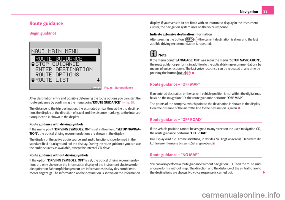
After destination entry and possible determing the route options you can start the
route guidance by confirming the menu point“ ROUTE GUIDANCE” ⇒ fig. 28 .
The distance to the trip destination, the estimated arrival time at the trip destina-
tion, the display of the direction of travel and the distance markings to the intersec-
tion/junction is shown in the display.
Route guidance with driving symbols
If the menu point “ DRIVING SYMBOLS: ON ” is set in the menu “SETUP NAVIGA-
TION ”, the optical driving recommendations are shown in the display.
The display of the active audio source and audio functions is performed in the
standard field - background - of the displa y. During the route guidance you can use
the audio sources as available, except the internal CD drive.
Route guidance without driving symbols
If the option “ DRiVING SYMBOLS: OFF” is set, the optical driving recommenda-
tions are only shown on the information display of the instrument clusterwerden
die optischen Fahrempfehl ungen nur am Informations display des Kombiinstru-
ments angezeigt. The information on the destination is shown on the information display. If your vehicle ist not fitted with an informatio display in the instrument
cluster, the navigation system uses on the voice response.
Indicate extensive destination information
After pressing the button the curr
ent destination is show and the last
audible driving recommendation is repeated.
Note
If the menu point “ LANGUAGE: ON” was set in the menu “ SETUP NAVIGATION”,
the route guidance performs in addition to the optical driving recommendations by
means of voice response. The last voice responce can be repeated at any time by
pressing the button .
Route guidance - “OFF MAP”
If an entered desination or the current vehicle position is not within the digital map
basis on the navgation CD, th e route guidance performs “OFF MAP”.
The points of the compass, which point to the destination is shown in the display.
Here the distance of the air traffi c line to the destination is given.
Route guidance - “OFF ROAD”
If the vehicle position cannot be assigned to any street on the used navigation CD,
the route guidance performs “ OFF ROAD”.
Im Display wird die Himmelsrichtung, in der das Ziel liegt, angezeigt. Dazu wird die
Luftlinienentfernung bis zum Ziel angegeben.
Route guidance - “NO MAP”
You can also perform a route guidance with out navigation CD. Then the route guid-
ance performs without map. The direction an d the distance of the air traffic line to
the destinations are shown. No voice response is carried out.
Fig. 28 Start guidance
INFOA17
INFOA17
s2ck.7.book Page 31 Friday, April 20, 2007 12:38 PM
Page 33 of 43
Navigation
32
This function is intended for large motoway drives, whereby as a rule less informa-
tion is required from the navigation system.
You will reach the “ NO MAP” route guidance, by removing the navigation CD from
the navigation system during the route guidance. After re-inserting the navigation
CD, the route guidance continues if the route guidance was previously active.
Note
•For technical reasons this can last several minutes, until the route guidance
continues audibly and with driving symbols after re-inserting the navigation CD.
This time is necessary in order to cl early determine the current location.
•In narrowly built-ip areas with dense road network this can lead to error
locating until the navigation system has clea rly and properly orientated itself. Insert
the navigation CD, if possib le, once again on the motorway, in order to accelerate
the orientation process.
Reached your destination
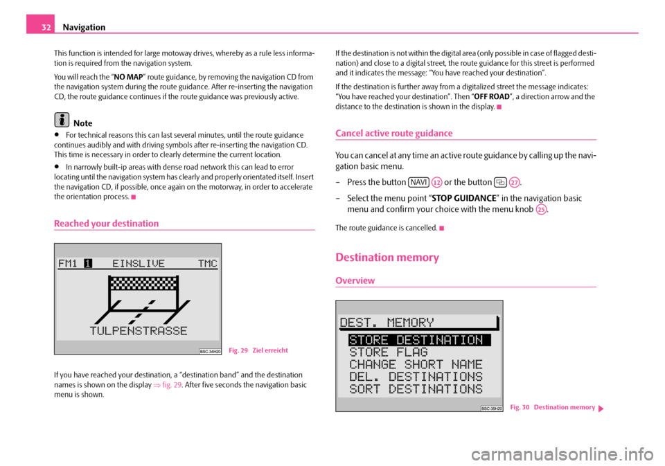
If you have reached your destination, a “destination band” and the destination
names is shown on the display ⇒fig. 29 . After five seconds the navigation basic
menu is shown. If the destination is not within the digital area (only possible in case of flagged desti-
nation) and close to a digital street, the ro
ute guidance for this street is performed
and it indicates the message: “You have reached your destination”.
If the destination is further away from a digitalized street the message indicates:
“You have reached your destination”. Then “ OFF ROAD”, a direction arrow and the
distance to the destination is shown in the display.
Cancel active route guidance
You can cancel at any time an active route guidance by calling up the navi-
gation basic menu.
– Press the button or the button .
– Select the menu point “ STOP GUIDANCE” in the navigation basic
menu and confirm your choice with the menu knob .
The route guidance is cancelled.
Destination memory
Overview
Fig. 29 Ziel erreicht
NAVIA12A27
A25
Fig. 30 Destination memory
s2ck.7.book Page 32 Friday, April 20, 2007 12:38 PM
Page 35 of 43
Navigation
34
Delete destinations
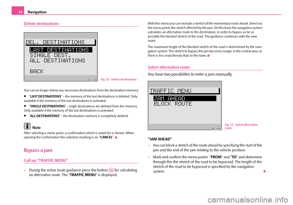
You can no longer delete any necessary destinations from the destination memory.
•“ LAST DESTINATIONS ” - the memory of the last destinations is deleted. Only
available if the memory of the last destinations is activated.
•“ SINGLE DESTINATIONS ” - single destinations are deleted from the memory.
Only available if the memory of the last destinations is activated.
•“ ALL DESTINATIONS ” - the destination memory is completely deleted.
Note
After selecting a menu point, a confirmati on which is asked for is shown. When
opening the confirmation the selection marking is on “ CANCEL”.
Bypass a jam
Call up “TRAFFIC MENU”
– During the active route guidance press the button for calculating
an alternative route. The “ TRAFFIC MENU” is displayed.
With this menu you can exclude a stretch of the momentary route ahead. Select via
the menu points the stretch affected by the jam. On this basis the navigation system
calculates an alternative route to the dest ination, in order to bypass as far as
possible the blocked stretch of the road . The guidance continues with the new
route.
The maximum length of the blocked stretch of the road is determined by the navi-
gation system. The stretch to bypass the jam becomes longer in the central area, as
there is less road density than in the town.
Select alternative route
You have two possibilites to enter a jam manually.
“JAM AHEAD”
– You can block a stretch of the route ahead by specifying the start of the jam and the end of the jam rela ting to the vehicle position.
– Mark and confirm the menu points “ FROM” and “TO” and determine
through this the stretch of the road to be bypassed. The length of the
stretch of the road to be bypassed is specified by the navigation
system.
Fig. 32 Delete destinations
A26
Fig. 33 Select alternative
route
s2ck.7.book Page 34 Friday, April 20, 2007 12:38 PM
Page 36 of 43
Navigation35
“BLOCK ROUTE”
– The route list is displayed. You can block individual roads.
– Mark and confirm with the menu kn ob the start and end point of
the stretch of the road to be bypassed. The blocked stretch of the road
is marked by a black bar in front of the route list.
Note
•There are not always alternative routes for the stretch of the route ahead.
•Blocked stretches of the road remain stored until the end of the drive.
•If the “ TRAFFIC MENU ” is used repetitively, the already blocked stretch of the
road is deleted and the new stretch of the road is stored in relation to the momen-
tary route.
•If there is an alternative route; the vo ice response performs:“Continue to follow
the route”.
Automatic tailback function
As an alternative to the manually blocked stretch with the “ TRAFFIC MENU”, a
convenient possibility to bypass a jam is available to you with TMC (T raffic Message
C hannel = traffic mess age channel) and the dynami c route guidance. With TMC
your navigation system receives from the TMC radio stations current, digital traffic
information, which is intended for the ro ute planning. Under the condition that the
TMC station was ⇒page 16 selected in radio mode and the dynamic route guid-
ance is activated ⇒page 29.
Note
For automatic tailback function the navigati on system always calculates a time opti-
mized route; i.e. if a tailback leads to detours, the navigation system can under
these circumstances guide through the tail back. This depends on the length and
type of the reported tailback and the length of the possible detour.
TOURLIST
Description
With the tourlist you have the possibility to combine several destinations to one
tour and then to call it up. This function is meaningful if you wish to visit e.g. the
sight of a city.
Travel guide
Description
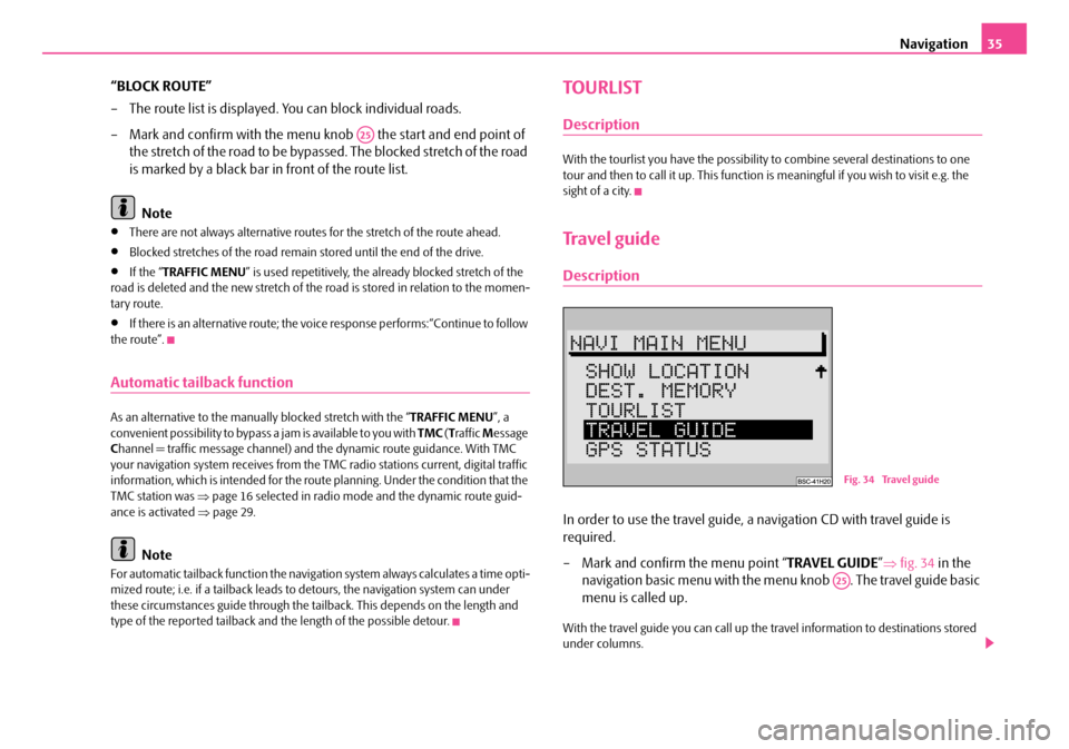
In order to use the travel guide, a navigation CD with travel guide is
required.
– Mark and confirm the menu point “ TRAVEL GUIDE”⇒ fig. 34 in the
navigation basic menu with the me nu knob . The travel guide basic
menu is called up.
With the travel guide you can call up the travel information to destinations stored
under columns.
A25
Fig. 34 Travel guide
A25
s2ck.7.book Page 35 Friday, April 20, 2007 12:38 PM
Page 38 of 43
Glossary37
Glossary
Description
ABS
Antilock Brake System ⇒page 5
AF
Alternative frequency ⇒page 16
AM
Amplitude modulation, middle waveband, MW ⇒ page 4, ⇒page 16, ⇒page 17,
⇒ page 17, ⇒page 19, ⇒page 19
AS
Auto-Store - automatically stores the stat ions with the strongest reception in the
selected waveband ⇒page 17
BALANCE
Volume ratio of left/right loudspeaker is adjusted ⇒page 19
CD
Compact Disc ⇒page 4, ⇒page 6, ⇒page 7, ⇒page 8, ⇒page 9, ⇒page 12,
⇒ page 14, ⇒page 18, ⇒page 18, ⇒page 19, ⇒page 22
EON
Enhanced Other Networks; traf fic information of other stations can also be trans-
mitted by the navigation system duri ng play function of an audio source
EON is a RDS function, which ensures that all traffic information of a broadcasting
company is transmitted in the TP mode ⇒page 8.
FA D E R
Volume ratio of front/rear loudspeaker is adjusted ⇒page 19 FM
Frequency modulation, ultra short waveband, USW
⇒page 4, ⇒page 8,
⇒ page 9, ⇒page 11, ⇒page 16, ⇒page 17, ⇒page 17, ⇒page 19, ⇒page 19
GALA
Speed dependent volume adaptation - ⇒page 13
GPS
Global Positioning System - global satellite locating system ⇒page 5
MENU
Menu ⇒page 4, ⇒page 11
MUTE
Mute switch ⇒page 4, ⇒page 8, ⇒page 16
NO MESSAGE
No news ⇒page 17
NO TMC
No Traffic Message Channel - no tr affic message channel is available ⇒ page 17
NO TP
No Traffic Program - no station with traffic information is available ⇒page 17
RDS
Radio Data System - Radio station data system, coded data transfer of USW station
⇒ page 12, ⇒page 12
SAFE
Secured ⇒page 6
SCAN
Brief playing of all stations with the strongest reception in the selected waveband
or all tracks on a CD ⇒page 4, ⇒page 9, ⇒page 18.
s2ck.7.book Page 37 Friday, April 20, 2007 12:38 PM