CD changer SKODA FABIA 2016 3.G / NJ Columbus Amundsen Bolero Infotainment System Navigation Manual
[x] Cancel search | Manufacturer: SKODA, Model Year: 2016, Model line: FABIA, Model: SKODA FABIA 2016 3.G / NJPages: 100, PDF Size: 12.8 MB
Page 73 of 100

A route destination
In the route plan, the following information is displayed at the destina-
tion » Fig. 75 -
.
Area with function surfaces
Destination information Estimated time of arrival at destination / remaining driving time to desti-
nation 1)
Remaining distance to the destination
Chosen route type (economic, fastest, shortest)
Current vehicle position (address / GPS coordinates)
The display of the arrival time or the remaining driving time can be adjusted as
follows.
▶ In the Navigation main menu, tap on the functional surface
→ Advanced set-tings
→
Time display:
.
Several route destinations
In the route plan, the following information is displayed at the respective des- tinations » Fig. 75 -
.
Area with functional surfaces
Stopover (with sequential number)
Final destination
Estimated time of arrival at destination / stopover
Driving distance to destination / stopover
Substitution of destinations among themselves
Delete the destination
Continuation of the route guidance from the selected target (previous
waypoints are skipped)
Display the destination details » page 68
Insert destination into the route ▶ In the area
A
Name destination
Tap the functional surface and enter a new
destination.
▶ or: In the area
A
destinations
Tap the functional surface and select a destina-
tion in the list of stored destinations.
AB CDAEach additional destination is added to the list as the first subsequent destina-
tion route.
Change positions of destinations with each other
▶ The relevant function surface
and move the destination to the desired po-
sition.
With destinations on the route already reached the note Dest. reached
is dis-
played below the destination name. It is not possible to change the position of
these destinations with each other.
Store route ▶ In the area
A
, tap the functional surface
Save
.
▶ Save the edited route as a new route or replace the existing saved route.
Stop route guidance ▶ In the area
A
, tap the functional surface
stop
.
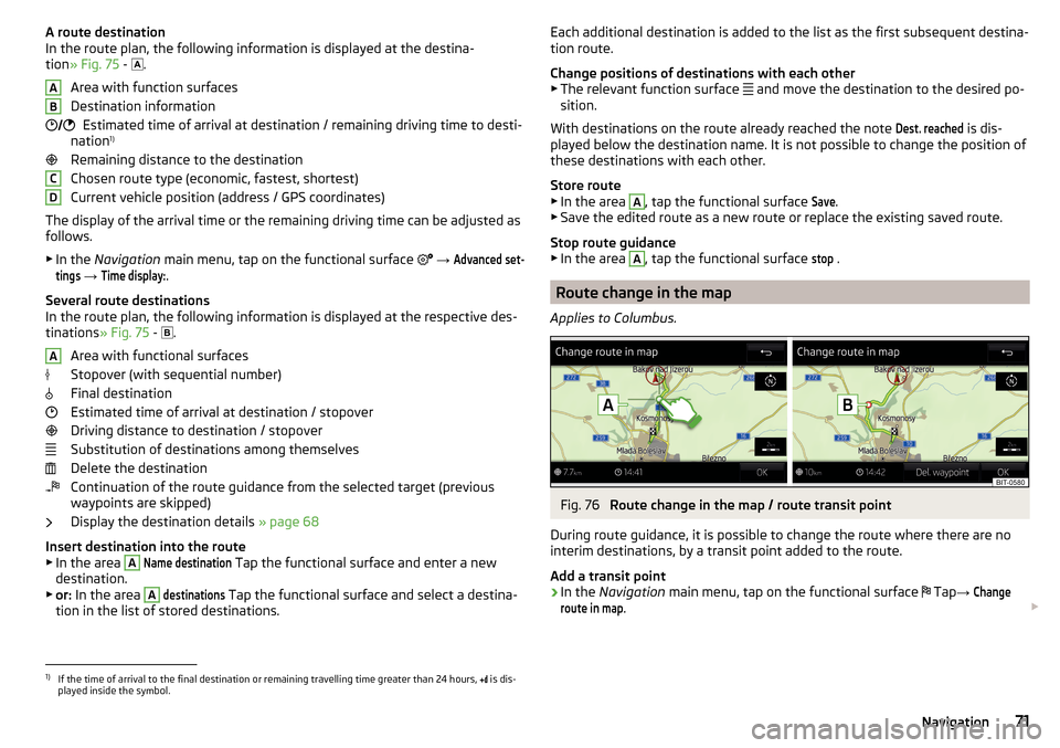
Route change in the map
Applies to Columbus.
Fig. 76
Route change in the map / route transit point
During route guidance, it is possible to change the route where there are no
interim destinations, by a transit point added to the route.
Add a transit point
›
In the Navigation main menu, tap on the functional surface
Tap
→
Changeroute in map
.
1)
If the time of arrival to the final destination or remaining travelling time greater than 24 hours,
is dis-
played inside the symbol.
71Navigation
Page 74 of 100

›Touch the screen in the route field and move the cross-point to the desired
location on the map, e.g. A, move » Fig. 76 .
The transit point B
is added to the route » Fig. 76.
›
Tap on the function
surface.
A route calculation occurs and route guidance starts.
Customize transit point
›
In the Navigation main menu, tap on the functional surface
Tap
→
Changeroute in map
.
›
Touch the transit point
B
and move to a different location on the map.
›
Tap on the function
surface.
A route calculation occurs and route guidance starts.
Remove transit point
›
In the Navigation main menu, tap on the functional surface
Tap
→
Changeroute in map
.
›
Tap the functional surface
Delete waypoint
.
›
Tap on the function
surface.
A route calculation occurs and route guidance starts.
Route management
›
In the Navigation main menu, tap on the functional surface
Tap
→
routes
.
New route ▶ Tap the function surface
New route
.
Insert a route destination in one of the following ways.
▶ Tap on The functional surface
Name destination
and enter a new destination.
▶ Or Press the function surface
destinations
and select a destination from the list
of registered destinations.
▶ To save the created route, tap the functional surface
Save
.
▶ Tap the functional surface
Start
to start route guidance.
Route management
▶ Choose the desired saved route, and then select one of the following menu
items.
Clear saved route
- Edit route
- Calculate route and start route guidance
DeleteEditStartWaypoint mode
Introduction to the subject
Applies to Columbus.
This mode is suitable for off-road navigation or for areas where maps are not
available.
The device allows the recording of waypoint tours driven using automatic of
manually entered waypoints.
Then there is the possibility to start route guidance to the stored waypoint
tour or to save the waypoint tour on the SD card.
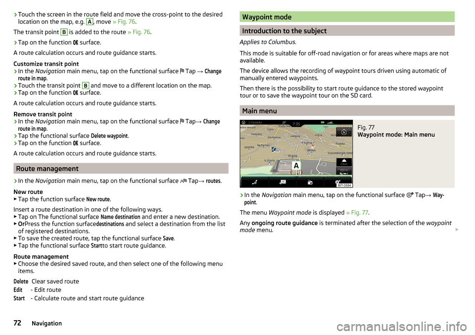
Main menu
Fig. 77
Waypoint mode: Main menu
›
In the Navigation main menu, tap on the functional surface
Tap
→
Way-point
.
The menu Waypoint mode is displayed » Fig. 77.
Any ongoing route guidance is terminated after the selection of the waypoint
mode menu.
72Navigation