warning TOYOTA 4RUNNER 2005 N210 / 4.G Navigation Manual
[x] Cancel search | Manufacturer: TOYOTA, Model Year: 2005, Model line: 4RUNNER, Model: TOYOTA 4RUNNER 2005 N210 / 4.GPages: 135, PDF Size: 5.23 MB
Page 2 of 135

05 4RUNNER NAVI_U (L/O 0408)
ii
Important information about this manual
For safety reasons, this manual indicates
items requiring particular attention with the
following marks.
CAUTION
This is a warning against anything
which may cause injury to people if the
warning is ignored. You are informed
about what you must or must not do in
order to reduce the risk of injury to
yourself and others.
NOTICE
This is a warning against anything
which may cause damage to the ve-
hicle or its equipment if the warning is
ignored. You are informed about what
you must or must not do in order to
avoid or reduce the risk of damage to
your vehicle and its equipment.
INFORMATION
This provides additional information.
Initial screen
When you start the engine or turn the ignition
switch to the “ACC” position, the initial
screen appears and the system begins
operating.
CAUTION
When the vehicle is stopped with the
engine running, always apply the park-
ing brake for safety.
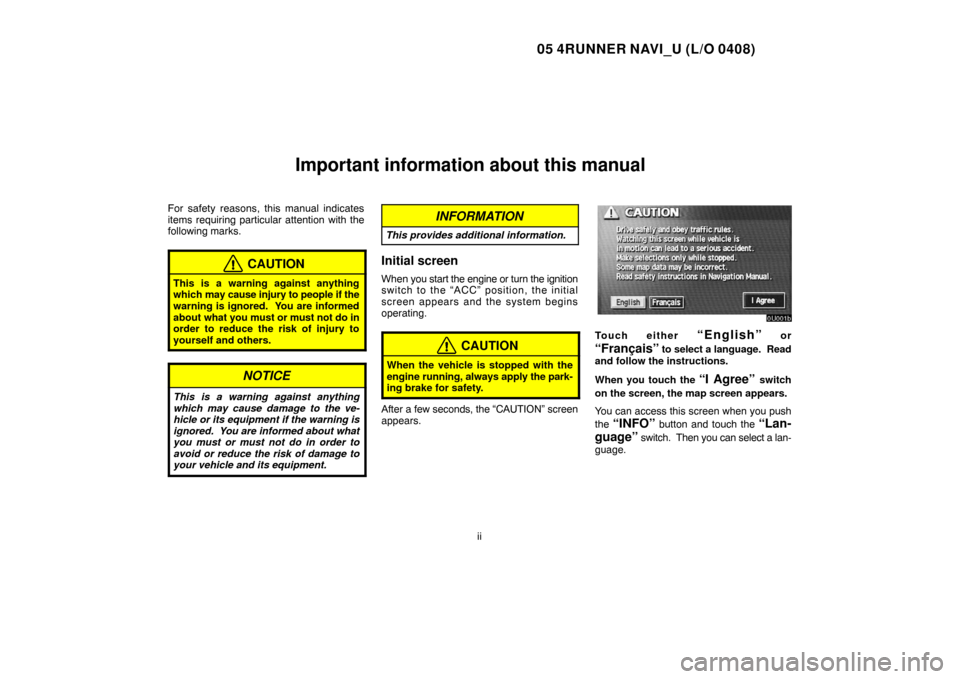
After a few seconds, the “CAUTION” screen
appears.
Touch either “English” or
“Français” to select a language. Read
and follow the instructions.
When you touch the
“I Agree” switch
on the screen, the map screen appears.
You can access this screen when you push
the
“INFO” button and touch the “Lan-
guage”
switch. Then you can select a lan-
guage.
Page 24 of 135

05 4RUNNER NAVI_U (L/O 0408)
14
WARNINGS
The DATABASE reflects reality as
existing before you received the
DATABASE and it comprises data and
information from government and other
sources, which may contain errors and
omissions. Accordingly, the DATABASE
may contain inaccurate or incomplete
information due to the passage of time,
changing circumstances, and due to the
nature of the sources used. The
DATABASE does not include or reflect
information on − inter alia −
neighborhood safety; law enforcement;
emergency assistance; construction
work; road or lane closures; vehicle or
speed restrictions; road slope or grade;
bridge height, weight or other limits; road
or traffic conditions; special events;
traffic congestion; or travel time.GOVERNMENT END USERS
If the DATABASE is for a region of North
America and is being acquired by or on
behalf of the United States government
or any other entity seeking or applying
rights similar to those customarily
claimed by the United States
government, the DATABASE is licensed
with “limited rights.” Utilization of the
DATABASE is subject to the restrictions
specified in the “Rights in Technical Data
and Computer Database” clause at
DFARS 252.227−7013, or the equivalent
clause for non−defense agencies.
Manufacturer of the DATABASE for
North America is Geographic Data
Technology, Inc., at 11 Lafayette Street,
Lebanon, New Hampshire 03766, USA.END USER NOTICE
PLEASE READ THIS NOTICE
CAREFULLY BEFORE USING THIS
NAVIGATION SYSTEM
The Point Of Interest Data (“POI” Data) in
the navigation system is in part provided
by infoUSA Inc. (“infoUSA”). By using
the POI Data, you accept and agree to all
terms and conditions set forth below.
1. Ownership
All rights, title and interest to the infoUSA
POI Data shall be retained by infoUSA.
2. Limitations on use
Except to the extent explicitly permitted
by mandatory laws, you may not extract
or re−utilize any portion of the contents of
the POI Data, nor reproduce, copy,
modify, adapt, translate, disassemble,
decompile, or reverse engineer any
portion of the POI Data.
3. Transfer
You may not transfer the POI Data to third
parties, except together with the system
for which it was created, provided that
you do not retain any copy of the POI
Data.