navigation system TOYOTA PRIUS C 2015 NHP10 / 1.G Navigation Manual
[x] Cancel search | Manufacturer: TOYOTA, Model Year: 2015, Model line: PRIUS C, Model: TOYOTA PRIUS C 2015 NHP10 / 1.GPages: 285, PDF Size: 4.97 MB
Page 1 of 285

2
This manual explains the operation of the system. Please read this manual
carefully to ensure proper use. Keep this manual in your vehicle at all times.
The screen shots in this document and the actual screens of the system differ
depending on whether the functions and/or a contract existed and the map data
available at the time of producing this document.
Please be aware that the content of this manual may be different from the sys-
tem in some cases, such as when the system’s software is updated.
The Navigation System is one of the most technologically advanced vehicle ac-
cessories ever developed. The system receives satellite signals from the Global
Positioning System (GPS) operated by the U.S. Department of Defense. Using
these signals and other vehicle sensors, the system indicates your present po-
sition and assists in locating a desired destination.
The navigation system is designed to select efficient routes from your present
starting location to your destination. The system is also designed to direct you
to a destination that is unfamiliar to you in an efficient manner. The system uses
AISIN AW maps. The calculated routes may not be the shortest nor the least
traffic congested. Your own personal local knowledge or “short cut” may at
times be faster than the calculated routes.
The navigation system’s database includes Point of Interest categories to allow
you to easily select destinations such as restaurants and hotels. If a d\
estination
is not in the database, you can enter the street address or a major intersection
close to it and the system will guide you there.
The system will provide both a visual map and audio instructions. The audio in-
structions will announce the distance remaining and the direction to tur\
n in when
approaching an intersection. These voice instructions will help you keep your
eyes on the road and are timed to provide enough time to allow you to maneu-
ver, change lanes or slow down.
Please be aware that all current vehicle navigation systems have certain limita-
tions that may affect their ability to perform properly. The accuracy of the vehi-
cle’s position depends on satellite conditions, road configuration, vehicle
condition or other circumstances. For more information on the limitations of the
system, refer to page 250.
NAVIGATION SYSTEM OWNER’S MANUAL
NAVIGATION SYSTEM
Introduction
Page 4 of 285
5
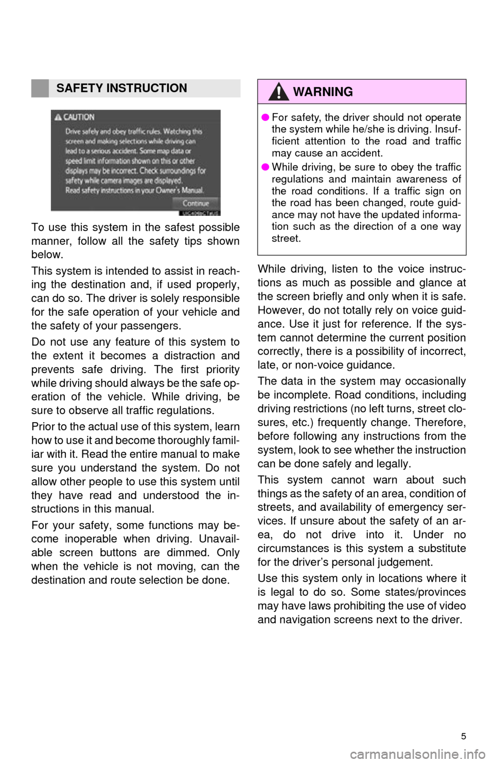
To use this system in the safest possible
manner, follow all the safety tips shown
below.
This system is intended to assist in reach-
ing the destination and, if used properly,
can do so. The driver is solely responsible
for the safe operation of your vehicle and
the safety of your passengers.
Do not use any featur e of this system to
the extent it becom es a distraction and
prevents safe driving. The first priority
while driving should always be the safe op-
eration of the vehicle. While driving, be
sure to observe all traffic regulations.
Prior to the actual us e of this system, learn
how to use it and become thoroughly famil-
iar with it. Read the entire manual to make
sure you understand the system. Do not
allow other people to use this system until
they have read and understood the in-
structions in this manual.
For your safety, some functions may be-
come inoperable when driving. Unavail-
able screen buttons are dimmed. Only
when the vehicle is not moving, can the
destination and route selection be done. While driving, listen to the voice instruc-
tions as much as possible and glance at
the screen briefly and only when it is safe.
However, do not totally rely on voice guid-
ance. Use it just for reference. If the sys-
tem cannot determine the current position
correctly, there is a po
ssibility of incorrect,
late, or non-voice guidance.
The data in the system may occasionally
be incomplete. Road conditions, including
driving restrictions (no left turns, street clo-
sures, etc.) frequently change. Therefore,
before following any instructions from the
system, look to see whether the instruction
can be done safely and legally.
This system cannot warn about such
things as the safety of an area, condition of
streets, and availability of emergency ser-
vices. If unsure about the safety of an ar-
ea, do not drive into it. Under no
circumstances is this system a substitute
for the driver’s personal judgement.
Use this system only in locations where it
is legal to do so. Some states/provinces
may have laws prohibiting the use of video
and navigation screens next to the driver.
SAFETY INSTRUCTIONWA R N I N G
● For safety, the driver should not operate
the system while he/she is driving. Insuf-
ficient attention to the road and traffic
may cause an accident.
● While driving, be sure to obey the traffic
regulations and maintain awareness of
the road conditions. If a traffic sign on
the road has been changed, route guid-
ance may not have the updated informa-
tion such as the direction of a one way
street.
Page 7 of 285

TABLE OF CONTENTS
8
1. BASIC OPERATION ...................... 188
QUICK REFERENCE .......................... 188
MAP SCREEN OPERATION ............... 191
MAP SCREEN INFORMATION ........... 197
TRAFFIC INFORMATION.................... 201
2. DESTINATION SEARCH ............... 204
DESTINATION SEARCH SCREEN ..... 204
SEARCH OPERATION ........................ 206
STARTING ROUTE GUIDANCE ......... 216
3. ROUTE GUIDANCE....................... 220
ROUTE GUIDANCE SCREEN ............ 220
TYPICAL VOICE GUIDANCE
PROMPTS......................................... 225
EDITING ROUTE ................................. 226
4. MEMORY POINTS ......................... 231
MEMORY POINTS SETTINGS ........... 231
5. SETUP ........................................... 240
DETAILED NAVIGATION SETTINGS ........................................ 240
TRAFFIC SETTINGS ........................... 244
6. TIPS FOR THE NAVIGATION SYSTEM ....................................... 250
GPS (GLOBAL POSITIONING
SYSTEM) .......................................... 250
MAP DATABASE VERSION AND COVERED AREA .............................. 252
1. Entune App Suite OVERVIEW .... 256
Entune App Suite SERVICE................. 256
2. Entune App Suite OPERATION ................................ 261
Entune App Suite ................................. 261
3. SETUP ........................................... 268
Entune App Suite SETTINGS .............. 268
ALPHABETICAL INDEX ................... 272
8NAVIGATION SYSTEM9Entune App Suite
INDEX
Page 46 of 285
47
2. Bluetooth® SETTINGS
BASIC FUNCTION
2
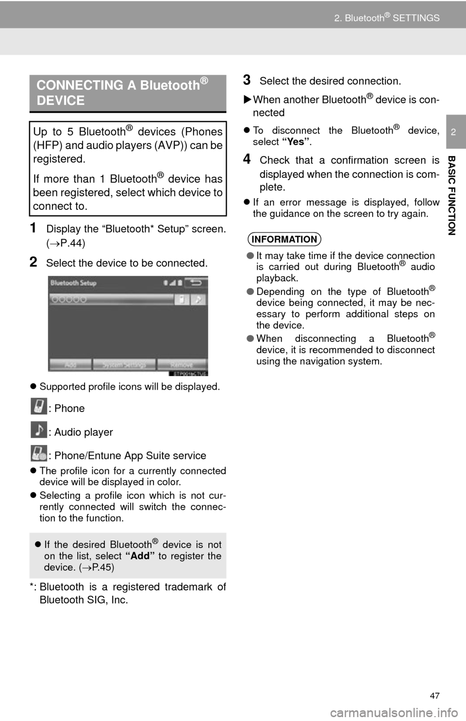
1Display the “Bluetooth* Setup” screen.
(P.44)
2Select the device to be connected.
Supported profile icons will be displayed.
: Phone
: Audio player
: Phone/Entune App Suite service
The profile icon for a currently connected
device will be displayed in color.
Selecting a profile icon which is not cur-
rently connected will switch the connec-
tion to the function.
*: Bluetooth is a registered trademark of
Bluetooth SIG, Inc.
3Select the desired connection.
When another Bluetooth
® device is con-
nected
To disconnect the Bluetooth® device,
select “Yes”.
4Check that a confirmation screen is
displayed when the connection is com-
plete.
If an error message is displayed, follow
the guidance on the screen to try again.
CONNECTING A Bluetooth®
DEVICE
Up to 5 Bluetooth® devices (Phones
(HFP) and audio players (AVP)) can be
registered.
If more than 1 Bluetooth
® device has
been registered, select which device to
connect to.
If the desired Bluetooth® device is not
on the list, select “Add” to register the
device. ( P.45)
INFORMATION
● It may take time if the device connection
is carried out during Bluetooth® audio
playback.
● Depending on the type of Bluetooth
®
device being connected, it may be nec-
essary to perform additional steps on
the device.
● When disconnecting a Bluetooth
®
device, it is recommended to disconnect
using the navigation system.
Page 132 of 285
133
1. VOICE COMMAND SYSTEM OPERATION
VOICE COMMAND SYSTEM
4
3. COMMAND LIST
Frequently used commands are listed in the following tables.
For devices that are not installed in the vehicle, the related commands will not be dis-
played in the screen. Also, according to conditions, other commands may not be dis-
played in the screen.
The functions available may vary according to the system installed.
Basic
Apps
When the voice recognition language is set to English.
Navigation
Recognizable voice commands and their actions are shown below.
Voice recognition language can be changed. ( P.52)
CommandAction
“Help”Prompts voice guidance to offer examples of commands
or operation methods
“Go Back”Returns to the previous screen
“Number one/two/three/four/five”Selects the number on the list screen
“Next Page”Displays the next page
“Previous Page”Displays the previous page
“Go to
CommandAction
“Launch
CommandAction
“Find Nearby
tion
“Enter an Address”Enables setting a destination by saying the address
“Go Home”Displays the route to home
“Cancel Route”Stops the route guidance
*: For example; “Gas stations”, “Restaurants”, etc.
Page 165 of 285
166
1. PHONE OPERATION (HANDS-FREE SYSTEM FOR CELLULAR PHONES)
■EDITING QUICK REPLY MESSAG-
ES
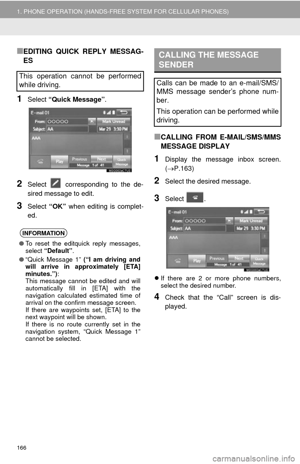
1Select “Quick Message” .
2Select corresponding to the de-
sired message to edit.
3Select “OK” when editing is complet-
ed.
■CALLING FROM E-MAIL/SMS/MMS
MESSAGE DISPLAY
1Display the message inbox screen.
( P.163)
2Select the desired message.
3Select .
If there are 2 or more phone numbers,
select the desired number.
4Check that the “Call” screen is dis-
played.
This operation cannot be performed
while driving.
INFORMATION
●To reset the editquick reply messages,
select “Default” .
● “Quick Message 1” (“I am driving and
will arrive in approximately [ETA]
minutes.”) :
This message cannot be edited and will
automatically fill in [ETA] with the
navigation calculated estimated time of
arrival on the confirm message screen.
If there are waypoints set, [ETA] to the
next waypoint will be shown.
If there is no route currently set in the
navigation system, “Quick Message 1”
cannot be selected.
CALLING THE MESSAGE
SENDER
Calls can be made to an e-mail/SMS/
MMS message sender’s phone num-
ber.
This operation can be performed while
driving.
Page 185 of 285
186
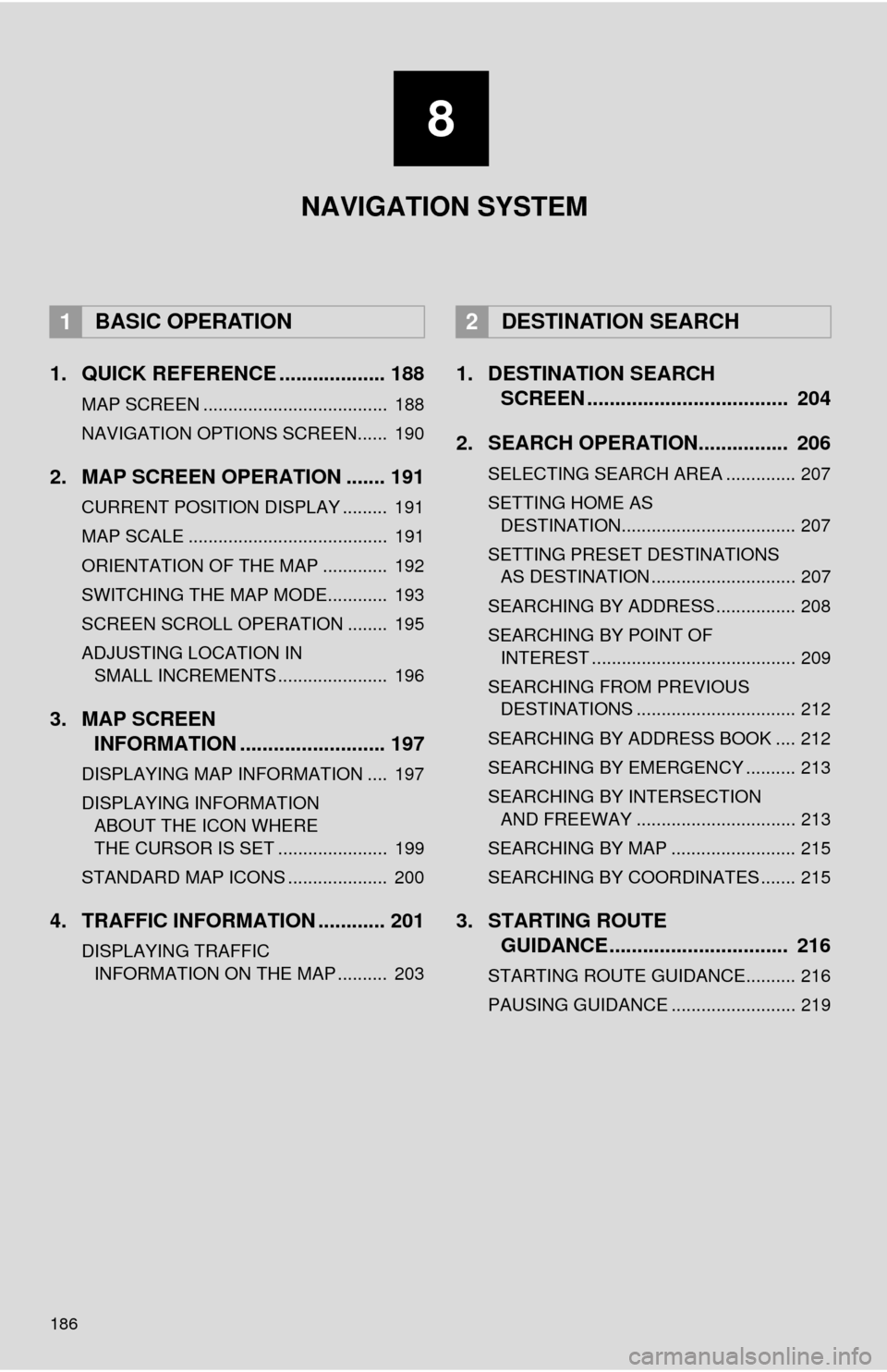
1. QUICK REFERENCE ................... 188
MAP SCREEN ..................................... 188
NAVIGATION OPTIONS SCREEN...... 190
2. MAP SCREEN OPERATION ....... 191
CURRENT POSITION DISPLAY ......... 191
MAP SCALE ........................................ 191
ORIENTATION OF THE MAP ............. 192
SWITCHING THE MAP MODE............ 193
SCREEN SCROLL OPERATION ........ 195
ADJUSTING LOCATION IN SMALL INCREMENTS ...................... 196
3. MAP SCREEN INFORMATION .......................... 197
DISPLAYING MAP INFORMATION .... 197
DISPLAYING INFORMATION
ABOUT THE ICON WHERE
THE CURSOR IS SET ...................... 199
STANDARD MAP ICONS .................... 200
4. TRAFFIC INFORMATION ............ 201
DISPLAYING TRAFFIC INFORMATION ON THE MAP .......... 203
1. DESTINATION SEARCH SCREEN .................................... 204
2. SEARCH OPERATION.. .............. 206
SELECTING SEARCH AREA .............. 207
SETTING HOME AS
DESTINATION................................... 207
SETTING PRESET DESTINATIONS AS DESTINATION ............................. 207
SEARCHING BY ADDRESS ................ 208
SEARCHING BY POINT OF INTEREST ......................................... 209
SEARCHING FROM PREVIOUS DESTINATIONS ................................ 212
SEARCHING BY ADDRESS BOOK .... 212
SEARCHING BY EMERGENCY .......... 213
SEARCHING BY INTERSECTION AND FREEWAY ................................ 213
SEARCHING BY MAP ......................... 215
SEARCHING BY COORDINATES ....... 215
3. STARTING ROUTE GUIDANCE ....... ......................... 216
STARTING ROUTE GUIDANCE.......... 216
PAUSING GUIDANCE ......................... 219
1BASIC OPERATION2DESTINATION SEARCH
8
NAVIGATION SYSTEM
Page 186 of 285
8
187
4
5
6
7
9
1
2
3
8
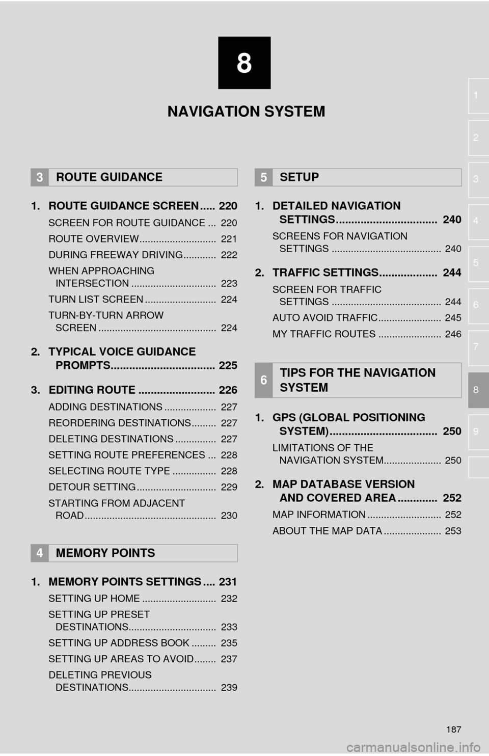
1. ROUTE GUIDANCE SCREEN ..... 220
SCREEN FOR ROUTE GUIDANCE ... 220
ROUTE OVERVIEW............................ 221
DURING FREEWAY DRIVING............ 222
WHEN APPROACHING INTERSECTION ............................... 223
TURN LIST SCREEN .......................... 224
TURN-BY-TURN ARROW SCREEN ........................................... 224
2. TYPICAL VOICE GUIDANCE PROMPTS.................................. 225
3. EDITING ROUTE ......................... 226
ADDING DESTINATIONS ................... 227
REORDERING DESTINATIONS ......... 227
DELETING DESTINATIONS ............... 227
SETTING ROUTE PREFERENCES ... 228
SELECTING ROUTE TYPE ................ 228
DETOUR SETTING ............................. 229
STARTING FROM ADJACENT ROAD ................................................ 230
1. MEMORY POINTS SETTINGS .... 231
SETTING UP HOME ........................... 232
SETTING UP PRESET DESTINATIONS................................ 233
SETTING UP ADDRESS BOOK ......... 235
SETTING UP AREAS TO AVOID ........ 237
DELETING PREVIOUS DESTINATIONS................................ 239
1. DETAILED NAVIGATION SETTINGS ................................. 240
SCREENS FOR NAVIGATION
SETTINGS ........................................ 240
2. TRAFFIC SETTINGS................... 244
SCREEN FOR TRAFFIC SETTINGS ........................................ 244
AUTO AVOID TRAFFIC....................... 245
MY TRAFFIC ROUTES ....................... 246
1. GPS (GLOBAL POSITIONING SYSTEM) .................... ............... 250
LIMITATIONS OF THE
NAVIGATION SYSTEM..................... 250
2. MAP DATABASE VERSION AND COVERED AREA ............. 252
MAP INFORMATION ........................... 252
ABOUT THE MAP DATA ..................... 253
3ROUTE GUIDANCE
4MEMORY POINTS
5SETUP
6TIPS FOR THE NAVIGATION
SYSTEM
NAVIGATION SYSTEM
Page 187 of 285
188
1. BASIC OPERATION
1. QUICK REFERENCE
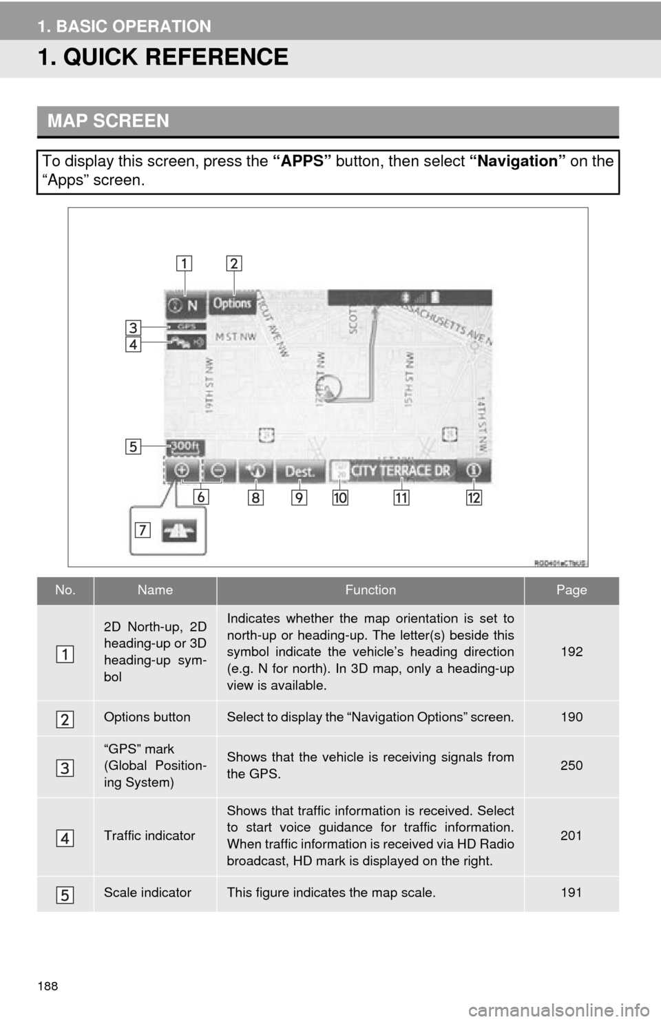
MAP SCREEN
To display this screen, press the “APPS” button, then select “Navigation” on the
“Apps” screen.
No.NameFunctionPage
2D North-up, 2D
heading-up or 3D
heading-up sym-
bolIndicates whether the map orientation is set to
north-up or heading-up. The letter(s) beside this
symbol indicate the vehicle’s heading direction
(e.g. N for north). In 3D map, only a heading-up
view is available.
192
Options buttonSelect to display the “Navigation Options” screen.190
“GPS” mark
(Global Position-
ing System)Shows that the vehicle is receiving signals from
the GPS.250
Traffic indicator
Shows that traffic information is received. Select
to start voice guidance for traffic information.
When traffic information is received via HD Radio
broadcast, HD mark is displayed on the right.
201
Scale indicatorThis figure indicates the map scale.191
Page 188 of 285
189
1. BASIC OPERATION
NAVIGATION SYSTEM
8
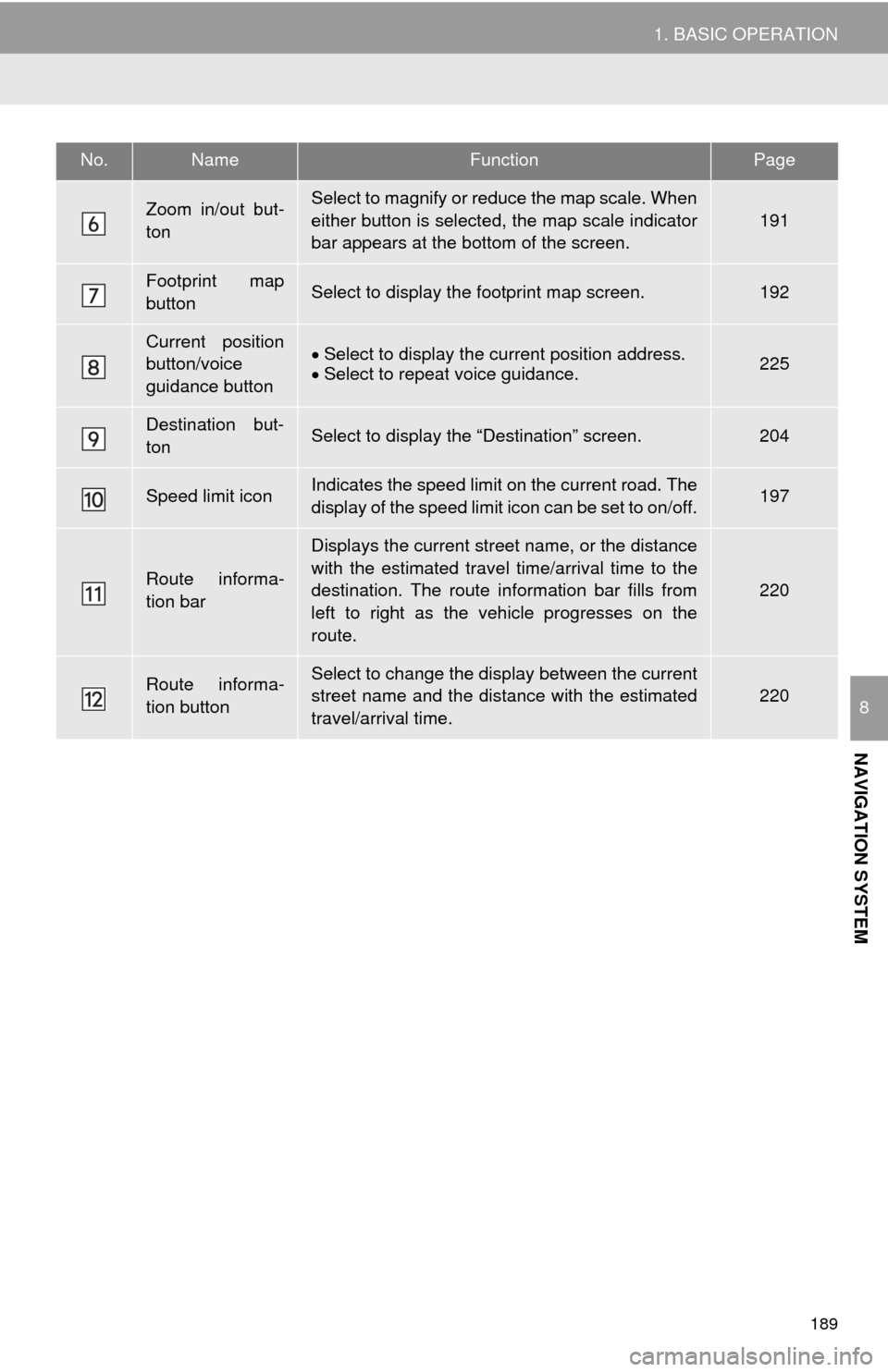
Zoom in/out but-
tonSelect to magnify or reduce the map scale. When
either button is selected, the map scale indicator
bar appears at the bottom of the screen.
191
Footprint map
buttonSelect to display the footprint map screen.192
Current position
button/voice
guidance buttonSelect to display the current position address.
Select to repeat voice guidance.225
Destination but-
tonSelect to display the “Destination” screen.204
Speed limit iconIndicates the speed limit on the current road. The
display of the speed limit icon can be set to on/off.197
Route informa-
tion bar
Displays the current street name, or the distance
with the estimated travel time/arrival time to the
destination. The route information bar fills from
left to right as the vehicle progresses on the
route.
220
Route informa-
tion buttonSelect to change the display between the current
street name and the distance with the estimated
travel/arrival time.220
No.NameFunctionPage