reset VOLVO S60 2019 Sensus Navigation Manual
[x] Cancel search | Manufacturer: VOLVO, Model Year: 2019, Model line: S60, Model: VOLVO S60 2019Pages: 43, PDF Size: 0.53 MB
Page 7 of 43

NAVIGATION
* Option/accessory.5
Navigation system * symbols andbuttons
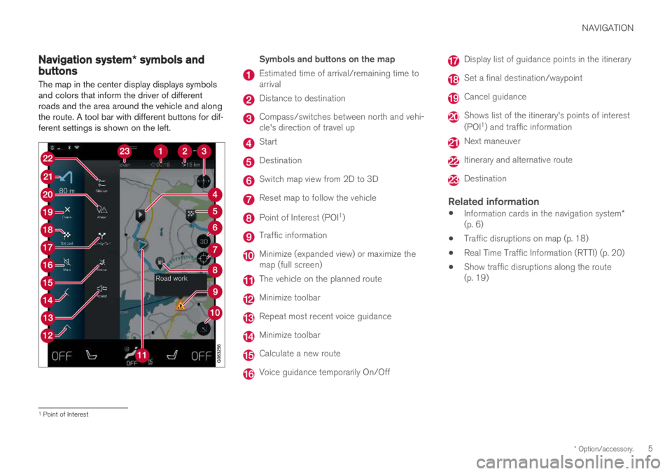
The map in the center display displays symbols and colors that inform the driver of differentroads and the area around the vehicle and alongthe route. A tool bar with different buttons for dif-ferent settings is shown on the left.
Symbols and buttons on the map
Estimated time of arrival/remaining time to arrival
Distance to destination
Compass/switches between north and vehi- cle's direction of travel up
Start
Destination
Switch map view from 2D to 3D
Reset map to follow the vehicle
Point of Interest (POI 1
)
Traffic information
Minimize (expanded view) or maximize the map (full screen)
The vehicle on the planned route
Minimize toolbar
Repeat most recent voice guidance
Minimize toolbar
Calculate a new route
Voice guidance temporarily On/Off
Display list of guidance points in the itinerary
Set a final destination/waypoint
Cancel guidance
Shows list of the itinerary's points of interest (POI 1
) and traffic information
Next maneuver
Itinerary and alternative route
Destination
Related information
Information cards in the navigation system
*
(p. 6)
Traffic disruptions on map (p. 18)
Real Time Traffic Information (RTTI) (p. 20)
Show traffic disruptions along the route (p. 19)
1
Point of Interest
Page 8 of 43

NAVIGATION
* Option/accessory.
6
Information cards in the navigation
system *
All icons on the map, such as destinations, way- points and favorites, have an information cardthat can be opened by tapping the icon.
Press the information card once to display a small card, and press twice to display a largercard with more information. The information andpossible options vary depending on the type oficon. For example, when a POI( 2
) is highlighted, the
driver can select e.g.:
Start navigation - save the location as a
destination
Add as waypoint - the position is saved as
an intermediate destination (only displayed at the specified destination)
Save - the position is saved in the library
Remove from itinerary - the position is
removed if it is included in the itinerary
Nearby POI - points of interest close to the
car's position are shown
Related information
Itinerary (p. 15)
Entering a POI as a destination (p. 12)
Viewing points of interest along the route (p. 17)
Navigation system
* in center display
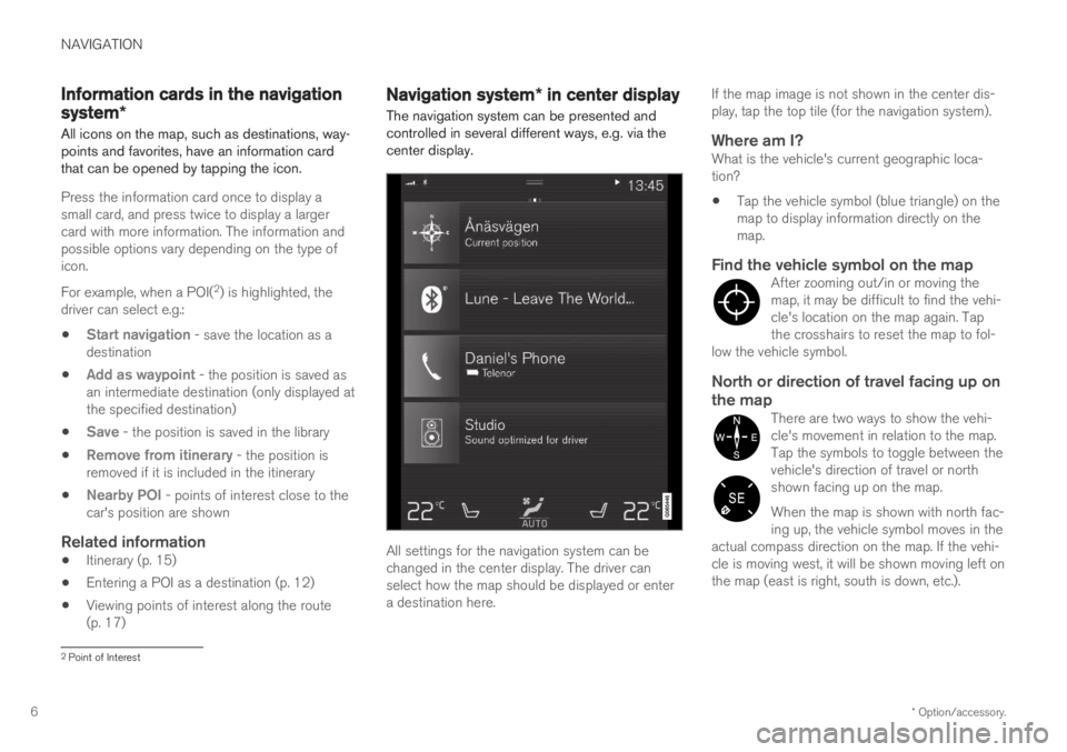
The navigation system can be presented and controlled in several different ways, e.g. via thecenter display.
All settings for the navigation system can be changed in the center display. The driver canselect how the map should be displayed or entera destination here. If the map image is not shown in the center dis-play, tap the top tile (for the navigation system).
Where am I?What is the vehicle's current geographic loca-tion?
Tap the vehicle symbol (blue triangle) on themap to display information directly on themap.
Find the vehicle symbol on the mapAfter zooming out/in or moving themap, it may be difficult to find the vehi-cle's location on the map again. Tapthe crosshairs to reset the map to fol-
low the vehicle symbol.
North or direction of travel facing up on the map
There are two ways to show the vehi- cle's movement in relation to the map.Tap the symbols to toggle between thevehicle's direction of travel or northshown facing up on the map. When the map is shown with north fac- ing up, the vehicle symbol moves in the
actual compass direction on the map. If the vehi-cle is moving west, it will be shown moving left onthe map (east is right, south is down, etc.).
2 Point of Interest