navigation VOLVO XC60 2019 Sensus Navigation Manual
[x] Cancel search | Manufacturer: VOLVO, Model Year: 2019, Model line: XC60, Model: VOLVO XC60 2019Pages: 43, PDF Size: 0.53 MB
Page 24 of 43
||
NAVIGATION
* Option/accessory.
22
Map Display FormatSelect Map Display Format to choose back-
ground lighting for the map:
Day - bright colors.
Night - dark colors for better night vision.
Auto - the system will switch between Dayand Night depending on the ambient light in
the passenger compartment.
Speed cameras 17Select Show Speed Cameras to display speed
cameras on the map.
FavoritesTo display Favorites on the map, select.
Point of Interest (POI 18
)Select POIs to be displayed on the map underPoint of Interest (POI). Tap on the desired cat-
egory, e.g. "Transportation", and then select show all or specific sub categories. Tap
Back or Closeto exit the menu.
Related information
Navigation system
* settings (p. 21)
Route settings and guidance (p. 22)
Traffic information settings (p. 23)
Viewing points of interest along the route (p. 17)
Entering a POI as a destination (p. 12)
Entering a destination using Recent/Favor-ites/Library (p. 13)
Route settings and guidance Settings for how the route is calculated and how guidance is presented in the navigation system
*
are selected here.
SettingsNavigationRoute and
Guidance
Settings can be personalized in the following areas:
Arrival Time Format
Voice Guidance Level
Choose Default Route Type
Route Learning
Avoidance Settings
Propose Gas Station
17 This function is not available on all markets.
18 Point of Interest
Page 25 of 43
NAVIGATION
}}
* Option/accessory.23
Arrival Time FormatChoose how arrival time will be displayed:
ETA19 (estimated time of arrival at the desti-
nation)
RTA20 (remaining time to arrival at destina-
tion)
Times are displayed according to the time zone of the destination.
Voice Guidance Level1. Tap Voice Guidance Level.
2. Tap desired voice guidance:
None (no automatic voice guidance, but
guidance can be manually requested once)
Low (only one message per guidance
point)
Medium (up to 3 messages per guidance
point, with limited information provided)
Full (up to 4 messages per guidance
point and all available information provi- ded)
Choose Default Route TypeSelect the default type of route to be used:
Fast
Eco
Scenic (highways/freeways are avoided
whenever possible; note that this could lead to longer travel times)
It is also possible to display an alternative routewhile driving.
Route LearningSelect Route Learning to allow data to be col-
lected to optimize route calculations.
AvoidTap Avoidance Settings to open a menu of
options to automatically avoid (if possible) when calculating a route. Possible selections includetunnels, ferries, congestion charge zones, etc.
Suggest service stationTap Propose Gas Station to activate or deacti-
vate the display of suggestions for nearby service stations in the instrument panel when fuel level islow.
Related information
Navigation system
* settings (p. 21)
Map settings (p. 21)
Traffic information settings (p. 23)
Viewing alternative routes (p. 17)
Traffic information settings The following settings determine how traffic information 21
is presented in the navigation sys-
tem *.
SettingsNavigationTraffic
Settings can be personalized in the following areas:
Show and Handle Traffic Events
Avoid Traffic Events
Show Free Flowing Traffic
Real Time Traffic Information
Show & Handle Traffic EventsSelect to display traffic events on the map and use this information to calculate routes:
None
Major
All types
19 Estimated Time of Arrival
20 Remaining Time to Arrival
Page 26 of 43
||
NAVIGATION
* Option/accessory.
24
Avoid Traffic EventsSelect to avoid traffic problems when calculating routes.
Never
Ask - (suggestions for alternate routes will
be provided when available during the trip)
Always
Show Free Flowing TrafficSelect Show Free Flowing Traffic to show this
on the map.
Using RTTI 22Select Real Time Traffic Information to use
enhanced traffic information when the vehicle is connected to the Internet (RTTI).
Related information
Navigation system
* settings (p. 21)
Map settings (p. 21)
Route settings and guidance (p. 22)
Real Time Traffic Information (RTTI) (p. 20)
Map updating
MapCare is a map update service for Volvo vehi- cles equipped with Sensus Navigation *.
General update informationThere are two ways to update maps. Either via a computer and USB flash drive or directly from the vehicle 23
(if the vehicle has an Internet connec-
tion). The vehicle's map is divided into a number of fixed regions. When updating map data, the driverdoes not need to update all of these regions, butcan instead choose to update only one or morespecific regions. One or more regions can be updated when the vehicle has an Internet connection. However,updating a large number of regions or the entiremap requires a significant amount of data, and itmay be advisable to use a computer and USBflash drive instead.
NOTE
If an itinerary includes more than one region, all regions should have the same versionnumber to enable the system to calculate thebest route to the destination.
Updating the map structureChanging the map structure may sometimes be necessary, e.g., if a region is added or if a largeregion is divided into smaller ones. If this is thecase, normal updates of individual regions maynot be possible and a message will be displayedexplaining what has happened. In this situation, the entire map must be reinstal- led from a USB flash drive. For additional infor-mation, see the Volvo Cars support site(support.volvocars.com) or contact a Volvoretailer.
Updating navigation system softwareIn addition to maps, the navigation system's ownsoftware is under constant development andneeds to be updated occasionally. This couldmean that a recently downloaded map is not sup-ported by the current navigation system software.In such cases, a message will be displayed indi-cating that the navigation system software mustbe updated. Consult a Volvo retailer for assis-tance with the update.
21 Certain markets only.22
Certain markets only.23 Only available in certain countries.
Page 27 of 43
NAVIGATION
}}
* Option/accessory.25
FAQs
AskAnswer
Can the map dataplatform bechangedfrom e.g.Europe toNorthAmerica? Yes, with some exceptions.Contact a Volvo retailer for up-to-date information.
How longdo mapupdatestake? This depends on the size of thefile(s) and the speed of theInternet connection. Informationabout the size of the update (inMB) will be displayed on thescreen.
How big isan update? This varies from market to mar-ket. For detailed information onyour market's map, see theVolvo Cars support site,support.volvocars.com.
The updateis not work-ing. Whatshould I do? Try the Volvo Cars support site(support.volvocars.com) or con-tact a Volvo retailer.
Related information
Updating maps with a computer and USB flash drive (p. 25)
Updating maps from a vehicle with Internetconnection (p. 27)
Frequently Asked Questions regarding the navigation system
* (p. 28)
Navigation license agreements
* (p. 29)
Navigation system
* copyright (p. 35)
Updating maps with a computer andUSB flash drive
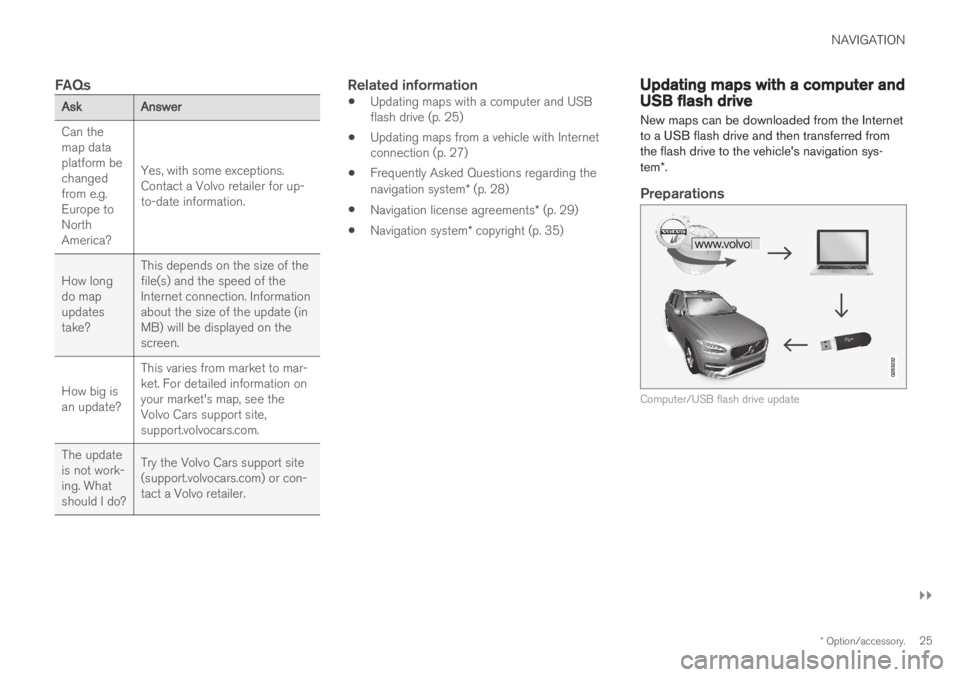
New maps can be downloaded from the Internet to a USB flash drive and then transferred fromthe flash drive to the vehicle's navigation sys- tem *.
Preparations
Computer/USB flash drive update
Page 28 of 43
||
NAVIGATION
26
USB flash drive
For use in updates, the USB flash drive must meet the following requirements:
ParameterRequirement
USB standard (1.0/2.0/3.0): At least 2.0
File system(Ext2/NTFS/FAT32): FAT32
Capacity(8/16/32/64GB): Map file size varies frommarket to market. See filesize descriptions under"Detailed information" foryour market on the VolvoCars support site(support.volvocars.com).
Determining the current map version
1.
Tap Download Center in App view.
2. Tap the arrow to expand the region.
> Detailed map information will be dis-played.
3. Make a note of the map information shown under the map image.
Downloading map data from the Internet to a USB flash drive
Make sure you have a USB flash drive and the map information you noted down.
1. Go to the Volvo Cars support site(support.volvocars.com) on a computer con- nected to the Internet.
2. Select the maps, vehicle model and model year.
3. Tap the region to be updated. > A map containing information about thelatest map data for the region will appear.
4. Verify that the map version is newer than the version in the vehicle.
5. Connect a USB flash drive to the computer and download the update to the USB flashdrive.
The time required for the download variesdepending on the size of the map and the speedof the Internet connection.
Transferring map data from the USB flash drive to the vehicle
The time required to transfer data from the USB flash drive to the vehicle varies depending on thesize of the map data file. The update can be donewhile driving. The navigation system can be usedwhile updating a map region, but it cannot beused during the update of an entire map market,e.g. the EU. If the transfer has not been comple-ted when the ignition is switched off, the updatewill continue the next time the vehicle is driven.
Page 29 of 43
NAVIGATION
}}
* Option/accessory.27
Updating
1. Activate the navigation system.
2. Connect the USB flash drive to the vehicle's
USB port. If there are two USB ports, the other port cannot be used at the same time.
3. The navigation system automatically detects that an update is available and, during theupdate of the whole map database, shows onthe screen what percentage of the process iscomplete.
> When individual regions are updated, theupdate will start immediately. To start an update of the entire map data- base, tap
Confirm. Tap Cancel to stop
the installation.
4. Tap
Confirm. The update of the entire map
database will begin and progress information will be shown on the center display.
5. The center display will indicate when the update is finished. Remove the USB flashdrive from the port.
6. Restart the infotainment system.
7. Verify that the correct map data has been transferred to the vehicle by repeating the steps described above under "Determiningthe current map version".
Interruptions
If an update is interrupted, an explanatory text will always appear in the center display.
What happens if...Answer
the infotainment system is turned offwhile an update isin progress? The process will pauseand will continue auto-matically when the sys-tem is reactivated, e.g.when the engine isstarted.
The USB flash driveis removed from theUSB port beforethe update is fin-ished? The process will pauseand will continue auto-matically when the USBflash drive is reconnec-ted to the USB port.
For additional information, see the Volvo Cars support site (support.volvocars.com) or contact aVolvo retailer.
Related information
Updating maps from a vehicle with Internetconnection (p. 27)
Map updating (p. 24)
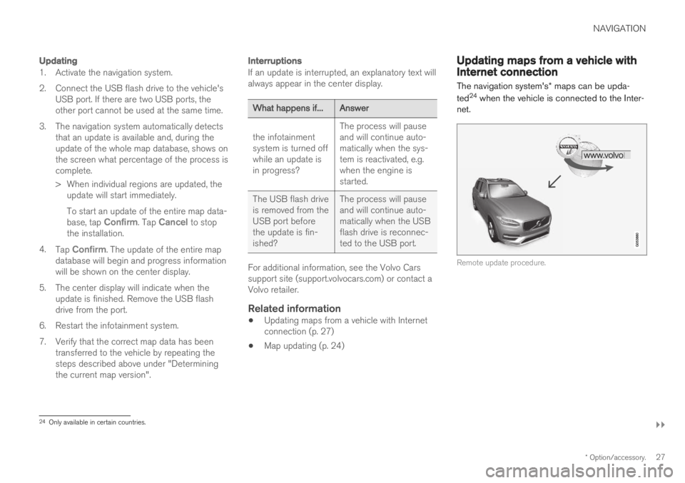
Updating maps from a vehicle withInternet connection The navigation system's
* maps can be upda-
ted 24
when the vehicle is connected to the Inter-
net.
Remote update procedure.
24 Only available in certain countries.
Page 30 of 43
||
NAVIGATION
* Option/accessory.
28 The vehicle must be connected to the Internet.
1.
Tap Download Center in App view.
> The app will start and a number shown near
Maps indicates the number of avail-
able map updates for the specified home region. This number will be displayed untila new search for updates has been per-formed or until updates have been instal-led.
2. Tap
Maps.
3. Tap
Install and then Confirm.
> The installation/update of the selected map will begin.
For additional information, see the Volvo Cars support site (support.volvocars.com) or contact aVolvo retailer.
Automatic map updates
Automatic updates can only be selected if theAuto Software Update function is activated under
SettingsSystemDownload
Center.
1. Automatic map updates can only be selected for your home region. If the home region is not already selected, tap the down-arrow toexpand the region.
> Detailed map information will be dis-played.
2. Tap
Set as home region.
3. Check the
Auto update: box.
> When the vehicle is connected to the Internet and map updates are available, they will be automatically downloaded tothe vehicle.
Related information
Updating maps with a computer and USBflash drive (p. 25)
Map updating (p. 24)
Frequently Asked Questions
regarding the navigation system
*
Here are answers to some frequently asked questions about the navigation system SensusNavigation.
The vehicle's location on the map is not correct
The navigation system displays the vehicle's loca- tion with an accuracy of approximately 20 meters(65 ft). Accuracy may be reduced slightly when driving on a road that is parallel with another road, wind-ing roads, multi-level roads and long stretches ofroad with no distinct curves. High mountains, buildings, tunnels, viaducts, interchanges, multi-level roads, etc. may alsoaffect the satellite signal reception, which mayalso reduce the system's ability to accurately cal-culate the vehicle's location.
The system does not always calculate
the fastest/shortest route
Route calculation takes into account factors suchas distance, road width, type of road, traffic inten-sity and speed limits to find the theoretically bestpossible route. Familiarity with an area and expe-rience may enable the driver to find a more effi-cient route.
Page 31 of 43
NAVIGATION
}}
* Option/accessory.29
The system uses e.g. toll roads or highways even though I have chosen toavoid them
When calculating longer routes over greater dis- tances, the system may choose major roads fortechnical reasons. If you have chosen to avoid toll roads and high- ways, these will be avoided whenever possibleand only used when no other viable option isavailable.
After being transported, the vehicle's
location on the map is not correct
If the vehicle is transported on e.g. a ferry or train,or if satellite signals have been blocked for someother reason, it may take up to 5 minutes beforethe vehicle's location can be accurately calcula-ted.
The vehicle symbol moves erratically on
the screen after changing tires
In addition to satellite signals, the vehicle'sspeedometer and a gyroscopic sensor are alsoused to calculate location, speed and direction oftravel. If any of the tires are changed, e.g. a sparetire or snow tires have been installed, the systemneeds to "learn" the new tire dimensions. To help ensure the system functions optimally, Volvo recommends driving for a short period onroads with good satellite reception (clear view).
The map does not represent actual road conditions
Because road changes/additions/rerouting, new traffic regulations, etc. are always being imple-mented, the map database may not be up todate. The database is continuously being updated and improved. Check regularly for updates.
The vehicle symbol jumps around or spins
The system may need a few seconds to deter-mine the vehicle's location before you start driv-ing. Switch off both the navigation system and the ignition. Restart but remain at a standstill for amoment before driving.
The map information is not up to dateSee the next heading.
Is the most recent map version
installed?
Map information is continuously being updatedand improved. When updating maps via a com-puter and USB, the vehicle's current map versioncan be displayed. Check the map version in thevehicle and compare it with the available mapversion on the Volvo Cars support page,support.volvocars.com.
Related information
Map updating (p. 24)
Navigation license agreements
*
The following is information for the end-user of the Sensus Navigation system.
END USER LICENSE AGREEMENT FOR DISTRIBUTION BY HERE
FOR THE AMERICAS/ASIA PACIFIC
Page 32 of 43
||
NAVIGATION
30
END-USER TERMS
The content provided (“Data”) is licensed, not sold. By opening this package, or installing,copying, or otherwise using the Data, you agreeto be bound by the terms of this agreement. Ifyou do not agree to the terms of this agreement,you are not permitted to install, copy, use, resellor transfer the Data. If you wish to reject theterms of this agreement, and have not installed,copied, or used the Data, you must contact yourretailer or HERE North America, LLC (as definedbelow) within thirty (30) days of purchase for arefund of your purchase price. To contact HERE,please visit www.here.com. The Data is providedfor your personal, internal use only and may notbe resold. It is protected by copyright, and issubject to the following terms (this “End UserLicense Agreement”) and conditions which areagreed to by you, on the one hand, and HEREand its licensors (including their licensors andsuppliers) on the other hand. For purposes ofthese terms, “HERE” shall mean (a) HERE North America, LLC with respect to Data for the Americas and/or the Asia Pacificregion and (b) HERE Europe B.V. for Data forEurope, the Middle East and/or Africa. The Dataincludes certain information and related contentprovided under license to HERE from thirdparties and is subject to the applicable supplierterms and copyright notices set forth at thefollowing URL: here.com/supplierterms
TERMS AND CONDITIONS
License Limitations on Use: You agree that
your li¬cense to use this Data is limited to and conditioned on use for solely personal,noncommercial purposes, and not for servicebureau, timesharing or other similar purposes.Except as otherwise set forth herein, you agreenot to otherwise reproduce, copy, modify,decompile, disassemble or reverse engineer anyportion of this Data, and may not transfer ordistribute it in any form, for any purpose, exceptto the extent permitted by mandatory laws. License Limitations on Transfer : Your limited
license does not allow transfer or resale of the Data, except on the condition that you maytransfer the Data and all accompanying materialson a permanent basis if: (a) you retain no copiesof the Data; (b) the recipient agrees to the termsof this End User License Agreement; and (c) youtransfer the Data in the exact same form as youpurchased it by physically transferring the originalmedia (e.g., the CDROM or DVD you purchased),all original packaging, all Manuals and otherdocumentation. Specifically, Multidisc sets mayonly be transferred or sold as a complete set asprovided to you and not as a subset thereof. Additional License Limitations : Except where
you have been specifically licensed to do so by HERE in a separate written agreement, andwithout limiting the preceding paragraph, yourlicense is conditioned on use of the Data asprescribed in this agreement, and you may not (a) use this Data with any products, systems, orapplications installed or otherwise connected toor in communication with vehicles capable ofvehicle navigation, positioning, dispatch, real timeroute guidance, fleet management or similarapplications; or (b) with, or in communicationwith, including without limitation, cellular phones,palmtop and handheld computers, pagers, andpersonal digital assistants or PDAs. Warning
: This Data may contain inaccurate or
incom¬plete information due to the passage of time, changing circumstances, sources used andthe nature of collecting comprehensivegeographic Data, any of which may lead toincorrect results. No Warranty : This Data is provided to you “as is”,
and you agree to use it at your own risk. HERE and its licensors (and their licensors andsuppliers) make no guarantees, representationsor warranties of any kind, express or implied,arising by law or otherwise, including but notlimited to, content, quality, accuracy,completeness, effectiveness, reliability, fitness fora particular purpose, usefulness, use or results tobe obtained from this Data, or that the Data orserver will be uninterrupted or error free. Disclaimer of Warranty : HERE AND ITS
LICENSORS (INCLUDING THEIR LICENSORS AND SUPPLIERS) DISCLAIM ANYWARRANTIES, EXPRESS OR IMPLIED, OFQUALITY, PERFORMANCE,
Page 33 of 43
NAVIGATION
}}
31
MERCHANTABILITY, FITNESS FOR A PARTICULAR PURPOSE ORNONINFRINGEMENT. Some States, Territoriesand Countries do not allow certain warrantyexclusions, so to that extent the above exclusionmay not apply to you. Disclaimer of Liability
: HERE AND ITS
LICENSORS (INCLUDING THEIR LICENSORS AND SUPPLIERS) SHALL NOT BE LIABLE TOYOU IN RESPECT OF ANY CLAIM, DEMANDOR ACTION, IRRESPECTIVE OF THE NATUREOF THE CAUSE OF THE CLAIM, DEMAND ORACTION ALLEGING ANY LOSS, INJURY ORDAMAGES, DIRECT OR INDIRECT, WHICH MAYRESULT FROM THE USE OR POSSESSION OFTHIS DATA; OR FOR ANY LOSS OF PROFIT,REVENUE, CONTRACTS OR SAVINGS, OR ANYOTHER DIRECT, INDIRECT, INCIDENTAL,SPECIAL OR CONSEQUENTIAL DAMAGESARISING OUT OF YOUR USE OF OR INABILITYTO USE THIS DATA, ANY DEFECT IN THISDATA, OR THE BREACH OF THESE TERMS ORCON¬DITIONS, WHETHER IN AN ACTION INCONTRACT OR TORT OR BASED ON AWARRANTY, EVEN IF HERE OR ITSLICENSORS HAVE BEEN ADVISED OF THEPOSSIBILITY OF SUCH DAMAGES. SomeStates, Territories and Countries do not allowcertain liability exclusions or damages limitations,so to that extent the above may not apply to you. Export Control : You agree not to export from
any¬where any part of the Data or any direct product thereof except in compliance with, and with all licenses and ap¬provals required under,applicable export laws, rules and regulations,including but not limited to the laws, rules andregulations administered by the Office of ForeignAssets Control of the U.S. Department ofCommerce and the Bureau of Industry andSecurity of the U.S. De¬partment of Commerce.To the extent that any such export laws, rules orregulations prohibit HERE from complying withany of its obligations hereunder to deliver ordistribute Data, such failure shall be excused andshall not constitute a breach of this Agreement. Entire Agreement
: These terms and conditions
constitute the entire agreement between HERE (and its licensors, including their licensors andsuppliers) and you pertaining to the subjectmatter hereof, and supersedes in their entiretyany and all written or oral agreements previouslyexisting between us with respect to such subjectmatter. Severability : You and HERE agree that if any
portion of this agreement is found illegal or unenforceable, that portion shall be severed andthe remainder of the Agreement shall be givenfull force and effect. Governing Law : The above terms and conditions
shall be governed by the laws of the State of Illinois (for Data for the Americas and/or the AsiaPacific region) or The Netherlands (for Data forEurope, the Middle East and Africa), without giving effect to (i) its conflict of laws provisions,or (ii) the United Nations Convention forContracts for the International Sale of Goods,which is explicitly excluded. For any and alldisputes, claims and actions arising from or inconnection with the Data (“Claims”), you agree tosubmit to the personal juris¬diction of (a) theState of Illinois for Claims related to Data for theAmericas and/or the Asia Pacific regionpro¬vided to you hereunder, and (b) TheNetherlands for Data for Europe, the Middle Eastand/or Africa provided to you hereunder. Government End Users
: If the Data is being
acquired by or on behalf of the United States government or any other entity seeking orapplying rights similar to those customarilyclaimed by the United States government, thisData is a “commercial item” as that term isdefined at 48 C.F.R. (“FAR”) 2.101, is licensed inaccordance with this End User LicenseAgreement, and each copy of Data delivered orotherwise furnished shall be marked andembedded as appropriate with the following“Notice of Use”, and be treated in accordancewith such Notice: