sat nav GENESIS G80 2021 Premium Navigation Manual
[x] Cancel search | Manufacturer: GENESIS, Model Year: 2021, Model line: G80, Model: GENESIS G80 2021Pages: 298, PDF Size: 12.97 MB
Page 3 of 298

3
Table of contents
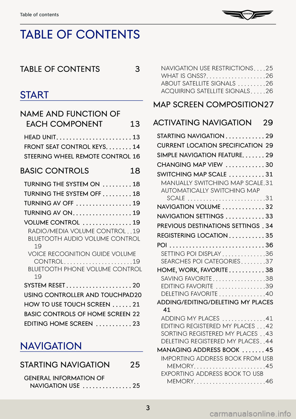
Table of conTenTs 3
sTa rT
name and func Tion of
each componenT 13
head uniT . . . . . . . . . . . . . . . . . . . . . . .13
fronT seaT conTrol KeY s . . . . . . . .14
sTeering wheel remo Te conTrol 16
basic conTrols 18
Turning The sYsTem on . . . . . . . . .18
Turning The sY sTem off . . . . . . . . .18
Turning a V off . . . . . . . . . . . . . . . . .19
Turning aV on . . . . . . . . . . . . . . . . . .19
Volume conTrol . . . . . . . . . . . . . . .19
Radio/Media VoluMe ContRol . .19
Bluetooth a udio VoluMe ContRol
19
VoiCe ReCognition guide VoluMe
ContRol . . . . . . . . . . . . . . . . . . . . . .19
Bluetooth phone VoluMe ContRol
19
sYsTem reseT . . . . . . . . . . . . . . . . . . . .20
using conTroller and Touchpad 20
how To use Touch screen . . . . . .21
b asic conTrols of home screen 22
ediTing home screen . . . . . . . . . . .23
na Viga Tion
sTar Ting na VigaTion 25
general informa Tion of
naViga Tion use . . . . . . . . . . . . . . .25
naVigation use RestRiC tions . . . .25
What is gnss? . . . . . . . . . . . . . . . . . . .26
aBout satellite signals . . . . . . . . .26
aCquiRing satellite signals . . . . .26
map screen composiTion 27
ac TiV aTing na VigaTion 29
sTar Ting na VigaTion . . . . . . . . . . . .29
Current LoC ation SpeCifiCation 29
simple na VigaTion fea Ture . . . . . . .29
changing map View . . . . . . . . . . . .30
swiT ching map scale . . . . . . . . . . .31
Manually sWit Ching Map sCale .31
autoMatiC ally sWitChing Map
sCale . . . . . . . . . . . . . . . . . . . . . . . . .31
na Viga Tion Volume . . . . . . . . . . . . .32
naViga Tion seTTings . . . . . . . . . . . .33
preVious des TinaTions seTTings .34
regis Tering loca Tion . . . . . . . . . . .35
poi . . . . . . . . . . . . . . . . . . . . . . . . . . . . .36
setting poi display . . . . . . . . . . . . . .36
seaRChes poi CategoRies . . . . . . . .37
home, worK, f aV oriTe . . . . . . . . . . .38
sa Ving Fa VoRite . . . . . . . . . . . . . . . . .38
editing Fa VoRite . . . . . . . . . . . . . . . .39
deleting Fa VoRite . . . . . . . . . . . . . . .40
adding/ediTing/deleTing mY places
41
adding My pla Ces . . . . . . . . . . . . . .41
editing RegisteRed My pla Ces . . .42
soRting RegisteRed My pla Ces . .43
deleting RegisteRed My pla Ces . .44
managing address booK . . . . . . .45
iMpoRting addRess Book FRoM usB
MeMoR y . . . . . . . . . . . . . . . . . . . . . . .45
expoRting addRess Book to usB
MeMoR y . . . . . . . . . . . . . . . . . . . . . . .46
Table of conTenT s
Page 25 of 298

25
Starting Navigation
sTar Ting na VigaTion
general informa Tion of naVigaTion use
naViga Tion use res TricTions
Please observe and comply with local traffic rules and regulations.
䠐For your safety, some features cannot be operated while driving. Features that cannot be
operated will be disabled.
䠐The route displayed for destination guidance is a reference and the route guidance will
take you to the vicinity of your destination. The highlighted route is not always; the shortest
distance, the least congested, and in some cases might, not be the fastest route.
䠐Road, name, and POI information may not always been completely updated. Some places
may not include up to date information.
䠐The car position mark does not always indicate your exact location. This system uses GPS
information, various sensors, and road map data to display the current position. However,
errors in displaying your location may occur if the satellite is transmitting inaccurate signals
or two or less satellite signals are being received. Errors that occur in such conditions
cannot be corrected.
䠐The position of the vehicle within the navigation may differ from your actual location
depending on various reasons, including the satellite transmission state, vehicle state
(driving location and conditions), etc. Additionally, the car position mark may differ from the
actual position if the map data is different from the actual road landscape, such as changes
due to the construction of new roads. If such differences occur, driving for a short period
of time will automatically correct the position of the vehicle through map matching or GPS
information.
Page 26 of 298

26
Starting Navigation
whaT is gnss?
The GNSS(Global Navigation Satellite System) is a satellite-based navigation system made up
of a network of 32 satellites placed into orbit by the Global Positioning System (GPS) of U.S.A,
GLONASS of RUSSIA, etc.
GNSS works in any weather conditions, anywhere in the world, 24 hours a day.
There are no subscription fees or setup charges to use GNSS.
abouT sa TelliTe signals
Your head unit must acquire satellite signals to operate. If you are indoors, near tall buildings
or trees, or in a parking garage, the unit may not be able to acquire satellite signals.
acquiring sa TelliTe signals
Before the head unit can determine your current position and navigate a route, you must do
the following steps:
1. Go outside to an area free from tall obstructions.
2. Turn on the head unit. Acquiring satellite signals can take a few minutes.