HONDA CIVIC SEDAN 2017 Navigation Manual (in English)
CIVIC SEDAN 2017
HONDA
HONDA
https://www.carmanualsonline.info/img/13/34538/w960_34538-0.png
HONDA CIVIC SEDAN 2017 Navigation Manual (in English)
Page 88 of 147
86
uuMap Operation uTraffic Information
Navigation
Traffic Information
When you set the traffic feature, the system examines traffic conditions and
optimizes the route for the shortest time. If a severe tra ffic delay occurs while you
are navigating, the system searches for a fast er route. If it finds one, the system will
prompt you and you can choose to accept the new route.
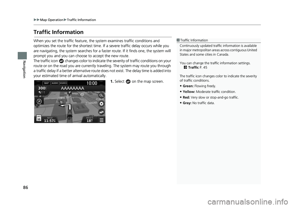
The traffic icon changes color to indicate the severity of traffic conditions on your
route or on the road you are currently tra veling. The system may route you through
a traffic delay if a better alternative route do es not exist. The delay time is added into
your estimated time of arrival automatically.
1.Select on the map screen.1Traffic Information
Continuously updated traffic information is available
in major metropolitan areas across contiguous United
States and some ci ties in Canada.
You can change the traffi c information settings.
2 Traffic P. 45
The traffic icon changes color to indicate the severity
of traffic conditions.
•Green: Flowing freely.
•Yellow: Moderate traffic condition.
•Red: Very slow or stop-and-go traffic.
•Gray: No traffic data.
Page 89 of 147
87
uuMap Operation uTraffic Information
Continued
Navigation
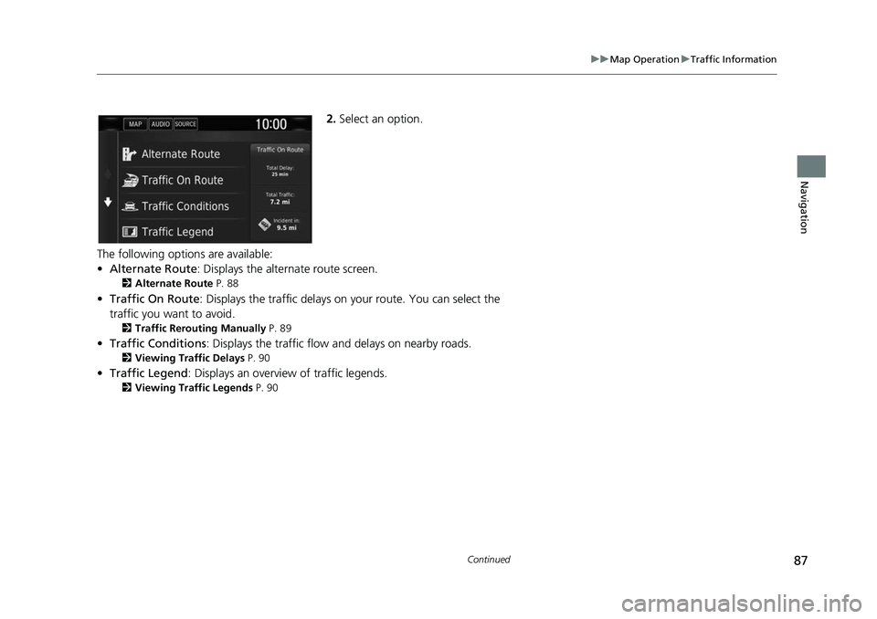
2. Select an option.
The following options are available:
• Alternate Route: Displays the alternate route screen.
2 Alternate Route P. 88
•Traffic On Route: Displays the traffic delays on your route. You can select the
traffic you want to avoid.
2 Traffic Rerouting Manually P. 89
•Traffic Conditions : Displays the traffic flow and delays on nearby roads.2Viewing Traf fic Delays P. 90
•Traffic Legend : Displays an overview of traffic legends.2Viewing Traffic Legends P. 90
Page 90 of 147
88
uuMap Operation uTraffic Information
Navigation
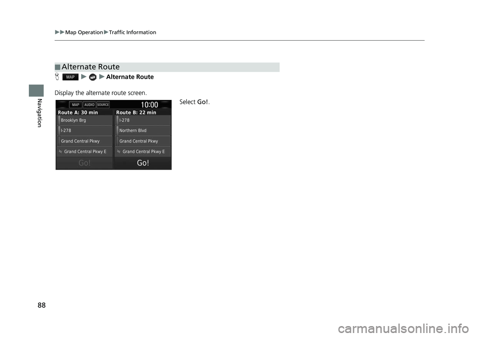
H uuAlternate Route
Display the alternate route screen. Select Go!.
■Alternate Route
Page 91 of 147
89
uuMap Operation uTraffic Information
Continued
Navigation
H uuTraffic On Route
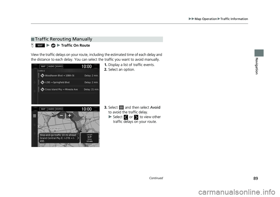
View the traffic delays on your route, incl uding the estimated time of each delay and
the distance to each delay. You can select the traffic you want to avoid manually.
1.Display a list of traffic events.
2. Select an option.
3. Select and then select Avoid
to avoid the traffic delay.
u Select or to view other
traffic delays on your route.
■Traffic Rerouting Manually
Page 92 of 147
90
uuMap Operation uTraffic Information
Navigation
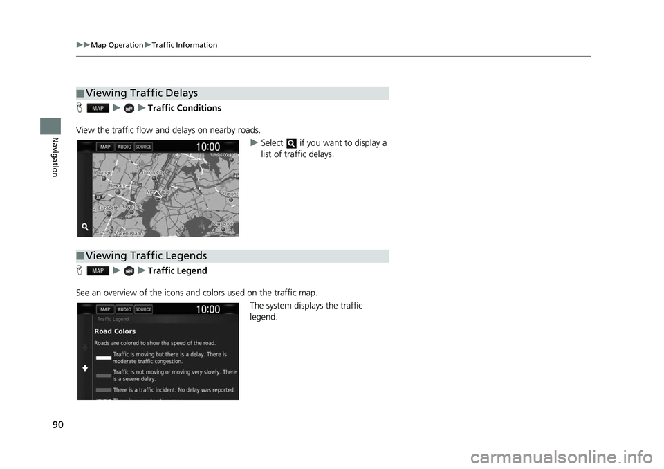
H uuTraffic Conditions
View the traffic flow and delays on nearby roads. uSelect if you want to display a
list of traffic delays.
H uuTraffic Legend
See an overview of the icons a nd colors used on the traffic map.
The system displays the traffic
legend.
■Viewing Traffic Delays
■Viewing Traffic Legends
Page 93 of 147
91
Navigation
Changing Your Route
Stopping the Route
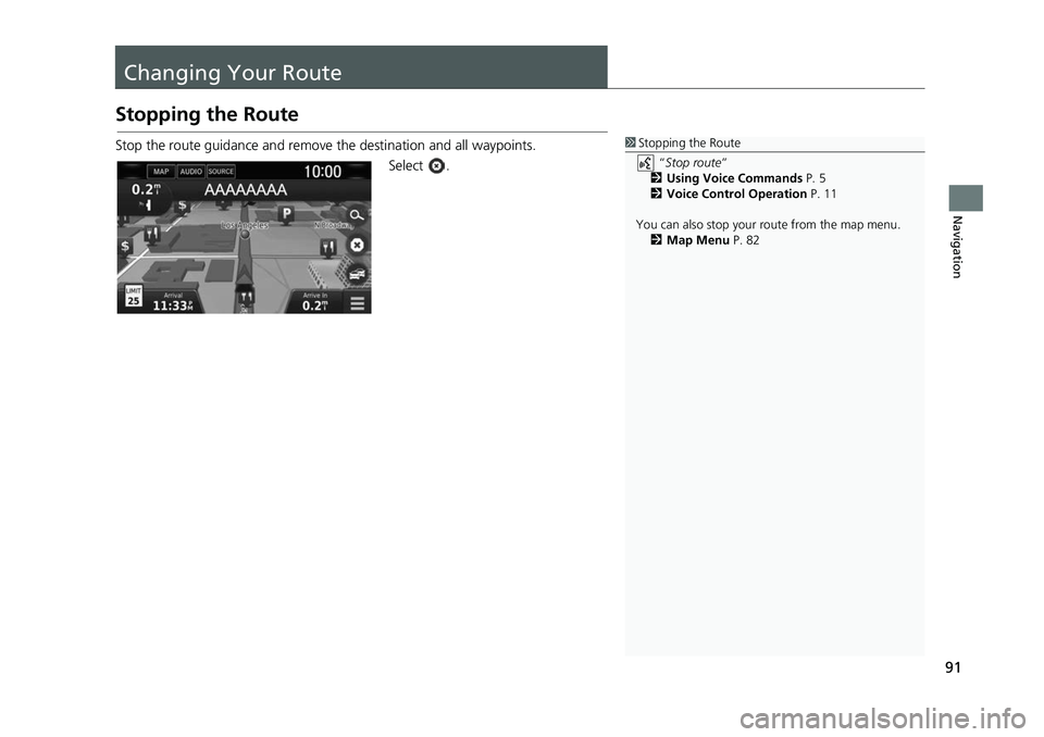
Stop the route guidance and remove the destination and all waypoints.
Select .1Stopping the Route
“Stop route ”
2 Using Voice Commands P. 5
2 Voice Control Operation P. 11
You can also stop your route from the map menu. 2 Map Menu P. 82
Page 94 of 147
92
uuChanging Your Route uTaking a Detour
Navigation
Taking a Detour
H u (Menu) uDetour (when en route)
Calculate a new route to avoid something ahead of you. The system creates a new
route if possible. The system attempts to get you back on your original route as
quickly as possible.
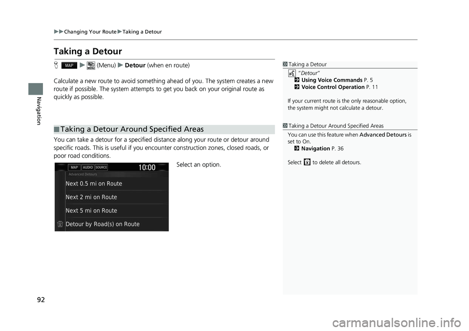
You can take a detour for a specified distan ce along your route or detour around
specific roads. This is useful if you encounter construction zones, closed roads, or
poor road conditions.
Select an option.
■Taking a Detour Around Specified Areas
1
Taking a Detour
“Detour ”
2 Using Voice Commands P. 5
2 Voice Control Operation P. 11
If your current route is the only reasonable option,
the system might not calculate a detour.
1 Taking a Detour Around Specified Areas
You can use this feature when Advanced Detours is
set to On. 2 Navigation P. 36
Select to dele te all detours.
Page 95 of 147
93
uuChanging Your Route uTaking a Detour
Navigation
The following options are available:
• Next 0.5 mi on Route : Calculates a new route by avoiding the next 0.5 mile on
your route.
• Next 2 mi on Route : Calculates a new route by av oiding the next 2 miles on
your route.
• Next 5 mi on Route : Calculates a new route by avoiding the next 5 miles on your
route.
• Detour by Road(s) on Route : Calculates a new route by avoiding the specific
roads on your route. Selec t roads from the turn list.
Page 96 of 147
94
uuChanging Your Route uAdding Waypoints
Navigation
Adding Waypoints
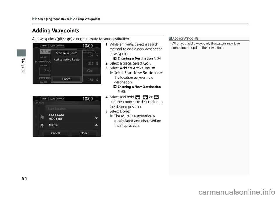
Add waypoints (pit stops) along the route to your destination.
1.While en route, select a search
method to add a new destination
or waypoint.
2 Entering a Destination P. 54
2.Select a place. Select Go!.
3. Select Add to Active Route .
u Select Start New Route to set
the location as your new
destination.
2 Entering a New Destination
P. 98
4. Select and hold , or
and then move the destination to
the desired position.
5. Select Done.
u The route is automatically
recalculated and displayed on
the map screen.
1Adding Waypoints
When you add a waypoint, the system may take
some time to update the arrival time.
Page 97 of 147
95
Navigation
Changing Your Destination
Selecting a Destination on the Map
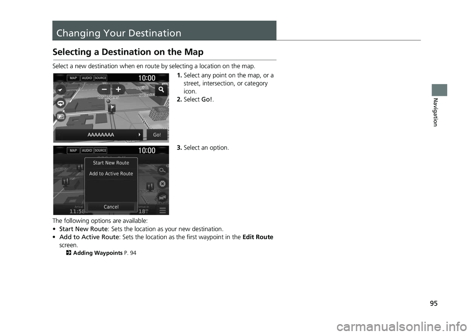
Select a new destination when en route by selecting a location on the map.
1.Select any point on the map, or a
street, intersection, or category
icon.
2. Select Go!.
3. Select an option.
The following options are available:
• Start New Route : Sets the location as your new destination.
• Add to Active Route : Sets the location as th e first waypoint in the Edit Route
screen.
2 Adding Waypoints P. 94

