INFINITI QX30 2019 Infiniti Connection
Manufacturer: INFINITI, Model Year: 2019, Model line: QX30, Model: INFINITI QX30 2019Pages: 283, PDF Size: 1.59 MB
Page 161 of 283
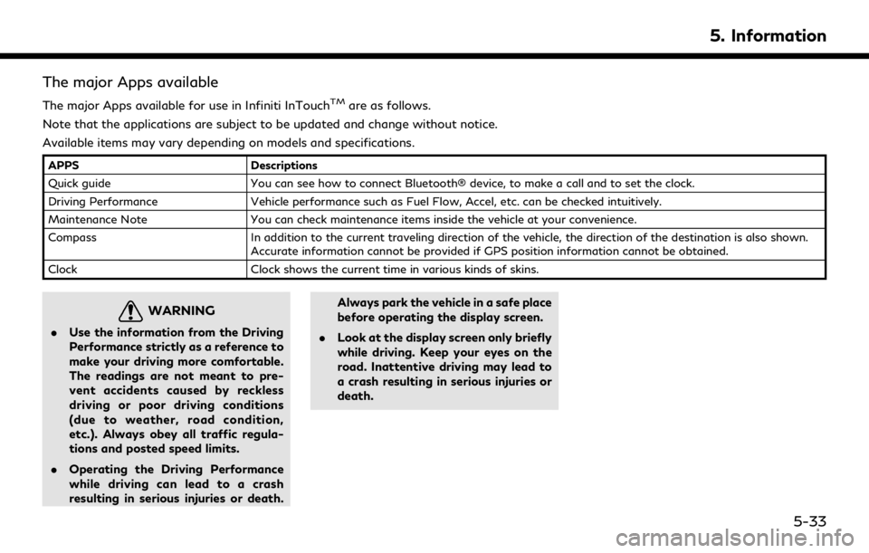
The major Apps available
The major Apps available for use in Infiniti InTouchTMare as follows.
Note that the applications are subject to be updated and change without notice.
Available items may vary depending on models and specifications.
APPS Descriptions
Quick guide You can see how to connect Bluetooth® device, to make a call and to set the clock.
Driving Performance Vehicle performance such as Fuel Flow, Accel, etc. can be checked intuitively.
Maintenance Note You can check maintenance items inside the vehicle at your convenience.
Compass In addition to the current traveling direction of the vehicle, the direction of the destination is also shown.
Accurate information cannot be provided if GPS position information cannot be obtained.
Clock Clock shows the current time in various kinds of skins.
WARNING
.Use the information from the Driving
Performance strictly as a reference to
make your driving more comfortable.
The readings are not meant to pre-
vent accidents caused by reckless
driving or poor driving conditions
(due to weather, road condition,
etc.). Always obey all traffic regula-
tions and posted speed limits.
. Operating the Driving Performance
while driving can lead to a crash
resulting in serious injuries or death. Always park the vehicle in a safe place
before operating the display screen.
. Look at the display screen only briefly
while driving. Keep your eyes on the
road. Inattentive driving may lead to
a crash resulting in serious injuries or
death.
5. Information
5-33
Page 162 of 283
5. Information
Example of how Vehicle Apps is
used
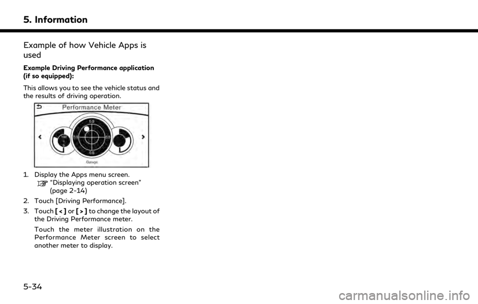
Example Driving Performance application
(if so equipped):
This allows you to see the vehicle status and
the results of driving operation.
1. Display the Apps menu screen.“Displaying operation screen”
(page 2-14)
2. Touch [Driving Performance].
3. Touch [<]or[>]to change the layout of
the Driving Performance meter.
Touch the meter illustration on the
Performance Meter screen to select
another meter to display.
5-34
Page 163 of 283

6 Navigation (if so equipped)
Safety information ........................................................... 6-3
Map data authentication ................................................ 6-3
Map operation ................................................................... 6-4Map types ..................................................................... 6-4
Displaying current vehicle location ........................ 6-6
Moving map ................................................................... 6-7
Changing scale of map .............................................. 6-8
Changing map orientation ........................................ 6-9
Setting split screen ..................................................... 6-9
Map view settings .................................................... 6-11
Setting information on map ................................... 6-14
Traffic information on map .................................... 6-14
Setting destination ......................................................... 6-15 Changing region ........................................................ 6-15
Destination screen .................................................... 6-17
Finding address ......................................................... 6-20
Finding points of interest ....................................... 6-21
Setting home as destination .................................. 6-23
Finding nearby place ................................................ 6-24
Searching from stored locations ........................... 6-24
Searching from history ............................................ 6-25
Using Journey Planner ............................................. 6-25
Setting intersection .................................................. 6-26
Setting freeway entrance/exit .............................. 6-26
Setting city center ..................................................... 6-27 Setting by phone number ..................................... 6-27
Setting from stored routes ................................... 6-27
Searching by connecting Data Center .............. 6-28
Setting by Infiniti InTouch
TMServices .............. 6-28
Setting point on map ............................................. 6-29
Procedures after setting route ........................... 6-30
Route guidance ............................................................... 6-31
About route guidance ............................................ 6-31
Route guidance screens ........................................ 6-34
Canceling route ........................................................ 6-36
Route menu screen ................................................. 6-36
Editing route ............................................................. 6-37
Recalculating route ................................................. 6-39
Searching for detour route using
traffic information ................................................. 6-40
Displaying turn list .................................................. 6-41
Route guidance settings ....................................... 6-42
Storing a location/route .............................................. 6-47 Storing location ....................................................... 6-47
Storing route ........................................................... 6-48
Storing avoid area .................................................. 6-48
Editing stored information .................................. 6-50
Deleting stored item ............................................... 6-53
Transferring information to/from
address book ............................................................ 6-55
Page 164 of 283

Navigation settings ........................................................ 6-56
General information ....................................................... 6-59Current vehicle location .......................................... 6-59 Route calculation .................................................... 6-62
Route guidance ........................................................ 6-64
Map data ................................................................... 6-66
Page 165 of 283

SAFETY INFORMATION
The navigation system is primarily designed
to help you reach your destination. However,
you, the driver, must use the system safely
and properly. Information concerning road
conditions, traffic signs and the availability
of services may not always be up to date.
The system is not a substitute for safe,
proper, and legal driving.
WARNING
.Do not rely on route guidance alone.
Always be sure that all driving man-
euvers are legal and safe in order to
avoid accidents.
MAP DATA AUTHENTICATION
When using a navigation system for the first
time, map data authentication is necessary.
1. The system starts when the ignition
switch is placed in the ACC or ON
position for the first time. The map data
authentication screen is displayed.
2. Enter the 16 alphanumeric characters in four parts containing four characters
each. Each of the four parts is displayed
separately.
6. Navigation (if so equipped)
6-3
Page 166 of 283
6. Navigation (if so equipped)
MAP OPERATION
MAP TYPES
Two types of map views are available: 2D
map and Birdview™ (3D) map.
2D map
The 2D map displays the map in a two-
dimensional environment similar to a road
map.
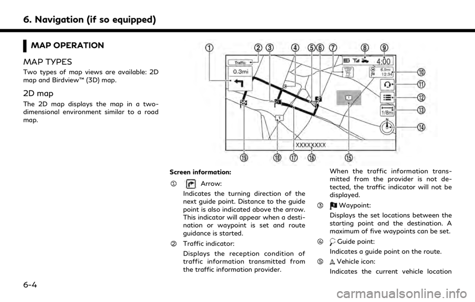
Screen information:
Arrow:
Indicates the turning direction of the
next guide point. Distance to the guide
point is also indicated above the arrow.
This indicator will appear when a desti-
nation or waypoint is set and route
guidance is started.
Traffic indicator:
Displays the reception condition of
traffic information transmitted from
the traffic information provider. When the traffic information trans-
mitted from the provider is not de-
tected, the traffic indicator will not be
displayed.
Waypoint:
Displays the set locations between the
starting point and the destination. A
maximum of five waypoints can be set.
Guide point:
Indicates a guide point on the route.
Vehicle icon:
Indicates the current vehicle location
6-4
Page 167 of 283
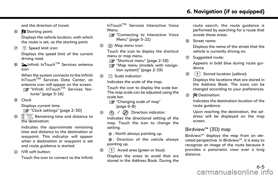
and the direction of travel.
Starting point:
Displays the vehicle location, with which
the route is set, as the starting point.
Speed limit icon:
Displays the speed limit of the current
driving road.
Infiniti InTouchTMServices antenna
icon
When the system connects to the Infiniti
InTouch
TMServices Data Center, an
antenna icon will appear on the screen.
“Infiniti InTouchTMServices fea-
tures” (page 5-16)
Clock
Displays current time.
“Clock settings” (page 2-30)
Remaining time and distance to
the destination:
Indicates the approximate remaining
time and distance to the destination or
waypoint. This indicator will appear
when a destination or waypoint is set
and route guidance is started.
IVR soft button:
Touch the icon to connect to the Infiniti InTouch
TMServices Interactive Voice
Menu.
“Connecting to Interactive Voice
Menu” (page 5-21)
Map menu icon:
Touch the icon to display the shortcut
menu or map menu.
“Shortcut menu” (page 2-18)“Map menu (models with naviga-
tion system)” (page 2-19)
Scale indicator:
Indicates the scale of the map.
Touch the icon to display the scale bar.
The map scale can be adjusted using the
scale bar.
“Changing scale of map”
(page 6-8)
/Direction indicator:
Indicates the directional setting of the
map. Touch the icon to change the
setting.
: North always pointing up.
: Direction of the vehicle always
pointing up.
Avoid area (green or blue):
Displays the areas to avoid that are
stored in the Address Book. During the route search, the route guidance is
performed by searching for a route that
avoids those areas.
Street name:
Displays the name of the street that the
vehicle is currently driving on.
Suggested route:
Appears in bold blue during route gui-
dance.
Stored location (yellow):
Displays the locations that are stored in
the Address Book. The icons can be
changed according to your preferences.
Destination:
Indicates the destination location of the
route guidance.
Upon reaching the destination, the ad-
dress will be displayed on the map
screen.
Birdview™ (3D) map
Birdview™ displays the map from an ele-
vated perspective. In Birdview™, it is easy to
recognize an image of the route because it
provides a panoramic view over a long
distance.
6. Navigation (if so equipped)
6-5
Page 168 of 283
6. Navigation (if so equipped)
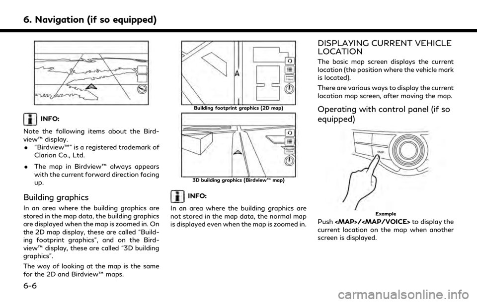
INFO:
Note the following items about the Bird-
view™ display. . “Birdview™” is a registered trademark of
Clarion Co., Ltd.
. The map in Birdview™ always appears
with the current forward direction facing
up.
Building graphics
In an area where the building graphics are
stored in the map data, the building graphics
are displayed when the map is zoomed in. On
the 2D map display, these are called “Build-
ing footprint graphics”, and on the Bird-
view™ display, these are called “3D building
graphics”.
The way of looking at the map is the same
for the 2D and Birdview™ maps.
Building footprint graphics (2D map)
3D building graphics (Birdview™ map)
INFO:
In an area where the building graphics are
not stored in the map data, the normal map
is displayed even when the map is zoomed in.
DISPLAYING CURRENT VEHICLE
LOCATION
The basic map screen displays the current
location (the position where the vehicle mark
is located).
There are various ways to display the current
location map screen, after moving the map.
Operating with control panel (if so
equipped)
Example
Push
Page 169 of 283
Operating with INFINITI controller
(if so equipped)
Push
location on the map when another screen is
displayed.
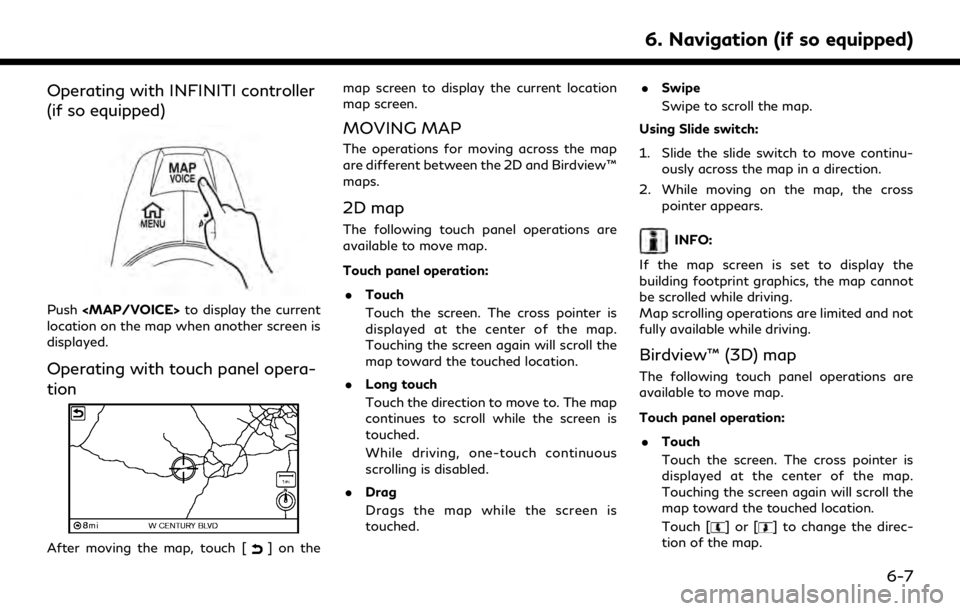
Operating with touch panel opera-
tion
After moving the map, touch [] on the map screen to display the current location
map screen.
MOVING MAP
The operations for moving across the map
are different between the 2D and Birdview™
maps.
2D map
The following touch panel operations are
available to move map.
Touch panel operation:
. Touch
Touch the screen. The cross pointer is
displayed at the center of the map.
Touching the screen again will scroll the
map toward the touched location.
. Long touch
Touch the direction to move to. The map
continues to scroll while the screen is
touched.
While driving, one-touch continuous
scrolling is disabled.
. Drag
Drags the map while the screen is
touched. .
Swipe
Swipe to scroll the map.
Using Slide switch:
1. Slide the slide switch to move continu- ously across the map in a direction.
2. While moving on the map, the cross pointer appears.INFO:
If the map screen is set to display the
building footprint graphics, the map cannot
be scrolled while driving.
Map scrolling operations are limited and not
fully available while driving.
Birdview™ (3D) map
The following touch panel operations are
available to move map.
Touch panel operation: . Touch
Touch the screen. The cross pointer is
displayed at the center of the map.
Touching the screen again will scroll the
map toward the touched location.
Touch [
]or[] to change the direc-
tion of the map.
6. Navigation (if so equipped)
6-7
Page 170 of 283
![INFINITI QX30 2019 Infiniti Connection 6. Navigation (if so equipped)
.Long touch
Touch and hold a point on the map or
touch and hold [
]or[] in the
direction to move the map to. The map
continues to move while the screen is
touched.
While INFINITI QX30 2019 Infiniti Connection 6. Navigation (if so equipped)
.Long touch
Touch and hold a point on the map or
touch and hold [
]or[] in the
direction to move the map to. The map
continues to move while the screen is
touched.
While](/img/42/35077/w960_35077-169.png)
6. Navigation (if so equipped)
.Long touch
Touch and hold a point on the map or
touch and hold [
]or[] in the
direction to move the map to. The map
continues to move while the screen is
touched.
While driving, one-touch continuous
scrolling is disabled.
. Drag
Drags the map while the screen is
touched.
. Swipe
Swipe the touch panel to scroll the map
screen quickly.
Using slide switch:
1. Slide the slide switch to move continu- ously across the map in a direction.
2. While moving on the map, the cross pointer appears.
INFO:
If the map screen is set to display the
building footprint graphics, the map cannot
be scrolled while driving.
Map scrolling operations are limited and not
fully available while driving.
CHANGING SCALE OF MAP
There are several methods for changing the
map scale.
INFO:
While driving, operation for changing map
scale is limited.
Touch panel operation
1. Touch [].
The scale bar is displayed.
2. Touch [Zoom In] or [Zoom Out] to change the scale.
Pinch-in
To view a wider area, pinch-in the map
screen.
Pinch-out
To view the map in detail, pinch-out the map
screen.
INFO:
While driving, pinch-in/pinch-out are dis-
abled.
6-8