navigation Lexus ES300h 2014 Navigation Manual
[x] Cancel search | Manufacturer: LEXUS, Model Year: 2014, Model line: ES300h, Model: Lexus ES300h 2014Pages: 424, PDF Size: 16.46 MB
Page 2 of 424
11
ES350/300h_Navi_OM33A66U_(U)13.07.11 10:10
1QUICK GUIDE9
2 BASIC FUNCTION31
3 NAVIGATION SYSTEM67
4PHONE143
5 AUDIO/VIDEO SYSTEM207
6AIR CONDITIONING291
7VOICE COMMAND SYSTEM307
8 INFORMATION323
9LEXUS ENFORM WITH SAFETY
CONNECT347
10
PERIPHERAL MONITORING SYSTEM375
INDEX387
TABLE OF CONTENTS
Page 3 of 424
2
ES350/300h_Navi_OM33A66U_(U)13.07.11 10:10
Introduction
This manual explains the operation of the Navigation System. Please read this manual
carefully to ensure proper use. Keep th is manual in your vehicle at all times.
The screen shots in this document and the actual screens of the navigation system dif-
fer depending on whether the functions and/or a contract existed and the map data
available at the time of producing this document.
The Navigation System is one of the most technologically advanced vehicle accesso-
ries ever developed. The system receives satellite signals from the Global Positioning
System (GPS) operated by the U.S. Department of Defense. Using these signals and
other vehicle sensors, the system indicates yo ur present position and assists in locating
a desired destination.
The navigation system is desi gned to select efficient routes from your present starting
location to your destination. The system is al so designed to direct you to a destination
that is unfamiliar to you in an efficient manner. The system uses DENSO maps. The cal-
culated routes may not be the shortest nor the least traffic congested. Your own per-
sonal local knowledge or “short cut” may at times be faster than the calculated routes.
The navigation system’s database includes Point of Interest categories to allow you to
easily select destinations such as restaurants and hotels. If a destination is not in the da-
tabase, you can enter the street address or a major intersection close to it and the sys-
tem will guide you there.
The system will provide both a visual map and audio instructions. The audio instructions
will announce the distance remaining and the direction to turn in when approaching an
intersection. These voice instructions will he lp you keep your eyes on the road and are
timed to provide enough time to allow you to maneuver, change lanes or slow down.
Please be aware that all current vehicle navi gation systems have certain limitations that
may affect their ability to perform properly. The accuracy of the vehicle’s position de-
pends on satellite conditions, road configuration, vehicle condition or other circum-
stances. For more informatio n on the limitations of the system, refer to pages 139
through 141.
NAVIGATION SYSTEM OWNER’S MANUAL
NAVIGATION SYSTEM
Page 6 of 424
5
ES350/300h_Navi_OM33A66U_(U)13.07.11 10:10
To use this system in the safest possible
manner, follow all the safety tips shown be-
low.
This system is intended to assist in reaching
the destination and, if used properly, can do
so. The driver is solely responsible for the
safe operation of your vehicle and the safety
of your passengers.
Do not use any feature of this system to the
extent it becomes a distraction and pre-
vents safe driving. The first priority while
driving should always be the safe operation
of the vehicle. While driving, be sure to ob-
serve all traffic regulations.
Prior to the actual use of this system, learn
how to use it and become thoroughly famil-
iar with it. Read the entire Navigation Sys-
tem Owner’s Manual to make sure you
understand the system . Do not allow other
people to use this system until they have
read and understood th e instructions in this
manual.
For your safety, some functions may be-
come inoperable when driving. Unavailable
screen buttons are dimmed. Only when the
vehicle is not moving, can the destination
and route selection be done. While driving, listen to
the voice instructions
as much as possible and glance at the
screen briefly and only when it is safe. How-
ever, do not totally rely on voice guidance.
Use it just for referenc e. If the system can-
not determine the current position correct-
ly, there is a possibility of incorrect, late, or
non-voice guidance.
The data in the system may occasionally be
incomplete. Road conditions, including
driving restrictions (no left turns, street clo-
sures, etc.) frequently change. Therefore,
before following any instructions from the
system, look to see whether the instruction
can be done safely and legally.
This system cannot warn about such things
as the safety of an area, condition of streets,
and availability of emergency services. If un-
sure about the safety of an area, do not drive
into it. Under no circumstances is this sys-
tem a substitute for the driver’s personal
judgement.
Use this system only in locations where it is
legal to do so. Some states/provinces may
have laws prohibiting the use of video and
navigation screens next to the driver.
SAFETY INSTRUCTIONCAUTION
●For safety, the driver should not operate
the navigation system while he/she is
driving. Insufficient attention to the road
and traffic may cause an accident.
●While driving, be sure to obey the traffic
regulations and maintain awareness of
the road conditions. If a traffic sign on the
road has been changed, route guidance
may not have the updated information
such as the direction of a one way street.
Page 7 of 424
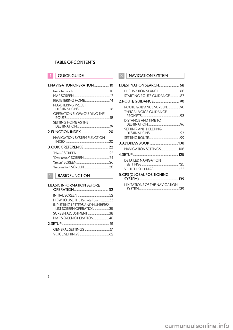
TABLE OF CONTENTS
6
ES350/300h_Navi_OM33A66U_(U)13.07.11 10:10
1. NAVIGATION OPERATION..................... 10
Remote Touch........................................................... 10
MAP SCREEN ......................................................... 12
REGISTERING HOME ....................................... 14
REGISTERING PRESET DESTINATIONS ................................................. 16
OPERATION FLOW: GUIDING THE ROUTE..................................................................... 18
SETTING HOME AS THE DESTINATION .................................................... 19
2. FUNCTION INDEX ..................................... 20
NAVIGATION SYSTEM FUNCTION INDEX .....................................................................20
3. QUICK REFERENCE .................................. 22
“Menu” SCREEN ................................................... 22
“Destination” SCREEN ........................................ 24
“Setup” SCREEN.................................................... 26
“Information” SCREEN........................................28
1. BASIC INFORMATION BEFORE
OPERATION ............................................... 32
INITIAL SCREEN .................................................. 32
HOW TO USE THE Remote Touch ............. 33
INPUTTING LETTERS AND NUMBERS/LIST SCREEN OPERATION .......................35
SCREEN ADJUSTMENT ..................................38
MAP SCREEN OPERATION.........................40
2. SETUP ................................................................. 51
GENERAL SETTINGS ........................................ 51
VOICE SETTINGS ............................................... 62
1. DESTINATION SEARCH............................ 68
DESTINATION SEARCH ................................ 68
STARTING ROUTE GUIDANCE ............... 87
2. ROUTE GUIDANCE ................................... 90
ROUTE GUIDANCE SCREEN .................... 90
TYPICAL VOICE GUIDANCE PROMPTS............................................................. 93
DISTANCE AND TIME TO DESTINATION .................................................. 96
SETTING AND DELETING DESTINATIONS.................................................97
SETTING ROUTE................................................. 99
3. ADDRESS BOOK ....................................... 108
NAVIGATION SETTINGS............................ 108
4. SETUP .............................................................. 125
DETAILED NAVIGATION SETTINGS............................................................125
VEHICLE SETTINGS .........................................133
5. GPS (GLOBAL POSITIONING SYSTEM)...................................................... 139
LIMITATIONS OF THE NAVIGATION SYSTEM ................................................................139
1QUICK GUIDE
2BASIC FUNCTION
3NAVIGATION SYSTEM
Page 9 of 424
TABLE OF CONTENTS
8
ES350/300h_Navi_OM33A66U_(U)13.07.11 10:10
1. LEXUS ENFORM WITH SAFETY CONNECT-OVERVIEW ..................... 348
FUNCTIONAL OVERVIEW ...................... 348
TYPE A: FUNCTION ACHIEVED BY USING A CELLULAR PHONE ..............349
TYPE B: FUNCTION ACHIEVED BY USING DCM AND THE
NAVIGATION SYSTEM ............................354
TYPE C: FUNCTION ACHIEVED BY USING DCM .................................................... 357
2. LEXUS ENFORM WITH SAFETY
CONNECT OPERATION ................... 358
APPS ........................................................................ 358
Destination Assist ................................................365
eDestination ........................................................... 367
Lexus Insider ..........................................................370
1. REAR VIEW MONITOR SYSTEM .........376
REAR VIEW MONITOR SYSTEM............ 376
REAR VIEW MONITOR SYSTEM PRECAUTIONS............................................. 380
THINGS YOU SHOULD KNOW ........... 385
ALPHABETICAL INDEX............................. 388
9LEXUS ENFORM WITH
SAFETY CONNECT
10PERIPHERAL MONITORING
SYSTEM
INDEX
Page 10 of 424
1
1
2
3
4
5
6
7
8
9
9
ES350/300h_Navi_OM33A66U_(U)13.07.11 09:52
10
1. Remote Touch ............................................... 10
2. MAP SCREEN.............................................. 12
3. REGISTERING HOME............................. 14
4. REGISTERING PRESET DESTINATIONS....................................... 16
5. OPERATION FLOW: GUIDING THE ROUTE......................................................... 18
6. SETTING HOME AS THE DESTINATION ......................................... 19
1. NAVIGATION SYSTEM FUNCTION INDEX ............................... 20
1. “Menu” SCREEN ........................................ 22
2. “Destination” SCREEN ............................. 24
3. “Setup” SCREEN ........................................ 26
4. “Information” SCREEN ............................. 28
1NAVIGATION OPERATION
2FUNCTION INDEX
3QUICK REFERENCE
QUICK GUIDE
Page 11 of 424

10
ES350/300h_Navi_OM33A66U_(U)13.07.11 10:10
1. NAVIGATION OPERATION
1. Remote Touch
Page 12 of 424
1. NAVIGATION OPERATION
1
QUICK GUIDE
11
ES350/300h_Navi_OM33A66U_(U)13.07.11 10:10
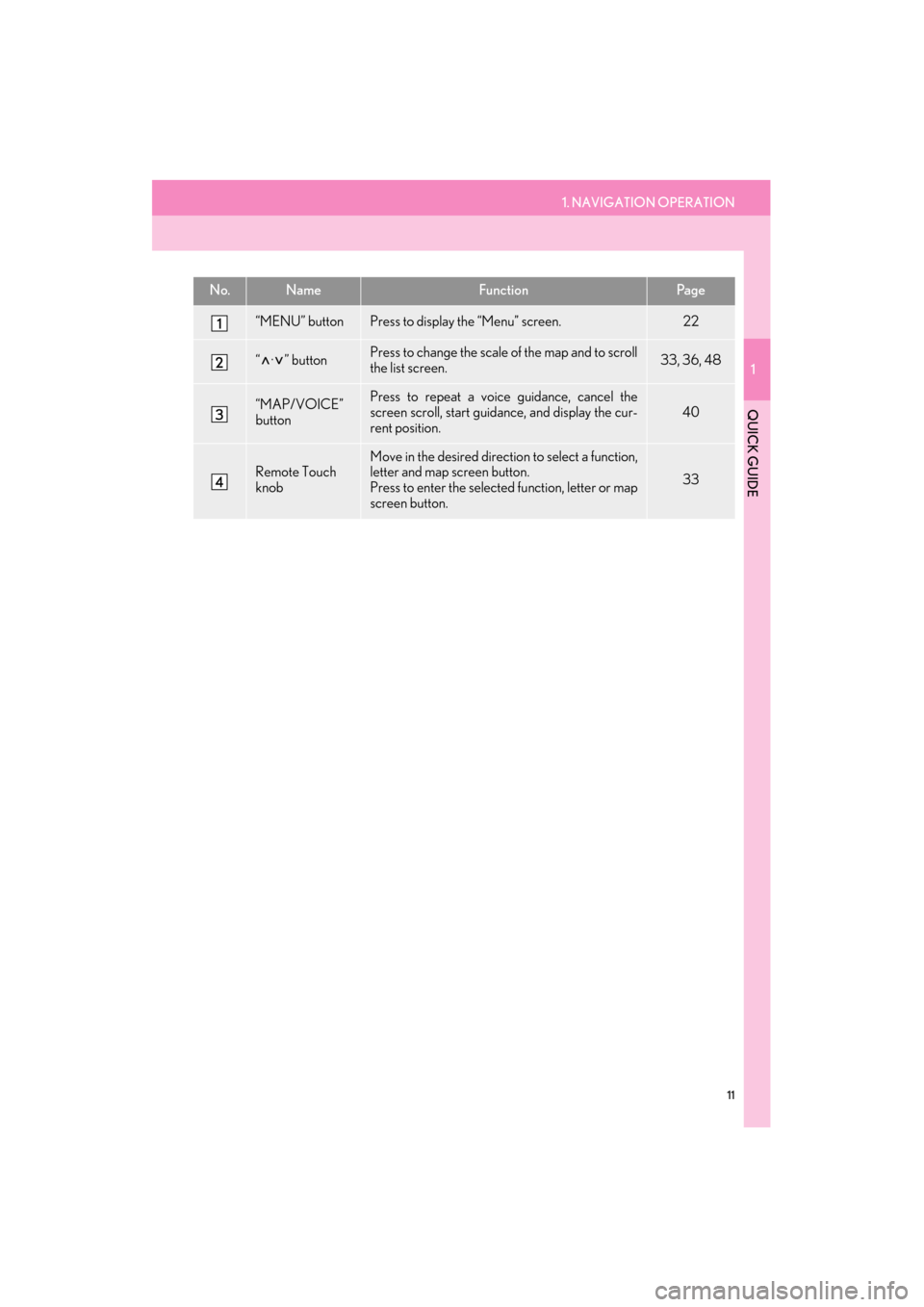
No.NameFunctionPa g e
“MENU” buttonPress to display the “Menu” screen.22
“ · ” buttonPress to change the scale of the map and to scroll
the list screen.33, 36, 48
“MAP/VOICE”
buttonPress to repeat a voice guidance, cancel the
screen scroll, start guidance, and display the cur-
rent position.
40
Remote Touch
knob
Move in the desired direction to select a function,
letter and map screen button.
Press to enter the selected function, letter or map
screen button.
33
Page 13 of 424
12
1. NAVIGATION OPERATION
ES350/300h_Navi_OM33A66U_(U)13.07.11 10:10
2. MAP SCREEN
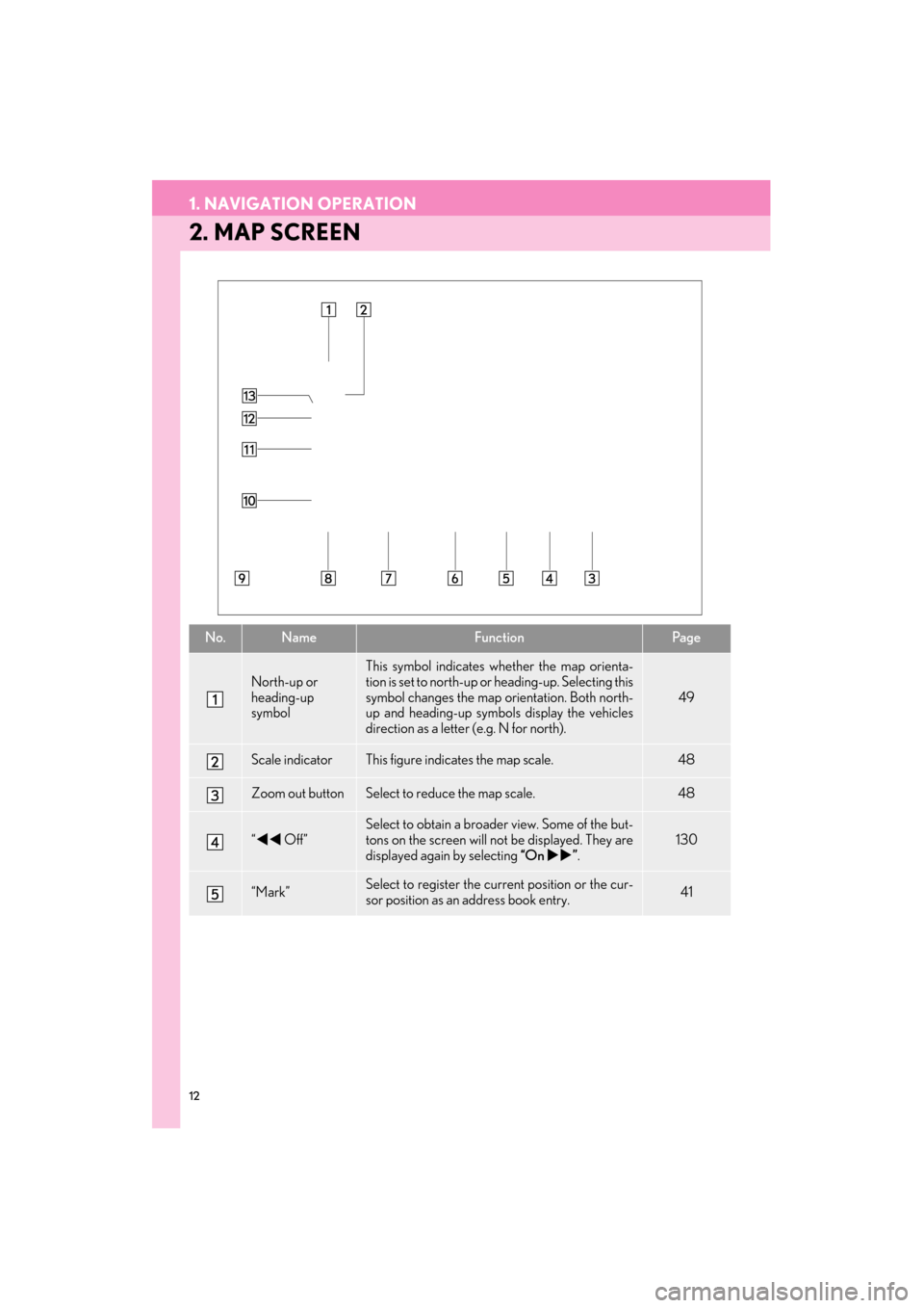
No.NameFunctionPa g e
North-up or
heading-up
symbol
This symbol indicates whether the map orienta-
tion is set to north-up or heading-up. Selecting this
symbol changes the map or ientation. Both north-
up and heading-up symb ols display the vehicles
direction as a letter (e.g. N for north).
49
Scale indicatorThis figure indicates the map scale.48
Zoom out buttonSelect to reduce the map scale.48
“ �W�W Off”
Select to obtain a broade r view. Some of the but-
tons on the screen will not be displayed. They are
displayed again by selecting “On�X�X”.
130
“Mark”Select to register the cu rrent position or the cur-
sor position as an address book entry.41
Page 14 of 424
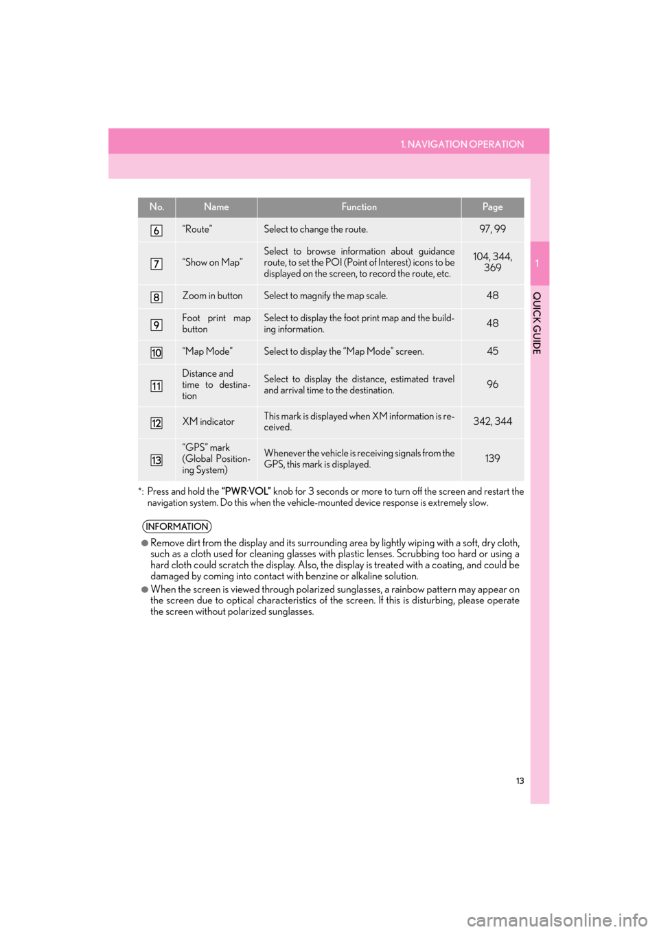
1. NAVIGATION OPERATION
1
QUICK GUIDE
13
ES350/300h_Navi_OM33A66U_(U)13.07.11 10:10
*: Press and hold the “PWR·VOL” knob for 3 seconds or more to tu rn off the screen and restart the
navigation system. Do this when the vehicle- mounted device response is extremely slow.
“Route”Select to change the route.97, 99
“Show on Map”
Select to browse information about guidance
route, to set the POI (Point of Interest) icons to be
displayed on the screen, to record the route, etc.104, 344,
369
Zoom in buttonSelect to magnify the map scale.48
Foot print map
buttonSelect to display the foot print map and the build-
ing information.48
“Map Mode”Select to display the “Map Mode” screen.45
Distance and
time to destina-
tionSelect to display the distance, estimated travel
and arrival time to the destination.96
XM indicatorThis mark is displayed when XM information is re-
ceived.342, 344
“GPS” mark
(Global Position-
ing System)Whenever the vehicle is receiving signals from the
GPS, this mark is displayed.139
INFORMATION
●
Remove dirt from the display and its surrounding area by lightly wiping with a soft, dry cloth,
such as a cloth used for cleaning glasses with plastic lenses. Scrubbing too hard or using a
hard cloth could scratch the disp lay. Also, the display is treated with a coating, and could be
damaged by coming into contact with benzine or alkaline solution.
●When the screen is viewed through polarized sunglasses, a rainbow pattern may appear on
the screen due to optical characteristics of the screen. If this is disturbing, please operate
the screen without polarized sunglasses.
No.NameFunctionPa g e