navigation update Lexus IS300h 2013 Navigation manual
[x] Cancel search | Manufacturer: LEXUS, Model Year: 2013, Model line: IS300h, Model: Lexus IS300h 2013Pages: 415, PDF Size: 42.75 MB
Page 2 of 415
2
IS300h/250_Navi_EE
This manual explains the operation of the Navigation System. Please read this
manual carefully to ensure proper use. Keep this manual in your vehicle at all
times.
The screen shots in this document and the actual screens of the navigation sys-
tem differ depending on whether the functions and/or a contract existed and the
map data available at the time of producing this document.
Please be aware that the content of this manual may be different from the nav-
igation system in some cases, such as when the system’s software is updated.
The Navigation System is one of the most technologically advanced vehicle ac-
cessories ever developed. The system receives satellite signals from the Global
Positioning System (GPS) operated by the U.S. Department of Defense. Using
these signals and other vehicle sensors, the system indicates your present posi-
tion and assists in locating a desired destination.
The navigation system is designed to select efficient routes from your present
starting location to your destination. The system is also designed to direct you
to a destination that is unfamiliar to you in an efficient manner. Map database
is made based on AISIN AW maps, whose information source comes from
NAVTEQ maps. The calculated routes may not be the shortest nor the least
traffic congested. Your own personal local knowledge or “short cut” may at
times be faster than the calculated routes.
The navigation system’s database includes Point of Interest categories to allow
you to easily select destinations such as restaurants and hotels. If a destination
is not in the database, you can enter the street address or a major intersection
close to it and the system will guide you there.
The system will provide both a visual map and audio instructions. The audio
instructions will announce the distance remaining and the direction to turn
when approaching an intersection. These voice instructions will help you keep
your eyes on the road and are timed to provide enough time to allow you to ma-
neuver, change lanes or slow down.
Please be aware that all current vehicle navigation systems have certain limita-
tions that may affect their ability to perform properly. The accuracy of the ve-
hicle’s position depends on satellite conditions, road configuration, vehicle
condition or other circumstances. For more information on the limitations of
the system, refer to page 182.
NAVIGATION SYSTEM OWNER’S MANUAL
NAVIGATION SYSTEM
Introduction
Page 5 of 415
5
IS300h/250_Navi_EE
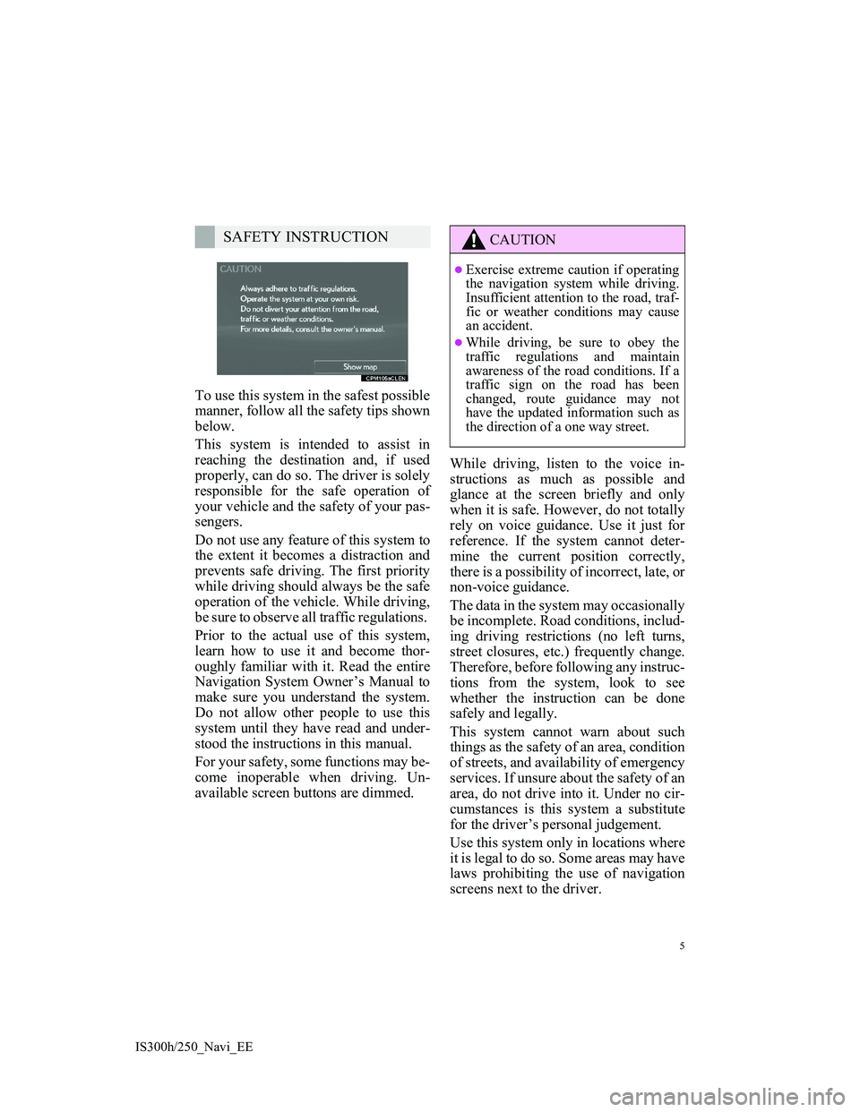
To use this system in the safest possible
manner, follow all the safety tips shown
below.
This system is intended to assist in
reaching the destination and, if used
properly, can do so. The driver is solely
responsible for the safe operation of
your vehicle and the safety of your pas-
sengers.
Do not use any feature of this system to
the extent it becomes a distraction and
prevents safe driving. The first priority
while driving should always be the safe
operation of the vehicle. While driving,
be sure to observe all traffic regulations.
Prior to the actual use of this system,
learn how to use it and become thor-
oughly familiar with it. Read the entire
Navigation System Owner’s Manual to
make sure you understand the system.
Do not allow other people to use this
system until they have read and under-
stood the instructions in this manual.
For your safety, some functions may be-
come inoperable when driving. Un-
available screen buttons are dimmed.While driving, listen to the voice in-
structions as much as possible and
glance at the screen briefly and only
when it is safe. However, do not totally
rely on voice guidance. Use it just for
reference. If the system cannot deter-
mine the current position correctly,
there is a possibility of incorrect, late, or
non-voice guidance.
The data in the system may occasionally
be incomplete. Road conditions, includ-
ing driving restrictions (no left turns,
street closures, etc.) frequently change.
Therefore, before following any instruc-
tions from the system, look to see
whether the instruction can be done
safely and legally.
This system cannot warn about such
things as the safety of an area, condition
of streets, and availability of emergency
services. If unsure about the safety of an
area, do not drive into it. Under no cir-
cumstances is this system a substitute
for the driver’s personal judgement.
Use this system only in locations where
it is legal to do so. Some areas may have
laws prohibiting the use of navigation
screens next to the driver.
SAFETY INSTRUCTIONCAUTION
Exercise extreme caution if operating
the navigation system while driving.
Insufficient attention to the road, traf-
fic or weather conditions may cause
an accident.
While driving, be sure to obey the
traffic regulations and maintain
awareness of the road conditions. If a
traffic sign on the road has been
changed, route guidance may not
have the updated information such as
the direction of a one way street.
Page 91 of 415
91
1. BASIC OPERATION
IS300h/250_Navi_EE
3
NAVIGATION SYSTEM
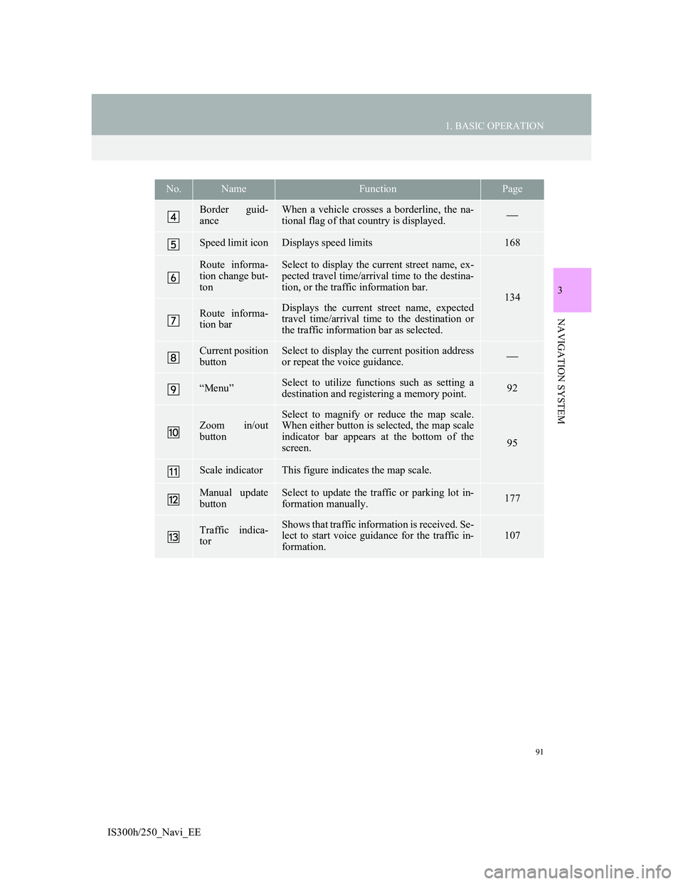
Border guid-
anceWhen a vehicle crosses a borderline, the na-
tional flag of that country is displayed.
Speed limit iconDisplays speed limits168
Route informa-
tion change but-
tonSelect to display the current street name, ex-
pected travel time/arrival time to the destina-
tion, or the traffic information bar.
134
Route informa-
tion barDisplays the current street name, expected
travel time/arrival time to the destination or
the traffic information bar as selected.
Current position
buttonSelect to display the current position address
or repeat the voice guidance.
“Menu”Select to utilize functions such as setting a
destination and registering a memory point.92
Zoom in/out
button
Select to magnify or reduce the map scale.
When either button is selected, the map scale
indicator bar appears at the bottom of the
screen.
95
Scale indicatorThis figure indicates the map scale.
Manual update
buttonSelect to update the traffic or parking lot in-
formation manually. 177
Traffic indica-
torShows that traffic information is received. Se-
lect to start voice guidance for the traffic in-
formation.107
No.NameFunctionPage
Page 117 of 415
117
2. DESTINATION SEARCH
3
NAVIGATION SYSTEM
IS300h/250_Navi_EE
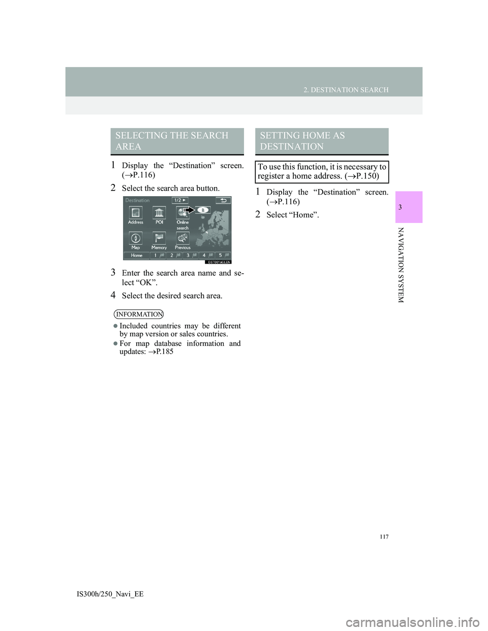
1Display the “Destination” screen.
(P.116)
2Select the search area button.
3Enter the search area name and se-
lect “OK”.
4Select the desired search area.
1Display the “Destination” screen.
(P.116)
2Select “Home”.
SELECTING THE SEARCH
AREA
INFORMATION
Included countries may be different
by map version or sales countries.
For map database information and
updates: P. 1 8 5
SETTING HOME AS
DESTINATION
To use this function, it is necessary to
register a home address. (P.150)
Page 131 of 415
131
2. DESTINATION SEARCH
3
NAVIGATION SYSTEM
IS300h/250_Navi_EE
*: Can only be used when receiving
TPEG (Transport Protocol Experts
Group) information. Depending on the
country or area, receiving TPEG infor-
mation may not be possible.
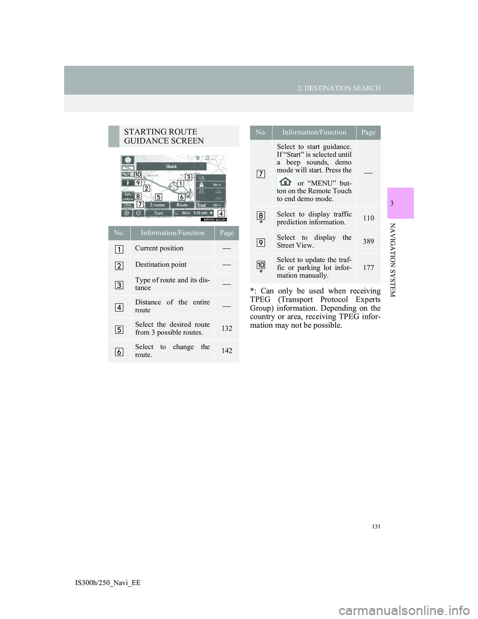
STARTING ROUTE
GUIDANCE SCREEN
No.Information/FunctionPage
Current position
Destination point
Type of route and its dis-
tance
Distance of the entire
route
Select the desired route
from 3 possible routes.132
Select to change the
route.142
Select to start guidance.
If “Start” is selected until
a beep sounds, demo
mode will start. Press the
or “MENU” but-
ton on the Remote Touch
to end demo mode.
*
Select to display traffic
prediction information.110
Select to display the
Street View.389
*
Select to update the traf-
fic or parking lot infor-
mation manually.
177
No.Information/FunctionPage
Page 141 of 415
141
3. ROUTE GUIDANCE
3
NAVIGATION SYSTEM
IS300h/250_Navi_EE
2. TYPICAL VOICE GUIDANCE PROMPTS
As the vehicle approaches an inter-
section, or point, where maneuvering
the vehicle is necessary, the system’s
voice guidance will provide various
messages.
CAUTION
Be sure to obey the traffic regulations
and keep the road condition in mind
especially when you are driving on
IPD roads (roads that are not com-
pletely digitized in our database). The
route guidance may not have the
updated information such as the
direction of a one way street.
INFORMATION
If a voice guidance command cannot
be heard, select on the map
screen to hear it again.
To adjust the voice guidance volume:
P. 8 1
Voice guidance may be made early or
late.
If the system cannot determine the
current position correctly, you may
not hear voice guidance or may not
see the magnified intersection on the
screen.
Page 167 of 415
167
4. MY MEMORY
3
NAVIGATION SYSTEM
IS300h/250_Navi_EE
1Display the “My memory” screen.
(P.148)
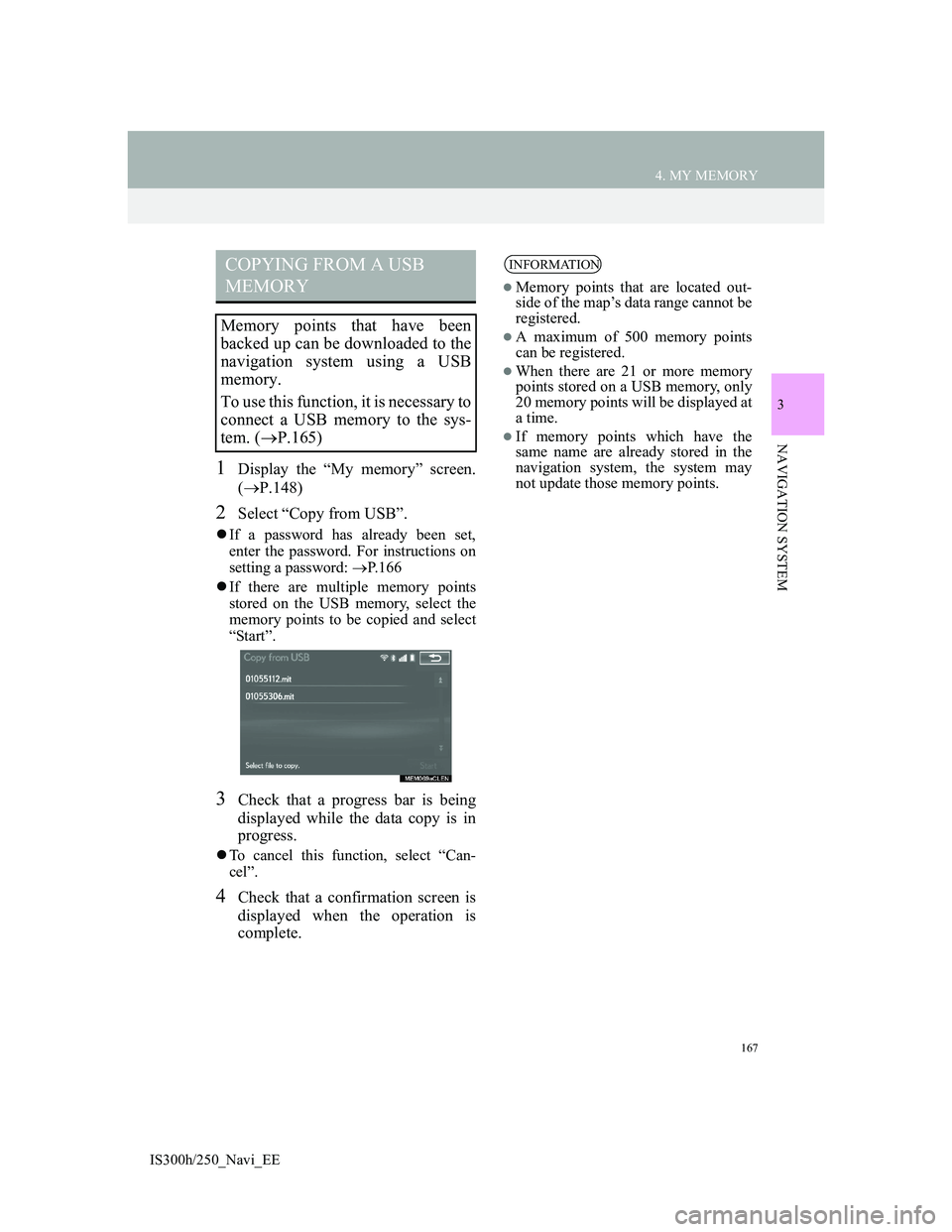
2Select “Copy from USB”.
If a password has already been set,
enter the password. For instructions on
setting a password: P.166
If there are multiple memory points
stored on the USB memory, select the
memory points to be copied and select
“Start”.
3Check that a progress bar is being
displayed while the data copy is in
progress.
To cancel this function, select “Can-
cel”.
4Check that a confirmation screen is
displayed when the operation is
complete.
COPYING FROM A USB
MEMORY
Memory points that have been
backed up can be downloaded to the
navigation system using a USB
memory.
To use this function, it is necessary to
connect a USB memory to the sys-
tem. (P.165)
INFORMATION
Memory points that are located out-
side of the map’s data range cannot be
registered.
A maximum of 500 memory points
can be registered.
When there are 21 or more memory
points stored on a USB memory, only
20 memory points will be displayed at
a time.
If memory points which have the
same name are already stored in the
navigation system, the system may
not update those memory points.
Page 177 of 415
177
5. SETUP
3
NAVIGATION SYSTEM
IS300h/250_Navi_EE
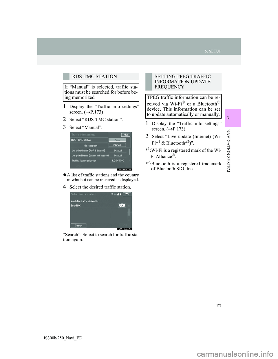
1Display the “Traffic info settings”
screen. (P.173)
2Select “RDS-TMC station”.
3Select “Manual”.
A list of traffic stations and the country
in which it can be received is displayed.
4Select the desired traffic station.
“Search”: Select to search for traffic sta-
tion again.
1Display the “Traffic info settings”
screen. (P.173)
2Select “Live update (Internet) (Wi-
Fi*
1 & Bluetooth*2)”.
*
1:Wi-Fi is a registered mark of the Wi-
Fi Alliance®.
*
2:Bluetooth is a registered trademark
of Bluetooth SIG, Inc.
RDS-TMC STATION
If “Manual” is selected, traffic sta-
tions must be searched for before be-
ing memorized.SETTING TPEG TRAFFIC
INFORMATION UPDATE
FREQUENCY
TPEG traffic information can be re-
ceived via Wi-Fi
® or a Bluetooth®
device. This information can be set
to update automatically or manually.
Page 179 of 415
179
5. SETUP
3
NAVIGATION SYSTEM
IS300h/250_Navi_EE
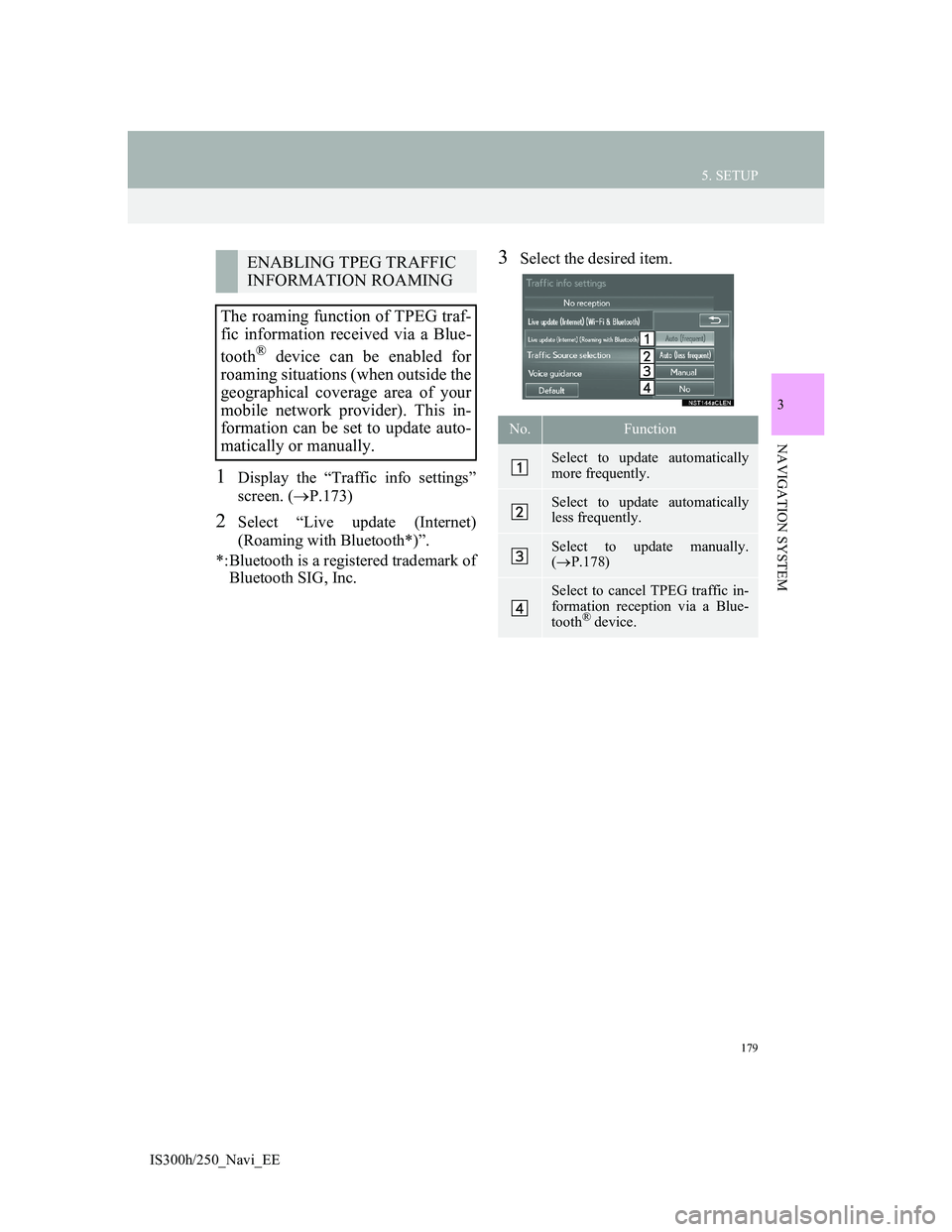
1Display the “Traffic info settings”
screen. (P.173)
2Select “Live update (Internet)
(Roaming with Bluetooth*)”.
*:Bluetooth is a registered trademark of
Bluetooth SIG, Inc.
3Select the desired item.ENABLING TPEG TRAFFIC
INFORMATION ROAMING
The roaming function of TPEG traf-
fic information received via a Blue-
tooth
® device can be enabled for
roaming situations (when outside the
geographical coverage area of your
mobile network provider). This in-
formation can be set to update auto-
matically or manually.
No.Function
Select to update automatically
more frequently.
Select to update automatically
less frequently.
Select to update manually.
(P.178)
Select to cancel TPEG traffic in-
formation reception via a Blue-
tooth
® device.
Page 181 of 415
181
5. SETUP
3
NAVIGATION SYSTEM
IS300h/250_Navi_EE
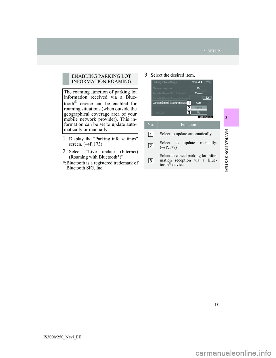
1Display the “Parking info settings”
screen. (P.173)
2Select “Live update (Internet)
(Roaming with Bluetooth*)”.
*:Bluetooth is a registered trademark of
Bluetooth SIG, Inc.
3Select the desired item.ENABLING PARKING LOT
INFORMATION ROAMING
The roaming function of parking lot
information received via a Blue-
tooth
® device can be enabled for
roaming situations (when outside the
geographical coverage area of your
mobile network provider). This in-
formation can be set to update auto-
matically or manually.
No.Function
Select to update automatically.
Select to update manually.
(P.178)
Select to cancel parking lot infor-
mation reception via a Blue-
tooth
® device.