change time MAZDA MODEL 6 2011 Navigation Manual (in English)
[x] Cancel search | Manufacturer: MAZDA, Model Year: 2011, Model line: MODEL 6, Model: MAZDA MODEL 6 2011Pages: 140, PDF Size: 1.75 MB
Page 6 of 140
6
Before Use
Navigation
Set Up
RDM-TMCIf
necessary
Rear View
Monitor
Safety Information
n
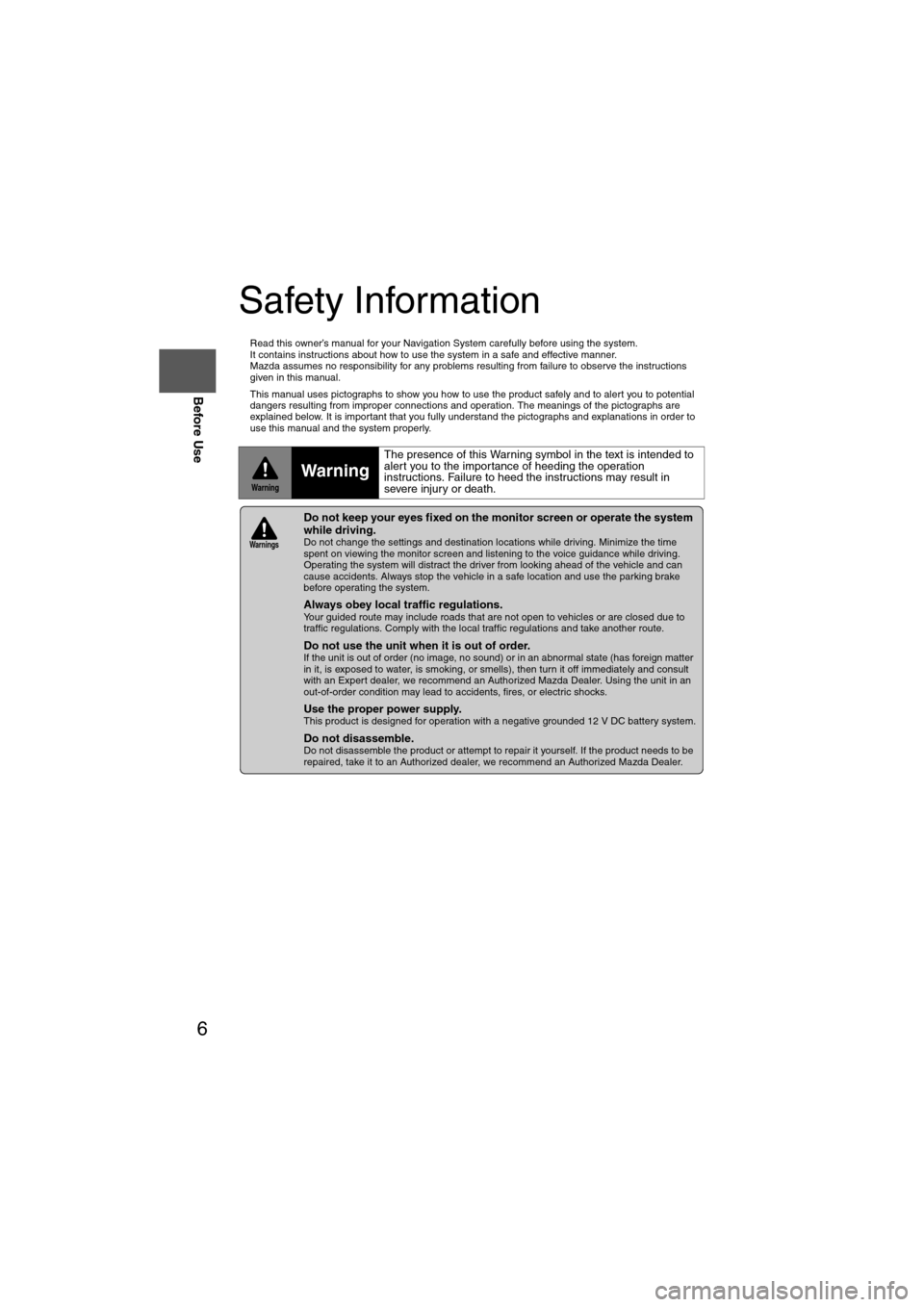
Read this owner’s manual for your Navigation System carefully before using the system.
It contains instructions about how to use the system in a safe and effective manner.
Mazda assumes no responsibility for any problems resulting from failure to observe the instructions
given in this manual.
n This manual uses pictographs to show you how to use the product safely and to alert you to potential
dangers resulting from improper connections and operation. The meanings of the pictographs are
explained below. It is important that you fully understand the pictographs and explanations in order to
use this manual and the system properly.
WarningWarning
The presence of this Warning symbol in the text is intended to
alert you to the importance of heeding the operation
instructions. Failure to heed the instructions may result in
severe injury or death.
nDo not keep your eyes fixed on the monitor screen or operate the system
while driving.
Do not change the settings and destination locations while driving. Minimize the time
spent on viewing the monitor screen and listening to the voice guidance while driving.
Operating the system will distract the driver from looking ahead of the vehicle and can
cause accidents. Always stop the vehicle in a safe location and use the parking brake
before operating the system.
n
Always obey local traffic regulations. Your guided route may include roads that are not open to vehicles or are closed due to
traffic regulations. Comply with the local traffic regulations and take another route.
n
Do not use the unit when it is out of order.If the unit is out of order (no image, no sound) or in an abnormal state (has foreign matter
in it, is exposed to water, is smoking, or smells), then turn it off immediately and consult
with an Expert dealer, we recommend an Authorized Mazda Dealer. Using the unit in an
out-of-order condition may lead to accidents, fires, or electric shocks.
n
Use the proper power supply. This product is designed for operation with a negative grounded 12 V DC battery system.
n
Do not disassemble. Do not disassemble the product or attempt to repair it yourself. If the product needs to be
repaired, take it to an Authorized dealer, we recommend an Authorized Mazda Dealer.
Warnings
Page 9 of 140
9
Before Use
If necessary
Rear View
Monitor
Names and Functions
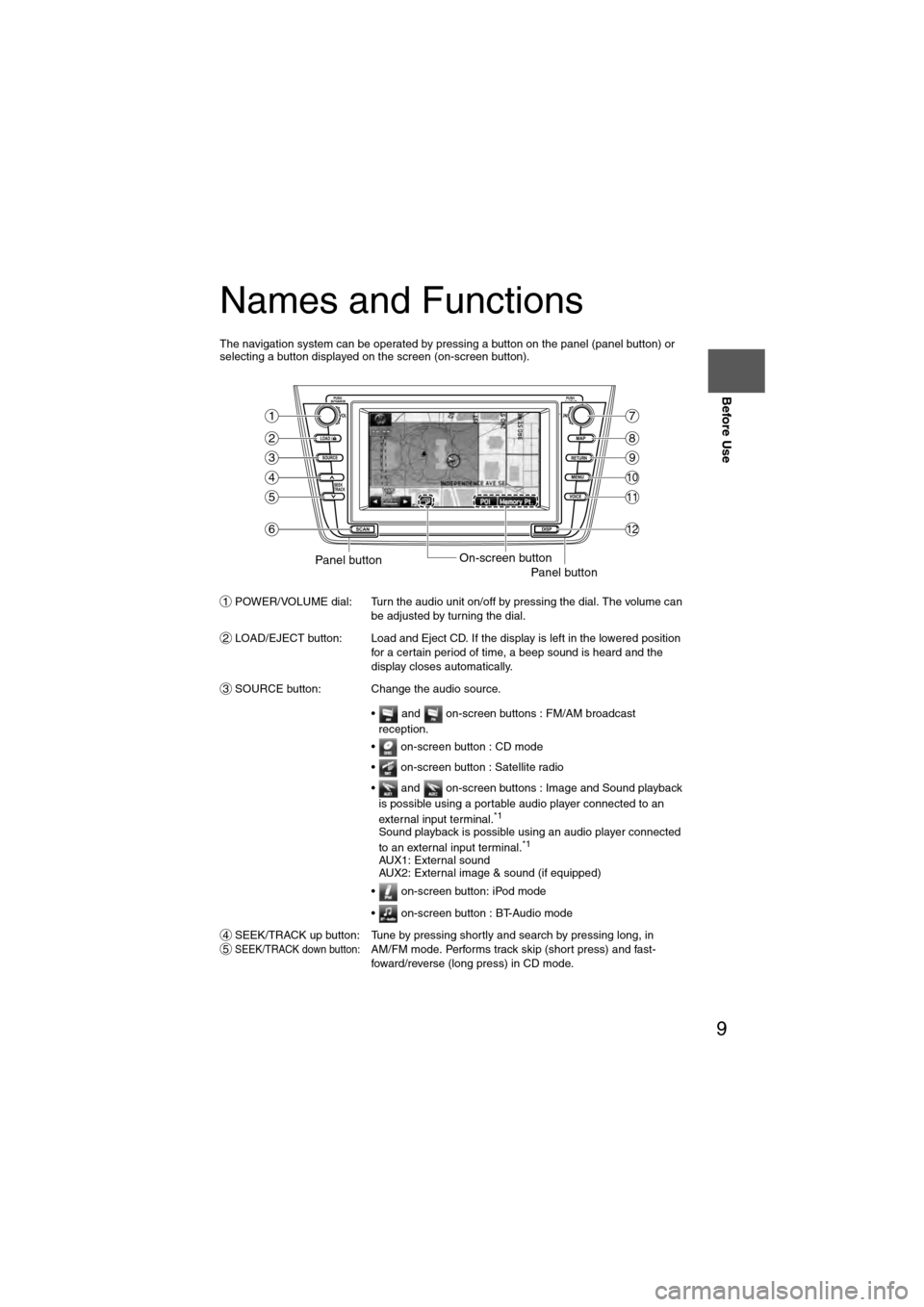
The navigation system can be operated by pressing a button on the panel (panel button) or
selecting a button displayed on the screen (on-screen button).POWER/VOLUME dial: Turn the audio unit on/off by pressing the dial. The volume can be adjusted by turning the dial.
LOAD/EJECT button: Load and Eject CD. If the display is left in the lowered position for a certain period of time, a beep sound is heard and the
display closes automatically.
SOURCE button: Change the audio source.
• and on-screen buttons : FM/AM broadcast reception.
• on-screen button : CD mode
• on-screen button : Satellite radio
• and on-screen buttons : Image and Sound playback is possible using a portable audio player connected to an
external input terminal.
*1
Sound playback is possible using an audio player connected
to an external input terminal.*1
AUX1: External sound
AUX2: External image & sound (if equipped)
• on-screen button: iPod mode
• on-screen button : BT-Audio mode
SEEK/TRACK up button: Tune by pressing shortly and search by pressing long, in
SEEK/TRACK down button:AM/FM mode. Performs track skip (short press) and fast-
foward/reverse (long press) in CD mode.
LOAD /
PUSHPOWERPUSHAUDIO
VOL
SOURCE
SCAN
SEEK
TRACK
MAP
DISP
MENU
VOICE RETURN
TUNE
On-screen buttonPanel buttonPanel button
1
2
3
4
5
6
7
8
9
10
11
12
1
2
3
45
Page 12 of 140
12
RoutingAddress
Book
Getting started
2
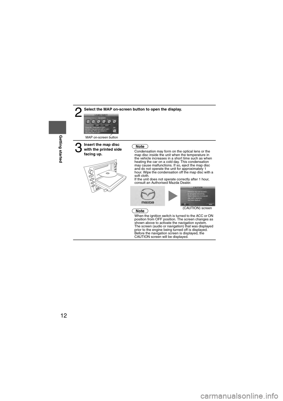
Select the MAP on-screen button to open the display.
3
Insert the map disc
with the printed side
facing up.Notel
Condensation may form on the optical lens or the
map disc inside the unit when the temperature in
the vehicle increases in a short time such as when
heating the car on a cold day. This condensation
may cause malfunctions. If so, eject the map disc
and do not operate the unit for approximately 1
hour. Wipe the condensation off the map disc with a
soft cloth.
If the unit does not operate correctly after 1 hour,
consult an Authorised Mazda Dealer.
NotelWhen the ignition switch is turned to the ACC or ON
position from OFF position. The screen changes as
shown above to activate the navigation system.
l The screen (audio or navigation) that was displayed
prior to the engine being turned off is displayed.
Before the navigation screen is displayed, the
CAUTION screen will be displayed.
MAP on-screen button
(CAUTION) screen
Page 16 of 140
16
RoutingAddress
Book
Getting started
Navigation Setup
l
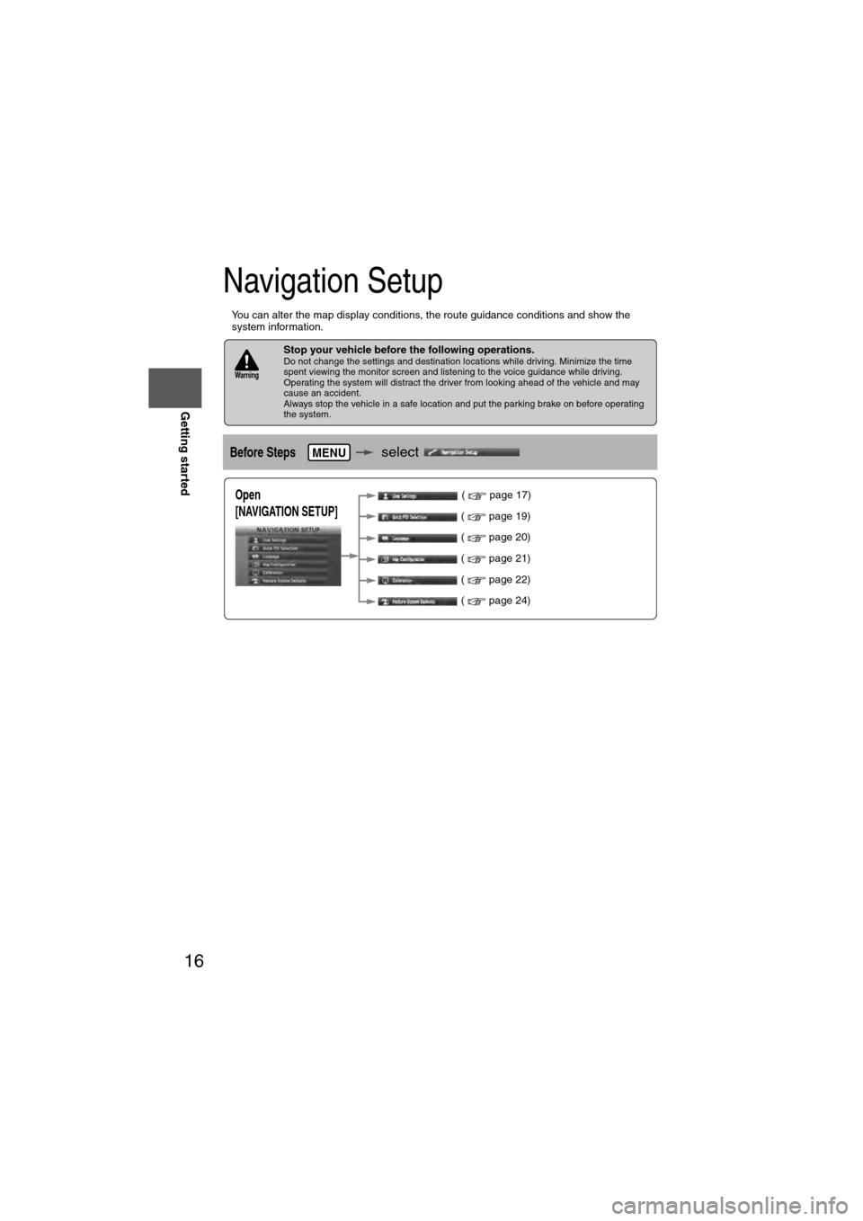
You can alter the map display conditions, the route guidance conditions and show the
system information.
nStop your vehicle before the following operations. Do not change the settings and destination locations while driving. Minimize the time
spent viewing the monitor screen and listening to the voice guidance while driving.
Operating the system will distract the driver from looking ahead of the vehicle and may
cause an accident.
Always stop the vehicle in a safe location and put the parking brake on before operating
the system.
Before Stepsselect
Warning
MENU
Open
[NAVIGATION SETUP] ( page 17)
( page 19)
( page 20)
( page 21)
( page 22)
( page 24)
Page 17 of 140
![MAZDA MODEL 6 2011 Navigation Manual (in English) 17
Getting started
Navigation Setup
Before Steps
select
select
User Settings
MENU
Open the
[USER SETTINGS]
screen
nMap Color
Select a screen color from the to options.
nMap Mode
lAuto : T MAZDA MODEL 6 2011 Navigation Manual (in English) 17
Getting started
Navigation Setup
Before Steps
select
select
User Settings
MENU
Open the
[USER SETTINGS]
screen
nMap Color
Select a screen color from the to options.
nMap Mode
lAuto : T](/img/28/13564/w960_13564-16.png)
17
Getting started
Navigation Setup
Before Steps
select
select
User Settings
MENU
Open the
[USER SETTINGS]
screen
nMap Color
Select a screen color from the to options.
nMap Mode
lAuto : The display will automatically switch between Day and Night illumination mode when the headlights are
turned off and on respectively.
lDay :The display will be presented in Day illumination mode
regardless of whether the headlights are on or off.
lNight : The display will be presented in Night illumination mode
regardless of whether the headlights are on or off.
nDistance
Select the distance unit from or .
nAverage Speed
Set the average speed for each road to be driven.
(This function sets the standard speed (average vehicle speed
for each route) used for calculating the estimated arrival time
when calculating the route time.)
: Average speed setting:Changes back to default
nRoad Restriction Warnings
The display of warnings during route guidance when passing
through areas with traffic restrictions can be turned on or off.
Page 25 of 140
25
Getting started
Screen Names and Functions
Note
lPerform the Navigation Setup before switching the Freeway Information screen on/off.
( page 21)
Screens Before Setting Route
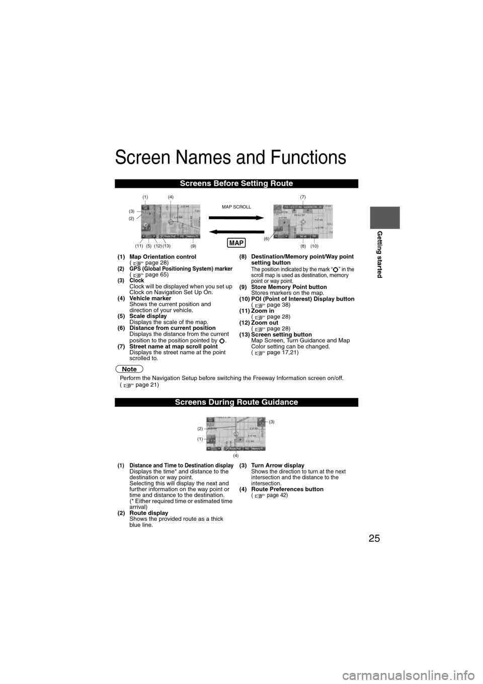
(1) Map Orientation control
( page 28)
(2) GPS (Global Positioning System) marker( page 65)(3) ClockClock will be displayed when you set up
Clock on Navigation Set Up On.
(4) Vehicle marker Shows the current position and
direction of your vehicle.
(5) Scale display
Displays the scale of the map.
(6) Distance from current position Displays the distance from the current
position to the position pointed by .
(7) Street name at map scroll point Displays the street name at the point
scrolled to. (8) Destination/Memory point/Way point
setting button
The position indicated by the mark “ ” in the
scroll map is used as destination, memory
point or way point.
(9) Store Memory Point buttonStores markers on the map.
(10) POI (Point of Interest) Display button ( page 38)
(11) Zoom in ( page 28)
(12) Zoom out ( page 28)
(13) Screen setting button Map Screen, Turn Guidance and Map
Color setting can be changed.
( page 17,21)
Screens During Route Guidance
(1) Distance and Time to Destination displayDisplays the time* and distance to the
destination or way point.
Selecting this will display the next and
further information on the way point or
time and distance to the destination.
(* Either required time or estimated time
arrival)
(2) Route display Shows the provided route as a thick
blue line. (3) Turn Arrow displayShows the direction to turn at the next
intersection and the distance to the
intersection.
(4) Route Preferences button( page 42)
(4)
(3)(1)(7)
(8) (10)
(9)(5)(11)(12) MAP SCROLL(6)(13)
(2)MAP
(4) (3)
(1)
(2)
Page 26 of 140
26
RoutingAddress
Book
Getting started
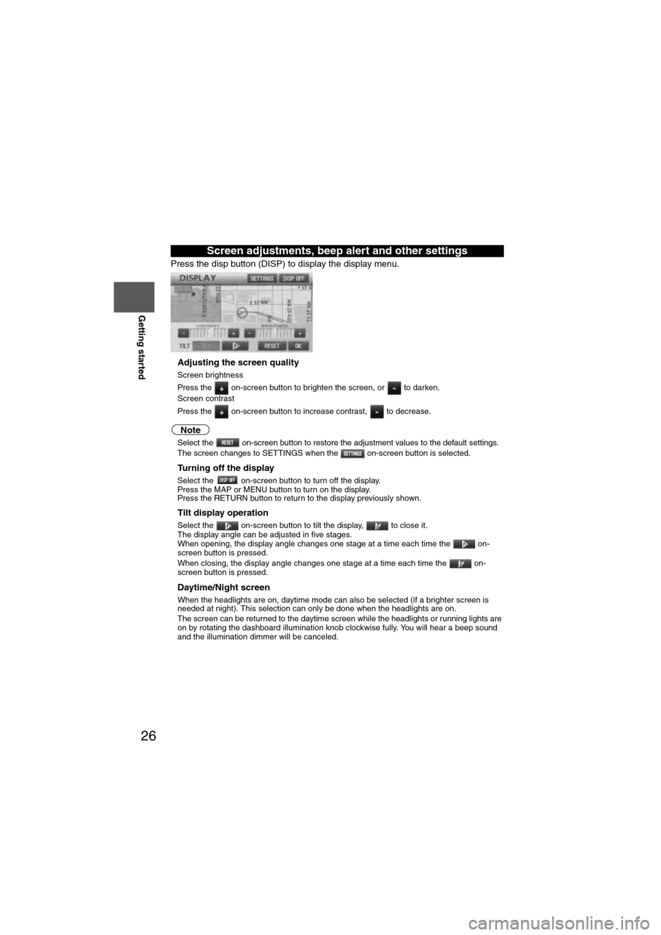
Press the disp button (DISP) to display the display menu.
nAdjusting the screen quality
l
Screen brightness
Press the on-screen button to brighten the screen, or to darken.
l Screen contrast
Press the on-screen button to increase contrast, to decrease.
Note
lSelect the on-screen button to restore the adjustment values to the default settings.lThe screen changes to SETTINGS when the on-screen button is selected.
nTurning off the display
Select the on-screen button to turn off the display.
Press the MAP or MENU button to turn on the display.
Press the RETURN button to return to the display previously shown.
nTilt display operation
Select the on-screen button to tilt the display, to close it.
The display angle can be adjusted in five stages.
When opening, the display angle changes one stage at a time each time the on-
screen button is pressed.
When closing, the display angle changes one stage at a time each time the on-
screen button is pressed.
nDaytime/Night screen
When the headlights are on, daytime mode can also be selected (if a brighter screen is
needed at night). This selection can only be done when the headlights are on.
l The screen can be returned to the daytime screen while the headlights or running lights are
on by rotating the dashboard illumination knob clockwise fully. You will hear a beep sound
and the illumination dimmer will be canceled.
Screen adjustments, beep alert and other settings
Page 28 of 140
28
RoutingAddress
Book
Getting started
Screen change
nDo not keep your eyes fixed on the monitor screen or operate the system
while driving
Do not change the settings and destination locations while driving. Minimize the time
spent viewing the monitor screen and listening to the voice guidance while driving.
Operating the system will distract the driver from looking ahead of the vehicle and may
cause an accident. Always stop the vehicle in a safe location and use the parking brake
before operating the system.
Map
orientation
Map scale
Warning
1
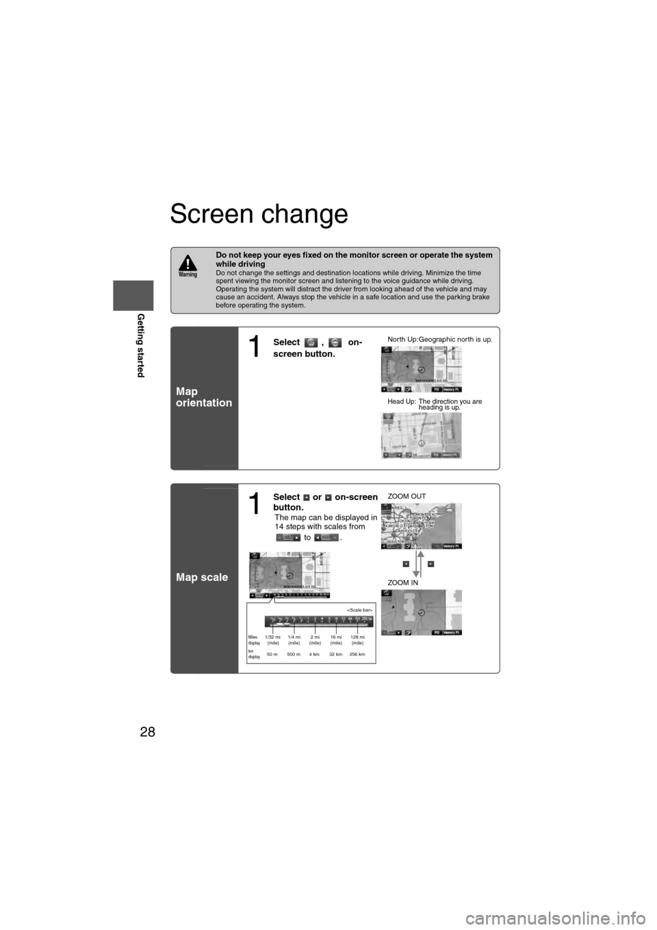
Select , on-
screen button.lNorth Up:Geographic north is up.
lHead Up: The direction you are
heading is up.
1
Select or on-screen
button.
lThe map can be displayed in
14 steps with scales from
to . l
ZOOM OUT
lZOOM IN
Miles
display1/32 mi
(mile) 1/4 mi
(mile) 2 mi
(mile) 16 mi
(mile) 128 mi
(mile)
km
display50 m 500 m 4 km 32 km 256 km
Page 31 of 140
31
Before
UseGetting
started
Routing
lFor Character Entry, please refer to page 39.
lDo not keep your eyes fixed on the monitor screen or operate the system while driving.Do not change the settings and destination locations while driving. Minimize the time spent
viewing the monitor screen and listening to the voice guidance while driving. Operating the system
will distract the driver from looking ahead of the vehicle and may cause an accident. Always stop
the vehicle in a safe location before operating the system.
lRoute searches with the navigation system can include roads that you cannot drive on and roads that you
are prohibited from driving on due to traffic regulations. Please comply with the traffic regulations.
Warnings
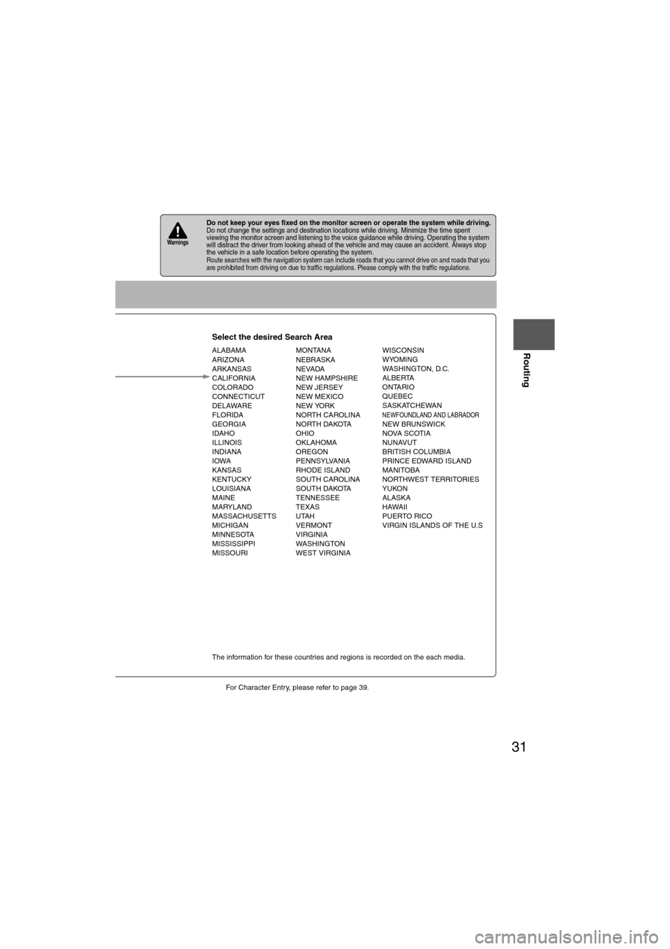
Select the desired Search Area
ALABAMA
ARIZONA
ARKANSAS
CALIFORNIA
COLORADO
CONNECTICUT
DELAWARE
FLORIDA
GEORGIA
IDAHO
ILLINOIS
INDIANA
IOWA
KANSAS
KENTUCKY
LOUISIANA
MAINE
MARYLAND
MASSACHUSETTS
MICHIGAN
MINNESOTA
MISSISSIPPI
MISSOURI MONTANA
NEBRASKA
NEVADA
NEW HAMPSHIRE
NEW JERSEY
NEW MEXICO
NEW YORK
NORTH CAROLINA
NORTH DAKOTA
OHIO
OKLAHOMA
OREGON
PENNSYLVANIA
RHODE ISLAND
SOUTH CAROLINA
SOUTH DAKOTA
TENNESSEE
TEXAS
UTAH
VERMONT
VIRGINIA
WASHINGTON
WEST VIRGINIA WISCONSIN
WYOMING
WASHINGTON, D.C.
ALBERTA
ONTARIO
QUEBEC
SASKATCHEWAN
NEWFOUNDLAND AND LABRADORNEW BRUNSWICK
NOVA SCOTIA
NUNAVUT
BRITISH COLUMBIA
PRINCE EDWARD ISLAND
MANITOBA
NORTHWEST TERRITORIES
YUKON
ALASKA
HAWAII
PUERTO RICO
VIRGIN ISLANDS OF THE U.S
Select
Select
Map information is displayed.
Disc A
Disc B
The information for these countries and regions is recorded on the each media.
Input State nameThe number of candidate
states is decreasing by
inputting more characters.
If there are less than 4
search results, the list of
the results is displayed
automatically.
Page 40 of 140
40
Before
UseGetting
started
Routing
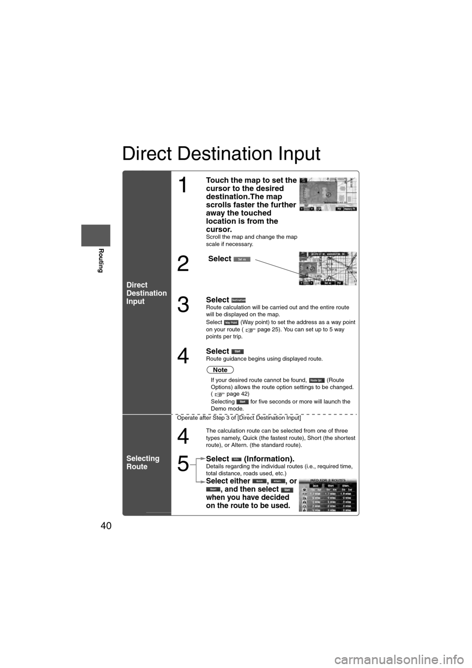
Direct Destination Input
Direct
Destination
Input
Selecting
Route
1
Touch the map to set the
cursor to the desired
destination.The map
scrolls faster the further
away the touched
location is from the
cursor.
Scroll the map and change the map
scale if necessary.
2
Select
3
Select Route calculation will be carried out and the entire route
will be displayed on the map.
Select (Way point) to set the address as a way point
on your route ( page 25). You can set up to 5 way
points per trip.
4
Select Route guidance begins using displayed route.
Note
l
If your desired route cannot be found, (Route
Options) allows the route option settings to be changed.
( page 42)
l Selecting for five seconds or more will launch the
Demo mode.
Operate after Step 3 of [Direct Destination Input]
4
The calculation route can be selected from one of three
types namely, Quick (the fastest route), Short (the shortest
route), or Altern. (the standard route).
5
Select (Information).Details regarding the individual routes (i.e., required time,
total distance, roads used, etc.)
Select either , , or , and then select
when you have decided
on the route to be used.