ESP MAZDA MODEL 6 2011 Navigation Manual (in English)
[x] Cancel search | Manufacturer: MAZDA, Model Year: 2011, Model line: MODEL 6, Model: MAZDA MODEL 6 2011Pages: 140, PDF Size: 1.75 MB
Page 6 of 140
6
Before Use
Navigation
Set Up
RDM-TMCIf
necessary
Rear View
Monitor
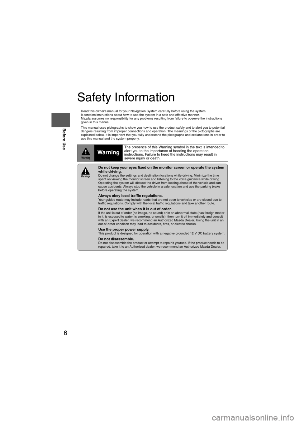
Safety Information
n
Read this owner’s manual for your Navigation System carefully before using the system.
It contains instructions about how to use the system in a safe and effective manner.
Mazda assumes no responsibility for any problems resulting from failure to observe the instructions
given in this manual.
n This manual uses pictographs to show you how to use the product safely and to alert you to potential
dangers resulting from improper connections and operation. The meanings of the pictographs are
explained below. It is important that you fully understand the pictographs and explanations in order to
use this manual and the system properly.
WarningWarning
The presence of this Warning symbol in the text is intended to
alert you to the importance of heeding the operation
instructions. Failure to heed the instructions may result in
severe injury or death.
nDo not keep your eyes fixed on the monitor screen or operate the system
while driving.
Do not change the settings and destination locations while driving. Minimize the time
spent on viewing the monitor screen and listening to the voice guidance while driving.
Operating the system will distract the driver from looking ahead of the vehicle and can
cause accidents. Always stop the vehicle in a safe location and use the parking brake
before operating the system.
n
Always obey local traffic regulations. Your guided route may include roads that are not open to vehicles or are closed due to
traffic regulations. Comply with the local traffic regulations and take another route.
n
Do not use the unit when it is out of order.If the unit is out of order (no image, no sound) or in an abnormal state (has foreign matter
in it, is exposed to water, is smoking, or smells), then turn it off immediately and consult
with an Expert dealer, we recommend an Authorized Mazda Dealer. Using the unit in an
out-of-order condition may lead to accidents, fires, or electric shocks.
n
Use the proper power supply. This product is designed for operation with a negative grounded 12 V DC battery system.
n
Do not disassemble. Do not disassemble the product or attempt to repair it yourself. If the product needs to be
repaired, take it to an Authorized dealer, we recommend an Authorized Mazda Dealer.
Warnings
Page 7 of 140
7
Before Use
If necessary
Rear View
Monitor
Operation is subject to the following two conditions;
(1) this device may not cause interference, and
(2) this device must accept any interference,
including interference that may cause undesired operation of the device.
This Category II radiocommunication device complies with Industry Canada Standard RSS-310.
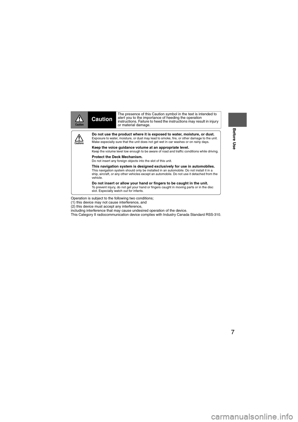
CautionCaution
The presence of this Caution symbol in the text is intended to
alert you to the importance of heeding the operation
instructions. Failure to heed the instructions may result in injury
or material damage.
nDo not use the product where it is exposed to water, moisture, or dust. Exposure to water, moisture, or dust may lead to smoke, fire, or other damage to the unit.
Make especially sure that the unit does not get wet in car washes or on rainy days.
n
Keep the voice guidance volume at an appropriate level. Keep the volume level low enough to be aware of road and traffic conditions while driving.
n
Protect the Deck Mechanism.Do not insert any foreign objects into the slot of this unit.
n
This navigation system is designed ex clusively for use in automobiles.This navigation system should only be installed in an automobile. Do not install it in a
ship, aircraft, or any other vehicles except an automobile. Do not use it detached from the
vehicle.
n
Do not insert or allow your hand or fingers to be caught in the unit. To prevent injury, do not get your hand or fingers caught in moving parts or in the disc
slot. Especially watch out for infants.
Cautions
Page 10 of 140
10
Before Use
Navigation
Set Up
RDM-TMCIf
necessary
Rear View
Monitor
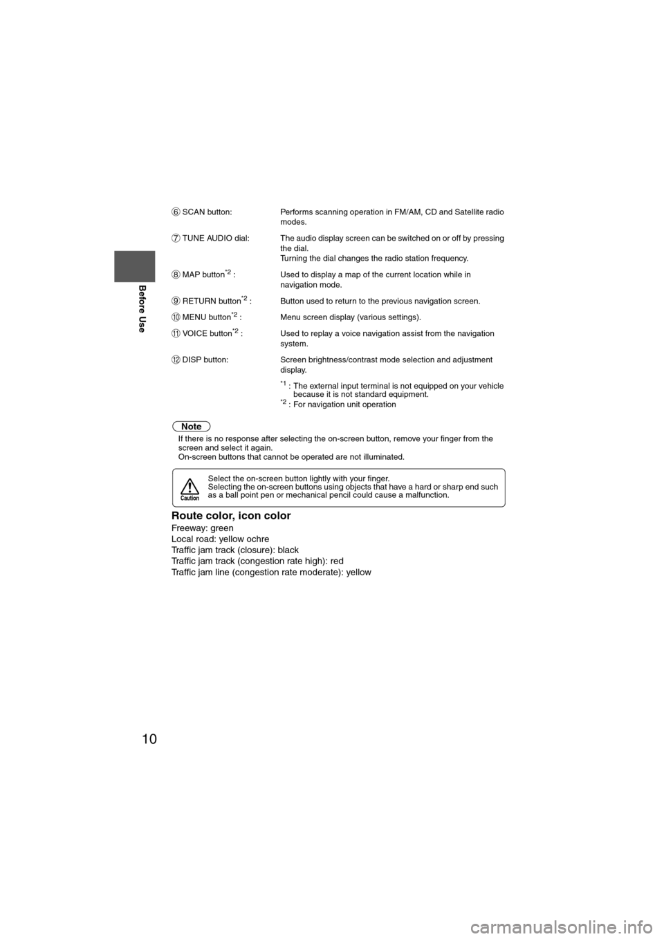
SCAN button:
Performs scanning operation in FM/AM, CD and Satellite radio
modes.
TUNE AUDIO dial: The audio display screen can be switched on or off by pressing the dial.
Turning the dial changes the radio station frequency.
MAP button
*2 : Used to display a map of the current location while in
navigation mode.
RETURN button
*2 : Button used to return to the previous navigation screen.
MENU button
*2 : Menu screen display (various settings).
VOICE button
*2 : Used to replay a voice navigation assist from the navigation system.
DISP button: Screen brightness/contrast mode selection and adjustment display.
*1 : The external input terminal is not equipped on your vehicle because it is not standard equipment.
*2 : For navigation unit operation
Note
lIf there is no response after selecting the on-screen button, remove your finger from the
screen and select it again.
l On-screen buttons that cannot be operated are not illuminated.
Route color, icon color
Freeway: green
Local road: yellow ochre
Traffic jam track (closure): black
Traffic jam track (congestion rate high): red
Traffic jam line (congestion rate moderate): yellow
Select the on-screen button lightly with your finger.
Selecting the on-screen buttons using objects that have a hard or sharp end such
as a ball point pen or mechanical pencil could cause a malfunction.
6
7
8
9
10
11
12
Caution
Page 17 of 140
![MAZDA MODEL 6 2011 Navigation Manual (in English) 17
Getting started
Navigation Setup
Before Steps
select
select
User Settings
MENU
Open the
[USER SETTINGS]
screen
nMap Color
Select a screen color from the to options.
nMap Mode
lAuto : T MAZDA MODEL 6 2011 Navigation Manual (in English) 17
Getting started
Navigation Setup
Before Steps
select
select
User Settings
MENU
Open the
[USER SETTINGS]
screen
nMap Color
Select a screen color from the to options.
nMap Mode
lAuto : T](/img/28/13564/w960_13564-16.png)
17
Getting started
Navigation Setup
Before Steps
select
select
User Settings
MENU
Open the
[USER SETTINGS]
screen
nMap Color
Select a screen color from the to options.
nMap Mode
lAuto : The display will automatically switch between Day and Night illumination mode when the headlights are
turned off and on respectively.
lDay :The display will be presented in Day illumination mode
regardless of whether the headlights are on or off.
lNight : The display will be presented in Night illumination mode
regardless of whether the headlights are on or off.
nDistance
Select the distance unit from or .
nAverage Speed
Set the average speed for each road to be driven.
(This function sets the standard speed (average vehicle speed
for each route) used for calculating the estimated arrival time
when calculating the route time.)
: Average speed setting:Changes back to default
nRoad Restriction Warnings
The display of warnings during route guidance when passing
through areas with traffic restrictions can be turned on or off.
Page 42 of 140
42
Before
UseGetting
started
Routing
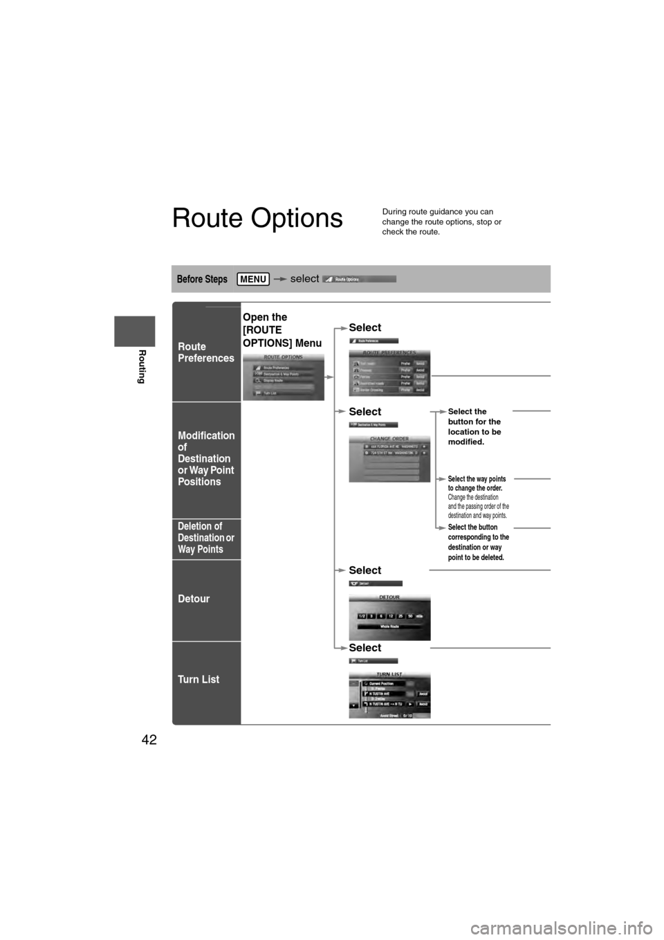
Route Options
l
During route guidance you can
change the route options, stop or
check the route.
Before Steps select
Route
Preferences
Modification
of
Destination
or Way Point
Positions
Deletion of
Destination or
Way Points
Detour
Tu r n L i s t
MENU
Open the
[ROUTE
OPTIONS] MenuSelect
Select
roads, FreRestrictedCrossing.The route wthe specifie
Select Select the
button for the
location to be
modified.
Select the way points
to change the order.
Change the destination
and the passing order of the
destination and way points.
Select the button
corresponding to the
destination or way
point to be deleted.
Select
Select
Select
(Change
Location).
Shows the map for
the destination/
way points.
Press
to change the
order.
Select
Select
from the roads
to be avoided.
:
Searches the detour rmiles) from the presenroute. (Display range vset distance of the selRoute searches the ropresent position for al
Page 43 of 140
43
Before
UseGetting
started
Routing
nDo not keep your eyes fixed on the monitor screen or operate the system while drivingDo not change the settings and destination locations while driving. Minimize the time spent viewing the monitor screen and
listening to the voice guidance while driving. Operating the system will distract the driver from looking ahead of the vehicle
and
may cause an accident. Always stop the vehicle in a safe location and use the parking brake before operating the system.Warning
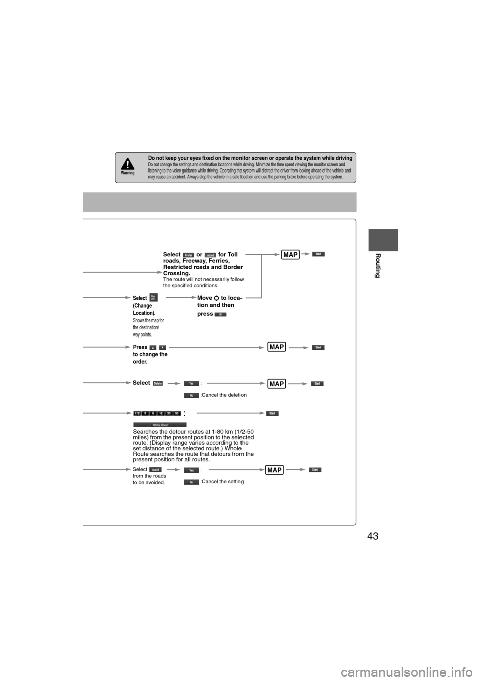
Select or for Toll
roads, Freeway, Ferries,
Restricted roads and Border
Crossing.
The route will not necessarily follow
the specified conditions.
Select the
button for the
location to be
modified.
Select the way points
to change the order.
Change the destination
and the passing order of the
destination and way points.
Select the button
corresponding to the
destination or way
point to be deleted.
MAP
MAP
MAP
Select
(Change
Location).
Shows the map for
the destination/
way points.
Press
to change the
order.
Select
Select
from the roads
to be avoided.
MAP
Move to loca-
tion and then
press
:
:Cancel the deletion
:
:Cancel the setting
:
Searches the detour routes at 1-80 km (1/2-50
miles) from the present position to the selected
route. (Display range varies according to the
set distance of the selected route.) Whole
Route searches the route that detours from the
present position for all routes.
Page 47 of 140
47
Before
UseGetting
started
Routing
Address Book
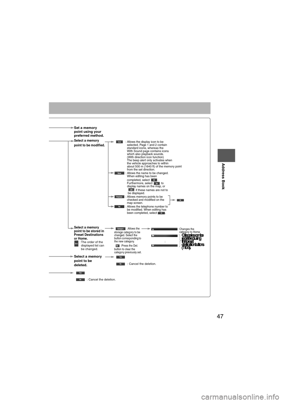
Set a memory
point using your
preferred method.
Select a memory
point to be modified. : Allows the display icon to be
selected. Page 1 and 2 contain
standard icons, whereas the
With Sound page contains icons
which also playback sounds.
(With direction icon function)
The beep alert only activates when
the vehicle approaches to within
about 500 m (1640 ft) of the memory point
from the set direction.
: Allows the name to be changed. When editing has been
completed, select .
Furthermore, select to
display names on the map, or
if these names are not to
be displayed.
: Allows memory points to be checked and modified on the
map screen.
: Allows the telephone number to be modified. When editing has
been completed, select .
Select a memory
point to be stored in
Preset Destinations
or Home.
: The order of the
displayed list can
be changed.
:Allows the
storage category to be
changed. Select the
button corresponding to
the new category.
:Press the Del.
button to clear the
category previously set.:Changes the
category to Home
:
Select a memory
point to be
deleted.
: Cancel the deletion.
: Cancel the deletion.
Show all icons or
Cat eg ories can be
re gis tered usin g
th e p reset
d es tin atio n b utto ns
(1 to 5).
Page 53 of 140
53
Before
UseGetting
started
Routing Address
Book
Voice Recognition
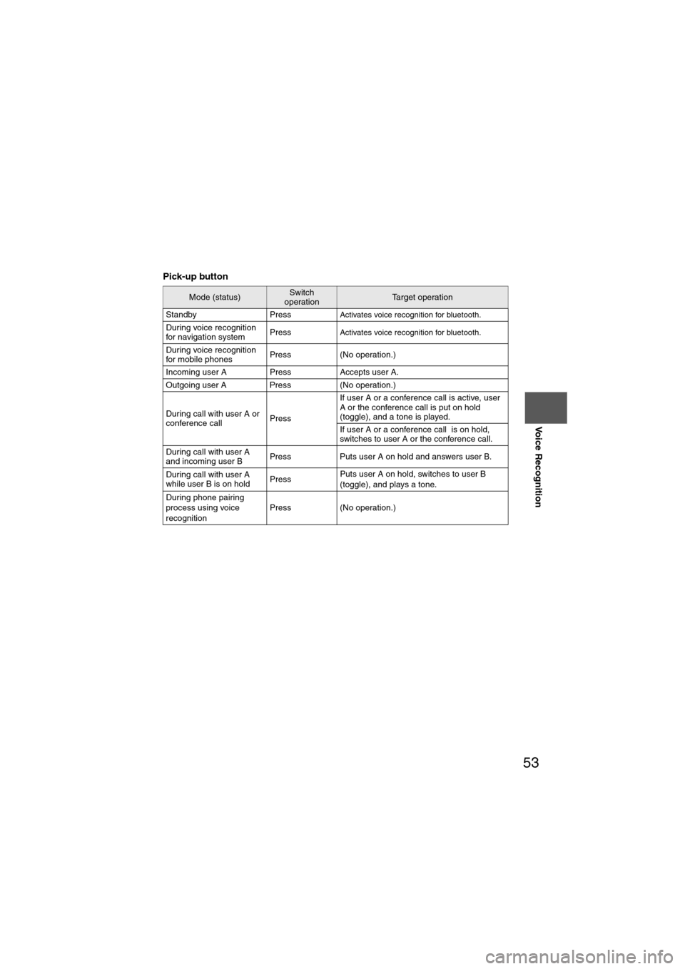
Pick-up button
Mode (status)Switch
operationTarget operation
Standby Press
Activates voice recognition for bluetooth.
During voice recognition
for navigation system PressActivates voice recognition for bluetooth.
During voice recognition
for mobile phonesPress (No operation.)
Incoming user A Press Accepts user A.
Outgoing user A Press (No operation.)
During call with user A or
conference call PressIf user A or a conference call is active, user
A or the conference call is put on hold
(toggle), and a tone is played.
If user A or a conference call is on hold,
switches to user A or the conference call.
During call with user A
and incoming user B Press Puts user A on hold and answers user B.
During call with user A
while user B is on hold PressPuts user A on hold, switches to user B
(toggle), and plays a tone.
During phone pairing
process using voice
recognition Press (No operation.)
Page 63 of 140
63
Before
UseGetting
started
Routing Address
BookVoice
Recognition
Traffic Information
nt icon can
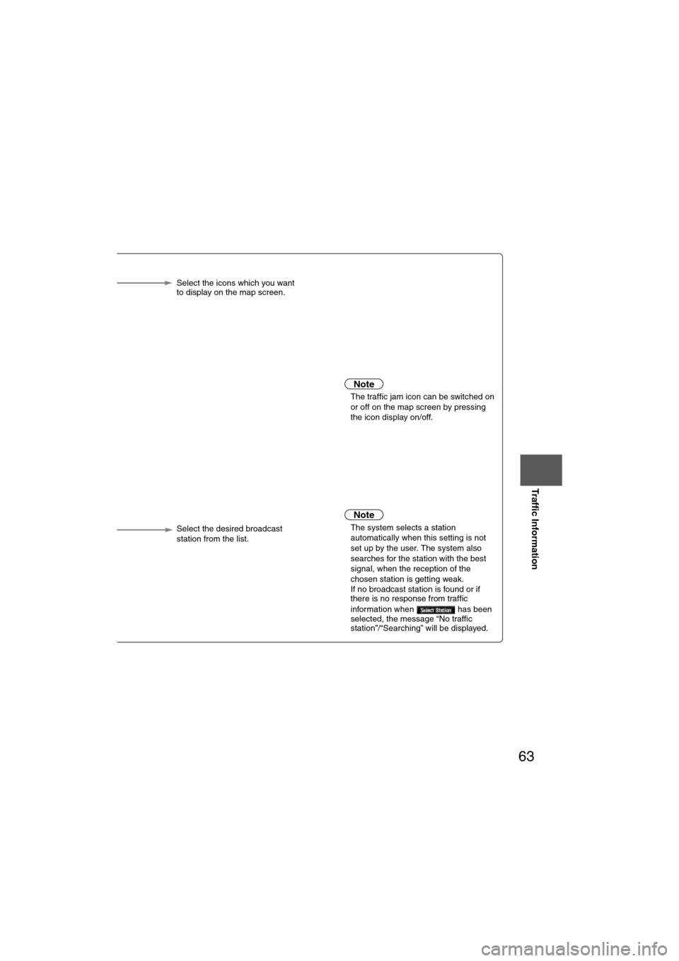
n the map Select the icons which you want
to display on the map screen.
or
selected, the system will different route for you when c jam on your route.
Note
l
The traffic jam icon can be switched on
or off on the map screen by pressing
the icon display on/off.
or
selected, voice guidance
a traffic event occurs on
Note
l The system selects a station
automatically when this setting is not
set up by the user. The system also
searches for the station with the best
signal, when the reception of the
chosen station is getting weak.
l If no broadcast station is found or if
there is no response from traffic
information when has been
selected, the message “No traffic
station”/“Searching” will be displayed.
tion is
e radio. Select the desired broadcast
station from the list.
Page 64 of 140
64
Before
UseGetting
started
Routing Address
Book
Voice Recognition
Navigation
Set Up
If necessary
Precautions/System Performance
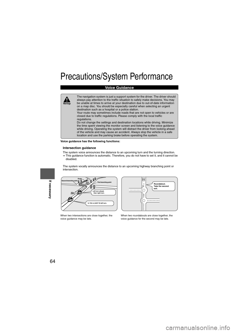
Voice guidance has the following functions:
nIntersection guidance
l
The system voice announces the distance to an upcoming turn and the turning direction.
This guidance function is automatic. Therefore, you do not have to set it, and it cannot be
disabled.
l The system vocally announces the distance to an upcoming highway branching point or
intersection.
Voice Guidance
l The navigation system is just a support system for the driver. The driver should
always pay attention to the traffic situation to safely make decisions. You may
be unable at times to arrive at your destination due to out-of-date information
on a map disc. You should be especially careful when selecting an urgent
destination such as a hospital or a police station.
l Your route may sometimes include roads that are not open to vehicles or are
closed due to traffic regulations. Please comply with the local traffic
regulations.
l Do not change the settings and destination locations while driving. Minimize
the time spent viewing the monitor screen and listening to the voice guidance
while driving. Operating the system will distract the driver from looking ahead
of the vehicle and may cause an accident. Always stop the vehicle in a safe
location and use the parking brake before operating the system.
When two intersections are close together, the
voice guidance may be late. When two roundabouts are close together, the
voice guidance for the second may be late.
Warnings
Second branching pointFirst branching pointRoute
Left turn ahead,
then right turn.
150 m
(492 ft)
100 m
(328 ft)
In 700 m (2297 ft) left turn.
Roundabout.
Take the second
exit.