display MERCEDES-BENZ C-Class SEDAN 2017 W205 Comand Manual
[x] Cancel search | Manufacturer: MERCEDES-BENZ, Model Year: 2017, Model line: C-Class SEDAN, Model: MERCEDES-BENZ C-Class SEDAN 2017 W205Pages: 178, PDF Size: 9.47 MB
Page 176 of 178

Region of origin category
Atlantic, North
and South Pacific
Oceans
Name of tropical storm
(Hurricane Category (Hurricane Category
3) 3)
Displays hurricane cate-
gories 1 through 5
Northwestern
Pacific Ocean
Name of tropical storm
(Tropical Low (Tropical Low
Press. Sys.) Press. Sys.)
Northwestern
Pacific Ocean
Name of tropical storm
(Tropical Cyclone) (Tropical Cyclone)
Northwestern
Pacific Ocean
Name of tropical storm
(Typhoon) (Typhoon)
Northwestern
Pacific Ocean
Name of tropical storm
(Super-Typhoon) (Super-Typhoon)
If you have selected a map scale of 50 mi
(50 km) or smaller you will also see the time
stamp for the current weather data.
The weather map shows wind directions and
wind speeds.
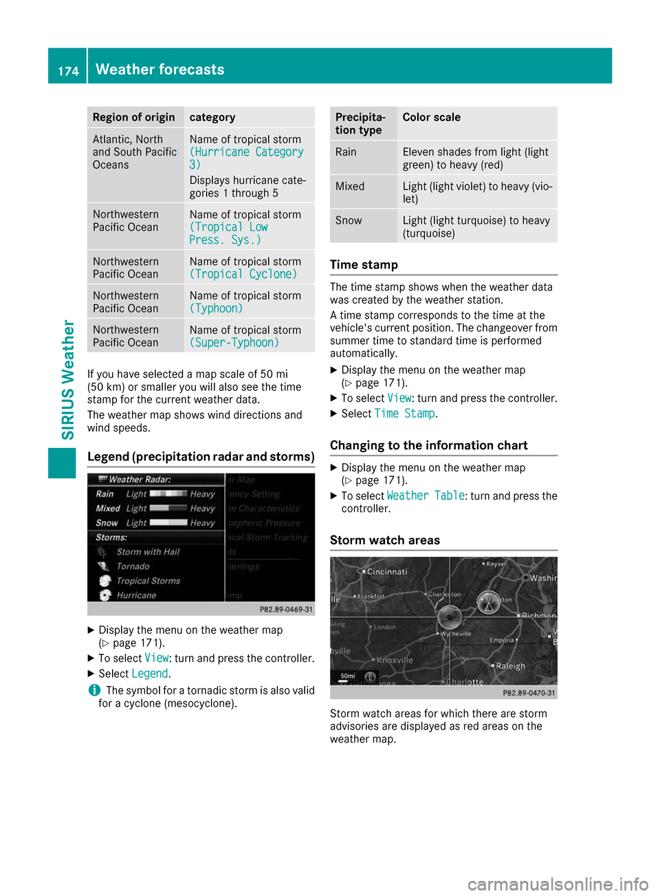
Legend (precipitation radar and storms) X
Display the menu on the weather map
(Y page 171).
X To select View View: turn and press the controller.
X Select Legend
Legend.
i The symbol for a tornadic storm is also valid
for a cyclone (mesocyclone). Precipita-
tion type Color scale
Rain Eleven shades from light (light
green) to heavy (red)
Mixed Light (light violet) to heavy (vio-
let) Snow Light (light turquoise) to heavy
(turquoise)
Time stamp
The time stamp shows when the weather data
was created by the weather station.
A time stamp corresponds to the time at the
vehicle's current position. The changeover from
summer time to standard time is performed
automatically.
X Display the menu on the weather map
(Y page 171).
X To select View View: turn and press the controller.
X Select Time Stamp
Time Stamp.
Changing to the information chart X
Display the menu on the weather map
(Y page 171).
X To select Weather Weather Table
Table: turn and press the
controller.
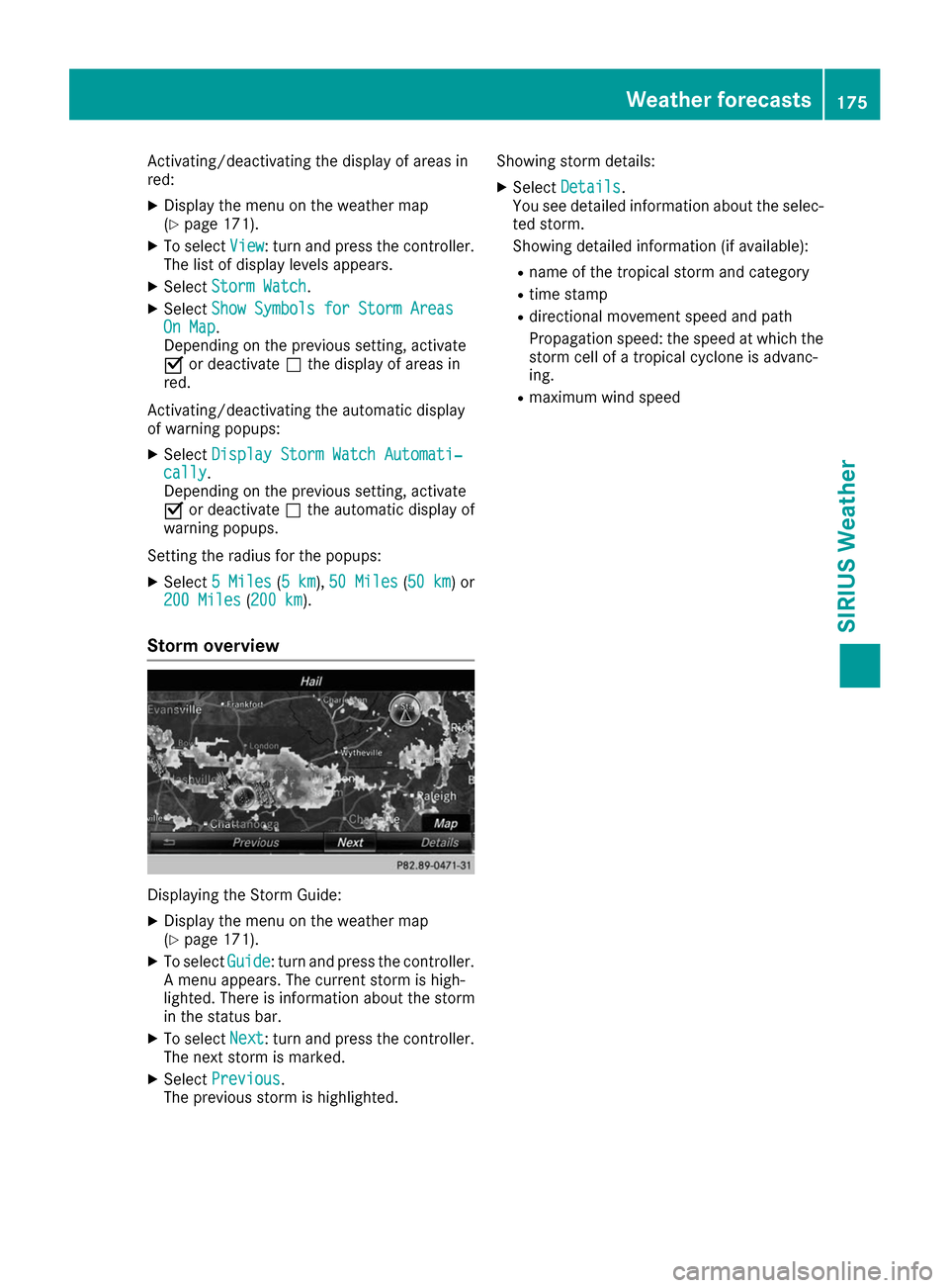
Storm watch areas Storm watch areas for which there are storm
advisories are displayed as red areas on the
weather map. 174
Weather forecastsSIRIUS Weather
Page 177 of 178

Activating/deactivating the display of areas in
red:
X Display the menu on the weather map
(Y page 171).
X To select View
View: turn and press the controller.
The list of display levels appears.
X Select Storm Watch
Storm Watch.
X Select Show Symbols for Storm Areas Show Symbols for Storm Areas
On Map
On Map .
Depending on the previous setting, activate
0073 or deactivate 0053the display of areas in
red.
Activating/deactivating the automatic display
of warning popups:
X Select Display Storm Watch Automati‐ Display Storm Watch Automati‐
cally
cally.
Depending on the previous setting, activate
0073 or deactivate 0053the automatic display of
warning popups.
Setting the radius for the popups:
X Select 5 Miles
5 Miles (5 km5 km), 50 Miles
50 Miles (50 km50 km) or
200 Miles
200 Miles (200 km200 km).
Storm overview Displaying the Storm Guide:
X Display the menu on the weather map
(Y page 171).
X To select Guide
Guide: turn and press the controller.
A menu appears. The current storm is high-
lighted. There is information about the storm
in the status bar.
X To select Next Next: turn and press the controller.
The next storm is marked.
X Select Previous
Previous.
The previous storm is highlighted. Showing storm details:
X Select Details
Details.
You see detailed information about the selec-
ted storm.
Showing detailed information (if available):
R name of the tropical storm and category
R time stamp
R directional movement speed and path
Propagation speed: the speed at which the
storm cell of a tropical cyclone is advanc-
ing.
R maximum wind speed Weather forecasts
175SIRIUS Weather