vehicle not in position p MERCEDES-BENZ M-Class 2012 W166 Comand Manual
[x] Cancel search | Manufacturer: MERCEDES-BENZ, Model Year: 2012, Model line: M-Class, Model: MERCEDES-BENZ M-Class 2012 W166Pages: 234, PDF Size: 6.74 MB
Page 52 of 234
COMAN
Dfea tures
Thes eOper atingIn st ruc tions desc ribeall
st andar dand optionalequipm enta vail able
for you rCOMAND systematthe time of
purcha se.Cou ntry-specifi cdeviation sare
possible. Pleasenotethat your COMAND
system maynotbeequipped withallthe
features described. Introd
uction Safet
ynotes G
WARN
ING
For safety reasons, onlyenteradestin ation
when thevehicle isstat ionary. Whenthe
vehicle isin motion ,ap assen gershoul dent er
th edest ination.Stud yma nua land select
rou tebefor edri vin g.
Bea rin mi nd tha tat asp ee dof jus t30 mph
(a pp roxi mately50 km/h) ,yo ur veh icleis
cove ringadi sta nce of44 feet(appro ximately
14 m)ever ysec ond.
COMA NDcalc ulate sth erout etothe
destination withouttakingaccount ofthe
following:
R Traffic lights
R Stop andright- of-way-signs
R Lane merging
R Parking orstopping prohibited areas
R Other roadandtraffic rulesandregulations
R Narrow bridges G
WARNING
COMAND maygiveincorr ectnavigation
commands ifthe data inthe digital mapdoes
not correspon dwith theactual road/traff ic
situation. Digitalmapsdonot cover allareas
nor allroutes withinanarea. Forexample, if
the traffic routing hasbeen changed orthe
direction ofaone-way roadhasbeen
reversed.
For this reason, youmust alway sobserve
applicable roadandtraffic rulesand regulations
duringyourjourney. Roadand
traffic rulesandregulations alwayshave
priority overthenavigation commands
generated bythe system. G
WARNING
Navigation announcementsare inten dedto
direct youwhile driving without diverting your
atten tionfrom theroad anddriving.
Please alwaysuse this feature instead of
consultin gthe map display fordirection s.
Consulting thesymbols ormap display for
direction smay cause youtodivert your
atten tionfrom driving andincrease yourrisk
of an accident . General
notes
Operat ionalreadiness ofthe navigation
system The
navigation systemmustdetermin ethe
position ofthe vehicle beforefirstuseor
whenever operational statusisrestored.
Therefore, youmay have todrive forawhile
before precise routeguidance ispossible.
GPS reception Correct
functioning ofthe navigation system
depends, amongstotherthings, onGPS
reception .Inc ertain situation s,GPS
recept ionmay beimpaired, theremay be
int erferen ceorther emay beno recept ionat
all, e.g. intunn elsorparkin ggarages.
Entry restriction On
vehicles forcert aincount ries,thereis a
rest riction onent ering data.
The restriction isactiv eabove avehicle speed
of about 3mph.The restriction isdeactiv ated
as soon asthe vehicle speeddropsbelow
about 2mph.
When therest riction isactiv e,cert ainentries
cann otbe made. Thiswillbeindicat edbythe 50
Intr
oduct ionNavigat ion
Page 64 of 234
X
To setthe map scale:as soon asyou turn
cVd theCOMAND controller,the scal ebar
app ears .
X Turn cVd untilthedesi redscal eis set.
Turni ngclockwi sezooms outfrom themap;
turning counter-clockwi sezooms in.
X To selectad estination: pressW the
COMA NDcontroller onceor seve raltim es.
You willsee either theaddres sent rymen u
with thedest inationaddres sor, ifCOMA ND
is unable toassign aunique address,a
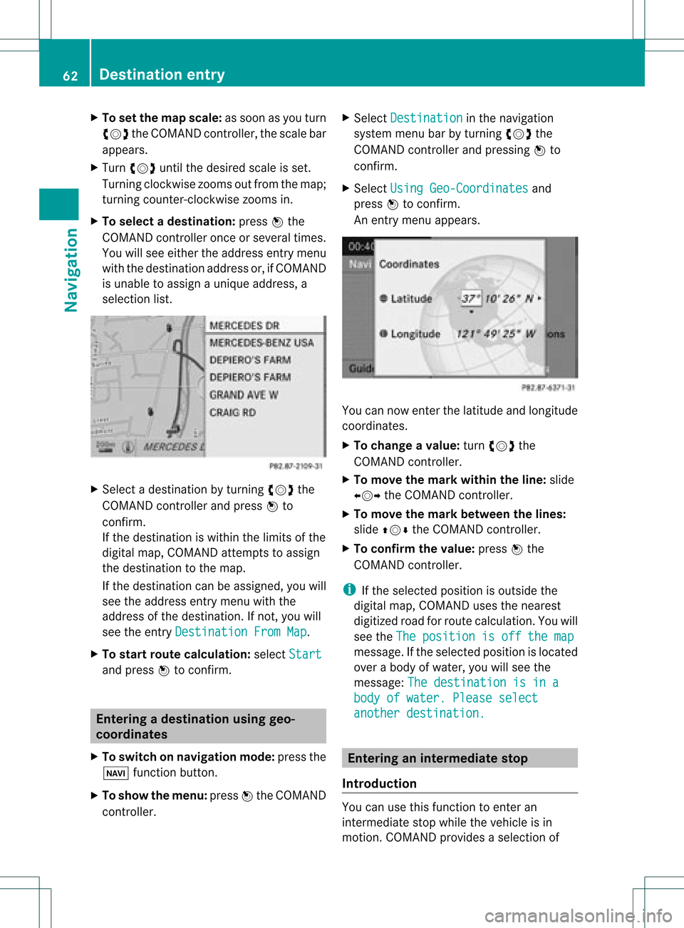
selec tionlist. X
Selec tadestination byturn ingcVd the
COMAND controller and press Wto
con firm.
If the destin ationiswithin thelimits ofthe
digital map,COMAND attempts toassign
the destin ationtothe map.
If the destin ationcanbeassigned, youwill
see theaddress entrymenu withthe
address ofthe destin ation. Ifnot ,you will
see theentryDestin ationFromMap .
X To sta rtrout ecalculat ion:select Start and
press Wtocon firm. Entering
adesti nation usin ggeo-
coord inates
X To switch onnav igat ionmod e:pres sth e
Ø function butt on.
X To show themen u:pres sW theCOMA ND
con troller . X
Sele ctDes tination in
thenav igat ion
syst emmen ubar byturnin gcVd the
COMA NDcontroller andpres singW to
con firm.
X Sele ctUsi ngGeo-Coordinates and
pres sW tocon firm.
An entrymen uappears . You
cannowent erthelatit ude andlongitude
coo rdin ates .
X To cha nge avalu e:tur ncVd the
COMA NDcontroller .
X To mov eth ema rkwith intheline: slide
XVY theCOMA NDcontroller .
X To mov eth ema rkbetween thelines:
slide ZVÆ theCOMA NDcontroller .
X To confir mthevalu e:pres sW the
COMA NDcontroller .
i Ifth eselec tedposit ionisout side the
digit almap, COMA NDuses then earest
digitized roadforroute calculation .You will
see theThe position isoff themap message.
Ifthe selected positionislocated
over abody ofwater, youwillsee the
message: Thedestination isina body
ofwater. Pleaseselect another
destination. Entering
aninterm ediate stop
Introdu ction You
canusethis funct iontoenter an
interm ediate stopwhile thevehicle isin
motion .COMAND provides aselection of 62
Destination
entryNavigation
Page 65 of 234
predefin
eddestin ations ineight categories
for this purpose, e.g.FILLIN GSTATIO N or
CAFÉ .
When youhave entered yourintermediate
stop, COMAND automaticallyrecalc ulates
the route tothe main destin ation.
Entering predefined destinations X
To switch onnavigat ionmode: pressthe
Ø function button.
X To show themenu: pressWthe COMAND
con troller.
X Select Destin ation in
the navigat ion
system menubarbyturn ingcVd the
COMAND controller and pressin gW to
con firm.
X Select Stopov er and
press Wtocon firm.
Opt ion 1:the rout edoes nothave an
inter media testop. Int
ermediat estop categ ories
X Select acateg ory;seeoption 2.
Opt ion 2:the rout ealrea dyhas an
inter media testop.
X Select Change Stopover and
press Wto
con firm.
X To select acatego ry:select acatego ryby
turning cVdtheCOM AND controll erand
press ingWtoconfirm.
COM AND firstsearches inthe selected
catego ryfor desti nations along theroute .
COM AND thensearches fordesti nations ina
rad iusof app roxima tely60mifrom the
current vehicleposi tion.
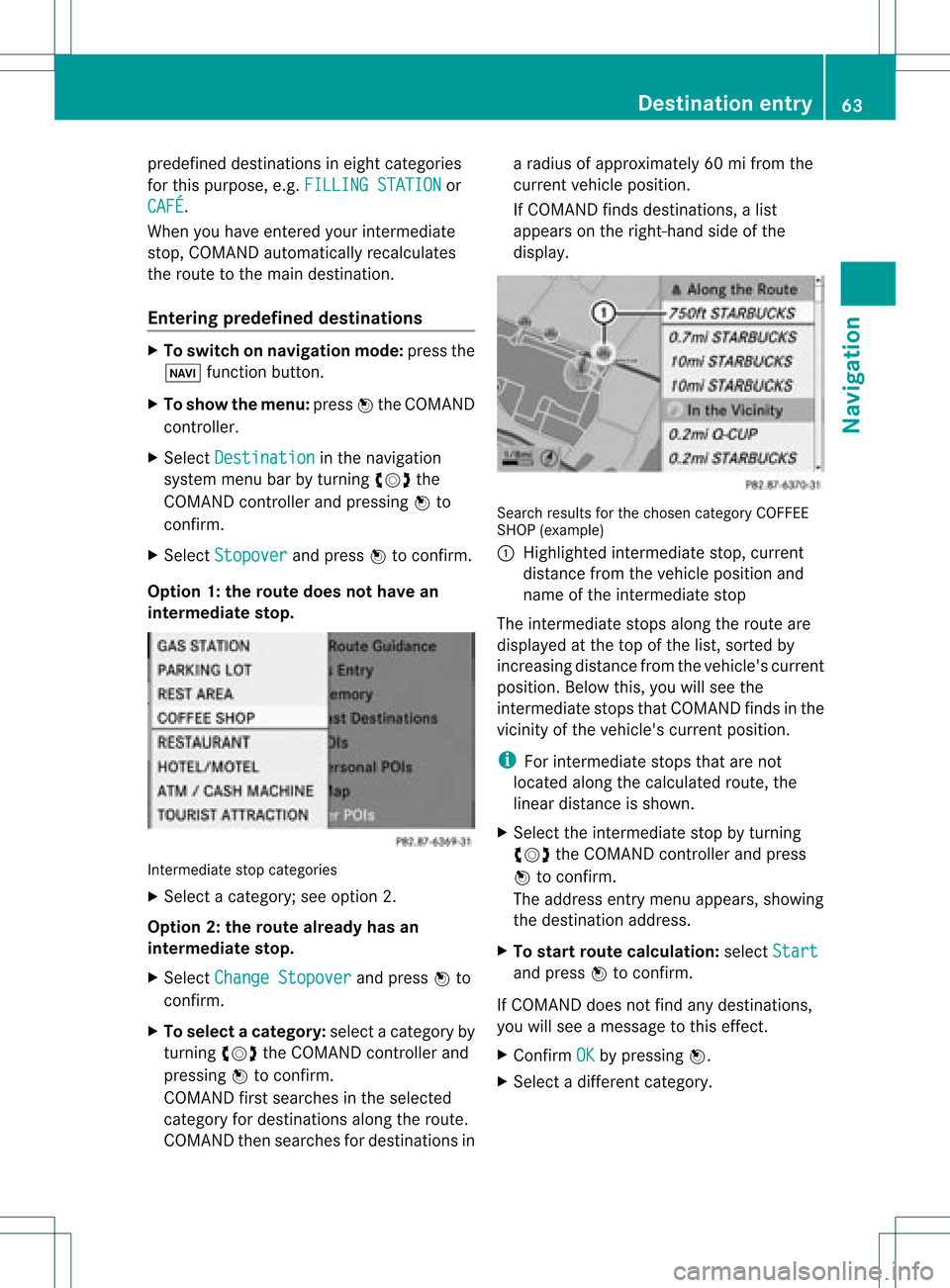
If COM AND finds destinations, alis t
app ears onthe right-hand sideof the
dis pla y. Search
resultsfor the chosen categoryCOFFEE
SHOP (example )
: Highl ighted intermed iate stop, current
dis tance fromthevehi cleposi tion and
name ofthe intermed iate stop
The intermed iate stops along theroute are
dis pla yedat the top ofthe list,sorted by
increa singdistance fromthevehi cle's current
posi tion. Belowthis, youwillsee the
intermed iate stops thatCOM AND finds inthe
vicini tyof the vehi cle's current position.
i For intermed iate stops thatarenot
loca tedalong thecalcu lated route ,the
line ardis tance isshow n.
X Sele ctthe intermed iate stop byturning
cVd theCOM AND controll erand press
W toconfirm.
The address entry menu appears ,show ing
the desti nation address.
X To start route calcul ation :sel ect Start and
press Wtoconfirm.
If COM AND doesnot find anydesti nations,
you willsee amessa getothis effect.
X Confi rmOK by
press ingW.
X Sele ctadiffe rent catego ry. De
stinati onentry
63Navigatio n Z
Page 68 of 234
X
To chang ethe seque nceof the
wa ypo ints: select Swap in
the waypoint
menu byturning cVd theCOMAND
contro ller and pressW toconfi rm.
The entri esaresw appe d.
X To del ete waypo ints: select the symbo l
for waypoint 1or 2in the waypoint menu
by turning cVd theCOMAND controller
and pressW toconfi rm.
X Sel ect Delete and
pressW toconfi rm.
i Youcan delete awa ypoint directl yaf ter
entry using thismenu item.
Ac ceptin gwa ypo ints forthe route X
Sel ect Start in
the waypoint menu by
tur ning cVd theCOMAND controller and
pre ssW toconfi rm.
The routeiscal cul ate dwi th the ente red
wa ypoints.
i Con t. is
displ ayed instea dof Sta rt wh
en
Cal culate AlternativeRoutes is
acti vated inthe navigati on menu
(Y page 82) ,op tio n2 . In
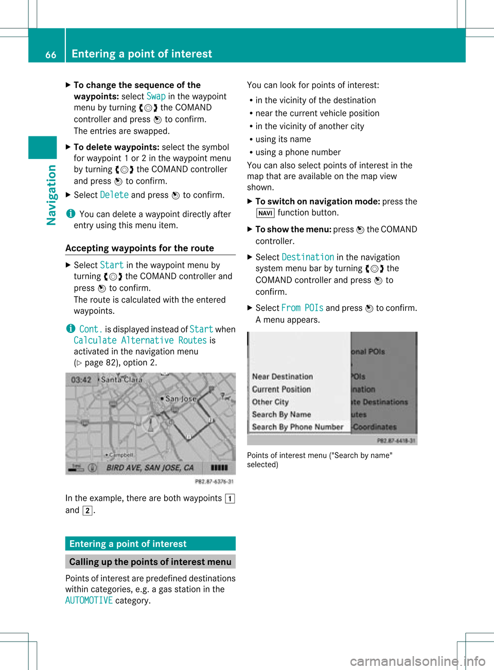
the exampl e,there areboth waypoints 1
and 2. Enterin
gap oint ofint eres t Callin
gup thepoint sof int eres tmenu
Poin tsof int eres tare prede fineddestina tions
withi ncate gor ies, e.g.ag asstatio nint he
AUTOMOTIVE category. You
canlook forpoints ofinterest :
R in the vicinity ofthe destination
R near thecurrent vehicleposition
R in the vicinity ofanother city
R using itsname
R using aphone number
You canalso select points ofinterest inthe
map thatareavaila bleonthe map view
shown.
X To switch onnavigation mode:pressthe
Ø functionbutton.
X To show themenu: pressWthe COMAND
cont roller.
X Select Destination in
the navigation
system menubarbyturning cVdthe
COMAND controller andpress Wto
confirm .
X Select From POIs and
press Wtoconfirm .
Am enu appears. Point
sof inter estmenu ("Search byname"
select ed) 66
Entering
apoint ofint eres tNavi gatio n
Page 71 of 234
Point
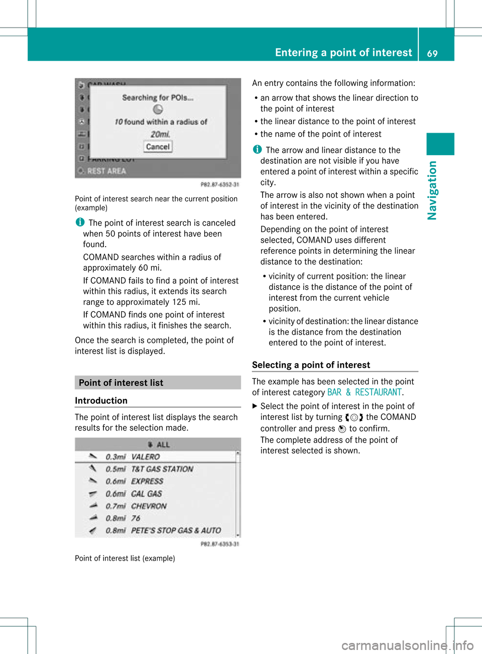
ofinter estsearch nearthecurrent position
(example)
i The point ofinter estsearch iscanc eled
when 50points ofinter esthave been
found.
COMAND searcheswithinaradius of
approximately 60mi.
If COMAND failstofind apoint ofinter est
within thisradius, itexten dsits search
range toapproximately 125mi.
If COMAND findsonepoint ofinter est
within thisradius, itfinishes thesearch.
Onc ethe search iscompleted, thepoint of
inter estlistisdisplay ed. Point
ofinterest list
Introdu ction The
point ofinter estlistdisplay sthe search
results forthe selection made. Point
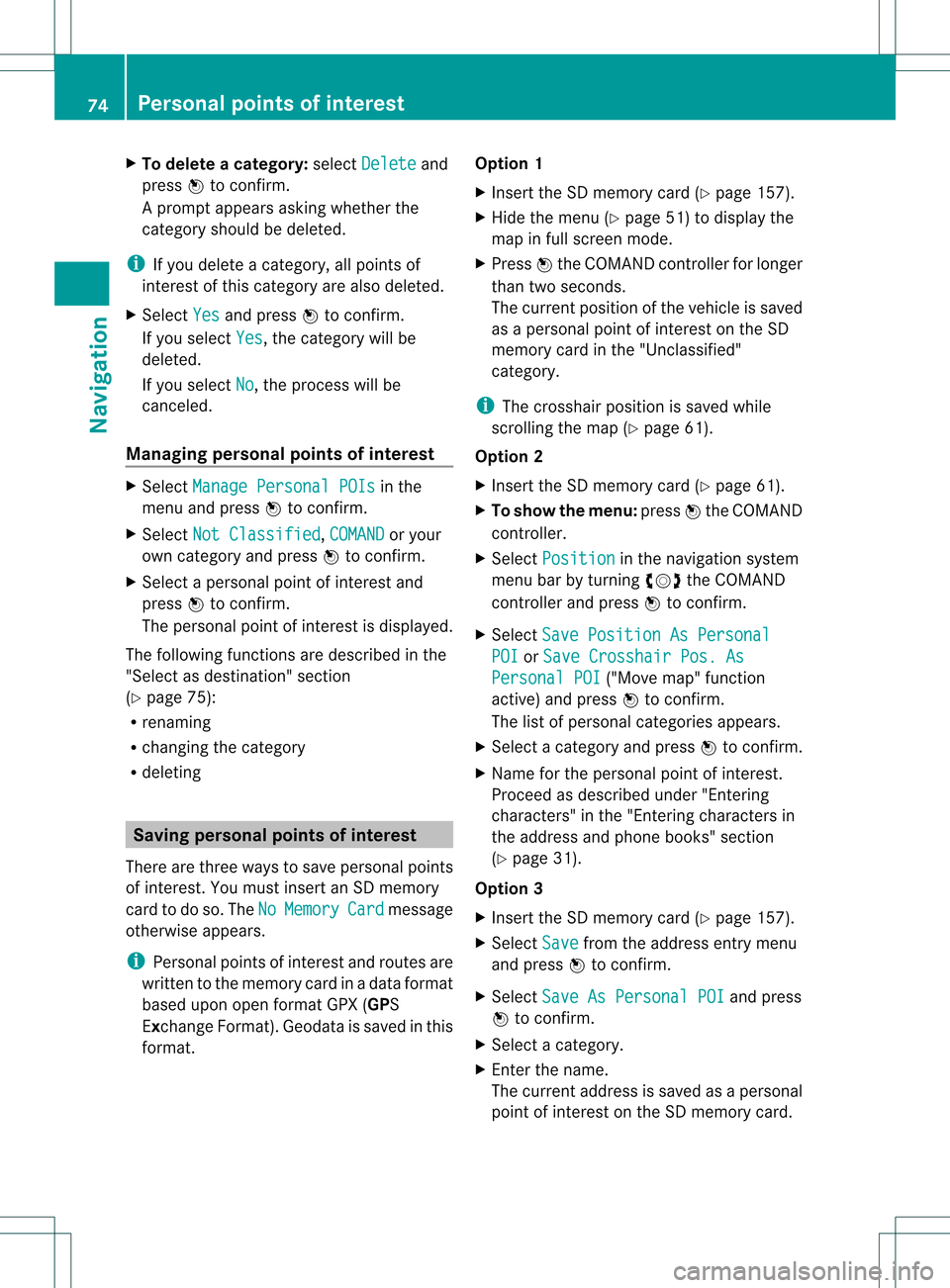
ofinter estlist(example) An
entrycont ains thefollowing information:
R an arrow thatshows thelinear direction to
the point ofinter est
R the linear distanc eto the point ofinter est
R the name ofthe point ofinter est
i The arrow andlinear distanc eto the
destinat ionare not visible ifyou have
ent ered apoint ofinter estwithin aspecific
city.
The arrow isalso notshown whenapoint
of inter estinthe vicinit yof the destinat ion
has been entered.
Dependin gon the point ofinter est
selected, COMAND usesdifferent
referen cepoints indetermin ingthe linear
distanc eto the destinat ion:
R vicinit yof curren tposition: thelinear
distanc eis the distanc eof the point of
inter estfrom thecurren tvehicle
position.
R vicinit yof destinat ion:thelinear distanc e
is the distanc efrom thedestinat ion
ent ered tothe point ofinter est.
Selecting apoint ofint eres t The
exam plehas been selectedin thepoin t
of interes tcate gor yBAR &RES TAURANT .
X Sel ect thepoin tof intere stinthepoin tof
int ere stlist byturnin gcVd theCOMA ND
co ntroll erand pres sW toconfirm .
The comple teaddre ssofthepoin tof
int erest selectedisshown . Enter
ingapoint ofint eres t
69Navi gatio n Z
Page 76 of 234
X
To del ete acate gory: select Delete and
pre ssW toconfi rm.
Ap rompt appears asking whethe rthe
category shouldbedeleted.
i Ifyou delete acategory, allpoints of
interest ofthis category arealso deleted.
X Select Yes and
press Wtoconfirm .
If you select Yes ,
the category willbe
deleted.
If you select No ,
the process willbe
canceled.
Managing personalpointsofinterest X
Select Manage Personal POIs in
the
menu andpress Wtoconfirm .
X Select NotClassified ,
COMAND or
your
own category andpress Wtoconfirm .
X Select apersonal pointofinterest and
press Wtoconfirm .
The personal pointofinterest isdispla yed.
The following functionsaredescribed inthe
"Select asdestination" section
(Y page 75):
R renaming
R changing thecategory
R deleting Saving
personal pointsofinterest
There arethree waysto save personal points
of interest .You must insert anSD memory
card todo so. The No Memory Card message
otherwise appears.
i Personal pointsofinterest androutes are
written tothe memory cardinadata format
based uponopenformat GPX(GPS
Exchange Format).Geodataissaved inthis
format. Option
1
X Insert theSDmemory card(Ypage 157).
X Hide themenu (Ypage 51)todispla ythe
map infull screen mode.
X Press Wthe COMAND controller forlonger
than twoseconds.
The current position ofthe vehicle issaved
as apersonal pointofinterest onthe SD
memory cardinthe "Unclassified"
category.
i The crosshair positionissaved while
scrolling themap (Ypage 61).
Option 2
X Insert theSDmemory card(Ypage 61).
X To show themenu: pressWthe COMAND
cont roller.
X Select Position in
the navigation system
menu barbyturning cVdtheCOMAND
cont roller andpress Wtoconfirm .
X Select SavePosition AsPersonal POI or
Save Crosshair Pos.As Personal
POI ("Move
map"function
active) andpress Wtoconfirm .
The listofpersonal categories appears.
X Select acategory andpress Wtoconfirm .
X Name forthe personal pointofinterest .
Proceed asdescribed under"Entering
characters" inthe "Ent ering characters in
the address andphone books" section
(Y page 31).
Option 3
X Insert theSDmemory card(Ypage 157).
X Select Save from
theaddress entrymenu
and press Wtoconfirm .
X Select SaveAsPersonal POI and
press
W toconfirm .
X Select acategory.
X Ent erthe name.
The current address issaved asapersonal
point ofinterest onthe SDmemory card. 74
Personal
pointsofinterestNavigat ion
Page 81 of 234
Exam
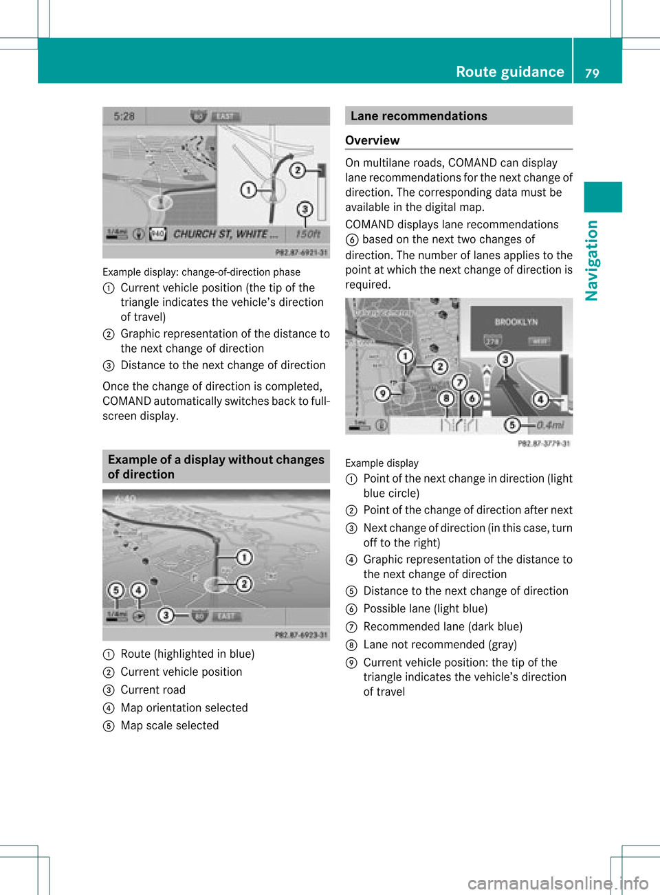
ple displ ay:c hange-of-direct ionphase
: Current vehicleposition (thetipofthe
triangle indicates thevehicle’s direction
of travel)
; Graphic representation ofthe distance to
the next change ofdirection
= Distanc eto the next change ofdirection
Once thechange ofdirection iscompleted,
COMAND automatically switchesbacktofull-
screen display. Example
ofad ispla ywithout changes
of dir ection :
Route (highlight edinblue)
; Curren tvehicle position
= Current road
? Map orient ationselect ed
A Map scale select ed Lane
recomm endations
Overview On
multilane roads,COMAND candisplay
lane recom mendat ionsforthe nextchange of
direction. Thecorresponding datamust be
availa bleinthe digital map.
COMAND displayslane recommen dations
B based onthe next twochanges of
direction. Thenumber oflanes appliestothe
point atwhich thenext change ofdirection is
required. Example
display
: Point ofthe next change indirection (light
blue circle)
; Point ofthe change ofdirection afternext
= Next change ofdirection (inthis case, turn
off tothe right)
? Graphic representat ionofthe distance to
the next change ofdirection
A Distanc eto the next change ofdirection
B Possible lane(light blue)
C Recommended lane(dark blue)
D Lane notrecommen ded(gray)
E Current vehicleposition: thetipofthe
triangle indicates thevehicle’s direction
of travel Route
guidance
79Navigation Z
Page 87 of 234
Exam
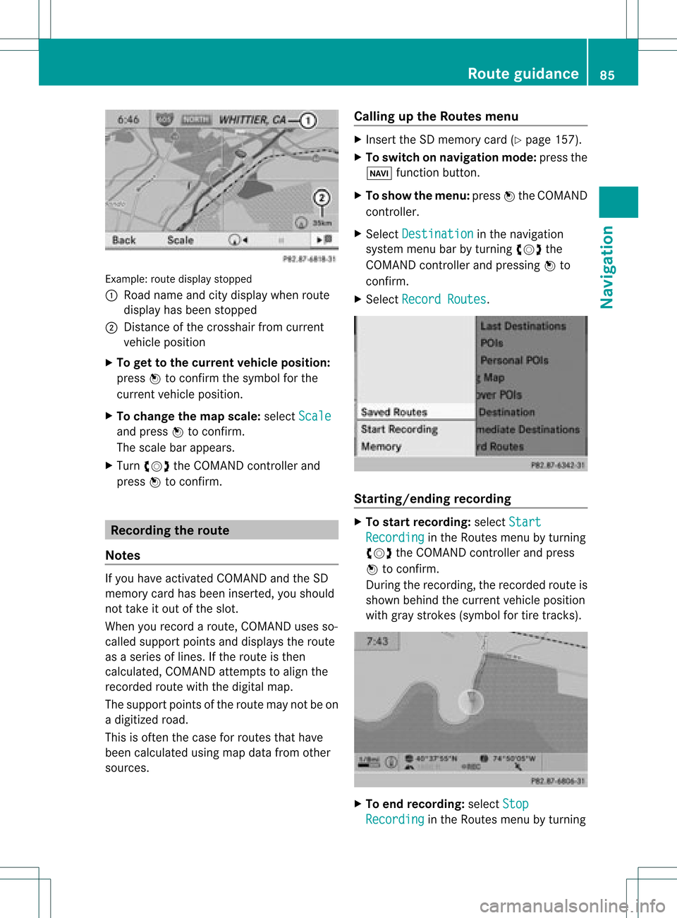
ple: rou tedispl aystop ped
: Road nam eand citydispl aywhen rou te
di spl ayhasbe en stop ped
; Distance ofthe cros shairfrom current
veh iclepo sitio n
X To gettoth ecur rent vehicle position:
pres sW tocon firm thesymbo lfor the
cur ren tvehicle position .
X To change themap scale: selectScale and
press Wtocon firm.
The scale barappears.
X Turn cVd theCOMAND controller and
press Wtocon firm. Recording
therout e
Notes If
you have activated COMAND andtheSD
memory cardhasbeen insert ed,you should
not take itout ofthe slot.
When yourecor daroute, COMAND usesso-
called support pointsand displays theroute
as aseries oflines. Ifthe route isthen
calculated, COMANDattemptstoalign the
recor dedroute withthedigital map.
The support pointsof the route maynotbeon
a digitized road.
This isoften thecase forroutes thathave
been calculated usingmapdata from other
sources. Calling
upthe Rout esmenu X
Inser tthe SDmemory card(Ypage 157).
X To switch onnavigat ionmode: pressthe
Ø function button .
X To show themenu: pressWthe COMAND
con troller .
X Select Destina tion in
the navigation
system menubarbyturn ingcVd the
COMAND controller andpressing Wto
con firm.
X Select Record Routes .
Sta
rting/ending recording X
To star trecord ing:select Start Recordi
ng in
the Routes menubyturn ing
cVd theCOMAND controller andpress
W tocon firm.
Durin gthe recor ding, therecor dedroute is
shown behind thecurren tvehicle position
with gray strokes (symbol fortire tracks). X
To end record ing:select Stop Recordi
ng in
the Routes menubyturn ing Rout
eguida nce
85Navigation Z
Page 89 of 234
X
Sel ect Swap in
the menu byturni ngcVd
the COMAND controllera nd pre ssW to
confi rm.
De letin gthe route
X Sel ect Delete in
the menu byturning
cVd theCOMAND controller and press
W toconfi rm.
Ap rompt appears asking whethe rthe route
should bedeleted.
X Select Yes or
No and
press Wtoconfirm .
If you select Yes ,
the route willbedeleted.
If you select No ,
the process willbe
canceled.
Scanning thememory The
SDmemory cardisinserted.
X Select Memory in
the Routes menu
(Y page 85)byturning cVdtheCOMAND
cont roller andpress Wtoconfirm .
The route memory isdispla yed. Off-r
oadand off-ma p
Import antsafety note G
WARNING
The COMAND navigation systemmaydirect
you tooff-road routesthatyour vehicle may
not becapable oftraversing throughwithout
damaging yourtires, wheels orvehicle. Itis
the driver's soleresponsibility todetermine
the suitabili tyof the route. Off-roadroutes
may beofvarying condition sand their appropriateness
foruse may beaffected by
various factorssuchastime ofday, time of
year andimmediate weathercondition sthat
cannot bejudged ortaken intoconsideration
by the COMAND system.
Route guidance toadestination thatis
not onadigitized road COMAND
canguide youtodestinations
which arewithin thearea covered bythe
digital map,butwhich arenot themselves
recorded onthe map.
These destinations areknown asoff-r oad
destinations, whichyoucan enter using the
map, forexample. Inthese cases, COMAND
guides youforaslong aspossible with
navigation announcemen tsand displa yson
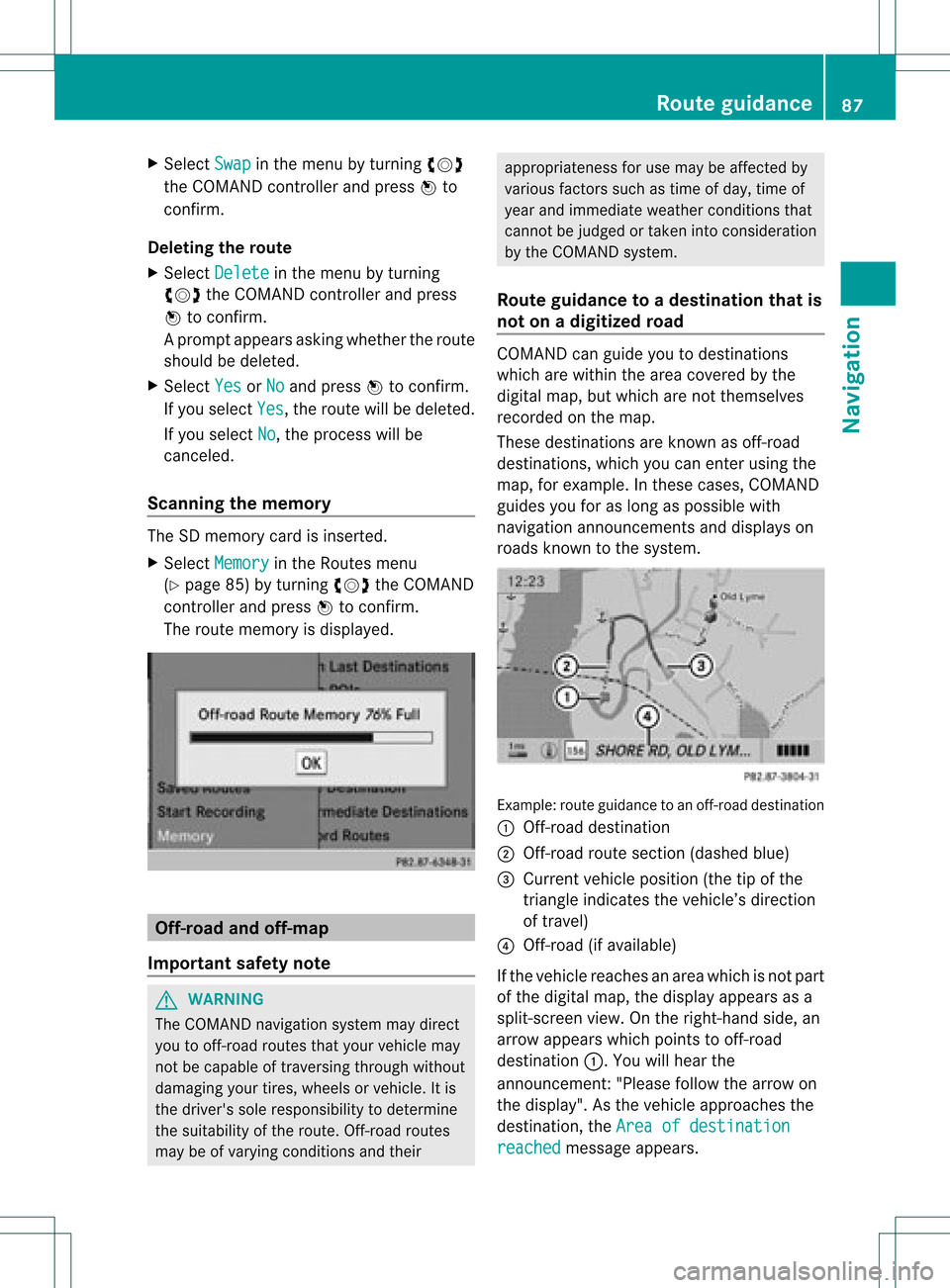
roads known tothe system. Example:
routeguidance toan off-road destination
: Off-r oaddestination
; Off-r oadroute section (dashed blue)
= Current vehicleposition (thetipofthe
triangle indicates thevehicle’s direction
of travel)
? Off-r oad(ifavaila ble)
If the vehicle reaches anarea which isnot part
of the digital map,thedispla yappea rsas a
split-screen view.Onthe right-hand side,an
arrow appearswhich points tooff-r oad
destination :.Youwill hear the
announc ement:"Please followthearrow on
the display" .Asthe vehicle approachesthe
destination, theArea ofdestination reached message
appears. Route
guidance
87Navigation Z
Page 100 of 234
Storing
thevehicle position inthe list
of previous destinations
X To switch onnavigation mode:pressthe
Ø functionbutton.
X To show themenu: pressWthe COMAND
cont roller.
X Select Position in
the navigation system
menu barbyturnin gcVd theCOMAND
cont roller andpress Wtoconf irm.
X Select Save vehicle position and
press
W toconf irm.
COMAND storesthecurrent vehicle
position asadestination inthe listof
previous destinations . Storing
thecrosshair positioninthe
list ofprevious destinations
Ac rossha irapp ears onthe map ifyou have
moved themap manua lly.Y ou can store the
crosshair positionasadestinat ioninthe list
of previous destinations.
X To show themenu: pressWthe COMAND
cont roller.
X Select Position in
the navigation system
menu barbyturnin gcVd theCOMAND
cont roller andpress Wtoconf irm.
X Select Savecrosshair position and
press Wtoconf irm. Dele
ting oneofthe previous
destinat ions
X To switch onnavigation mode:pressthe
Ø functionbutton .
X To show themenu: pressWthe COMAND
cont roller.
X Select Destination in
the navigation
system menubarbyturnin gcVd the
COMAND controller andpressing Wto
conf irm. X
Select Fromlastdestinations and
press Wtoconf irm.
The listoflast destination sappears.
X Select thedesired destinationandpress
W tocon firm.
The destin ationaddress appears.
X Select Delete and
press Wtocon firm.
Ap rompt appears asking whethe rthe entr y
should bedeleted.
X Select Yes or
No and
press Wtoconfirm .
If you select Yes ,
the entr yis deleted.
If you select No ,
the process willbeaborted. Map
operation andsettings Note
Company logosdisplayedonthe map are
trademarks ofthe respective companies and
used solely forthe purpose ofindicating the
location ofthese companies. Theuseofsuch
logos onthe map does notindicate approval
of, support ofor advertising bythese
companies forthe navigation systemitself. Setting
themap scale
X To hide themenu: slideZVtheCOMAND
cont roller and,when theFull Screen menu
itemisshown, pressW.
X To call upthe scale bar:assoon asyou
turn cVd theCOMAND controller, scale
bar =appea rs.
X Turn cVd untilthedesired scaleisset. 98
Map
operat ionand settingsNavigat ion