navigation system MERCEDES-BENZ S-Class 2014 W222 Comand Manual
[x] Cancel search | Manufacturer: MERCEDES-BENZ, Model Year: 2014, Model line: S-Class, Model: MERCEDES-BENZ S-Class 2014 W222Pages: 278, PDF Size: 6.65 MB
Page 91 of 278
regulations always have priority over system
driving recommendations.
COMAND calculates the route to the
destination without taking account of the
following, for example:
R traffic lights
R stop and give way signs
R merging lanes
R parking or stopping in a no parking/no
stopping zone
R other road and traffic rules and regulations
R narrow bridges
COMAND may give differing navigation
commands if the actual street/traffic
situation does not correspond with the digital
map's data. For example, if the road layout or
the direction of a one-way street has been
changed.
For this reason, you must always observe
road and traffic rules and regulations during
your journey. Road and traffic rules and
regulations always have priority over the
system's driving recommendations.
Route guidance begins once a route has been
calculated (Y page 78).
COMAND guides you to your destination by
means of navigation announcements in the
form of audible navigation announcements
and route guidance displays.
The route guidance displays can be seen if the
display is switched to navigation mode.
If you do not follow the navigation
announcements or if you leave the calculated
route, COMAND automatically calculates a
new route to the destination.
If the digital map contains the corresponding
information, the following applies:
R during route guidance, COMAND tries to
avoid roads with restricted access. Those
roads, for example, that are closed to
through-traffic.
R roads that have time restrictions (e.g.
closed on Sundays and public holidays) are
considered for route guidance on days when they are open. For this purpose, the
relevant times must be correctly stored in
the database. Route guidance
89Navigation Z
Page 102 of 278
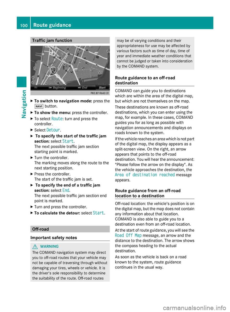
Traffic jam function
X
To switch to navigation mode: press the
00BE button.
X To show the menu: press the controller.
X To select Route
Route: turn and press the
controller.
X Select Detour
Detour .
X To specify the start of the traffic jam
section: selectStart
Start.
The next possible traffic jam section
starting point is marked.
X Turn the controller.
The marking moves along the route to the
next starting position.
X Press the controller.
The start of the traffic jam is set.
X To specify the end of a traffic jam
section: selectEnd
End .
The next possible traffic jam section end
point is marked.
X Turn and press the controller.
X To calculate the detour: selectStart Start. Off-road
Important safety notes G
WARNING
The COMAND navigation system may direct
you to off-road routes that your vehicle may
not be capable of traversing through without
damaging your tires, wheels or vehicle. It is
the driver's sole responsibility to determine
the suitability of the route. Off-road routes may be of varying conditions and their
appropriateness for use may be affected by
various factors such as time of day, time of
year and immediate weather conditions that
cannot be judged or taken into consideration
by the COMAND system.
Route guidance to an off-road
destination COMAND can guide you to destinations
which are within the area of the digital map,
but which are not themselves on the map.
These destinations are known as off-road
destinations, which you can enter using the
map, for example. In these cases, COMAND
guides you for as long as possible with
navigation announcements and displays on
roads known to the system.
If the vehicle reaches an area which is not part
of the digital map, the display appears as a
split-screen view. On the right, an arrow
appears that points to the off-road
destination. You will hear the announcement:
"Please follow the arrow on the display". As
the vehicle approaches the destination, the
Area of destination reached Area of destination reached
message
appears.
Route guidance from an off-road
location to a destination Off-road location: the vehicle's position is on
the digital map, but the map does not contain
any information about that location.
COMAND is also able to guide you to a
destination even from an off-road location.
At the start of route guidance, you will see the
Road Off Map Road Off Map message, an arrow and the
distance to the destination. The arrow shows
the compass heading to the actual
destination.
As soon as the vehicle is back on a road
known to the system, route guidance
continues in the usual way. 100
Route guidanceNavigation
Page 103 of 278
Off-road during route guidance
Due to roadworks, for example, there may be
differences between the data on the digital
map and the actual course of the road.
In such cases, the system will temporarily be
unable to locate the vehicle position on the
digital map. The vehicle is therefore in an off-
road position.
In the display, you will see the Road Off Road Off
Map
Map message, an arrow and the distance to
the destination. The direction arrow shows
the compass heading to the destination.
As soon as the system can assign the vehicle
position to the map again, route guidance
continues in the usual way. Real-time traffic reports
Prerequisites
i This function is currently not available for
Canada.
In order to receive real-time traffic reports via
satellite radio, you need to subscribe to
SIRIUS XM Satellite Radio Traffic Message
Service.
Further information on satellite radio
(Y page 182).
COMAND can receive traffic reports via
satellite radio and take account of these for
route guidance in the navigation system.
Received traffic reports are displayed on the
map either as text or as symbols. Real-time traffic reports
101Navigation Z
Page 110 of 278
Map functions
General notes
Company logos displayed on the map are trademarks of the respective companies and used
solely for the purpose of indicating the locations of these companies. The use of such logos
on the map does not indicate approval of, support of or advertising by these companies for
the navigation system itself. Map settings
Setting the map scale Requirement: the map is in full screen mode, the menu is faded out (Y
page 70).
The lower left-hand section of the map shows the currently set map scale and compass needle.
Right-hand-drive vehicles: the currently set map scale and compass needle are displayed in
the lower right-hand section of the map.
Displaying the map in full screen mode
X To hide the menu: press the 0038button.
or
X Slide 00970052and press the controller.
X To set the map scale: as soon as you turn the controller, the scale bar appears on the
bottom of the display.
X Turn the controller until the desired scale is set.
The needle points to the currently selected scale.
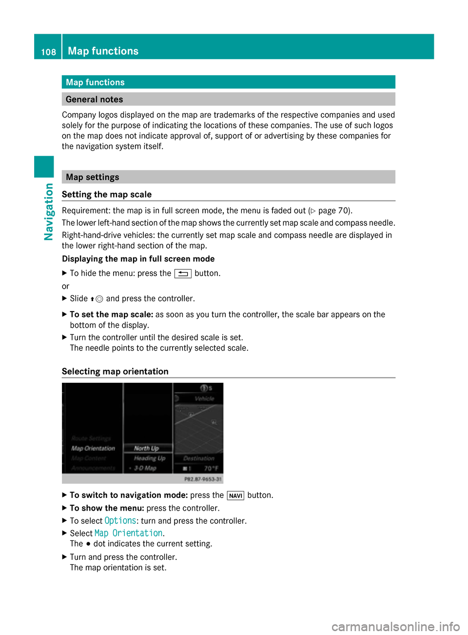
Selecting map orientation X
To switch to navigation mode: press the00CBbutton.
X To show the menu: press the controller.
X To select Options
Options : turn and press the controller.
X Select Map Orientation
Map Orientation.
The 003Bdot indicates the current setting.
X Turn and press the controller.
The map orientation is set. 108
Map functionsNavigation
Page 118 of 278
Deleting all areas:
X
Slide 00520096and press the controller while the list is shown.
X Select Delete All Delete All .
A prompt appears asking whether you wish to delete all areas.
X Select Yes
Yes orNo
No.
After selecting Yes
Yes , all areas are deleted. SIRIUS XM service
Displaying SIRIUS XM service
information You can display the SIRIUS XM service
information.
X To switch to navigation mode: press the
00BE button.
X To show the menu: press the controller.
X To select Traffic
Traffic: turn the controller and
press to confirm.
X Select SIRIUS Service SIRIUS Service.
The window on the right half of the display
shows the telephone number of the
provider (SIRIUS XM) and the serial number
of your service module.
Registering for the SIRIUS XM traffic
report service X
Call the provider telephone number shown
on the COMAND display.
i You can also have the satellite service
activated online. To do so, visit the SIRIUS
XM Radio website at
http://www.sirius.com (USA).
Once the connection has been established:
X Follow the service employee's instructions.
The activation process may take up to ten
minutes.
If registration is not included when
purchasing the system, your credit card
details will be required to activate your
account. Updating the digital map
Introduction The digital maps generated by the map
software become outdated in the same way
as conventional road maps. Optimal route
guidance can only be provided by
the navigation system in conjunction with the
most up-to-date map software.
Information about new versions of the digital
map can be obtained from an authorized
Mercedes-Benz Center. You can have the
digital map updated there using a data
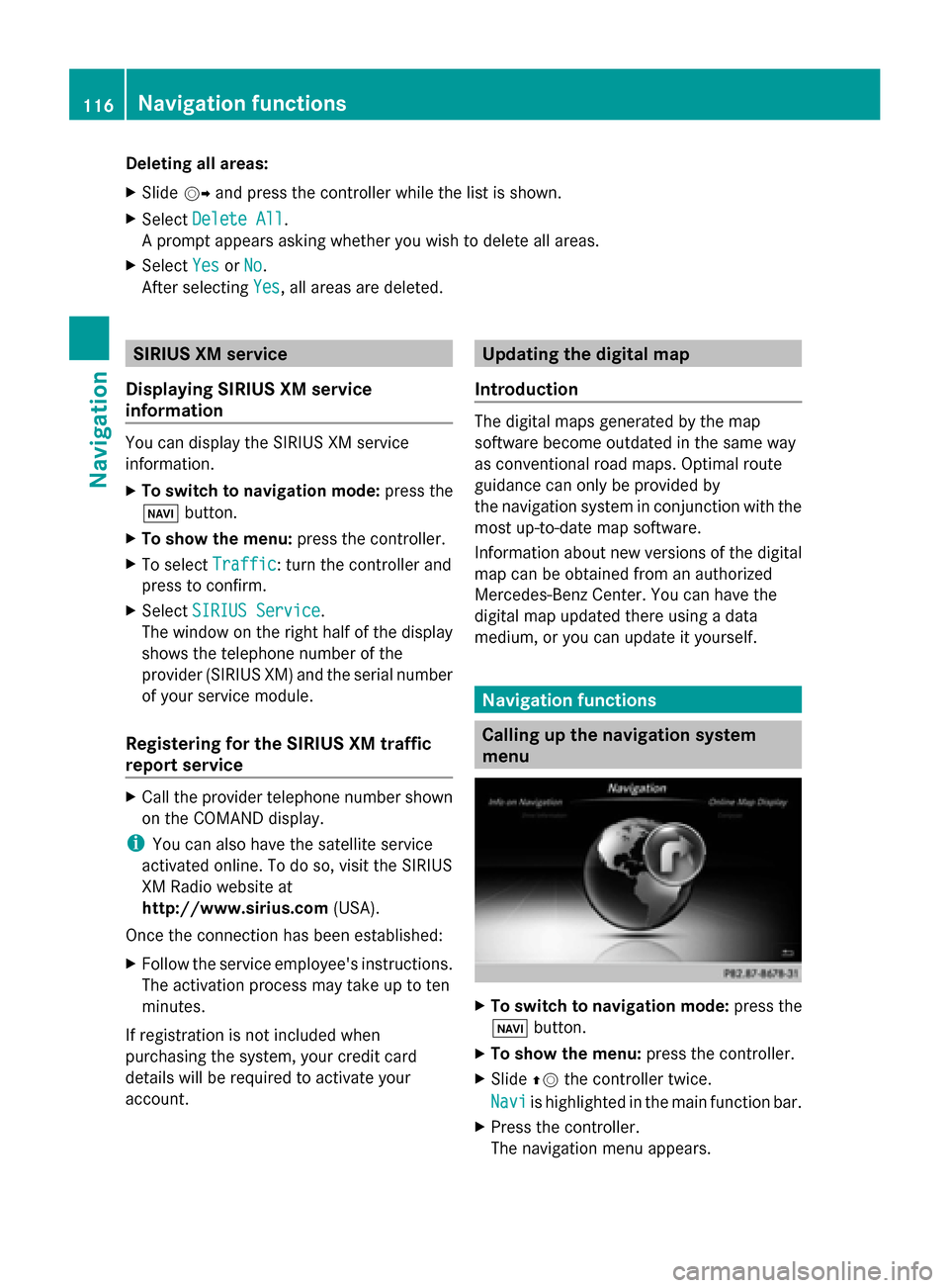
medium, or you can update it yourself. Navigation functions
Calling up the navigation system
menu
X
To switch to navigation mode: press the
00CB button.
X To show the menu: press the controller.
X Slide 00970052the controller twice.
Navi Navi is highlighted in the main function bar.
X Press the controller.
The navigation menu appears. 116
Navigation fun
ctionsNavigation
Page 121 of 278
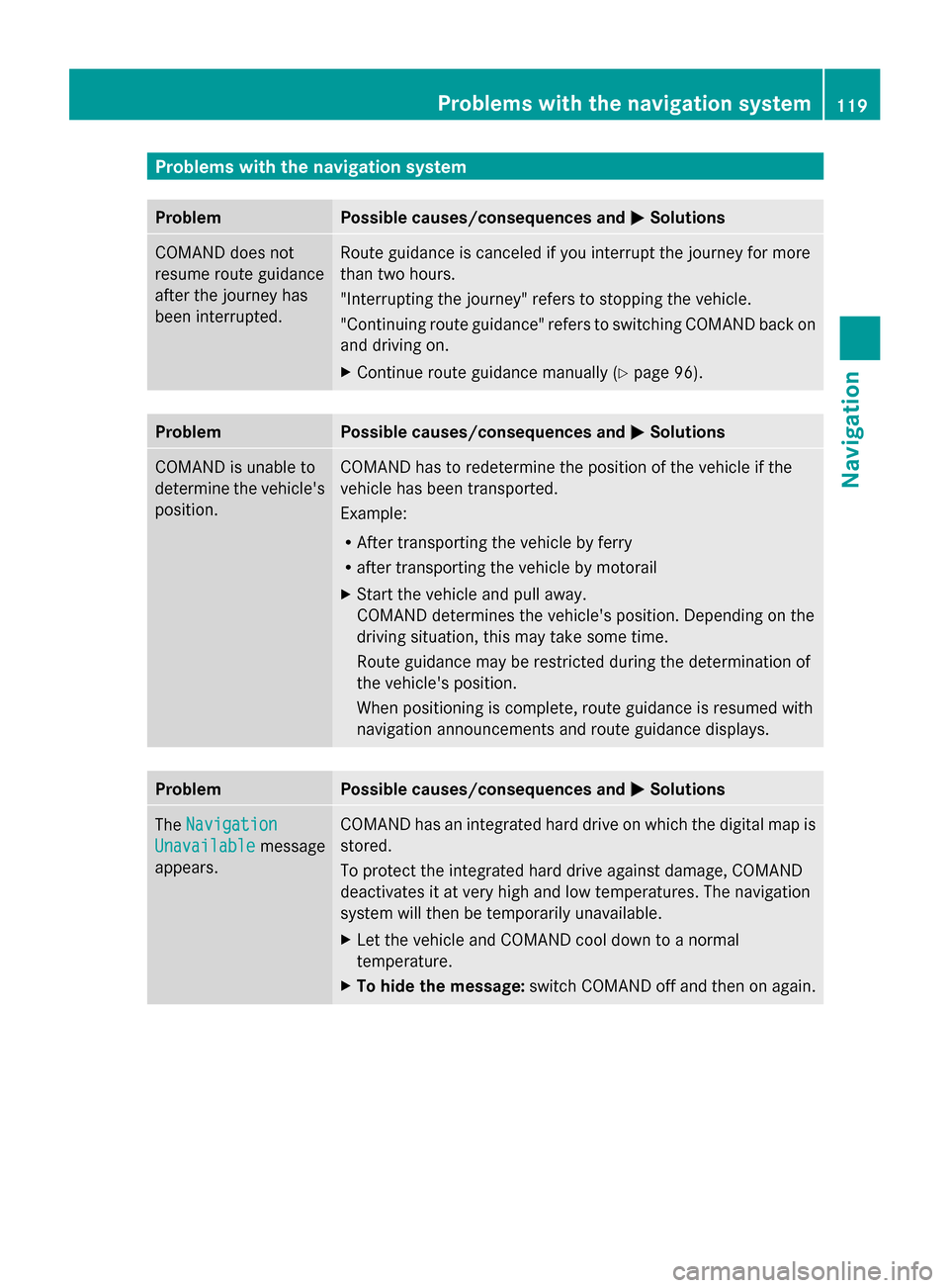
Problems with the navigation system
Problem Possible causes/consequences and
0050
0050Solutions COMAND does not
resume route guidance
after the journey has
been interrupted. Route guidance is canceled if you interrupt the journey for more
than two hours.
"Interrupting the journey" refers to stopping the vehicle.
"Continuing route guidance" refers to switching COMAND back on
and driving on.
X
Continue route guidance manually (Y page 96).Problem Possible causes/consequences and
0050 0050Solutions COMAND is unable to
determine the vehicle's
position. COMAND has to redetermine the position of the vehicle if the
vehicle has been transported.
Example:
R
After transporting the vehicle by ferry
R after transporting the vehicle by motorail
X Start the vehicle and pull away.
COMAND determines the vehicle's position. Depending on the
driving situation, this may take some time.
Route guidance may be restricted during the determination of
the vehicle's position.
When positioning is complete, route guidance is resumed with
navigation announcements and route guidance displays. Problem Possible causes/consequences and
0050 0050Solutions The
Navigation
Navigation
Unavailable
Unavailable message
appears. COMAND has an integrated hard drive on which the digital map is
stored.
To protect the integrated hard drive against damage, COMAND
deactivates it at very high and low temperatures. The navigation
system will then be temporarily unavailable.
X
Let the vehicle and COMAND cool down to a normal
temperature.
X To hide the message: switch COMAND off and then on again. Problems with the navigation system
119Navigation Z
Page 122 of 278
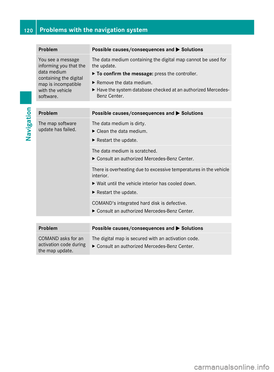
Problem Possible causes/consequences and
0050
0050Solutions You see a message
informing you that the
data medium
containing the digital
map is incompatible
with the vehicle
software. The data medium containing the digital map cannot be used for
the update.
X
To confirm the message: press the controller.
X Remove the data medium.
X Have the system database checked at an authorized Mercedes-
Benz Center. Problem Possible causes/consequences and
0050 0050Solutions The map software
update has failed. The data medium is dirty.
X
Clean the data medium.
X Restart the update. The data medium is scratched.
X
Consult an authorized Mercedes-Benz Center. There is overheating due to excessive temperatures in the vehicle
interior.
X
Wait until the vehicle interior has cooled down.
X Restart the update. COMAND's integrated hard disk is defective.
X
Consult an authorized Mercedes-Benz Center. Problem Possible causes/consequences and
0050 0050Solutions COMAND asks for an
activation code during
the map update. The digital map is secured with an activation code.
X
Consult an authorized Mercedes-Benz Center. 120
Problems with the navigation systemNavigation
Page 150 of 278
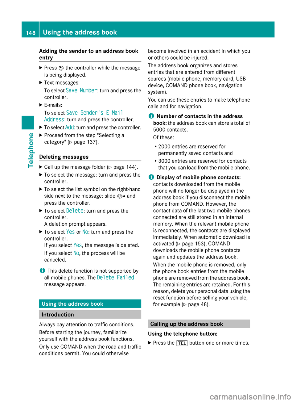
Adding the sender to an address book
entry X
Press 0098the controller while the message
is being displayed.
X Text messages:
To select Save
Save Number Number : turn and press the
controller.
X E-mails:
To select Save Sender's E-Mail
Save Sender's E-Mail
Address Address: turn and press the controller.
X To select Add
Add: turn and press the controller.
X Proceed from the step "Selecting a
category" ( Ypage 137).
Deleting messages X
Call up the message folder ( Ypage 144).
X To select the message: turn and press the
controller.
X To select the list symbol on the right-hand
side next to the message: slide 00520096and
press the controller.
X To select Delete
Delete : turn and press the
controller.
A deletion prompt appears.
X To select Yes
Yes orNo No: turn and press the
controller.
If you select Yes
Yes , the message is deleted.
If you select No
No, the process will be
canceled.
i This delete function is not supported by
all mobile phones. The Delete Failed Delete Failed
message appears. Using the address book
Introduction
Always pay attention to traffic conditions.
Before starting the journey, familiarize
yourself with the address book functions.
Only use COMAND when the road and traffic
conditions permit. You could otherwise become involved in an accident in which you
or others could be injured.
The address book organizes and stores
entries that are entered from different
sources (mobile phone, memory card, USB
device, COMAND phone book, navigation
system).
You can use these entries to make telephone
calls and for navigation.
i Number of contacts in the address
book: the address book can store a total of
5000 contacts.
Of these:
R 2000 entries are reserved for
permanently saved contacts and
R 3000 entries are reserved for contacts
that you can load from the mobile phone.
i Display of mobile phone contacts:
contacts downloaded from the mobile
phone will no longer be displayed in the
address book if you disconnect the mobile
phone from COMAND. However, the
contact data of the last two mobile phones
connected are still stored in an internal
memory. When the relevant mobile phone
is reconnected, the contacts are displayed
immediately. When automatic download is
activated (Y page 153), COMAND
downloads the mobile phone contacts
again and updates the address book.
When the mobile phone is removed, only
the phone book entries from the mobile
phone are removed from the address book.
The remaining entries are retained. For this
reason, delete your personal data using the
reset function before selling your vehicle,
for example (Y page 48). Calling up the address book
Using the telephone button:
X Press the 002Bbutton one or more times. 148
Using the address bookTelephone
Page 166 of 278
X
Select and confirm the entry.
The selected service provider is accepted.
X To exit the menu: select0039.
Deleting search queries X
Select the Options menu for the Google
Google
Local Search
Local Search app (Ypage 166).
The menu shows the current settings.
X To select Delete
Delete All AllSearches
Searches : turn and
press the controller.
A prompt appears, asking whether you
really wish to delete the search.
X Select Yes YesorNo
No.
If you select Yes
Yes, the search queries are
deleted.
If you select No
No, the process will be
canceled.
Resetting search history X
Select the Options menu for the Google
Google
Local Search
Local Search app (Ypage 166).
The menu shows the current settings.
X To select Reset
Reset Search Search History
History: turn the
controller and press to confirm.
A prompt appears, asking whether you
really wish to reset the search history.
X Select Yes YesorNo
No.
If you select Yes
Yes, the search history is
deleted.
If you select No
No, the process will be
canceled.
i The last ten search queries are reset. Destination/route download
Introduction
You can use Google™ Maps to send
navigation destinations to the server and then
download them from the vehicle. You can use
destinations for route guidance and save
them in COMAND for further use. In order to use the destination download
function, the mbrace system must be:
R
activated
R set up
R and activated for COMAND and Internet
access services.
For information on the mbrace system, see
the separate vehicle Operator's Manual. Sending destinations to the server
X Call up the website for Google™ Maps on
the Internet.
X Enter a destination.
X Click "More" at the destination.
X Click "Send".
X Click "Send to vehicle".
X Select Mercedes-Benz as the vehicle
brand.
X Enter the mbrace e-mail address or the
vehicle identification number.
Vehicle identification number
(Y page 166).
X Click "Send".
The destination is sent to the server.
i The availability of the destination/route
download function is country-dependent. Downloading destinations from the
server
Proceed as follows to use destinations/
routes that have been sent to the server:
X Press the 002Bbutton.
The last function called up appears.
X Select TEL/ TEL/00A7 in the main function bar by
sliding 00970052, turning and pressing the
controller.
A menu appears.
X To select Internet Internet: turn and press the
controller.
The menu for the Internet functions
appears. 164
Destination/route downloadOnline and Internet
Page 192 of 278
Your COMAND equipment
These operating instructions describe all
standard and optional equipment available
for your COMAND system at the time of
purchase. Country-specific differences are
possible. Please note that your
COMAND system may not be equipped with
all the features described. This also applies to
safety-relevant systems and functions.
Therefore, the equipment on your COMAND
system may differ from that in the
descriptions and illustrations. Should you
have any questions concerning equipment
and operation, please consult an authorized
Mercedes-Benz Center. Activating media mode
General notes
There are several ways to activate media
sources using COMAND.
The relevant sections of the Operator's
Manual describe the simplest way to activate
a media source.
This section describes all options for
activating media sources. Using the MEDIA button
X Press the 00FDbutton.
The menu for the last accessed media
source appears.
X To select the media source: keep pressing
the 00FD button until the required media
source has been set.
The media sources appear in the following
order:
R CD/DVD
R Memory card
R Media Register
R USB 1
R Media Interface 1
R USB 2 R
Media Interface 2
R BT audio
R TV (if your vehicle is equipped with a TV)
R AUX
If playable music files are found, they will
be played by COMAND.
X To display the function bars: slide 005200C5the
controller. Switching on automatically
X When an external media source is
connected, this media mode is
automatically switched on by COMAND.
External media sources:
R
Apple devices (e.g. iPhone ®
)
R USB devices (e.g. USB stick, MP3 player)
R SD cards
R via AUX cable (automatic activation
depends on the device connected)
R via devices connected by Bluetooth ®
If playable music files are found, they will
be played by COMAND.
i If a media function is already switched on
in COMAND, this will be interrupted and the
basic display of the newly connected
device will appear.
If another function, such as navigation, is
operating, the basic display will not change.
Only the music from the newly connected
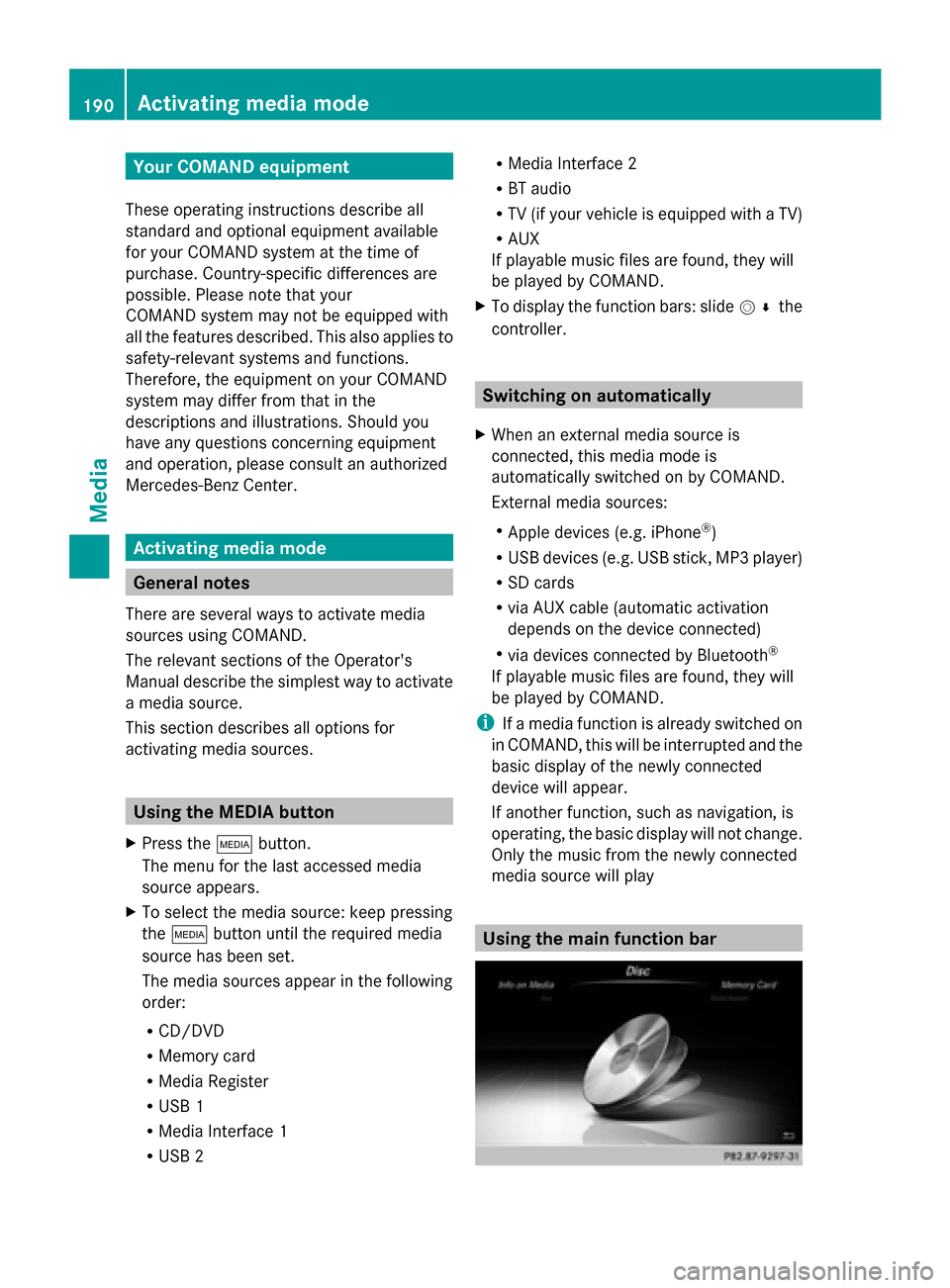
media source will play Using the main function bar190
Activa
ting media modeMedia