sat nav MERCEDES-BENZ SL-CLASS ROADSTER 2013 Owners Manual
[x] Cancel search | Manufacturer: MERCEDES-BENZ, Model Year: 2013, Model line: SL-CLASS ROADSTER, Model: MERCEDES-BENZ SL-CLASS ROADSTER 2013Pages: 572, PDF Size: 9.23 MB
Page 213 of 572
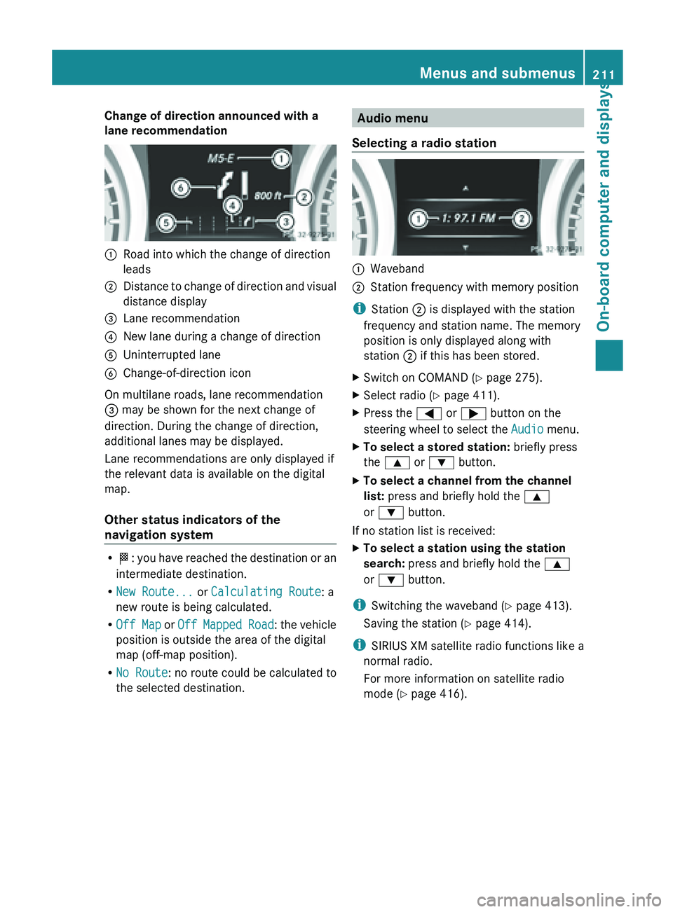
Change of direction announced with a
lane recommendation
:
Road into which the change of direction
leads
; Distance to change of direction and visual
distance display
= Lane recommendation
? New lane during a change of direction
A Uninterrupted lane
B Change-of-direction icon
On multilane roads, lane recommendation
= may be shown for the next change of
direction. During the change of direction,
additional lanes may be displayed.
Lane recommendations are only displayed if
the relevant data is available on the digital
map.
Other status indicators of the
navigation system R
O: you
have reached the destination or an
intermediate destination.
R New Route... or Calculating Route: a
new route is being calculated.
R Off Map or Off Mapped Road : the vehicle
position is outside the area of the digital
map (off-map position).
R No Route : no route could be calculated to
the selected destination. Audio menu
Selecting a radio station :
Waveband
; Station frequency with memory position
i Station ; is displayed with the station
frequency and station name. The memory
position is only displayed along with
station ; if this has been stored.
X Switch on COMAND (Y page 275).
X Select radio ( Y page 411).
X Press the = or ; button on the
steering wheel to select the Audio menu.
X To select a stored station: briefly press
the 9 or : button.
X To select a channel from the channel
list: press and briefly hold the 9
or : button.
If no station list is received:
X To select a station using the station
search: press and briefly hold the 9
or : button.
i Switching the waveband ( Y page 413).
Saving the station ( Y page 414).
i SIRIUS XM satellite radio functions like a
normal radio.
For more information on satellite radio
mode ( Y page 416). Menus and submenus
211
On-board computer and displays Z
Page 270 of 572
Useful information
i These operating instructions describe all
the standard and optional equipment of
your COMAND system, as available at the
time of going to print. Country-specific
differences are possible. Please note that
your COMAND system may not be
equipped with all the features described.
This also applies to safety-related systems
and functions.
i Read the information on qualified
specialist workshops: ( Y page 31).
Operating safety
Important safety notes
G
WARNING
Making alterations to electronic components
can cause malfunctions.
Radio, satellite
radio, amplifier, DVD changer,
navigation module, phone and voice control
are networked. If one component is not
functional or if it has been incorrectly
removed/replaced, this could impair the
operation of other components.
This could seriously jeopardize the
operational safety of your vehicle.
We recommend that you always have
maintenance work on electronic components
carried out at an authorized Mercedes-Benz
Center. G
WARNING
In
order to avoid distraction which could lead
to an accident, the driver should only enter
system settings
with the vehicle at a standstill
and operate the system only when road,
weather and traffic conditions permit.
Bear in mind that at a speed of only 30 mph
(approximately 50 km/h), the vehicle covers
a distance of 44 feet (approximately 14 m) per
second. COMAND delivers information to simplify
your choice of route and guide you
comfortably and safely to your destination.
For safety reasons, we recommend that you
bring your vehicle to a standstill, paying
attention to road and traffic conditions,
before making or accepting a telephone call
or viewing navigation maps, instructions or
downloaded information on the COMAND
screen.
G
WARNING
While the navigation system provides
directional assistance,
the driver must remain
focused on safe driving behavior, especially
attention to traffic and street signs, and
should utilize the system's audio cues while
driving.
The navigation system does not supply any
information on stop signs, yield signs, traffic
regulations or traffic safety rules. Their
observance always remains in the driver's
personal responsibility. DVD maps do not
cover all areas nor all routes within an area. G
WARNING
This equipment complies with FCC radiation
exposure limits set forth for uncontrolled
equipment and meets the FCC radio
frequency (RF) Exposure Guidelines in
Supplement C to OET65.
This equipment has very low levels of RF
energy that is deemed to comply without
maximum permissive exposure evaluation
(MPE). But it is desirable that it should be
installed and operated with at least 8
inches
(20 cm)
and more between the radiator and a
person's body (excluding extremities: hands,
wrists, feet and legs.) 268
Operating safety
COMAND
Page 335 of 572
As soon as the system can assign the vehicle
position to the map again, route guidance
continues in the usual way.
Traffic reports
Conditions i
This function
is currently not available for
Canada.
To receive real-time traffic reports via
satellite radio, you require:
R optionally available satellite radio
equipment
R a subscription to SIRIUS XM Satellite Radio
Traffic Message Service
Further information on satellite radio
(Y page 416).
COMAND can receive traffic reports via
satellite radio and take account of these for
route guidance in the navigation system.
Received traffic reports are displayed on the
map either as text or as symbols.
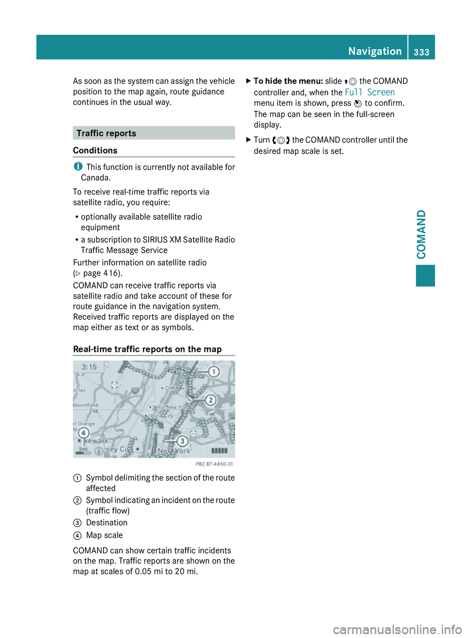
Real-time traffic reports on the map :
Symbol delimiting the section of the route
affected
; Symbol indicating an incident on the route
(traffic flow)
= Destination
? Map scale
COMAND can show certain traffic incidents
on the
map. Traffic reports are shown on the
map at scales of 0.05 mi to 20 mi. X
To hide the menu: slide ZV
the COMAND
controller and, when the Full Screen
menu item is shown, press W to confirm.
The map can be seen in the full-screen
display.
X Turn cVd the COMAND controller until the
desired map scale is set. Navigation
333
COMAND Z
Page 348 of 572
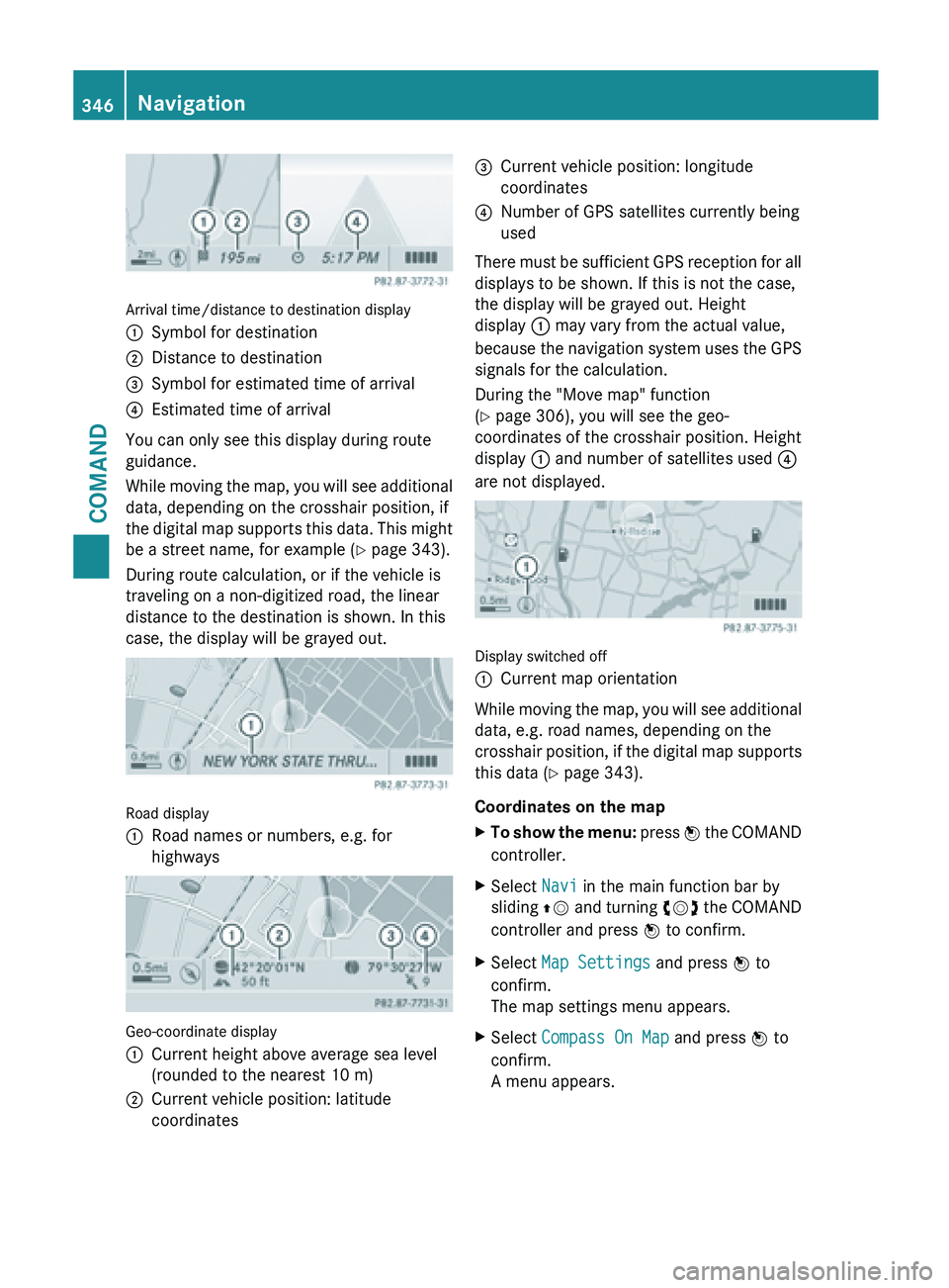
Arrival time/distance to destination display
:
Symbol for destination
; Distance to destination
= Symbol for estimated time of arrival
? Estimated time of arrival
You can only see this display during route
guidance.
While moving
the map, you will see additional
data, depending on the crosshair position, if
the digital map supports this data. This might
be a street name, for example ( Y page 343).
During route calculation, or if the vehicle is
traveling on a non-digitized road, the linear
distance to the destination is shown. In this
case, the display will be grayed out. Road display
:
Road names or numbers, e.g. for
highways Geo-coordinate display
:
Current height above average sea level
(rounded to the nearest 10 m)
; Current vehicle position: latitude
coordinates =
Current vehicle position: longitude
coordinates
? Number of GPS satellites currently being
used
There must be sufficient GPS reception for all
displays to be shown. If this is not the case,
the display will be grayed out. Height
display : may vary from the actual value,
because the
navigation system uses the GPS
signals for the calculation.
During the "Move map" function
(Y page 306), you will see the geo-
coordinates of the crosshair position. Height
display : and number of satellites used ?
are not displayed. Display switched off
:
Current map orientation
While moving the map, you will see additional
data, e.g. road names, depending on the
crosshair position,
if the digital map supports
this data ( Y page 343).
Coordinates on the map
X To show the menu: press W
the COMAND
controller.
X Select Navi in the main function bar by
sliding ZV and
turning cVd the COMAND
controller and press W to confirm.
X Select Map Settings and press W to
confirm.
The map settings menu appears.
X Select Compass On Map and press W to
confirm.
A menu appears. 346
Navigation
COMAND
Page 350 of 572
X
Select Navi in the main function bar by
sliding ZV and
turning cVd the COMAND
controller and press W to confirm.
X Select Map Settings and press W to
confirm.
The map settings menu appears.
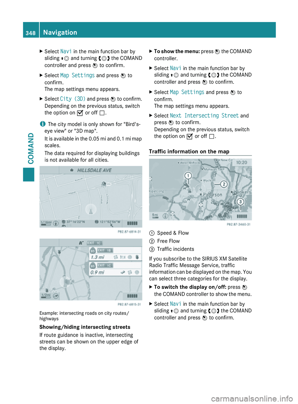
X Select City (3D)
and press W to confirm.
Depending on the previous status, switch
the option on O or off ª.
i The city model is only shown for "Bird's-
eye view" or "3D map".
It is
available in the 0.05 mi and 0.1 mi map
scales.
The data required for displaying buildings
is not available for all cities. Example: intersecting roads on city routes/
highways
Showing/hiding intersecting streets
If route guidance is inactive, intersecting
streets can be shown on the upper edge of
the display. X
To show the menu: press W
the COMAND
controller.
X Select Navi in the main function bar by
sliding ZV and
turning cVd the COMAND
controller and press W to confirm.
X Select Map Settings and press W to
confirm.
The map settings menu appears.
X Select Next Intersecting Street and
press W to confirm.
Depending on the previous status, switch
the option on O or off ª.
Traffic information on the map :
Speed & Flow
; Free Flow
= Traffic incidents
If you subscribe to the SIRIUS XM Satellite
Radio Traffic Message Service, traffic
information can
be displayed on the map. You
can select three categories for the display.
X To switch the display on/off: press W
the COMAND
controller to show the menu.
X Select Navi in the main function bar by
sliding ZV and
turning cVd the COMAND
controller and press W to confirm. 348
Navigation
COMAND
Page 353 of 572
X
Select Using Map , From Memory or From
Personal POIs and press W to confirm.
If you select Using Map, the map with the
crosshair appears.
If you select From memory or From
Personal POIs, either the destination
memory or the list of categories for POIs
appears.
R Destination memory ( Y page 304)
R List of categories for personal POIs
(Y page 319)
X Select the desired destination or personal
POI and press W to confirm.
X When the destination address is displayed,
select Continue and press W to confirm.
The map appears.
X To avoid a new area: call up
the area menu
again ( Y page 349).
Switching an avoided area on/off
X Call up the area list ( Y page 350).
X Select an entry in the list by turning cVd
the COMAND controller and press W to
confirm.
The avoided area is switched on O or off
ª depending on the previous status.
Displaying and changing an avoided area
X Call up the area list ( Y page 350).
X Select an entry in the list by turning cVd
the COMAND controller.
X Slide VY the COMAND controller and
press W to confirm.
X Select Display /
Change and press W to
confirm.
The area to be avoided is indicated in the
map.
X To change the location of the area: slide
XVY, ZVÆ or aVb the COMAND
controller.
The area is moved on the map. X
To adjust the size of the area: turn
cVd the COMAND controller.
The area is enlarged or reduced.
X To confirm the change: press W the
COMAND controller.
The list
appears and the change is entered.
Deleting a set area
X Call up the area list ( Y page 350).
X Select an entry in the list by turning cVd
the COMAND controller.
X Slide VY the COMAND controller and
press W to confirm.
X Select Delete and press W to confirm.
A query appears asking whether the entry
should be deleted.
X Select Yes or No.
If you select Yes, the entry is deleted.
If you select No, the process will be
canceled.
SIRIUS XM service Displaying SIRIUS XM service information
You can display the SIRIUS XM service
information.
X
To show the menu: press W
the COMAND
controller.
X Select Navi in the main function bar by
sliding ZV and
turning cVd the COMAND
controller and press W to confirm.
X Select SIRIUS Service and press W to
confirm.
The window
on the right half of the display
shows the telephone number of the
provider (SIRIUS XM) and the serial number
of your service module.
Registering for the SIRIUS XM traffic
report service
X Call the traffic report provider's phone
number shown on the screen.
i You can also have the satellite service
activated online. To do so, visit the SIRIUS Navigation
351
COMAND Z
Page 354 of 572
XM Radio website at
http://www.sirius.com (USA) or
http://www.siriuscanada.com
(Canada).
Once the connection has been established:
X Follow the instructions of the operator.
The activation process may take up to ten
minutes.
If registration is not included when
purchasing the system, your credit card
details will be required to activate your
account.
Compass function In the compass view, you can see the current
direction of travel, the current height above
sea level and the coordinates of the vehicle
position, for example.
X
To switch on navigation mode: press the
Ø function button.
X To show the menu:
press W
the COMAND
controller.
X Select Position in the navigation system
menu bar by sliding VÆ and turning cVd
the COMAND controller and press W to
confirm.
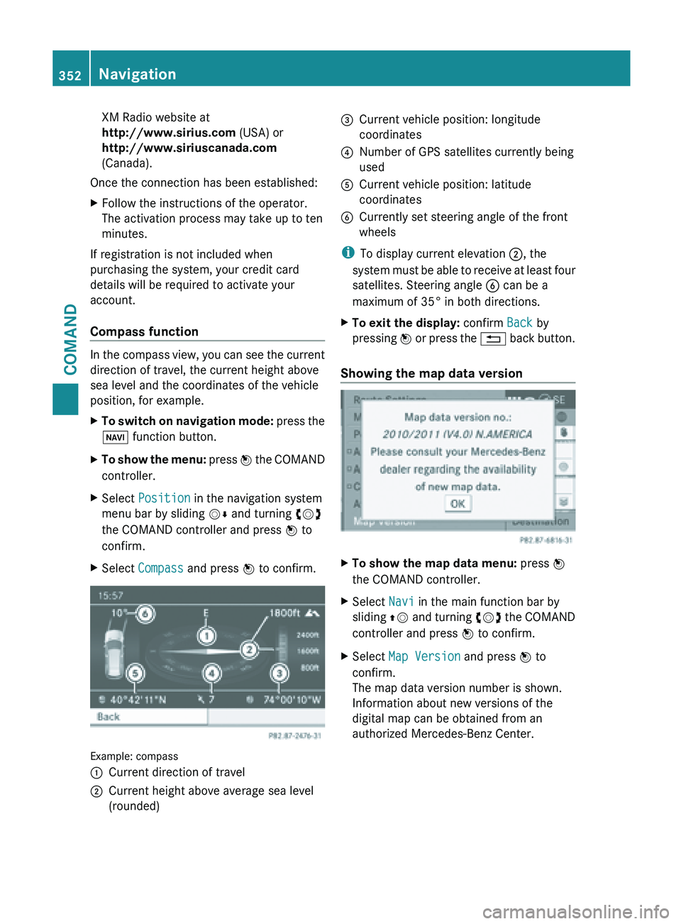
X Select Compass and press W to confirm. Example: compass
:
Current direction of travel
; Current height above average sea level
(rounded) =
Current vehicle position: longitude
coordinates
? Number of GPS satellites currently being
used
A Current vehicle position: latitude
coordinates
B Currently set steering angle of the front
wheels
i To display current elevation ;, the
system must
be able to receive at least four
satellites. Steering angle B can be a
maximum of 35° in both directions.
X To exit the display: confirm Back by
pressing W or
press the % back button.
Showing the map data version X
To show the map data menu: press W
the COMAND controller.
X Select Navi in the main function bar by
sliding ZV and
turning cVd the COMAND
controller and press W to confirm.
X Select Map Version and press W to
confirm.
The map data version number is shown.
Information about new versions of the
digital map can be obtained from an
authorized Mercedes-Benz Center. 352
Navigation
COMAND
Page 418 of 572
X
Select Info in the radio display by sliding
VÆ and turning cVd the COMAND
controller and press W to confirm.
Information on the currently selected
station is displayed. Content is dependent
on the station.
X To return to the radio display: confirm
Info by pressing W.
X Slide ZV the COMAND controller up. Satellite radio
Important notes i
The satellite
radio mode described below
requires optionally available satellite radio
equipment and registration with a satellite
radio provider.
i Note that the categories and channels
shown in the illustrations depend on the
program content offered by the provider.
The program content may vary. The
illustrations and descriptions in these
operating instructions may therefore differ
from the channels and categories offered
by the provider.
Satellite radio mode may be temporarily
unavailable or interrupted for a variety of
reasons. These reasons include
environmental or topographical conditions
as well as other issues beyond the control
of Mercedes-Benz USA, LLC. This means
operation may not be possible in certain
areas.
These include:
R tunnels
R parking garages
R locations inside or next to buildings
R locations in the vicinity of other
structures
i SIRIUS XM Radio offers more than 130
radio stations in digital quality, for example
100% commercial-free music, sports, news
and entertainment. SIRIUS XM Radio employs a fleet of high-
performance
satellites
to broadcast around
the clock throughout the USA and Canada.
The satellite radio program is available for
a monthly fee. Details are available from
the SIRIUS XM Service Center and at
http://www.sirius.com (USA) or
http://www.siriuscanada.com
(Canada).
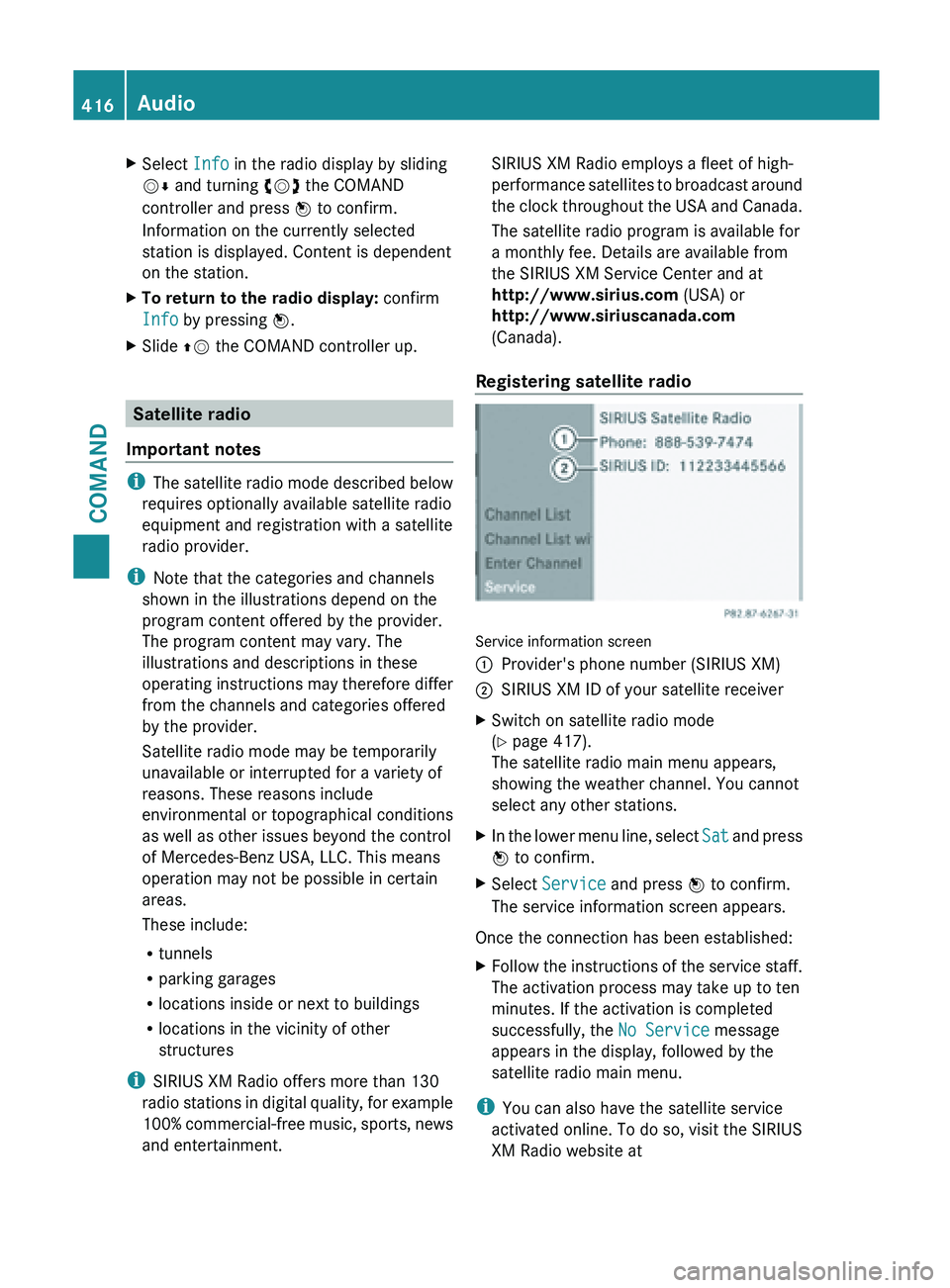
Registering satellite radio Service information screen
:
Provider's phone number (SIRIUS XM)
; SIRIUS XM ID of your satellite receiver
X Switch on satellite radio mode
(Y page 417).
The satellite radio main menu appears,
showing the weather channel. You cannot
select any other stations.
X In the lower menu line, select Sat and
press
W to confirm.
X Select Service and press W to confirm.
The service information screen appears.
Once the connection has been established:
X Follow the instructions of the service staff.
The activation process may take up to ten
minutes. If the activation is completed
successfully, the No Service message
appears in the display, followed by the
satellite radio main menu.
i You can also have the satellite service
activated online. To do so, visit the SIRIUS
XM Radio website at 416
Audio
COMAND
Page 419 of 572
http://www.sirius.com (USA) or
http://www.siriuscanada.com
(Canada).
i If registration is not included when
purchasing the system, your credit card
details will be required to activate your
account.
If the
satellite receiver is not installed or is
not installed correctly, the Device
Unavailable message will appear.
Switching on satellite radio mode Notes
For example, to select a channel or scroll in
the lists, you can also use the
=;
9: buttons on the multifunction
steering wheel ( Y page 211).
Important information on registering the
satellite radio (Y
page 416).
Option 1
X Press the $ function button.
The No Service message appears after
switching on or if no signal is being
received. Once COMAND receives the
signal, the satellite radio display appears.
The station last selected is played.
i Repeatedly pressing this function button
switches through the wavebands in this
order: FM, AM, WB and subsequently
switches on
the satellite radio. Pressing the
button again takes you back to FM radio
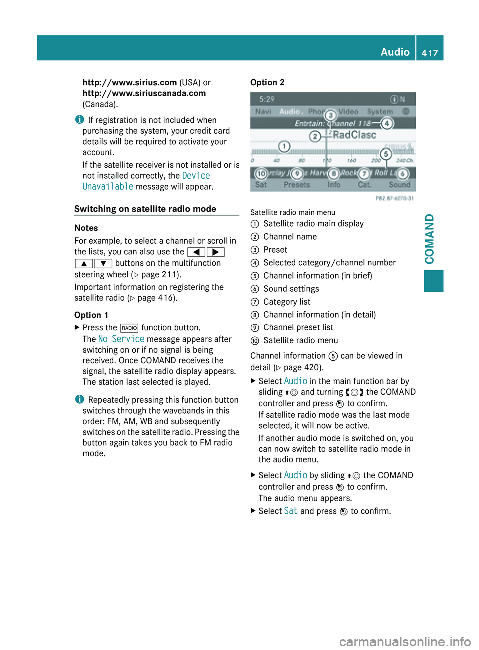
mode. Option 2 Satellite radio main menu
:
Satellite radio main display
; Channel name
= Preset
? Selected category/channel number
A Channel information (in brief)
B Sound settings
C Category list
D Channel information (in detail)
E Channel preset list
F Satellite radio menu
Channel information A can be viewed in
detail ( Y page 420).
X Select Audio in the main function bar by
sliding ZV and
turning cVd the COMAND
controller and press W to confirm.
If satellite radio mode was the last mode
selected, it will now be active.
If another audio mode is switched on, you
can now switch to satellite radio mode in
the audio menu.
X Select Audio by sliding ZV the COMAND
controller and press W to confirm.
The audio menu appears.
X Select Sat and press W to confirm. Audio
417
COMAND Z
Page 420 of 572
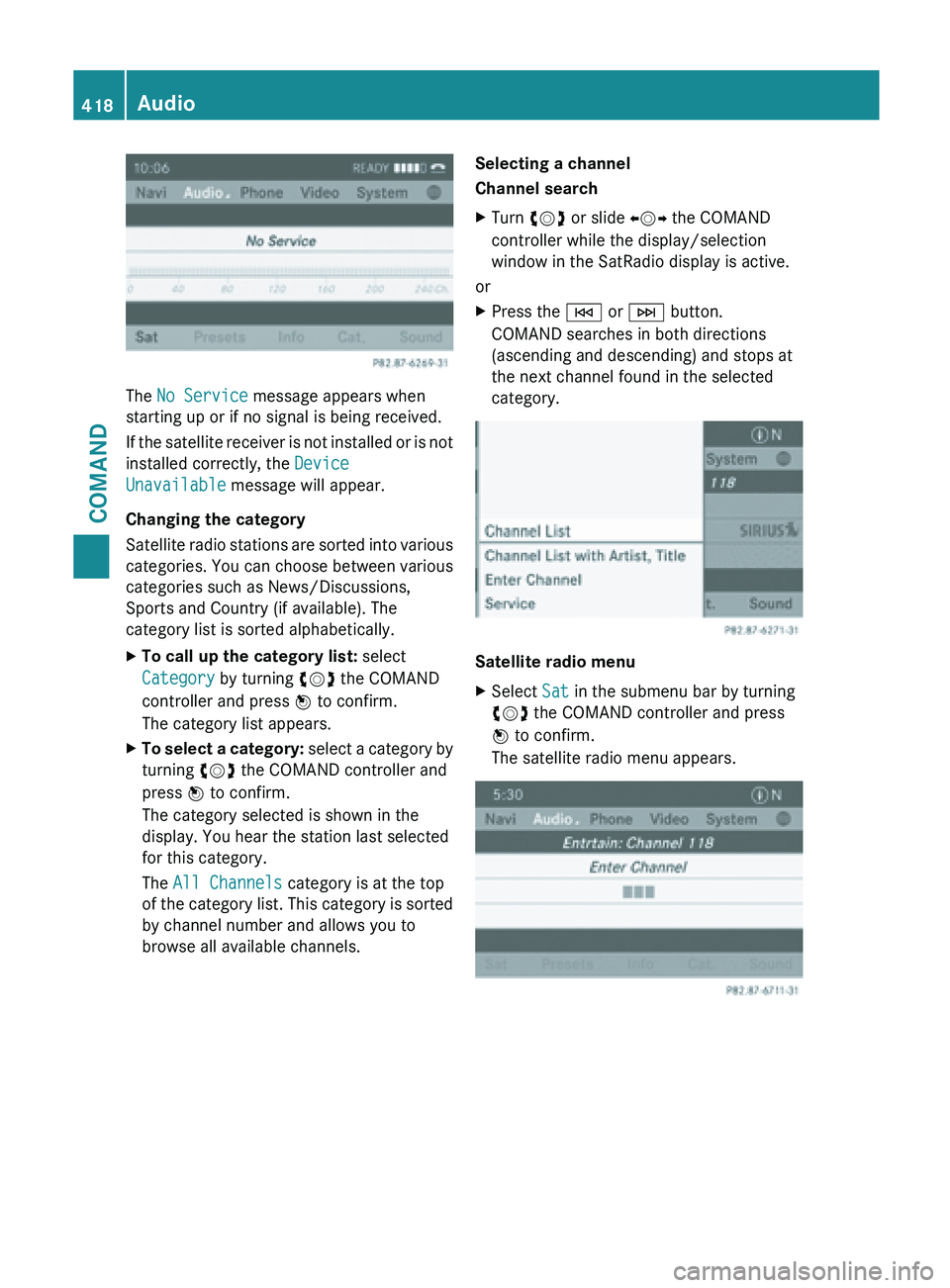
The No Service message appears when
starting up or if no signal is being received.
If
the
satellite receiver is not installed or is not
installed correctly, the Device
Unavailable message will appear.
Changing the category
Satellite radio stations are sorted into various
categories. You can choose between various
categories such as News/Discussions,
Sports and Country (if available). The
category list is sorted alphabetically.
X To call up the category list: select
Category by turning cVd the COMAND
controller and press W to confirm.
The category list appears.
X To select a category: select
a category by
turning cVd the COMAND controller and
press W to confirm.
The category selected is shown in the
display. You hear the station last selected
for this category.
The All Channels category is at the top
of the category list. This category is sorted
by channel number and allows you to
browse all available channels. Selecting a channel
Channel search
X
Turn cVd or slide XVY the COMAND
controller while the display/selection
window in the SatRadio display is active.
or
X Press the E or F button.
COMAND searches in both directions
(ascending and descending) and stops at
the next channel found in the selected
category. Satellite radio menu
X
Select Sat in the submenu bar by turning
cVd the COMAND controller and press
W to confirm.
The satellite radio menu appears. 418
Audio
COMAND