sensor MITSUBISHI LANCER EVOLUTION 2014 10.G MMCS Manual
[x] Cancel search | Manufacturer: MITSUBISHI, Model Year: 2014, Model line: LANCER EVOLUTION, Model: MITSUBISHI LANCER EVOLUTION 2014 10.GPages: 226, PDF Size: 31.21 MB
Page 27 of 226
Navigation Functions 27
NAVIBasic Operation
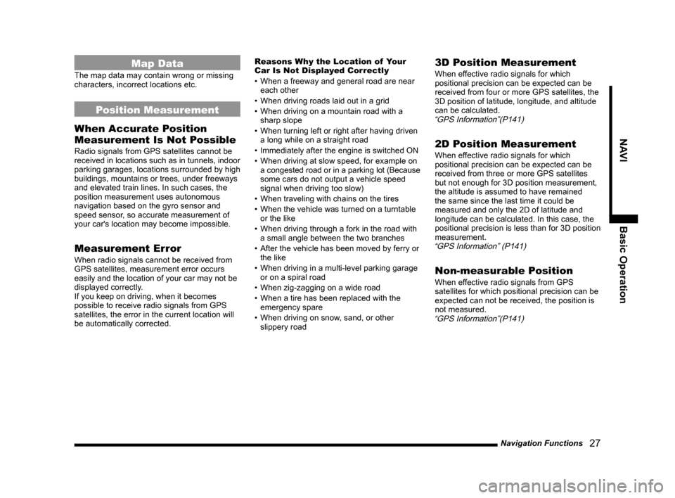
Map Data
The map data may contain wrong or missing
characters, incorrect locations etc.
Position Measurement
When Accurate Position
Measurement Is Not Possible
Radio signals from GPS satellites cannot be
received in locations such as in tunnels, indoor
parking garages, locations surrounded by high
buildings, mountains or trees, under freeways
and elevated train lines. In such cases, the
position measurement uses autonomous
navigation based on the gyro sensor and
speed sensor, so accurate measurement of
your car's location may become impossible.
Measurement Error
When radio signals cannot be received from
GPS satellites, measurement error occurs
easily and the location of your car may not be
displayed correctly.
If you keep on driving, when it becomes
possible to receive radio signals from GPS
satellites, the error in the current location will
be automatically corrected. Reasons Why the Location of Your
Car Is Not Displayed Correctly
•
When a freeway and general road are near
each other
• When driving roads laid out in a grid
• When driving on a mountain road with a
sharp slope
• When turning left or right after having driven
a long while on a straight road
• Immediately after the engine is switched ON
• When driving at slow speed, for example on
a congested road or in a parking lot (Because
some cars do not output a vehicle speed
signal when driving too slow)
• When traveling with chains on the tires
• When the vehicle was turned on a turntable
or the like
• When driving through a fork in the road with
a small angle between the two branches
• After the vehicle has been moved by ferry or
the like
• When driving in a multi-level parking garage
or on a spiral road
• When zig-zagging on a wide road
• When a tire has been replaced with the
emergency spare
• When driving on snow, sand, or other
slippery road
3D Position Measurement
When effective radio signals for which
positional precision can be expected can be
received from four or more GPS satellites, the
3D position of latitude, longitude, and altitude
can be calculated.
“GPS Information”(P141)
2D Position Measurement
When effective radio signals for which
positional precision can be expected can be
received from three or more GPS satellites
but not enough for 3D position measurement,
the altitude is assumed to have remained
the same since the last time it could be
measured and only the 2D of latitude and
longitude can be calculated. In this case, the
positional precision is less than for 3D position
measurement.
“GPS Information” (P141)
Non-measurable Position
When effective radio signals from GPS
satellites for which positional precision can be
expected can not be received, the position is
not measured.
“GPS Information”(P141)
Page 28 of 226
28 Navigation Functions
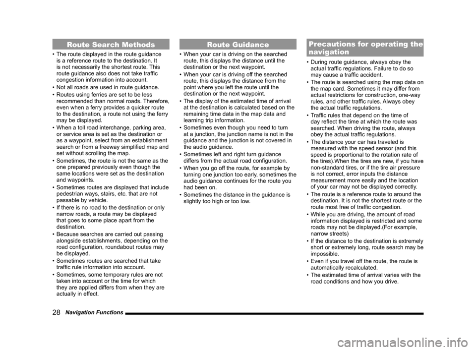
Route Search Methods
• The route displayed in the route guidance
is a reference route to the destination. It
is not necessarily the shortest route. This
route guidance also does not take traffic
congestion information into account.
• Not all roads are used in route guidance.
• Routes using ferries are set to be less
recommended than normal roads. Therefore,
even when a ferry provides a quicker route
to the destination, a route not using the ferry
may be displayed.
• When a toll road interchange, parking area,
or service area is set as the destination or
as a waypoint, select from an establishment
search or from a freeway simplified map and
set without scrolling the map.
• Sometimes, the route is not the same as the
one prepared previously even though the
same locations were set as the destination
and waypoints.
• Sometimes routes are displayed that include
pedestrian ways, stairs, etc. that are not
passable by vehicle.
• If there is no road to the destination or only
narrow roads, a route may be displayed
that goes to some place apart from the
destination.
• Because searches are carried out passing
alongside establishments, depending on the
road configuration, roundabout routes may
be displayed.
• Sometimes routes are searched that take
traffic rule information into account.
• Sometimes, some temporary rules are not
taken into account or the time for which
they are applied differs from when they are
actually in effect.
Route Guidance
• When your car is driving on the searched
route, this displays the distance until the
destination or the next waypoint.
• When your car is driving off the searched
route, this displays the distance from the
point where you left the route until the
destination or the next waypoint.
• The display of the estimated time of arrival
at the destination is calculated based on the
remaining time data in the map data and
learning trip information.
• Sometimes even though you need to turn
at a junction, the junction name is not in the
guidance and the junction is not covered in
the audio guidance.
• Sometimes left and right turn guidance
differs from the actual road configuration.
• When you go off the route, for example by
turning one junction too early, sometimes the
audio guidance continues for the route you
had been on.
• Sometimes the distance in the guidance is
slightly too high or too low.
Precautions for operating the
navigation
• During route guidance, always obey the
actual traffic regulations. Failure to do so
may cause a traffic accident.
• The route is searched using the map data on
the map card. Sometimes it may differ from
actual restrictions for construction, one-way
rules, and other traffic rules. Always obey
the actual traffic regulations.
• Traffic rules that depend on the time of
day reflect the time at which the route was
searched. When driving the route, always
obey the actual traffic regulations.
• The distance your car has traveled is
measured with the speed sensor (and this
speed is proportional to the rotation rate of
the tires).When the tires are new, if you have
non-standard tires, or if the tire air pressure
is not correct, error inputs the distance
measurement more easily and the location
of your car may not be displayed correctly.
• The route is a reference route to around the
destination. It is not the shortest route or the
route most free of traffic congestion.
• While you are driving, the amount of road
information displayed is restricted and some
roads may not be displayed.(For example,
narrow streets)
• If the distance to the destination is extremely
short or extremely long, route search may be
impossible.
• Even if you travel off the route, the route is
automatically recalculated.
• The estimated time of arrival varies with the
road conditions and how you drive.
Page 182 of 226
182 List of Audio Commands
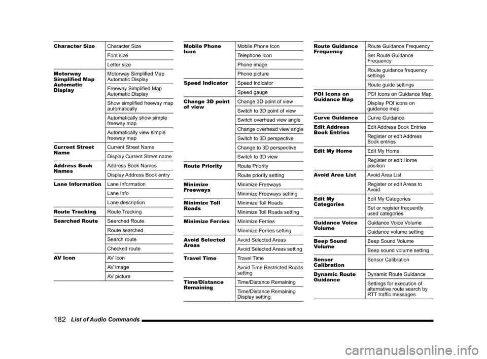
Character Size Character Size
Font size
Letter size
Motorway
Simplified Map
Automatic
Display Motorway Simplified Map
Automatic Display
Freeway Simplified Map
Automatic Display
Show simplified freeway map
automatically
Automatically show simple
freeway map
Automatically view simple
freeway map
Current Street
Name Current Street Name
Display Current Street name
Address Book
Names Address Book Names
Display Address Book entry
Lane Information Lane Information
Lane Info
Lane description
Route Tracking Route Tracking
Searched Route Searched Route
Route searched
Search route
Checked route
AV Icon AV Icon
AV image
AV pictureMobile Phone
IconMobile Phone Icon
Telephone Icon
Phone image
Phone picture
Speed Indicator Speed Indicator
Speed gauge
Change 3D point
of view Change 3D point of view
Switch to 3D point of view
Switch overhead view angle
Change overhead view angle
Switch to 3D perspective
Change to 3D perspective
Switch to 3D view
Route Priority Route Priority
Route priority setting
Minimize
Freeways Minimize Freeways
Minimize Freeways setting
Minimize Toll
Roads Minimize Toll Roads
Minimize Toll Roads setting
Minimize Ferries Minimize Ferries
Minimize Ferries setting
Avoid Selected
Areas Avoid Selected Areas
Avoid Selected Areas setting
Travel Time Travel Time
Avoid Time Restricted Roads
setting
Time/Distance
Remaining Time/Distance Remaining
Time/Distance Remaining
Display settingRoute Guidance
FrequencyRoute Guidance Frequency
Set Route Guidance
Frequency
Route guidance frequency
settings
Route guide settings
POI Icons on
Guidance Map POI Icons on Guidance Map
Display POI icons on
guidance map
Cur ve Guidance Curve Guidance
Edit Address
Book Entries Edit Address Book Entries
Register or edit Address
Book entries
Edit My Home Edit My Home
Register or edit Home
position
Avoid Area List Avoid Area List
Register or edit Areas to
Avoid
Edit My
Categories Edit My Categories
Set or register frequently
used categories
Guidance Voice
Volume Guidance Voice Volume
Guidance volume setting
Beep Sound
Volume Beep Sound Volume
Beep sound volume setting
Sensor
Calibration Sensor Calibration
Dynamic Route
Guidance Dynamic Route Guidance
Settings for execution of
alternative route search by
RTT traffic messages
Page 202 of 226
202 Navi Settings
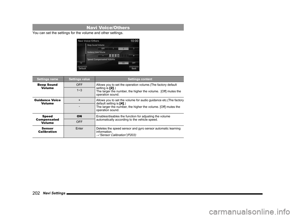
Navi Voice/Others
You can set the settings for the volume and other settings.
Settings name Settings value Settings content
Beep Sound Volume OFF
Allows you to set the operation volume.(The factory default
setting is [2].)
The larger the number, the higher the volume. [Off] mutes the
operation sound.
1~3
Guidance Voice Volume +
Allows you to set the volume for audio guidance etc.(The factory
default setting is [4].)
The larger the number, the higher the volume. [Off] mutes the
operation sound.
-
Speed
Compensated Volume ON
Enables/disables the function for adjusting the volume
automatically according to the vehicle speed.
OFF
Sensor
Calibration Enter
Deletes the speed sensor and gyro sensor automatic learning
information.
→“Sensor Calibration”(P203)
Page 203 of 226
Navi Settings 203
INFO/SETTINGS SETTINGS
Sensor Calibration
The levels for the speed sensor and gyro sensor are raises through autom\
atic learning. When a
tire is replaced, it is necessary to erase the speed learning data and r\
elearn it.
1Press the NAVI MENU key.
This displays the navi menu.
2Touch Navi Voice/Others .
3Touch Enter in “Sensor
Calibration”.
▼
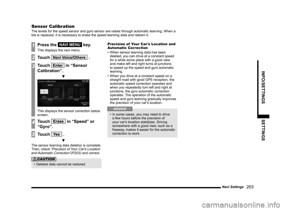
This displays the sensor correction status
screen.
4Touch Erase in “Speed” or
“Gyro”.
5Touch Ye s .
▼
The sensor learning data deletion is complete.
Then, check “Precision of Your Car's Location
and Automatic Correction”(P203) and correct.
CAUTION
• Deleted data cannot be restored. Precision of Your Car's Location and
Automatic Correction
•
When sensor learning data has been
deleted, you can drive at a constant speed
for a while some place with a good view
and make left and right turns at junctions
to speed up the speed and gyro automatic
learning.
• When you drive at a constant speed on a
straight road with good GPS reception, the
automatic speed correction operates and
when you repeatedly turn left and right at
junctions, the gyro automatic correction
operates. The operation of the automatic
speed and gyro learning gradually improves
the precision of your car's location.
ADVICE
• In some cases, you may need to drive
a few hours before the precision of
your car's location stabilizes. Driving
somewhere with a good view, such as a
freeway, makes it easier for the automatic
correction to work.