four wheel drive NISSAN ALMERA N16 2003 Electronic Repair Manual
[x] Cancel search | Manufacturer: NISSAN, Model Year: 2003, Model line: ALMERA N16, Model: NISSAN ALMERA N16 2003Pages: 3189, PDF Size: 54.76 MB
Page 2767 of 3189

NOTE:
The road map data is based on data stored in the map DVD-ROM.
SEL686V
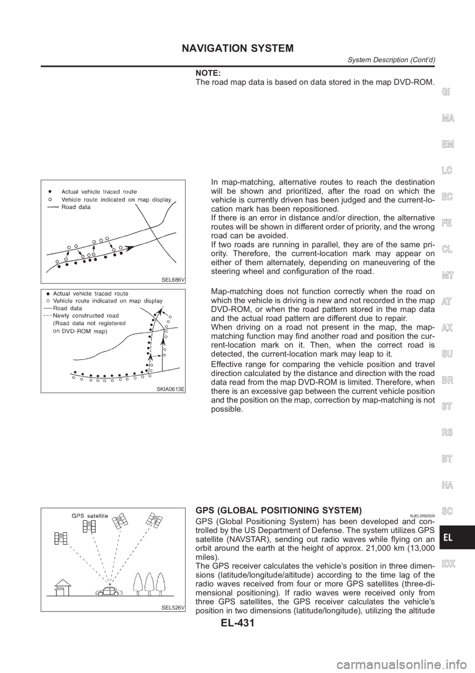
In map-matching, alternative routes to reach the destination
will be shown and prioritized, after the road on which the
vehicle is currently driven has been judged and the current-lo-
cation mark has been repositioned.
If there is an error in distance and/or direction, the alternative
routes will be shown in different order of priority, and the wrong
road can be avoided.
If two roads are running in parallel, they are of the same pri-
ority. Therefore, the current-location mark may appear on
either of them alternately, depending on maneuvering of the
steering wheel and configuration of the road.
SKIA0613E
Map-matching does not function correctly when the road on
which the vehicle is driving is new and not recorded in the map
DVD-ROM, or when the road pattern stored in the map data
and the actual road pattern are different due to repair.
When driving on a road not present in the map, the map-
matching function may find another road and position the cur-
rent-location mark on it. Then, when the correct road is
detected, the current-location mark may leap to it.
Effective range for comparing the vehicle position and travel
direction calculated by the distance and direction with the road
data read from the map DVD-ROM is limited. Therefore, when
there is an excessive gap between the current vehicle position
and the position on the map, correction by map-matching is not
possible.
SEL526V
GPS (GLOBAL POSITIONING SYSTEM)NJEL0592S04GPS (Global Positioning System) has been developed and con-
trolled by the US Department of Defense. The system utilizes GPS
satellite (NAVSTAR), sending out radio waves while flying on an
orbit around the earth at the height of approx. 21,000 km (13,000
miles).
The GPS receiver calculates the vehicle’s position in three dimen-
sions (latitude/longitude/altitude) according to the time lag of the
radio waves received from four or more GPS satellites (three-di-
mensional positioning). If radio waves were received only from
three GPS satellites, the GPS receiver calculates the vehicle’s
position in two dimensions (latitude/longitude), utilizing the altitude
GI
MA
EM
LC
EC
FE
CL
MT
AT
AX
SU
BR
ST
RS
BT
HA
SC
IDX
NAVIGATION SYSTEM
System Description (Cont’d)
EL-431
Page 3062 of 3189

SHIA0239E
SRS443
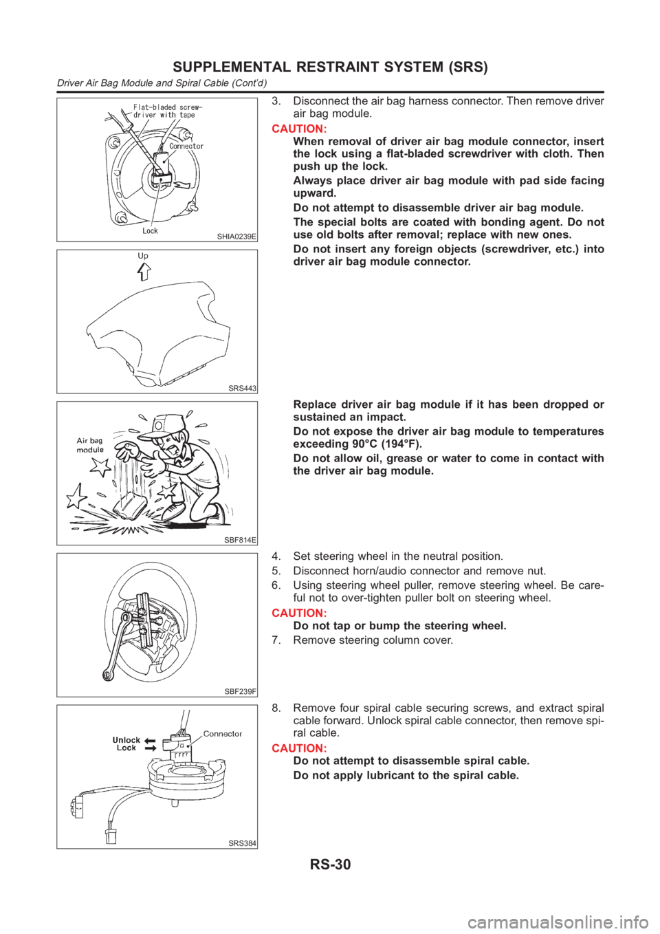
3. Disconnect the air bag harness connector. Then remove driver
air bag module.
CAUTION:
When removal of driver air bag module connector, insert
the lock using a flat-bladed screwdriver with cloth. Then
push up the lock.
Always place driver air bag module with pad side facing
upward.
Do not attempt to disassemble driver air bag module.
The special bolts are coated with bonding agent. Do not
use old bolts after removal; replace with new ones.
Do not insert any foreign objects (screwdriver, etc.) into
driver air bag module connector.
SBF814E
Replace driver air bag module if it has been dropped or
sustained an impact.
Do not expose the driver air bag module to temperatures
exceeding 90°C (194°F).
Do not allow oil, grease or water to come in contact with
the driver air bag module.
SBF239F
4. Set steering wheel in the neutral position.
5. Disconnect horn/audio connector and remove nut.
6. Using steering wheel puller, remove steering wheel. Be care-
ful not to over-tighten puller bolt on steering wheel.
CAUTION:
Do not tap or bump the steering wheel.
7. Remove steering column cover.
SRS384
8. Remove four spiral cable securing screws, and extract spiral
cable forward. Unlock spiral cable connector, then remove spi-
ral cable.
CAUTION:
Do not attempt to disassemble spiral cable.
Do not apply lubricant to the spiral cable.
SUPPLEMENTAL RESTRAINT SYSTEM (SRS)
Driver Air Bag Module and Spiral Cable (Cont’d)
RS-30