buttons NISSAN ALTIMA 2008 L32A / 4.G Navigation Manual
[x] Cancel search | Manufacturer: NISSAN, Model Year: 2008, Model line: ALTIMA, Model: NISSAN ALTIMA 2008 L32A / 4.GPages: 237, PDF Size: 3.25 MB
Page 7 of 237

2 Getting started
Control buttons and functions.......................2-2
Control panel..................................2-2
Steering wheel switch...........................2-3
Start-up screen...................................2-4
Menu screen types and how to operate..............2-5
Menu screens and their purposes................2-5
Using controls to adjust values, levels, etc.........2-8
Map menu screen..............................2-9
Start menu....................................2-10
Functions disabled while driving....................2-12
Operating maps..................................2-13
How to view a map screen......................2-13
Map screen types.............................2-14
Switching map view...........................2-15
Moving around within a map....................2-16
Changing the scale of a map....................2-17Storing your home location/address................2-18
How to store your home........................2-18
Character (letter and number) input screen.......2-22
Phone number input screen.....................2-23
List screen....................................2-25
Setting a destination..............................2-26
Searching for a destination.....................2-26
Starting route guidance........................2-29
Deleting a route...............................2-30
Setting the voice guidance........................2-31
Turning voice guidance on/off...................2-31
Adjusting voice guidance volume................2-33
Voice recognition.................................2-34
NISSAN voice recognition......................2-34
Basic voice control............................2-34
Voice command examples......................2-36
ZREVIEW COPYÐ2008 Altima(alt)
Navigation System OMÐUSA_English(nna)
03/13/07Ðarosenma
X
Page 8 of 237

CONTROL PANEL
h1DAY/NIGHT:
Press to switch between the day screen
(bright) and the night screen (dark) .
h2TILT:
Press and hold to access the DVD-ROM
drive to remove or install the map
DVD-ROM.
h3INFO:
Press to access system information.
h4SETUP:
Press to access system settings.
h5MAP:
Press to display the current location map
screen.
h6DEST:
Press to enter a destination. Various meth-
ods for entering a destination are available.
“4. Setting a destination”.Additional keys/items may appear on the touch-
screen after pressing one of the above control
panel buttons. For additional information, see the
following sections.
“MENU”:
Touch to store a location or change settings on
the current location map screen.
“Route”:
Touch to access guidance control functions
(guidance cancellation, route priority, waypoint
setting on the route, etc.) .
“ZOOM IN”, “ZOOM OUT”:
Touch to change the map scale.LNV0422
CONTROL BUTTONS AND FUNC-
TIONS
2-2Getting started
ZREVIEW COPYÐ2008 Altima(alt)
Navigation System OMÐUSA_English(nna)
03/13/07Ðarosenma
X
Page 9 of 237

STEERING WHEEL SWITCH
h1SOURCE :
Use to switch the audio mode (source) . For
additional information, see the Owner’s
Manual.
h2ENTER :
Move up or down to highlight an item on the
screen, etc. Then press to select the high-
lighted item.
h3:
Press this button during a setting operation
to return to the previous screen. In certain
screens, this button can also be used to ap-
ply the setting. This button will only work
when the “Back” key is shown on the
screen.
h4–or+:
Use to adjust the volume. These buttons
have the same function as that of the volume
knob. For additional information, see the
Owner’s Manual.
h5:
Press to start the voice recognition mode.
Press and hold for 2 seconds to cancel
voice commands when in the voice recogni-
tion mode.
h6:
Use to enable BluetoothTHands-Free
Phone. For additional information, see the
Owner’s Manual.
LNV0423
Getting started2-3
ZREVIEW COPYÐ2008 Altima(alt)
Navigation System OMÐUSA_English(nna)
03/13/07Ðarosenma
X
Page 189 of 237

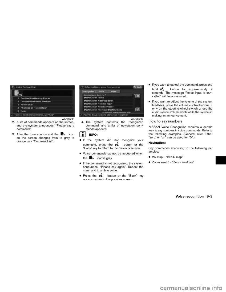
2. A list of commands appears on the screen,
and the system announces, “Please say a
command”.
3. After the tone sounds and the
icon
on the screen changes from to gray to
orange, say “Command list”.4. The system confirms the recognized
command, and a list of navigation com-
mands appears.INFO:
cIf the system did not recognize your
command, press the
button or the
“Back” key to return to the previous screen.
cVoice commands cannot be accepted when
the
icon is gray.
cIf the command is not recognized, the system
announces, “Please say again”. Repeat the
command in a clear voice.
cPress the
button or the “Back” key
once to return to the previous screen.cIf you want to cancel the command, press and
hold
button for approximately 2
seconds. The message “Voice input is can-
celled” will be announced.
cIf you want to adjust the volume of the system
feedback, press the volume control buttons +
or – on the steering wheel switch or use the
audio system volume knob while the system is
making an announcement.
How to say numbers
NISSAN Voice Recognition requires a certain
way to say numbers in voice commands. Refer to
the following examples. (General rule: Either
“zero” or “oh” can be used for “0”.)
Navigation:
Say commands according to the following ex-
amples:
c2D map - “Two D map”
cZoom level 5 - “Zoom level five”
WNV0552WNV0553
Voice recognition9-3
ZREVIEW COPYÐ2008 Altima(alt)
Navigation System OMÐUSA_English(nna)
03/06/07Ðarosenma
X
Page 205 of 237

WHEN A GRAY ROAD IS DIS-
PLAYED ON THE MAP
cWhen you are driving on a road displayed in
gray after the vehicle has deviated from the
suggested route during route guidance, auto-
matic rerouting may not start immediately.
cThe navigation system does not provide route
guidance for roads displayed in dark green.
Therefore, if the destination is set on a road
displayed in dark green, the enlarged map
display will return to the ordinary map screen
at some point on a suggested route that is
near the destination. Also, voice guidance will
stop at some point on a suggested route that
is near the destination.
cPOI information and street names near roads
displayed in gray may not be contained in the
map data.cThere may be cases that carpool lanes are in-
cluded on a suggested route when the auto-
matic rerouting function is activated, even if
the “Use Time Restricted Roads” is turned off.“SETTING CONDITIONS FOR
THE ROUTE CALCULATION”
(page 5-10)
cThe navigation system does not provide route
guidance for roads displayed in dark green.
cIf the destination is set on a dark green road,
the enlarged map display will switch to the or-
dinary map screen at some point and suggest
a route that is near the destination. The dis-
tance and direction to the endpoint of the
suggested route will be displayed in the lower
right corner of the screen.
Also, at this time, voice guidance will
announce, “The route to your destination in-
cludes roads through incomplete map
areas. Voice guidance will not be provided
in these areas”.
When approaching the endpoint of the sug-
gested route, voice guidance will announce,
“Entering the road with incomplete map
data. Please use the direction arrow and
distance information to proceed to your
destination.” To reach your destination, refer
to the map screen. Always follow actual
roads and regulations and drive safely.cThe suggested route may not be the shortest,
nor are other circumstances, such as traffic
jams, considered.
cBecause of the inevitable difference in road
conditions and circumstances between the
time you use this system and the time the in-
formation was produced for the map
DVD-ROM, there may be discrepancies in
roads and regulations. In such cases, follow
the actual information available.
cDuring route calculation, the map will not
scroll, however the vehicle icon will move with
the actual vehicle’s movement.
cDuring route calculation, buttons such as
MAP and DEST will be disabled.
cIn some cases, after the calculation is
complete, the calculated route may not be im-
mediately displayed.
cWaypoints that have been passed will be dis-
regarded by rerouting calculation.
cIf you scroll the map while the suggested
route is being drawn, it may take more time to
finish drawing.
cIf waypoints are set, the system calculates
multiple routes between waypoints
simultaneously, and the following may result:
ROUTE CALCULATION
General system information10-9
ZREVIEW COPYÐ2008 Altima(alt)
Navigation System OMÐUSA_English(nna)
03/13/07Ðarosenma
X
Page 235 of 237

12 Index
2Dmap................2-14, 3-2, 3-6
3Dmap ............2-15, 3-3, 3-7, 10-3
A
About route guidance..............5-6
About the map DVD-ROM..........10-15
Adding a destination or waypoint........5-3
Adding additional destinations to a route . . .4-39
Address book..................10-2
Adjusting the current vehicle location.....8-12
Adjusting the location of the destination . . .4-38
Adjusting voice guidance volume.......2-33
Automatic reroute................10-3
Available items after setting a destination . . .5-2
Available views..................3-4
Avoid area....................10-2
Avoid area settings................6-6
B
Background color................8-5
Basic operations................11-3
Basics of voice guidance...........10-11
Before starting...............2-34, 9-2
Birdview™...........2-15, 3-3, 3-7, 10-3
Brightness....................8-4
C
Change/edit route...............5-12
Changing the scale of a map.........2-17
Changing the scale of the left screen.....3-15
Character (letter and number) input screen . .2-22
Characteristics of a liquid crystal display . .10-17
Clock settings..................8-7
Command list.............2-35, 9-2, 9-6
Confirming a route...............5-20
Control buttons and functions..........2-2
Current vehicle location............10-4
Customer assistance..............11-2
Customizing nearby places..........6-26
D
Deleting a route.............2-30, 5-25
Deleting a stored item.............6-21
Deleting a stored item individually.......6-22
Deleting all stored items............6-24
Deleting an individual item on the map. . . .6-23
Deleting/reactivating a route..........5-25
Destination screen................4-2
Detailed Map Coverage Areas (MCA) for the
navigation system................10-8
Detailed route priorities.............5-10
Detour......................10-3
Directions provided and the distances to
guide points..................10-11
Disc replacement...............10-16Display of current vehicle location.......10-4
Display settings..................8-3
Displaying landmark icons...........3-16
DVD-ROM drive location...........10-15
E
Editing a route..................5-14
Editing the address book............6-10
Editing the avoid area..............6-20
Editing the stored home and location.....6-11
F
Features of this navigation system.......10-2
For safe operation................1-2
Functions disabled while driving........2-12
H
How to handle the display..........10-17
How to handle the DVD-ROM........10-17
How to order map DVD-ROM updates . . .10-15
How to store your home............2-18
How to use this manual.............1-2
How to view map screen............2-13
ZREVIEW COPYÐ2008 Altima(alt)
Navigation System OMÐUSA_English(nna)
03/13/07Ðarosenma
X