height NISSAN MAXIMA 2004 A34 / 6.G Navigation Manual
[x] Cancel search | Manufacturer: NISSAN, Model Year: 2004, Model line: MAXIMA, Model: NISSAN MAXIMA 2004 A34 / 6.GPages: 186, PDF Size: 4.27 MB
Page 142 of 186

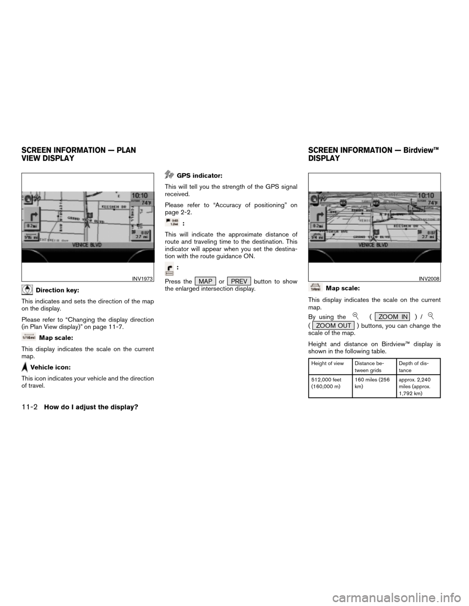
Direction key:
This indicates and sets the direction of the map
on the display.
Please refer to “Changing the display direction
(in Plan View display)” on page 11-7.
Map scale:
This display indicates the scale on the current
map.
Vehicle icon:
This icon indicates your vehicle and the direction
of travel.
GPS indicator:
This will tell you the strength of the GPS signal
received.
Please refer to “Accuracy of positioning” on
page 2-2.
:
This will indicate the approximate distance of
route and traveling time to the destination. This
indicator will appear when you set the destina-
tion with the route guidance ON.
:
Press the MAP or PREV button to show
the enlarged intersection display.
Map scale:
This display indicates the scale on the current
map.
By using the
( ZOOM IN ) /
( ZOOM OUT ) buttons, you can change the
scale of the map.
Height and distance on Birdview™ display is
shown in the following table.
Height of view Distance be-
tween gridsDepth of dis-
tance
512,000 feet
(160,000 m)160 miles (256
km)approx. 2,240
miles (approx.
1,792 km)
INV1973INV2008
SCREEN INFORMATION — PLAN
VIEW DISPLAYSCREEN INFORMATION — Birdview™
DISPLAY
11-2How do I adjust the display?
ZREVIEW COPYÐ2004 Maxima(max)
Navigation System OM(navi)ÐUSA_English(nna)
04/27/04Ðtbrooks
X
Page 143 of 186

Height of view Distance be-
tween gridsDepth of dis-
tance
128,000 feet
(40,000 m)40 miles (64 km) approx. 560
miles (approx.
896 km)
64,000 feet
(20,000 m)20 miles (32 km) approx. 280
miles (approx.
448 km)
32,000 feet
(10,000 m)10 miles (16 km) approx. 140
miles (approx.
224 km)
16,000 feet
(4,800 m)4.0 miles (8 km) approx. 70 miles
(approx. 112
km)
8,000 feet
(2,400 m)2.0 miles (4 km) approx. 35 miles
(approx. 56 km)
4,000 feet
(1,200 m)1.0 mile (2 km) approx. 17-1/2
miles (approx.
28 km)
2,000 feet (600
m)1/2 mile (1 km) approx. 8-3/4
miles (approx.
14 km)
1,000 feet (300
m)1/4 mile (500 m) approx. 4-3/8
miles (approx. 7
km)
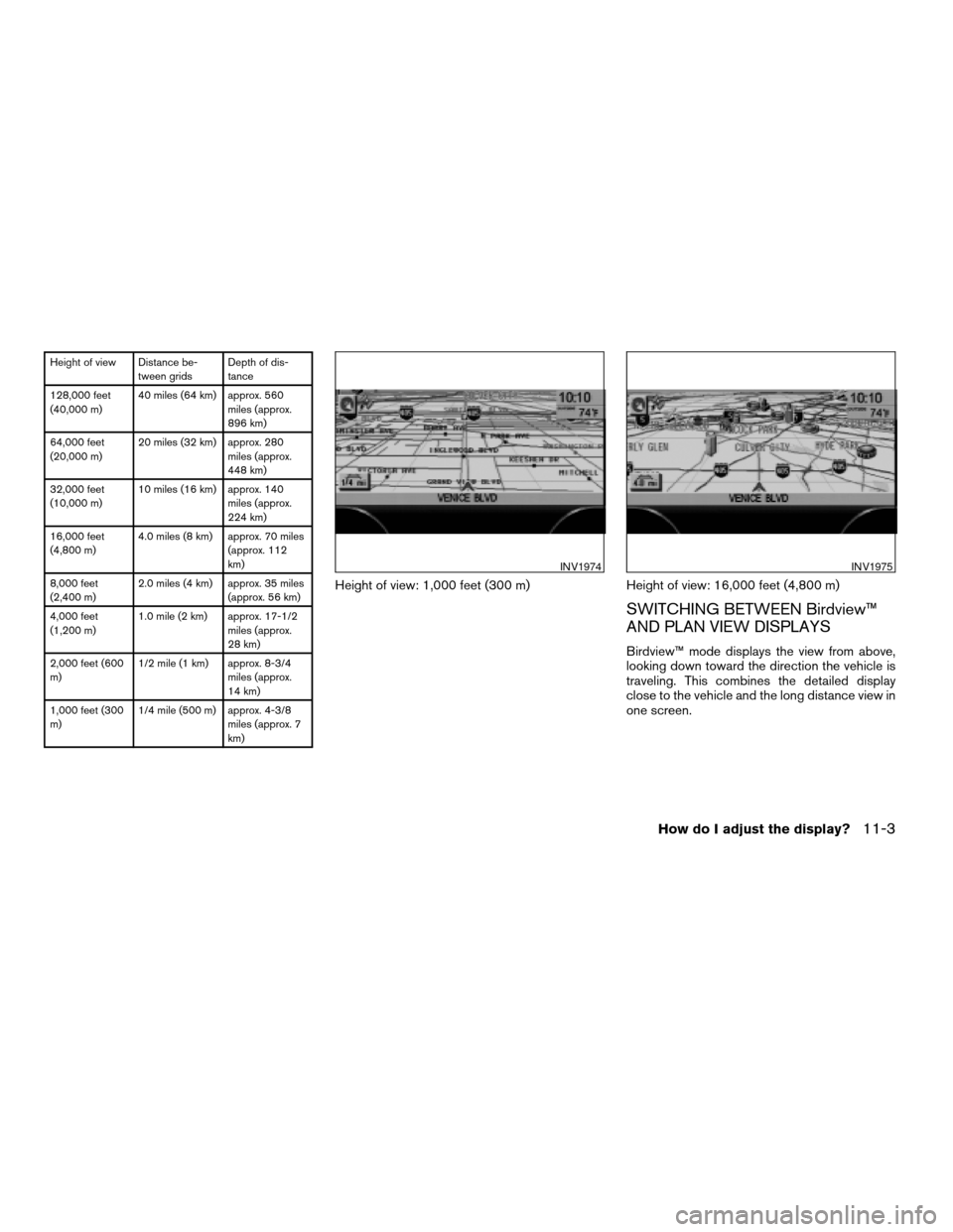
Height of view: 1,000 feet (300 m) Height of view: 16,000 feet (4,800 m)
SWITCHING BETWEEN Birdview™
AND PLAN VIEW DISPLAYS
Birdview™ mode displays the view from above,
looking down toward the direction the vehicle is
traveling. This combines the detailed display
close to the vehicle and the long distance view in
one screen.
INV1974INV1975
How do I adjust the display?11-3
ZREVIEW COPYÐ2004 Maxima(max)
Navigation System OM(navi)ÐUSA_English(nna)
04/27/04Ðtbrooks
X
Page 146 of 186

cWhen the system is re-drawing the display in
Birdview™ display, the distance the vehicle
travels becomes longer, and/or the degree
the vehicle turns becomes larger than in the
Planview display in order to complete
re-drawing.
cThe names of the roads and locations may
differ, depending on where the names appear
on the screen.
cIn order to avoid having too much detail on the
map, all road names are not always shown on
the screen. When the display re-draws the
map, a road name which is shown on the pre-
vious screen may not appear on the new
screen.Use the( ZOOM IN ) /
( ZOOM OUT ) buttons to change the scale of
the display and height view.
Nine map scales are available from the most de-
tailed (1 : 10,000) to the widest view (1 : 20.48
million) .
Each time the
( ZOOM IN ) button is
pressed, the map scale will change one level to
display a more detailed map.
Each time the
( ZOOM OUT ) button is
pressed, the map scale will change one level to
display a map that shows a wider area.
The chosen map scale will be displayed on the
left side of the screen.
INFO:
By pressing the button repeatedly, you can skip
the levels to reach the map of desired scale.
Scale level on the Plan View display
Map scale Actual distance
1 : 20.48 million 160 miles (256 km)
1 : 5.12 million 40 miles (64 km)
1 : 1.28 million 10 miles (16 km)
1 : 320,000 2.5 miles (4 km)
1 : 160,000 1 mile (2 km)
1 : 80,000 1/2 mile (1 km)
Map scale Actual distance
1 : 40,000 1/4 mile (500 m)
1 : 20,000 1/8 mile (200 m)
1 : 10,000 1/16 mile (100 m)
Scales on the Birdview™ are listed on page
11-2.
ZOOMING IN AND OUT OF THE MAP
11-6How do I adjust the display?
ZREVIEW COPYÐ2004 Maxima(max)
Navigation System OM(navi)ÐUSA_English(nna)
04/27/04Ðtbrooks
X
Page 170 of 186

Abbreviation Meaning
ACCS ACCESS
ACRS ACRES
ALY ALLEY
APPR APPROACH
AVE AVENUE
BCH BEACH
BND BEND
BLF BLUFF
BLVD BOULEVARD
BRG BRIDGE
BRK BROOK
BYP BYPASS
BYWY BYWAY
CYN CANYON
CSWY CAUSEWAY
CTR CENTER
CHSE CHASE
CIR CIRCLE
CLFS CLIFFS
CLB CLUB
COR CORNER
CT COURTAbbreviation Meaning
CV COVE
CRK CREEK
CRES CRESCENT
XING CROSSING
CURV CURVE
DL DALE
DR DRIVE
EST ESTATES
EXP EXPRESS
EXPY EXPRESSWAY
EXT EXTENSION
FRY FERRY
FLD FIELD
FLDS FIELDS
FLTS FLATS
FRD FORD
FWY FREEWAY
GDNS GARDENS
GTWY GATEWAY
GLN GLEN
GRV GROVE
HVN HAVENAbbreviation Meaning
HTS HEIGHTS
HWY HIGHWAY
HL HILL
HLS HILLS
HOLW HOLLOW
JCT JUNCTION
KY KEY
KNL KNOLL
KNLS KNOLLS
LNDG LANDING
LN LANE
LCK LOCK
MNR MANOR
MDWS MEADOWS
ML MILL
MT MOUNT
MTN MOUNTAIN
OPAS OVERPASS
PKWY PARKWAY
PSGE PASSAGE
PNES PINES
PL PLACE
ABBREVIATIONS DEFINITION LIST
12-6Information on map data discs
ZREVIEW COPYÐ2004 Maxima(max)
Navigation System OM(navi)ÐUSA_English(nna)
04/27/04Ðtbrooks
X