sat nav NISSAN MURANO 2015 3.G LC2 Kai Navigation Manual
[x] Cancel search | Manufacturer: NISSAN, Model Year: 2015, Model line: MURANO, Model: NISSAN MURANO 2015 3.GPages: 203, PDF Size: 1.12 MB
Page 78 of 203
![NISSAN MURANO 2015 3.G LC2 Kai Navigation Manual 5. Information
Menu itemResult
[SXM Movie Listings] [Nearby Theaters] Displays a list of theaters by distance. Select the theater for Theater Details such as its
location and phone number. While viewi NISSAN MURANO 2015 3.G LC2 Kai Navigation Manual 5. Information
Menu itemResult
[SXM Movie Listings] [Nearby Theaters] Displays a list of theaters by distance. Select the theater for Theater Details such as its
location and phone number. While viewi](/img/5/436/w960_436-77.png)
5. Information
Menu itemResult
[SXM Movie Listings] [Nearby Theaters] Displays a list of theaters by distance. Select the theater for Theater Details such as its
location and phone number. While viewing the Theater Details, touch [Go here] for route
guidance. While viewing the list of Nearby Theaters, touch [Movies] to display a list of
movies that are playing at that theater. Select the movie to display Movie Details including
the rating, running time, and show times.
[Current Movies] Displays a list of movies that are currently playing. Touch [Details] to display Movie
Details including the rating, running time, and show times. While viewing the list of
Current Movies, select the movie to display a list of Nearby Theaters. Select the theater
for Theater Details such as its location and phone number. Touch [Movies] for a detailed
description and show times of the selected movie. Touch [Go Here] for route guidance to
the selected theater.
[Vehicle] (if so equipped) [Eco Drive Report] Display the Eco Drive Report.
[Where am I?] The name and distance of the next/previous street, and other information that indicates
the current vehicle location are displayed. GPS coordinates and altitude are shown on
the bottom right.
[SXM Weather Alerts] Display the list of weather alerts.
Touch [Nearby Current] to display nearby current alerts, touch [Nearby Destination] to
display nearby destination alerts.
[Navigation Version] Displays the information of the current map version, program version, unit code, etc.
[GPS Position] Displays GPS information, such as number of satellites, latitude/longitude, and
approximate altitude.
5-4
Page 81 of 203

SiriusXM TRAVEL LINK
SiriusXM Travel Link information is a subscription
service offered by SiriusXM Satellite Radio. It is
necessary to subscribe to use the SiriusXM
Travel Link information.
This service provides real-time information re-
garding current weather, fuel prices, sports
scores, stock tickers and movie times where
available. The SiriusXM Travel Link is broadcast
to the vehicle by SiriusXM Satellite Radio.
The service enables you to view the following
information on the navigation system:
*Current information around the destination
*Detailed information and forecasts of an area of
interest
*Countrywide and local maps with the current
weather, temperature, warnings and road condi-
tion information
*List of warning/watches events detected
around the current location
*Pop-up messages on the navigation screen with
voice announcements when warnings and
watches are detected around the current loca-
tion
WARNING
SiriusXM Travel Link information is not a
substitute for attentive driving. Weather
conditions change constantly and emer-
gency situations can arise without warn-
ing. Relying only on SiriusXM Travel Link
information could result in serious per-
sonal injury.
VIEWING SiriusXM TRAVEL LINK
SiriusXM Satellite Radio and SiriusXM Travel
Link subscriptions are sold separately or as a
package, and are continuous until you call
SiriusXM to cancel. See SiriusXM Customer
Agreement for complete terms at www.siriusxm.
com. SiriusXM Travel Link is available in select
markets.
For more information, call Listener Care at 1-
877-447-0011 or visit siriusxm.com/travellink.
INFO:
. If a contract is not completed for the
SiriusXM Travel Link information service, a
message appears and it will not be possible
to check the information on the traffic information system.
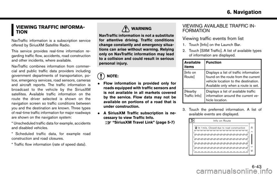
Example
.
The weather information is available only for
areas that provide weather information to
SiriusXM Travel Link.
. Not all vehicles or devices are capable of
receiving all services offered by SiriusXM.
Data displays and individual product avail-
ability vary by vehicle hardware. Current
information and features may not be available
in all locations, or on all receivers. SiriusXM is
not responsible for any errors or inaccuracies
in the data services or their use in the vehicle.
Notes on SiriusXM Traffic information
.The SiriusXM Traffic information service is
not provided for some cities. In addition, the
cities for which the traffic information service
is provided may be changed.
5. Information
5-7
Page 127 of 203

VIEWING TRAFFIC INFORMA-
TION
NavTraffic information is a subscription service
offered by SiriusXM Satellite Radio.
This service provides real-time information re-
garding traffic flow, accidents, road construction
and other incidents, where available.
NavTraffic combines information from commer-
cial and public traffic data providers including
government departments of transportation, po-
lice, emergency services, road sensors, cameras
and aircraft reports. The traffic information is
broadcast to the vehicle by the SiriusXM
satellites. Available traffic information on the
route the driver selected is shown on the
navigation screen so traffic conditions between
you and the destination are known. Three types
of real-time traffic information for major roadways
are shown on the navigation system:
* Unscheduled traffic data for example, accidents
and disabled vehicles.
* Scheduled traffic data, for example road
construction and road closures.
* Traffic flow information (rate of speed data) .
WARNING
NavTraffic information is not a substitute
for attentive driving. Traffic conditions
change constantly and emergency situa-
tions can arise without warning. Relying
only on NavTraffic information may lead
to a collision and could result in serious
personal injury.
NOTE:
. Flow information is provided only for
roads equipped with traffic sensors and
is not available in all markets covered
by the service. Flow data may not be
available on portions of a road that is
under construction.
. A SiriusXM Traffic subscription is ne-
cessary to view Traffic Info.
“SiriusXM Travel Link” (page 5-7)
VIEWING AVAILABLE TRAFFIC IN-
FORMATION
Viewing traffic events from list
1. Touch [Info] on the Launch Bar.
2. Touch [SXM Traffic]. A list of available types
of information are displayed.
Available
items Function
[Info on
Route] Displays a list of traffic information
found on the route from the current
vehicle location to the destination.
Available only when a route is set.
[Nearby
Traffic Info] Displays a list of available traffic
information around the current ve-
hicle location.
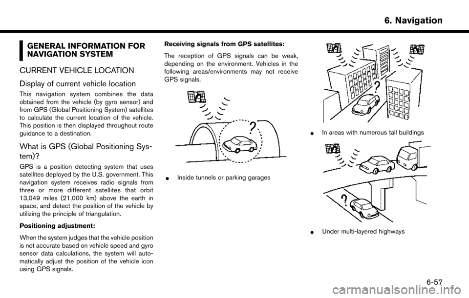
3. Touch the preferred information. A list of
available events are displayed.
6. Navigation
6-43
Page 141 of 203

GENERAL INFORMATION FOR
NAVIGATION SYSTEM
CURRENT VEHICLE LOCATION
Display of current vehicle location
This navigation system combines the data
obtained from the vehicle (by gyro sensor) and
from GPS (Global Positioning System) satellites
to calculate the current location of the vehicle.
This position is then displayed throughout route
guidance to a destination.
What is GPS (Global Positioning Sys-
tem)?
GPS is a position detecting system that uses
satellites deployed by the U.S. government. This
navigation system receives radio signals from
three or more different satellites that orbit
13,049 miles (21,000 km) above the earth in
space, and detect the position of the vehicle by
utilizing the principle of triangulation.
Positioning adjustment:
When the system judges that the vehicle position
is not accurate based on vehicle speed and gyro
sensor data calculations, the system will auto-
matically adjust the position of the vehicle icon
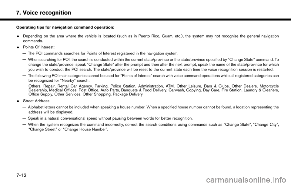
using GPS signals. Receiving signals from GPS satellites:
The reception of GPS signals can be weak,
depending on the environment. Vehicles in the
following areas/environments may not receive
GPS signals.
*Inside tunnels or parking garages
*In areas with numerous tall buildings
*Under multi-layered highways
6. Navigation
6-57
Page 164 of 203

7. Voice recognition
Operating tips for navigation command operation:. Depending on the area where the vehicle is located (such as in Puerto Rico, Guam, etc.) , the system may not recognize the general navigation
commands.
. Points Of Interest:
— The POI commands searches for Points of Interest registered in the navigation system.
— When searching for POI, the search is conducted within the current state/province or the state/province specified by “Change State” command. To change the state/province, speak “Change State” after the prompt and then after the next prompt, speak the name of the state/province for which
you wish to conduct the POI search. The state/province will be reset to the current state each time the voice recognition session is restarted.
— The following POI main categories cannot be used for “Points of Interest” search with voice command operations while all registered categories can be recognized for “Nearby” search:
Others, Repair, Rental Car Agency, Parking, Police Station, Administration, ATM, Other Leisure, Bars & Clubs, Other Dealers, Motorcycle
Dealership, Medical Offices, Post Office, Auto Parts, Banquets & Food Delivery, Carwash, Copying, Day Care, Fire Station, Laundry & Cleaners,
Office Supply, Other Services, Other Shopping, Package Delivery
. Street Address:
— Alphabet letters cannot be included when speaking a house number. When a specified house number cannot be found, a location representing the address will be displayed.
— Speak in a natural conversational speed without pausing between words for better recognition.
— When the system recognizes the command incorrectly, correct the search conditions using commands such as “Change State”, “Change City”, “Change Street” or “Change House Number”.
7-12