technical data NISSAN PATHFINDER 2012 R52 / 4.G 06IT Navigation Manual
[x] Cancel search | Manufacturer: NISSAN, Model Year: 2012, Model line: PATHFINDER, Model: NISSAN PATHFINDER 2012 R52 / 4.GPages: 235, PDF Size: 5.14 MB
Page 145 of 235

XM NavTraffic®information is a subscription
service offered by XM®Satellite Radio.
This service provides real-time information
regarding traffic flow, accidents, road construc-
tion and other incidents, where available.
XM NavTraffic
®combines information from
commercial and public traffic data providers
including government departments of transpor-
tation, police, emergency services, road sen-
sors, cameras and aircraft reports. The traffic
information is broadcast to the vehicle by the
XM
®satellites. Available traffic information on
the route the driver selected is shown on the
navigation screen so traffic conditions between
you and the destination are known. Three types
of real-time traffic information for major road-
ways are shown on the navigation system:
* Unscheduled traffic data for example, acci-
dents and disabled vehicles.
* Scheduled traffic data, for example road
construction and road closures.
* Traffic flow information (rate of speed data) .
WARNING
XM NavTraffic®information is not a
substitute for attentive driving. Traffic
conditions change constantly and emergency situations can arise with-
out warning. Relying only on XM
NavTraffic
®information may lead to
a collision and could result in serious
personal injury.
NOTE:
Flow information is provided only for
roads equipped with traffic sensors and
is not available in all markets covered by
the service. Flow data may not be available
on portions of a road that is under
construction.
XM NavTraffic
®information is available in limited
markets. To subscribe or to check if this service
is available in your area:
call 1-800-XM-RADIO (1-800-967-2346) or
see www.xmradio.com/navtraffic
INFO:
If you do not have a contract for XM NavTraffic
®
traffic information service, a message appears,
and it will not be possible to check the
information on the traffic information system.
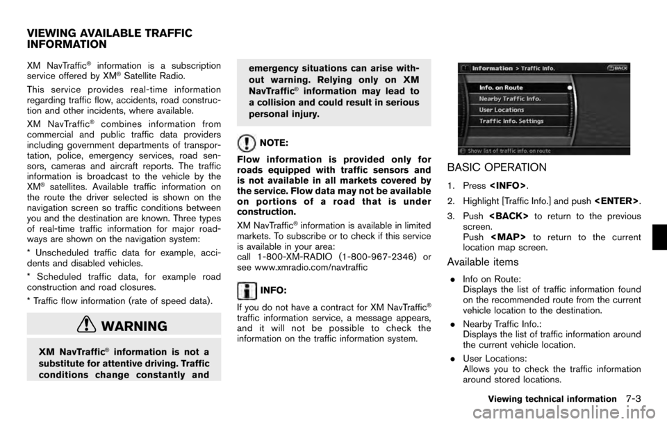
BASIC OPERATION
1. Press
2. Highlight [Traffic Info.] and push
3. Push
screen.
Push
Page 209 of 235

instances, rely on your own driving
judgement, taking into account the
driving conditions at the time.
. Do not use the navigation system
to locate emergency services. The
database does not contain a com-
plete listing of emergency services
such as police stations, fire halls,
hospitals and walk-in clinics.
Please show discretion and ask
for directions in such instances.
. As the driver, you alone are re-
sponsible for your driving safety.
— In order to avoid a traffic acci-
dent, do not operate the system
while driving.
— In order to avoid a traffic acci- dent, operate the system only
when the vehicle is stopped at a
safe place and the parking
brake is on.
— In order to avoid a traffic acci- dent or traffic offence, remem-
ber that actual road conditions
and traffic regulations take pre-
cedence over the information
contained on the navigation sys- tem.
— The Software may contain inac- curate or incomplete informa-
tion due to the passage of
time, changing circumstances,
and the sources of information
used. Please respect current
traffic conditions and regula-
tions at all times while driving.
— Where actual road conditions and highway regulations differ
from the information contained
on the navigation system, abide
by the highway regulations.
— Keep the amount of time spent viewing the screen while driving
to a strict minimum.
The navigation system does not provide,
nor represent in any way information on:
traffic and highway regulations; technical
aspects of the vehicle including weight,
height, width, load and speed limits; road
conditions including grade, percentage of
incline and surface conditions; obstacles
such as the height and width of bridges
and tunnels; and other current driving or road conditions. Always rely on your own
judgement when driving a car, taking into
account current driving conditions.
“The company trademarks used in this product
to identify locations and business offices are the
trademarks of their respective owners. Their use
does not represent sponsorship, approval or
recommendation of this product by these
companies.”
END-USER TERMS
The Map Data Disc (“Data”) is provided for your
personal, internal use only and not for resale. It is
protected by copyright, and is subject to the
following terms (this “End- User License Agree-
ment”) and conditions which are agreed to by
you, on the one hand, and NAVTEQ North
America, LLC (“NT”) and its licensors (including
their licensors and suppliers) on the other hand.
The Data for areas of Canada includes informa-
tion taken with permission from Canadian
authorities, including:
*CHer Majesty the Queen
in Right of Canada,*CQueen’s Printer for
Ontario,*CCanada Post Corporation, Geo-
Base®.
NT holds a non-exclusive license from the
United States Postal Service
®to publish and
sell ZIP+4®information.
*CUnited States Postal Service®2009. Prices
General system information10-15