ECO mode NISSAN TITAN 2008 1.G 04IT Navigation Manual
[x] Cancel search | Manufacturer: NISSAN, Model Year: 2008, Model line: TITAN, Model: NISSAN TITAN 2008 1.GPages: 270, PDF Size: 5.97 MB
Page 130 of 270
![NISSAN TITAN 2008 1.G 04IT Navigation Manual Black plate (132,1)
Model "NISSAN_NAVI" EDITED: 2007/ 2/ 26
NAV2880
3. The selected location is displayed at the
center of the map. Highlight [Add to Route]
after confirming the location and push
<ENT NISSAN TITAN 2008 1.G 04IT Navigation Manual Black plate (132,1)
Model "NISSAN_NAVI" EDITED: 2007/ 2/ 26
NAV2880
3. The selected location is displayed at the
center of the map. Highlight [Add to Route]
after confirming the location and push
<ENT](/img/5/794/w960_794-129.png)
Black plate (132,1)
Model "NISSAN_NAVI" EDITED: 2007/ 2/ 26
NAV2880
3. The selected location is displayed at the
center of the map. Highlight [Add to Route]
after confirming the location and push
INFO:
You can modify the location by selecting
[Alter Location]. The method of adjusting a
location is the same as the one for a
destination.
“ADJUSTING THE LOCATION OF
THE DESTINATION” (page 4-49)
NAV2881
4. Highlight [Destination] or [Waypoint] and
push
The system starts calculating a route that
includes the added destination or waypoint.
When the calculation is finished, the route is
displayed.
INFO:
.If a waypoint was added, [More Routes]
cannot be selected.
.If a destination was added, the prior
destination becomes a waypoint.
5-6Route guidance
Page 131 of 270
![NISSAN TITAN 2008 1.G 04IT Navigation Manual Black plate (133,1)
Model "NISSAN_NAVI" EDITED: 2007/ 2/ 26
After setting the route, select [Start] to begin
route guidance.
Throughout route guidance, the system navi-
gates you through the guide poi NISSAN TITAN 2008 1.G 04IT Navigation Manual Black plate (133,1)
Model "NISSAN_NAVI" EDITED: 2007/ 2/ 26
After setting the route, select [Start] to begin
route guidance.
Throughout route guidance, the system navi-
gates you through the guide poi](/img/5/794/w960_794-130.png)
Black plate (133,1)
Model "NISSAN_NAVI" EDITED: 2007/ 2/ 26
After setting the route, select [Start] to begin
route guidance.
Throughout route guidance, the system navi-
gates you through the guide points using visual
and voice guidance.
CAUTION
The navigation system’s visual and voice
guidance is for reference purposes only.
The contents of the guidance may be
inappropriate depending on the situa-
tion.
When driving along the suggested route,
follow all traffic regulations (e.g., one-
way traffic) .
“ROUTE GUIDANCE” (page 9-11)
VOICE GUIDANCE DURING ROUTE
GUIDANCE
When approaching a guide point (intersection or
corner) , destination, etc. during route guidance,
voice guidance announces the remaining dis-
tance and/or turning direction.
Push
voice guidance.
NAI0418
Example of voice guidance
&1“In about one quarter mile (400 meters) ,
right (left) turn.”
“Right (left) turn ahead.”
&2“In about one quarter mile (400 meters)
freeway entrance on your right onto (road
number and direction) .”
“Freeway entrance on your right onto (road
number and direction) .”
&3“In about one mile (1.6 kilometers) , exit on
your right.”
“Take the second exit on your right.”
&4“You have arrived at your destination. Ending
route guidance.”
ABOUT ROUTE GUIDANCE
Route guidance5-7
Page 147 of 270
![NISSAN TITAN 2008 1.G 04IT Navigation Manual Black plate (149,1)
Model "NISSAN_NAVI" EDITED: 2007/ 2/ 26
NAV2903
3. Highlight [Delete] and push<ENTER>to
delete the location.
NAV2904
4. A confirmation message is displayed. Con-
firm the contents NISSAN TITAN 2008 1.G 04IT Navigation Manual Black plate (149,1)
Model "NISSAN_NAVI" EDITED: 2007/ 2/ 26
NAV2903
3. Highlight [Delete] and push<ENTER>to
delete the location.
NAV2904
4. A confirmation message is displayed. Con-
firm the contents](/img/5/794/w960_794-146.png)
Black plate (149,1)
Model "NISSAN_NAVI" EDITED: 2007/ 2/ 26
NAV2903
3. Highlight [Delete] and push
delete the location.
NAV2904
4. A confirmation message is displayed. Con-
firm the contents of the message, highlight
[Yes] and push
The destination or waypoint is deleted from
the route.
INFO:
If the destination is deleted, the final waypoint of
the route becomes the destination.
Route guidance5-23
Page 204 of 270
![NISSAN TITAN 2008 1.G 04IT Navigation Manual Black plate (208,1)
Model "NISSAN_NAVI" EDITED: 2007/ 2/ 26
NAV3100
Display off
To turn off the display, push<ENTER>and turn
the [Display off] indicator on, and hold<>
(Day/Night) for more than 2 seco NISSAN TITAN 2008 1.G 04IT Navigation Manual Black plate (208,1)
Model "NISSAN_NAVI" EDITED: 2007/ 2/ 26
NAV3100
Display off
To turn off the display, push<ENTER>and turn
the [Display off] indicator on, and hold<>
(Day/Night) for more than 2 seco](/img/5/794/w960_794-203.png)
Black plate (208,1)
Model "NISSAN_NAVI" EDITED: 2007/ 2/ 26
NAV3100
Display off
To turn off the display, push
the [Display off] indicator on, and hold<>
(Day/Night) for more than 2 seconds.
NAV3101
When any button is pushed with the display off,
the display turns on. The display will automati-
cally turn off 3 seconds after the operation is
finished.
To turn on the display, push<
>(Day/Night)
for more than 2 seconds.
NAV3102
Brightness
Adjust the display brightness by tilting the
joystick in the direction of [+] or [−].
INFO:
The preview of the map screen is displayed on
the upper portion of the screen, if the previous
screen showed a map.
8-4Other settings
Page 214 of 270

Black plate (218,1)
Model "NISSAN_NAVI" EDITED: 2007/ 2/ 26
NAV3105
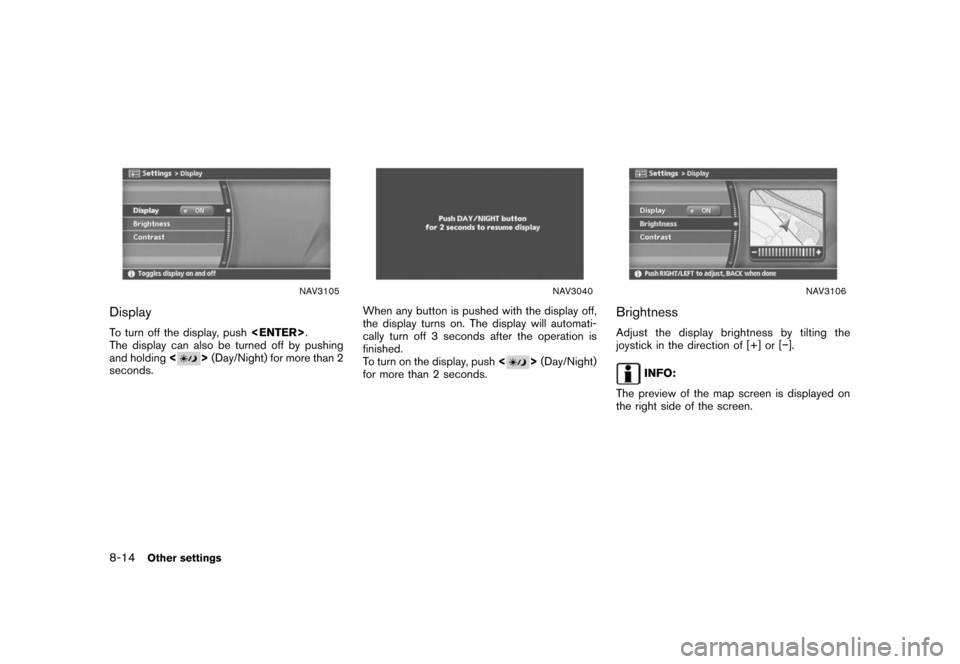
Display
To turn off the display, push
The display can also be turned off by pushing
and holding<
>(Day/Night) for more than 2
seconds.
NAV3040
When any button is pushed with the display off,
the display turns on. The display will automati-
cally turn off 3 seconds after the operation is
finished.
To turn on the display, push<
>(Day/Night)
for more than 2 seconds.
NAV3106
Brightness
Adjust the display brightness by tilting the
joystick in the direction of [+] or [−].
INFO:
The preview of the map screen is displayed on
the right side of the screen.
8-14Other settings
Page 228 of 270

Black plate (232,1)
Model "NISSAN_NAVI" EDITED: 2007/ 2/ 26
ROUTE GUIDANCE
The main features of the NISSAN Navigation
System are visual guidance and voice guidance
in selected map coverage areas. Utilizing a
network of GPS (Global Positioning System)
satellites, the NISSAN Navigation System tracks
your location on the map and navigates you to a
preferred location.
Once you set the destination in a map coverage
area, the NISSAN Navigation System will
calculate a route from your current location to
your destination. The real-time map display and
turn-by-turn voice guidance leads the driver
along the route.
These features can be especially helpful when
driving to unfamiliar locations.
The system may be unable to set a destination
and/or calculate a route when the destination is
outside the map coverage area. Additionally,
voice guidance may not be available if the
destination is outside the map coverage area.
For more information on how to set a destina-
tion, refer to section 4.
POINTS OF INTEREST (POI) DIREC-
TO RY
The NISSAN Navigation System offers an
extensive Points of Interest (POI) directory in
map coverage areas. This directory includes awide variety of destinations ranging from gas
stations, ATMs, and restaurants to casinos, ski
resorts, shopping centers and businesses. By
accessing the Points of Interest directory, you
can search for addresses and phone numbers
for a destination, and just by pushing a button,
the NISSAN Navigation System will calculate a
route to the destination.
The POI directory has many uses. For example,
the directory can be sorted by the various types
of restaurants near your current location. If you
need an ATM or gas station, the NISSAN
Navigation System can navigate you to the
closest preferred location.
For more information on how to use the Points of
Interest directory, refer to section 4.
ADDRESS BOOK
The Address Book can store up to 100 locations
from map coverage areas into a personal
directory. This is especially useful for frequently
visited locations, such as clients, relatives and
friends. The Address Book function allows easy
access to frequently visited locations when
setting them as your destination.
For more information on how to use the Address
Book, refer to section 6.
AVOID AREA
The Avoid Area function allows you to identify
areas or freeways that you would like the
NISSAN Navigation System to avoid when
calculating routes. For example, if a freeway or
area is always congested with traffic, you can
set the NISSAN Navigation System to calculate
routes that exclude that freeway or area.
For more information on the Avoid Area function,
refer to section 6.
AUTOMATIC REROUTE
If you deviate from the suggested route, the
NISSAN Navigation System will automatically
recalculate a new route to your destination.
For more information on the Automatic reroute
function, refer to section 5.
DETOUR
If you want to make a detour due to traffic
conditions, you can use the Detour function to
calculate an alternative route. The NISSAN
Navigation System can calculate a route using
secondary roads that will return you to primary
roads after a specified number of miles.
For more information on the Detour function,
refer to section 5.
FEATURES OF THIS NAVIGATION
SYSTEM
9-2General system information
Page 229 of 270

Black plate (233,1)
Model "NISSAN_NAVI" EDITED: 2007/ 2/ 26
NAV2710
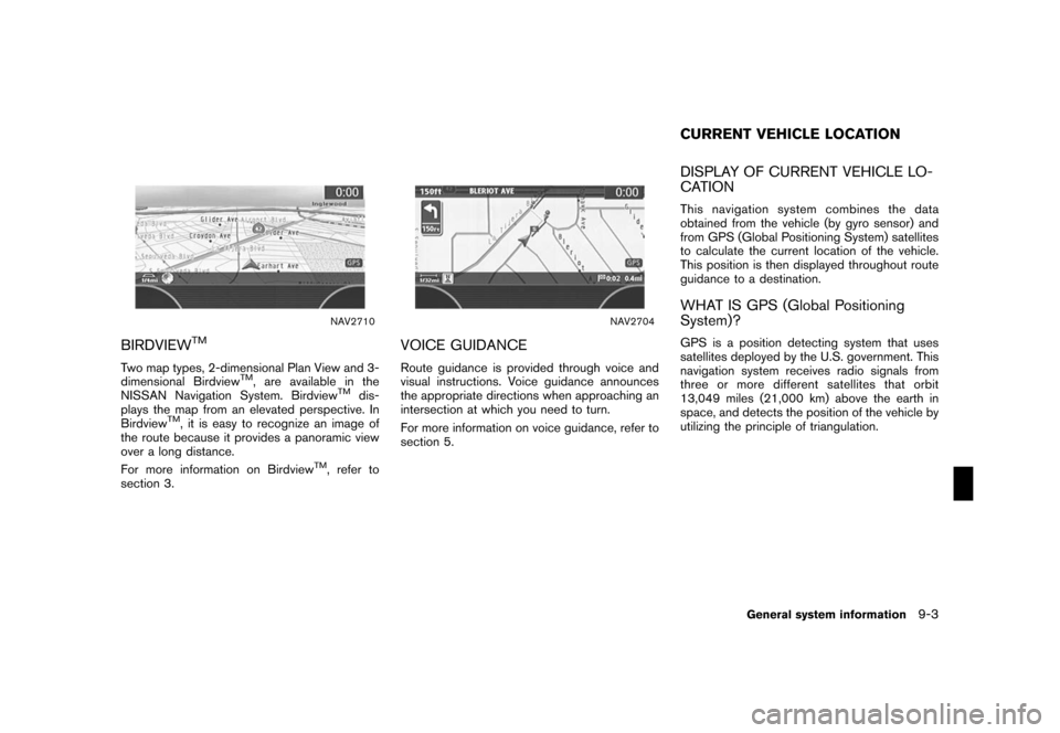
BIRDVIEWTM
Two map types, 2-dimensional Plan View and 3-
dimensional BirdviewTM, are available in the
NISSAN Navigation System. BirdviewTMdis-
plays the map from an elevated perspective. In
Birdview
TM, it is easy to recognize an image of
the route because it provides a panoramic view
over a long distance.
For more information on Birdview
TM, refer to
section 3.
NAV2704
VOICE GUIDANCE
Route guidance is provided through voice and
visual instructions. Voice guidance announces
the appropriate directions when approaching an
intersection at which you need to turn.
For more information on voice guidance, refer to
section 5.
DISPLAY OF CURRENT VEHICLE LO-
CATION
This navigation system combines the data
obtained from the vehicle (by gyro sensor) and
from GPS (Global Positioning System) satellites
to calculate the current location of the vehicle.
This position is then displayed throughout route
guidance to a destination.
WHAT IS GPS (Global Positioning
System)?
GPS is a position detecting system that uses
satellites deployed by the U.S. government. This
navigation system receives radio signals from
three or more different satellites that orbit
13,049 miles (21,000 km) above the earth in
space, and detects the position of the vehicle by
utilizing the principle of triangulation.
CURRENT VEHICLE LOCATION
General system information9-3
Page 239 of 270

Black plate (243,1)
Model "NISSAN_NAVI" EDITED: 2007/ 2/ 26
NAI0440
Notification of a freeway junction
1. “In about one mile (1.6 kilometers) , keep to
the right (left) onto (road number and
direction) , then in about one quarter mile
(400 meters) keep to the right (left) .”
2. “Keep to the right (left) onto (road number
and direction) , then in about one quarter
mile (400 meters) keep to the right (left)
onto (road number and direction) .”3. “Keep to the right (left) onto (road number
and direction) .”
NAI0441
Notification of a freeway exit
1. “In about one mile (1.6 kilometers) , exit on
your right.”
2. “Take the second exit on your right.”
General system information9-13
Page 241 of 270

Black plate (245,1)
Model "NISSAN_NAVI" EDITED: 2007/ 2/ 26
.The displayed street names may sometimes
differ from the actual names, or “UN-
KNOWN STREET NAME” may be dis-
played.
.Voice guidance is not available when the
[Guidance Voice] indicator is not illuminated.
.Voice guidance will start when the vehicle
enters the suggested route. Refer to the
map for directions to the starting point of the
route.
.When approaching a waypoint, voice gui-
dance will announce, “You have arrived at
waypoint 1 (2, 3, 4,...) .” Voice guidance will
switch to the next section of the route. When
voice guidance is not available, refer to the
map for directions.
.In some cases, voice guidance ends before
arrival at the destination. Refer to the
destination icon on the map to reach the
destination.
.If the system recognizes on which side the
destination (waypoint) is located, voice
guidance will announce “on the right/left”
after announcing the arrival at the destina-
tion.
.Voice guidance may be partially operational
or inoperative due to the angle of roads at an
intersection.HOW TO ORDER MAP DVD-ROM
UPDATES
To order updated map DVD-ROMs or additional
map DVD-ROMs, contact the NISSAN NAVI-
GATION SYSTEM HELPDESK. See the contact
information on the inside front cover of this
manual.
ABOUT THE MAP DVD-ROM
1. This map DVD-ROM has been prepared by
ZENRIN CO., LTD. under license from
Navigation Technologies Corporation.
ZENRIN CO., LTD. has added, processed
and digitized data based on the digital road
map data of Navigation Technologies Cor-
poration. Due to the production timing of the
map data, some new roads may not be
included in this map data or some of the
names or roads may be different from those
at the time you use this map DVD-ROM.
2. Traffic control and regulation data used in
this map DVD-ROM may be different from
those at the time you use this map DVD-
ROM due to the data production timing.
When driving your vehicle, follow the actual
traffic control signs and notices on the
roads.
3. Reproducing or copying this map software
is strictly prohibited by law.
Published by NISSAN North America, Inc.
*C2002 Navigation Technologies. All rights
reserved. “Certain business data provided by
infoUSA.com, Inc. Copyright 2002. All rights
reserved”.
MAP DVD-ROM
General system information9-15
Page 244 of 270

Black plate (248,1)
Model "NISSAN_NAVI" EDITED: 2007/ 2/ 26
NAI0449
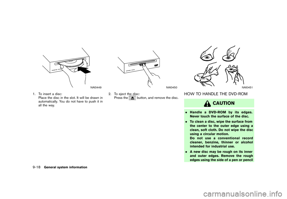
1. To insert a disc:
Place the disc in the slot. It will be drawn in
automatically. You do not have to push it in
all the way.
NAI0450
2. To eject the disc:
Press thebutton, and remove the disc.
NAI0451
HOW TO HANDLE THE DVD-ROM
CAUTION
.Handle a DVD-ROM by its edges.
Never touch the surface of the disc.
.To clean a disc, wipe the surface from
the center to the outer edge using a
clean, soft cloth. Do not wipe the disc
using a circular motion.
Do not use a conventional record
cleaner, benzine, thinner or alcohol
intended for industrial use.
.A new disc may be rough on its inner
and outer edges. Remove the rough
edges using the side of a pen or pencil
9-18General system information