change time SKODA FABIA 2005 1.G / 6Y Sat Compass Navigation System Manual
[x] Cancel search | Manufacturer: SKODA, Model Year: 2005, Model line: FABIA, Model: SKODA FABIA 2005 1.G / 6YPages: 71, PDF Size: 2.81 MB
Page 8 of 71
7RADIO NAVIGATION SYSTEMINTRODUCTION
The radio navigation system makes it very
easy to operate the convenient radio, CD and
navigation features in your vehicle. You can also
equip the system with an original Škoda 6-disc
CD changer.
Navigation
The navigation system is your "Intelligent pas
-
senger". With its help, you can travel from your
current location to any selected destination quick -
ly, easily and safely without having to use a lot of
complicated roadmaps. In cities and towns unfa -
miliar to you, for example, you can drive directly
to the nearest petrol station. The system uses
the data stored on the navigation CD to calcula -
te the route to the selected destination. During
route guidance, different display modes provide
you with visual driving recommendations, such
as where to turn (direction and distance to the
next turning point), information on your estimated
time of arrival, on the remaining travelling time
and the distance to your destination.
In addition, you can also receive "spoken" driving
recommendations from your radio navigation
system. How does navigation work?
T h e e l e c t r o n i c s p e e d o m e t e r s i g n a l a n d
the locating signals received from the GPS
satellites (Global Positioning System) are used
to determine the vehicle‘s current position. The
route travelled is measured by the speedometer
signal. This information is fed into the navigation
system and compared to the map information
stored there.
Important notes
Operating the radio navigation system
while driving
The demands of today‘s road traffic require the
full concentration of road users at all times.
Never operate the radio navigation system
with its many different features unless traffic
conditions permit. Do not adjust any of the
basic settings for the radio navigation system
or enter your destination information unless
your vehicle is stationary.
The different volume settings should be selected
so that acoustic signals from the outside, e.g.
police or fire brigade sirens, can be heard at
all times.
Always devote your attention primarily to
driving! As the driver of a motor vehicle,
you bear full responsibility for your road
safety. Never operate the radio navigation
system in a way that could interfere with
your ability to maintain control of your
vehicle in all traffic situations!
N o t e s o n u s i n g t h e r a d i o n a v i g a t i o n
system
• The route calculated by the navigation system
is a recommendation on how best to reach
your selected destination. The Road Traffic
Rules always take priority over any driving
r e c o m m e n d a t i o n p r o v i d e d . S h o r t - t e r m
changes in traffic conditions, such as road
works or one-way street regulations are not
included on the CDs.
• Street and place names may change. In rare
cases, the names stored on the CD might not
be the same as those used now.
• If you have your tyres changed, the system
may not operate correctly until the navigation
system has determined the new tyre size. For
more information, please read the section on
NAVIGATION SETUP on page 14.
Page 9 of 71
8RADIO NAVIGATION SYSTEM
INTRODUCTION
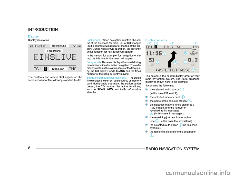
Display illustration
The contents and menus that appear on the
screen consist of the following standard fields:
Display
Background -
When navigation is active, the sta -
tus of the functions for radio, CD or CD changer
(audio sources) will appear at the top of the dis-
play. During radio or CD operation, the currently
active function for navigation will appear.
In the menus, for example, for navigation or se -
tup, the title line for the menu will appear.
Foreground - This area displays the visual driving
recommendations for active navigation. The radio
display contains the station name or the frequen -
cy, the CD display reads TRACK and the track
number of the song currently playing.
Status line (for audio operation only) - The status
line displays the current audio source or memory
bank during radio operation, the station button
preset, the CD number, the active functions,
such as SCAN, INFO , and traffic information
standby.Display contents
The screen is the central display area for your radio navigation system. The route guidance
display is shown here in the example.
It contains the following:
the selected audio source
(in this case FM level 1),
the selected memory bank ,
the name of the selected station ,
an indication that the tuned station is a
TMC station, and the number of
received traffic messages
(in this case 3 messages),
the remaining journey time or arrival
time
(in this case the arrival time)
the selected route option (in this case
dynamic),
the remaining distance to the destination
,
1234
56
79
10
8
Background
Foreground
Status line
Page 15 of 71
14RADIO NAVIGATION SYSTEM
INTRODUCTION
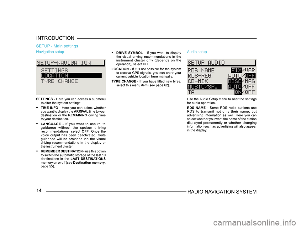
Navigation setup
SETTINGS
- Here you can access a submenu
to alter the system settings:
- TIME INFO - Here you can select whether
you want to display the ARRIVAL time to your
destination or the REMAINING driving time
to your destination.
- LANGUAGE - If you want to use route
g u i d a n c e w i t h o u t t h e s p o k e n d r i v i n g
recommendations, select OFF. Once the
voice output has been deactivated, route
guidance will be provided via the visual
driving recommendations in the display or
the instrument cluster.
- REMEMBER DESTINATION - use this option
to switch the automatic storage of the last 10
destinations in the LAST DESTINATIONS
memory on or off (see Destination memory,
page 55).
SETUP - Main settings
- DRIVE SYMBOL - If you want to display
the visual driving recommendations in the
instrument cluster only (depends on the
operation), select OFF.
LOCATION - If it is not possible for the system
to receive GPS signals, you can enter your
current vehicle location here manually.
TYRE CHANGE - If you have fitted new tyres, select this menu item (see page 62). Audio setup
Use the Audio Setup menu to alter the settings
for audio operation.
RDS NAME - Some RDS radio stations use
R D S t o t r a n s m i t n o t o n l y t h e i r n a m e , b u t
advertising information as well. Here you can
select whether you want the name of the station
displayed permanently or whether changing
information such as advertising will also appear
in the display.
Page 51 of 71
50RADIO NAVIGATION SYSTEM
NAVIGATION
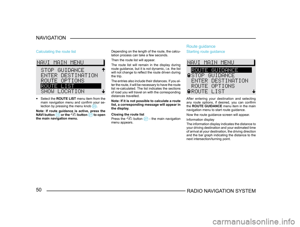
Calculating the route list
•
Select the ROUTE LIST menu item from the
main navigation menu and confirm your se-
lection by pressing the menu knob
.
Note: If route guidance is active, press the
NAVI button or the button to open the main navigation menu. Depending on the length of the route, the calcu-
lation process can take a few seconds.
Then the route list will appear.
The route list will remain in the display during
route guidance, but it is not dynamic, i.e. the list
will not change to reflect the route driven during
the trip.
The entries also include their distances. If you al
-
ter the route, it will be necessary to have the route
list re-calculated. The list indicates the sections
of road you will travel on with the corresponding
distances travelled.
Note: If it is not possible to calculate a route
list, a corresponding message will appear in
the display.
Closing the route list
Press the button - the main navigation menu appears.
Route guidance
Starting route guidance
After entering your destination and selecting
any route options, if desired, you can confirm
the ROUTE GUIDANCE menu item in the main
navigation menu to start route guidance.
Now the route guidance screen will appear.
Information display
The information display indicates the distance to
your driving destination and your estimated time
of arrival at your destination, the driving direction
and the bar graph indicating the distance to the
next intersection/turning point.
Page 57 of 71
56RADIO NAVIGATION SYSTEM
NAVIGATION
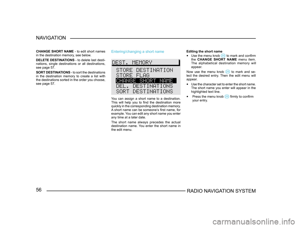
CHANGE SHORT NAME
- to edit short names
in the destination memory, see below.
DELETE DESTINATIONS - to delete last desti-
nations, single destinations or all destinations,
see page 57.
SORT DESTINATIONS - to sort the destinations
in the destination memory to create a list with
the destinations sorted in the order you choose,
see page 57.Entering/changing a short name
You can assign a short name to a destination.
This will help you to find the destination more
quickly in the corresponding destination memory.
A short name can be someone’s first name, for
example. You can edit any short name you enter
any time at a later date.
The short name always precedes the actual
destination name. You enter the short name in
the edit menu. Editing the short name
• Use the menu knob to mark and confirm the CHANGE SHORT NAME menu item.
The alphabetical destination memory will
appear.
Now use the menu knob
to mark and se-lect the desired entry. Then the edit menu will
appear.
• Use the character set to enter the short name.
The short name you enter will appear in the
highlighted text line.
• Press the menu knob firmly to confirm
your entry .