tow SKODA OCTAVIA 2014 3.G / (5E) Columbus Infotinment Navigation System Manual
[x] Cancel search | Manufacturer: SKODA, Model Year: 2014, Model line: OCTAVIA, Model: SKODA OCTAVIA 2014 3.G / (5E)Pages: 83, PDF Size: 5.16 MB
Page 26 of 83

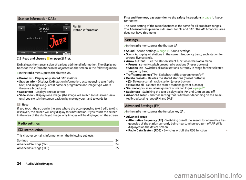
Station information DAB)Fig. 16
Station information
Read and observe on page 21 first.
DAB allows the transmission of various additional information. The display op-
tions for this informationcan be adjusted on the screen in the following menu.
›
In the radio menu, press the fbutton
.
■ Preset list - Display only stored DAB stations
■ Station info. - Displays DAB station information, accompanying text (radio
text) and images (e.g., artist name or programme and image type where
these are broadcast)
■ Radio text - Displays one radio text
■ Slide show - Displays one image; (the image will switch to full-screen view
until you switch the screen back on by moving your hand towards it)
Note
If you touch the screen in the area where the accompanying text (radio text) is
displayed, the screen will only display this information. If you touch the screen
in the area of the displayed image, only images will be displayed on the screen.
Radio settings
Introduction
This chapter contains information on the following subjects:
Settings
24
Advanced Settings (FM)
24
Advanced Settings (DAB)
25First and foremost, pay attention to the safety instructions » page 4 , Impor-
tant notes .
The basic setting of the radio functions is the same for all broadcast ranges.
The Advanced setup menu is different for FM and DAB. The AM broadcast area
does not have this menu.
Settings
›
In the radio menu, press the fbutton
.
■ Sound - Sound settings » page 18, Sound settings
■ Scan - Auto-play all stations in the current frequency band, each station for
around five seconds.
■ Arrow buttons: - Set the station select function in the Radio menu
■ Preset list - only switch preset radio stations (Preset buttons)
■ Station list - Switches all radio stations currently in range for the selected
frequency band
■ Traffic programme (TP) - Switches traffic programme on/off
■ Delete presets - Deletes the stored stations (preset buttons)
■ - Delete a certain radio station (preset button)
■
Delete all - Deletes the stored stations (preset buttons)
■ Station logos - manual assignment of station logos » page 23
■ Radio text - Switching the text display radio (FM and DAB) on and off
■ Advanced setup - another setting that is different depending on the selec-
ted broadcasting range(FM and DAB)
Advanced Settings (FM)
›
In the radio menu, press the function key
.
■ Advanced setup
■ Alternative frequency (AF) - Switching on/off the search for alternative fre-
quencies of the station currently being heard, when you turn off AF off is
displayed on the device screen
■ Radio Data System (RDS) - Switches on/off the RDS function
24Audio/Video/Images
Page 52 of 83

■Define home address - Display/enter/edit the home address
■ Current position - Set the home address to the current vehicle position
■ Address - Enter a new address » page 51. If the home address has al-
ready been entered, the following is displayed:
■ - Reduces map display
■ - Enlarges map display
■ Edit - Edit the home address
■ Delete my points of interest (Personal POI) - Delete saved personal points
of interest
■ Update my points of interest (personal POI) - Update saved personal POI
■ Delete user data - Select the data to be deleted (the selected data is deleted
by pressing Delete)
■ Last destinations - Delete the list of last destinations
■ Destination memory - Delete the list of stored destinations
■ Tour memory - Delete the list of stored tours
■ My points of interest (Personal POI) - Delete the list of personal points of
interest
■ Entered towns - Delete the list of entered towns
■ Home address - Delete the set home address
■ Flagged destination - Delete the flagged destination
Operating the map
Introduction
This chapter contains information on the following subjects:
Introductory information
50
Map display options
50
Map operation
51
Traffic signs
51
Home address entry
51
First and foremost, pay attention to the safety instructions » page 4 , Impor-
tant notes .
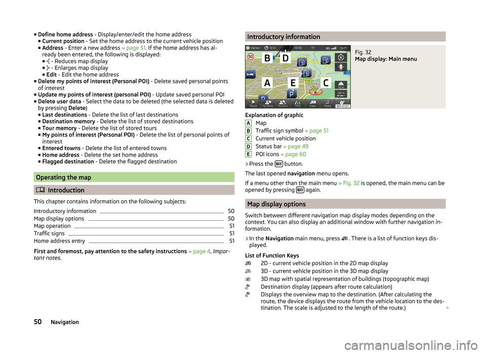
Introductory informationFig. 32
Map display: Main menu
Explanation of graphic
Map
Traffic sign symbol » page 51
Current vehicle position
Status bar » page 49
POI icons » page 60
›
Press the button.
The last opened navigation menu opens.
If a menu other than the main menu » Fig. 32 is opened, the main menu can be
opened by pressing
again.
Map display options
Switch between different navigation map display modes depending on the
context. You can also display an additional window with further navigation in-
formation.
›
In the Navigation main menu, press
. There is a list of function keys dis-
played.
List of Function Keys 2D - current vehicle position in the 2D map display
3D - current vehicle position in the 3D map display
3D map with spatial representation of buildings (topographic map)
Destination display (appears after route calculation)
Displays the overview map to the destination. (After calculating the
route, the device displays the route from the vehicle location to the des-
tination. The scale is adjusted to the length of the route.)
ABCDE50Navigation
Page 57 of 83

Navigation
Enter new destination
Introduction
This chapter contains information on the following subjects:
Input destination possibilities
55
Address
55
Map
56
First and foremost, pay attention to the safety instructions » page 4 , Impor-
tant notes .
Input destination possibilities
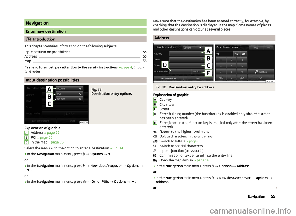
Fig. 39
Destination entry options
Explanation of graphic
Address » page 55
POI » page 58
in the map » page 56
Select the menu with the option to enter a destination » Fig. 39.
›
In the Navigation main menu, press
→ Options →
.
or
›
In the Navigation main menu, press
→ New dest./stopover → Options →
.
or
›
In the Navigation main menu, press
→ Other POIs → Options →
.
ABCMake sure that the destination has been entered correctly, for example, by
checking that the destination is displayed in the map. Some names of places
and other destinations can occur at several places.
Address
Fig. 40
Destination entry by address
Explanation of graphic Country
City / town
Street
Enter building number (the function key is enabled only after the street
has been entered)
Enter junction (the function key is enabled only after the street has been
entered)
Return to the higher-level menu
Delete characters in the entry line
Switch to letters » page 8
Switch to special characters
Input a junction (crossroads)
Confirmation of text entered into the entry line
Open the map display » page 56
›
In the Navigation main menu, press
→ Options → Address .
or
›
In the Navigation main menu, press
→ New dest./stopover → Options →
Address .
or
ABCDE
55Navigation
Page 63 of 83

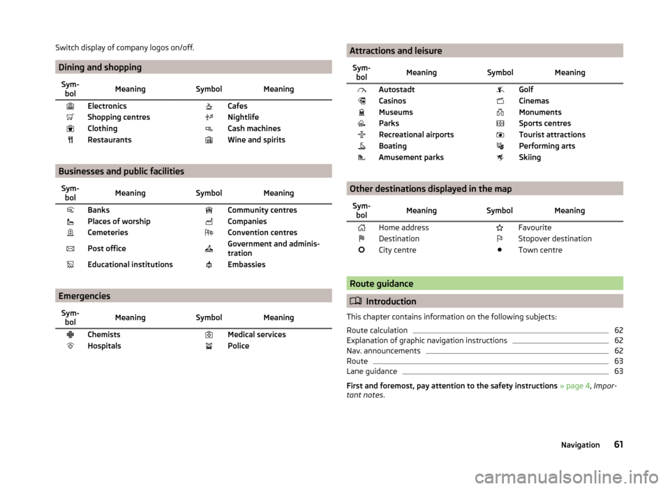
Switch display of company logos on/off.
Dining and shopping
Sym-bolMeaning SymbolMeaningElectronics CafesShopping centres NightlifeClothing Cash machinesRestaurants Wine and spirits
Businesses and public facilities
Sym-bolMeaning SymbolMeaningBanks Community centresPlaces of worship CompaniesCemeteries Convention centresPost office Government and adminis-
trationEducational institutions Embassies
Emergencies
Sym- bolMeaning SymbolMeaningChemists Medical servicesHospitals Police Attractions and leisureSym-bolMeaning SymbolMeaningAutostadt GolfCasinos CinemasMuseums MonumentsParks Sports centresRecreational airports Tourist attractionsBoating Performing artsAmusement parks Skiing
Other destinations displayed in the map
Sym-bolMeaning SymbolMeaningHome address FavouriteDestination Stopover destinationCity centre Town centre
Route guidance
Introduction
This chapter contains information on the following subjects:
Route calculation
62
Explanation of graphic navigation instructions
62
Nav. announcements
62
Route
63
Lane guidance
63
First and foremost, pay attention to the safety instructions » page 4 , Impor-
tant notes .
61Navigation