SKODA RAPID SPACEBACK 2016 1.G Columbus Amundsen Bolero Infotainment System Navigation Manual
Manufacturer: SKODA, Model Year: 2016, Model line: RAPID SPACEBACK, Model: SKODA RAPID SPACEBACK 2016 1.GPages: 100, PDF Size: 12.8 MB
Page 71 of 100
Alternative routes
With selection of alternative routes turned on, the following menu is displayed
after the calculation of a new route » Fig. 73.
Calculate the most economical route with shortest travelling time and
distance travelled – the route is highlighted green
Calculate the fastest route to the destination, even if a detour is nec-
essary - the route is highlighted in red
Calculate the shortest route to the destination, even if a longer travel-
ling time is required - the route is highlighted in orange
In the functional surfaces, Information is displayed on route length as well as
estimated travel time and the following symbols (applies to Columbus).
Use of a toll motorway
Use of a train / ferry
Using a toll tunnel
Use of a toll road
Using a vignette duty highway
It is possible to select an already calculated alternative route before the calcu-
lation of the remaining routes is completed.
Selecting the type of route will start the route guidance.
If no route selection is made within 30 s after the calculation of all routes, the
route guidance is automatically started according to the preferred route type.
Route calculation for the trailer
When driving with a trailer or any other accessory connected to the trailer
socket, we recommend that you switch on the trailer recognition, if necessary
to set the maximum speed for towing a trailer.
›
For calculating the route for towing a trailer, tap the functional surface in the
main navigation menu
→
route options
→
surface.
›
To set the speed limit for towing a trailer (applies to Superb), press the but-
ton then the functional surface
Tap
→
Driver assistance
→ Trailer detec-
tion →
Top speed for trailers
.
Demo mode
The Demo mode provides a travel simulation to the entered destination. The
function offers the chance to travel through the calculated route “virtually”.
ABCWhen the Demo mode is turned on, a menu for route guidance in the Demo
mode or in normal operation is displayed before the start of route guidance.›
To switch on/off in the main menu Navigation, tap on the functional surface
Tap →
Advanced settings
→
Demo mode
.
When the demoMode is switched on, the route starting point can be defined.
›
In the Navigation main menu, tap on the functional surface
Tap →
Advancedsettings
→
define the starting point demo mode
.
›
Define the starting point by entering the address or the current vehicle posi-
tion.
›
The starting point of demoMode can also be set as long as the demo mode is
turned on by tapping the desired map location and the menu item
Start demomode
is selected » page 65, Tap map point .
Graphical driving recommendations
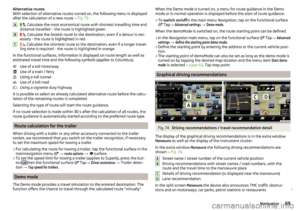
Fig. 74
Driving recommendations / travel recommendation detail
The display of the graphical driving recommendations is in the extra window
Manoeuvre
as well as the display of the instrument cluster.
In the extra window
Manoeuvre
the following driving recommendations are
shown » Fig. 74 .
Street name / street number of the current vehicle position
Driving recommendations with street names / road numbers, with the
route and the travel time to the manoeuvre place
Details of driving recommendation (is displayed near the manoeuvre)
Lane recommendation
In the split screen
Manoeuvre
the device also announces TMC traffic obstruc-
tions and on motorways, car parks, petrol stations or restaurants.
ABCD69Navigation
Page 72 of 100
Speed limits
With activated function → Advanced settings
→
Note: national border crossed
dis-
play the country-specific speed limits when crossing international borders.
These speed limits can be displayed by tapping the function surface
→
topspeed
From the navigation main menu.
Nav. announcements
The device gives out navigation announcements.
The navigation announcements are generated by the device. The flawless
clarity of the message (e.g., road or city name) cannot always be guaranteed.
The last navigation announcement is repeated by pressing the control switch
Be repeated.
The timing of the navigation message is dependent on the road being used
and travel speed (e.g. on motorways the first announcement will sound for
about 2000 m / 6000 ft before the manoeuvre).
The type of navigation announcements can be set:
Nav. announcements
.
Most common routes
The unit automatically stores up to three of the most commonly travelled
routes.
A route guidance to one of the stored routes can be started as long as no
guidance or route guidance takes place to one of these routes.
›
to route selection in the additional window, tap the functional surface
Freq.Routes
Tap→
show in map
.
›
Select the desired route.
Then a selected rout is calculated and the route guidance starts.
The menu display in the additional window can be turned on/off in the main menu navigation by tapping the functional surface
→
Route options
→
Freq.routes
.
The stored most frequent routes can be deleted in the main menu navigation
by tapping the functional surface
→
Manage memory
→
Delete User Data
→
Mostfrequent routes
deleted .
Finish route guidance
The route guidance can be finished in one of the following ways.›
The final destination is reached.
›
In the main menu Navigation by tapping the functional surface
→
Stop guid-ance
.
›
By turning off the ignition for longer than 120 minutes.
Abort route guidance
If the ignition is switched off and on again, then the route guidance is contin-
ued depending on the stop time in one of the following ways.
▶ Within 15 min. - route guidance is continued taking into account the calcula-
ted route.
▶ Between 15 min and 120 min - the screen displays the message
Continue routeguidance?
, after you confirm the message, the route guidance continues using
the calculated route.
▶ After 120 min - the route guidance is cancelled.
Route
Route plan
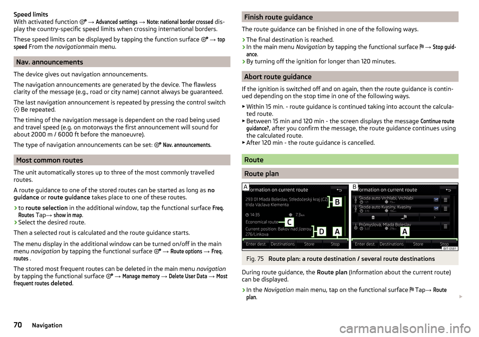
Fig. 75
Route plan: a route destination / several route destinations
During route guidance, the Route plan (Information about the current route)
can be displayed.
›
In the Navigation main menu, tap on the functional surface
Tap
→
Routeplan
.
70Navigation
Page 73 of 100
A route destination
In the route plan, the following information is displayed at the destina-
tion » Fig. 75 -
.
Area with function surfaces
Destination information Estimated time of arrival at destination / remaining driving time to desti-
nation 1)
Remaining distance to the destination
Chosen route type (economic, fastest, shortest)
Current vehicle position (address / GPS coordinates)
The display of the arrival time or the remaining driving time can be adjusted as
follows.
▶ In the Navigation main menu, tap on the functional surface
→ Advanced set-tings
→
Time display:
.
Several route destinations
In the route plan, the following information is displayed at the respective des- tinations » Fig. 75 -
.
Area with functional surfaces
Stopover (with sequential number)
Final destination
Estimated time of arrival at destination / stopover
Driving distance to destination / stopover
Substitution of destinations among themselves
Delete the destination
Continuation of the route guidance from the selected target (previous
waypoints are skipped)
Display the destination details » page 68
Insert destination into the route ▶ In the area
A
Name destination
Tap the functional surface and enter a new
destination.
▶ or: In the area
A
destinations
Tap the functional surface and select a destina-
tion in the list of stored destinations.
AB CDAEach additional destination is added to the list as the first subsequent destina-
tion route.
Change positions of destinations with each other
▶ The relevant function surface
and move the destination to the desired po-
sition.
With destinations on the route already reached the note Dest. reached
is dis-
played below the destination name. It is not possible to change the position of
these destinations with each other.
Store route ▶ In the area
A
, tap the functional surface
Save
.
▶ Save the edited route as a new route or replace the existing saved route.
Stop route guidance ▶ In the area
A
, tap the functional surface
stop
.
Route change in the map
Applies to Columbus.
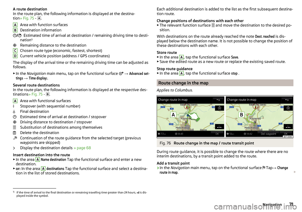
Fig. 76
Route change in the map / route transit point
During route guidance, it is possible to change the route where there are no
interim destinations, by a transit point added to the route.
Add a transit point
›
In the Navigation main menu, tap on the functional surface
Tap
→
Changeroute in map
.
1)
If the time of arrival to the final destination or remaining travelling time greater than 24 hours,
is dis-
played inside the symbol.
71Navigation
Page 74 of 100
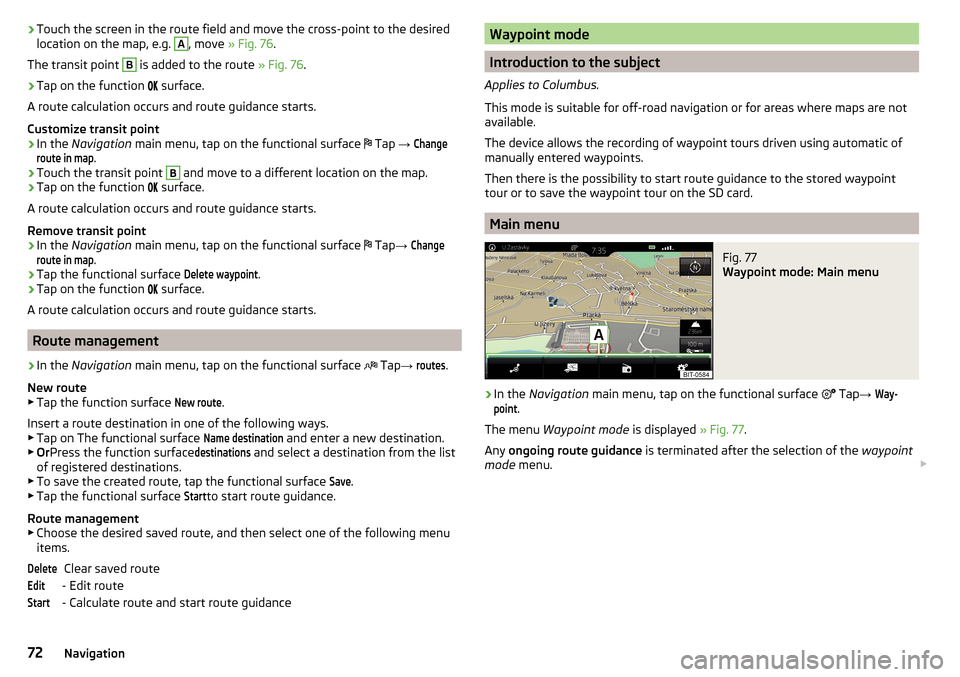
›Touch the screen in the route field and move the cross-point to the desired
location on the map, e.g. A, move » Fig. 76 .
The transit point B
is added to the route » Fig. 76.
›
Tap on the function
surface.
A route calculation occurs and route guidance starts.
Customize transit point
›
In the Navigation main menu, tap on the functional surface
Tap
→
Changeroute in map
.
›
Touch the transit point
B
and move to a different location on the map.
›
Tap on the function
surface.
A route calculation occurs and route guidance starts.
Remove transit point
›
In the Navigation main menu, tap on the functional surface
Tap
→
Changeroute in map
.
›
Tap the functional surface
Delete waypoint
.
›
Tap on the function
surface.
A route calculation occurs and route guidance starts.
Route management
›
In the Navigation main menu, tap on the functional surface
Tap
→
routes
.
New route ▶ Tap the function surface
New route
.
Insert a route destination in one of the following ways.
▶ Tap on The functional surface
Name destination
and enter a new destination.
▶ Or Press the function surface
destinations
and select a destination from the list
of registered destinations.
▶ To save the created route, tap the functional surface
Save
.
▶ Tap the functional surface
Start
to start route guidance.
Route management
▶ Choose the desired saved route, and then select one of the following menu
items.
Clear saved route
- Edit route
- Calculate route and start route guidance
DeleteEditStartWaypoint mode
Introduction to the subject
Applies to Columbus.
This mode is suitable for off-road navigation or for areas where maps are not
available.
The device allows the recording of waypoint tours driven using automatic of
manually entered waypoints.
Then there is the possibility to start route guidance to the stored waypoint
tour or to save the waypoint tour on the SD card.
Main menu
Fig. 77
Waypoint mode: Main menu
›
In the Navigation main menu, tap on the functional surface
Tap
→
Way-point
.
The menu Waypoint mode is displayed » Fig. 77.
Any ongoing route guidance is terminated after the selection of the waypoint
mode menu.
72Navigation
Page 75 of 100
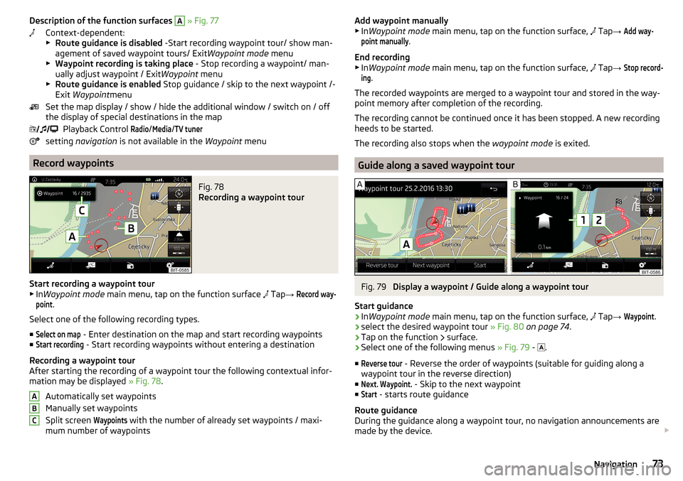
Description of the function surfaces A » Fig. 77
Context-dependent:
▶ Route guidance is disabled -Start recording waypoint tour/ show man-
agement of saved waypoint tours/ Exit Waypoint mode menu
▶ Waypoint recording is taking place - Stop recording a waypoint/ man-
ually adjust waypoint / Exit Waypoint menu
▶ Route guidance is enabled Stop guidance / skip to the next waypoint /-
Exit Waypoint menu
Set the map display / show / hide the additional window / switch on / off the display of special destinations in the map
Playback Control Radio
/
Media
/
TV tuner
setting navigation is not available in the Waypoint menu
Record waypoints
Fig. 78
Recording a waypoint tour
Start recording a waypoint tour
▶ In Waypoint mode main menu, tap on the function surface
Tap
→
Record way-point
.
Select one of the following recording types. ■
Select on map
- Enter destination on the map and start recording waypoints
■
Start recording
- Start recording waypoints without entering a destination
Recording a waypoint tour
After starting the recording of a waypoint tour the following contextual infor-
mation may be displayed » Fig. 78.
Automatically set waypoints
Manually set waypoints
Split screen
Waypoints
with the number of already set waypoints / maxi-
mum number of waypoints
ABCAdd waypoint manually
▶ In Waypoint mode main menu, tap on the function surface, Tap → Add way-point manually
.
End recording
▶ In Waypoint mode main menu, tap on the function surface,
Tap →
Stop record-ing
.
The recorded waypoints are merged to a waypoint tour and stored in the way-
point memory after completion of the recording.
The recording cannot be continued once it has been stopped. A new recording
heeds to be started.
The recording also stops when the waypoint mode is exited.
Guide along a saved waypoint tour
Fig. 79
Display a waypoint / Guide along a waypoint tour
Start guidance
›
In Waypoint mode main menu, tap on the function surface,
Tap
→
Waypoint
.
›
select the desired waypoint tour » Fig. 80 on page 74 .
›
Tap on the function
surface.
›
Select one of the following menus
» Fig. 79 -
.
■
Reverse tour
- Reverse the order of waypoints (suitable for guiding along a
waypoint tour in the reverse direction)
■
Next. Waypoint.
- Skip to the next waypoint
■
Start
- starts route guidance
Route guidance
During the guidance along a waypoint tour, no navigation announcements are
made by the device.
73Navigation
Page 76 of 100
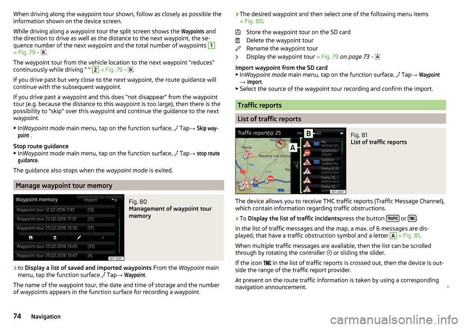
When driving along the waypoint tour shown, follow as closely as possible the
information shown on the device screen.
While driving along a waypoint tour the split screen shows the Waypoints
and
the direction to drive as well as the distance to the next waypoint, the se-
quence number of the next waypoint and the total number of waypoints
1
» Fig. 79 -
.
The waypoint tour from the vehicle location to the next waypoint “reduces”
continuously while driving “ ”
2
» Fig. 79 -
.
If you drive past but very close to the next waypoint, the route guidance will
continue with the subsequent waypoint.
If you drive past a waypoint and this does “not disappear” from the waypoint tour (e.g. because the distance to this waypoint is too large), then there is the
possibility to “skip” over this waypoint and continue the guidance to the next
waypoint.
▶ In Waypoint mode main menu, tap on the function surface,
Tap
→
Skip way-point
.
Stop route guidance
▶ In Waypoint mode main menu, tap on the function surface,
Tap
→
stop routeguidance
.
The guidance also stops when the waypoint mode is exited.
Manage waypoint tour memory
Fig. 80
Management of waypoint tour
memory
›
to Display a list of saved and imported waypoints From the Waypoint main
menu, tap the function surface Tap
→
Waypoint
.
The name of the waypoint tour, the date and time of storage and the number
of waypoints appears in the function surface for recording a waypoint.
› The desired waypoint and then select one of the following menu items
» Fig. 80 .
Store the waypoint tour on the SD card
Delete the waypoint tour
Rename the waypoint tour
Display the waypoint tour » Fig. 79 on page 73 -
Import waypoint from the SD card ▶ In Waypoint mode main menu, tap on the function surface,
Tap → Waypoint
→
Import
.
▶ Select the source of the waypoint tour recording and confirm the import.
Traffic reports
List of traffic reports
Fig. 81
List of traffic reports
The device allows you to receive TMC traffic reports (Traffic Message Channel),
which contain information regarding traffic obstructions.
›
To Display the list of traffic incidents press the button or .
In the list of traffic messages and the map, a max. of 6 messages are dis-
played, that have a traffic obstruction symbol and a letter
A
» Fig. 81 .
When multiple traffic messages are available, then the list can be scrolled
through by rotating the controller or sliding the slider.
If the icon in the list of traffic reports is crossed out, then the device is out-
side the range of the traffic report provider.
At present on the route traffic information is taken by using a corresponding
navigation announcement.
74Navigation
Page 77 of 100
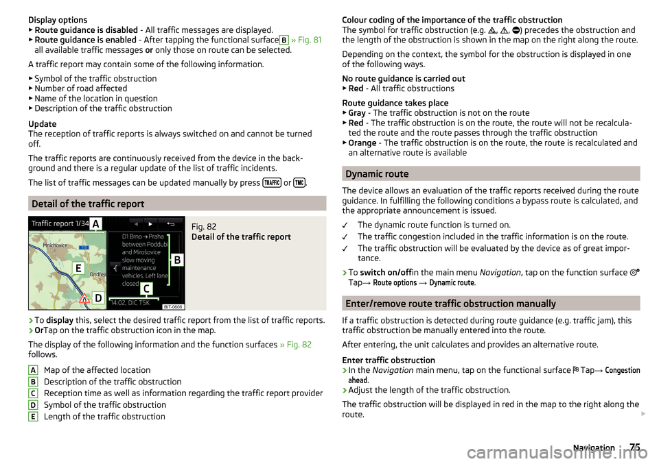
Display options▶ Route guidance is disabled - All traffic messages are displayed.
▶ Route guidance is enabled - After tapping the functional surfaceB
» Fig. 81
all available traffic messages or only those on route can be selected.
A traffic report may contain some of the following information. ▶ Symbol of the traffic obstruction
▶ Number of road affected
▶ Name of the location in question
▶ Description of the traffic obstruction
Update
The reception of traffic reports is always switched on and cannot be turned
off.
The traffic reports are continuously received from the device in the back-
ground and there is a regular update of the list of traffic incidents.
The list of traffic messages can be updated manually by press
or .
Detail of the traffic report
Fig. 82
Detail of the traffic report
›
To
display this, select the desired traffic report from the list of traffic reports.
›
OrTap on the traffic obstruction icon in the map.
The display of the following information and the function surfaces » Fig. 82
follows.
Map of the affected location
Description of the traffic obstruction
Reception time as well as information regarding the traffic report provider
Symbol of the traffic obstruction
Length of the traffic obstruction
ABCDEColour coding of the importance of the traffic obstruction
The symbol for traffic obstruction (e.g. , , ) precedes the obstruction and
the length of the obstruction is shown in the map on the right along the route.
Depending on the context, the symbol for the obstruction is displayed in one
of the following ways.
No route guidance is carried out ▶ Red - All traffic obstructions
Route guidance takes place
▶ Gray - The traffic obstruction is not on the route
▶ Red - The traffic obstruction is on the route, the route will not be recalcula-
ted the route and the route passes through the traffic obstruction
▶ Orange - The traffic obstruction is on the route, the route is recalculated and
an alternative route is available
Dynamic route
The device allows an evaluation of the traffic reports received during the route
guidance. In fulfilling the following conditions a bypass route is calculated, and
the appropriate announcement is issued.
The dynamic route function is turned on.
The traffic congestion included in the traffic information is on the route. The traffic obstruction will be evaluated by the device as of great impor-
tance.
›
To switch on/off in the main menu Navigation, tap on the function surface
Tap →
Route options
→
Dynamic route
.
Enter/remove route traffic obstruction manually
If a traffic obstruction is detected during route guidance (e.g. traffic jam), this
traffic obstruction be manually entered into the route.
After entering, the unit calculates and provides an alternative route.
Enter traffic obstruction
›
In the Navigation main menu, tap on the functional surface
Tap
→
Congestionahead
.
›
Adjust the length of the traffic obstruction.
The traffic obstruction will be displayed in red in the map to the right along the
route.
75Navigation
Page 78 of 100
Remove traffic obstruction
The traffic obstruction is removed from the route after completion of the route
guidance or can manually be removed as follows.›
In the Navigation main menu, tap on the functional surface
Tap
→
Cancel"congest. ahead"
.
Settings
Route options
›
In the Navigation main menu, tap on the functional surface
Tap →
route op-tions
.
■
Suggest 3 alternative routes
- Switch on/off the menu for alternative routes (eco-
nomical, fast, short)
■
Route:
- Setting the preferred route
■
Most frequent routes
- Show/hide the menu of the most frequent routes in the
split screen
■
Dynamic route
- Switch on/off dynamic route recalculation due to TMC traffic
reports
■
Avoid motorways
- Switch on/off the non-use of motorways in the route cal-
culation
■
Avoid ferries and motorail trains
- Switch on/off the non-use of ferries and mo-
torail trains in the route calculation
■
Avoid toll roads
- Switch on/off use of toll roads for the route calculation
■
Avoid tunnels
- Switch on/off use of tunnels for the route calculation
■
Avoid routes requiring toll stickers
- Switch use of routes requiring toll stickers
on/off for route calculation
■
Show available toll stickers
- Selection of countries for which a valid toll sticker is
required (routes requiring toll stickers are used for route calculation)
■
Consider trailer
- Turn on / off the option to take the trailer into account for
route calculation » page 69
Map
›
In the Navigation main menu, tap on the functional surface
Tap
→
map
.
■
Show road signs
- Switch on/off the display of traffic signs
■
Lane guidance
- Display of lane guidance on/off
■
Show favourites
- Switch on/off the display of favourites
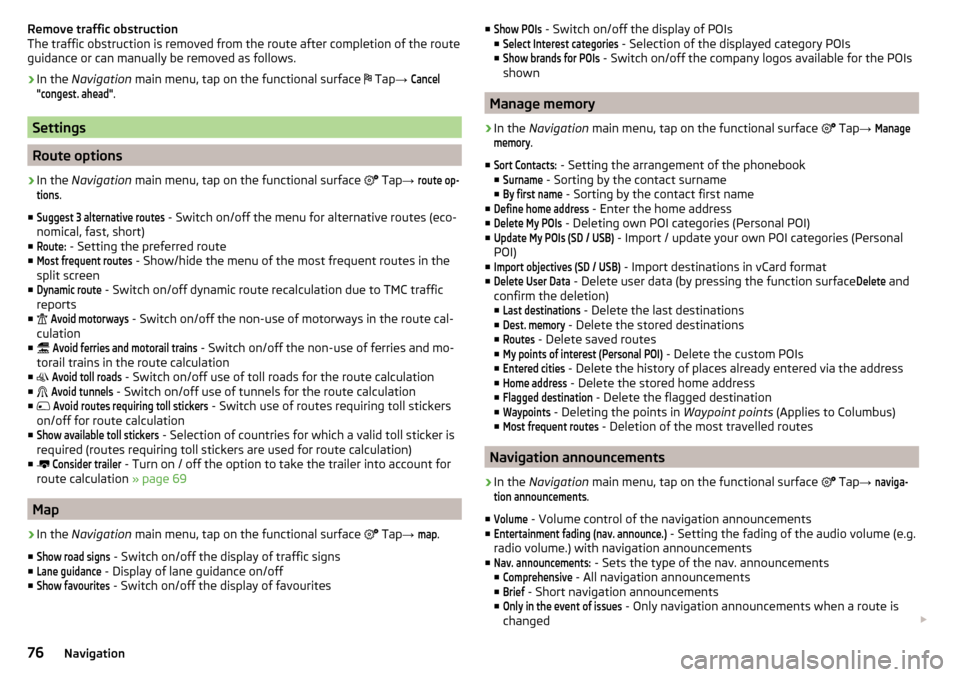
■Show POIs - Switch on/off the display of POIs
■Select Interest categories
- Selection of the displayed category POIs
■
Show brands for POIs
- Switch on/off the company logos available for the POIs
shown
Manage memory
›
In the Navigation main menu, tap on the functional surface
Tap →
Managememory
.
■
Sort Contacts:
- Setting the arrangement of the phonebook
■
Surname
- Sorting by the contact surname
■
By first name
- Sorting by the contact first name
■
Define home address
- Enter the home address
■
Delete My POIs
- Deleting own POI categories (Personal POI)
■
Update My POIs (SD / USB)
- Import / update your own POI categories (Personal
POI)
■
Import objectives (SD / USB)
- Import destinations in vCard format
■
Delete User Data
- Delete user data (by pressing the function surface
Delete
and
confirm the deletion) ■
Last destinations
- Delete the last destinations
■
Dest. memory
- Delete the stored destinations
■
Routes
- Delete saved routes
■
My points of interest (Personal POI)
- Delete the custom POIs
■
Entered cities
- Delete the history of places already entered via the address
■
Home address
- Delete the stored home address
■
Flagged destination
- Delete the flagged destination
■
Waypoints
- Deleting the points in Waypoint points (Applies to Columbus)
■
Most frequent routes
- Deletion of the most travelled routes
Navigation announcements
›
In the Navigation main menu, tap on the functional surface
Tap
→
naviga-tion announcements
.
■
Volume
- Volume control of the navigation announcements
■
Entertainment fading (nav. announce.)
- Setting the fading of the audio volume (e.g.
radio volume.) with navigation announcements
■
Nav. announcements:
- Sets the type of the nav. announcements
■
Comprehensive
- All navigation announcements
■
Brief
- Short navigation announcements
■
Only in the event of issues
- Only navigation announcements when a route is
changed
76Navigation
Page 79 of 100
■No navigation sound during call - Enable / disable the playback of navigation
prompts during a telephone conversation
■Note: “My POIs”
- Turn on/off an audible indication when approaching a custom
POI (if supported by the imported custom POI) (applies to Columbus)
Fuel options
›
In the Navigation main menu, tap on the functional surface
Tap →
tank op-tions
.
■
Select preferred fuel station
- Select your preferred fuel station brand (the selec-
ted station brand will be displayed in the first three positions of the list)
■
Tank warning
-Turn on- / Off the display of a warning message with the option
to visit the nearest petrol station when the fuel level reaches the reserve
area
Advanced settings
›
In the Navigation main menu, tap on the functional surface
Tap
→
Advancedsettings
.
■
Time display:
- Select the time display in the status line
■ -Estimated arrival time at destination
■ -Estimated travelling time to the destination
■
Status line:
- Selection of the target type for which the route and travel time
are displayed in the status line (Thereby it is also determined which destina-
tion type by the choice of
→
is displayed in the map)
■ - Route destination
■ - Next waypoint
■
Note: national border crossed
- Switching on/off the display for information on na-
tional speed limits when crossing the national border
■
Demo mode
- Switch on/off guidance in demo mode
■
Define the starting point demo mode
- Specifying the start point of the route guid-
ance in the demo mode by entering the address or the current vehicle posi-
tion
77Navigation
Page 80 of 100
Vehicle systems
CAR - vehicle setting
Introduction to the subject
In the menu CAR travel data and information displayed on the vehicle and
some vehicle systems can be set.
Description of the individual systems » Owner's Manual .
Note
Settings relating to the vehicle systems can only be made when the ignition is
switched on.
Main menu
Fig. 83
Function surfaces in the main
menu
›
Press the button The main menu appears with the following functional
surfaces » Fig. 83.
Selecting the following menu points
▶
Conv. consumers
▶
Driving data
▶
DriveGreen
▶
Vehicle status
Playback control - Radio / Media / TV tuner
Depending on the vehicle equipment with manual air conditioning: Set-
ting the auxiliary heating and ventilation / operating the heated wind- screen
Vehicle system settings
Convenience consumer›
Press the button, then tap on the function surface
Tap →
Comfort con-sumers
.
The screen displays up to three consumers that currently have the largest
share of fuel consumption (e.g. air conditioning or similar). A display also ap-
pears which shows the fuel used for the operation of all convenience systems.
Driving data
Fig. 84
Driving data
›
Press the button, then tap on the function surface
→
Driving data
.
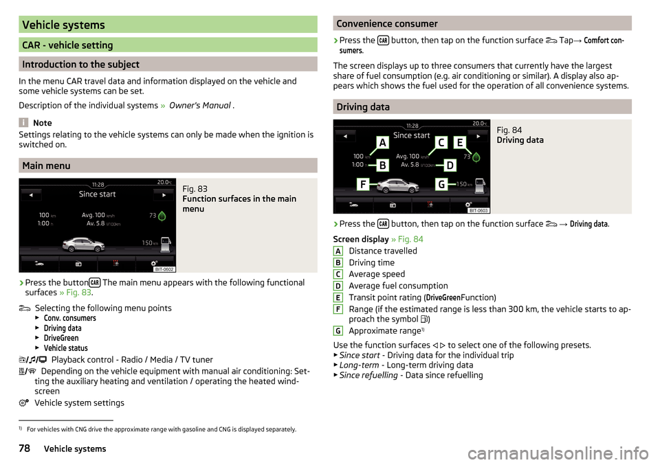
Screen display » Fig. 84
Distance travelled
Driving time
Average speed
Average fuel consumption
Transit point rating (
DriveGreen
Function)
Range (if the estimated range is less than 300 km, the vehicle starts to ap-
proach the symbol )
Approximate range 1)
Use the function surfaces
to select one of the following presets.
▶ Since start - Driving data for the individual trip
▶ Long-term - Long-term driving data
▶ Since refuelling - Data since refuelling
ABCDEFG1)
For vehicles with CNG drive the approximate range with gasoline and CNG is displayed separately.
78Vehicle systems