SKODA SUPERB 2007 1.G / (B5/3U) DX Navigation System Manual
Manufacturer: SKODA, Model Year: 2007, Model line: SUPERB, Model: SKODA SUPERB 2007 1.G / (B5/3U)Pages: 66, PDF Size: 3.45 MB
Page 41 of 66
Navigation
40
Route calculation
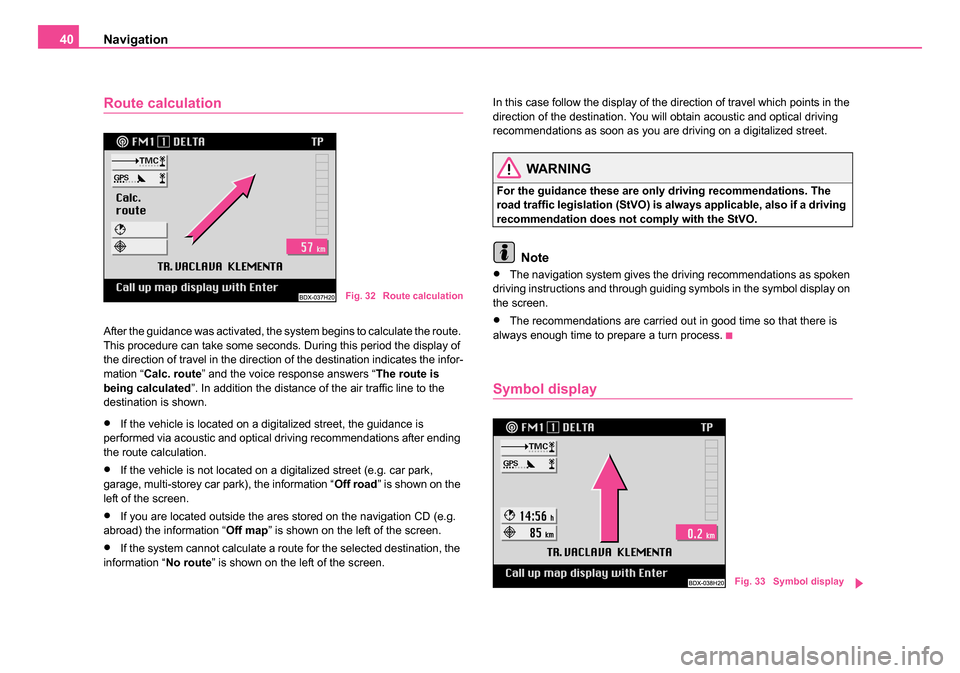
After the guidance was activated, the system begins to calculate the route.
This procedure can take some seconds. During this period the display of
the direction of travel in the direction of the destination indicates the infor-
mation “ Calc. route ” and the voice response answers “ The route is
being calculated ”. In addition the distance of the air traffic line to the
destination is shown.
•If the vehicle is located on a digitalized street, the guidance is
performed via acoustic and optical driving recommendations after ending
the route calculation.
•If the vehicle is not located on a digitalized street (e.g. car park,
garage, multi-storey car park), the information “ Off road” is shown on the
left of the screen.
•If you are located outside the ares stored on the navigation CD (e.g.
abroad) the information “ Off map” is shown on the left of the screen.
•If the system cannot calculate a route for the selected destination, the
information “ No route” is shown on the left of the screen. In this case follow the display of the direction of travel which points in the
direction of the destination. You will obtain acoustic and optical driving
recommendations as soon as you are driving on a digitalized street.
WARNING
For the guidance these are only driving recommendations. The
road traffic legislation (StVO) is always applicable, also if a driving
recommendation does not comply with the StVO.
Note
•The navigation system gives the driving recommendations as spoken
driving instructions and through guiding symbols in the symbol display on
the screen.
•The recommendations are carried out in good time so that there is
always enough time to prepare a turn process.
Symbol display
Fig. 32 Route calculation
Fig. 33 Symbol display
20.book Page 40 Tuesday, December 6, 2005 2:26 PM
Page 42 of 66
Navigation41
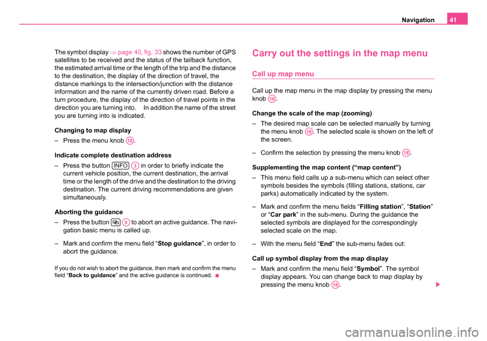
The symbol display ⇒page 40, fig. 33 shows the number of GPS
satellites to be received and the status of the tailback function,
the estimated arrival time or the length of the trip and the distance
to the destination, the display of the direction of travel, the
distance markings to the intersection/junction with the distance
information and the name of the currently driven road. Before a
turn procedure, the display of the direction of travel points in the
direction you are turning into. In addition the name of the street
you are turning into is indicated.
Changing to map display
– Press the menu knob .
Indicate complete destination address
– Press the button in order to briefly indicate the current vehicle position, the current destination, the arrival
time or the length of the drive and the destination to the driving
destination. The current driving recommendations are given
simultaneously.
Aborting the guidance
– Press the button to abort an active guidance. The navi- gation basic menu is called up.
– Mark and confirm the menu field “ Stop guidance”, in order to
abort the guidance.
If you do not wish to abort the guidance, then mark and confirm the menu
field “ Back to guidance” and the active guidance is continued.
Carry out the settings in the map menu
Call up map menu
Call up the map menu in the map display by pressing the menu
knob .
Change the scale of the map (zooming)
– The desired map scale can be selected manually by turning
the menu knob . The selected scale is shown on the left of
the screen.
– Confirm the selection by pressing the menu knob .
Supplementing the map content (“map content”)
– This menu field calls up a sub-menu which can select other symbols besides the symbols (filling stations, stations, car
parks) automatically indicated by the system.
– Mark and confirm the menu fields “ Filling station”, “Station ”
or “ Car park ” in the sub-menu. During the guidance the
selected symbols are displayed for the correspondingly
selected scale on the map.
– With the menu field “ End” the sub-menu fades out:
Call up symbol display from the map display
– Mark and confirm the menu field “ Symbol”. The symbol
display appears. You can change back to map display by
pressing the menu knob .
A18
INFOA3
A9
A18
A18
A18
A18
20.book Page 41 Tuesday, December 6, 2005 2:26 PM
Page 43 of 66
Navigation
42
Note
•If the segment A has been marked and confirmed, the map is
displayed in the auto zoom mode. This means that the map is shown auto-
matically in the correct scale. The correct scale depends on the distance
to the next decision point (e.g. turn point) and the driven road category
(e.g. motorway). The scale changes depending on the distance to the next
decision point ⇒page 43.
•The selected menu fields are marked with a tick.
•Pressing the menu knob deletes the tick again.
Select menu field “Map detail”
Possibilities of the map setting
Alignment of the map:
•in direction of travel
•in direction of destination
•automatic
•to the north
Selection of map type:
•Location map (shows the current vehicle position)
•Overview map (shows the current vehicle position and the destination)
•Destination map (shows the destination)
Move:
•Moving mode for moving the map, in order to view the map details Zoom setting (reduce/enlarge):
•Call up the sub-menu auto zoom for setting the scale on auto zoom
Select menu field “Alignment”
– Confirm the menu field “
Alignment”.
– Mark and confirm the desired alignment in the called up sub- menu. After this the map is shown; the marking of the vehicle
position is placed in the middle of the map.
In Direction of travel - the map is shown in the direction of travel on all
scales and can be altered according to the changes in the direction of
travel.
In direction of destination - the map is aligned in the direction of the
destination.
Automatic - the map is aligned depending on the selected scale:
•1 : 10 000 - 1 : 200 000: in direction of travel (in the display 100 m -
2km)
•1 : 500 000 - 1 : 50 000 000: to the north (in the display 5 km - 500 km)
To t h e n o r t h - the map is aligned to the north.
Note
The selection bar is on the last selected setting when calling up the sub-
menu.
A18
20.book Page 42 Tuesday, December 6, 2005 2:26 PM
Page 44 of 66
Navigation43
Select menu field “Map type”
– Mark and confirm the menu field “ Map type”.
– Mark and confirm the desired map type in the sub-menu called up below. Then the map is displayed.
Location map - Display of the map detail with the current vehicle position.
Scale and alignment of the map are not changed.
Overview map - Display of the current vehicle position and the destina-
tion.
Destination map - Display of the destination. Scale and alignment of the
map are not changed.
Note
•If the overview map is called up in the auto zoom mode, the scale is
constantly adapted when approaching the destination.
•The selection bar is on the last selected setting when calling up the
sub-menu.
Select menu field “Move”
This function is intended for viewing the neighbouring map detail.
– Mark and confirm the menu field “ Move”. Then the map with
the crosshair is displayed.
If the crosshair is moved to the edge of the screen by turning the menu
knob , a neighbouring map detail is called up (see move crosshair
⇒ page 37).
Select menu field“Zoom setting”
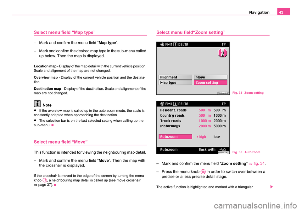
– Mark and confirm the menu field “ Zoom setting” ⇒ fig. 34 .
– Press the menu knob in order to switch over between a precise or a less precise detail stage.
The active function is highlighted and marked with a triangular.
A18
Fig. 34 Zoom setting
Fig. 35 Auto zoom
A18
20.book Page 43 Tuesday, December 6, 2005 2:26 PM
Page 45 of 66

Navigation
44
The distance information (after the road category) gives the scale in which
the map was shown during auto zoom.
Note
The distance information for the individual road categories is fixed and
cannot be changed.
Info mode
Select menu field “Info mode”– Mark and confirm the menu field “ Info mode” in the navigation
basic menu ⇒fig. 36 .
– Then the symbol display is shown ⇒fig. 37 . In order to change
in the map display, press the menu knob .
In the symbol display the direction arrow points to the north. Below the
arrow is indicated the name of the street on which the vehicle is located.
In the map display the current location map is shown in the selected scale.
The same settings apply as for the map display during a guidance.
Fig. 36 Info mode
Fig. 37 Symbol display
A18
20.book Page 44 Tuesday, December 6, 2005 2:26 PM
Page 46 of 66
Navigation45
Destination memory
Overview
The destination menu calls up directly from the navigation basic menu via
the menu field “Destination memory ”. The destination memories are the
alphabetical destination memory and the Top 10 memory .
The alphabetical destination memory contains all destination memory
entries. They are alphabetically classified. Here the destinations can be
stored; edited and selected for the destination entry.
A special memory is the Top 10 memory. Here up to ten frequently used
destination addresses can be stored, edited and selected for the destina-
tion entry.
Select the following destination memory possibilites via the menu fields:
•Store destination in the alphabetical destination memory and in the
Top 10 memory ⇒page 33
•Enter/change short name in the destination memory ⇒page 45
•Edit Top 10 memory ⇒page 46, e. g.: Classify destinations, copy desti-
nations
•Store flagged destination
•Delete destinations from the destination memory ⇒page 48
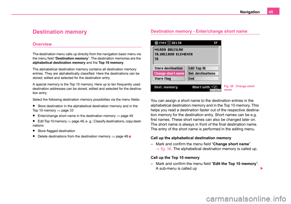
Destination memory - Enter/change short name
You can assign a short name to the destination entries in the
alphabetical destination memory and in the Top 10 memory. This
helps you read a destination faster out of the respective destina-
tion memory for the destination entry. Short names can be e.g.
first names. These short names can also be changed later on.
The short name is always in front of the final destination name.
The entry of the short name is performed in the editing menu.
Call up the alphabetical destination memory
– Mark and confirm the menu field “ Change short name”
⇒ fig. 38 . The alphabetical destination memory is called up.
Call up the Top 10 memory
– Mark and confirm the menu field “ Edit the Top 10 memory”.
A sub-menu is called up
Fig. 38 Change short
name
20.book Page 45 Tuesday, December 6, 2005 2:26 PM
Page 47 of 66
Navigation
46
– Mark and confirm the menu field “ Change short name” in the
sub-menu.
Select list entry
– Mark and confirm the desired entry in the respective destina- tion memory list. The editing menu is called up.
– Enter the desired short name into the editing menu. An already existing short name is deleted when entering the first
characters.
– Confirm the short name by pressing the menu knob for more than two seconds; a triangular appears - the new short
name was stored.
After confirmation of the short name appears either the destination
memory menu or the menu “Edit Top 10”.
From here you can return to the navigation basic menu by pressing the
menu field “ End”.
Note
You will find further information concerning the entering and correction of
a short name in the editing field under ⇒page 26.
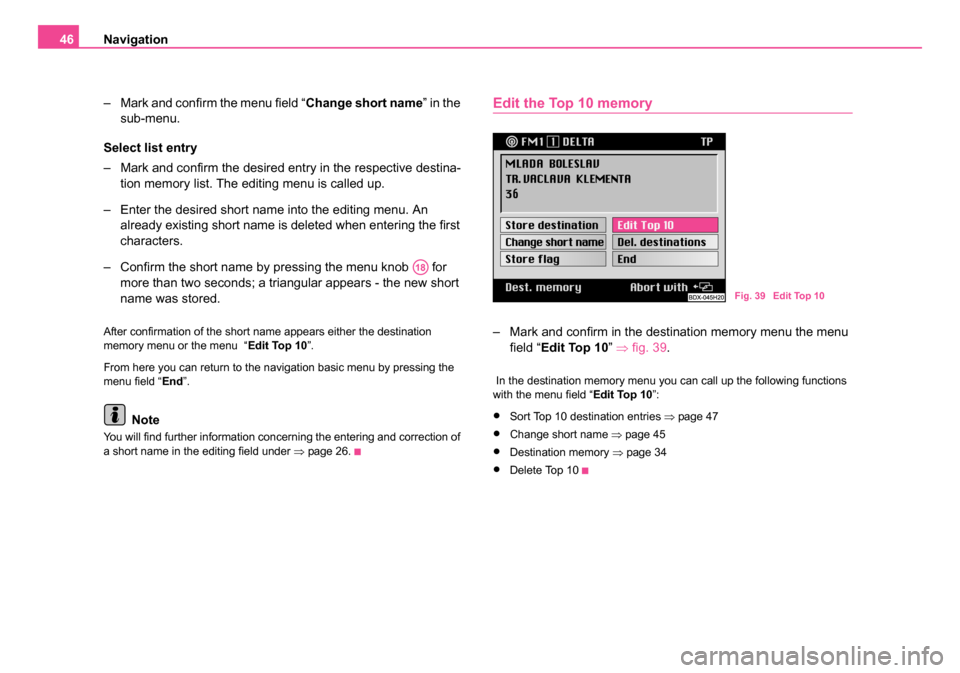
Edit the Top 10 memory
– Mark and confirm in the destination memory menu the menu
field “ Edit Top 10” ⇒fig. 39 .
In the destination memory menu you can call up the following functions
with the menu field “ Edit Top 10”:
•Sort Top 10 destination entries ⇒page 47
•Change short name ⇒page 45
•Destination memory ⇒page 34
•Delete Top 10
A18
Fig. 39 Edit Top 10
20.book Page 46 Tuesday, December 6, 2005 2:26 PM
Page 48 of 66
Navigation47
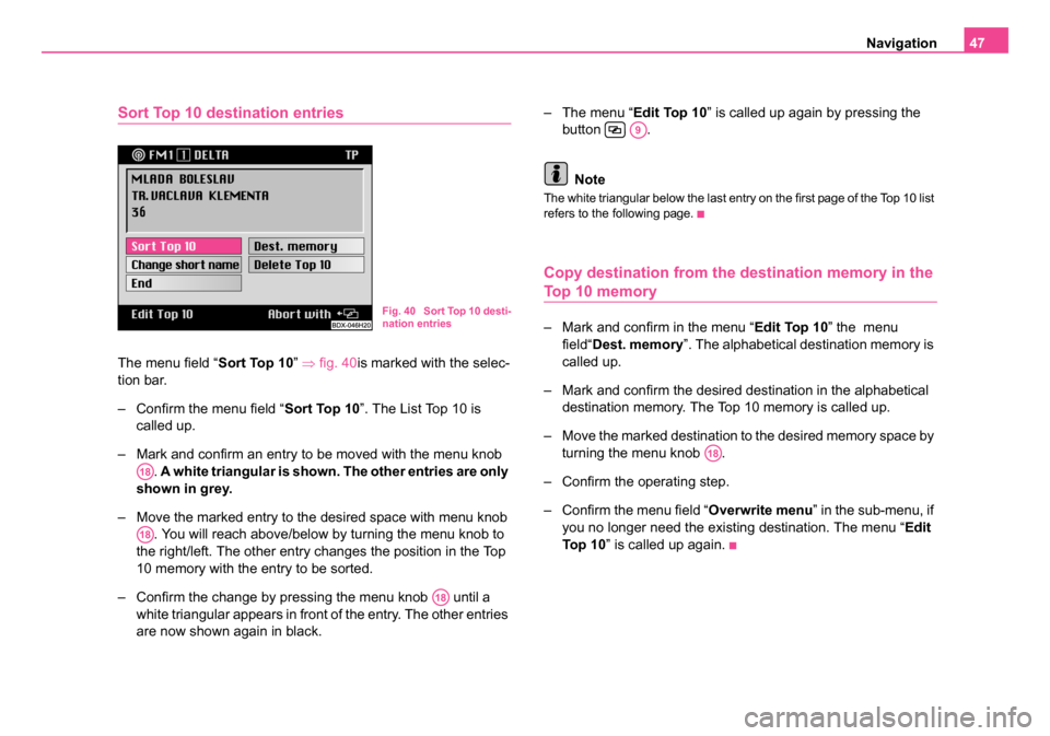
Sort Top 10 destination entries
The menu field “Sort Top 10” ⇒ fig. 40is marked with the selec-
tion bar.
– Confirm the menu field “ Sort Top 10”. The List Top 10 is
called up.
– Mark and confirm an entry to be moved with the menu knob . A white triangular is shown. The other entries are only
shown in grey.
– Move the marked entry to the desired space with menu knob . You will reach above/below by turning the menu knob to
the right/left. The other entry changes the position in the Top
10 memory with the entry to be sorted.
– Confirm the change by pressing the menu knob until a white triangular appears in front of the entry. The other entries
are now shown again in black. – The menu “
Edit Top 10” is called up again by pressing the
button .
Note
The white triangular below the last entry on the first page of the Top 10 list
refers to the following page.
Copy destination from the destination memory in the
Top 10 memory
– Mark and confirm in the menu “ Edit Top 10” the menu
field“ Dest. memory ”. The alphabetical destination memory is
called up.
– Mark and confirm the desired destination in the alphabetical destination memory. The Top 10 memory is called up.
– Move the marked destination to the desired memory space by turning the menu knob .
– Confirm the operating step.
– Confirm the menu field “Overwrite menu ” in the sub-menu, if
you no longer need the existing destination. The menu “ Edit
To p 1 0 ” is called up again.
Fig. 40 Sort Top 10 desti-
nation entries
A18
A18
A18
A9
A18
20.book Page 47 Tuesday, December 6, 2005 2:26 PM
Page 49 of 66
Navigation
48
Delete a destination from the destination memory
You can remove the destinations which are no longer needed
from the alphabetical destination memory and the Top 10
memory. First of all call up the respective memory from the desti-
nation memory menu. Then the entry to be deleted is selected in
the memory. In order to prevent a destination being deleted inad-
vertently, a confimation is asked for.
– Mark and confirm the menu field “ Delete destinations”.
– Mark and confirm in the destination memory menu the menu field “ Edit Top 10 ”. A sub-menu is called up
– Mark and confirm the menu field “ Delete Top 10” in the sub-
menu. The Top 10 memory is called up.
– Mark and confirm the entry to be deleted in the respective destination memory list.
– Confirm the menu field “ Delete destination”, in order to
delete the entry from the alphabetical destination memory.
The destination memory list is called up again. If required
other destinations can be deleted. Menu field “ Abort” - aborts
the deletion process and calls up again the destination
memory list.
– Confirm the menu field “ Delete from Top 10”. The destination
is deleted from the Top 10 memory and the menu “ Edit Top
10 ” is called up. Menu field “ Delete all” - also deletes the
destination from the alphabetical destination memory. NoteIf the destination to be deleted is also entered in the TOP 10 memory, the
message “
N.B. Top 10 destination ” appears in the menu bar. When
confirming the menu field “ Del. Destination” the destination is also
removed from the Top 10 memory.
Automatic tailback function (for units
with dynamic navigation)
Important information
The unit is prepared technically for dynamic navigation. For the availability
of this function, the following requirements apply:
•Navigation CD must assist the dynamic navigation
•at least one TMC station must be receiveable
Please do not hesitate to contact your Škoda Service Partner should you
have any further questions regarding this matter.
What is dynamic navigation?
The dynamic navigation enables an automatic adaptation of the calcu-
lated route on the basis of the receiveable traffic reports.
The traffic reports are not audibly emitted by different broadcasting
stations in addition to the radio program via a TMC (Traffic Message
Channel).
The navigation system receives this data via a separate TMC box and
evaluates it. If a traffic report is received, which is of great importance for
the calculated route, the route is automatically recalculated.
20.book Page 48 Tuesday, December 6, 2005 2:26 PM
Page 50 of 66
Navigation49
The traffic reports are shown in the map display by means of symbols:
• slow-moving traffic
• traffic jam
• closed road
The corresponding stretch of the journey is shown in the map display by
a dotted line.
So that you can use the dynamic navigation, a radio station must be able
to receive the traffic reports emitted via TMC. The TMC box selects auto-
matically a TMC station; you can also manually select another station.
Note
The proper functioning of the automatic route influence depends on
the transmitted traffic reports. The radio stations broadcasting the
traffic reports are responsible for its content.
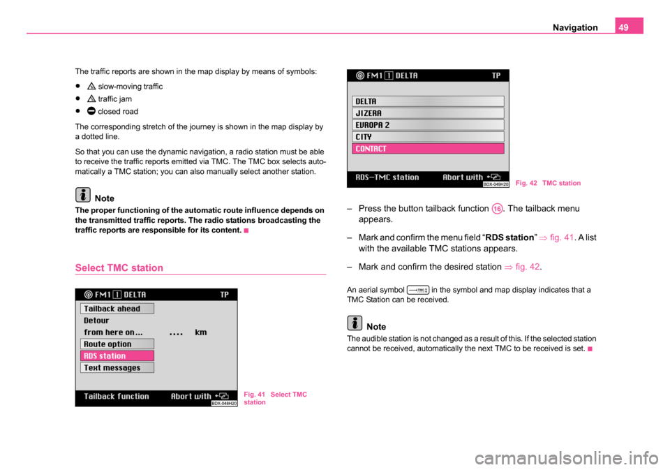
Select TMC station
– Press the button tailback function . The tailback menu appears.
– Mark and confirm the menu field “ RDS station” ⇒ fig. 41 . A list
with the available TMC stations appears.
– Mark and confirm the desired station ⇒fig. 42 .
An aerial symbol in the symbol and map display indicates that a
TMC Station can be received.
Note
The audible station is not changed as a result of this. If the selected station
cannot be received, automatically the next TMC to be received is set.
Fig. 41 Select TMC
station
Fig. 42 TMC station
A16
20.book Page 49 Tuesday, December 6, 2005 2:26 PM