navigation update SKODA YETI 2014 1.G / 5L Amundsen Infotainment Navigation System Manual
[x] Cancel search | Manufacturer: SKODA, Model Year: 2014, Model line: YETI, Model: SKODA YETI 2014 1.G / 5LPages: 88, PDF Size: 8.18 MB
Page 25 of 88
■Bluetooth - Switch on/off Bluetooth ®
function
■ Visibility: - Switch on/off the visibility of the Bluetooth ®
device for other de-
vices
■ Visible - Visibility is always on
■ Hidden - Visibility is off
■ Name: - Open the input screen with keyboard - Change the device name
■ Paired devices - Display the list of paired Bluetooth ®
devices; connect or de-
lete a paired device; delete the list of paired devices ■ Delete all - Delete all paired Bluetooth ®
devices
■ - Delete the paired Bluetooth ®
device
■ Find devices - Searches for available external devices with enabled Blue-
tooth ®
functions and activated visibility
■ Bluetooth audio (A2DP/AVRCP) - Switch on/off the connection option for
Bluetooth ®
profiles A2DP or AVRCP 1)
System Information
›
Press the button
→
→ System Information .
■ Device part number: ... - Part number of the unit
■ Hardware: ... - Version of the hardware used
■ Software: ... - Version of the software used
■ Navigation database: ... - Version of the navigation data
■ Media Codec: ... - Media codec version
■ Update software - the function key for the software update
The information about available software updates can be found on the ŠKODA
Internet pages www.infotainment.skoda-auto.com .
1)
A2DP or AVRCP are Bluetooth®
profiles that support multimedia functions.
22Familiarization with the unit
Page 60 of 88
Navigation
Description of the navigation system
Preface to navigation
Introduction
This chapter contains information on the following subjects:
Navigation data
57
Main menu
58
Map display
58
Map Orientation
59
Map scale
59
Options for map display
60
Split screen
60
First and foremost, pay attention to the safety instructions » page 7 , Impor-
tant notes .
The unit uses the GPS (Global Positioning System) satellite system for route
guidance. The satellite signal allows you to determine your current vehicle po-
sition.
Outside the range of the GPS satellite signal (e.g. in dense vegetation, in tun-
nels, parking garages, etc.), the unit navigates only with restrictions using on-
vehicle sensors.
The route guidance is as follows.
› With graphical driving recommendations in the device screen and MAXI DOT
display.
› With navigation announcements.
WARNING■
Information about traffic lights, stop and right of way signs, parking and
stopping restrictions as well as lane constrictions and speed restrictions is
not taken into account for route guidance by the unit.■
The navigation announcements provided may vary from the actual situa-
tions, e.g. due out-of-date navigation data.
■
The volume should be adjusted to ensure that acoustic signals from out-
side, e.g. sirens from vehicles which have the right of way, such as police,
ambulance and fire brigade vehicles, can be heard at all time.
CAUTIONIn some countries, some unit features can no longer be selected when the ve-
hicle is running faster than a certain speed. This is not a malfunction, but com-
plies with the national legal regulations.
Navigation data
Read and observe
and on page 57 first.
Navigation data source
You received the SD memory card with navigation data together with the unit.
For correct functioning of the device, the card must be inserted into slots
12
or
13
» Fig. 1 on page 7 during the entire route guidance.
Insert the memory card » page 33, SD memory card .
Data update
The navigation data is subject to constant changes (such as new streets,
changes of street names and house numbers) and are no longer valid after
some time. Therefore the route guidance may be inaccurate of incorrect. We
recommend that you update the navigation data on a regular basis.
For more information on updating the data, please visit the ŠKODA website
www.infotainment.skoda-auto.com or contact a ŠKODA Partner.
The version of the navigation data for maps can be found in the navigation
settings
→
→ Version information .
Card has been damaged or lost
If the SD memory card with the navigation data has been damaged or lost, a
new card can be obtained from ŠKODA original accessories. The navigation da-
ta can be loaded only on the original card.
57Description of the navigation system
Page 64 of 88
Traffic signs
The device offers the possibility to display the road signs in the information
display and the device screen of the data stored in the navigation information
of the map data.
Switching on the traffic sign display function » page 62.
Satellite data
The unit offers the possibility to show in the split screen display the following
Satellite data » Fig. 34 information about the current geographical position of
the vehicle.
longitude 1)
latitude 1)
elevation 2)
Number of received/available satellites
Settings
Introduction
This chapter contains information on the following subjects:
Main menu settings
61
Route options
61
Map
62
Fuel options
62
Navigation announcements
62
Advanced settings
62
Manage memory
62
First and foremost, pay attention to the safety instructions » page 7 , Impor-
tant notes .
The setting of the Navigation influences, for example the route calculation,
the type of route guidance or the map display.
Main menu settings›
Press in the menu Navigation function key
.
■ Route options - Set the parameters for route calculation » page 61
■ Map - Settings for the map display » page 62
■ Fuel options - Select preferred fuel station; switch on/off reminder of low
fuel level warning with the possibility to find the nearest fuel sta-
tion » page 62
■ Nav. announcements - Set the volume and the type of the navigation an-
nouncements » page 62
■ Advanced setup - Display additional information » page 62
■ Manage memory - Sort contacts, enter your home address, and delete desti-
nations » page 62
■ Import destinations - Import custom destinations previously pre-
pared » page 67
■ Version information - Displays the current version of the navigation data
with the possibility to update or load personal POIs » page 68
■ Top speeds - Display of maximum country-specific speed limits
Route options
›
Press in the menu Navigation function key
→ Route options .
■ Suggest 3 alternative routes - Switch on/off manual selection of the route
type (economical, fast, short) » page 70
■ Route: - Automatic selection of the preferred route type (manual route selec-
tion is switched off)
■ Economical - Calculate the most economical route with shortest travelling
time and distance travelled – the route is highlighted green
■ Fast - Calculate the fastest route to the destination, even if a detour is nec-
essary - the route is highlighted red
■ Short - Calculate the shortest route to the destination, even if a longer
travelling time is required - the route is highlighted orange
■ Dynamic route - Switch on/off continuous route calculation using TMC traffic
reports » page 72
■
Avoid motorways - switches on/off the use of motorways
1)
To view the information on the longitude and latitude of the current vehicle position display requires the
reception of GPS signals from at least three satellites.
2)
Display of elevation requires the reception of GPS signals from at least five satellites. Route guidance
must not be running in demo mode.
61Description of the navigation system
Page 65 of 88
■ Avoid ferries and motorail trains - Switch use of ferries and motorail
trains on/off
■ Avoid toll roads - Switch on/off use of toll roads
■ Avoid tunnels - Switch use of tunnels on/off
■ Avoid routes requiring toll stickers - Switch use of routes requiring toll
stickers on/off
■ Available toll stickers - Choose the use of toll roads for respective countries
(the choice is only available when the function Avoid routes requiring toll
stickers is on)
Map
›
Press in the menu Navigation function key
→ Map .
■ Lane guidance - Switch on/off the display with the recommended lane for
complicated intersections » page 71
■ Show favourites - Switch on/off the display of favourites
■ Show road signs - Switch on/off the display of traffic signs
■ Show POIs - Switch on / off the display of POIs (additional menu items ap-
pear only when this function is turned off)
■ Select categories for POIs - Select POIs that can be displayed on the map
from a list of available POIs (max. 10 POI categories) » page 69
■ Show brands for POIs - Switch on/off the display company logos at the POIs
Fuel options
›
Press in the menu Navigation function key
→ Fuel options .
■ Select preferred fuel station - Setting for the preferred fuel station brand
(the selected markers appear in the search on the first three positions of the
list, even if a different, non-preferred brand fuel station is closer)
■ Fuel warning - Switch on / off the display of the warning (when the pointer
of the fuel gauge reaches the reserve area)
When the pointer of the fuel gauge reaches the reserve area, a screen appears
when the function Fuel warning is switched on with the warning message
Warning: fuel tank almost empty. Would you like to find a fuel station near-
by? with the following menu items.
› Cancel
- Close the window with the warning
› Search
- Search for the nearest fuel station; when you select the fuel station,
the new route will be calculated from your current position
Navigation announcements›
Press in the menu Navigation function key
→ Navigation announce-
ments .
■ Volume - Volume control of the navigation announcements
■ No voice guidance during call - Enable / disable the navigation prompts dur-
ing a telephone conversation
Advanced settings
›
Press in the menu Navigation function key
→ Advanced setup .
■ Time display: - Select the time to be displayed in the status line
■ Time of arrival - displays the expected time to destination
■ Travelling time - Display the expected travelling time to the destination
■ Status line: Status line - Display information about your selected destination
in the status line ■ Destination - Display information about the distance and duration of the
guidance to the destination
■ Next stopover - Display information about the distance and duration of the
guidance to the stopover
■ Note: national border crossed - Switch on/off the display of the information
window with speed limits when crossing the national border
■ Demo mode - Switch on/off guidance in demo mode
■ Define demo mode starting point - Enter the start point of the route guid-
ance for the demo mode ■ Cancel - Cancel the entry
■ Position - Select the current vehicle position as the starting point
■ Address - Select an address as the starting point
Manage memory
›
Press in the menu Navigation function key
→ Manage memory .
■ Sort by: - Sort contacts imported from a connected telephone
■ Name - according to contact surname
■ Name - according to contact first name
■ Define home address - Enter / show / edit the home address » page 67,
Home address
■ Delete my POIs - Delete saved personal points of interest
■ Update my POIs (SD card) - Update / import personal POIs
62Navigation
Page 75 of 88
The navigation announcements can be repeated by pressing the right control-
ler 2 » Fig. 1 on page 7 .
The timing of the navigation announcement depends on the type of road and
the driving speed. For example, on motorways the first announcement is heard
about 2000 m (6000 ft) before the location of the motorway exit.
During dynamic route guidance, the unit notifies the driver of traffic problems. If a new route is calculated due to a traffic obstruction a corresponding mes-
sage appears in the devices screen Calculating the route…
It is possible to set the output volume of the navigation announcements, the
type of announcement or turning off during a phone conversation » page 62,
Navigation announcements .
Route
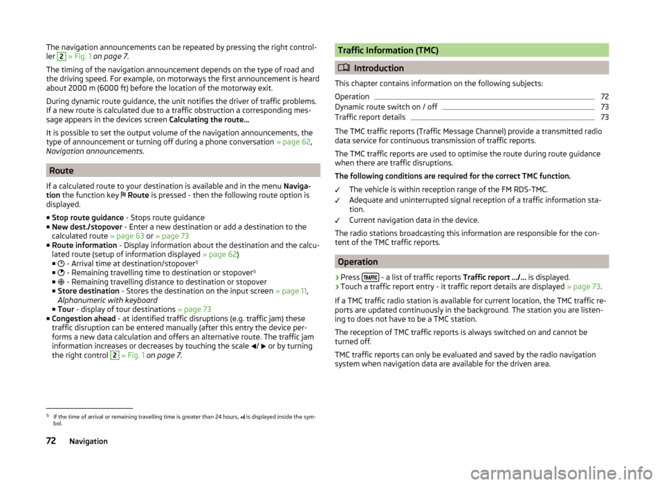
If a calculated route to your destination is available and in the menu Naviga-
tion the function key
Route is pressed - then the following route option is
displayed.
■ Stop route guidance - Stops route guidance
■ New dest./stopover - Enter a new destination or add a destination to the
calculated route » page 63 or » page 73
■ Route information - Display information about the destination and the calcu-
lated route (setup of information displayed » page 62)
■ - Arrival time at destination/stopover 1)
■ - Remaining travelling time to destination or stopover 1)
■ - Remaining travelling distance to destination or stopover
■ Store destination - Stores the destination on the input screen » page 11,
Alphanumeric with keyboard
■ Tour - display of tour destinations » page 73
■ Congestion ahead - at identified traffic disruptions (e.g. traffic jam) these
traffic disruption can be entered manually (after this entry the device per-
forms a new data calculation and offers an alternative route. The traffic jam
information increases or decreases by touching the scale /
or by turning
the right control
2
» Fig. 1 on page 7 .
Traffic Information (TMC)
Introduction
This chapter contains information on the following subjects:
Operation
72
Dynamic route switch on / off
73
Traffic report details
73
The TMC traffic reports (Traffic Message Channel) provide a transmitted radio
data service for continuous transmission of traffic reports.
The TMC traffic reports are used to optimise the route during route guidance when there are traffic disruptions.
The following conditions are required for the correct TMC function.
The vehicle is within reception range of the FM RDS-TMC.
Adequate and uninterrupted signal reception of a traffic information sta-
tion.
Current navigation data in the device.
The radio stations broadcasting this information are responsible for the con-
tent of the TMC traffic reports.
Operation
›
Press - a list of traffic reports
Traffic report …/… is displayed.
›
Touch a traffic report entry - it traffic report details are displayed » page 73.
If a TMC traffic radio station is available for current location, the TMC traffic re-
ports are updated continuously in the background. The station you are listen-
ing to does not have to be a TMC station.
The reception of TMC traffic reports is always switched on and cannot be
turned off.
TMC traffic reports can only be evaluated and saved by the radio navigation
system when navigation data are available for the driven area.
1)
If the time of arrival or remaining travelling time is greater than 24 hours, is displayed inside the sym-
bol.
72Navigation
Page 76 of 88
Dynamic route switch on / off›
Press in the menu Navigation function key
→ Route options → Dynamic
route .
The TMC traffic reports affect the route guidance when the function Dynamic
route » page 61 is switched on.
Dynamic route guidance can also be switched on / off during active route guid-
ance.
Dynamic route switched on
Information on traffic problems which affect the route are displayed in the
map by means of a coloured symbol (e.g., ,
,
, etc.). Traffic problems,
which do not affect the route, are displayed in the map by means of a grey
symbol. The direction in which a traffic problem is found, is displayed by means
of an arrow in the symbol.
Dynamic route switched off
You are not alerted to received traffic disruptions along your route and are gui-
ded through this traffic disruption by the radio navigation system. The traffic
reports are updated automatically in the unit and displayed by pressing
.
If there is a traffic obstruction on your route the route can be locked manually
by entering a traffic jam » page 72, Route .
Note
Making a diversion from a traffic jam based on TMC traffic reports may not al-
ways offer a time advantage, e.g. if the diversion route is also congested.
Traffic report details
Pressing
causes the following information to be displayed:
■ Function key All - show all traffic information.
■ Function key Route - only display the traffic information on the current route.
■ A map showing the traffic obstruction.
■ Window with the following information.
■ Location of event, the accuracy depends on the timeliness of the naviga-
tion data.
■ Description of up to three events related to the respective information.
■ Description of the direction with respect to the event.
■ Probable duration of the event.
■ Additional information, such as probable delay time.
■
An information line, on how current the information is and on the provider
of the message.
■ Symbol that specifies the type of information.
■ - zoom in window with described traffic obstruction.
■ - zoom out window with described traffic obstruction.
■ - show previous traffic information.
■ - show the following traffic information.
■ - display list of all received traffic messages.
My tour
Introduction
This chapter contains information on the following subjects:
New Tour / Tour editing
73
Tour memory
74
First and foremost, pay attention to the safety instructions » page 7 , Impor-
tant notes .
This chapter discusses the procedure for route entry and route processing or
storage.
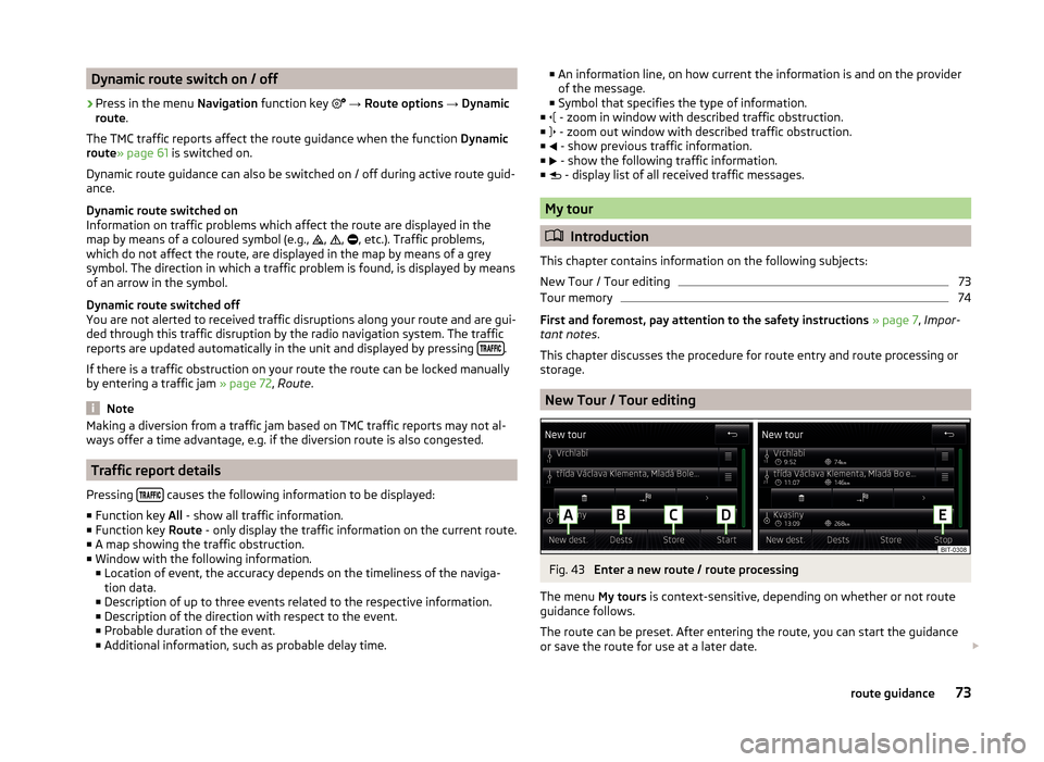
New Tour / Tour editing
Fig. 43
Enter a new route / route processing
The menu My tours is context-sensitive, depending on whether or not route
guidance follows.
The route can be preset. After entering the route, you can start the guidance
or save the route for use at a later date.
73route guidance
Page 80 of 88
Index
A
Abort route guidance
71
Additional keyboard languages21
Additional telephone40
Alphanumeric with keyboard11
AM23
Anti-theft protection7
Audio Media
29
Radio23
Audio source31
Automatic turning off of the device8
AUX34
B
Bluetooth Settings
21
Switch on/off21
Update22
Visibility21
Bluetooth - profile40
Bluetooth Player33
Breakdown service47
C
Call list Call list
50
Communication38
Component protection7
Conditions for coupling43
Conference call51
Connect device connected to a telephone
46
connected to two telephones46
more options of the telephone search46
no telephone connected46
Control lever15
Coupled device connected to a telephone
43
connected to two telephones44
more options of the telephone search44
Couple device no telephone connected
43
Couple telephone Telephone to the device
44
Custom destination67
D
DAB
23
Additional information24
Radio text and pictures presentation24
Settings27
Data transmission of mobile devices21
Delete the telephone from the list of paired de- vices
45
Demo mode62
Description of the device7
Destination Custom destination
67
Favourite75
Flagged destination66
GPS coordinates65
Home address67
Image with GPS67
Input options63
List of saved destinations66
Map point65
POI67
Storage75
Street address64
Destination details75
Destination management74
Destination details75
Favourite75
Stopover74
Storage75
Device connect to the telephone45
Disconnection47
Pair with your telephone42
Device language20
Device menu Radio
23
Device menus Device Settings
20
Media29
MirrorLink54
Navigation57
Pictures36
Sound19
Telephone38
Device operation Control lever
15
Device screen10
MAXI DOT display11
Multi-function steering wheel12
Multifunction steering wheel13, 14
device screen keyboard
11
Device screen20
Area10
important information8
Maintenance8
Operation10
Dial telephone number47
Digital radio reception27
DTMF50
Dynamic route switch on / off
73
E
Extra window on / off
60
F
Factory settings
21
77Index
Page 83 of 88
R
Radio
23
DAB settings27
FM - settings27
Frequency range24
List of available stations24
Main menu23
Multi-function steering wheel12
Operation23
Preface23
Save station25
Search for station25
Select station25
Settings27
Station Logo26
Traffic programme (TP)26
Voice control15
Radio station Logo
26
Save station25
Search for station25
Select station25
Radio station logo26
Route72
Route calculation70
Route info.72
Route list72
Route options61
S
Safe removal of the signal source
21
Satellite details61
Saved destinations66
Save radio station25
Screen see device screen
8
Screen display10
SD memory card33
Select frequency range See main menu23
Select radio station See main menu
23
Select source Images
37
Media32
Settings Additional keyboard languages
21
Bluetooth21
DAB27
Device19, 20
Device language20
Device screen20
FM27
Images37
Keyboard21
Language20
Manage favourites49
Media31
MirrorLink55
Navigation61
Radio27
Restore factory settings21
Software Update22
Sound19
System Information22
Telephone41
User profile49
Voice control21
Volume9
Setup20
SMS52
new52
Operation51
received53
Software Update22
Sound19
Split screen Audio60
Compass60
Manoeuvre60, 71
Menus60
on / off60
Road sign60
Satellite data60
Station See main menu radio
23
Status line10
Navigation62
Telephone39
Stopover73, 74
Street address64
T
telephone conditions for coupling
43
Telephone38
Additional telephone40
Bluetooth - profile40
Breakdown service47
Call list50
Conference call51
Connection - a connected telephone 46
Connection - more options of the telephone search
46
Connection - no telephone connected 46
Connection - two telephones connected 46
Connect telephone to the device44
connect to the device45
Coupling - connected telephone 43
Coupling - more options of the telephone search
44
Coupling - no telephone connected 43
Coupling - two telephones connected 44
Delete the telephone from the list of paired devices
45
Dial telephone number47
80Index