VAUXHALL MOKKA 2014 Infotainment system
Manufacturer: VAUXHALL, Model Year: 2014, Model line: MOKKA, Model: VAUXHALL MOKKA 2014Pages: 221, PDF Size: 4.66 MB
Page 131 of 221
Navigation131
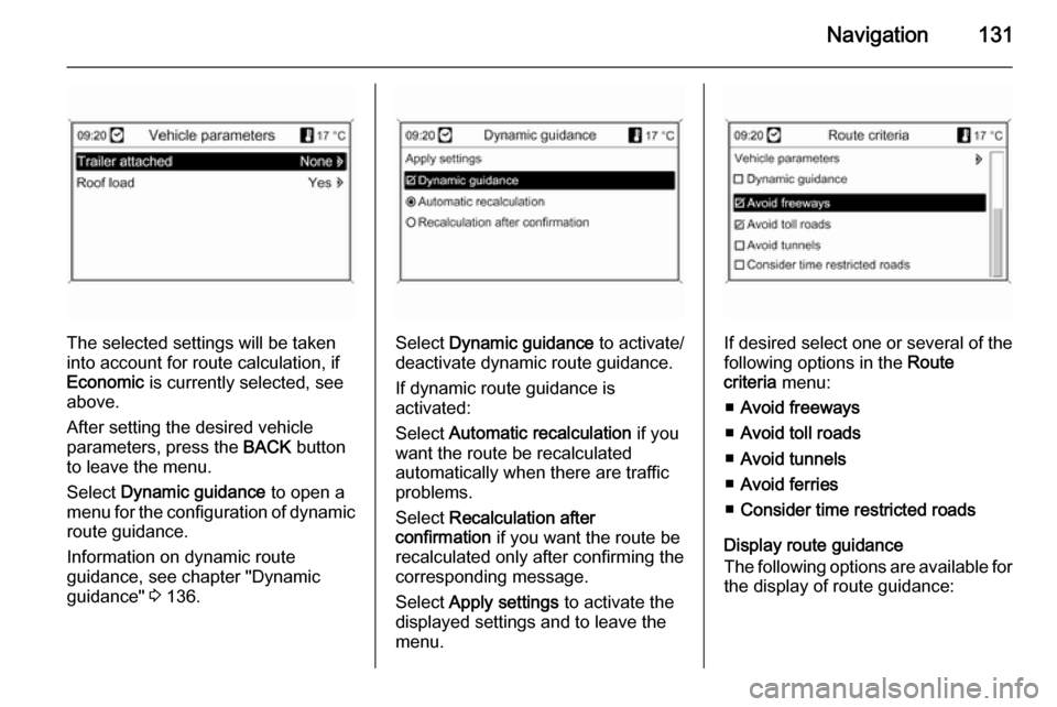
The selected settings will be taken
into account for route calculation, if
Economic is currently selected, see
above.
After setting the desired vehicle
parameters, press the BACK button
to leave the menu.
Select Dynamic guidance to open a
menu for the configuration of dynamic route guidance.
Information on dynamic route
guidance, see chapter "Dynamic
guidance" 3 136.Select Dynamic guidance to activate/
deactivate dynamic route guidance.
If dynamic route guidance is
activated:
Select Automatic recalculation if you
want the route be recalculated
automatically when there are traffic
problems.
Select Recalculation after
confirmation if you want the route be
recalculated only after confirming the
corresponding message.
Select Apply settings to activate the
displayed settings and to leave the menu.If desired select one or several of the
following options in the Route
criteria menu:
■ Avoid freeways
■ Avoid toll roads
■ Avoid tunnels
■ Avoid ferries
■ Consider time restricted roads
Display route guidance
The following options are available for
the display of route guidance:
Page 132 of 221
132Navigation
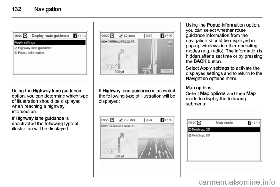
Using the Highway lane guidance
option, you can determine which type of illustration should be displayed
when reaching a highway
intersection.
If Highway lane guidance is
deactivated the following type of
illustration will be displayed:If Highway lane guidance is activated
the following type of illustration will be displayed:
Using the Popup information option,
you can select whether route
guidance information from the
navigation should be displayed in pop-up windows in other operating
modes ( e.g. radio). The information is
hidden after a set time or by pressing
the BACK button.
Select Apply settings to activate the
displayed settings and to return to the Navigation options menu.
Map options
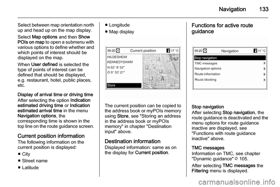
Select Map options and then Map
mode to display the following
submenu:
Page 133 of 221
Navigation133
Select between map orientation north
up and head up on the map display.
Select Map options and then Show
POIs on map to open a submenu with
various options to define whether and
which points of interest should be
displayed on the map.
When User defined is selected the
type of points of interest can be
defined that should be displayed,
e.g. restaurant, hotel, public places,
etc.
Display of arrival time or driving time
After selecting the option Indication
estimated driving time or Indication
estimated arrival time in the menu
Navigation options , the
corresponding time is shown in the
top line on the route guidance screen.
Current position information
The following information on the
current position is displayed:
■ City
■ Street name
■ Latitude■ Longitude
■ Map display
The current position can be copied to the address book or myPOIs memory
using Store, see "Storing an address
in the address book or myPOIs memory" in chapter "Destination
input" above.
Destination information Displayed information: same as on
the display for Current position .
Functions for active route
guidance
Stop navigation
After selecting Stop navigation , the
route guidance is deactivated and the
menu options for route guidance
inactive are displayed, see
"Functions with route guidance
inactive" above.
TMC messages
Information on TMC, see chapter
"Dynamic guidance" 3 105.
After selecting TMC messages the
Filtering menu is displayed.
Page 134 of 221
134Navigation
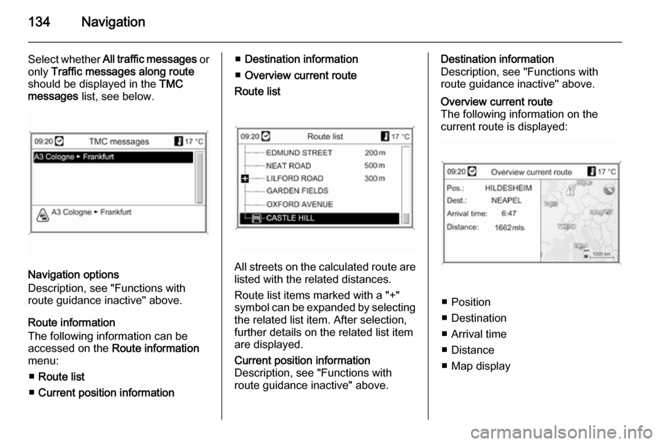
Select whether All traffic messages or
only Traffic messages along route
should be displayed in the TMC
messages list, see below.
Navigation options
Description, see "Functions with
route guidance inactive" above.
Route information
The following information can be
accessed on the Route information
menu:
■ Route list
■ Current position information
■Destination information
■ Overview current route
Route list
All streets on the calculated route are
listed with the related distances.
Route list items marked with a "+"
symbol can be expanded by selecting the related list item. After selection,
further details on the related list item
are displayed.
Current position information
Description, see "Functions with
route guidance inactive" above.Destination information
Description, see "Functions with
route guidance inactive" above.Overview current route
The following information on the
current route is displayed:
■ Position
■ Destination
■ Arrival time
■ Distance
■ Map display
Page 135 of 221
Navigation135
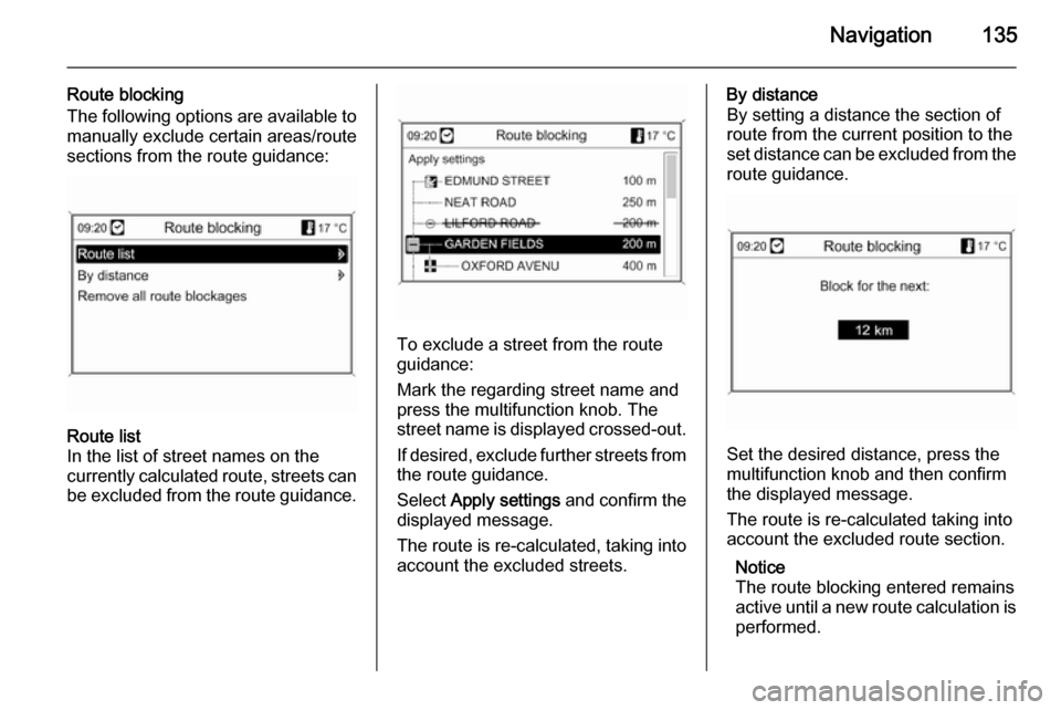
Route blocking
The following options are available to manually exclude certain areas/route
sections from the route guidance:Route list
In the list of street names on the
currently calculated route, streets can
be excluded from the route guidance.
To exclude a street from the route
guidance:
Mark the regarding street name and
press the multifunction knob. The
street name is displayed crossed-out.
If desired, exclude further streets from
the route guidance.
Select Apply settings and confirm the
displayed message.
The route is re-calculated, taking into account the excluded streets.
By distance
By setting a distance the section of
route from the current position to the
set distance can be excluded from the
route guidance.
Set the desired distance, press the
multifunction knob and then confirm
the displayed message.
The route is re-calculated taking into
account the excluded route section.
Notice
The route blocking entered remains
active until a new route calculation is
performed.
Page 136 of 221
136Navigation
Remove all route blockages
After selecting this option, all areas/
route sections previously selected as
to be excluded from the route
guidance will be taken into account
again for route guidance.
Dynamic guidance
If dynamic route guidance is active,
the entire current traffic situation that
the Infotainment system receives via
TMC is included in the calculation of
the route. The route is suggested
taking into account all traffic problems
or restrictions as per pre-set criteria
(e.g. "shortest route", "avoid
freeways" etc.).
In the case of a traffic problem (e.g.
traffic jam, closed road) on the route driven, a message is displayed and a
voice message output indicating the
nature of the problem. The driver can decide whether to drive around the
traffic problem taking the suggested
change to the route or to carry on
through the traffic problem.Nearby traffic problems are also
reported if route guidance is not
active.
If route guidance is active, the system
continuously checks, based on the
traffic information, whether it would
be better to recalculate the route or
take an alternative route taking into
account the current traffic situation.
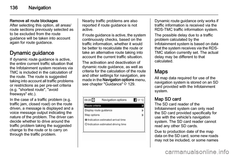
The activation and deactivation of
dynamic route guidance, as well as
criteria for the calculation of the route
and other settings for navigation, are
made in the Navigation options menu,
see chapter "Guidance" 3 129.Dynamic route guidance only works if
traffic information is received via the
RDS-TMC traffic information system.
The possible delay due to a traffic
problem calculated by the
Infotainment system is based on data
that the system receives via the RDS- TMC station currently set. The actual
delay may be different to that
calculated.
Maps
All map data required for use of the
navigation system is stored on an SD card provided with the Infotainment
system.
Map SD card
The SD card reader of the
Infotainment system can only read
the SD card provided specifically for
use with the vehicle's navigation
system. The SD card reader cannot
read any other SD cards.
Due to production date of the map
data on the SD card, some new roads may not be included, or some names
Page 137 of 221
Navigation137
and roads may differ from those in
use at the time the map data was produced.
To order additional SD cards or an
update of the map data, contact your
Opel Service Partner.
Replacing a map SD card, see below .
Important information on SD card
handlingCaution
Never attempt to use an SD card
that has been cracked, deformed
or repaired using adhesive tape.
Doing so may damage the
equipment.
■ Handle the SD card with care. Never touch the metal contacts.
■ Do not use any conventional cleaner, benzine, thinner, or
antistatic spray.
■ If you need to clean the SD card, use a soft cloth.
■ Do not bend the SD card. Do notuse any SD card that is bent or
cracked.
■ Do not put any sticker or write anything on either surface.
■ Do not store the SD card in locations exposed to direct
sunlight, or in high temperatures or
humidity.
■ Always place the SD card in its storage case, when not in use.
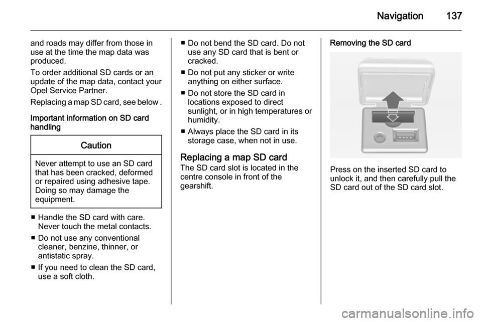
Replacing a map SD card
The SD card slot is located in the
centre console in front of the
gearshift.Removing the SD card
Press on the inserted SD card to
unlock it, and then carefully pull the
SD card out of the SD card slot.
Page 138 of 221

138Navigation
Inserting the SD card
Push the SD card with the cut-out
edge on the left side (see image
above) carefully into the SD card slot
until the card engages.
Notice
The SD card and SD card slot must
always be kept clean and dry.
Page 139 of 221

Navigation139Symbols overview
Page 140 of 221

140Navigation
No.Explanation1Current position (map)2Destination3Current position (route list)4not available5not available6Fog7Road works8Slippery road9Smog10Snow11Storm12Caution/warning13Closed road14Dense traffic15Traffic jam16Narrow lanes17Open listNo.Explanation18Closed list19Shopping centre20Toll road21Tourist information22Sight23Sport & leisure24Going out25Museum26Car rental27Travel information28Leisure activity29Provision of services30Cash machine31Bus station32Camp site