VOLKSWAGEN ID.5 2022 Owners Manual
ID.5 2022
VOLKSWAGEN
VOLKSWAGEN
https://www.carmanualsonline.info/img/18/55710/w960_55710-0.png
VOLKSWAGEN ID.5 2022 Owners Manual
Trending: Page 81, Tyre monitoring, phone, power steering, Rear, mirrors, technical data
Page 241 of 417
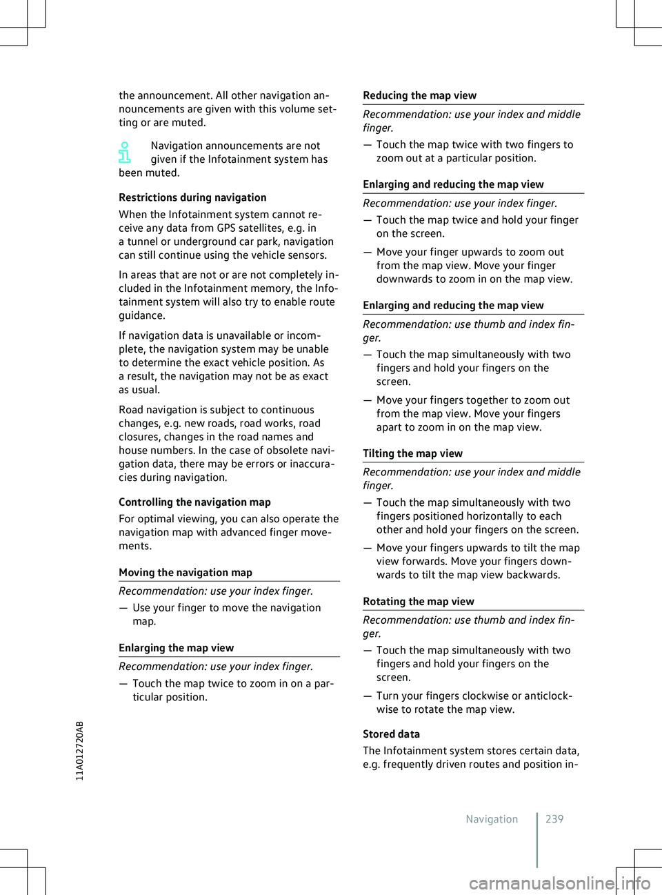
the announcement. All other navigation an-
nouncements are giv
en with this volume set-
ting or are muted.
Navigation announcements are not
given if the Infotainment system has
been muted.
Restrictions during navigation
When the Infotainment system cannot re-
ceive any data from GPS satellites, e.g. in
a tunnel or underground car park, navigation
can still continue using the vehicle sensors.
In areas that are not or are not completely in-
cluded in the Infotainment memory, the Info-
tainment system will also try to enable route
guidance.
If navigation data is unavailable or incom-
plete, the navigation system may be unable
to determine the exact vehicle position. As
a result, the navigation may not be as exact
as usual.
Road navigation is subject to continuous
changes, e.g. new roads, road works, road
closures, changes in the road names and
house numbers. In the case of obsolete navi-
gation data, there may be errors or inaccura-
cies during navigation.
Controlling the navigation map
For optimal viewing, you can also operate the
navigation map with advanced finger move-
ments.
Moving the navigation map 239
11A012720AB
Page 242 of 417
formation, to enable you to enter destina-
tions quickly and to optimise route guidance.
Deleting stored data
Basic functions Delete usage pattern.
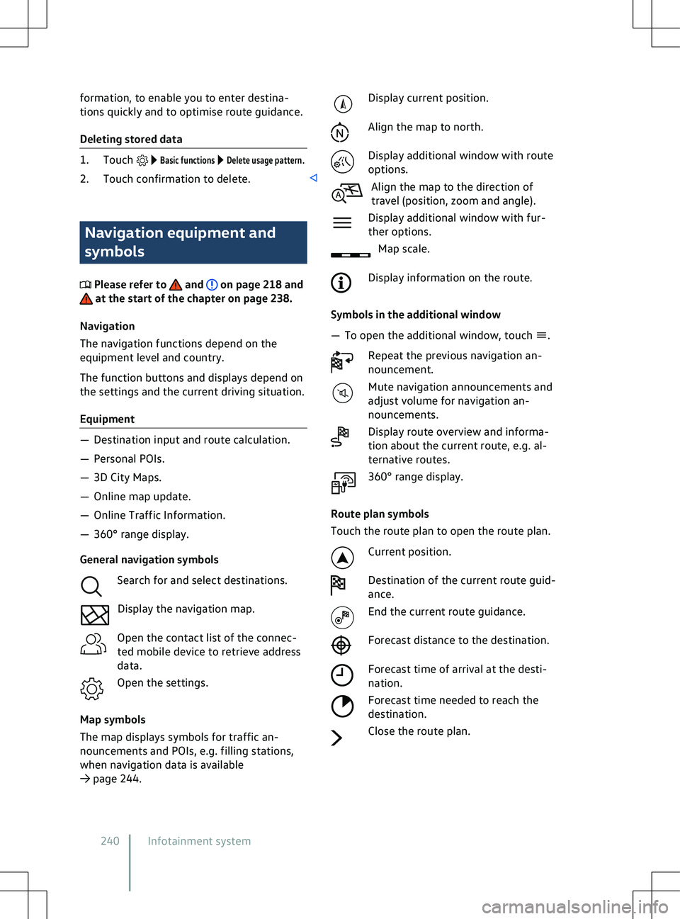
2. Touch confirmation to delete. Navigation equipment and
symbols
Please refer to and on page 218 and
at the start of the chapter on page 238.
Na
vigation
The navigation functions depend on the
equipment level and country.
The function buttons and displays depend on
the settings and the current driving situation.
Equipment Display current position.
Align the map to north.
Display additional window with route
options.
Align the map to the direction of
tra
vel (position, zoom and angle).
Display additional window with fur-
ther options. Map scale.
Display information on the route.
Symbols in the additional window
Page 243 of 417
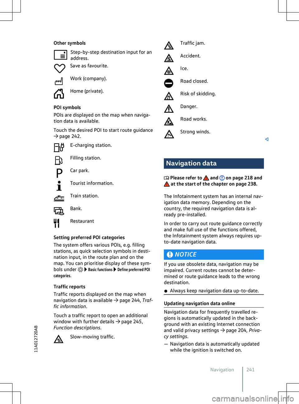
Other symbols
Step-by-step destination input f or an
address.
Save as favourite.
Work (company).
Home (private).
POI symbols
POIs are displayed on the map when naviga-
tion data is available.
Touch the desired POI to start route guidance
Page 244 of 417
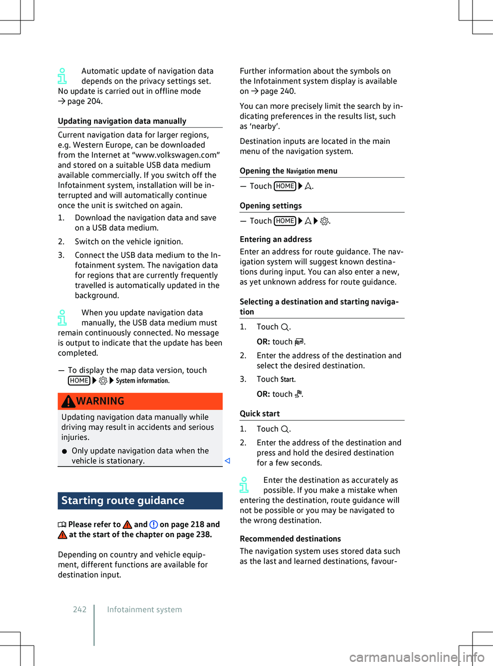
Automatic update of navigation data
depends on the priv
acy settings set.
No update is carried out in offline mode
Page 245 of 417
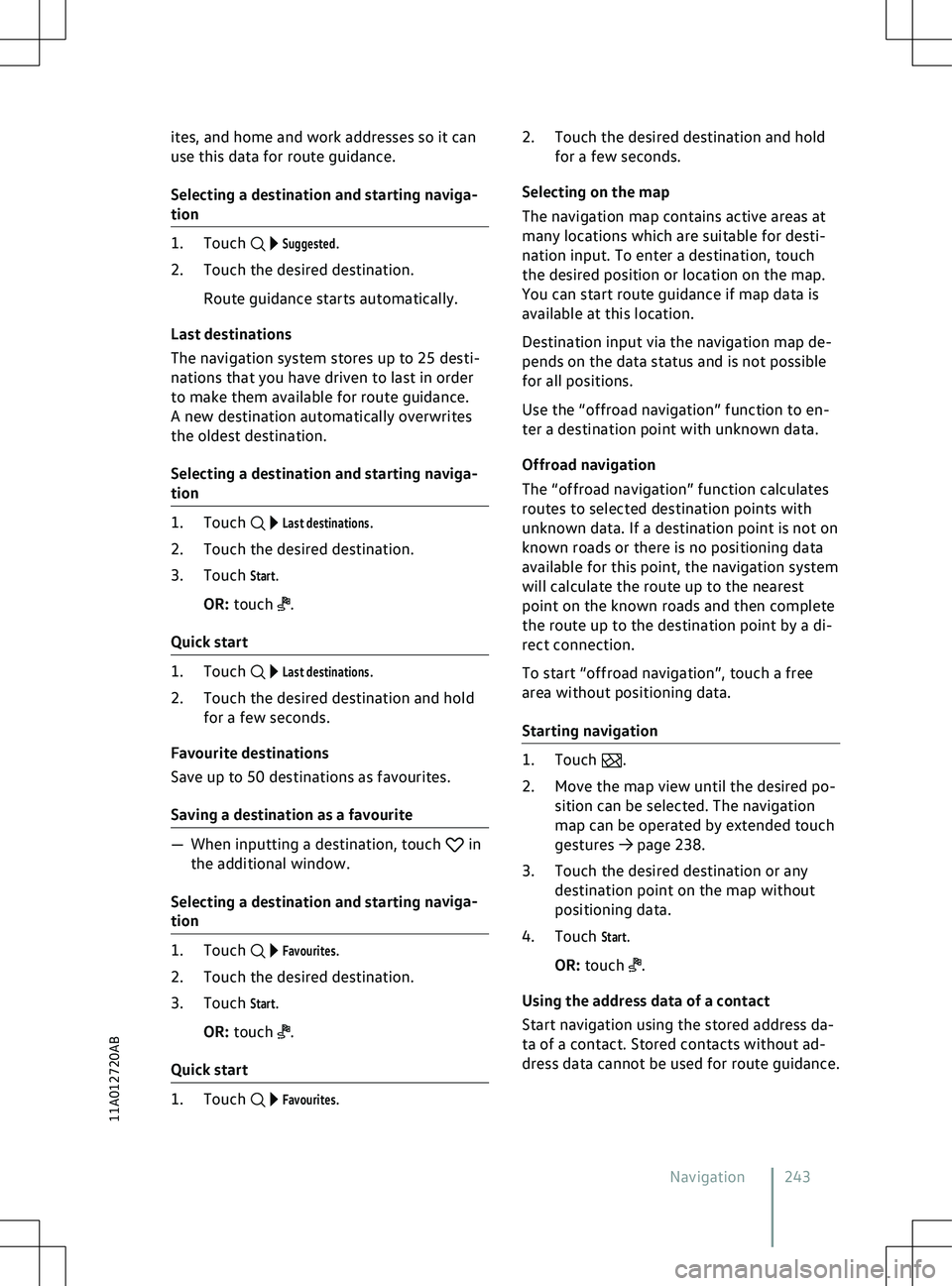
ites, and home and work addresses so it can
use this data f
or route guidance.
Selecting a destination and starting naviga-
tion
Suggested.
2. Touch the desired destination.
Route guidance starts automatically.
Last destinations
The navigation system stores up to 25 desti-
nations that you have driven to last in order
to make them available for route guidance.
A new destination automatically overwrites
the oldest destination.
Selecting a destination and starting naviga-
tion
Last destinations.
2. Touch the desired destination.
3. Touch
Start.
OR: touch .
Quick start
Last destinations.
2. Touch the desired destination and hold for a few seconds.
Favourite destinations
Save up to 50 destinations as favourites.
Saving a destination as a favourite in
the additional window.
Selecting a destination and starting na
viga-
tion
Favourites.
2. Touch the desired destination.
3. Touch
Start.
OR: touch .
Quick start
Favourites.2. Touch the desired destination and hold
f
or a few seconds.
Selecting on the map
The navigation map contains active areas at
many locations which are suitable for desti-
nation input. To enter a destination, touch
the desired position or location on the map.
You can start route guidance if map data is
available at this location.
Destination input via the navigation map de-
pends on the data status and is not possible
for all positions.
Use the “offroad navigation” function to en-
ter a destination point with unknown data.
Offroad navigation
The “offroad navigation” function calculates
routes to selected destination points with
unknown data. If a destination point is not on
known roads or there is no positioning data
available for this point, the navigation system
will calculate the route up to the nearest
point on the known roads and then complete
the route up to the destination point by a di-
rect connection.
To start “offroad navigation”, touch a free
area without positioning data.
Starting navigation .
2.
Move the map view until the desired po-
sition can be selected. The navigation
map can be operated by extended touch
gestures
Page 246 of 417
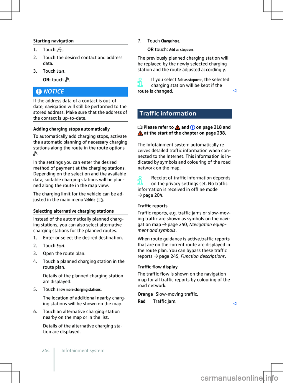
Starting navigation
.
2.
Touch the desired contact and address
data.
3. Touch
Start.
OR: touch .
NOTICE
If the address data of a contact is out-of-
date, na
vigation will still be performed to the
stored address. Make sure that the address of
the contact is up-to-date. .
In the settings you can enter the desired
method of payment at the charging stations.
Depending on the selection and the a
vailable
data, suitable charging stations will be plan-
ned along the route in the map view.
The charging limit for the vehicle can be ad-
justed in the main menu
Vehicle .
Selecting alternativ
e charging stations Traffic information
Please refer to and on page 218 and
at the start of the chapter on page 238.
The Inf
otainment system automatically re-
ceives detailed traffic information when con-
nected to the Internet. This information is in-
dicated by symbols and colouring of the road
network on the map.
Receipt of traffic information depends
on the privacy settings set. No traffic
information is received in offline mode
Page 247 of 417
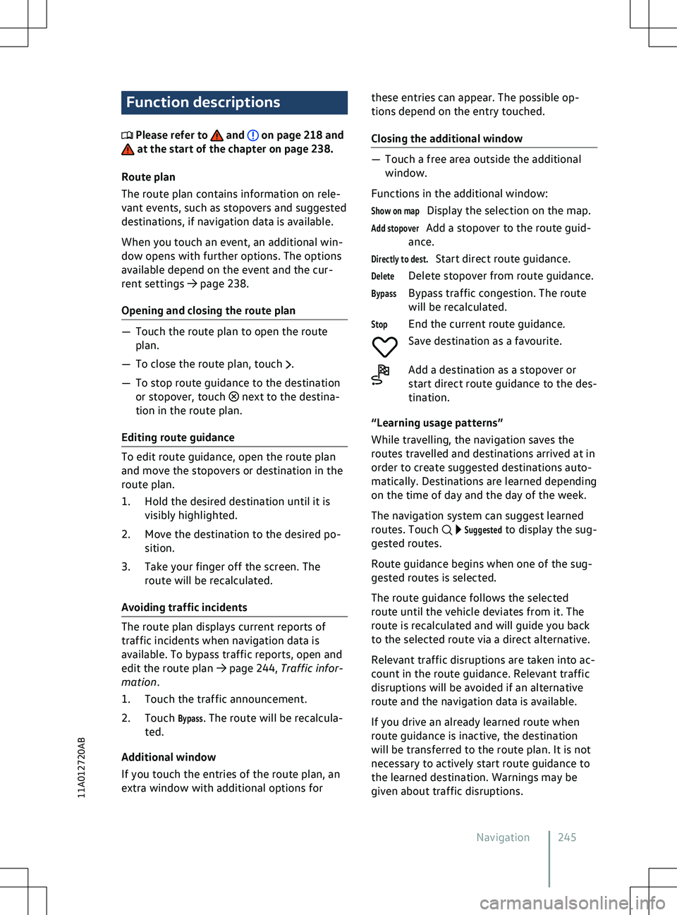
Function descriptions
Please refer to and on page 218 and
at the start of the chapter on page 238.
Route plan
The route plan contains inf
ormation on rele-
vant events, such as stopovers and suggested
destinations, if navigation data is available.
When you touch an event, an additional win-
dow opens with further options. The options
available depend on the event and the cur-
rent settings
Page 248 of 417
A forecast arrival time will be displayed.
You can activ
ate or deactivate the function at
any time and also delete the stored data for
the function.
Activating and deactivating “Learn usage
pattern”
Basic functions to open the set-
tings for this function.
2. To activate the function, activate
Learn us-
age pattern.
3. To deactivate the function, deactivate
Learn usage pattern.
Deleting stored data
.
If the charge le
vel is too low, the oper-
ating range display is automatically
hidden. When the battery has recharged, the
range display will reappear.
To show the complete range display
on the map, you may need to adjust
the map view
Page 249 of 417
Page 250 of 417
Trending: clock, lights, bulb, key battery, odometer, emergency towing, front sensor

